|
| Length |
Difficulty |
Streams |
Views |
Solitude |
Camping |
| 9.7 mls |
 |
 |
|
|
N/A |
Hiking
Time:
Elev. Gain:
Resources: |
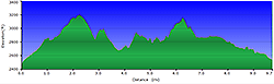
5.0 hours with breaks
1,900 ft
 Topo Hike Trails Map (PDF) Topo Hike Trails Map (PDF)
Marlinton WV Weather Forecast
Garmin (GDB), Gaia/Trails App (GPX) (What's
this?)
3D View of Route |
 By Trail Contributor: Jeff Monroe (Email Jeff) By Trail Contributor: Jeff Monroe (Email Jeff)
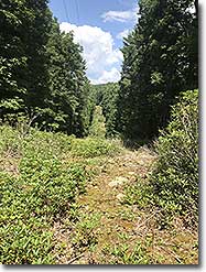
Finding summer trails in West Virginia that are not overgrown can be difficult! There are too many miles of trails and not enough volunteers, so we encourage you to bring clippers along with you on hikes in the Mountain State. This loop hike around Watoga State Park is a notable exception to Summer overgrowth – several miles of these trails are manicured carefully in July in preparation for the annual Watoga Mountain Trail Challenge Half Marathon, held the second weekend in August each year. While that weekend is not the time to be on these trails, the rest of the year the loop offers lots of solitude, even when other parts of the park have full campgrounds and cabins. And the trails are carefully checked in advance of the race.
This is not a full trail loop – you will have to walk along park roads in a couple of spots near the end of this journey. But speeds are kept down inside the park and this loop intentionally shows you many of the recreational opportunities the park offers. There are several options to shorten or alter this loop along the way, which are included in the description.
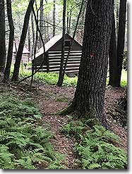
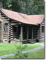
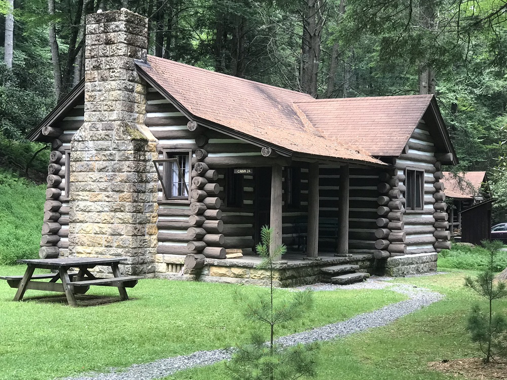
This is not a backpacking trail, but a loop through a state park that offers 90 campsites and many cabins for rent. This hike takes you past many of the prettiest rustic cabins offered in the park for rental.
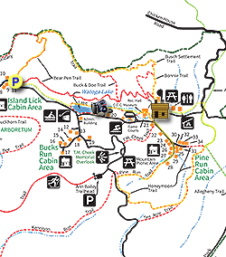
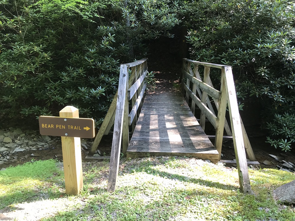
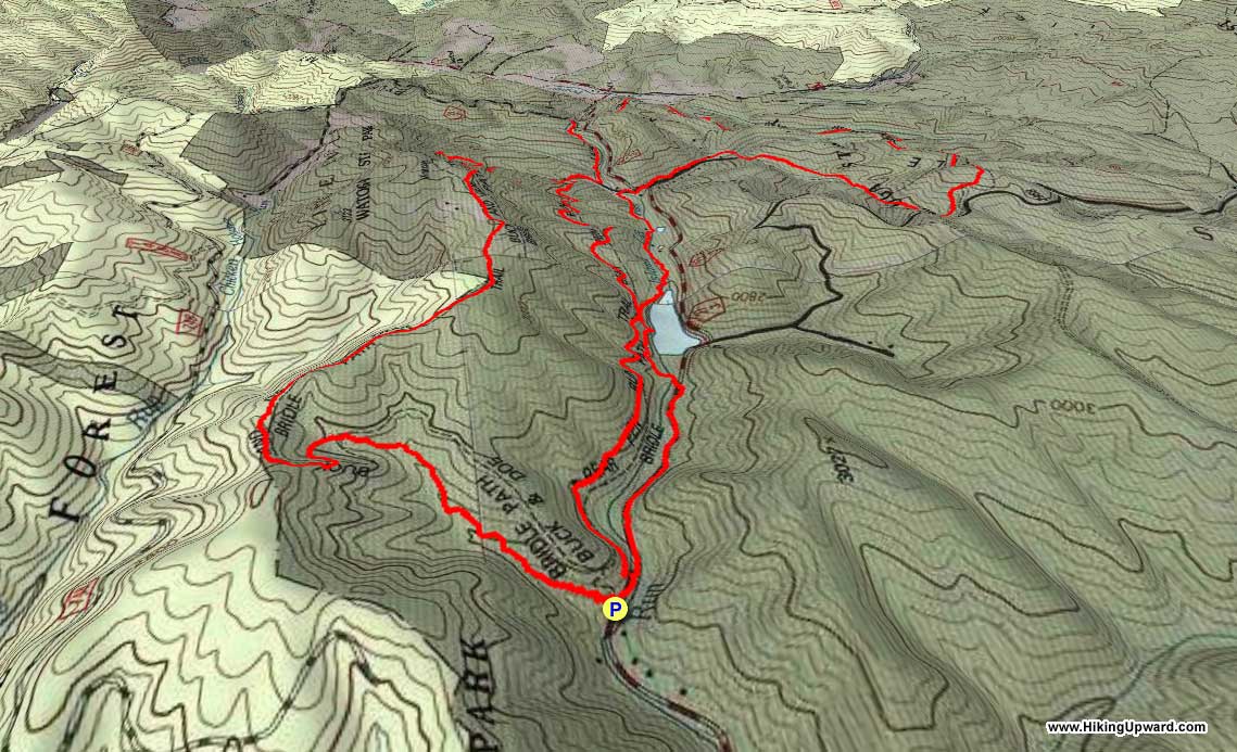
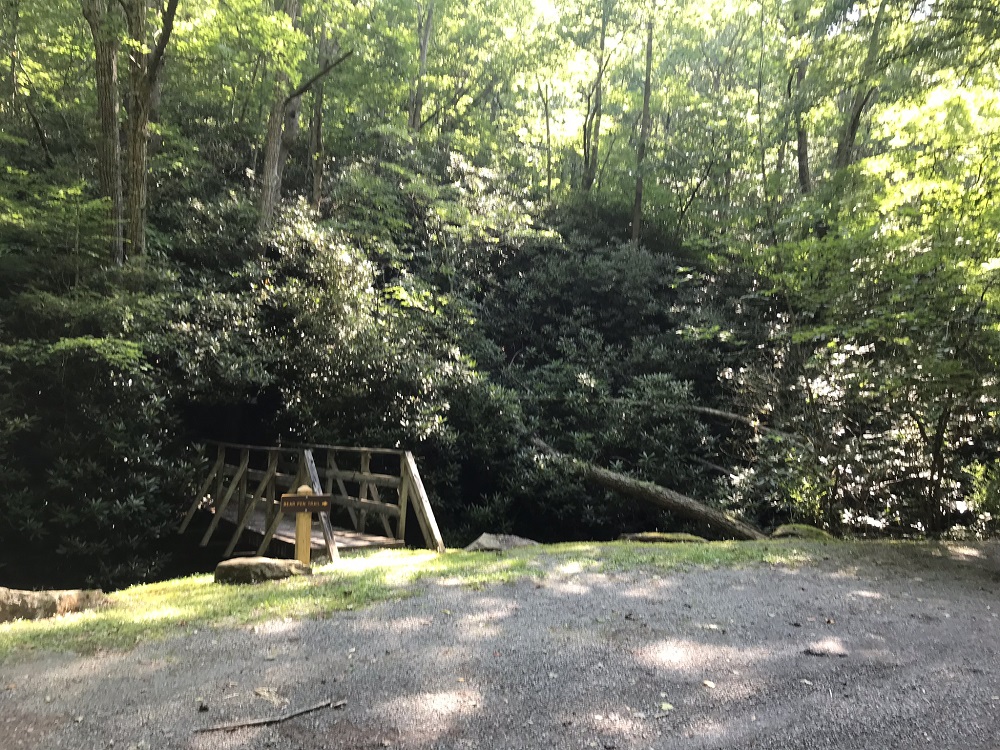
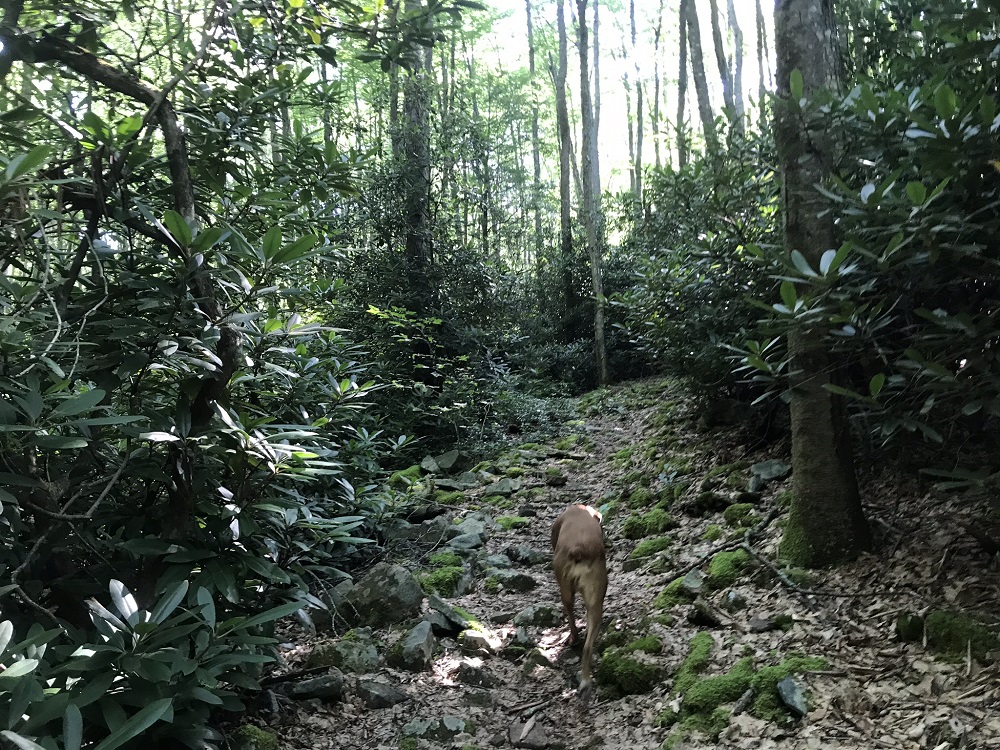
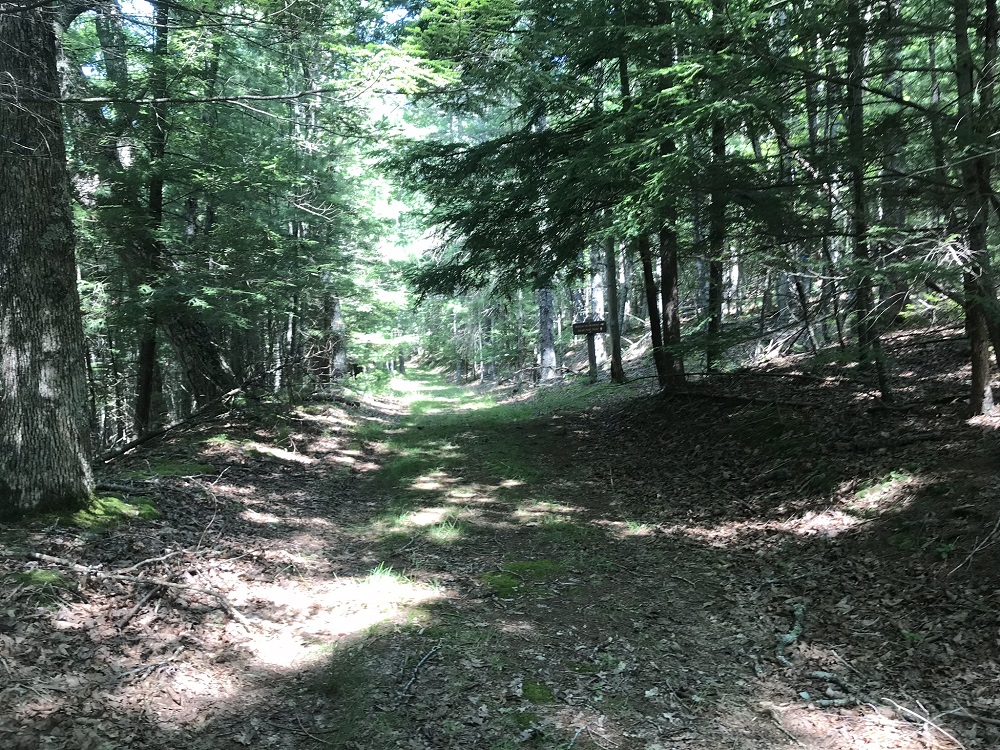
- Mile 0.0 – There are multiple places to start this hike, as the loop crosses several parking lots that will be described below. This parking area is along the main road through the park. There is space for 4 or 5 vehicles here and it is marked by a sign for the Bear Pen Trail. The trail starts by crossing a pedestrian bridge and entering into a tunnel of rhododendron. You will come to the Bear Pen Run Trail almost right away at a T intersection. Take a left on this trail, which is marked with yellow plastic circles nailed to trees. The beginning of the hike is thick with rhododendron.
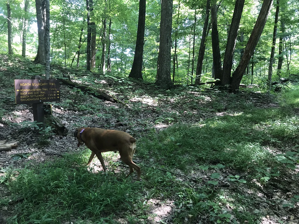
- Mile 1.0 – The Bear Pen Run Trail ends at an intersection with the North Boundary Trail, which is really an old forest road. Take a right on to the North Boundary Trail, marked by blue plastic diamonds nailed to trees.
- Mile 1.5 – The trail appears to split; stay to the left. Continue climbing.
- Mile 1.9 – The Buck and Doe Trail (blue diamonds) cuts right. Stay Straight.
- Mile 2.2 – Reach the crest of the mountain and your highest point on this hike at 3200 feet, though there is another climb later in the hike. A sign here tells you to continue on to reach several trails.
- Mile 2.6 – The North Boundary Trail becomes the Busch Settlement Trail, and begins descending via a couple of switchbacks.
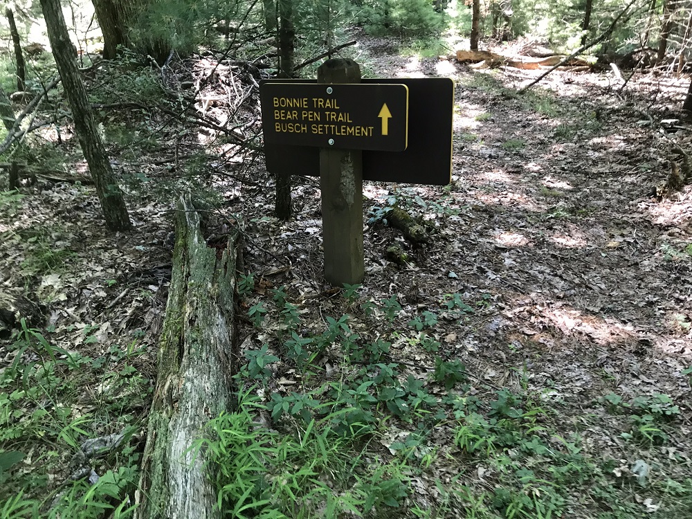
- Mile 2.9 – Take a right at a trail intersection to stay on the Busch Settlement Trail. Ahead is the Bonnie Trail, which cuts some distance off of this loop while reaching the same end point. The marathon heads right as well, ascending for 2/10 of a mile before descending again.
- Mile 3.4 – The Busch Settlement Trail ends at the Bear Pen Run Trail, which is an old road at this point. You could go right on the Bear Pen Run Trail for 2 miles to return to your vehicle after a loop hike of about 5.5 miles. This hike instead takes a left for a longer loop.
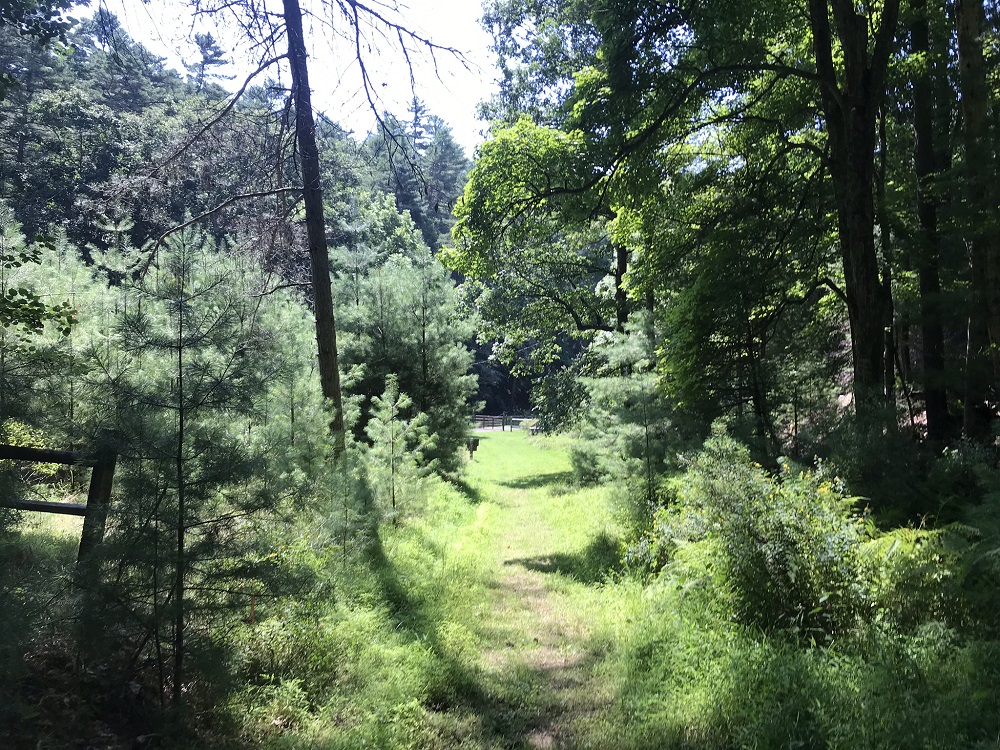
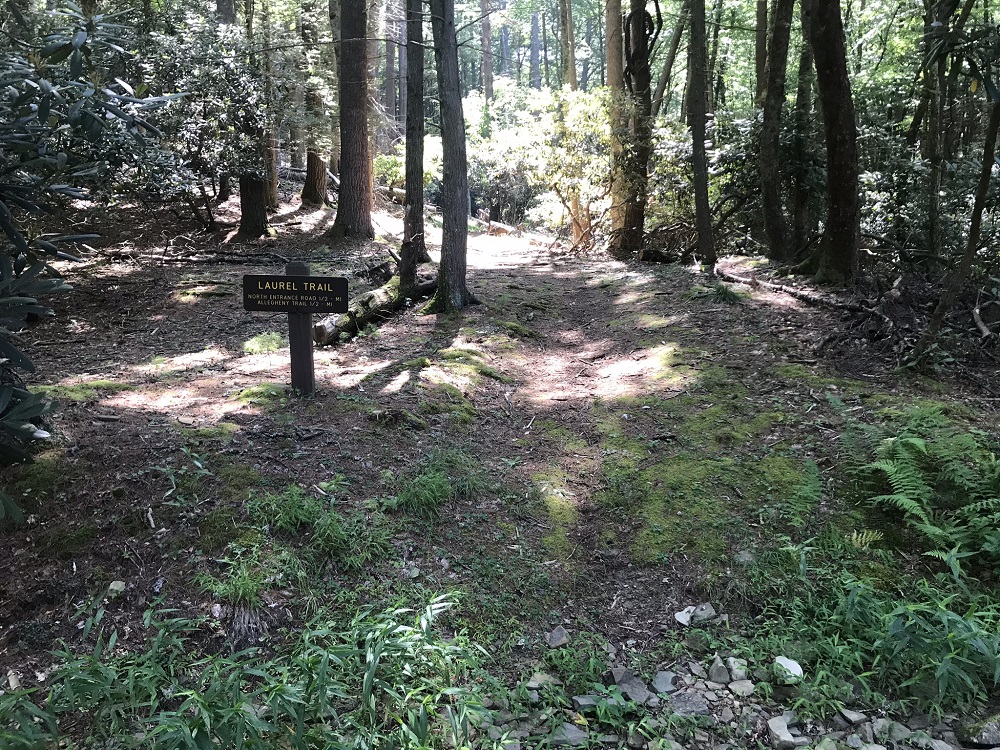
- Mile 3.6 – The Bear Pen Run Trail ends in an open field bisected by a park service road. Follow the park road to the right and then turn left on another road to walk towards the picnic area. There is a second parking area here. Walk past some restrooms and go around a picnic shelter to start down the Laurel Trail. (Note: the Laurel Trail is not shown on the current Watoga State Park Trail Map.)
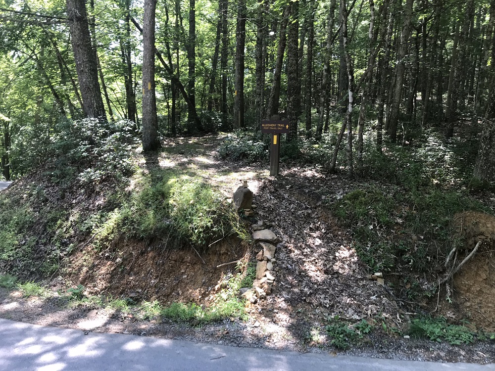
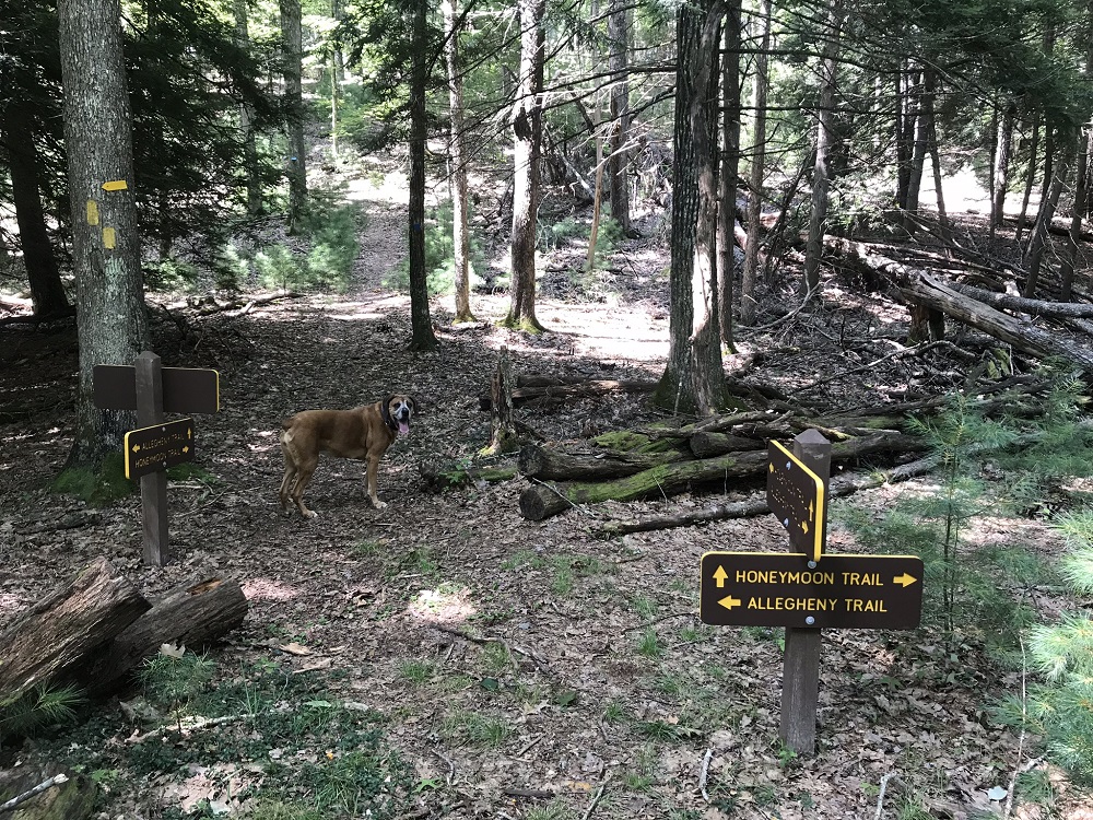
- Mile 4.3 – Follow the Laurel Trail for a half mile until it ends at the North Entrance Road. The Allegheny Trail crosses at this intersection, as well. The Allegheny Trail is a 330 mile trail that traverses the state and travels briefly through Watoga State Park. You should see that trail reaching the road on your left and straight ahead on your right. Cross the road on the right and follow the Allegheny Trail southbound, up a short, steep incline. The Allegheny Trail is marked by a painted yellow rectangle throughout its entire length.
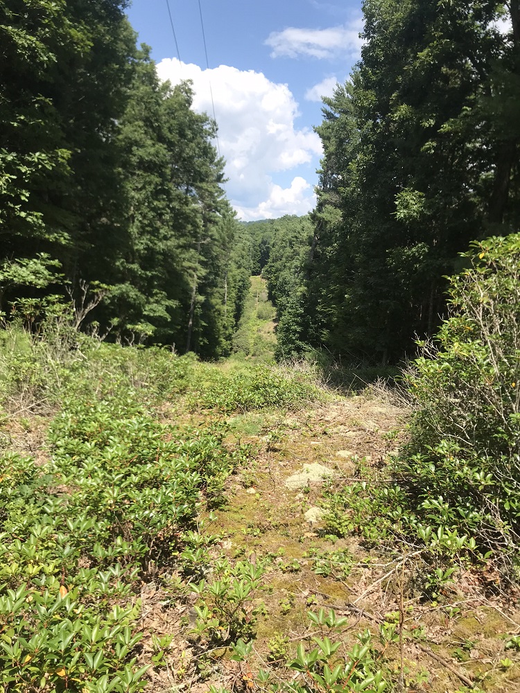
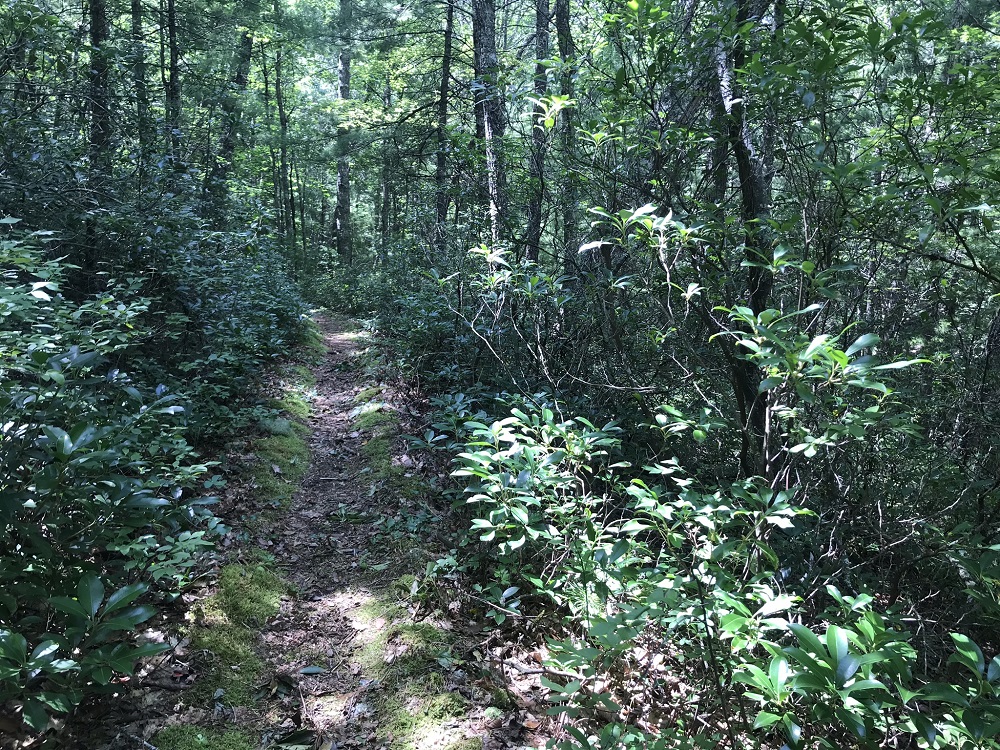
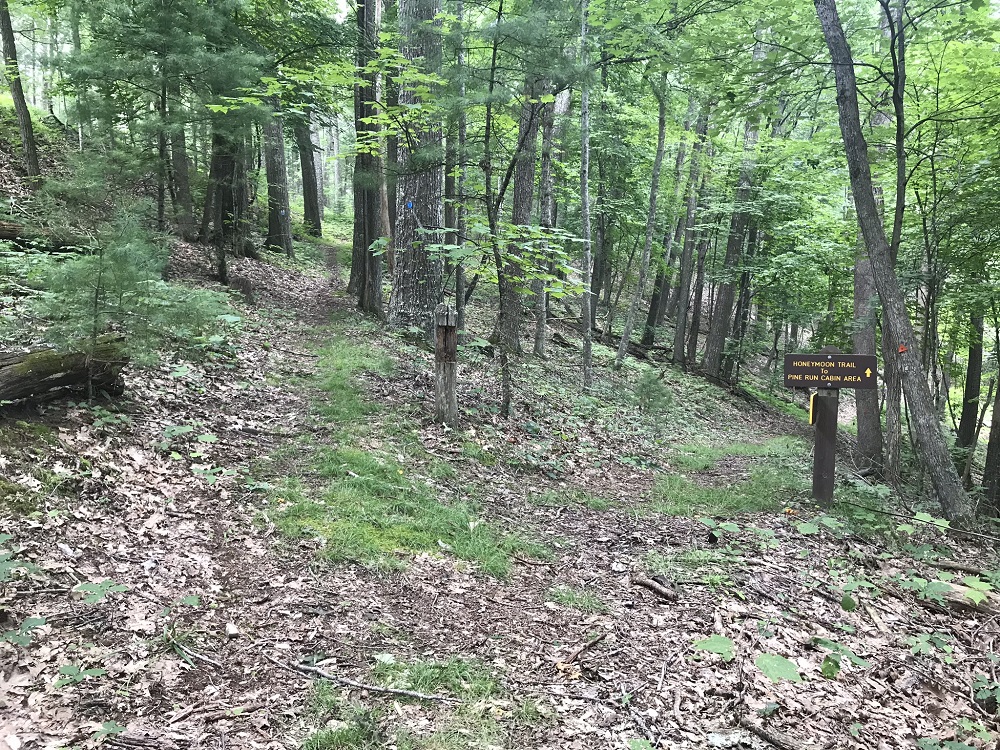
- Mile 5.0 – The trail crosses under a power line cut, providing one of the few views since the beginning of the hike. Right after that is a four-way trail intersection. The Honeymoon Trail comes from the right and continues straight ahead, while the Allegheny Trail turns left on its way out of the park. You could take a right here and cut a couple miles off of this hike, but you would miss some wonderful sights. Continue straight ahead, following the Honeymoon Trail, which is blazed with blue plastic diamonds. You will complete a second climb on this trail.
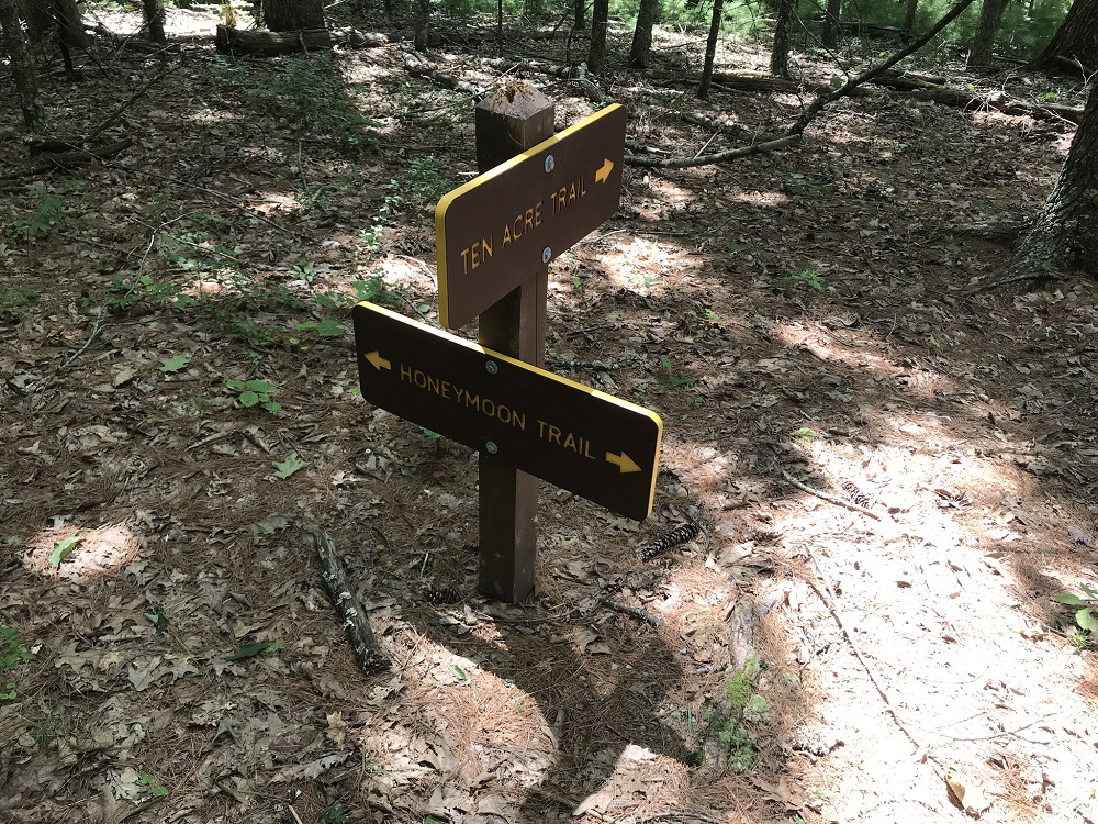
- Mile 6.1– Reach an intersection with the Ten Acre Trail. Stay to the right on the Honeymoon Trail. Shortly after this, the trail crests the second highest point on the loop (3150 feet), and heads downhill for the rest of the hike.
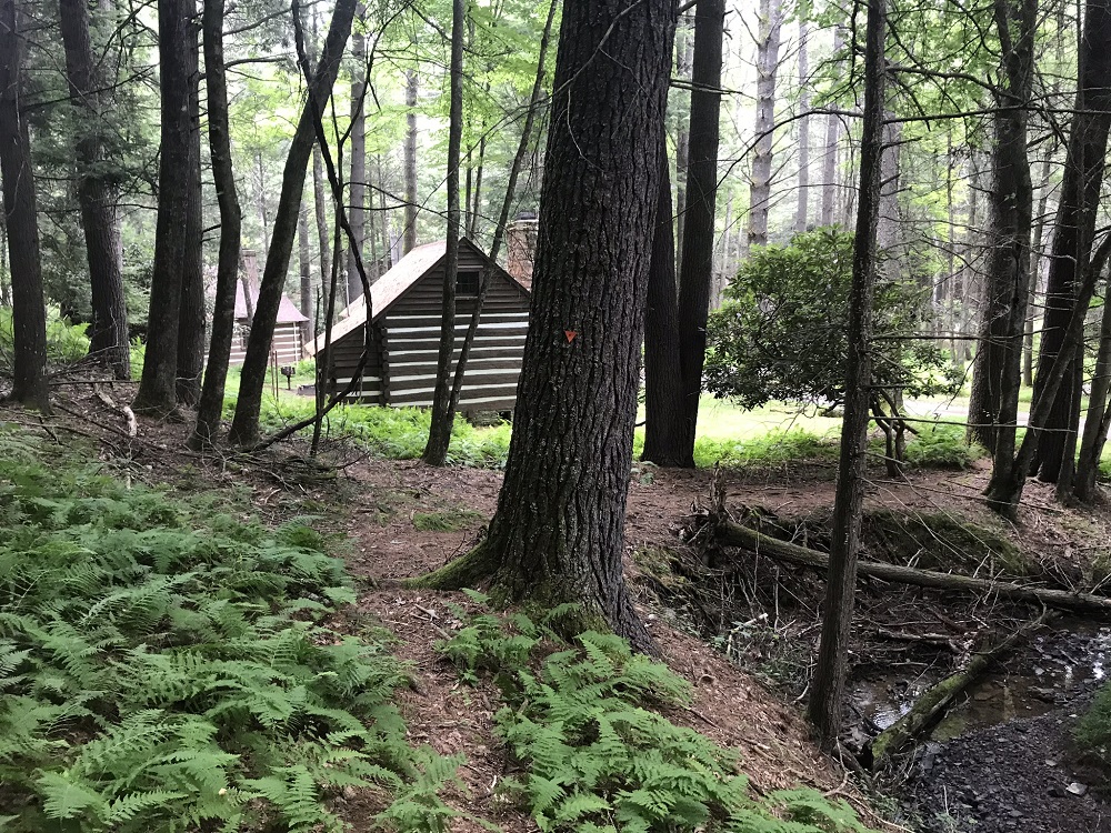
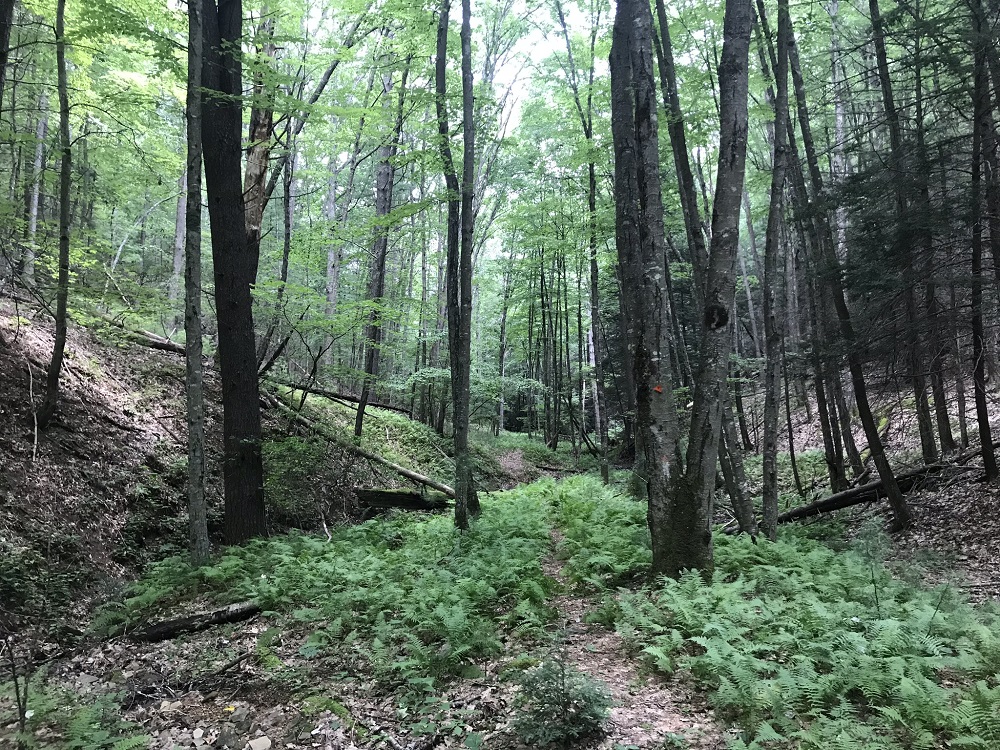
- Mile 6.5 – The trail forks. A sign here is confusing, because it appears to indicate that the Honeymoon Trail heads to the right to a cabin area, but the Honeymoon Trail is the left fork, and it ends at a park road shortly after this intersection, almost within sight. Go right, onto the Pine Run Trail, which descends into a pretty stream gully on its way to the Pine Run rental cabins. The Pine Run Trail is marked by orange plastic triangles and is not part of the trail race, so you might find it more overgrown than the trails you had been hiking.
- Mile 7.3 – The Pine Run Trail ends after coming out of pines onto a paved road where there are multiple rental cabins. Take a left onto the road and walk past the cabins, staying straight when another road comes in from the right next to some playground equipment.
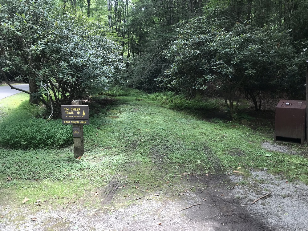
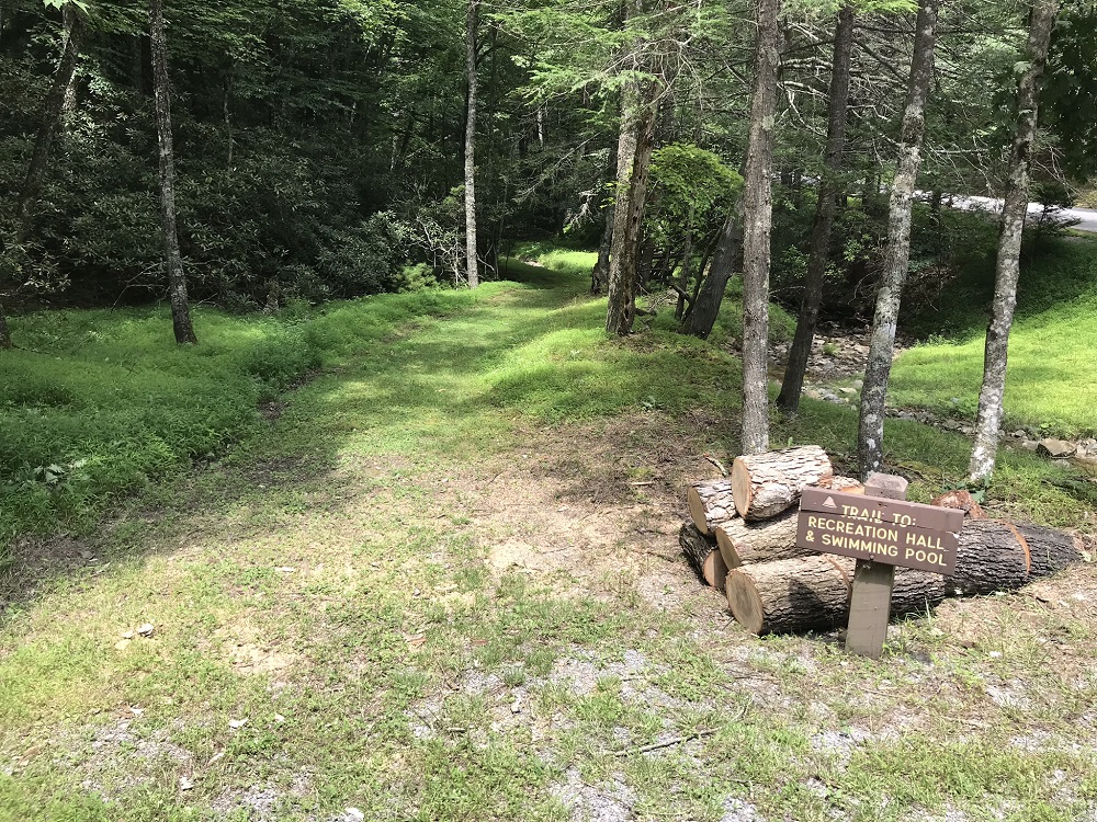
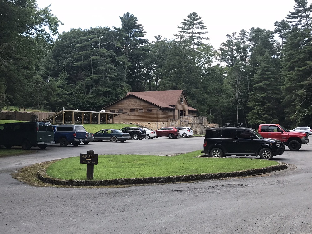
- Mile 7.8 – Pass the end of the T.M. Cheek trail on the left, between two cabins. You are once again on the race route. Continue on the road until it ends. Across the road is a sign saying “Trail to Recreation Hall & Swimming Pool”. Follow the trail.
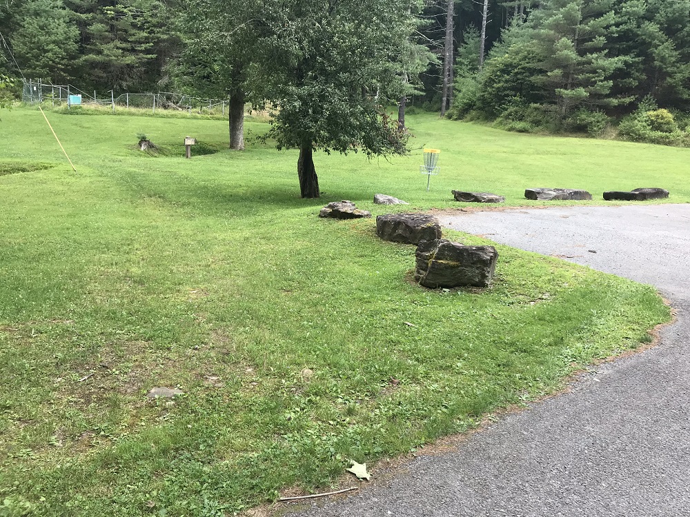
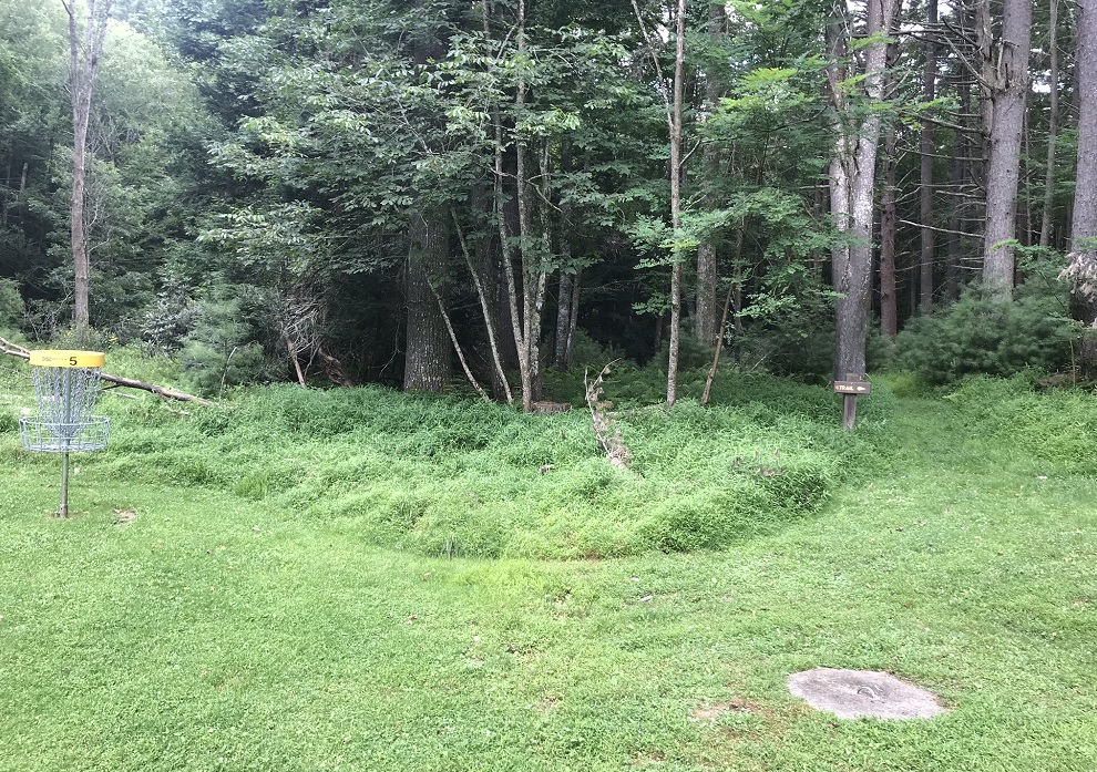
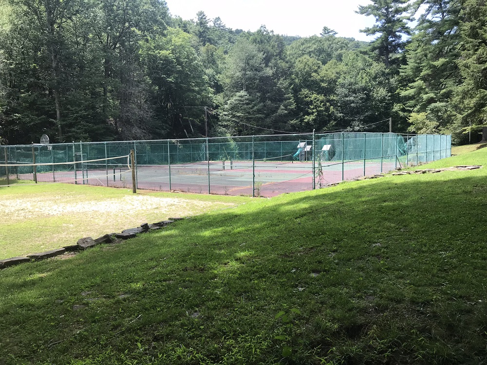
- Mile 7.9 – The trail comes back onto a park road, which you use to cross a creek. There is a parking area here and a Frisbee golf course. You have a couple of choices here. You can follow the road back 400 feet to the picnic area passed back at Mile 3.6, retrace your steps up the service road and take the Bear Pen Run Trail directly back to your vehicle. This is the most direct way back. Instead, the described loop traverses the open field on your left, through the Frisbee golf course, and heads for a small sign under the trees with “Trail” and an arrow, located near one of the Frisbee golf holes and visible from the road. This trail takes you back into the woods and past volleyball courts and basketball/tennis courts and around a park building before coming out at the parking lot for the public swimming pool.
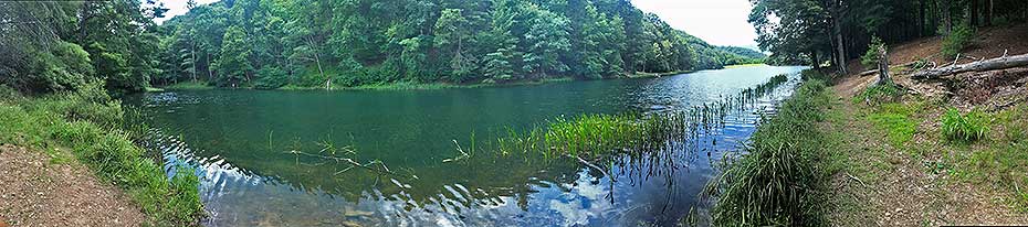
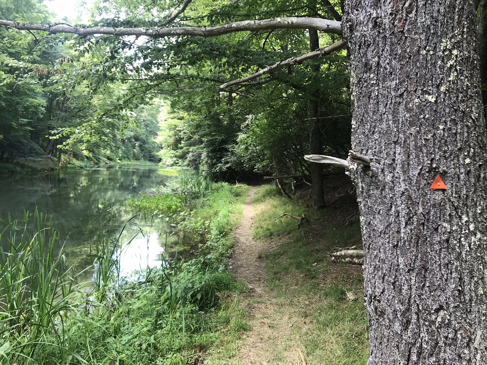
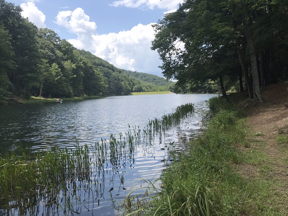
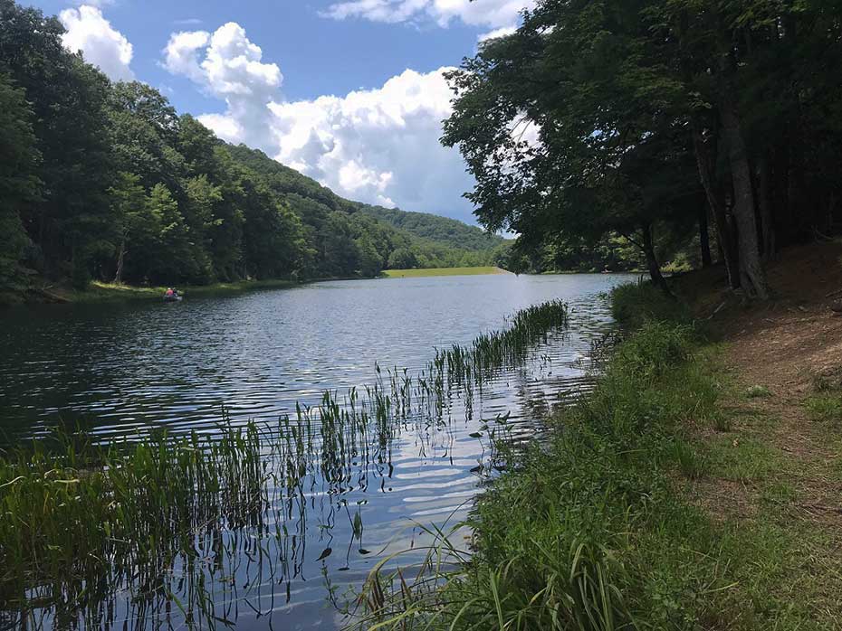
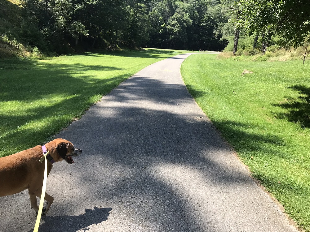
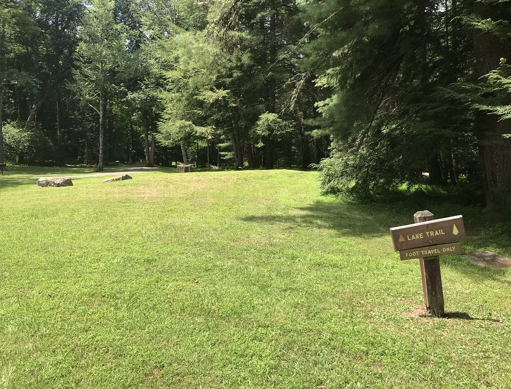
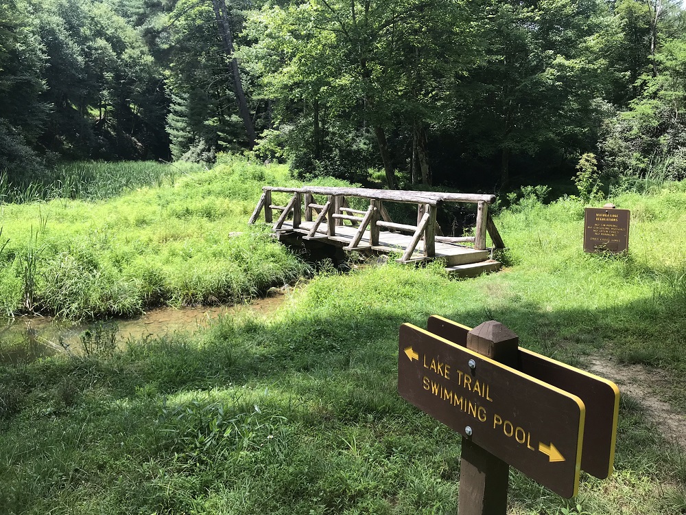
- Mile 8.2 – Pass through the parking lot for the swimming pool. Stop and take a dip if you want! The cost is nominal and how many hikes give you this option? Back on the trail, look on the other side of the parking lot for a sign announcing the Lake Trail. The trail itself is not obvious right away, as it looks like a mowed lawn with no trail. Cross that and look for a bridge signaling the start of the Lake Trail, and follow a defined trail marked by orange plastic triangles. Follow this trail with the lake on your left. There are many nice views of the lake along this trail.
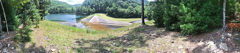
- Mile 8.9 – You will come to an opening in the trees with a view of the dam, and shortly afterwards the trail will cross the stream upstream of the dam on a wooden bridge.
- Mile 9.2 – Follow the woods road at the end of the dam up to the park’s main road, take a right away from the lake, and walk next to the park road a half mile to your vehicle, parked in the small lot on the side of this road.
- Mile 9.7 - Arrive back at the parking area.
|


