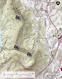
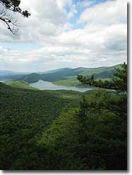
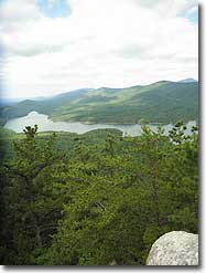
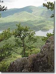
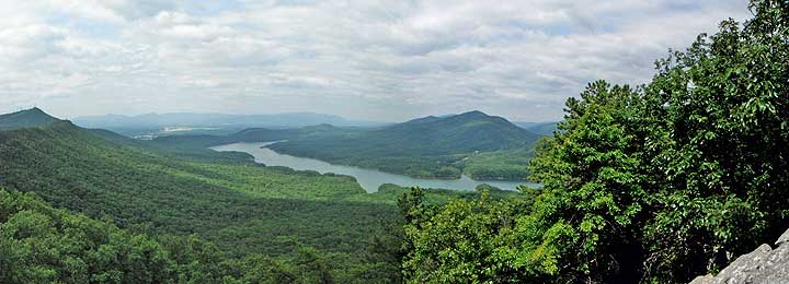
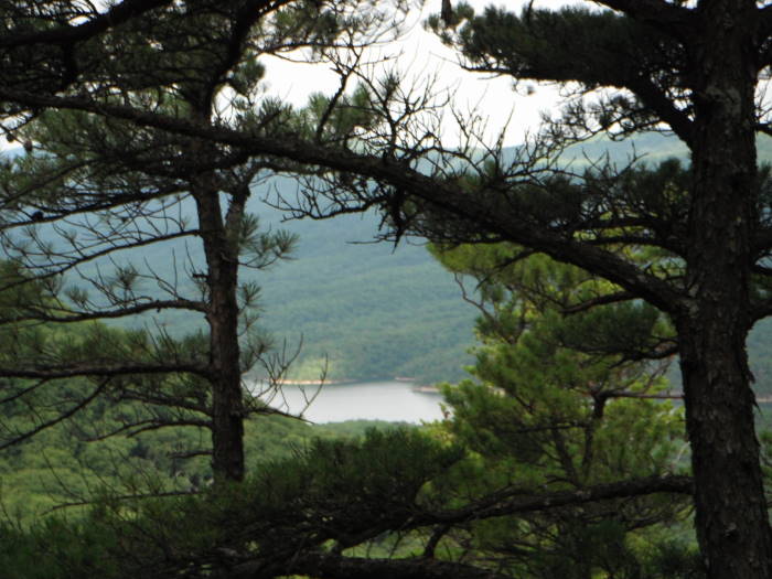
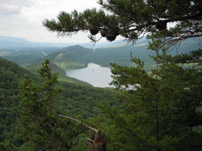
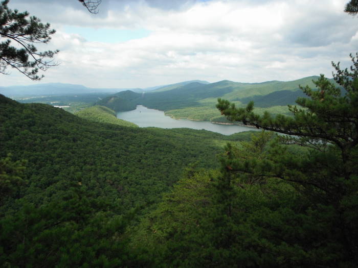
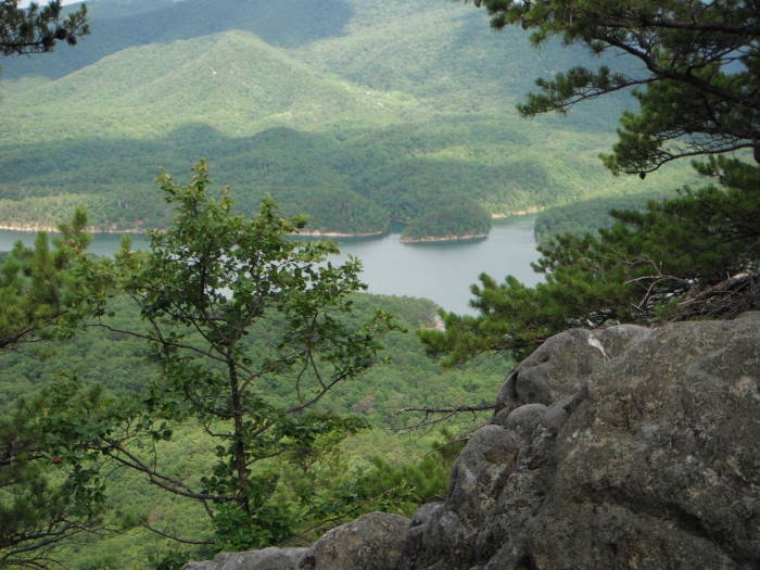
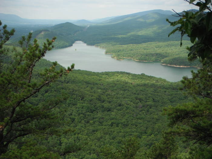
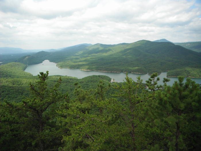
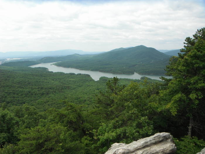
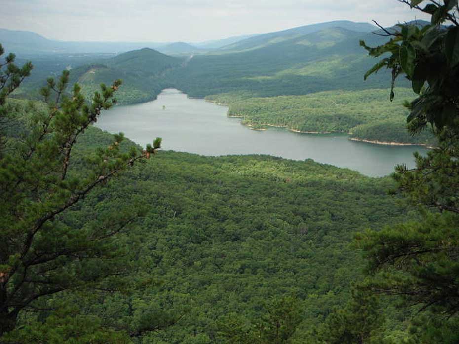
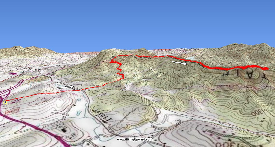
Are you tired of ridgeline hikes that have beautiful views of trees? If so, then head to Daleville, VA and go south on the A.T. for view after view of the Carvin Cove Reservoir below and mountains beyond. We marked 3 great overlooks but there are many more before finally reaching Hay Rock.
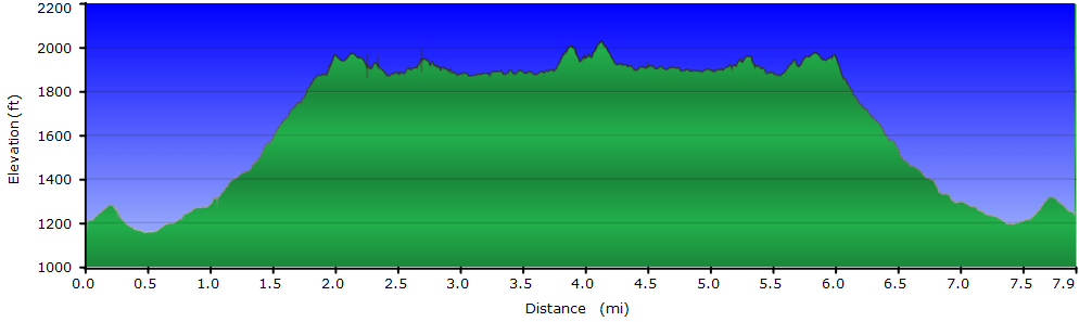
The climb to the ridgeline is about 2 miles. We last did this hike in late June, and can only imagine what this hike will be like in the Fall. You may need more time with all the stops to take in the views :)
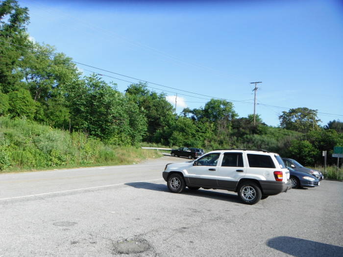
The trail begins at the guard rail behind the commuter parking area. There is room for 3-4 cars to park in front of the guard rail.
Mile 0.0 – Cross the road to the guard rail and continue 0.2 miles on the unmarked trail until you reach the A.T. Intersection.
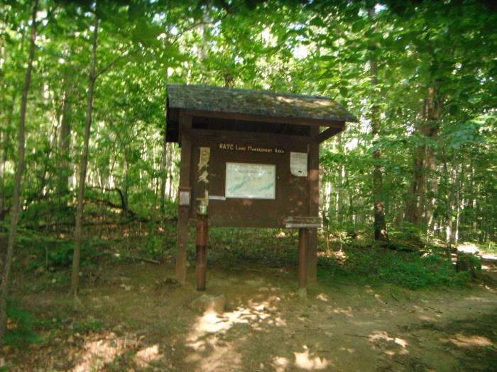
Mile 0.2 – At the A.T. intersection bear left onto the white blazed A.T. In the next 0.9 miles you will cross a creek and railroad tracks before reaching the RATC Information Kiosk.
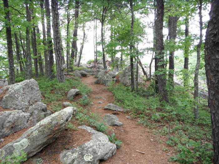
Mile 1.1 – RATC Information Kiosk. An easy hike to this point and we were beginning to wonder what happened to those lovely rocks we have come to expect on the A.T. in VA, should have kept our thoughts to ourselves!! From this point it becomes steeper and the trail more rocky.
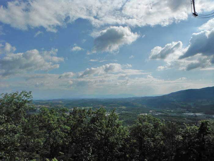
Mile 1.9 – Cross under a high voltage power line, and you'll cross this once again on the ridge. There are a few switchbacks prior to reaching the ridge at the 1.9 mile mark, passing under another high voltage power line. The power lines took away from some of the beauty of this hike, but the views will make you forget them. The view to the northeast is Daleville.
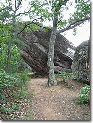
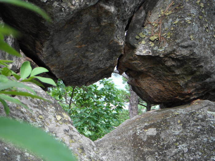
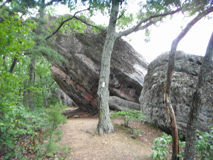
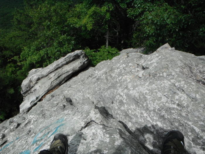
Mile 4.0 – Over the next 0.8 miles we marked 3 (there are others) really good overlooks with views to the west of McAfee Knob before finally reaching Hay Rock. There is a little bit of a climb to get to the best view on Hay Rockaccessed via the crevice near the north side. Please be careful as it is steep to get to the top. This section is not advised for small children. Some of the previous overlooks are better suited for lunch than Hay Rock.
Mile 8.0 – Enjoy your time here then retrace your steps back to the parking area on Route US220.
Late June
Carvin Cove
Carvin Cove/Hay Rock Hike Comments
Archived Comments
By:Dave M
Rating:
Date of Hike: Monday, November 11, 2019
I did this hike on Veteran's Day 2019 and it was amazing. I did notice that the hike information given mentions a Kiosk after the creek and railroad track crossings. This kiosk must have been removed as the only kiosk I noticed was at the intersection of the 0.2mile unmarked trail from the parking lot and the AT. This kiosk did appear to be rather new so maybe the other one was removed since the details of this hike were added. The only trouble I had was the leaves on the ground hiding some rocks/ other obstacles on the trail. If doing this hike in fall, be sure to watch your step. I thought this hike was easier than Andy Layne and Dragon's Tooth. Maybe it was about the same difficulty as the Knob. Get out there and see the world!
By:Michelle
Rating:
Date of Hike: Saturday, June 1, 2019
Great hike with gorgeous views. I would say difficulty is closer to 2.5 or 3 I found it much easier than something like the Tinker Cliffs/Andy Layne trail. The only thing I couldn't figure out was how anybody climbs onto Hay Rock! I was hiking alone and stayed put firmly at the bottom. There are plenty of great views before you get to that point anyway!
By:Steve
Rating:
Date of Hike: Sunday, October 14, 2018
It's been 30 years since I've been hiking. At 61 years of age, this was an excellent start for me. The first mile was a little rough, but once on top, it was worth the effort. the views are breathtaking. It had just rained, so the trails were very muddy. There is also a lot of rocky crevice to traverse. I recommend a good pair of high top hiking boots. Definitely worth the 3 hour drive to get here. Side note: there were a lot of hikers on the day we went, but all were friendly. My dog loved it.
By:PQK
Rating:
Date of Hike: Sunday, September 24, 2017
It was a beautiful day for this hike and the views did not disappoint! We saw very few day hikers even though it was a weekend, but did see a few AT overnight hikers. The hike is straight-forward once you know where the trail head is! I enjoyed having the variety in the terrain!
This was a bit of an impulse hike so we probably should have been a bit more prepared, because it did take us just over 4 hours including a snack break and stops for pics!
By:Dean Jarvis
Rating:
Date of Hike: Thursday, August 18, 2016
Agree with the reviewer on the ratings on the streams (I think there were 2 in 4 miles), but as for the difficulty, well I guess that depends on your age and condition, but I would rate this as a moderate hike.
I started at the park and ride lot. HikingUpward and other internet resources are great, you'd never know there was a trail behind that guard rail. I ran into some muddy spots the first half mile or so. Apart from the views one of the best things about this hike was the changing terrain. There was a lot of sandy soil to walk on (nice and smooth), there were places lightly covered in pine needles, and then there were some rocky areas. Some steep climbs here and there, but I'd rate this a moderate hike on the difficulty level because there are a few places where the path is just big rocks that you need to navigate down or through.
Many spots to see some great views, particularly between 2 and 4 miles. Hay Rock is not hard to miss, it hangs way across the trail. I will say that climbing up the Hay Rock is a little easier than coming down. I made it ok, but I don't think I'll do it again unless I'm hiking with a friend next time. I stopped and had a snack and water there and took some pictures.
Coming back was about the same as going up, perhaps a little easier. Near the end I did remember to veer right on the 'unmarked' trail instead of keeping left to continue on the AT.
All in all, it was a great location, I plan on going back this Fall.
By:gadevildawg
Rating:
Date of Hike: Monday, July 4, 2016
We hiked mid afternoon on the Fourth of July. The trail was well marked, secluded, and had very nice views. We have hiked many trails in VA and the Hiking Upward ratings are usually pretty accurate. This one was not. The trail difficulty rating was probably more like a 2 and the streams rating may have been a 1.
By:Kelley-Dale
Rating:
Date of Hike: Sunday, December 27, 2015
Confirm previous posts. Started at park & Ride. Took us 5 hours 8 miles to Hayrock and back.The younger folks were faster for sure. We plodded steadily. Great views. Especially with trees leafless. Once you make the ridge it is a great hike to Hay Rock with rock challenges mixed with soft pine needle trails. The contrasting views on either side of the ridge trail are amazing. Daleville/Botetourt below on the right and Carvin Cove valley on the left. This was our first day hike on the AT and we loved it. A great first hike. The ascent will get your heart rate up. Feet and knees pretty sore coming back down to Daleville.
By:Don Mc
Rating:
Date of Hike: Wednesday, September 2, 2015
Great hike and great views! The RATC has done an excellent job of trail maintenance and marking...some of the best we have seen. Worth the trip and will do it again!
By:SM T372
Rating:
Date of Hike: Saturday, January 17, 2015
All the accolades of prior posts...excellent hike... just posting this as an fyi...the AT has been re-routed from the railroad tracks (the trail mileage signs remain on the old section, visible to the right of the new trail upon leaving the RxR tracks) to about 200yards(?) from where Tinker Top Road approaches the AT. All that to say this...be prepared for MUD. Otherwise, it's well marked with blazes.
By:C&S
Rating:
Date of Hike: Saturday, November 23, 2013
This hike was so peaceful compared to McAfee, and we thought the views were better. We went to Hay Rock, but you don't need to go that far to enjoy the beautiful views. Today was sunny but cool (52) and cooler on top with wind. We only met 6 other "groups" along the way. The trail varies a lot - packed, sandy, rocky, piney. The views of Carvins Cove, Roanoke, and whatever else we saw, were awesome! The tagging on Hay Rock has been painted and it looks really good. So thank you to those who chose the color, and those who painted! We're middle-aged in good shape, and the hike was challenging but not too difficult. There are a few, short, rocky stretches where we paid more attention to our poles and feet, but that's what made it fun. We didn't start whining and crying about our knees and ankles until the last mile. We'll do this one again! Oh, the power lines are no big deal. Seeing them just made us grateful that our 8-mile-hike-cool-drinks would be cool when we got home.


