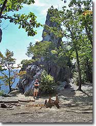
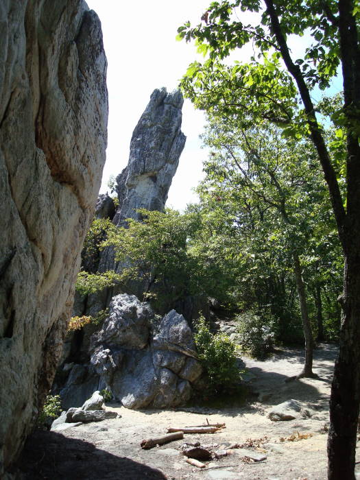
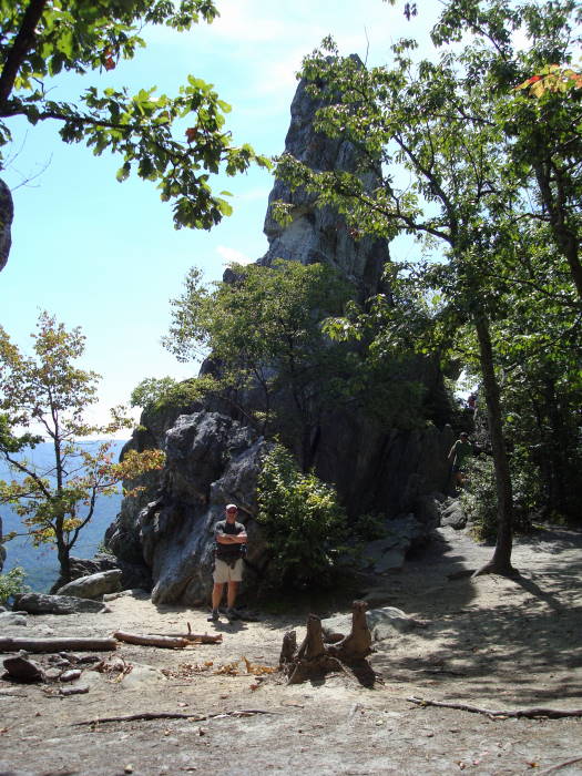
The Dragon’s Tooth is an aptly named rock monolith of Tuscarora quartzite straddling Craig and Roanoke Counties just west of Catawba, VA. It stands out on it’s own at the top of Cove Mountain. It's as popular a hike as its’ nearby neighbor, McAfee Knob , with one difference, sweat! McAfee Knob is a walk in the park compared to this tough short hike.
Please Note:During the last several years the the Dragon’s Tooth area has seen a significant increase in hiker traffic. Please follow the Leave-No-Trace hiking etiquette. There are unique rules regarding group size, and camping. Please visit the Roanoke Appalachian Trail club page for full rules and regulations.
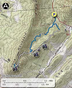
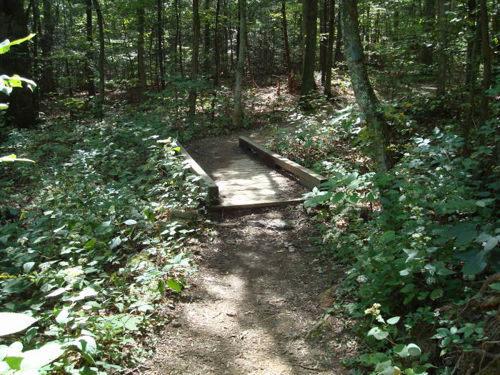
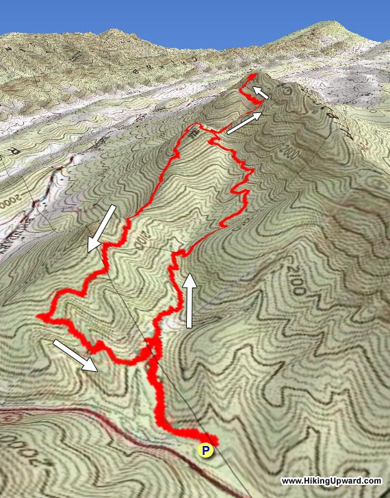
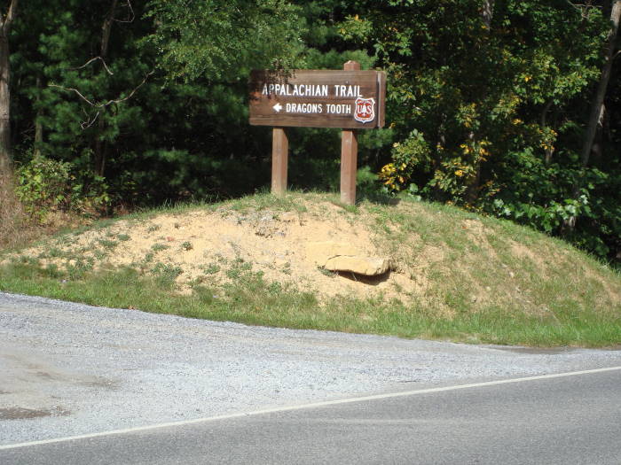
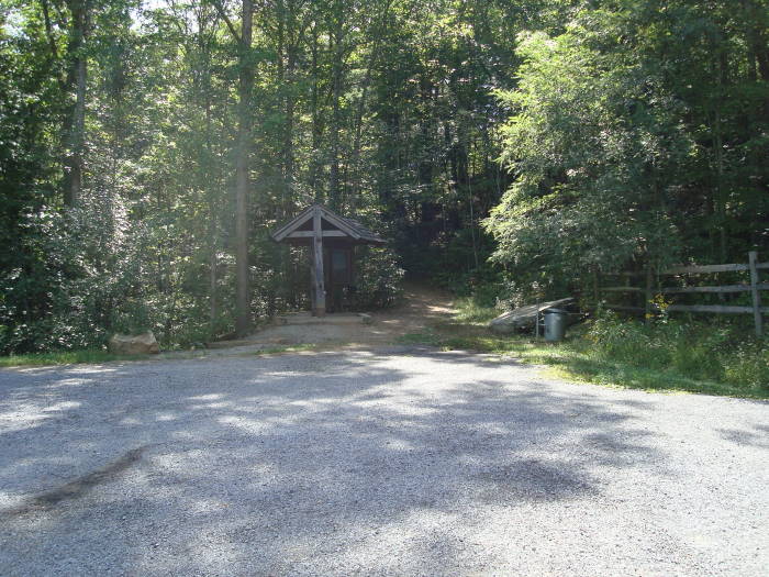
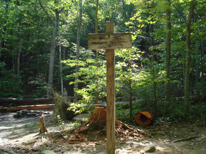
Parking is directly off VA311. From the Dragon’s Tooth parking area head towards the information kiosk located at the rear of the parking area (Note: non-flush toilets are available). The blue blazed Dragon’s Tooth Trail begins at the kiosk. Go about 0.25 miles, crossing two small bridges before arriving at the intersection of the yellow blazed Boy Scout Connector Trail. You will use the Boy Scout Connector Trail on the return trip. Bear to the right on the blue blazed Dragon’s Tooth Trail.
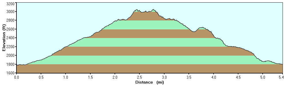
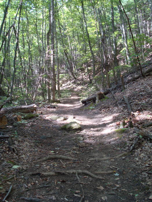
For the next 1.4 miles you will cross the creek/creek bed about 7-8 times on a steady but easy climb to the intersection of the white blazed Appalachian Trail (A.T.) Turn right onto the A.T., heading south towards the Dragon’s Tooth.
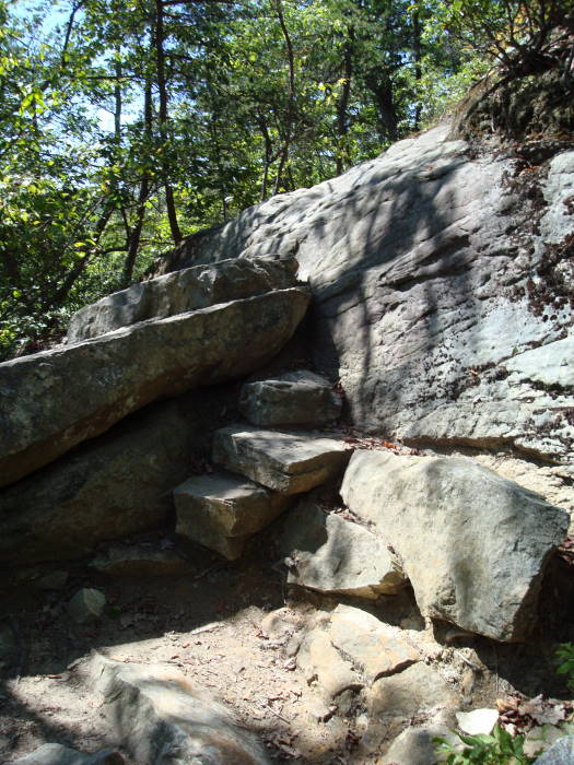
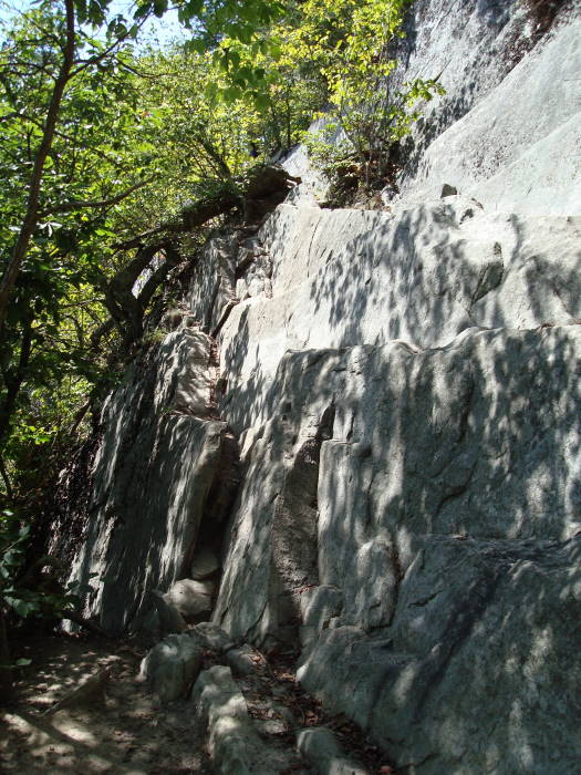
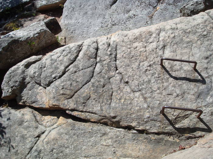
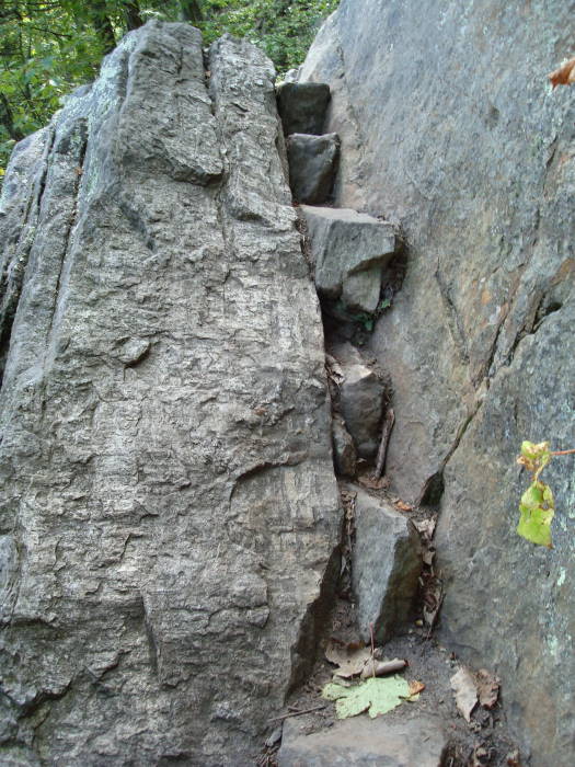
Now the fun begins!! The next 0.7 miles is one of the toughest parts of the A.T. that we have hiked. The trail becomes very rocky, climbing multiple series of rock steps, the trail seemingly clinging to the edge of the mountain at times, near the top at two different places you will use a series of u-shaped iron bar steps embedded in the rock due to the steepness of the trail, and a few overlooks to give you a breather prior to reaching the intersection of the blue blazed Dragon’s Tooth Spur Trail, bear left. Imagine doing this part of the trail as an A.T. thru-hiker with 25-35+ lbs on your back!
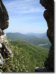
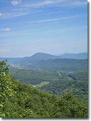
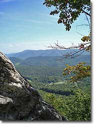
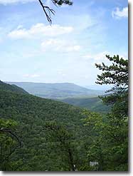
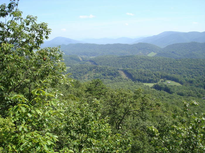
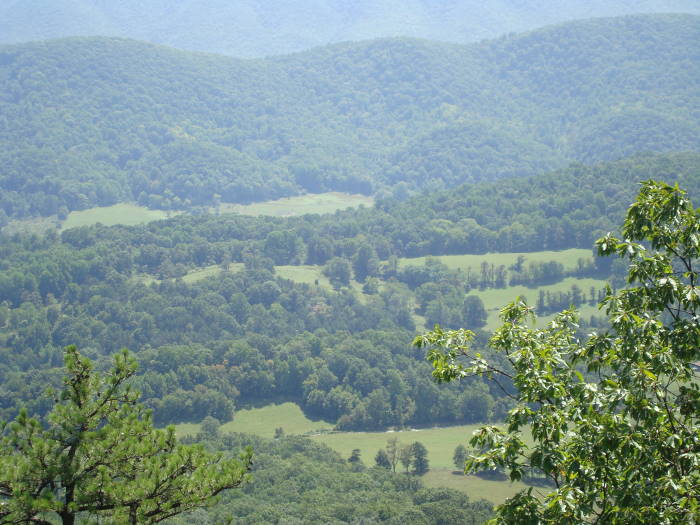
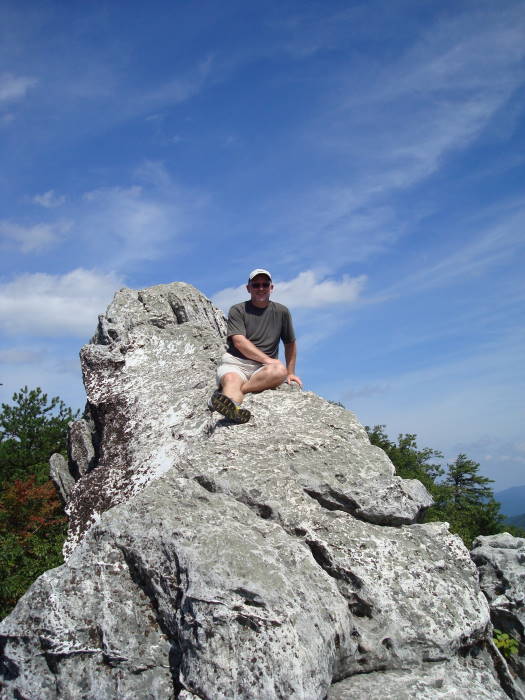
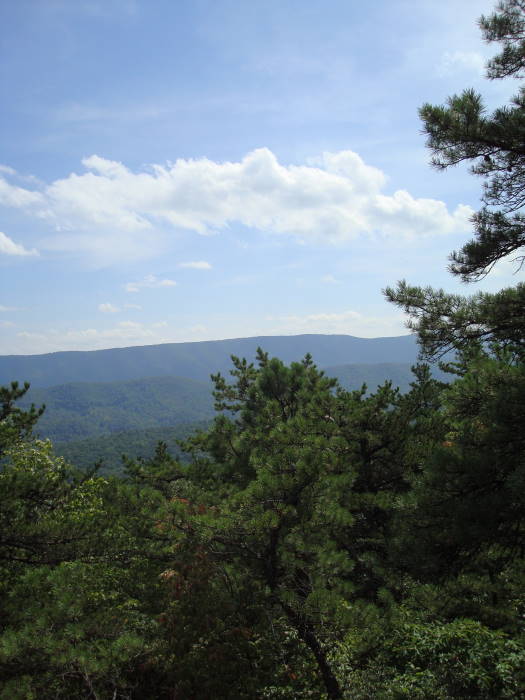
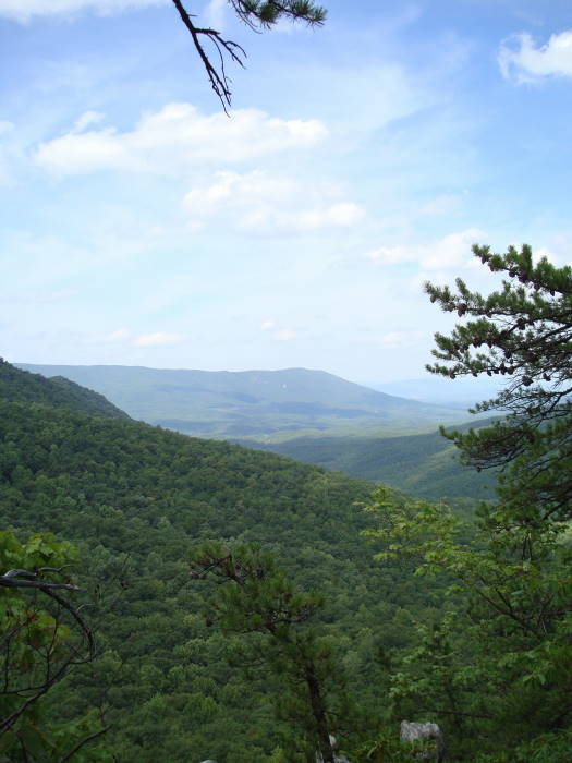
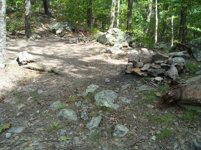
It is less than 0.3 miles to Dragon’s Tooth on an easy path. Keep your eyes open on the left for a paths leading to overlooks prior to reaching Dragon’s Tooth. Be sure to circle behind the Tooth, as there is a crevice that makes it possible to climb onto the Tooth. It is not the easiest climb, and if you don’t feel comfortable, don’t do it, be safe! There are plenty of good views without climbing the Tooth.
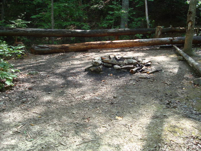
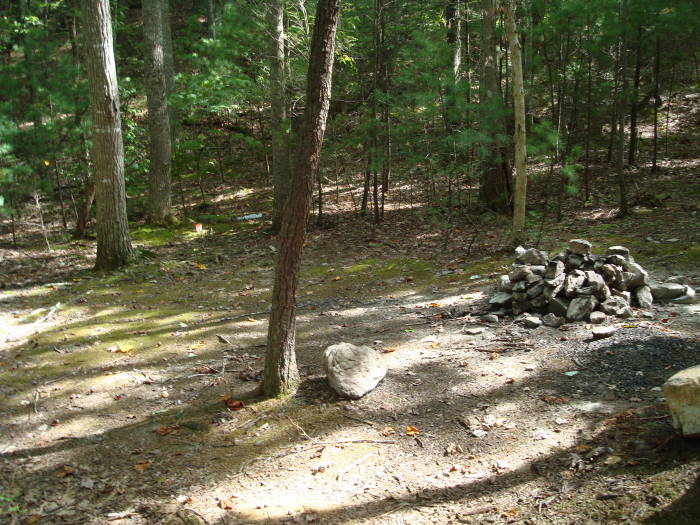
For your return trip; take the blue blazed Dragon’s Tooth Spur Trail back to the intersection of the A.T. taking a right and heading north. Stay on the A.T. reaching the intersection of the Dragon’s Tooth Trail in 0.7 miles. Instead of returning on the blue blazed Dragon’s Tooth Trail stay straight on the more scenic A.T. going north. There will be an overlook in less than 0.25 miles with a campsite (no water) about 0.5 miles beyond that. Take a left in 0.3 miles onto the yellow blazed Boy Scout Connector Trail, and in another 0.3 miles arrive at the blue blazed Dragon’s Tooth Trail passing the campsites mentioned near the beginning of the hike. Take a right on the Dragon’s Tooth Trail arriving at the Dragon’s Tooth Parking Lot in 0.25 miles.
Mid September
The Dragon's Tooth
Dragon's Tooth Hike Comments
Archived Comments
By:Herrick
Rating:
Date of Hike: Saturday, December 29, 2018
What an incredible hike!! The first 1.6mi is really easy with a bunch of creek crossings. The last .7mi was the fun part, but our dogs did not find it as fun.
One dog is 13 years old and part mountain goat. She can climb just about anything, but doesnt like being held or picked up. There were a few spots where she needed help and bit me for trying. The other dog is 9 years old and a solid muscle Pitt mix. He is not as capable a climber but more willing to be helped. Having them leashed created some difficulties in certain areas and straight dangerous conditions in others. I would highly recommend a hand leash that you can let go of if your dog is pulling you, dont bring a leash that is connected at the hip or otherwise hands free. The way down was mostly easier on them except for the ledge. The old dog displayed finesse and made it safely down, the big guy went for it on a dangerous route and almost tumbled to his death. Luckily a rock stopped his fall at the bottom of the ledge. Make sure you have a spotter.
The views and rocks at the top were incredible and worth every bit of the work getting up. There are campable sites near the start and about 1.6mi in.
By:Crystal Lynn
Rating:
Date of Hike: Wednesday, November 7, 2018
This was a easy hike for the first 1.8 miles the last mile was the fun. Yes it is a challenge and its not for those that are afraid of highs or clumpsy. This hike was thrilling w lots of foot and hand climbing. The view was amazing. I encourage anyone to go. Please wear good shoes
By:Maia's dad
Rating:
Date of Hike: Saturday, July 28, 2018
Great hike. Highly recommend. I took my 80lb Rottie and wasn't expecting it to be quite as hard as it was. My dog did great and having my girlfriend there to help in a couple places was needed. Going back down my dog didnt need any help except at the ledge. She did great. Having a smaller dog would be doable for a single person hike. The last .7 miles is no joke but very much worth it.
By:Senorita Hikes
Rating:
Date of Hike: Saturday, April 21, 2018
This was a pretty awesome hike! It starts off pretty easy and then you hit that .7mi of scrambling rocks. That part was a little difficult for me but still managed. Once you are at the top its pretty awesome. I did not climb to the very tip of the tooth, but there were many young adults doing it with no problem. I did climb onto the rocks though, for the view. The trail is pretty easy to follow, just follow the blue markings, then you hit the white markings for the Appalachian trail, then back to blue to get to Dragons Tooth. It was crowded which is expected especially since the weather was nice that day. If there is no parking in the parking lot, you can park your car on the side off the main road. There is a bathroom by the parking lot too. Take plenty of water with you because that rock scramble will wear you out. I saw people of all ages hiking and many with their dogs. It took my husband and I about 5.5 hrs to complete it, we stayed at the top for about an hr where we had lunch and then climbed the tooth and sat there for about 15-20 min, I wanted to sit longer but so many people were climbing up and there really isn't much space up there. I'm sure my husband could have finished it in shorter time since he is way more fit than I am. Overall, I enjoyed it. It was tough for me but definitely worth it. This is one of my fave hikes!
By:MRS
Rating:
Date of Hike: Sunday, February 18, 2018
This is second time hiking Dragons Tooth. I was skeptical of doing the rock scramble again as about 3 years ago I was sore and stiff and could barely move for MANY days after! There are a few places that are difficult reaches, or footing. There are loose rocks too, and if you have mud on your shoes the rocks can be slippery. I am so glad to have done this hike a second time, I was not sore at all!! We made good time and enjoyed sitting at the top for a nice view and some sun. Next time, I may just loop around instead of going all the way up, I have not done the alternate way down and think that may be a nice new hike for me as I get older (in 50s) I never thought I would do Dragons Tooth again, maybe knowing what to expect made it easier. Shooting for the triple crown.
By:Trail Wonder
Rating:
Date of Hike: Tuesday, May 23, 2017
Section hiking and came upon this heading north with a full pack. It was a rainy foggy day, no views. Really need to watch your footing descending. Ladder rungs could be placed in a few more areas and maybe closer for us hikers under 5'-5".
Besides this, always a surprise around the bend. Enjoyed the tinker cliffs more.
By:Ott Mountain
Rating:
Date of Hike: Thursday, March 23, 2017
Wow! This hike was really surprising, because the rock scramble ended up being quite a bit more technical than we originally thought. We hiked up from the parking area up and back for a total distance of about 5 miles. The trail up to the AT is exceptionally well maintained and pleasant with the babbling stream and tall trees. Once you get to the AT, the hike becomes more of a climb with lots of stairs and rocks. We would recommend not having bulky or heavy packs on this portion of the trail, purely from a safety perspective. Once you get to the top the Dragon's Tooth reminded us of Joshua Tree and some of the big rock formations out there...except here you're on the edge of a cliff with crazy awesome views! Highly recommend this hike but allow extra time when doing your planning. That last .7 miles to the top will take you a while, but enjoy! It's fun. We did a little video of our hike if you want to preview. It also shows camp sites and trail obstacles, etc. It's on our YouTube channel called Ott Mountain. Link is here:
https://www.youtube.com/edit?o=U&video_id=9gNezDa1r5o
By:forrestinthe4est
Rating:
Date of Hike: Saturday, March 18, 2017
The hike is tougher, but honestly I didn't think it was as difficult as people made it out to be. It's a really unique hike and the top is worth seeing - the rock formation up there is pretty sweet. Great view and I enjoyed making my way up. Definitely recommend.
By:Barb O
Rating:
Date of Hike: Sunday, August 28, 2016
Just finished a terrific Sunday morning and afternoon hike to the top! My friend and I are 65. While 'youngsters' were passing us at a steady clip, we did pretty fair ourselves at getting up and back in 5 hours with a long lunch on top and a split-off to the longer right trail ( as suggested) on the way down . (DON'T hike the split to the right on the way down. It's part of the AT. It's much longer, nothing to see at the top due to trees and some pretty miserable rocky spots as well, all anticlimactic during the return down. Just stick to the blue blazed trail). Saw one young guy with a 12 week old puppy... As others said, it's not possible for a dog to do it without being carried so be prepared for carrying your dog.
Otherwise we agreed with most reviewers... Harder ( shorter) than McAffees Notch, you need hiking boots for the best climb, and yes there was a bevy of activity at the top.
We had a great time!
By:Medic G
Rating:
Date of Hike: Tuesday, August 2, 2016
Good hike. The "work" on this hike is the 0.7 miles on the AT. As stated in the description, many rock scrambles which makes the 0.7 mile feel longer than what it actually is and takes additional time. No one at the tooth when we arrived and we were able to explore it all to ourselves. I did climb up the tooth some and almost all the way to the top. On the return, we continued past the Dragon's Tooth trail and continue south on the AT and picked up the Boy Scout connector trail. There were still a couple of small rock scrambles on the AT heading towards the Boy Scout connector trail. Didn't see anyone on the return trip on the AT south of the Dragon's Tooth trail heading towards the Boy Scout trail. The trails on this hike were well marked.


