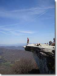
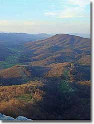
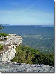
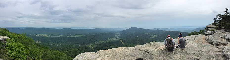
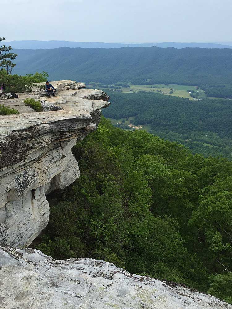
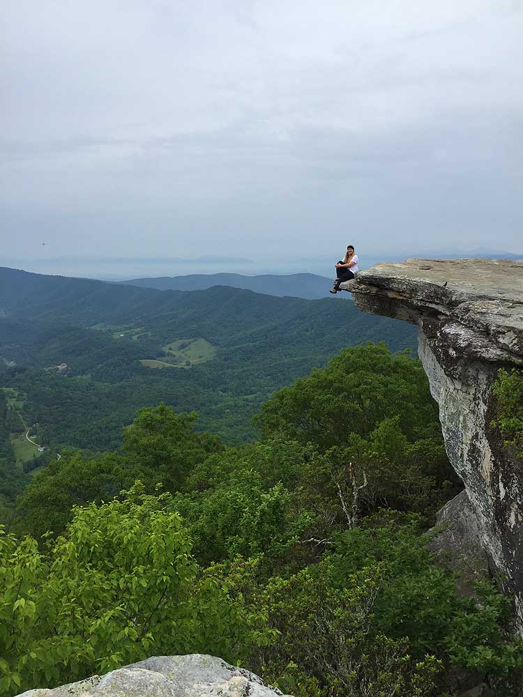
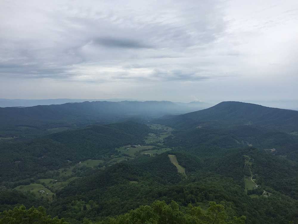
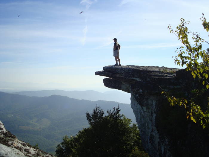
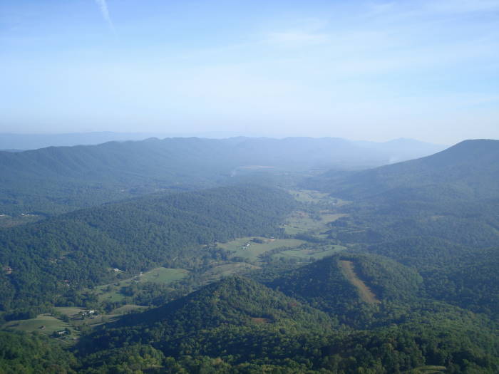
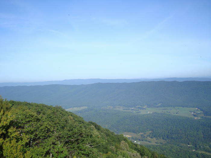
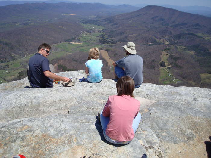
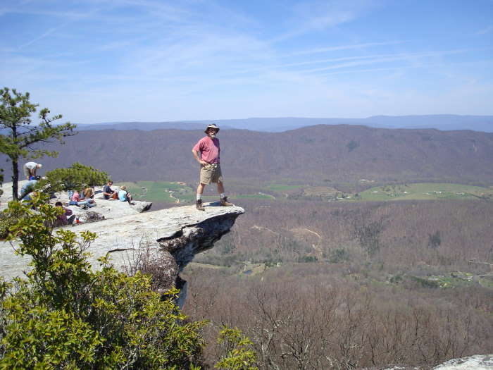
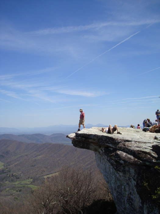
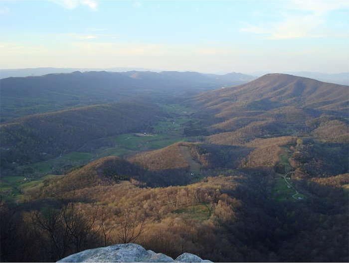
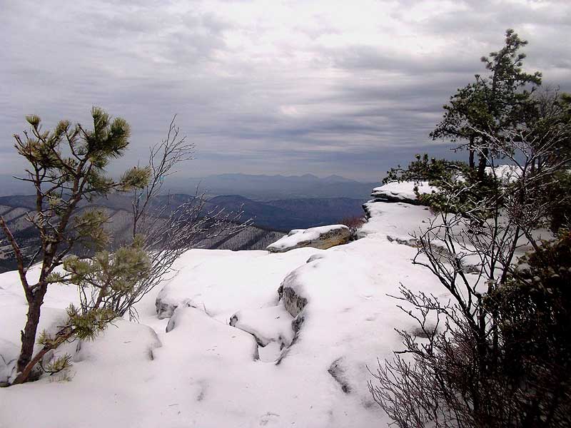
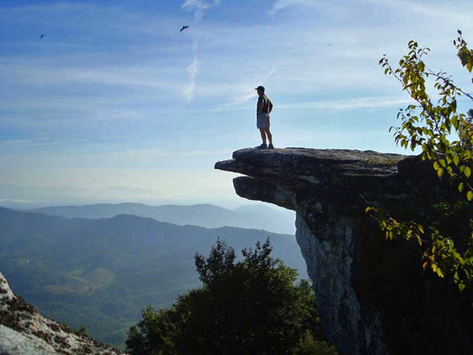
Part of the National Park Service, McAfee Knob is one of the most photographed spots on the Appalachian Trail (A.T.) as it winds its way through Virginia. Roanoke.com states: “In Virginia, McAfee Knob is the Appalachian Trail's poster and postcard image. Pick up an Appalachian Trail calendar and there's a good chance it's there.” The Knob has an almost 270 degree panorama of the Catawba Valley and North Mountain to the West, Tinker Cliffs to the North and the Roanoke Valley to the East. If you are going to do this as a backpack and plan on camping at the Pig Farm campsite or Campbell Shelter the total distance will be 9.4 miles
Please Note:During the last several years the McAfee Knob area has seen a significant increase in hiker traffic. Please follow the Leave-No-Trace hiking etiquette. There are unique rules regarding group size, and camping for this area. Please visit the Roanoke Appalachian Trail club page for full rules and regulations.
There is a new trailhead access at Catawba Sustainability that accesses the A.T. via a fire road and new Catawba Greenway trail. This makes the hike to McAfee Knob roughly 10 miles, however the parking is far less crowded. Detailed description of Catawba Greenway is available here.
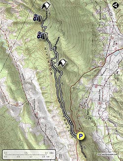
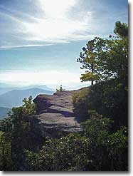
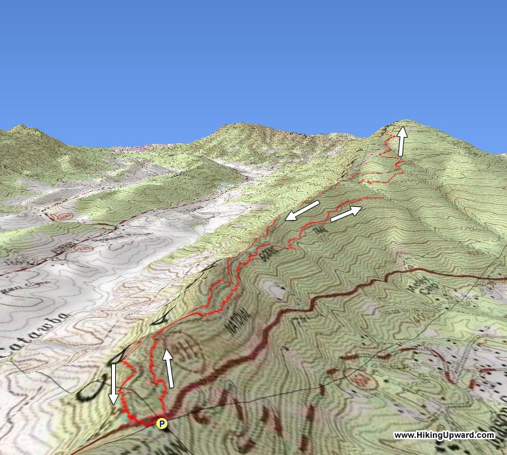
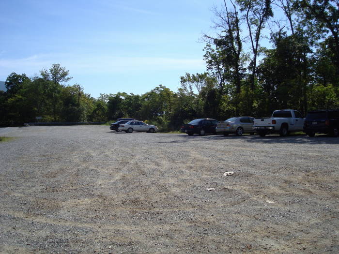
This out/back hike is a steady climb of around 1700’ in about 3.9 miles to McAfee Knob from the VA311 parking area so you will get a good workout. On a clear day you will have some of the best views in the Roanoke Valley. Due to its popularity you will not be alone on this hike, but the overhang of McAfee Knob and its views make up for the lack of solitude.
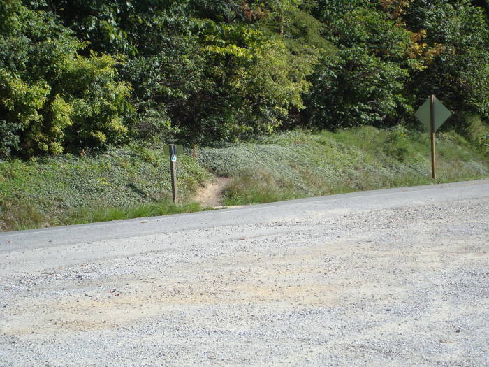
From the right side of the A.T. parking area, cross over VA311 where the Appalachian Trail crosses the road and pick up the white blazed A.T. north. In about 0.3 miles there will be an information kiosk on the left. Continue on the A.T. and pass the Johns Spring Shelter on the right.
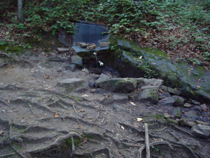
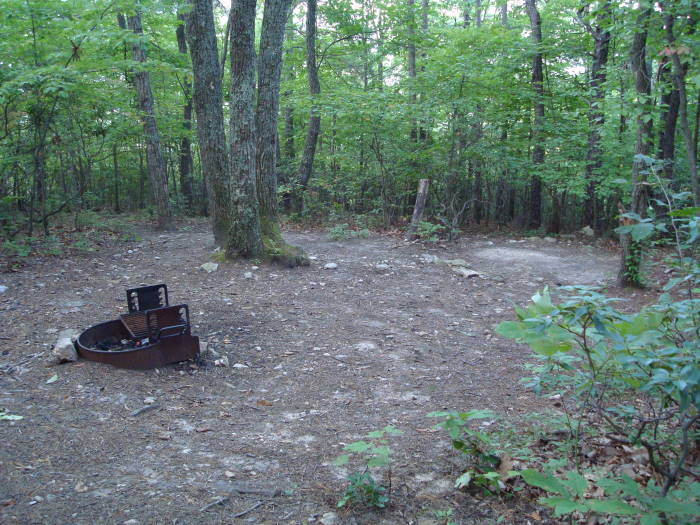
In less than 0.1 miles before the Catawba Mountain Shelter on the left, you will notice a spring with a white pipe protruding from some rocks. The water has dried up where there is a plastic pipe near the AT except in early spring or after very heavy rains. The spring goes underground and emerges in pools below the shelter. Follow blue blazes to the the pools. Continue downstream if necessary (note: always treat water from unknown sources). Staying on the A.T. for another 0.1 miles arrive at two good camp sites, the A.T. bears to the left just before the camp sites.
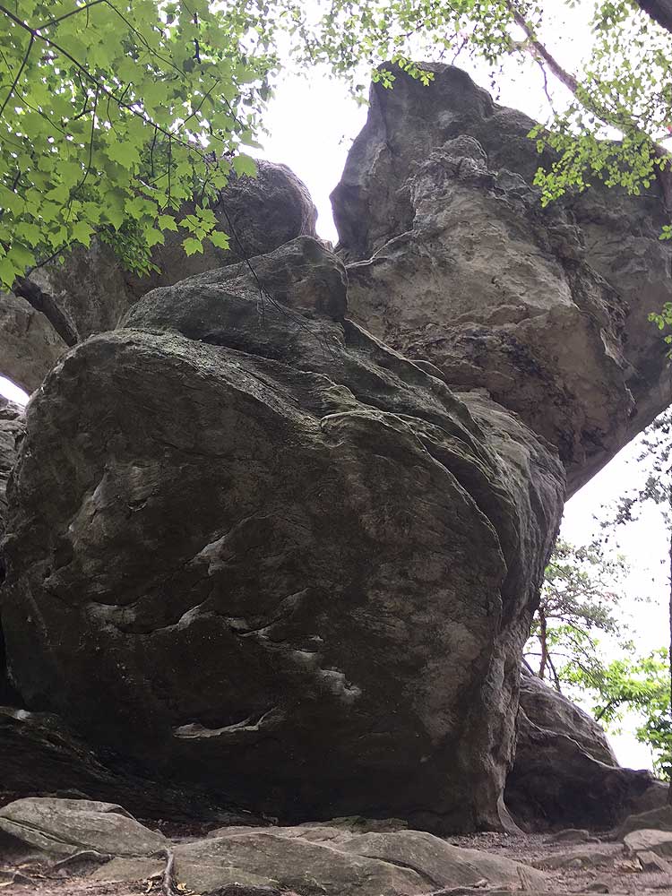
Remain on the A.T., crossing an old fire road and going through a high voltage power line clearing. In 0.3 miles past the power line clearing there will be the first good overlook on the left looking down to the Catawba Valley. Go 0.5 miles further up the trail to the McAfee Knob Spur Trail. Turn left, and in about 30 yards you will reach the top of the Knob with some outstanding views and of course, McAfee Knob protruding out well beyond the rest of the cliffs. There are significant drop offs so be careful.
For your return trip; retrace your steps and head south on the A.T. back to the parking lot for a round trip total of 7.8 miles.
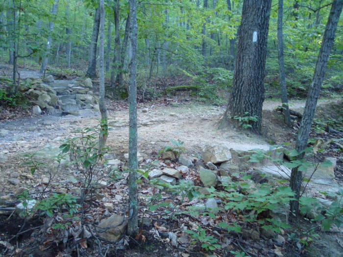
Alternate Route: This section of the A.T. is heavily traveled, and has over 50,000 hikers a year. To avoid the crowds, at the mile 0.3 and information kiosk on the A.T., stay left and take the fire road 2.5 miles to its second intersection with the AT. Turn left at the chain across the fire road and climb that stone steps on the A.T. to begin the last 1.1 mile of your hike to McAfee. On your return trip, turn right when you reach the fire road and walk about 2.5 miles on the fire road. Veer slightly left when you reach the chain across the fire road, climb briefly, and stay right at the top to rejoin the southbound A.T. and return to the parking lot in 0.3 mile.
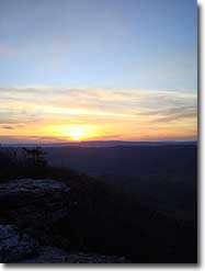
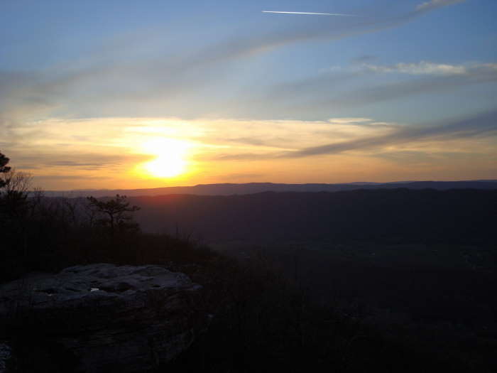
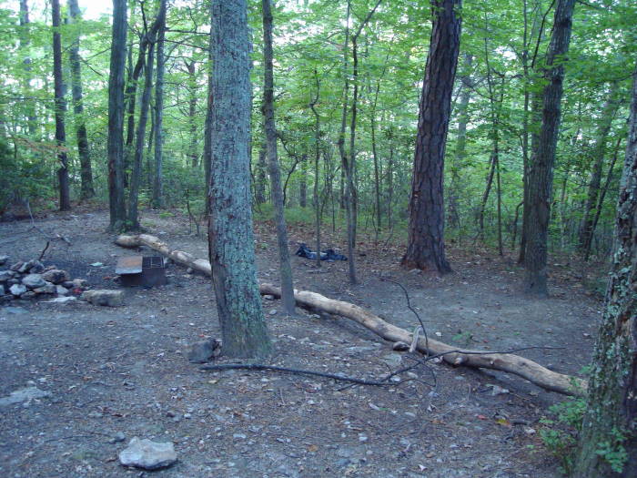
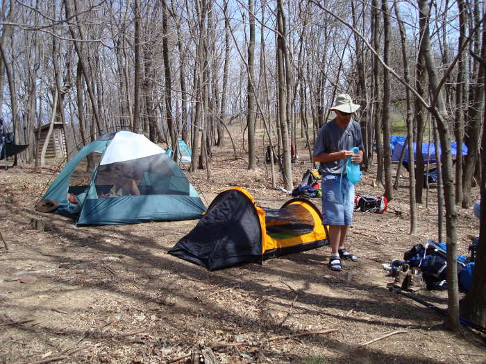
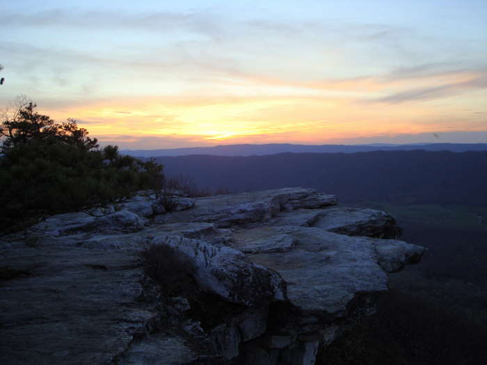
Camping/Backpacking: If you are doing McAfee Knob as an overnight backpack, from the McAfee Knob spur trail turn left onto the A.T heading north for about another 6/10 of a mile until you reach the Pig Farm Campsite with room for about 4 good sized tents. In less than 1/10 of a mile after that you will reach the Campbell Shelter with ample campsites and a Privy. The water source is a creek about 1/10 of a mile behind the shelter following a path under the power line and ending up on a fire road. There are also some good campsites in a grassy meadow on the way to the water source. A path from the Pig Farm Campsite also leads to this water source. Staying near the Campbell Shelter overnight made it possible to hike back up and see a beautiful sunset from McAfee Knob. No camping is allowed on the immediate area surrounding McAfee Knob.
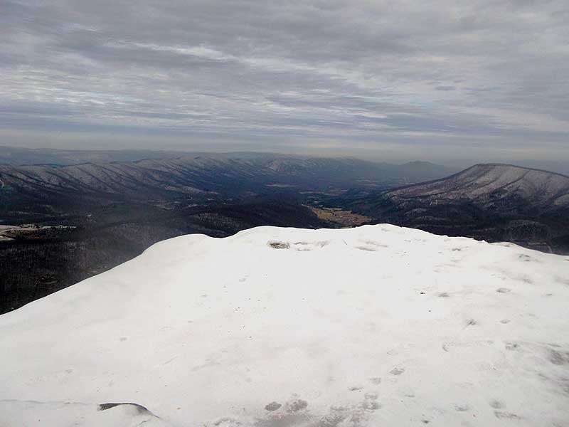
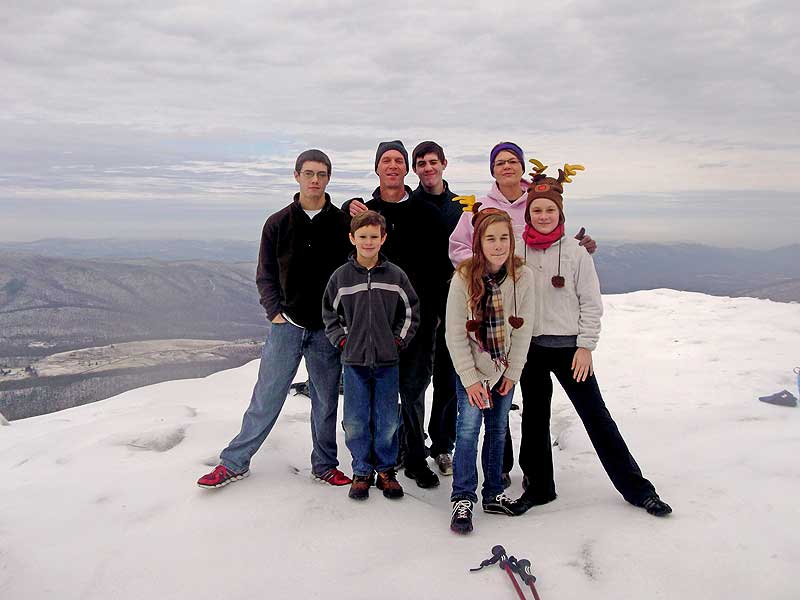
Late December - (photos provided by Dennis Cooley)
McAfee Knob
McAfee Knob Hike Comments
Archived Comments
By:Roy
Rating:
Date of Hike: Thursday, August 15, 2019
This trail is a fine start to Virginia's triple crown.(Dragon's tooth,Tinker Cliffs.I refer to these as Virginia's Triple Bypass.I noted one hiker only staying a few minutes to take some photos,Why not stay a while and ENJOY the view? Can the editors of the Website please add Tinker Cliffs to the All Hikes Map??? Maybe put an icon over the three hikes to distinguish them???? I do think it possible to do all three hikes in one day traveling from trailhead to trailhead.I did all three in two days,starting late on the first day.Hopefully without having to check into the local hospital in Catawba.Just a few final notes,a man with a dog asked me if Dragons tooth was dog friendly as he was with a dog.I thought later that I didn't think it was even people friendly,because of the difficulty.Knowing what I now know, I would have loved to take on the Carvin Cove Hay Rock hike,for the views.On a sad note the news of late,was the renewed interest in the Caldwell fields murders,that are very near McAfee Knob.Also not far away is the Audie Murphy Memorial.Y'all need to look that up if it interests ones curiosity.All in all,a fine introduction to the Roanoke area. HAPPY TRAILS,not HAPPY TRIALS!!!!
By:Divakar Naik
Rating:
Date of Hike: Saturday, July 20, 2019
Awesome !
By:RVA Hiker Girl
Rating:
Date of Hike: Monday, June 17, 2019
Absolutely amazing hike! The AT starts right across the street from the parking lot. The 1st 2 miles are fairly easy then it starts getting steeper the rest of the way. There are 2 shelters that allow over night camping and both have privies. The 2nd shelter you come to has a bear box. There are lots of different rock outcroppings at the summit to see breathtaking views. It also a great place to lunch or take a break and take in the views. North bound on the AT will take you to Tinker Cliffs or south bound the way you came will take you back to the parking lot. There is a fire road option to take down or up that is located by the 1st shelter. Its a much easier route, but I appreciate the AT and the work it takes to get to the summit that route and appreciate the summit even more. Be sure to take lots of water. I did not see a water source on the way up or down. I took 2 Liters but wish I would have taken 3L. I do have a video of my hike up McAfee showing the trail and the what the summit looks like if your interested. If you haven't done this hike this video may help you decide if its for you. https://youtu.be/b9e8pZ8lWJ8 DO THIS HIKE, the work it takes to get to the summit is so worth it!
By:DC Turtle
Rating:
Date of Hike: Saturday, April 20, 2019
Have made this hike dozens of times! It is definitely one of the all-time greats. Would note that this site describes it as being in Jefferson National Forest. Actually, as northbound AT hikers cross Va 624 north of Dragon's Tooth, they are entering a section over 30 miles long - including McAfee Knob, Tinker Cliffs, the AT through Daleville, all the way to Va 652 - where complete ownership of the AT is with the NATIONAL PARK SERVICE. The Appalachian National Scenic Trail (ANST) is actually a unit of the NPS with its own park superintendent based in Harpers Ferry, WV. Locally this section is part of the 120+ miles maintained by the Roanoke Appalachian Trail Club. It has restricted camping and other rules that do not apply in the national forest. For more complete details see, the page on the club website regarding McAfee Knob and "Virginia's Triple Crown" (includes Dragon's Tooth and Tinker Cliffs as well).
Updates and water conditions may be found on the RATC Facebook page.
By:Daddy daughter hike team
Rating:
Date of Hike: Friday, January 11, 2019
Hiked this trail on a cold (mid 30s during day and upper 20s that night) but clear and sunny day in January. We took backpacks with several bottles of water each and a bunch of junk food. We took flash lights and headlamps for the walk home after sunset, and a few basic outdoors safety items like ponchos and chemical hand warmers. We encountered about 15 people coming/going and at the top. It was nice seeing others while hiking, while still having plenty of privacy and feelings of solitude. The parking lot obviously wasn't an issue, which is one of the reasons we wanted a winter hike. Low volume of others and easy parking. We hit the trail at about 13:00. My daughter is 11, so we weren't fast but still hit the top by 16:00. We really did take our time and stopped to look around a lot on the way. An hour walking around at the top and taking pics was plenty of time... though we hung out a bit longer so we could walk back in the dark with all our personal lighting gear. We are both flashlight dorks and looked forward to the night hike about as much as we looked forward to reaching the Knob. With a good headlamp, even the rough parts of trail were fine for walking at night. Be sure to check out all the areas around the top though. Several are a bit off the path and take a few minutes of searching to locate. You can get some great views by looking around a bit and not just stopping at the first photo opportunity up there.
Feel free to contact me if you have questions. Im not an expert, but would be happy to share what I know.
By:Sarah
Rating:
Date of Hike: Sunday, June 17, 2018
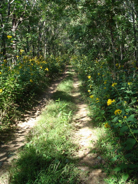
Absolutely beautiful views. Nice strenuous hike. Even if it's in summer, the tree canopy provides shade.
By:Megan A.
Rating:
Date of Hike: Friday, January 19, 2018
Fantastic hike! We went on a Friday and were the first car in the parking lot at 9:30AM. It took us just under two hours to get to the top, using the Appalachian Trail. We moved a pretty good pace, but did stop a several times to take photos along the way. The trail was still partially to fully covered with snow, but the trail is marked well so it was never an issue. We happen to be the only ones at the top that morning, but met half a dozen people on our way down. Snow and ice made the trail slick in a few spots (I did fall a couple times), so just be mindful of your footing.
By:forrestinthe4est
Rating:
Date of Hike: Saturday, October 21, 2017
I've done this hike a couple of times and it is definitely a favorite. This is a popular hike in the area with a lot of people on the trail and at the top, particularly on the weekend. The parking area will most always be overflowing with cars on a Saturday. It usually takes me one and a half to do the trail one-way, so about 3 hours total, plus however long we spend at the top. Not a very difficult hike IMO - just a gradual climb up to the overlook. Obviously, the fire road is slightly easier than the AT, but the two pretty much parallel each other and I didn't find either way terribly difficult. The last time I hiked it, we went up the fire road at night in the dark and camped overnight at an AT campsite, which is about 6/10 of a mile past the overlook (Camping at the overlook is not allowed, but the Campsite overlooks Roanoke and is pretty cool to see at night). We woke up before dawn and went to the overlook to watch the sunrise - that was easily one of the coolest experiences of my life. This hike definitely needs to be on your to do list.
By:Five Happy Campers
Rating:
Date of Hike: Sunday, October 15, 2017
My husband and I had been wanting to do this hike for awhile and decided the kids were ready to tackle it. We have three daughters, twins that are 9 and the youngest is 6. We do a lot of hiking with them and all three managed this hike just fine. We took the AT up and fire road on the way back to the 311 parking lot. We did this hike on a Sunday and the parking lot was nearly full at 6:50 in the morning. The whole thing took us about 6 1/2 hours but we spent about an hour at the top to have lunch and take a few pictures. There were only a few people on the trail early in the morning, but it was very busy on our way back. For us, with the kids, this was more about endurance than actual skill. I'd be lying if I said they weren't tired by the time we reached the car, but they didn't complain once. We had a great time and will be back.
By:Wendy
Rating:
Date of Hike: Saturday, October 14, 2017
We left our house at 5:15 am and arrived at the parking lot at 7:15 and it was already about full. Come early if you want to park in the parking lot. Headed on the trail about 7:30am. It was a great hike. We had 3 dogs with us (lots of dogs on this trail). The hike was somewhat difficult which we loved. There are many stairs and rocks to climb. It took us about 2.5-3 hours to get to the top but SOOOO worth it. The view was amazing. When we started it was clear, then we hike through fog for about 30 minutes and then back to clear. When we got to the top we realized we had hiked through the clouds because we were higher than the clouds and looking down at them. Got some really awesome pictures of this. There weren't that many people up there while we were there so we were able to get great pictures without other people in them. While up there, a young man got down on one knee and proposed to his girlfriend. She was shocked, but said yes. Congratulations to this newly engaged couple!! One the way back down we must have passed 200 people so we know the top was going to be very crowded. I recommend heading out early on this trail. Over all, it took us about 5.5 hours round trip. We stayed on the top for about 30 minutes enjoying the view and having lunch.


