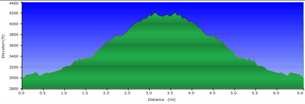
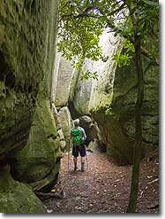
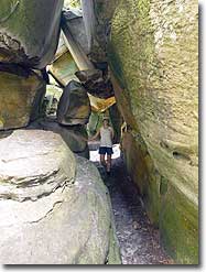
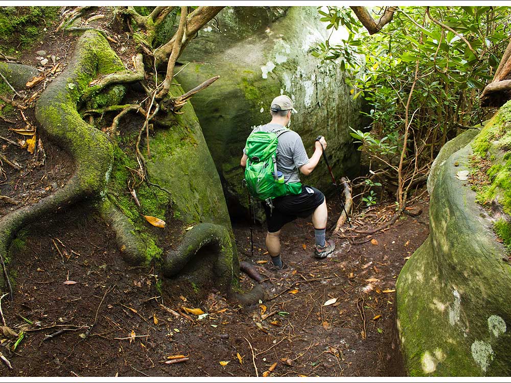
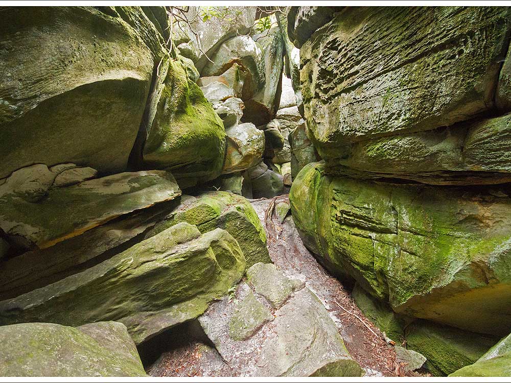
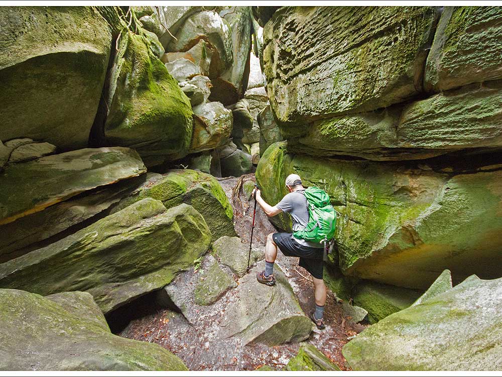
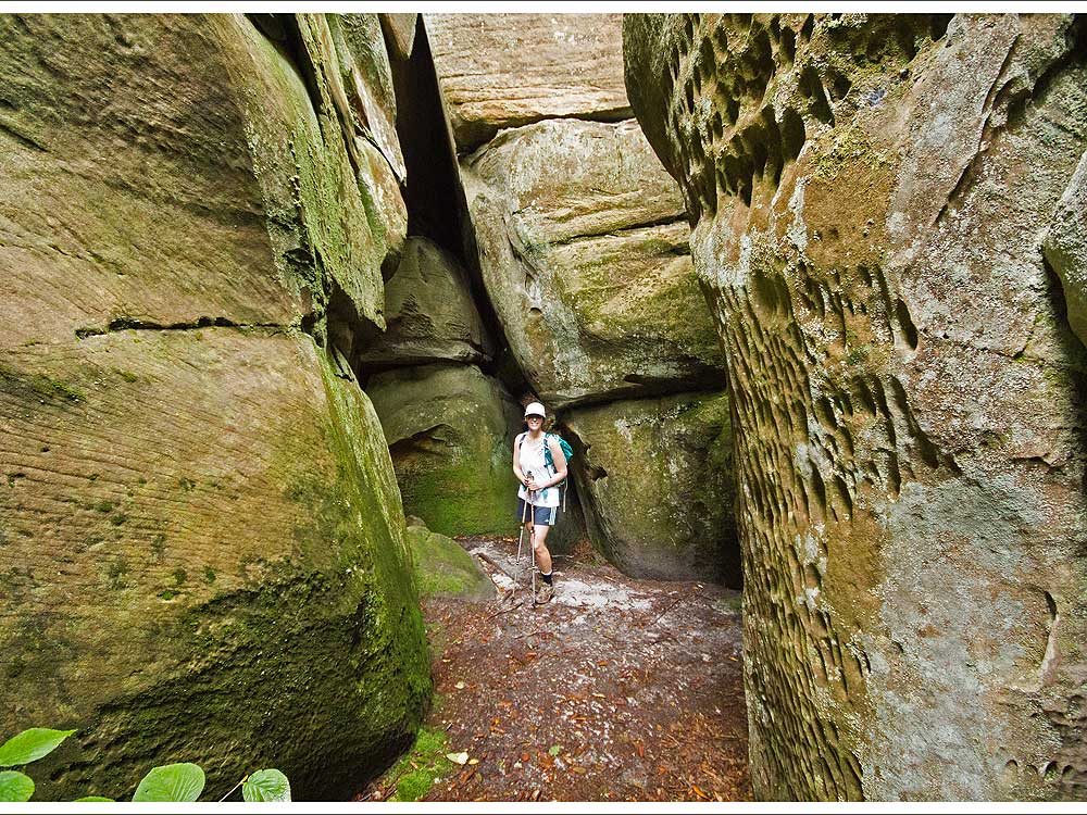
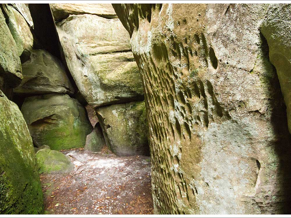
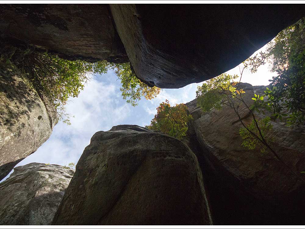
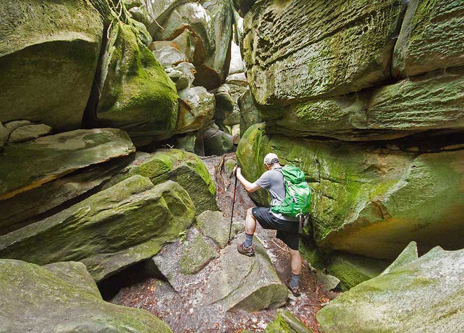
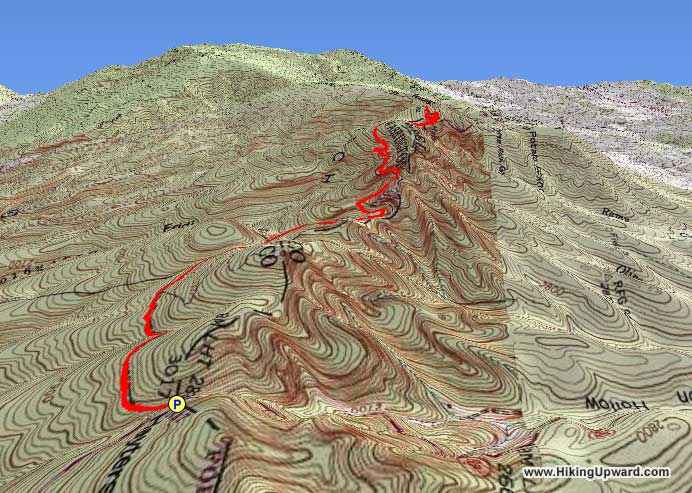
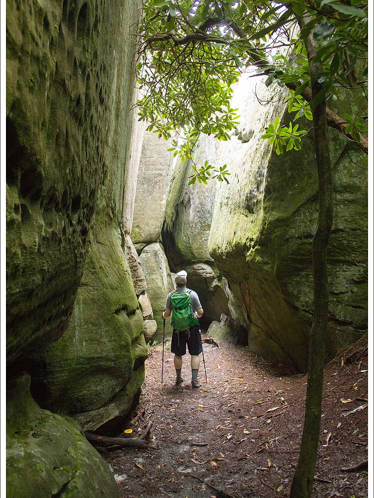
The Great Channels features a maze of slot canyons similar to what you may find in the southwestern United States. The hike is a hidden gem in southwest Virginia and you will find nothing else in Virginia quite like it. The Great Channels Natural Area Preserve is one of Virginia’s most geologically fascinating areas. This 6.6 mile out-and-back takes you down into a network of maze-like crevices formed in soft sandstone.
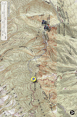
Mile 1.0 – On the right you will see some privately-owned cabins, but there is no trespassing on this private property.
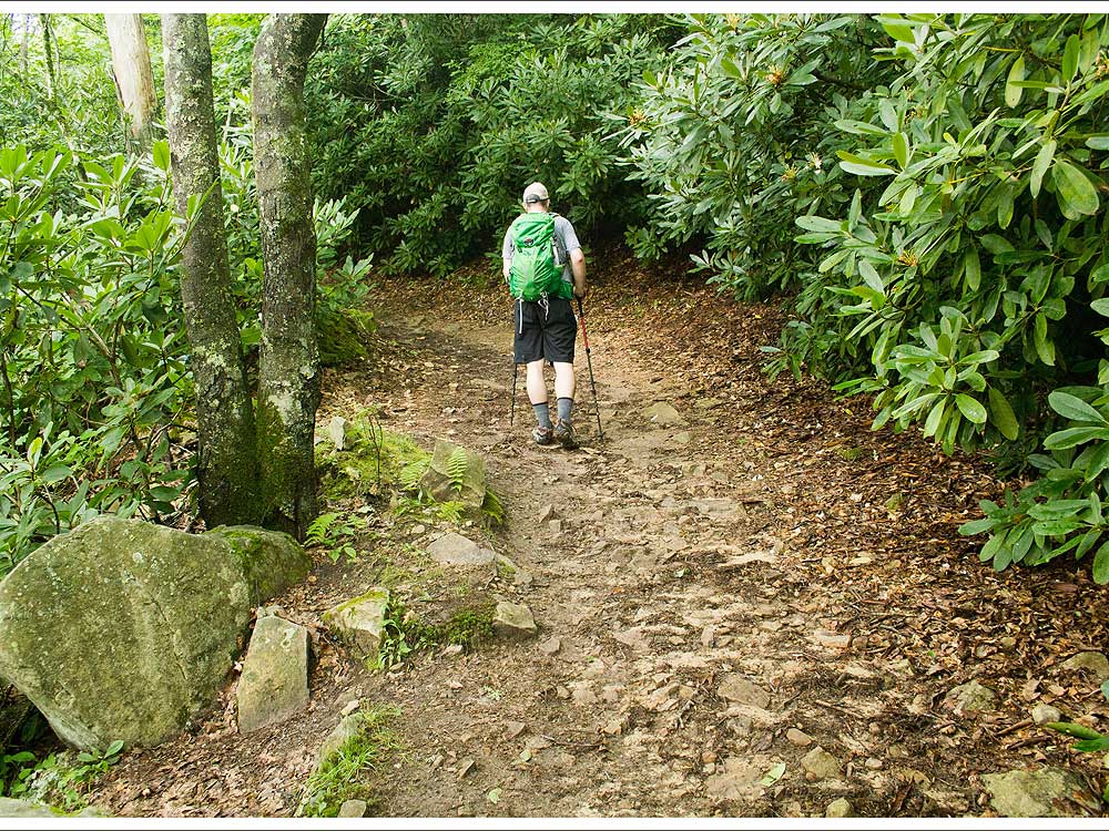
Mile 1.5 – You reach Shallow Gap, which provides some obstructed views to the right of the trail through the trees. The trail begins to become steeper.
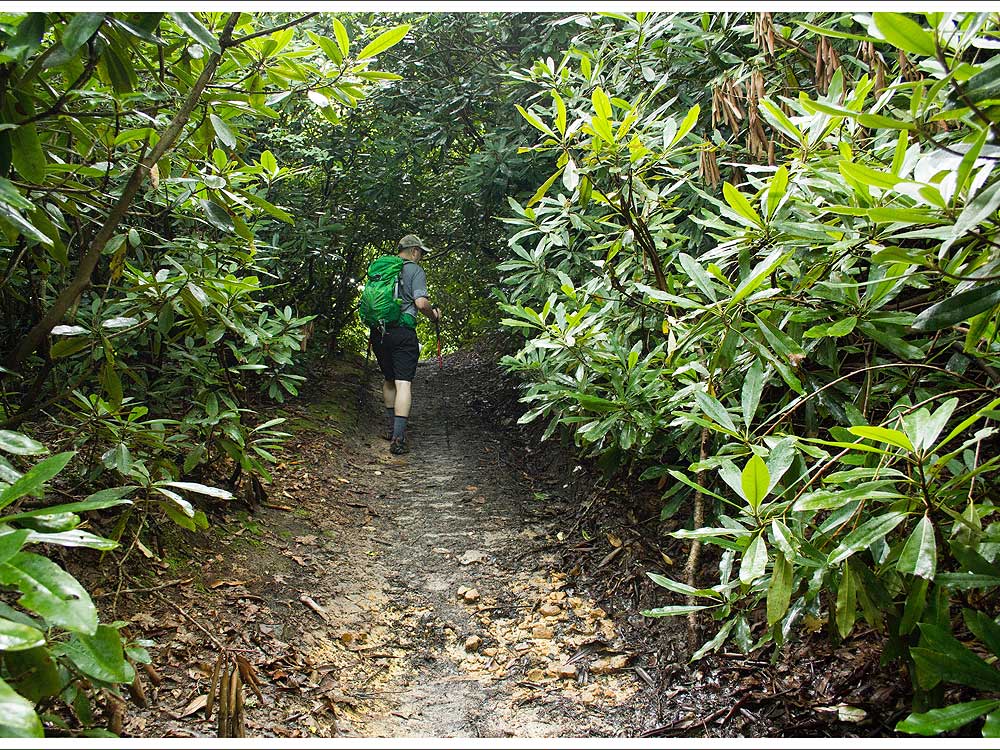
Mile 2.25 – Come to a small outcrop of sandstone, similar to what you will find at the Great Channels. Shortly after this, you will begin a couple of switchbacks, which take away some of the steepness of the terrain.
Mile 3.7 – Reach the junction with the white-blazed Brumley Mountain Trail. Take a right to follow the trail back to your starting point.
Mile 5.75 – Reach the junction where the fire road takes a sharp left uphill. Stay straight.
Mile 6.6 – Pass through the gate and return to the parking area and the end of the hike.
Late July
Great Channels
Great Channels Hike Comments
Archived Comments
By:Medic-G
Rating:
Date of Hike: Monday, July 10, 2017
Since there hasn't been a trail review in several years, I thought I would write one. My wife and I did this hike on July 10th.
We saw this hike on Hiking Upward and put it on our list of hikes to do. Since this hike was so far from where we lived, we decided to make a 3 day adventure out of it. We decided to stay and camp at Hungry Mother State Park which is about 32 miles from the parking area. The directions I printed off from Google Maps stated you had to turn off of Route 80 on to another road to get to the parking area. This was a little confusing/misleading because the parking area is on Route 80 right near the Washington and Russell County line.
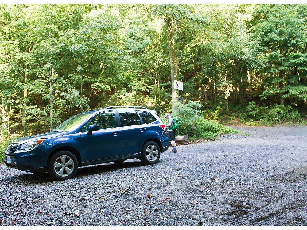
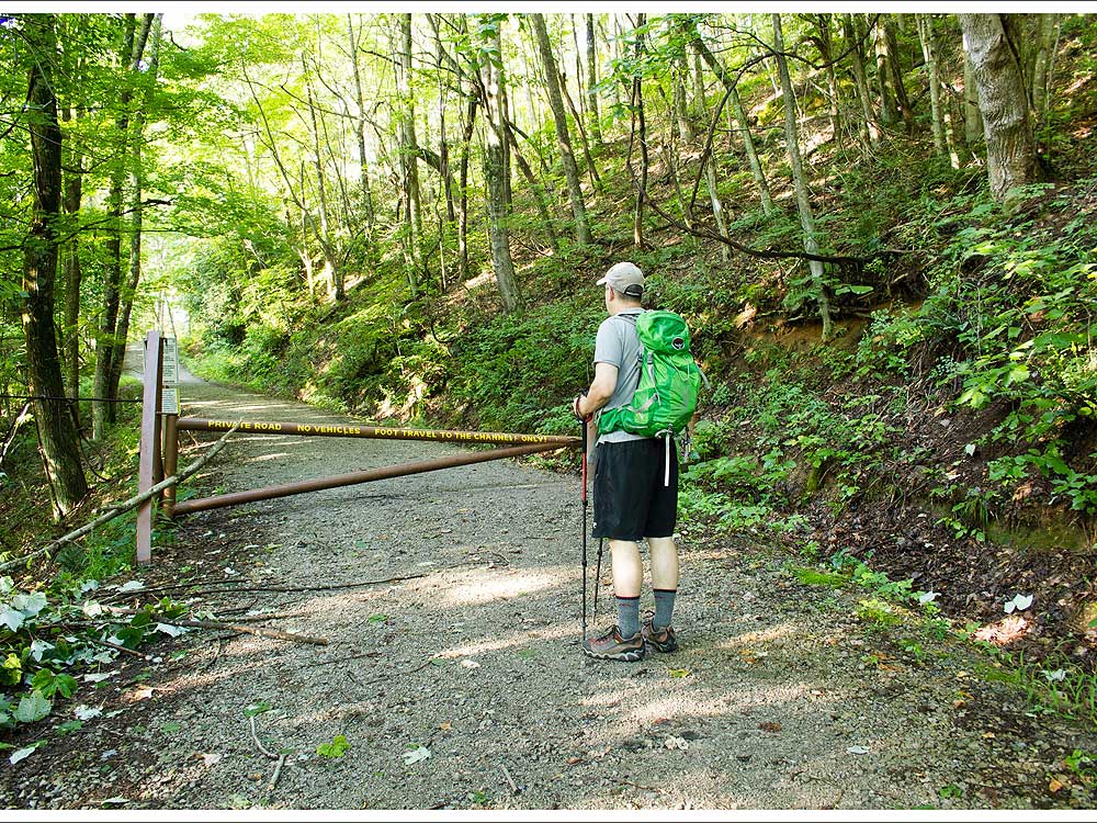
As the description states, you start by going up the gravel drive/road to the right side of the parking area. This is a drive/road which leads to Raven Ridge Lodge. This would be another option for a place to stay if you are traveling a distance to do this hike. A Google search for Raven Ridge Lodge at Hayters Gap should net you needed information if you are looking to stay there. There is a sign for the lodge posted to a tree at the end of the gravel drive/road beside the parking area. This is where you begin your hike and can also help you spot the parking area traveling up Route 80. There is also a wood kiosk/information board at the parking area however, there wasn't much information posted there.
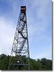
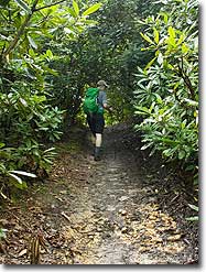
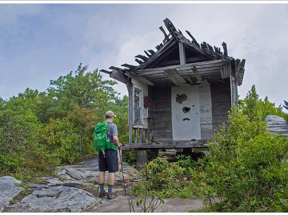
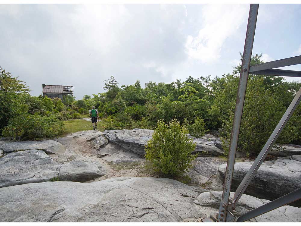
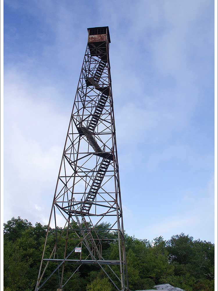
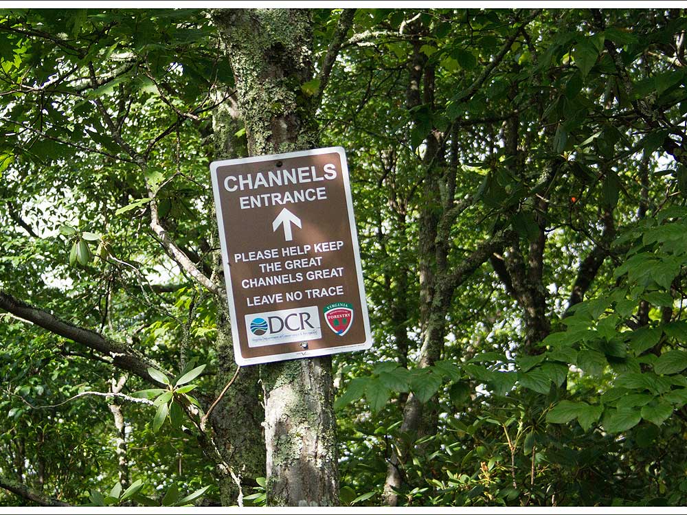
The trail conditions were good the day we did our hike. The majority of the trail was like a 'super highway' in trail terms with the trail relatively 'smooth' and large rock free. I usually where hiking boots which provide ankle support however, after reading some information on the trail/hike, I decided to wear low hiking boots. Based on the trail conditions, this was a good choice and you should do fine wearing boots/shoes which do not provide ankle support. I would agree with the trail difficulty rating of a 3. You basically do all of the uphill going to the Channels. When you reach the summit of Middle Knob on the Great Channels trail, the trail comes to a Y/T with no blazes as to which way to turn. At this point you can see the fire tower to your right. To reach the fire tower turn right and go up the small rock outcropping. If you turn to the left and follow the well established, unmarked trail, you will come to a large rock outcropping with some awesome views. We would have liked to have stayed here a little longer and enjoyed the views however, the rhododendron had bees buzzing all around them and my wife got stung several times without any provocation. So, we decided to cut short our time here. At the fire tower, the entrance to the Great Channels is about the 11-12 o'clock position as you are facing the fire tower's danger sign. There is signage there so, you shouldn't have any difficulty finding the entrance to the Channels. On a side note, too bad the fire tower isn't converted to an observation tower as I bet the views from there would have been awesome. My wife and I were tempted to climb it despite the warning and prohibition on climbing it. In the end, we resisted our urge to climb it and really wished it had been converted to an observation tower as we have seen done to other fire towers in Virginia.
Trail solitude was listed as a 3. Overall, it probably is a 3 however, the day we did our hike, I would rate it more as a 2 as we encountered quite a few people. This must also be a 'word of mouth' hike as we ran into 2 separate hiking parties who were headed to the Channels without any information, trail guide, or map. They just knew to start hiking from the parking area. Needless to say we provided these parties with some information which hopefully helped them out. You can do this trail without any maps/guides as it is well marked. Signage on the trail does point/direct to the Channels however, the trail guide from Hiking Upwards does help with some of the subtleties of the trail and gives you an idea of how far you've hiked along the way.
Trail views are listed as 2. I would agree with this rating however, you can catch a few views along the trail. This is not a 'deal killer' at all to me because you do this hike to see, explore, and experience the Channels.
Camping is listed as a 1. I would say camping should be listed as a zero. This hike is part of the Channels State Forest and Channels Natural Area Preserve. Camping is prohibited in the state forest and natural preserve. The Virginia Department of Forestry also provides some information about the Channels State Forest and the Channels on its website which is as follows:
The Channels were awesome and well worth exploring. It made this hike worthwhile and we are glad we did it. Rock formations like the Channels are something I think of as out in the mid-west. But, you can get a taste of what those mid-western slot canyons are like here in Virginia.
Hope this trail review helps and provides some additional information.
By:Smell N Roses
Rating:
Date of Hike: Sunday, June 1, 2014
Hiking Upwards needs to stop posting trip reports to my favorite secret spots! This is an awesome hike! The trip report failed to mention that if you keep a sharp eye open, there are multiple spots where you can climb on top of the rocks for awesome views of the surrounding area. You can easily see Beartown Mountain (VA's 7th highest) and the Mount Rogers high country, as well as the spine of Clinch and Brumley Mountains, Big A Mountain, and more. The trail is part of the Brumley Mountain Trail which connects with Hidden Valley WMA (fee area). So much to do in the nearby area as well. This part of Virginia is not well known to outsiders.


