|
| Length |
Difficulty |
Streams |
Views |
Solitude |
Camping |
| 5.8 mls |
 |
 |
 |
|
|
Hiking
Time:
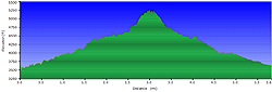
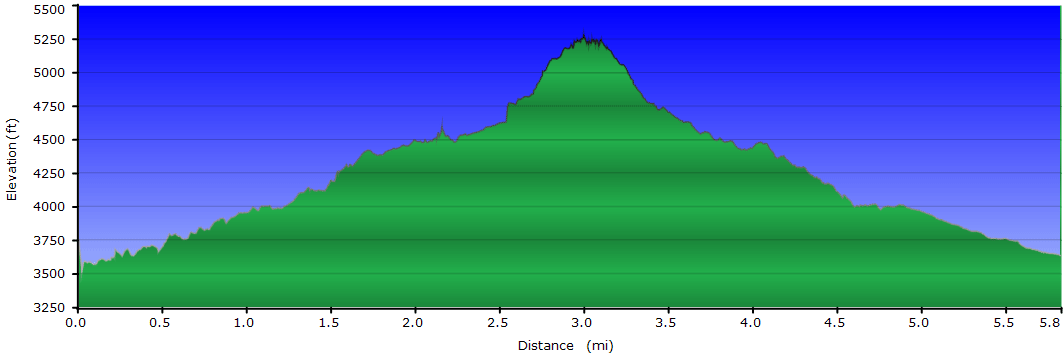
Elev. Gain:
Resources: |
3 hours and 45 minutes with 1 hour of breaks
1,635 ft
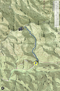
 Topo Hike Trails Map (PDF) Topo Hike Trails Map (PDF)
Otto, NC Weather Forecast
Garmin (GDB), Gaia/Trails App (GPX) (What's
this?)
3D
View of Route |
 By Trail Contributor: Zach Robbins (Contact Zach) By Trail Contributor: Zach Robbins (Contact Zach)
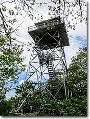
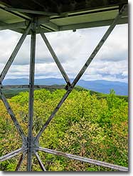
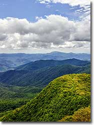
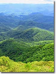
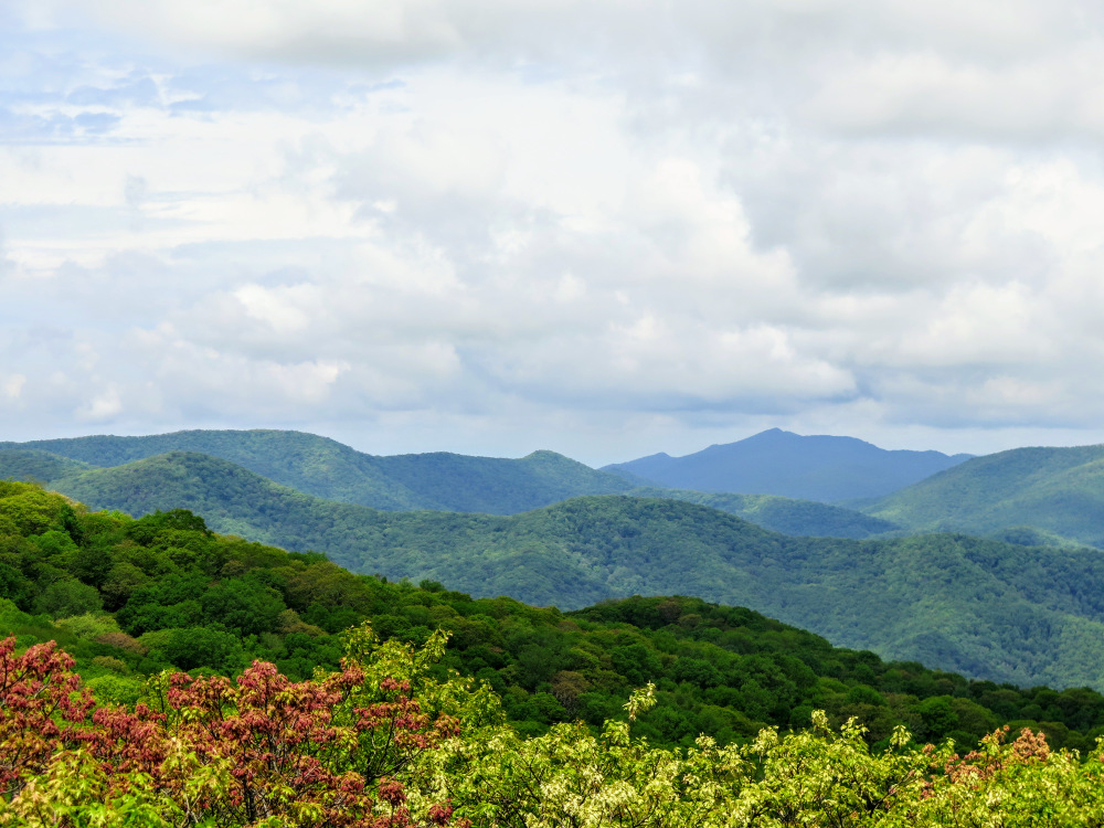
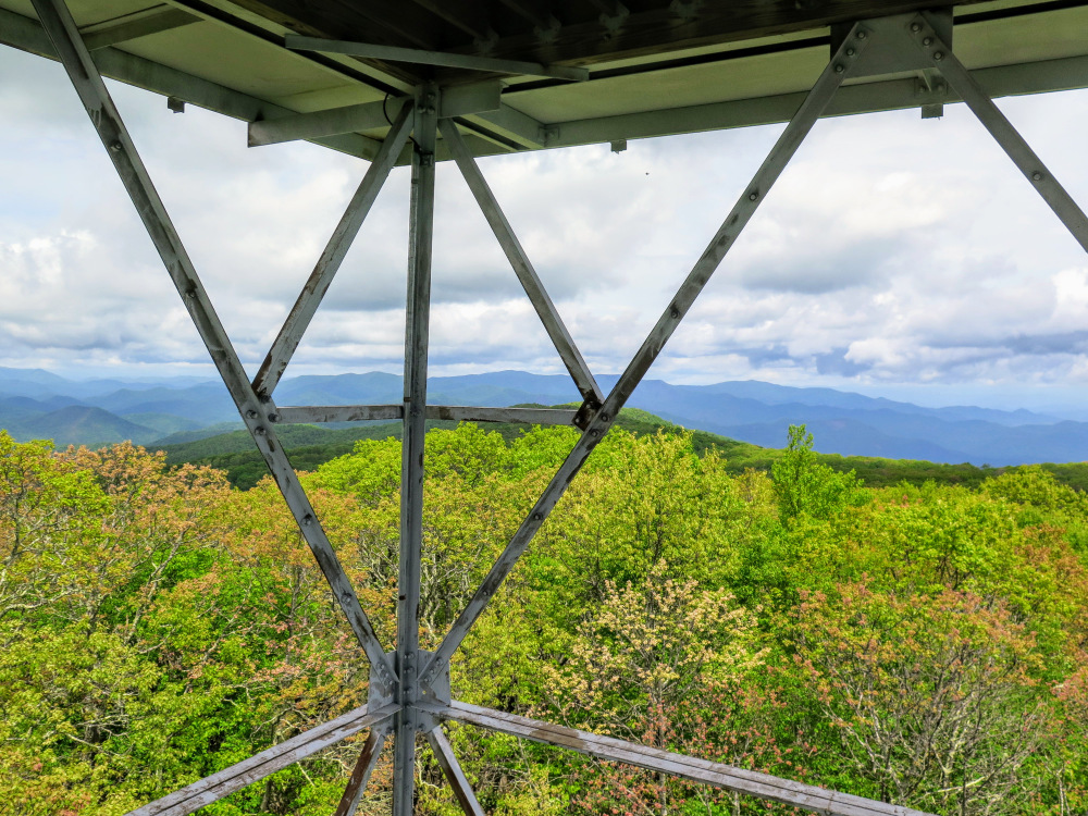
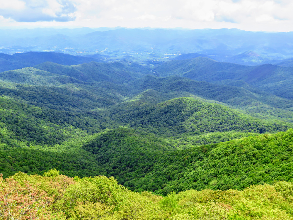
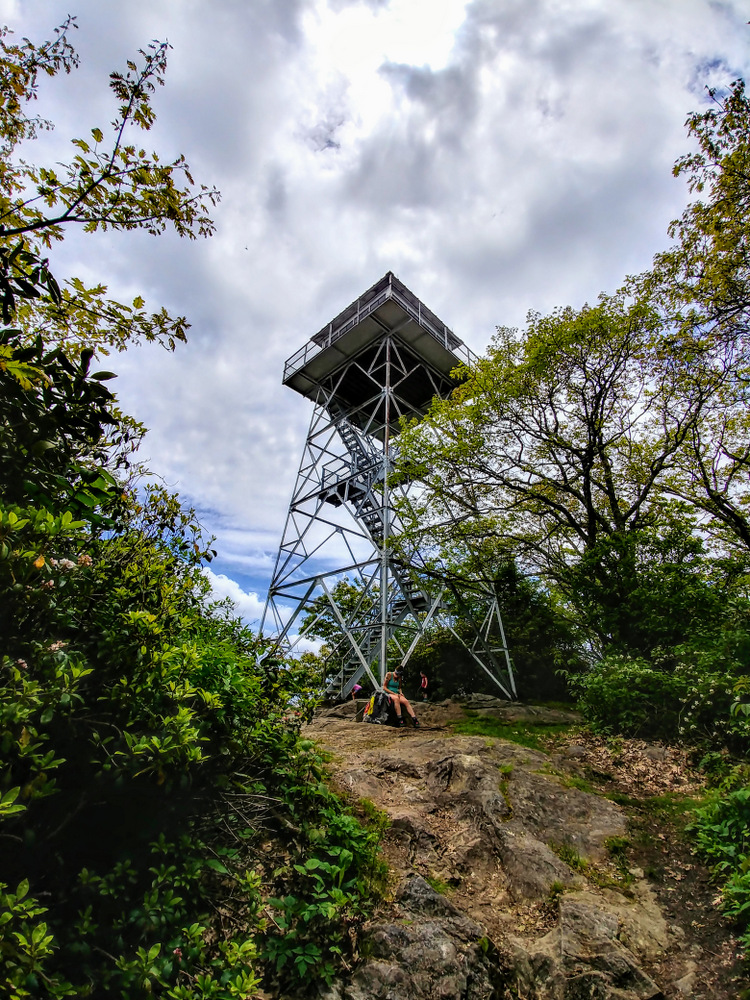
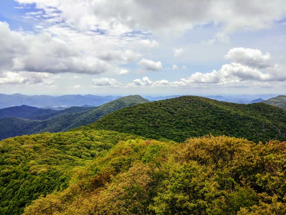
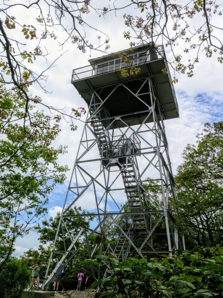
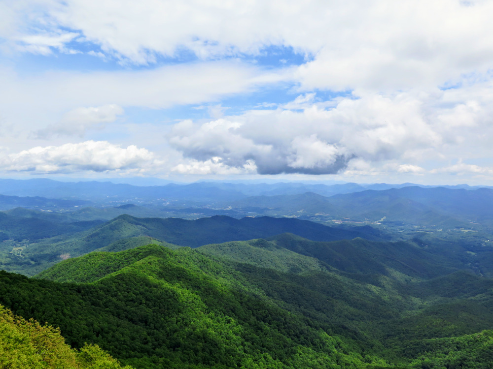
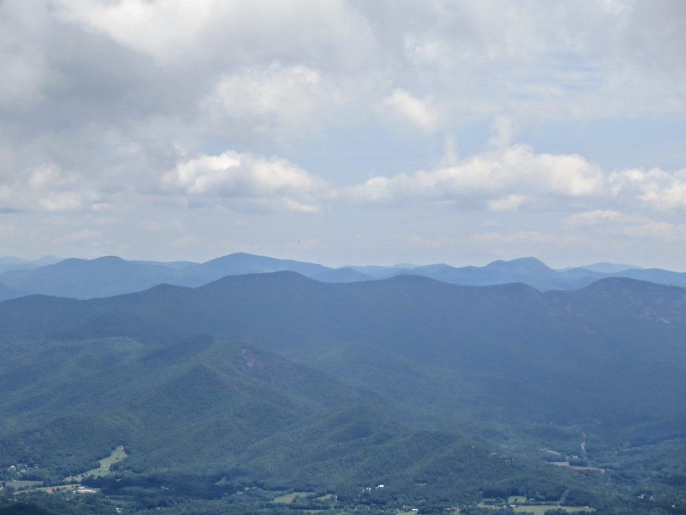
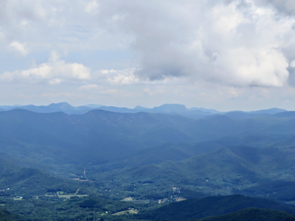
Albert Mountain, located outside of Franklin in the southeastern Nantahala Mountains, is the second tallest peak the Appalachian Trail crosses in its first 100 miles from Springer Mountain, GA. The 5,223-foot summit holds a 43-foot lookout tower, originally constructed in 1951 to overlook the Coweeta Hydrologic Laboratory to the east. The moderate day hike described here begins at FR 67 deep in the Nantahala River Basin and follows the Bearpen Gap Trail to its endpoint at the Appalachian Trail. Once you reach the Appalachian Trail it is a short but very steep 0.3-mile climb to the summit. Although the top cab is normally locked, you have great views from the stairs in three directions. To the southwest, the high peaks of the Southern Nantahala Wilderness closely surround the region. The land drops suddenly from northeast to southeast towards the Little Tennessee River Valley and the Highlands Plateau, with peaks such as Rabun Bald, Whiteside Mountain, and Yellow Mountain plainly visible. On clearer days, you can see the Great Balsam Mountains in the distant northeast. The tower supports block clear views of Wayah Bald and Wine Spring Bald due north, but that is the only drawback when the top cab is closed.
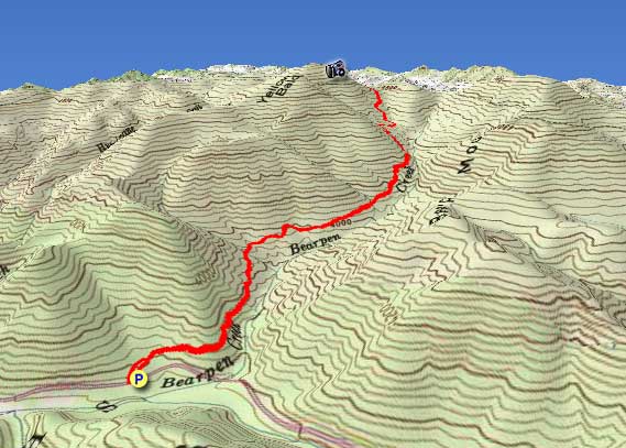
| Mile Summary and Highlights |
0.5 - Bearpen Gap Trail leaves FR 67K
2.6 - Bearpen Gap Trail ends at FR 67, follow Appalachian Trail north
2.9 - Albert Mountain summit (5,223 feet) and lookout tower |
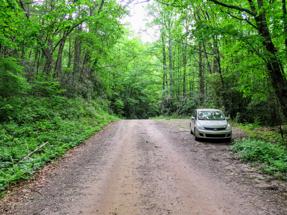
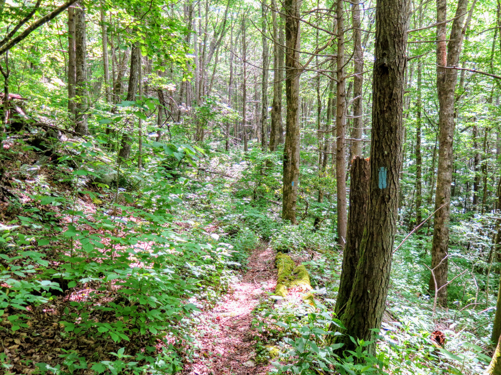
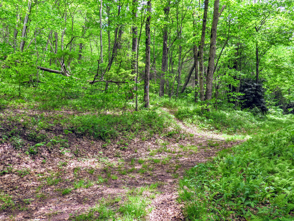
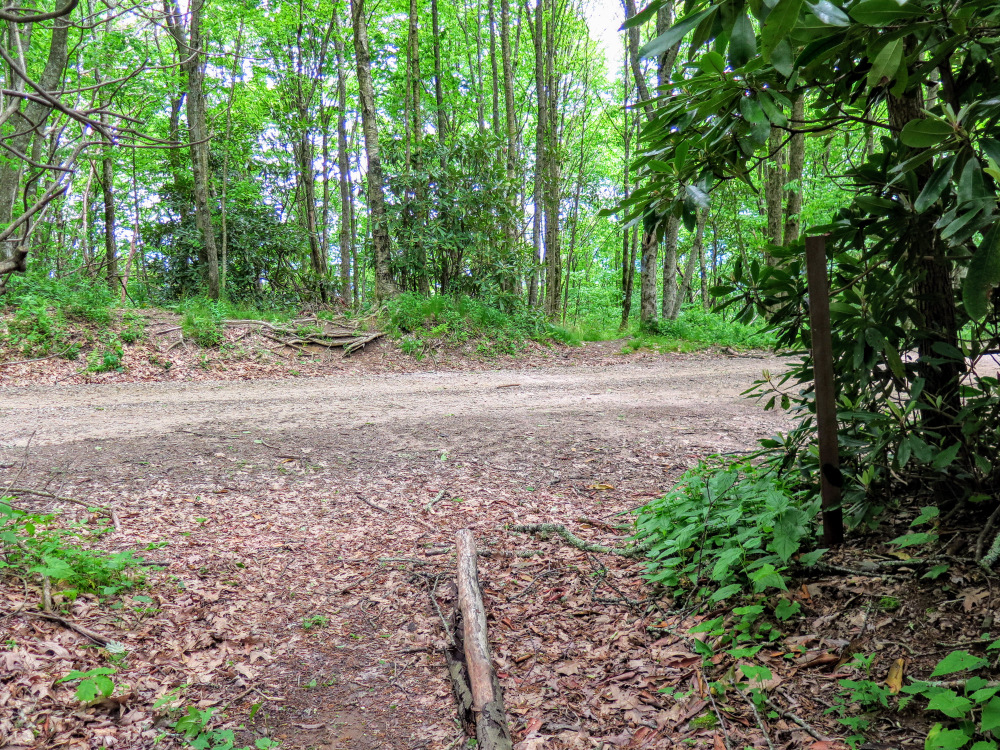
- Mile 0.0 – Park at a pullout on FR 67 opposite a gated forest road with a carsonite FR 67K sign. The Bearpen Gap Trail [442] (blue blaze) begins about hundred feet north, but it is easier to follow FR 67K which is wider and less overgrown.
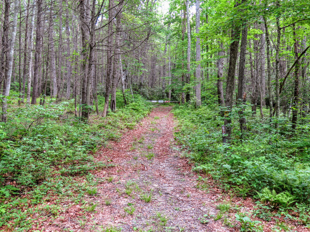
- Mile 0.1 – The Bearpen Gap Trail intersects with FR 67K and follows the forest road south. Immediately you’ll see orange blazes on the left and encounter a Y-junction with FR 67D/Thomas Branch Trail [375] (orange blaze) on the left. Continue straight/south on FR 67K/Bearpen Gap Trail past the Y-junction.
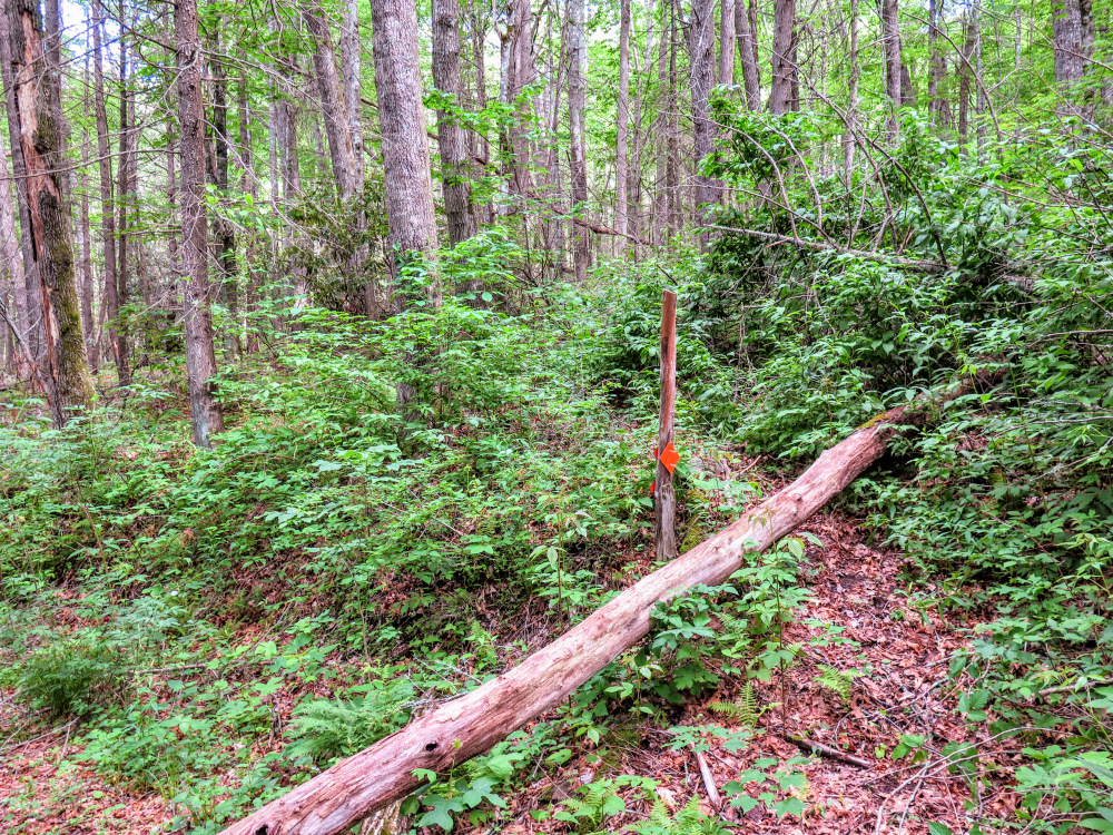
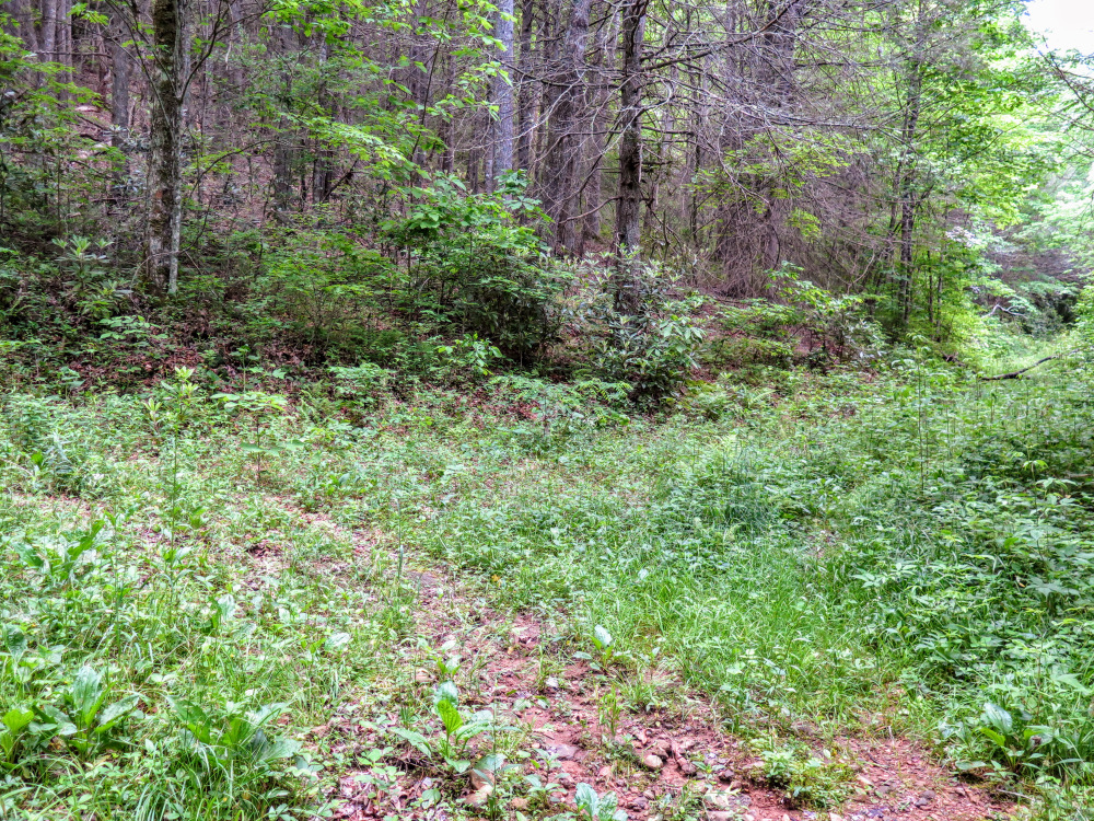
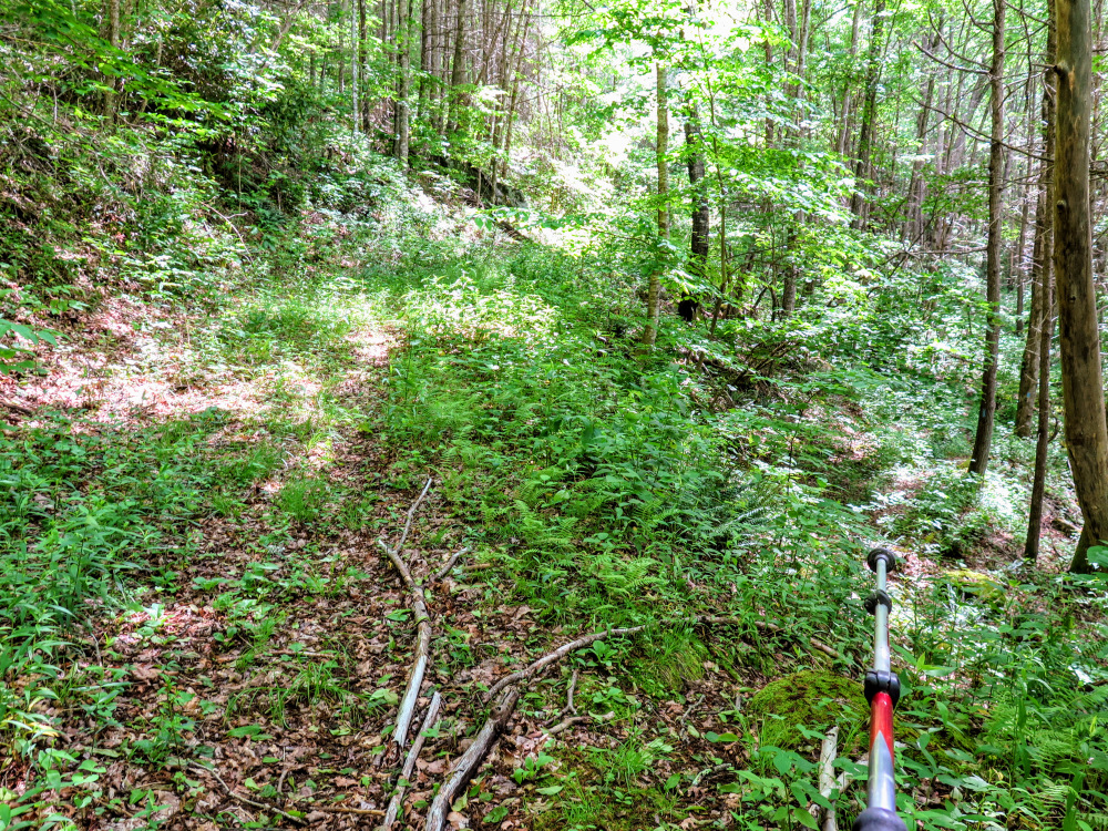
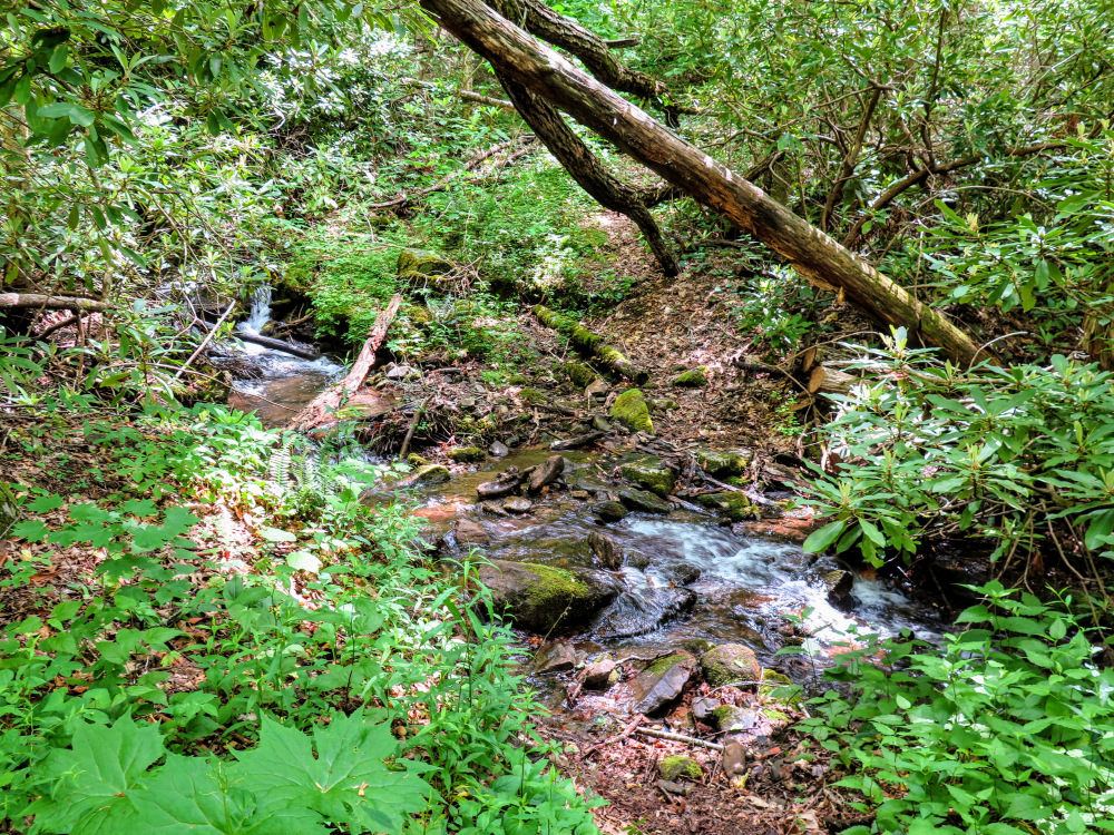
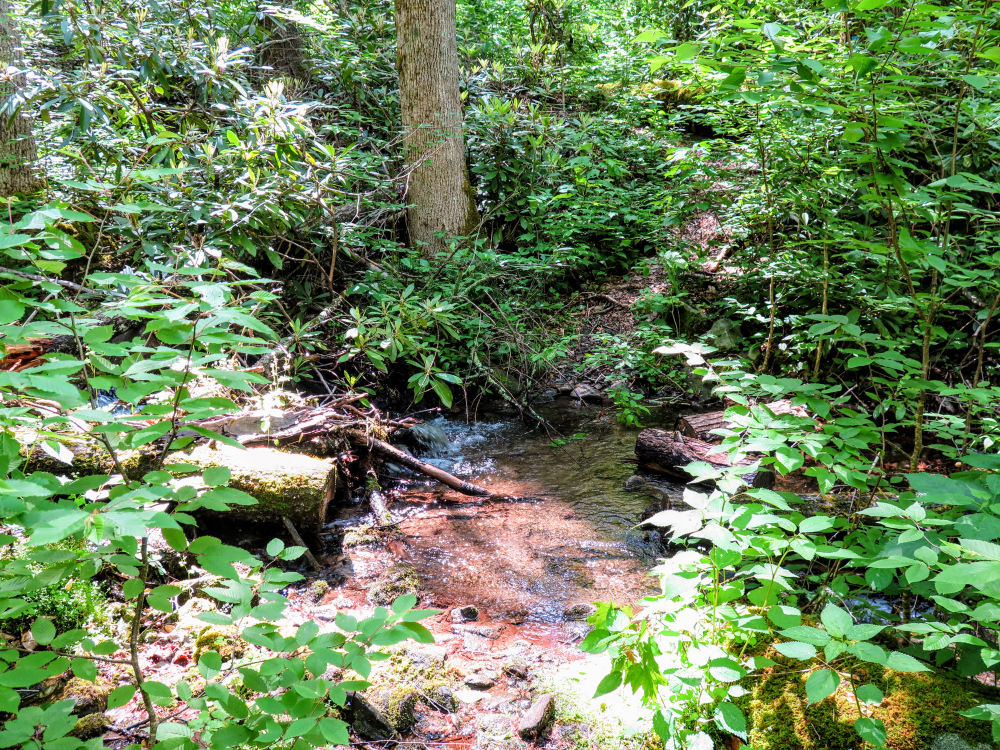
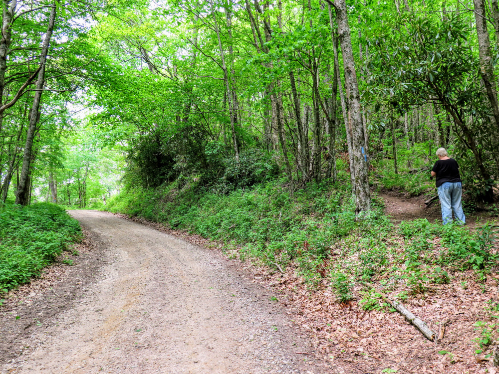
- Mile 0.5 – At a Y-junction the Bearpen Gap Trail turns right leaving FR 67K. You are now on a narrow trail above Bearpen Creek. Although the trail stays close to the creek, you are never close enough to get good views.
- Mile 0.8 – The trail rock hops a tributary of Bearpen Creek.
- Mile 1.4 – The trail rock hops a second tributary of Bearpen Creek.
- Mile 2.0 – The trail rock hops a third tributary of Bearpen Creek.
- Mile 2.1 – The trail rock hops a fourth tributary of Bearpen Creek.
- Mile 2.5 – Cross junction with FR 67Q.
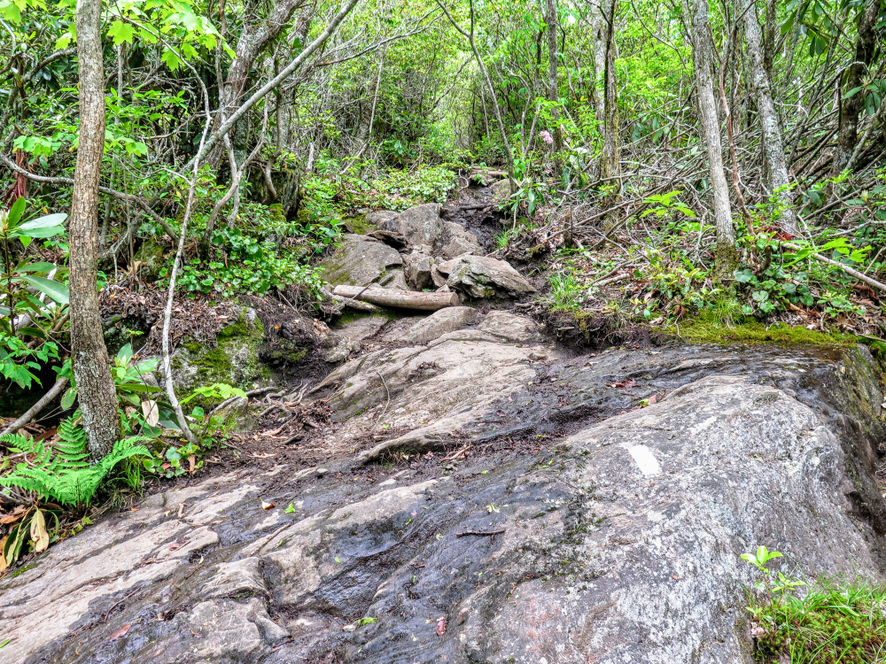
- Mile 2.6 – The Bearpen Gap Trail ends at FR 67. On the left pick up the Appalachian Trail (white blaze) heading north. The final 0.3-mi to Albert Mountain is a steep climb with steps and exposed rock faces.
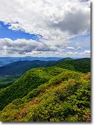
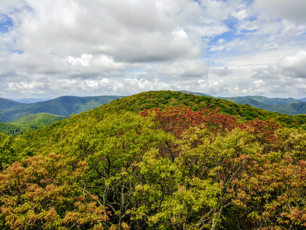
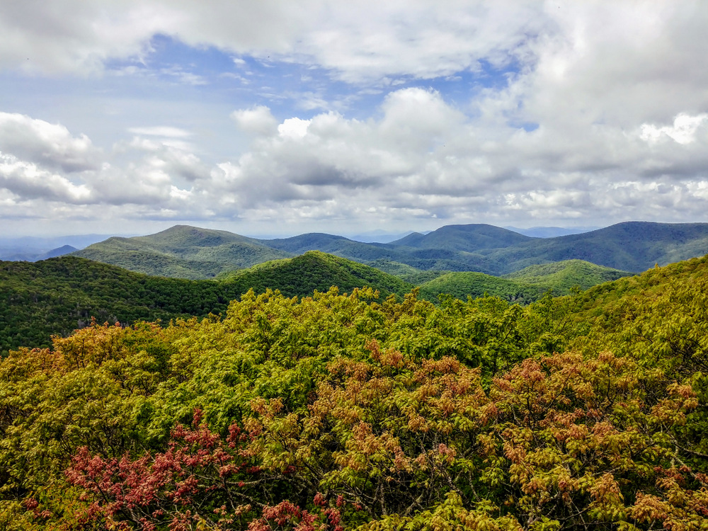
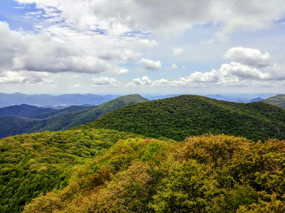
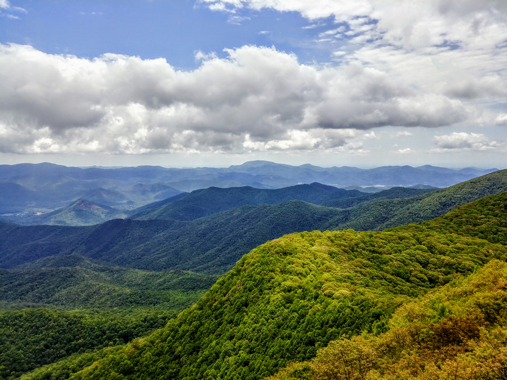
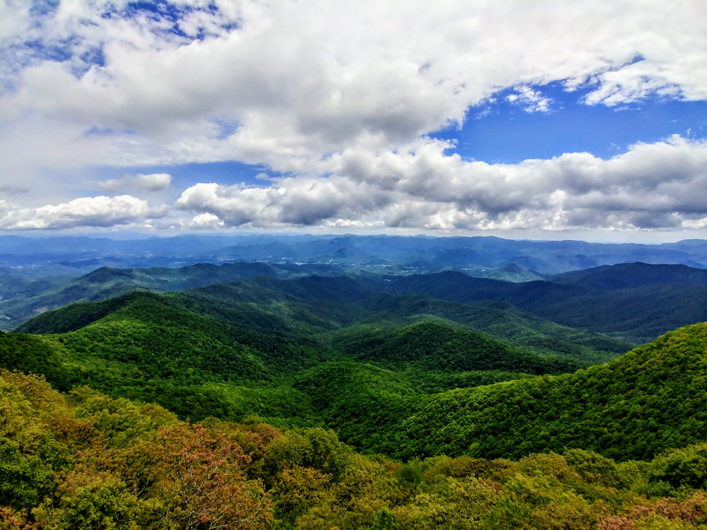
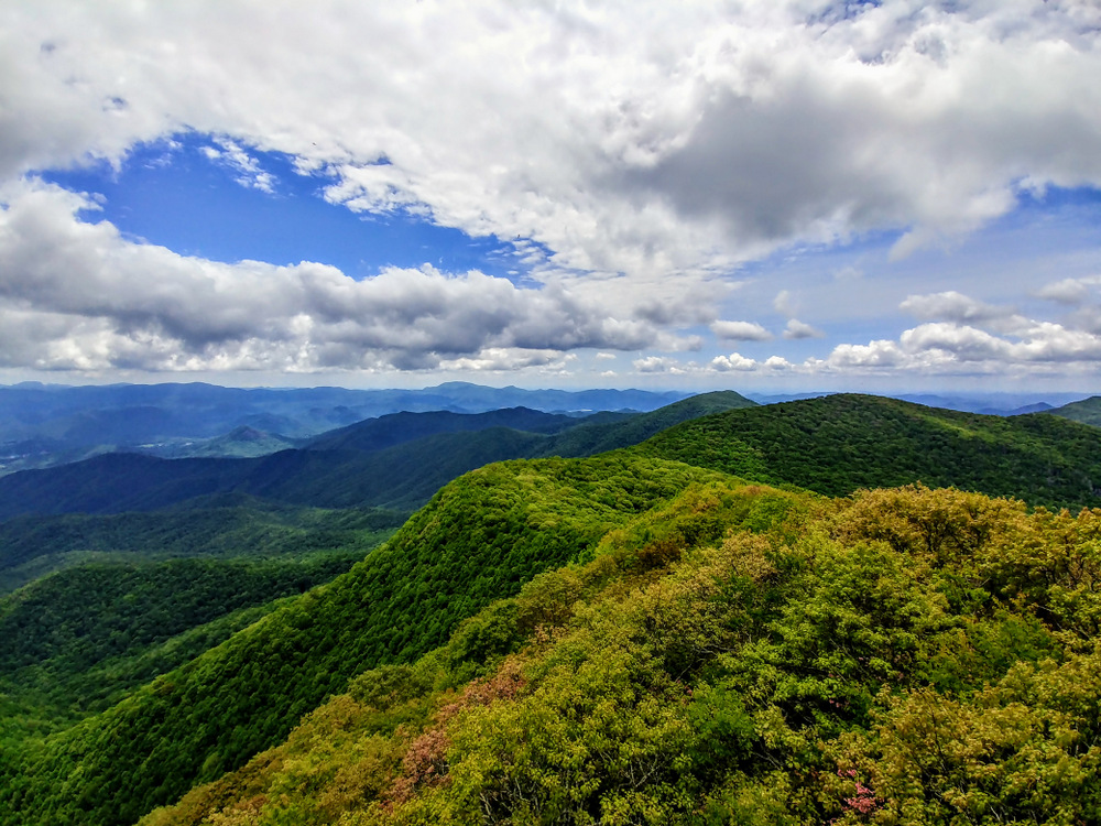
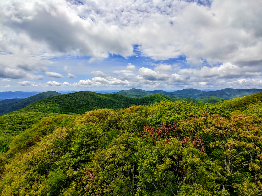
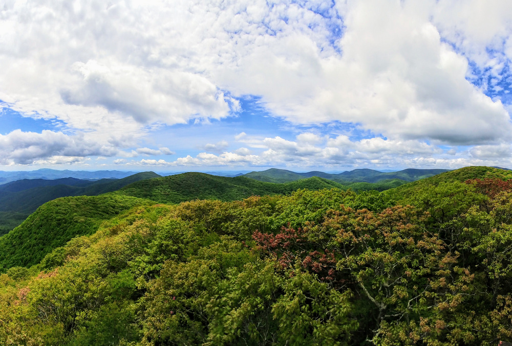
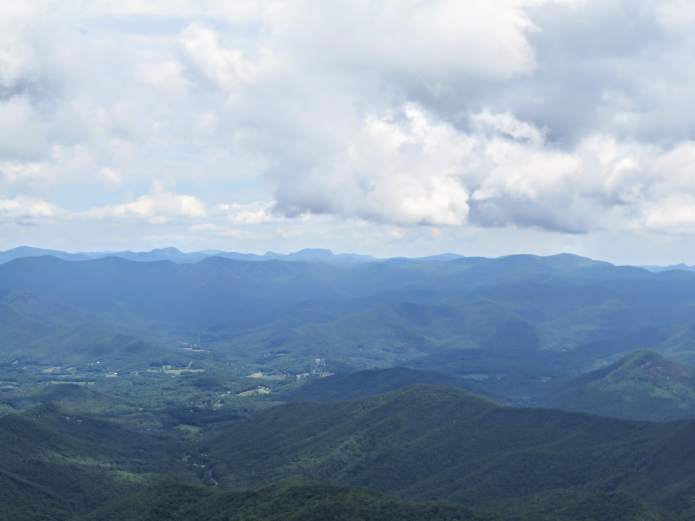
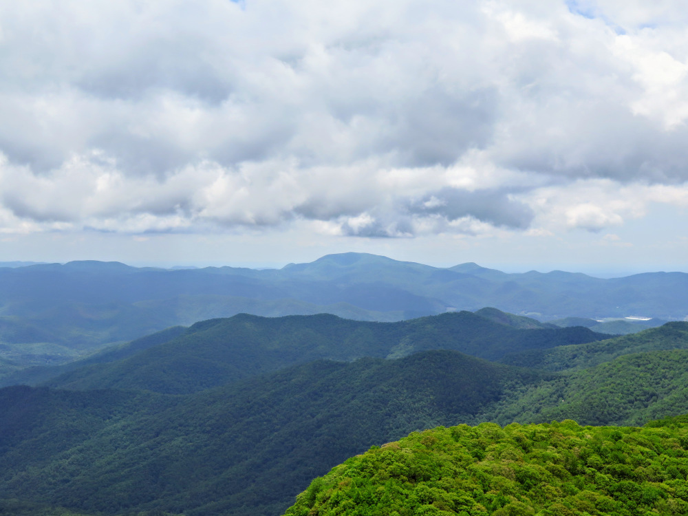
- Mile 2.9 – Reach the forested summit of Albert Mountain at 5,223 feet. Just below the summit is a small campsite on the west side of the trail. On the east side of the mountain is an information board about the Coweeta Hydrologic Laboratory and the mountain peaks you may see from this open outcrop. The 43-foot steel tower was built in 1951 to watch for forest fires in the outdoor laboratory. Near the top of the stairs is the best viewing area from a large platform. The tall peaks of the Southern Nantahala Wilderness encompass the immediate area from south to west, making a horseshoe around the headwaters of the Nantahala River. Yellow Bald is the closest peak to the tower just south of west only 2,100 feet away, hiding most of Standing Indian, the tallest peak in the Nantahala Mountains at 5,499 feet. Due west beyond Standing Indian is the conical Boteler Peak. You can spot Trimont Ridge to the north which holds Wine Spring Bald and Wayah Bald, although the tower supports obscure open views. East of Albert Mountain the land drops precipitously, over 2,000 feet, with expansive long views from northeast to southeast. In the foreground is the Coweeta Hydrologic Laboratory, with the Little Tennessee River Valley and Franklin northeast and the Highlands Plateau further east. In the distant northeast are the Great Balsam Mountains. Fishhawk Mountain is the massif due east rising above Highlands. Beyond Fishhawk Mountain are three of the tallest peaks in the Cowee Mountains. The broad, pyramidal peak on the left is Yellow Mountain. The two box-shaped peaks on the right are Shortoff Mountain, and Whiteside Mountain with its vertical southern cliffs. The dominant peak in the southeast direction is Rabun Bald, the second tallest peak in Georgia.
- Mile 5.8 – Hike ends at FR 67.
|

![Bearpen Gap Trail [442] (blue blaze)](images/052917/IMG_5185.jpg)
![Branch Trail [375] (orange blaze) on the left](images/052917/IMG_5187.jpg)