|
| Length |
Difficulty |
Streams |
Views |
Solitude |
Camping |
| 13.3 mls |
 |
N/A |
 |
 |
 |
Hiking
Time:
Elev. Gain:
Resources: |
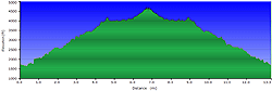
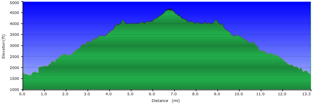
7 hours with 1 hour and 30 minutes of breaks
4,000 ft
 Topo Hike Trails Map (PDF) Topo Hike Trails Map (PDF)
Wesser, NC Weather Forecast
Garmin (GDB), Gaia/Trails App (GPX) (What's
this?)
3D
View of Route |
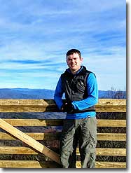
 By Trail Contributor: Zach Robbins (Contact Zach) By Trail Contributor: Zach Robbins (Contact Zach)
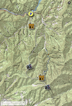
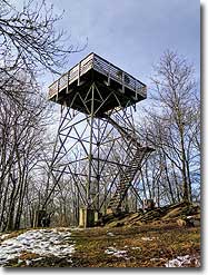
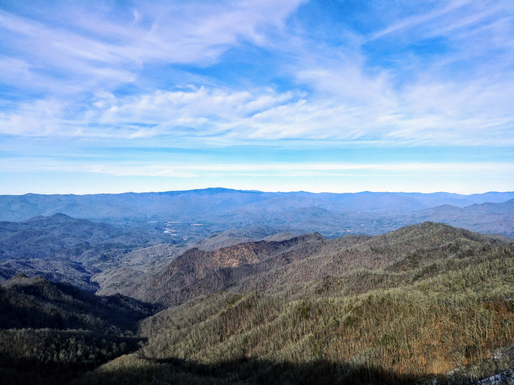
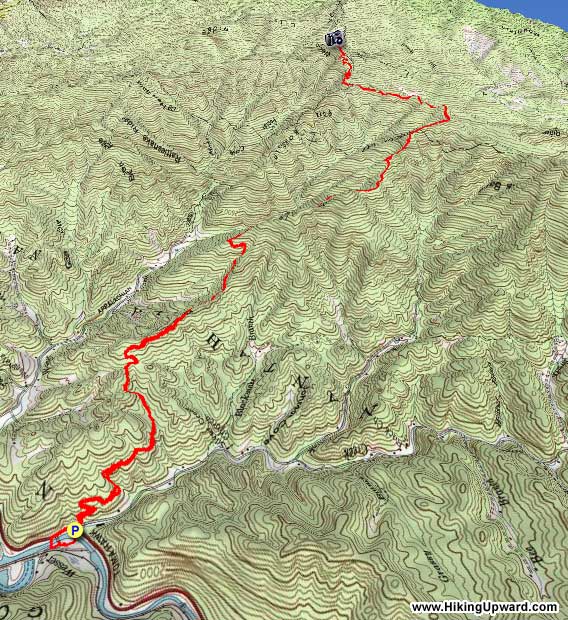
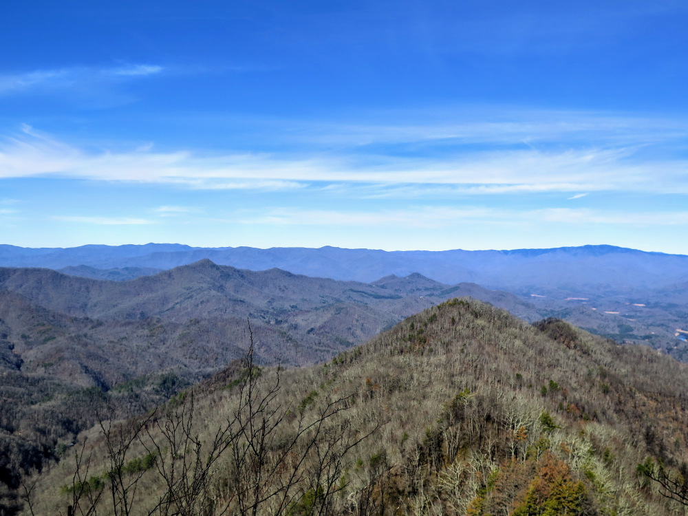
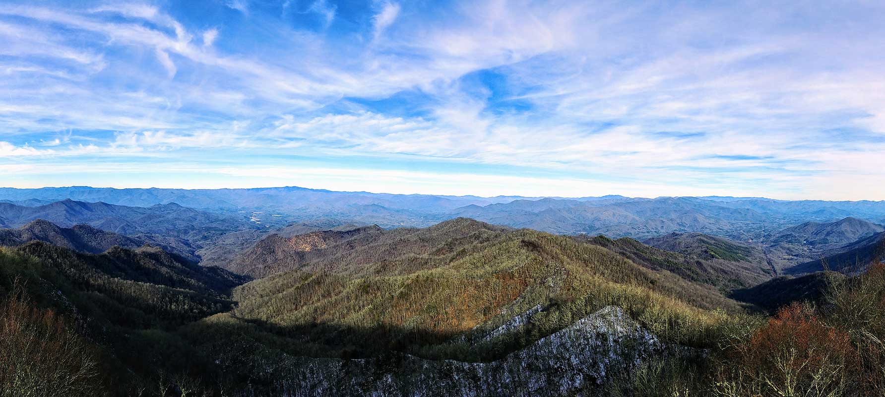
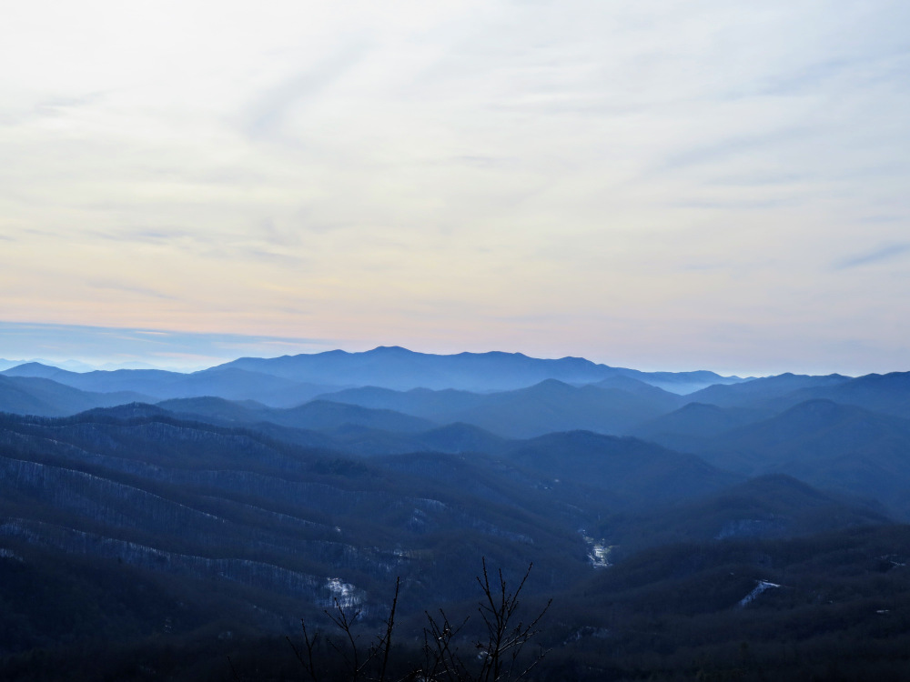
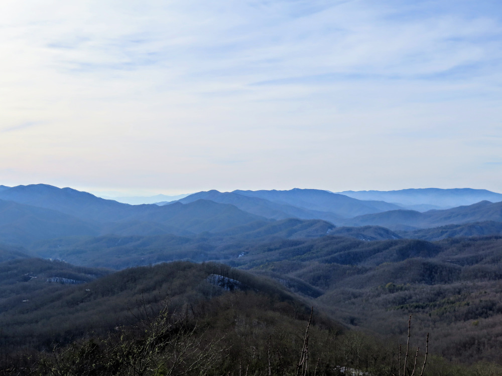
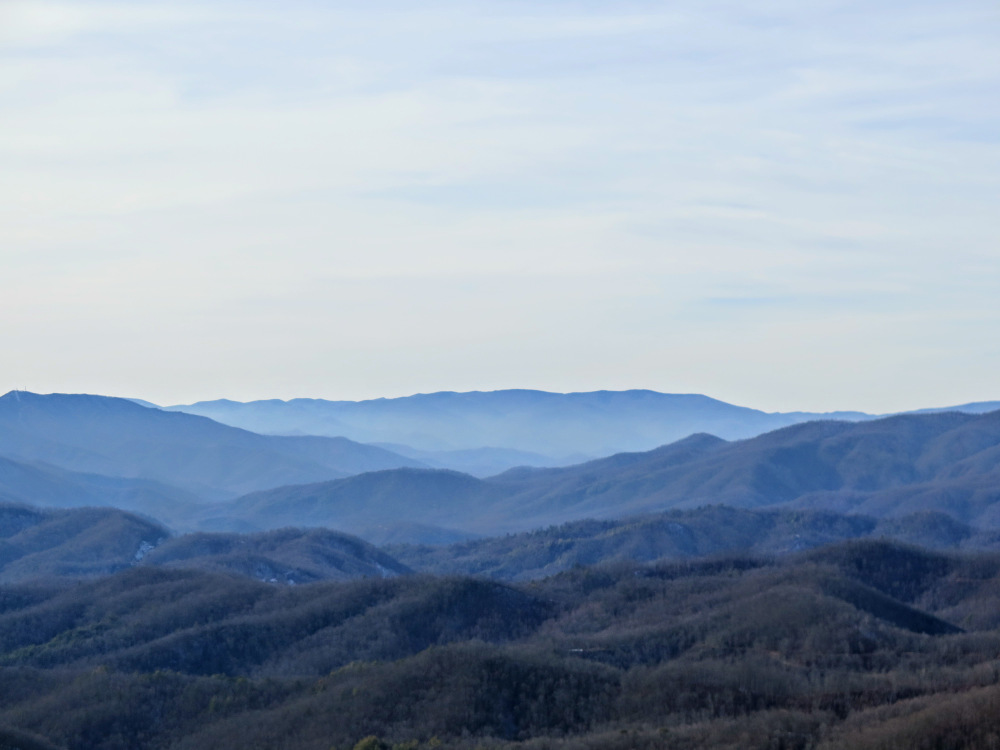
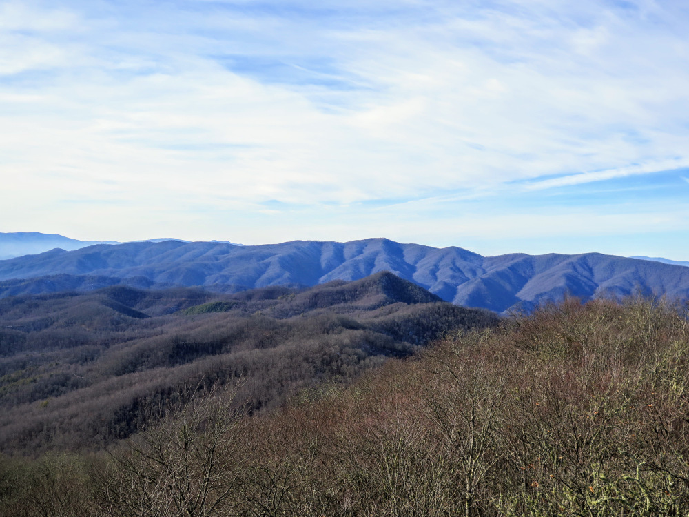
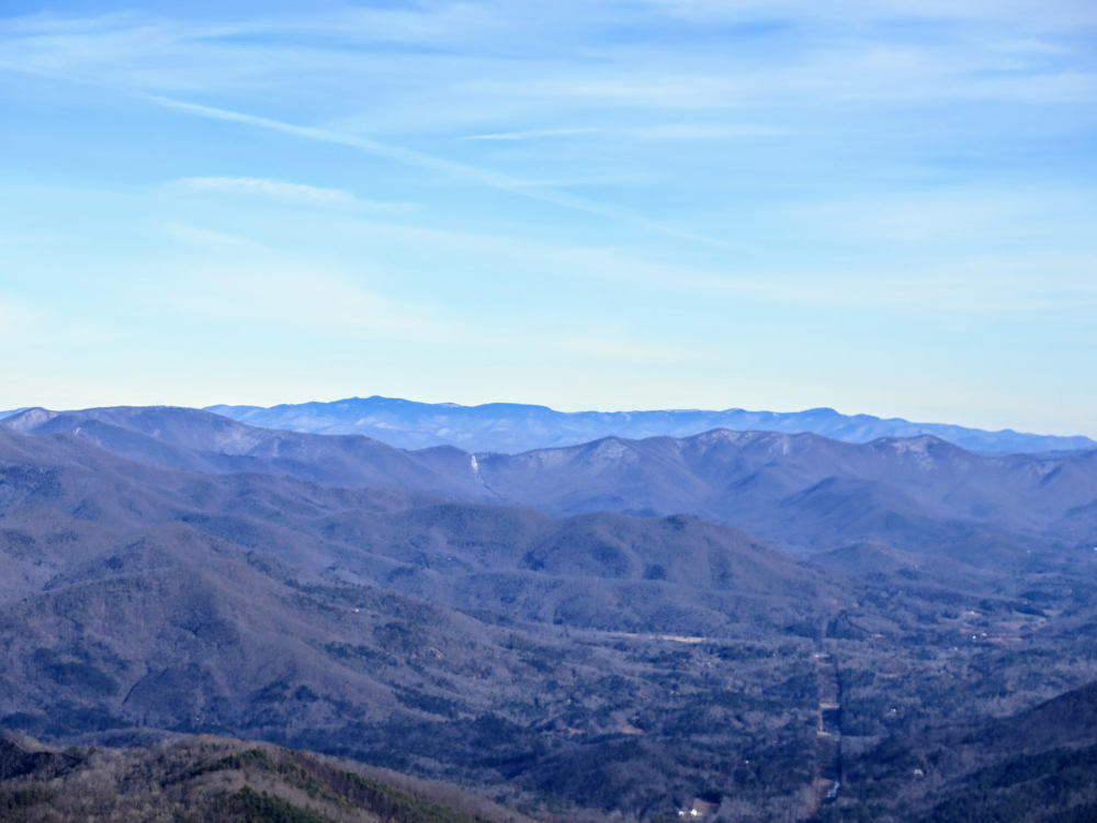
The lookout tower on Wesser Bald boasts some of the best views in North Carolina. You can hike to the tower three different ways, and the hike described here is the longest and toughest approach. You’ll begin the hike at the Nantahala Outdoor Center on U.S. 19/74 at the lower end of the Nantahala Gorge. The Appalachian Trail crosses the river and highway here, passing through the NOC which provides thru hikers with a fantastic resupply and food stop. The Appalachian Trail heads south, immediately climbing above the gorge on a consistent grade towards Paint Mountain. Just beyond the halfway point to Wesser Bald the trail follows a narrow ridge to The Jump Up. This viewpoint on the northwest side of Fork Mountain is a teaser for the views from Wesser Bald. Once you leave this outcrop the Appalachian Trail heads east, passing by the Wesser Bald Shelter before its final climb to Wesser Bald. The summit is home to a 30-foot lookout tower with an observation platform. The 360° views are phenomenal on a clear day as you can pick out many prominent peaks and ranges in the North Carolina Blue Ridge Mountains. Views include the Cheoah, Great Smoky, Plott Balsam, Alarka, Cowee, Great Balsam, Nantahala, Tusquitee, Valley River, Snowbird, and Unicoi mountain ranges. The round-trip distance is perfect for a full day hike, or a weekend backpacking trip with a stay around the Wesser Bald Shelter.
Alternate Hikes - Wesser Bald can also be accessed as a short 2.8 mile/767 ft gain hike starting at Tellico Gap on Otter Creek Rd, and as a difficult 8.6 mile/2,367 ft gain hike from the Wesser Creek Trailhead at the end of Wesser Creek Rd.
| Mile Summary and Highlights |
1.1 - Rufus Morgan Shelter
4.3 - The Jump Up rock outcrops with good northern views
5.9 - Wesser Bald Shelter and T-junction with Wesser Creek Trail
6.7 - Wesser Bald summit (4,627 feet) and lookout tower |
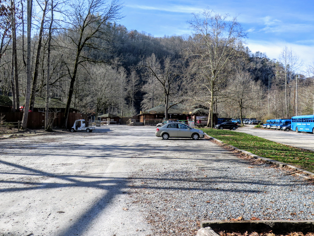
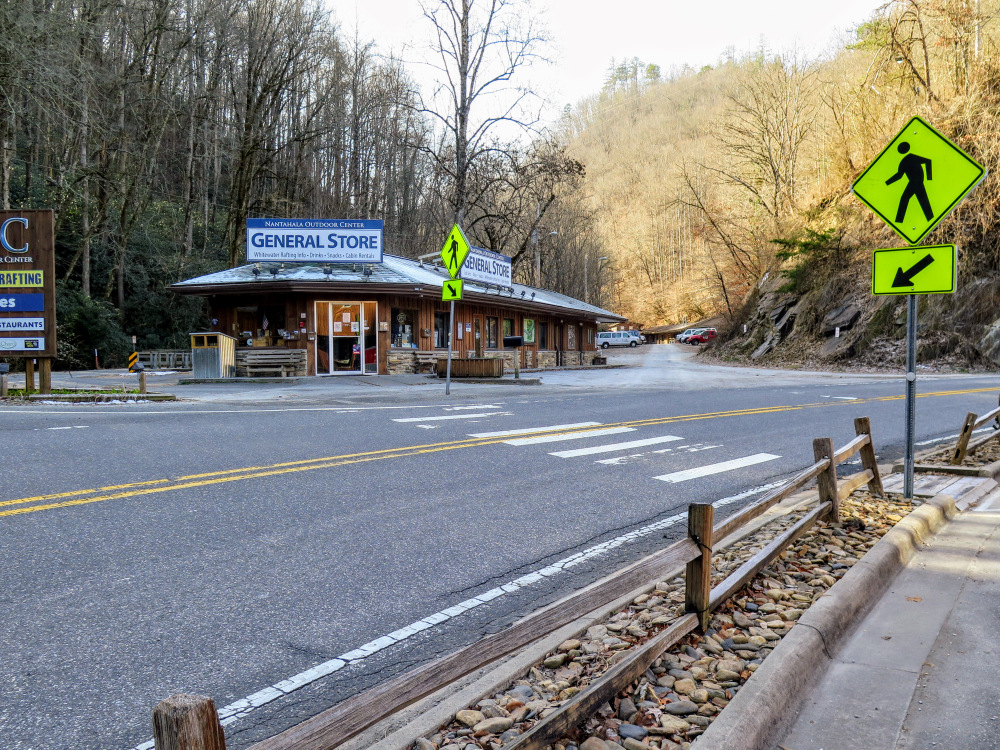
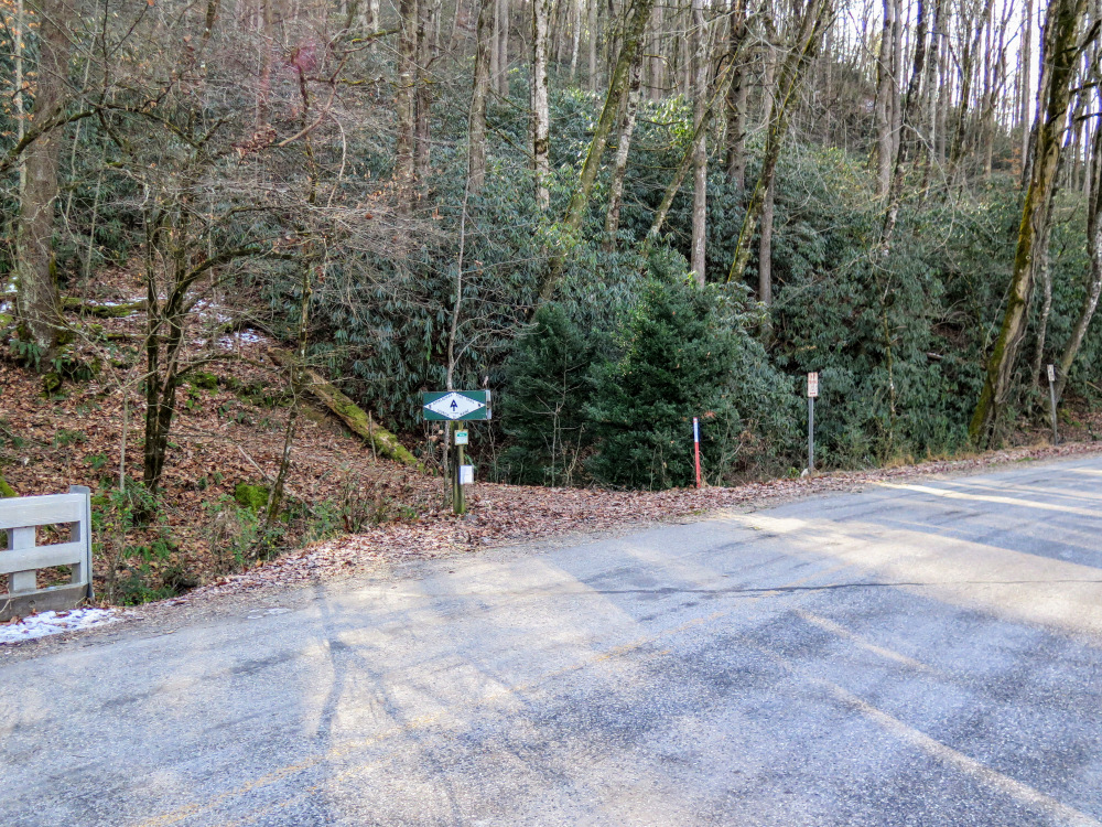
- Mile 0.0 – Park at the Nantahala Outdoor Center. Begin the hike by walking towards the pedestrian bridge over the Nantahala River. The Appalachian Trail passes through the NOC complex crossing the pedestrian bridge. This track crosses the road bridge which is slightly longer and less scenic, either option works.
- Mile 0.2 – Cross U.S. 19/74, pass beside the Wesser General Store, and cross Silvermine Rd. The Appalachian Trail (white blaze) continues south leaving the road behind and immediately climbs above the gorge on four switchbacks.
- Mile 1.1 – The trail drops into a flat clearing beside a stream. The Rufus Morgan Shelter is located on the left on the hillside.
- Mile 1.4 – At a right curve an old road continues straight. The AT follows a southerly course for the next 3.5 miles.
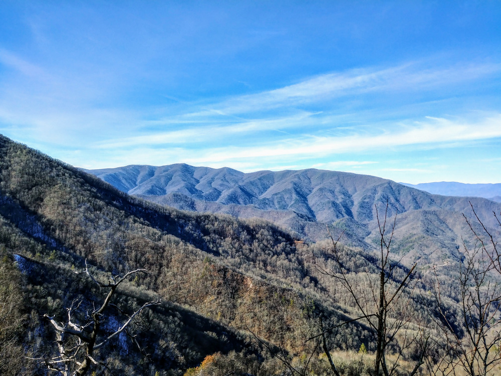
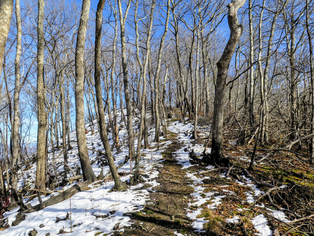
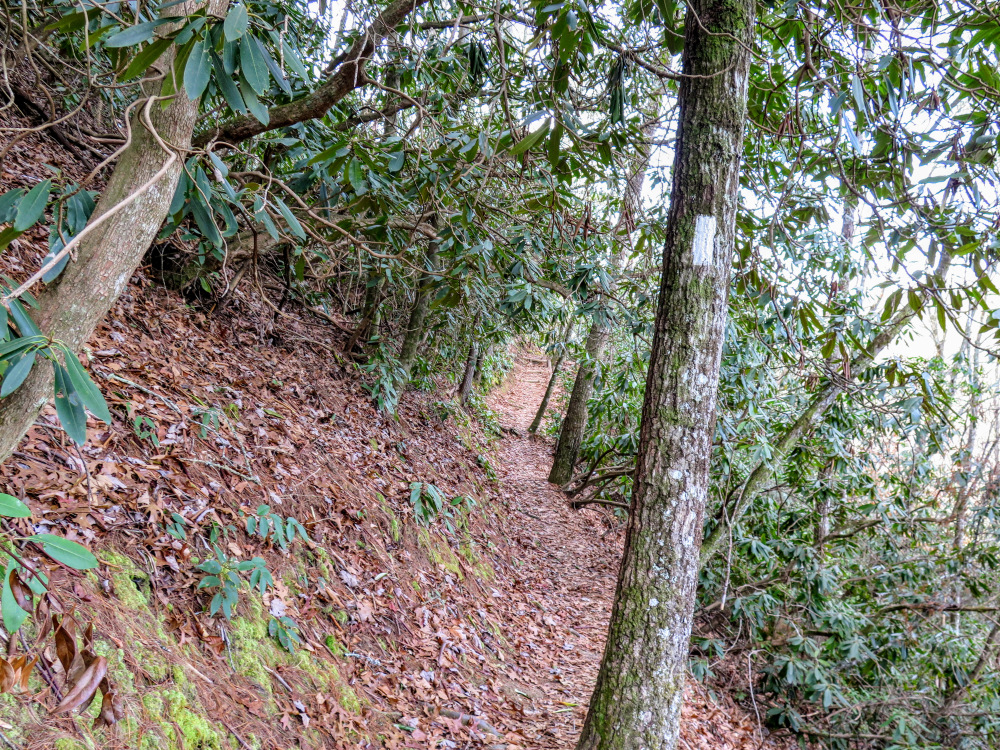
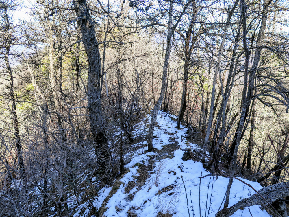
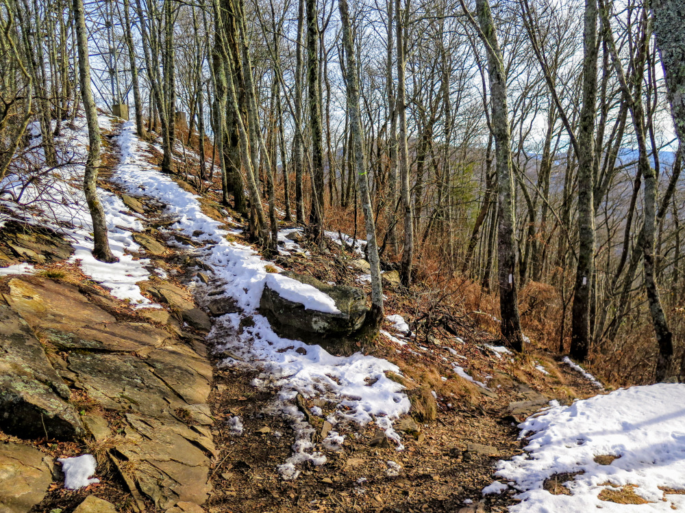
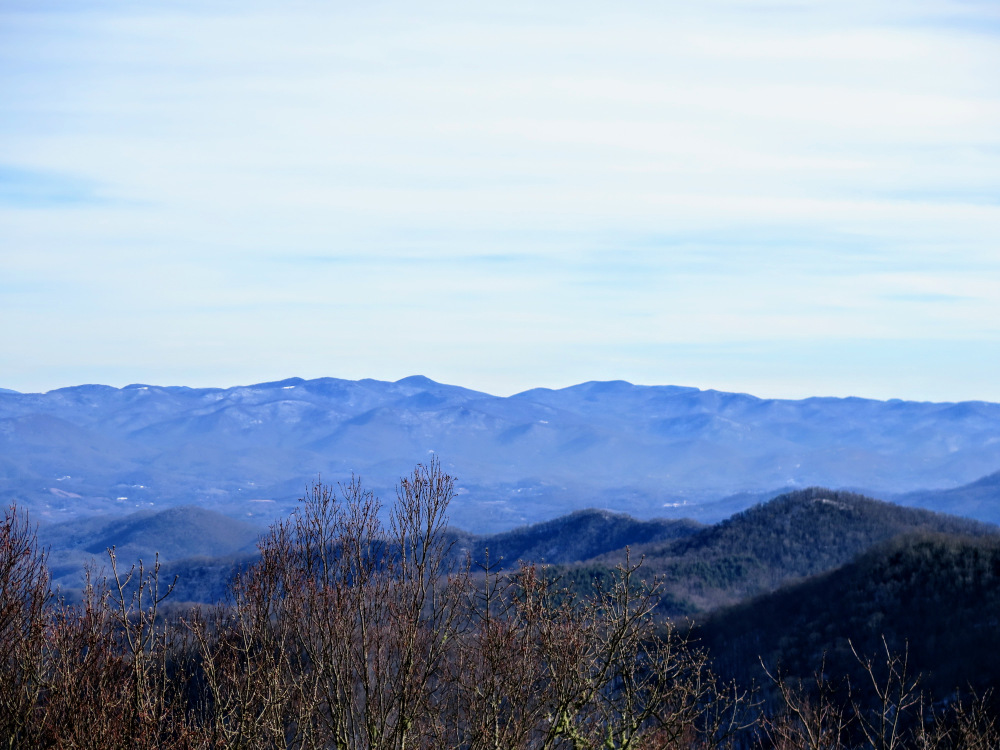
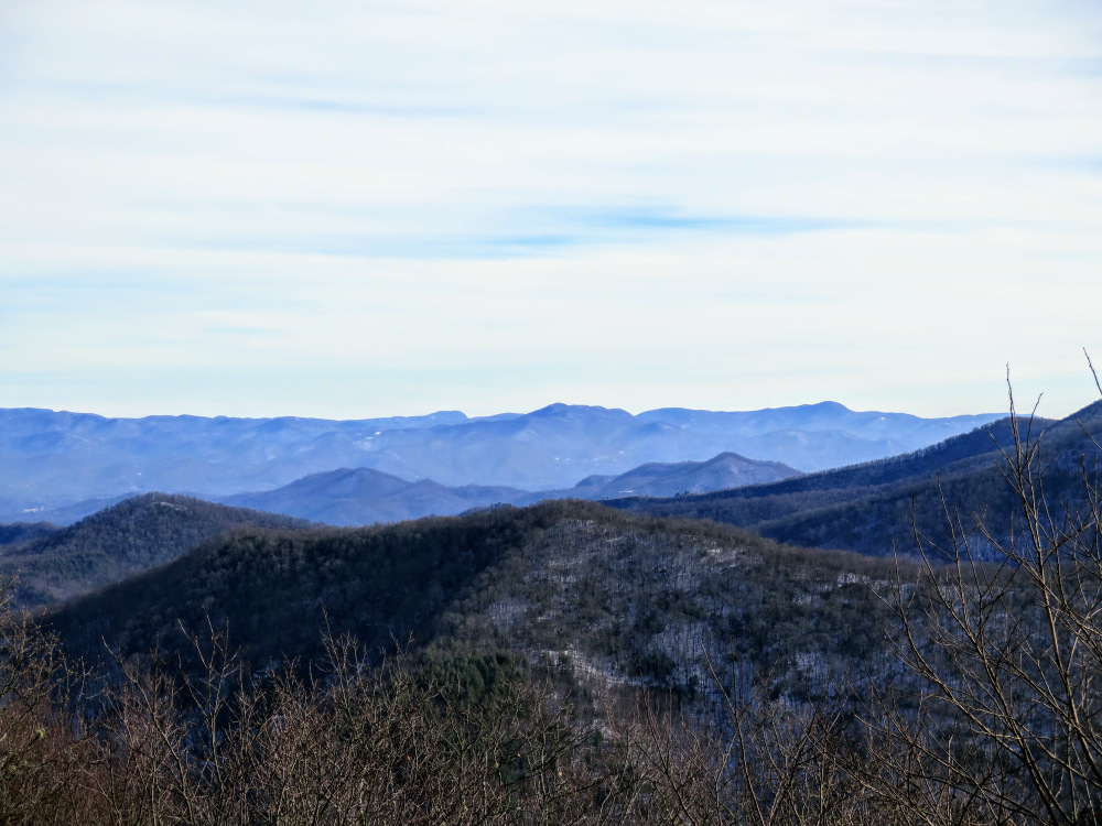
- Mile 4.1 – Begin a narrow ridgeline section with occasional winter views on either side. This section was damaged by a forest fire in November 2016. The grade steepens as you climb on narrow switchbacks to The Jump Up.
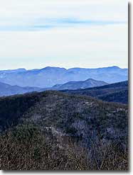
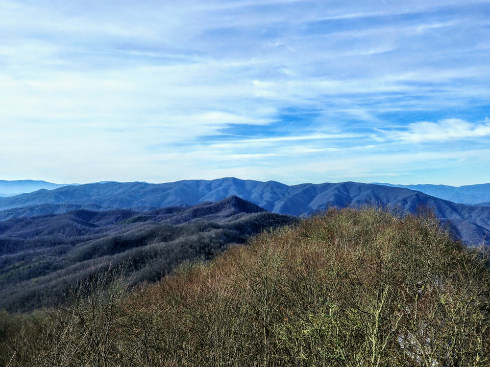
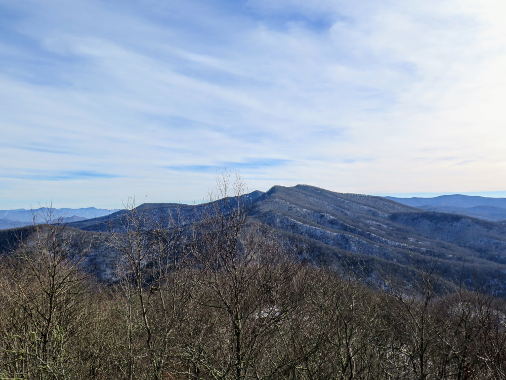
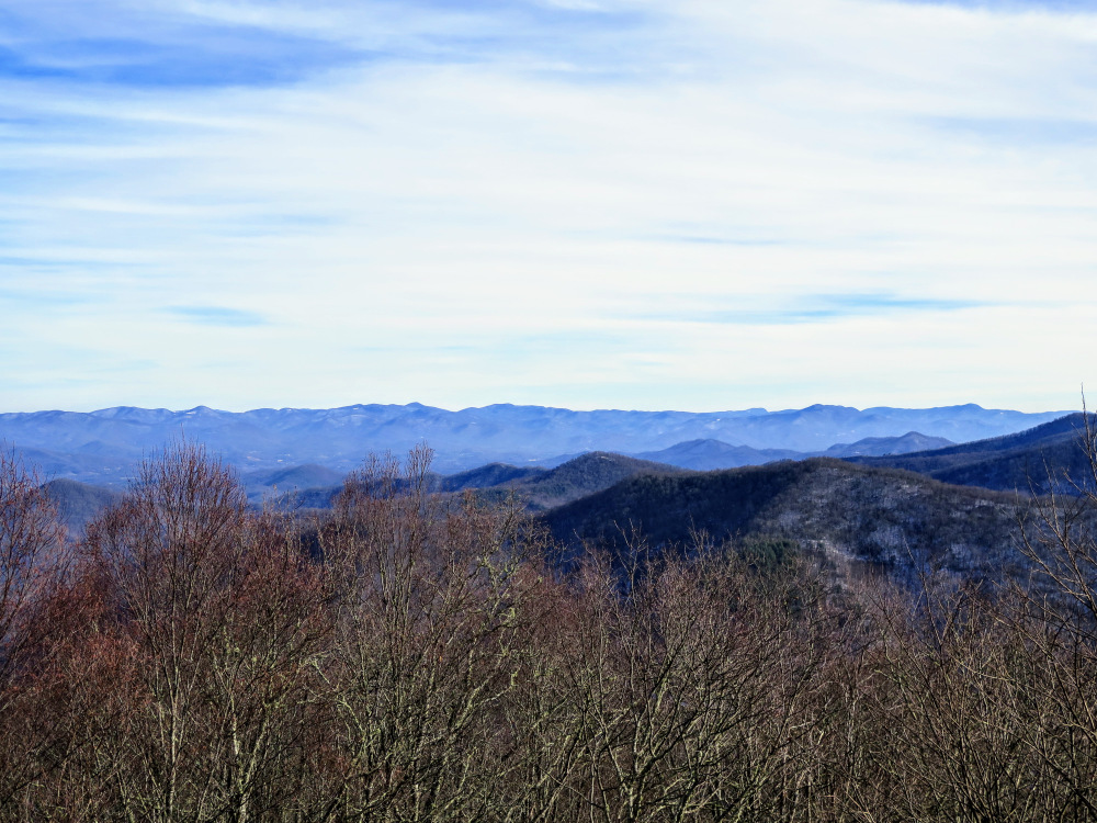
- Mile 4.3 – The Jump Up is a series of small rock outcrops with good views north. Marginally beyond the halfway mark to Wesser Bald, this spot is a preview of the views to come. Immediately west are the Cheoah Mountains rising above the Nantahala Gorge. The Great Smoky Mountains span the northern horizon beyond Fontana Lake. The AT continues south along the narrow ridgeline of Fork Mountain, then turns east at Mile 5.0. This stretch has good winter views, especially to the north.
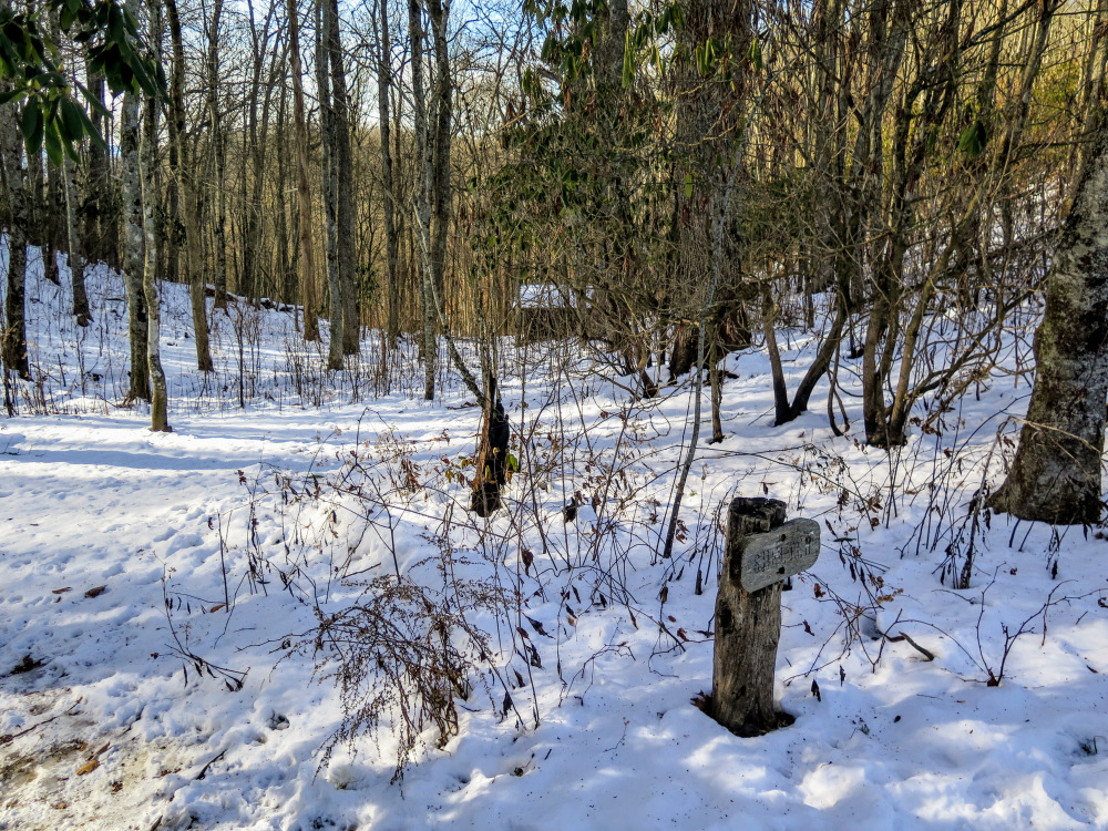
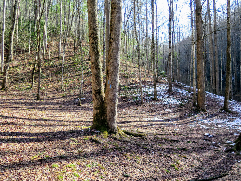
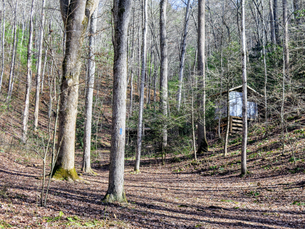
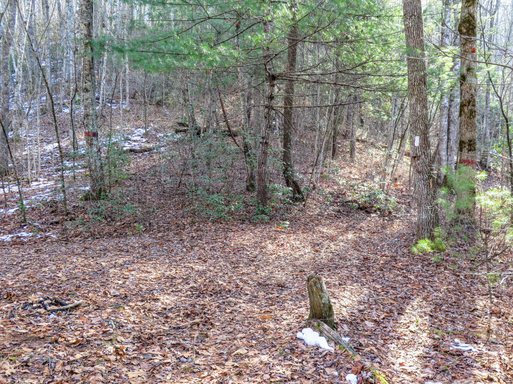
- Mile 5.9 – Drop into a saddle below Wesser Bald. You’ll pass by a T-junction with the Wesser Creek Trail [26] (blue blaze) on the left and then a side trail to the Wesser Bald Shelter on the right.
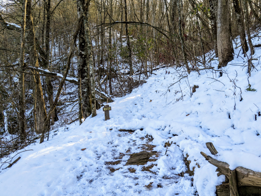
- Mile 6.0 – At a right turn, a signed “Water” spur trail leads to a spring.
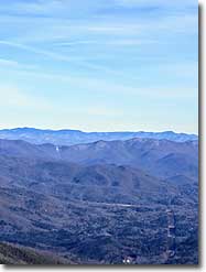
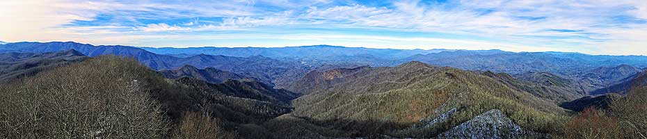
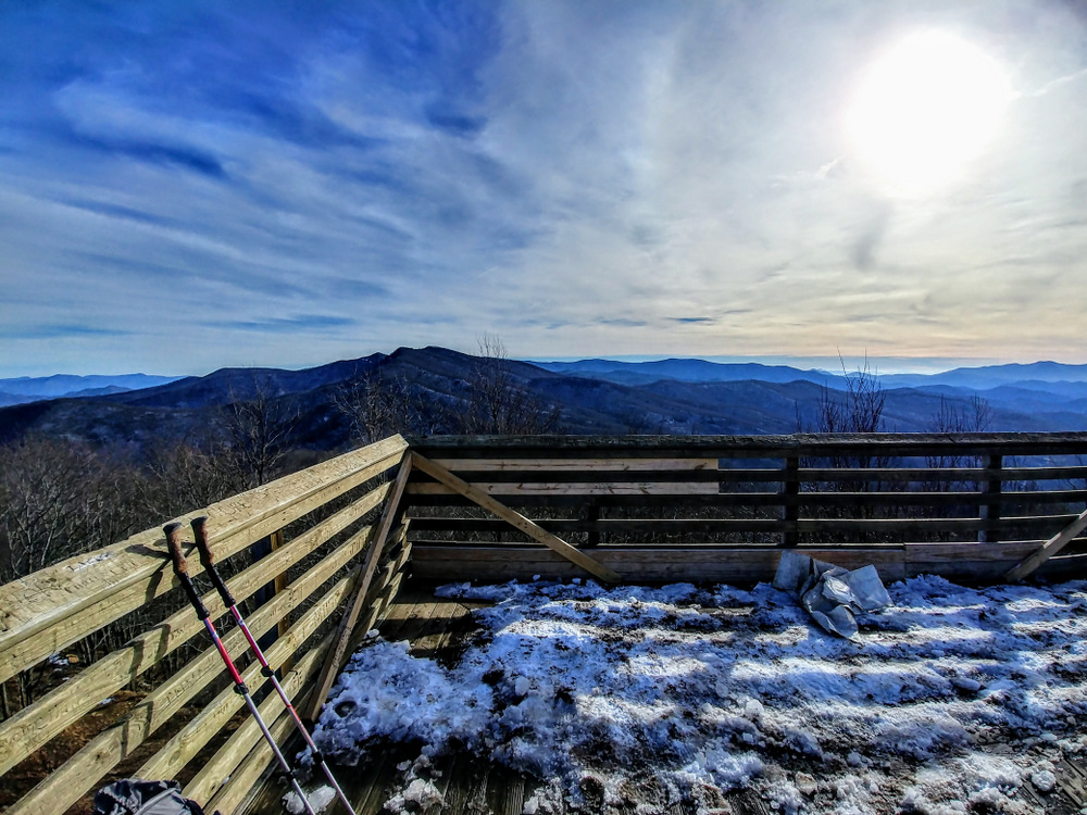
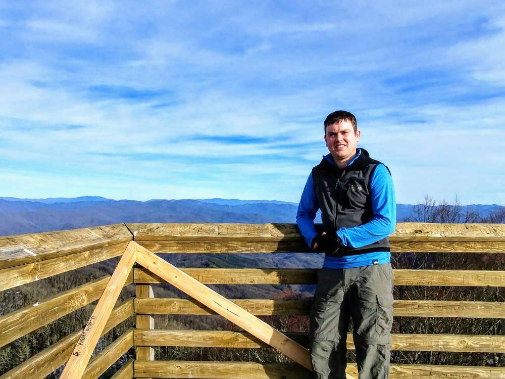
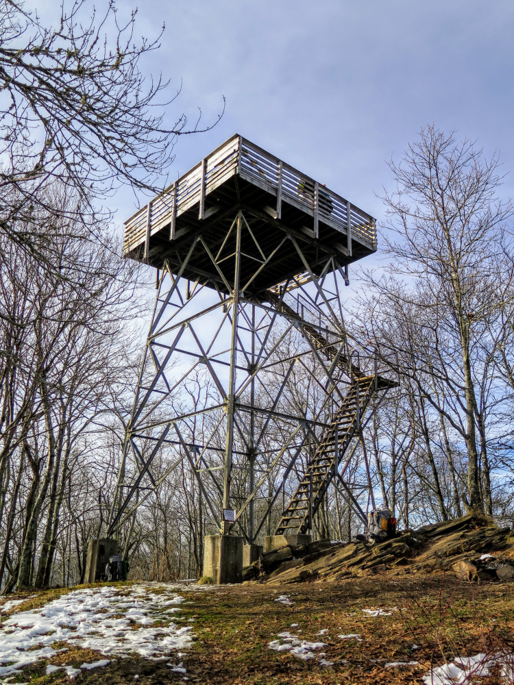
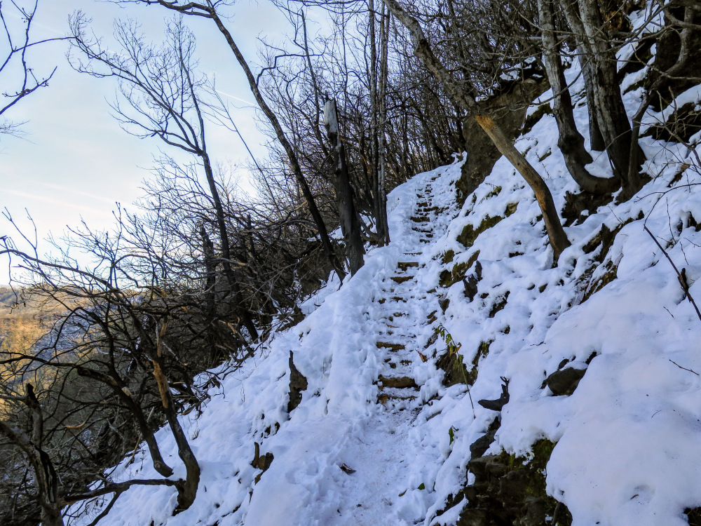
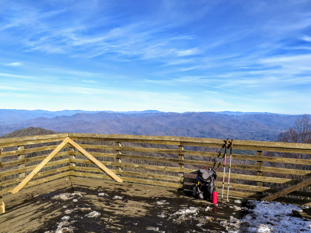
- Mile 6.7 – An obvious side path on the left leads to the summit of Wesser Bald (4,627 feet). The wooden lookout tower was built in 1993 to replace the original steel live-in cab. Unlike most towers in the state, the cab is an open-top observation platform. Rising 30 feet above the ground, and above the stunted trees on the summit, this tower provides some of the best views in North Carolina.
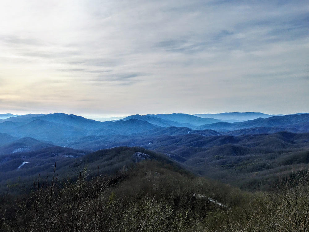
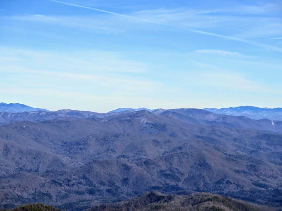
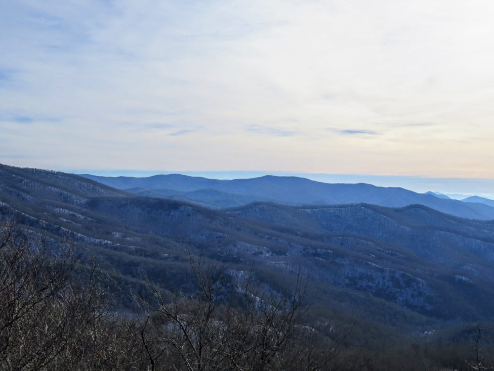
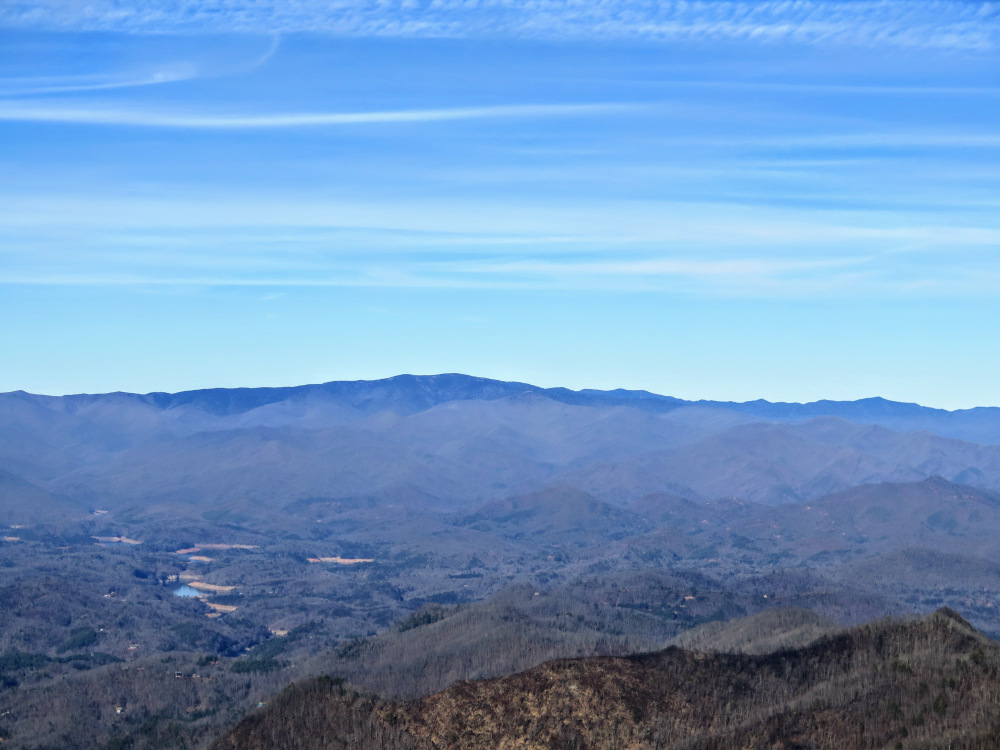
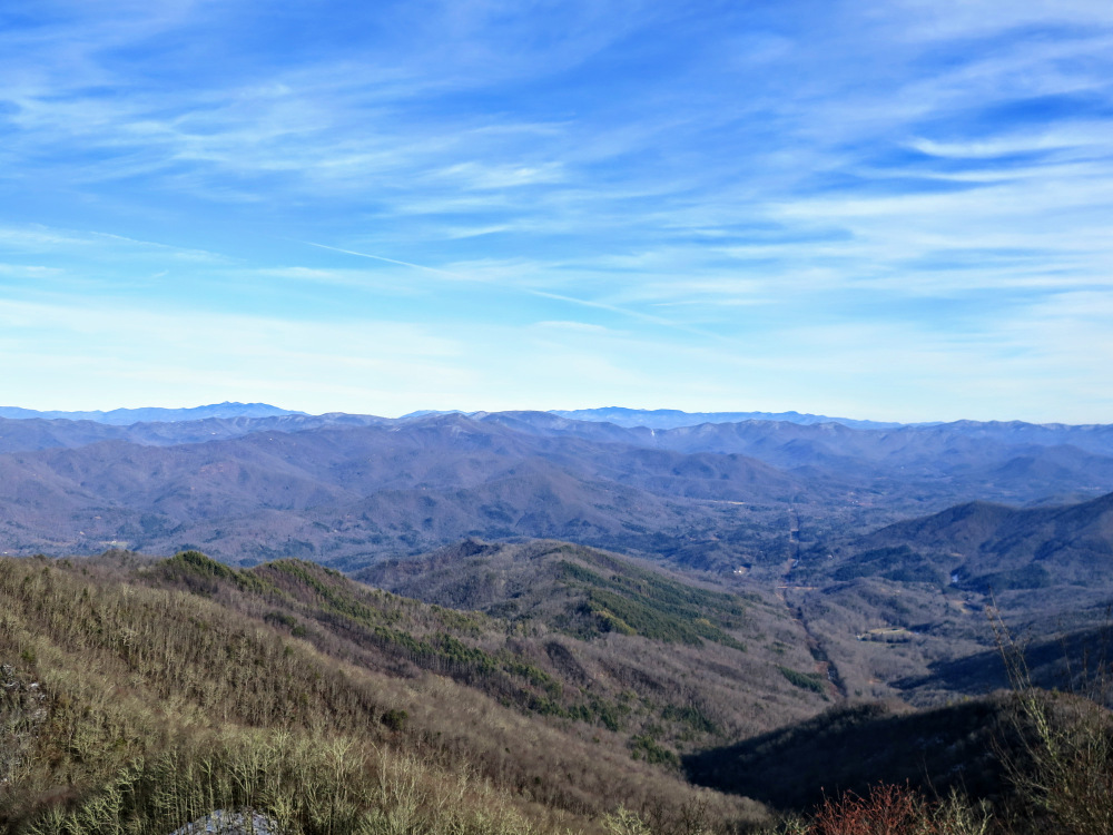
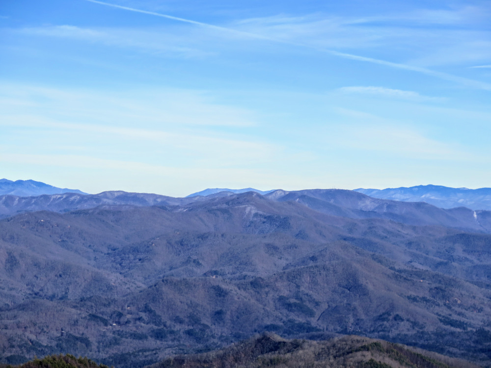
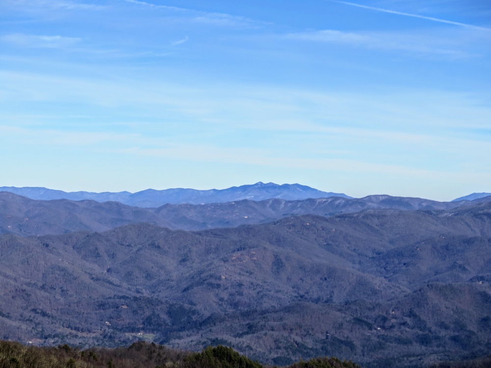
The 360° views include many prominent ranges in the Blue Ridge Mountains. The Appalachian Trail continues south into Tellico Gap then climbs the cluster of Rocky Bald, Tellico Bald, and Copper Ridge Bald. Behind to the right is Wine Spring Bald, the tallest peak on Trimont Ridge with multiple communication towers. From southwest to west are some of the more remote ranges in North Carolina. Towards the southwest are the Tusquitee and Valley River Mountains, which form the Fires Creek Gorge. In the gap between the Tusquitee and Nantahala Mountains you may be able to see Brasstown Bald, the tallest peak in Georgia. Due west are the Snowbird Mountains, with the towers on Teyahalee Bald clearly visible. Behind the Snowbird Mountains to the right are the Unicoi Mountains. Just north of west are the imposing Cheoah Mountains above Nantahala Gorge. The highest peak in the range, Cheoah Bald, is the pyramidal summit with a small grassy clearing. The Great Smoky Mountains span the northern horizon, with the massive blackish summit of Clingmans Dome as its centerpiece. Towards the northeast are the Alarka, Cowee, Plott Balsam, and Great Balsam Mountains. You can see the towers on Cowee Bald northeast, with the craggy, clustered Plott Balsam Mountains behind. The Great Balsam Mountains are the dominant range north of east, with the Cowee Mountains rising east above the Little Tennessee River Valley. The distinctive summits of Yellow Mountain, Shortoff Mountain, and Whiteside Mountain are all easily discernable.
- Mile 13.3 – Hike ends back at the Nantahala Outdoor Center.
|

![pass by a T-junction with the Wesser Creek Trail [26] (blue blaze) on the left](images/121617/IMG_6275.jpg)