|
| Length |
Difficulty |
Streams |
Views |
Solitude |
Camping |
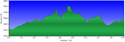
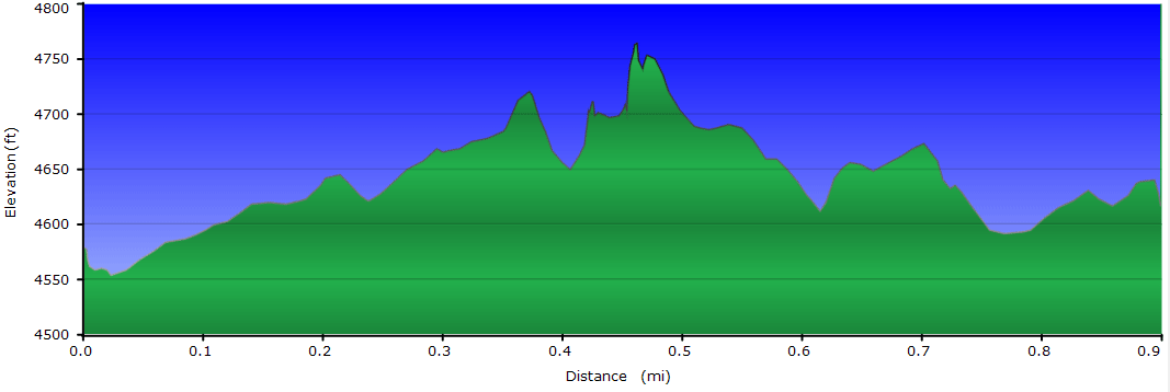
| 0.9 mls |
 |
N/A |
|
 |
N/A |
Hiking
Time:
Elev. Gain:
Resources: |
45 minutes with 10 minutes of breaks
175 ft
 Topo Hike Trails Map (PDF) Topo Hike Trails Map (PDF)
Beachertown, NC Weather Forecast
Garmin (GDB), Gaia/Trails App (GPX) (What's
this?)
3D
View of Route |
 By Trail Contributor: Zach Robbins (Contact Zach) By Trail Contributor: Zach Robbins (Contact Zach)
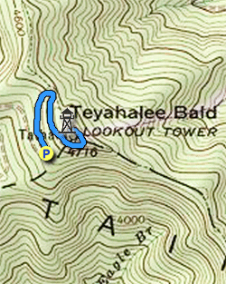
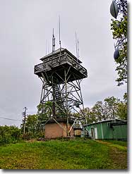
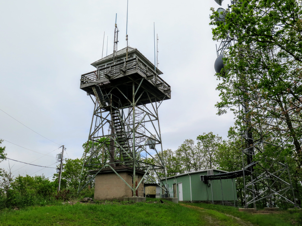
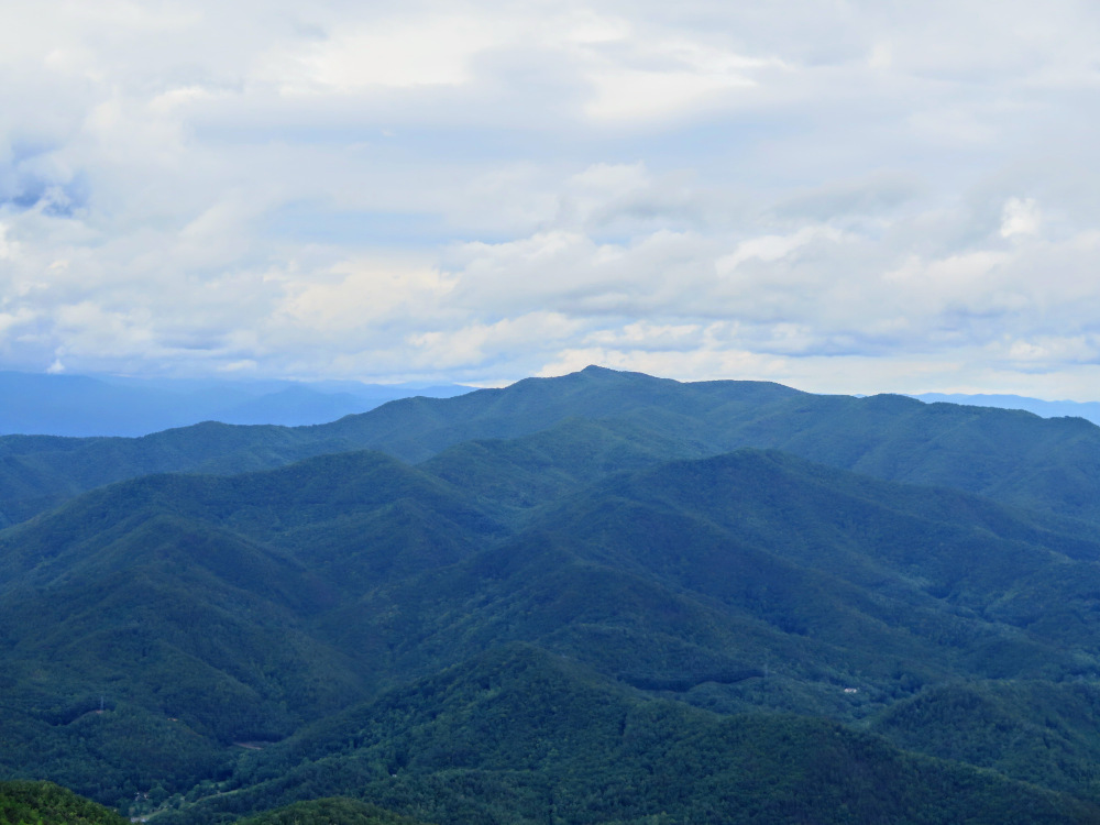
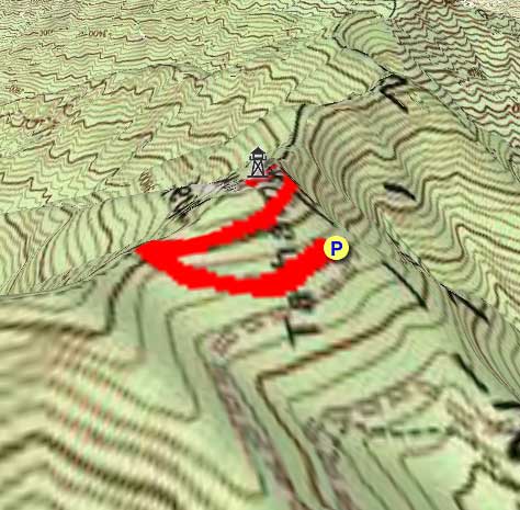
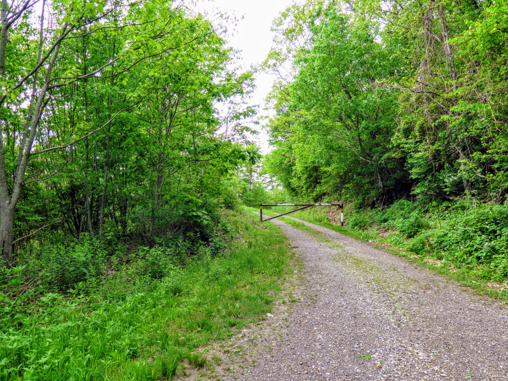
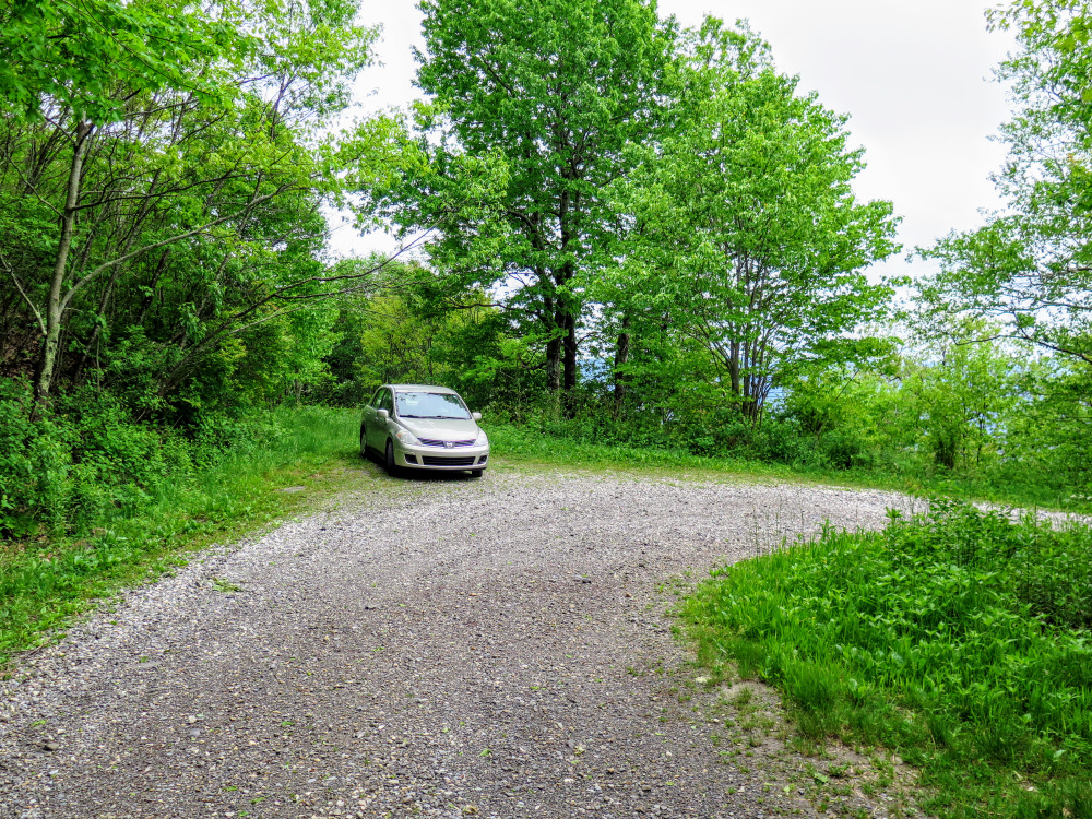
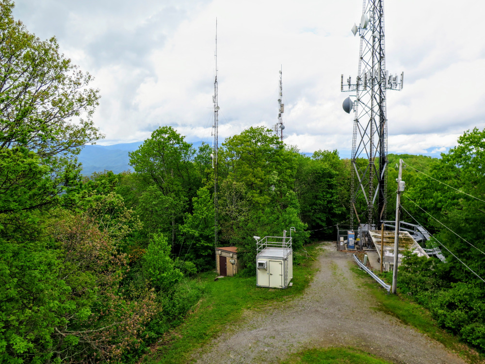
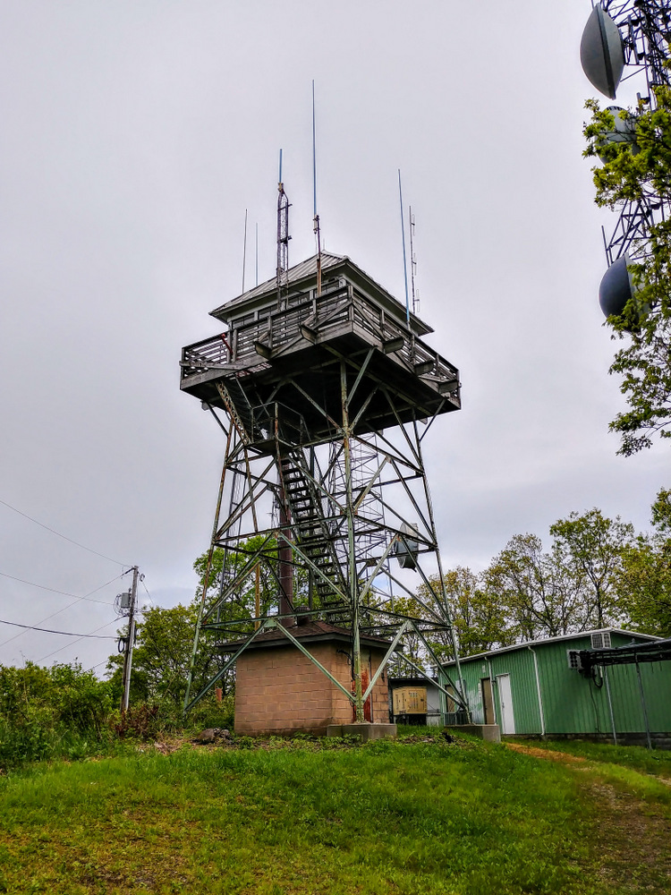
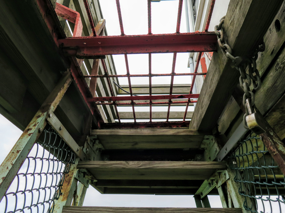
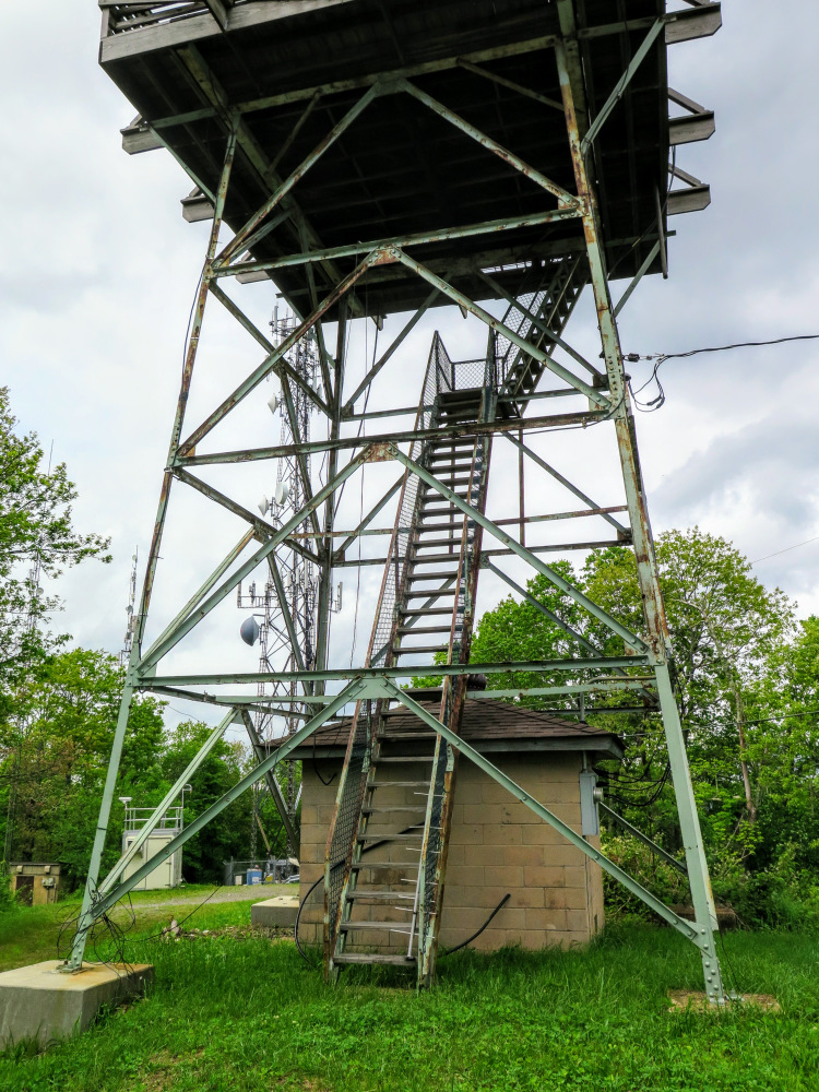
The Joanna Bald lookout tower is located in the remote Snowbird Mountains Wilderness Study Area of Nantahala National Forest in southwestern North Carolina. The short hike is accessible by a long, lonely drive on FR 423/Tatham Gap Road to Tatham Gap from the towns of Robbinsville or Andrews. Before you begin the drive, look up. From each town you should be able to see the towers on the summit. Once you reach Tatham Gap, you will then drive FR 423B, which is heavily overgrown in spots, to the gate near the summit. From the gate it is a short walk to the top of the mountain, which is forested and covered in communication towers. The official USGS benchmark for the mountain is Teyahalee Bald, but the alternative name Joanna Bald is more widely used to describe the tower. The top cab is normally locked, and views are very limited from the summit and the stairs. Your only open view to the northeast is impressive as Cheoah Bald dominates the landscape. This hike is not recommended unless you are trying to finish the Carolina Lookout Tower Challenge. The drive on FR 423 from either direction is long, bumpy, and isolated, and FR 423B is barely passable for small cars. Additionally, one or more gates will be locked during the winter meaning a hike to the summit could be many miles.
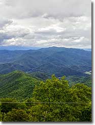
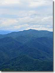
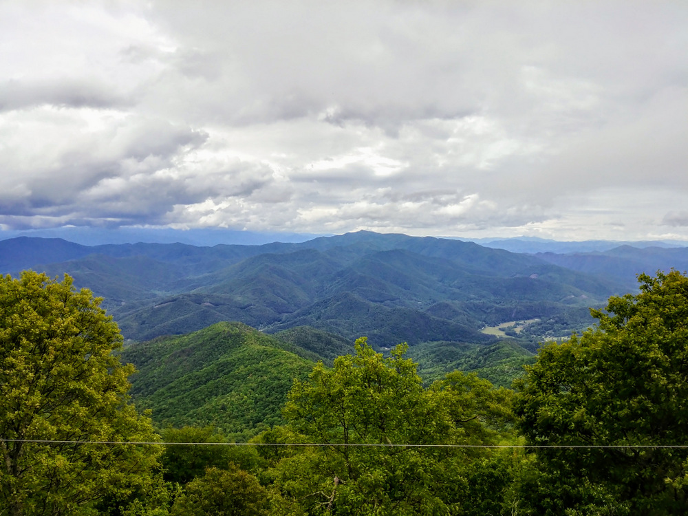
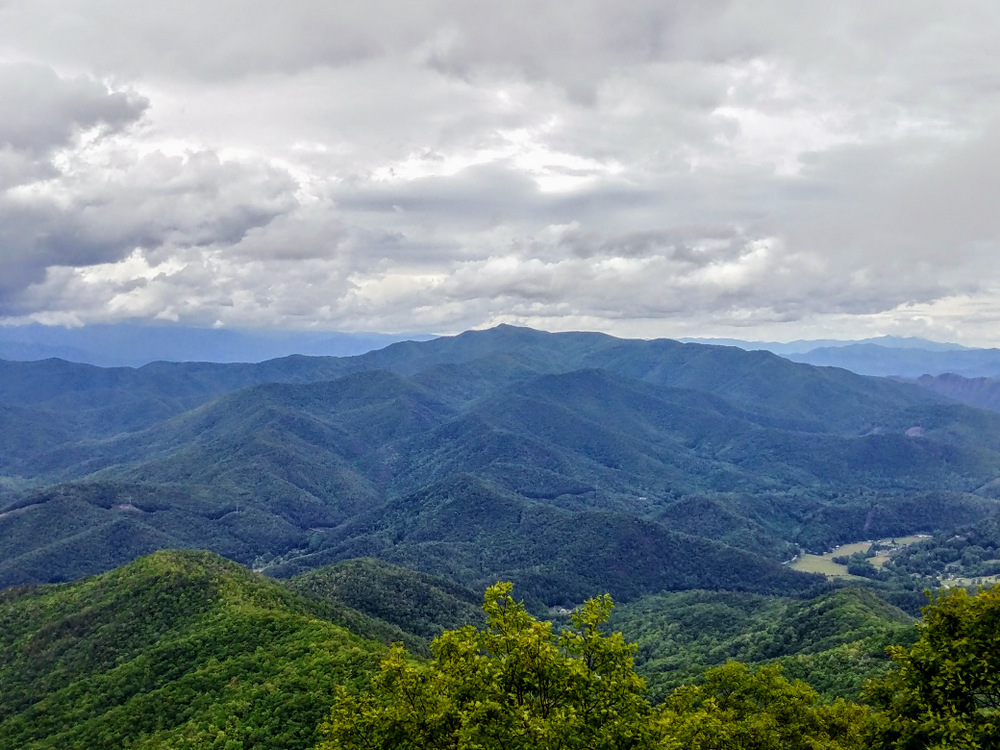
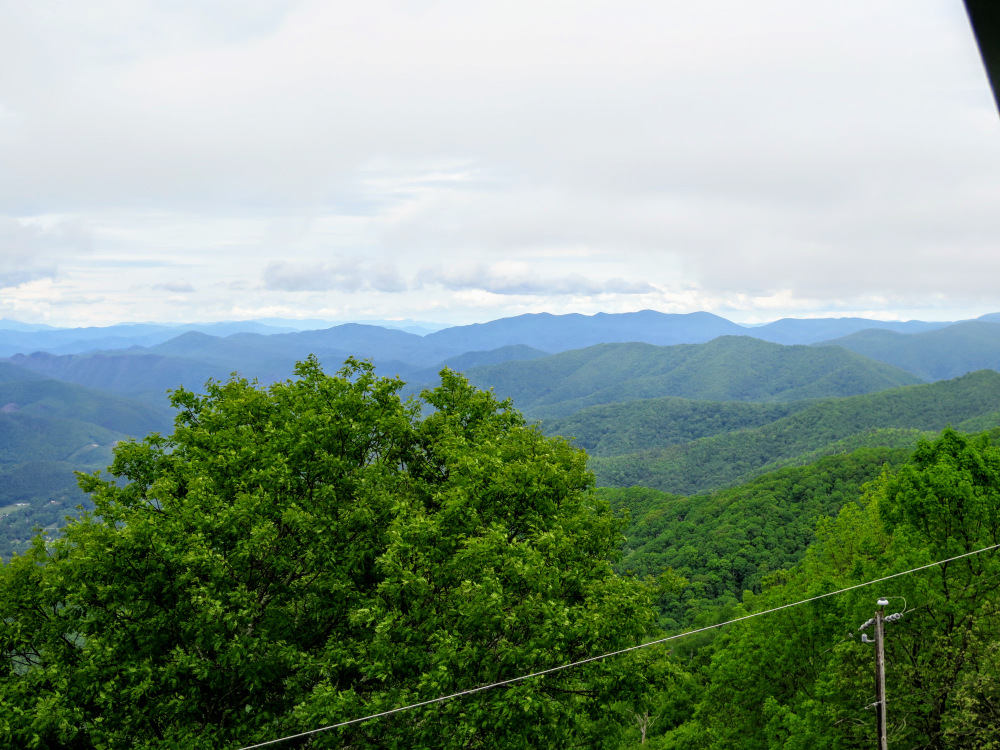
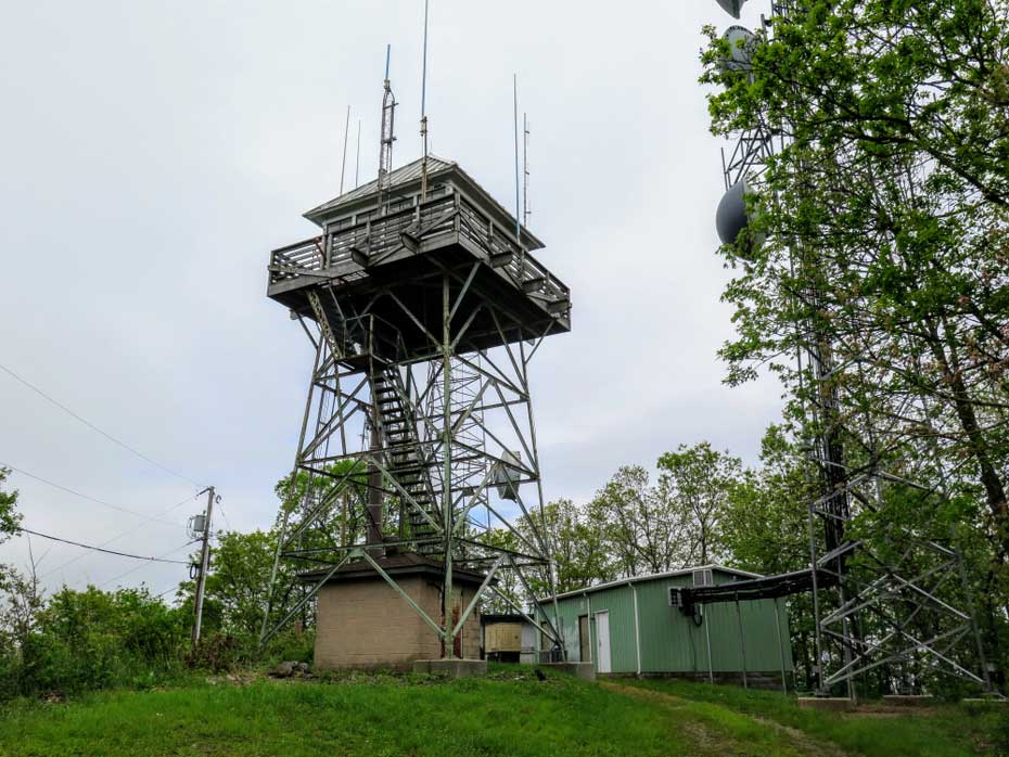
- Mile 0.4 – FR 423B makes a final left turn at the summit of Teyahalee Bald (4,716 feet). The mountain summit is covered in communication towers. The lookout tower is above to the left at the mountain high point. Although the USGS benchmark for the mountain is officially Teyahalee Bald, the alternative name Joanna Bald is more popular and thus the tower is commonly referred to as the Joanna Bald Lookout. Teyahalee Bald is the high point of the remote Snowbird Mountains that are mostly encompassed by the Snowbird Mountains Wilderness Study Area. This range is not known for sweeping views compared to its westerly neighbor, the Unicoi Mountains. Instead, the vast backcountry is home to large creeks and impressive waterfalls, primarily on the northern side. The 31-foot tower was originally constructed in 1952 and remains in good condition. Unfortunately, the top cab is typically locked. Views are very limited from the mountain and the tower stairs. The stairs ascend through the middle of the tower, and the tree line is mostly higher than the tower in every direction. Your only open view is to the east aided by a powerline cut. To the northeast the massive, pyramidal Cheoah Bald dominates the surroundings. Cheoah Bald is the high point of the Cheoah Mountains and a popular Appalachian Trail hike. To the southeast the smaller Snowbird Mountains are in the foreground of the Nantahala Gorge and the Valley River Mountains.
|
|
- Mile 0.9 – Hike ends at the gate on FR 423B.
|
