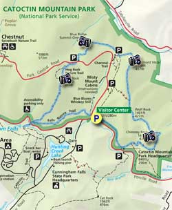
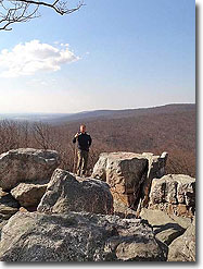
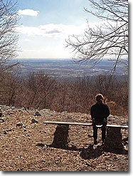
It's easy to see why Catoctin Mountain Park is one of the most popular hiking areas in Maryland. With great overlooks, including Chimney Rock, Thurmont Vista, the Blue Ridge Summit Overlook, and Hog Rock, plus a side trip to Cunningham Falls, you'll have more Kodak moments than you can shake a stick at!
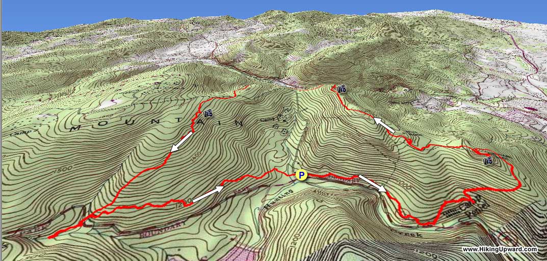
If you want to avoid the crowds, at least in the morning, try to get to the parking area by no later than 8 a.m. on weekends and there's a good chance you'll have Chimney Rock to yourself. The trails in Catoctin Mountain Park are not blazed, but are very well signed, and if you take a map along you shouldn't have any trouble following this circuit.
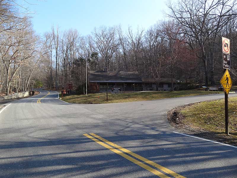
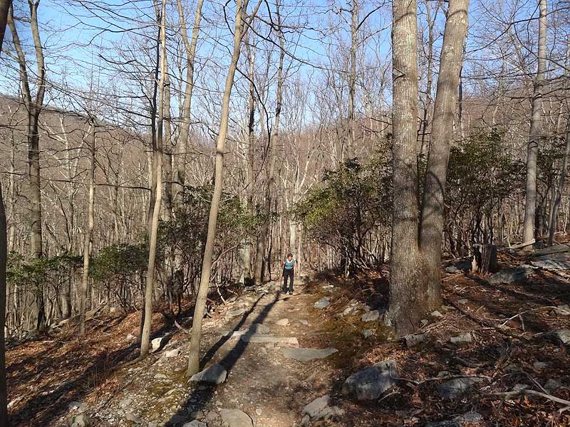
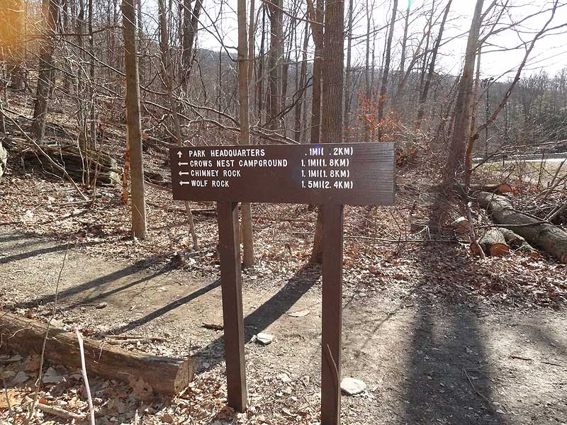
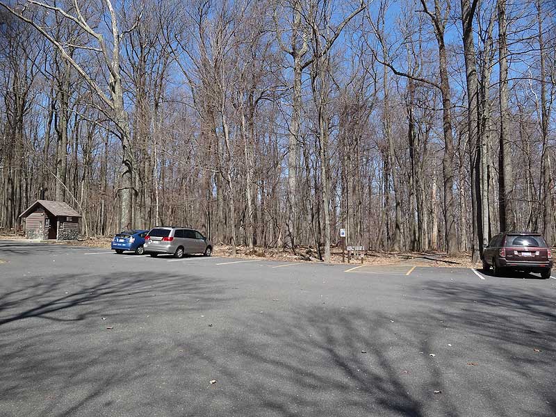
Mile 0.0 – From the parking area at the Visitors Center on Foxville Rd. MD77 start the hike a the far end of the eastern parking area. There are two trails that start at this point. Take the trail on the right that goes towards the Catoctin Mountain Park Headquarters and Chimney Rock. Follow the trail as it parallels Foxville Rd for 0.9 miles.
Mile 0.9 - At the intersection for the Catoctin Mountain Park Headquarters turn left uphill towards Chimney Rock, then in 0.1 miles pass the intersection for the Crows Nest Campground loop.
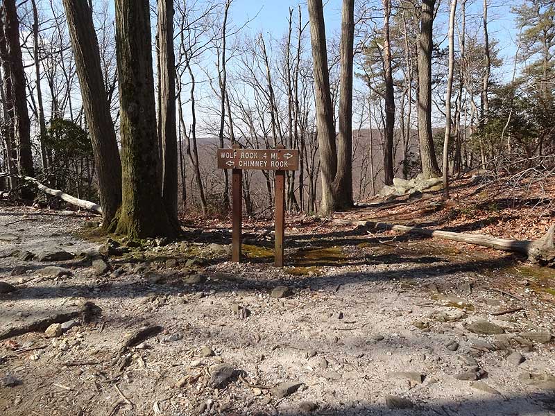
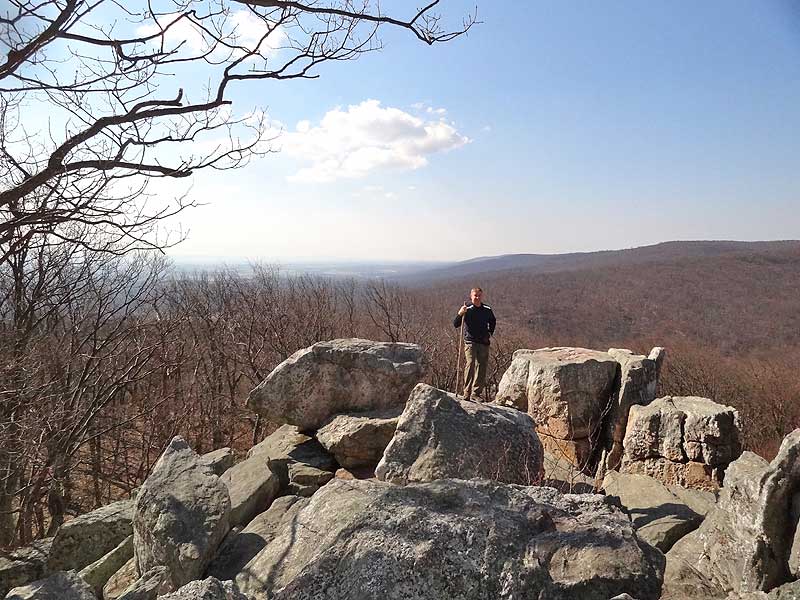
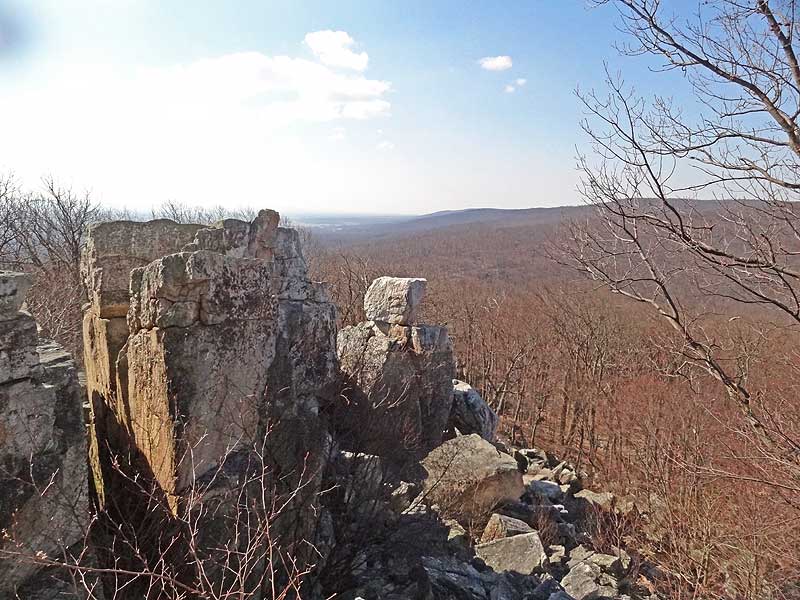
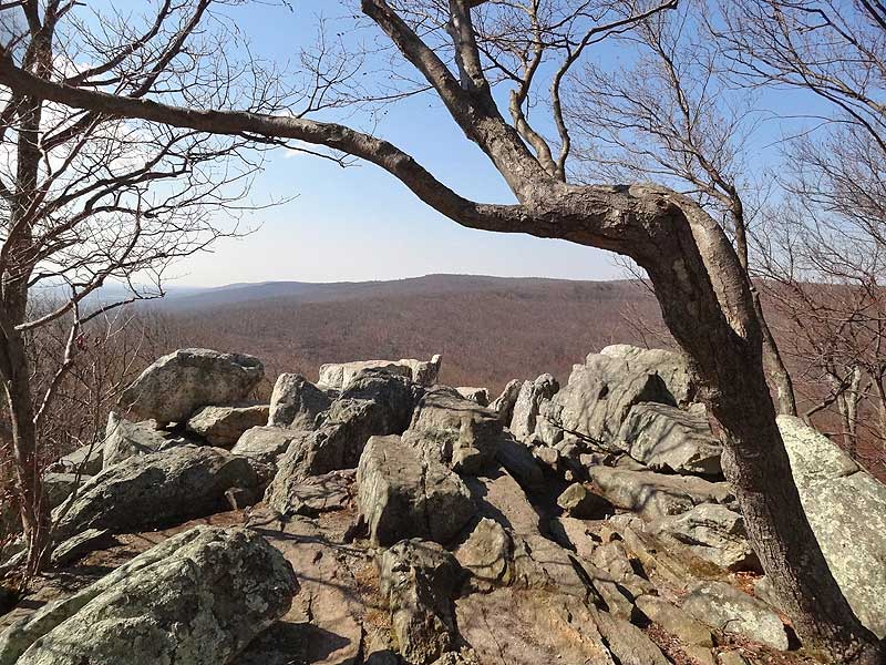
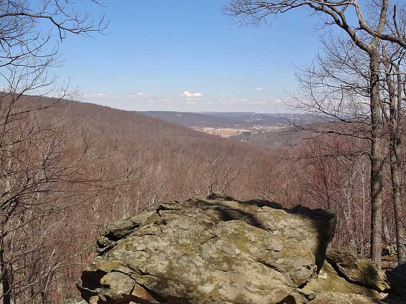
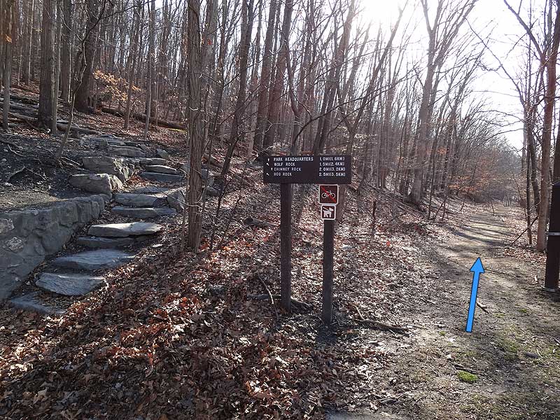
Mile 1.4 - Arrive a the ridgeline and other end of the Crows Nest Campground loop. Turn left towards Chimney Rock and pass around the eastern side if the ridge before reaching the Chimney Rock intersection. Turn left for the short walk to Chimney Rock.
Mile 2.0 - From Chimney Rock head back to the main trail and follow the signage for Wolf Rock.
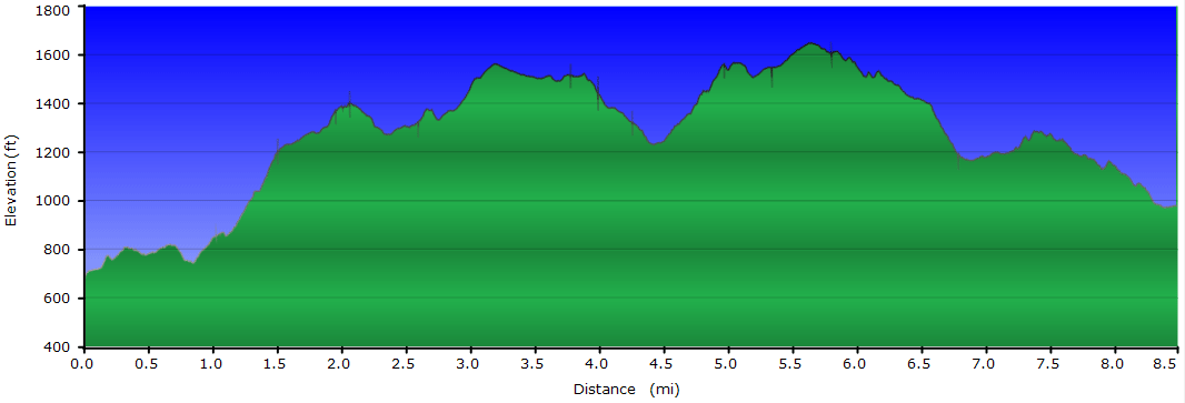
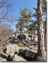
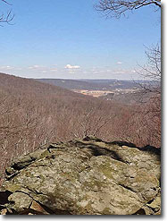
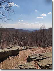
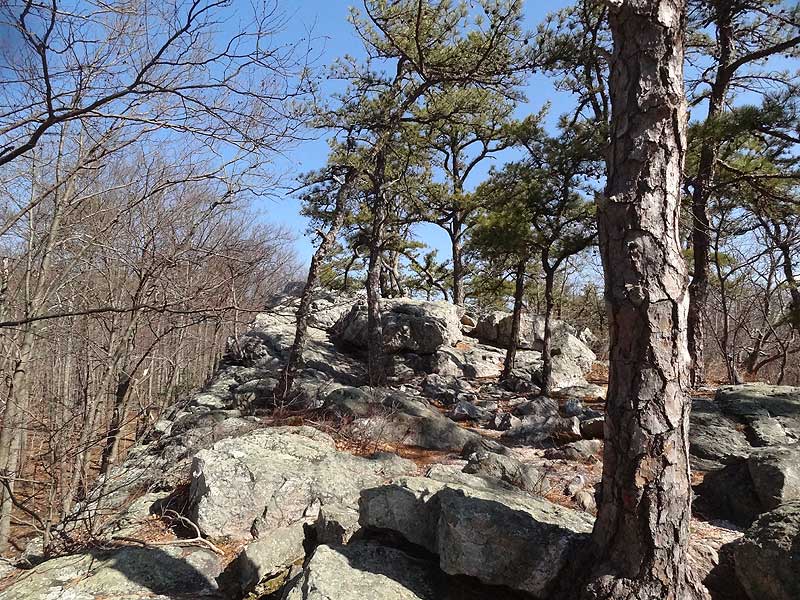
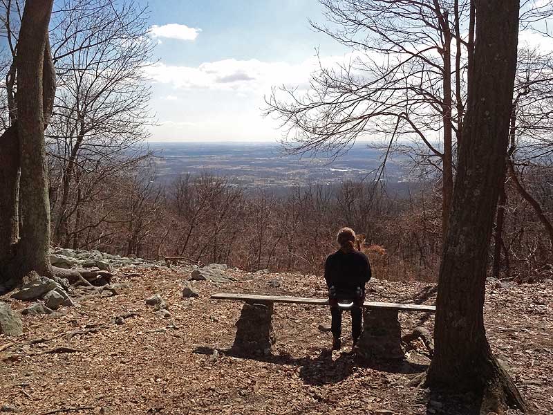
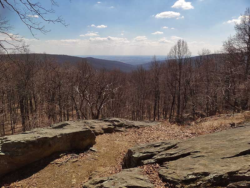
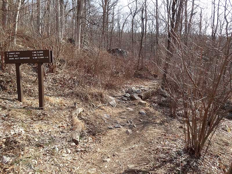
Mile 2.4 - Wolf Rock is a quartzite ledge that was deposited 550 million years ago, with the quartzite forming 250 million yeas ago. Since then the softer sediments above the quartzite have eroded leaving this spectacular feature. If you climb the Wolf Rock ridge and follow it to its northern end there are nice views of the Thurmont Valley below. From Wolf Rock continue along the trail and pass another intersection that leads to Park Central Rd. From this intersection it's 0.7 miles to the Thurmont Overlook.
Mile 3.4 - Leaving Thurmont Overlook the trail will head downhill for 0.4 miles to a 4-way intersection.
Mile 3.8 - Turn right following the signage to Hog Rock. The trail winds around the northern section of the mountain, then climbs before arriving at the Blue Ridge Summit Overlook.
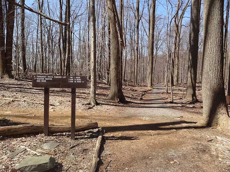
Mile 4.6 - From the Blue Ridge Summit Overlook continue on the trail to the Hog Rock parking area on Park Central Rd in another 0.3 miles.
Mile 4.9 - From the Hog Rock parking area cross Park Central Rd towards Hog Rock. Pass one end of the Hog Rock Nature Loop, then shortly arrive at Hog Rock.
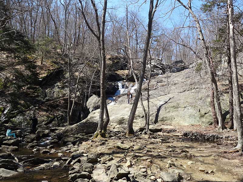
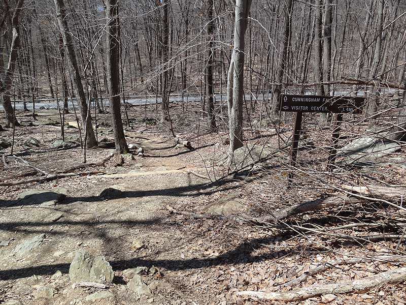
Mile 5.3 - From Hog Rock stay on the trail to the left that leads downhill towards Cunningham Falls (the trail just to the right is the terminus of the other end of the Hog Rock Nature loop). The trail becomes more steep and rocky then reaches the intersection of the Falls Nature Trail, and Foxville Rd MD77.
Mile 6.7 - Retrace your steps re-crossing Foxville Rd to the intersection of the Falls Nature Trail you just passed.
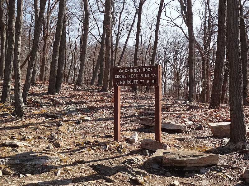
Mile 7.0 - Now turn right on the Falls Nature Trail and hike the remaining 1.4 miles back to the Visitor Center and parking area.
Mile 8.4 - Arrive back at the Visitor Center.
Late March
Catoctin Mountain
Catoctin Mountain Park Hike Comments
Archived Comments
By:urxc
Rating:
Date of Hike: Sunday, September 29, 2019
Looks like they might be expanding the parking lot at the Visitors Center, but until then I echo others comments about getting there early.
Check out Pryors Orchard off Rt. 77 on the way out of the park. We stopped for some fresh honeycrisps after hiking the Hog Rock yellow-blazed trail (4.5 miles) with my wife, 15-month-old (in backpack), and fit dachshund.
By:Sophie and Jerick
Rating:
Date of Hike: Saturday, February 11, 2017
We drove from DC and arrived at the parking lot at 8:15. I definitely recommend getting an early start because it was chock full upon our return at 12. This hike is a new favorite due to its beauty, geology, views, and proximity to DC. We hiked mostly alone for the first half, then started meeting more and more hikers as the day got later. If we do it again, we will probably turn back at Hog Rock because the first half is arguably more beautiful and rugged than the last half.
By:Kevin H.
Rating:
Date of Hike: Friday, January 20, 2017
Arrived around 10am to the visitor center. Parking wasn't an issue at that point. Plenty of spaces available. When we finished the lot was full so take that into account. The visitor center volunteer was very informative and explained the best trail to take. This particular day was misty and foggy so the sights of the trail were not seeable, but there was something about hiking this trail in the elements that made it fun. Hike took about 3.5 or 4 hours. Would like to do this hike again when the sights are seeable.
By:Brad K
Rating:
Date of Hike: Wednesday, November 16, 2016
I was not familiar with this park until reading about it on this site. Now I'm so glad I found it! What an absolute treasure and an incredible national park. The hike is the perfect combination of distance, scenery and elevation. I was there midweek during late fall and had pretty much the entire park to myself. Did not see any other person until near the waterfall at the end. I did it in a counterclockwise direction to spend more time exploring Chimney & Wolf rocks while still fresh. Saving the waterfall as the payoff near the end is also a nice bonus. The climbs were nice and steady, nothing I'd consider terribly steep at any point. Took 4.5 hours to complete the circuit, including a brief rest at the falls. Note the NPS is beginning to mark the trails with blazes, but at this point have only completed the project to near Wolf Rock. Despite lack of blazes, the trail is very well signed, wide and easy to follow. It would be very hard to get lost on this circuit. The views from the overlooks were not very good, quite overgrown, but the real highlight of this hike is the rock formations. It would be a very good idea to check in with the ranger station before beginning this hike, as it appears significant portions of the trail are closed upon short notice. Talking to the ranger afterward, the park gets essentially shut down when the president is using Camp David. You could find yourself a couple miles into the hike before being forced to turn around and go back down. On a brighter note, though, he pointed out that Obama hardly used the camp during his tenure and Trump does not appear to be much of outdoor kind of guy either. We're all hoping that the park will survive the next four years without being turned into casino under presidential order, or without any glass & steel monstrosity being built on top of the mountain! This hike is definitely one I'd like to repeat some day.
By:Jimmy
Rating:
Date of Hike: Saturday, October 10, 2015
This is my second time hiking at Catoctin. The trail was full and I would definitely recommend getting an early start if you want to find a parking spot. Leaves are starting to change with lots of yellow, gold, and some red. Did a ~4 mile loop. Trail seems to be in great shape and I'd recommend this to anyone looking for a nice hike!
By:Jeremy
Rating:
Date of Hike: Friday, September 25, 2015
I hiked this on a Friday in late September and had the park virtually to myself. I enjoyed the multiple overlooks and did some rock scrambling on Chimney Rock. I accidently took a wrong turn and added a two mile down and back to Camp Airy (the trail is not on the Park Service map).
Pros: Multiple overlooks, well maintained trails, good signage. I have always enjoyed Cunningham Falls so that is a good way to top off a day in the woods.
Cons: Several portions of the trail are wide smooth gravel. I guess one persons Pro is anothers Con. I thought it detracted from the natural experience. It seems funny that they dont blaze the trails to keep them more natural but are willing to truck in tons of gravel (note, the gravel tends to only be around the more popular places). The road noise off of 77 on the south side and 550 (to a lesser extent) on the north side was ever-present (mostly motorcycles). The hike between Cunningham Falls, the Visitor Center, and the Park HQ is within sight of the 77 which really detracted from the experience.
Youtube: https://youtu.be/Md8tP1_uvQI
By:harman
Rating:
Date of Hike: Sunday, August 9, 2015
A good hike. The trail goes up and down, up and down, giving you a good workout by the time you are done. The counterclockwise loop is good because you have more energy in the beginning to explore Chimney rock and Wolf rock.
Wolf rock was quite amazing.
The views from the overlooks were ok but not expansive and photographic. The falls were a welcome stop toward the end.
We (two of us) arrived at 8am (it is a 70min drive from Dulles Airport, near where we live), and there were only a couple of cars in the parking lot. Taking time to stop at the various milestones including the falls, were back to the parking lot at 11.30am. Very few people on the trail and the advice to wear hiking boots with sturdy soles is very useful. The hike is rocky! After the hike, walking on a paved road feels like stepping on memory foam. Heh.
If you are driving from the Fairfax county, on the way back there are quite a few nice wineries on 15-South after Frederick. We had lunch in downtown Frederick (street parking on Sundays is free). A couple of chilled IPA beers and a good cheeseburger at Isabella's did the trick for us.
By:ErikC
Rating:
Date of Hike: Sunday, June 7, 2015
As advertised in the difficulty is a solid 3 a few stream crossing, but mostly bridged. It had rained off and on just the days before, so a few mucky spots but were passable.
Not a trail for tennis shoes. A lot of rocks sticking out of the ground that will wear on your feet. I recommend solid pair of hiking shoes/boots.
Forest provides a lot of canopy cover so it does not let a lot of sun down low. It would be good on sunny day.
I will say that if you follow the I did this hike in reverse which was pretty awesome. I think heading east out of the parking lot gets a majority of the hard climb out of the way fast. The trail is solid all the way around. This may be a good hike for early winter as well.
By:Terri V
Rating:
Date of Hike: Sunday, May 24, 2015
Had a great time on this hike in just perfect weather. The views were very nice -- Chimney Rock and Thurmont Vista were my favorites. The trail was pretty rocky in spots but manageable. I took to heart the warning to get to the parking lot early, especially since it was a holiday weekend. I arrived at the Visitor Center at 7:15am, and my car was the only one in the lot when I set out. I didn't see anyone else until I got to Wolf Rock, and then I started running into lots of people. I noticed that the couple of guidebooks I have show this loop in the clockwise direction, and that looked to be the more popular choice. But I would definitely go back and do the hike the same way I did it this time. I got back to the parking lot around 10:45am, and there were cars circling looking for someone to vacate a spot. Plus there was a tour bus that had just disgorged a huge crowd. So definitely go early!!
By:Jimmy
Rating:
Date of Hike: Saturday, April 25, 2015
I have to say I agree with the previous review regarding there not being more reviews on this hike. I've hiked the Sugarloaf Mt. trail as well and I think that Catocitin definitely has it beat regarding views, but the two are similar. Started the hike just before noon on a chilly overcast day and there was plenty of parking left, but I am sure it fills up when the weather is nice. Finished the hike in 3 hours, without stopping for very long at many of the sights.
I'd definitely recommend climbing out on Wolf Rock, it's a pretty amazing feature and the view is great. Just be aware of the large crevasses in the rock. The same goes for Hog Rock.
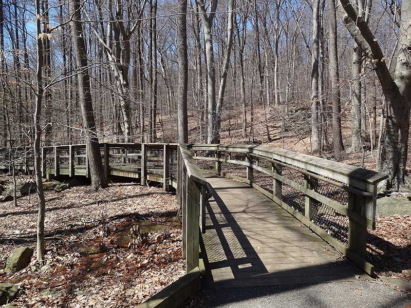
Cunningham Falls is the last sight on the trail and a great way to finish off. The cascading waterfall is very beautiful. Noticed several groups of high schoolers and their parents going off of the boardwalks that lead out to the falls, to get closer. There are clearly visible signs that say to "STAY ON THE BOARDWALK". The park officials are clearly trying to preserve this fragile area. Please don't be like these individuals. You can enjoy the falls from the boardwalk perfectly fine.


