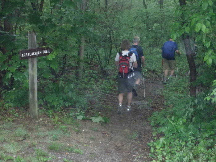
We did this hike as a one day 41 mile benefit challenge hike for the Blue Sky Fund, but we recommend doing it as a 4 day backpack, as also described on this site, which we used for planning our hike. This is also a very busy portion of the AT. If you can only do a day hike, park at the I-70 Parking area and hike 2.3 miles north on the A.T. to see Annapolis Rocks and then 1 more mile to see Black Rocks.
The directions below should give you enough information to keep your orientation and know how far you have come. We will also highlight the places to camp if doing this is done as a backpack.
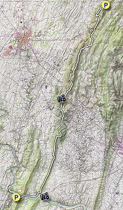
DAY ONE -10 Miles
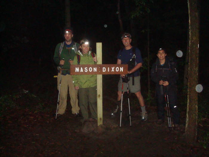
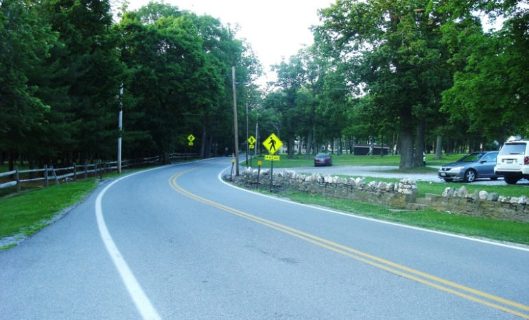
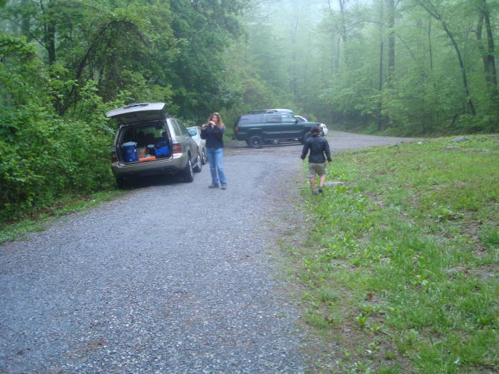
Mile 0.0 – Parking is at the Pen Mar County Park . If leaving a car overnight you should park in the gravel lot across from the park as the main parking lot is locked each night. The trail begins just to the right of the Overlook Pavilion and A.T. Sign, go 0.3 miles North on the AT, cross the RR Track and then reach the PA Line (Mason Dixon Line). Stop, take a photo. turn around and then head South on the AT, passing Pen Mar Park. Note: If backpacking you could leave your gear at Pen Mar Park and pick it up as you return south.
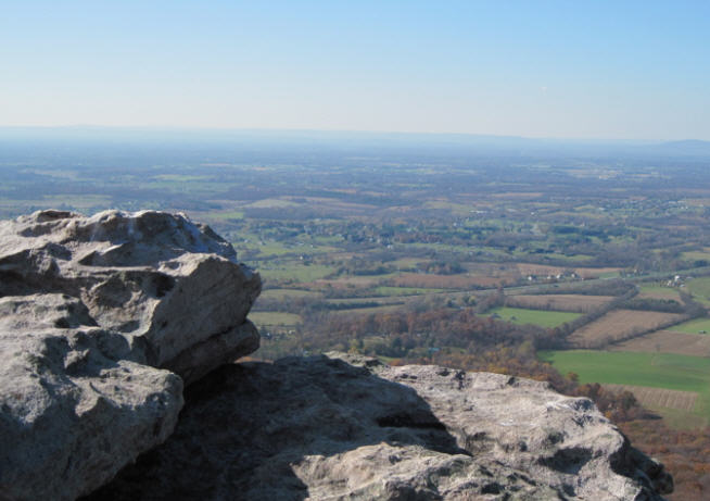
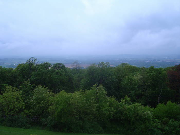
Mile 3.1 – Side trail to High Rock, supposedly really good views.
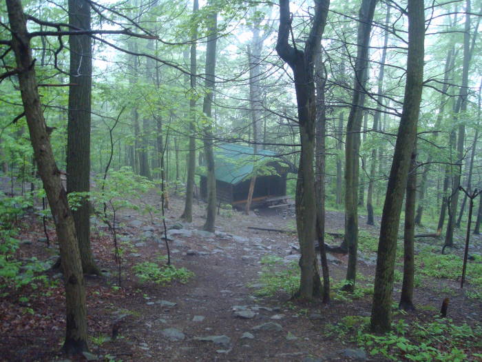
Mile 5.3 – Raven Rocks Shelter
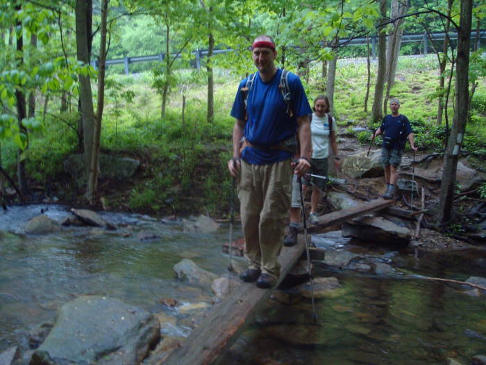
Mile 6.2 – MD 491 intersection. Couple of creek crossings near here
Mile 10.3 – MD 17 (Wolfsville Rd). There is a short 0.1 mile spur trail to an AT parking lot, 10-12 cars (Parking Lot Coordinates: 39.6283,-77.5593). Cross Wolfsville Rd to continue south on the AT.
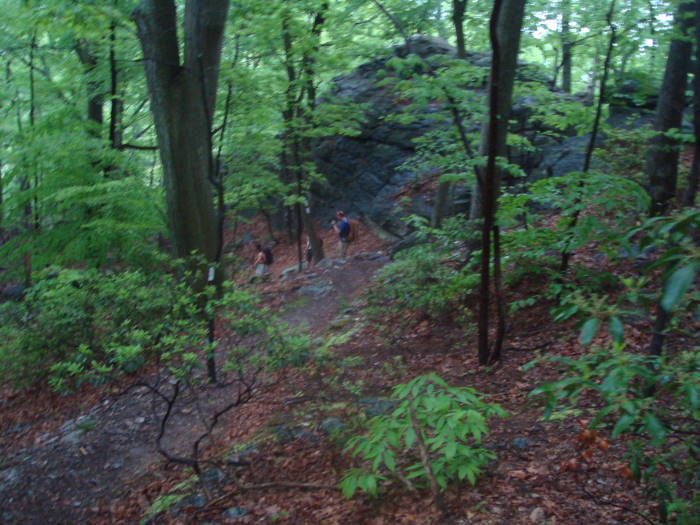
Mile 15.6 – Reach a couple of unmarked trails to Black Rock Cliffs in about 5.3 miles. Trail is pretty short to the cliffs.
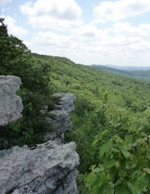
Mile 16.6 – Reach spur trail for Annapolis Rocks. 0.25 miles to the Rocks.
Mile 18.3 – Pine Knob Shelter, this is the Day 2 campsite.
DAY THREE – 12.8 Miles
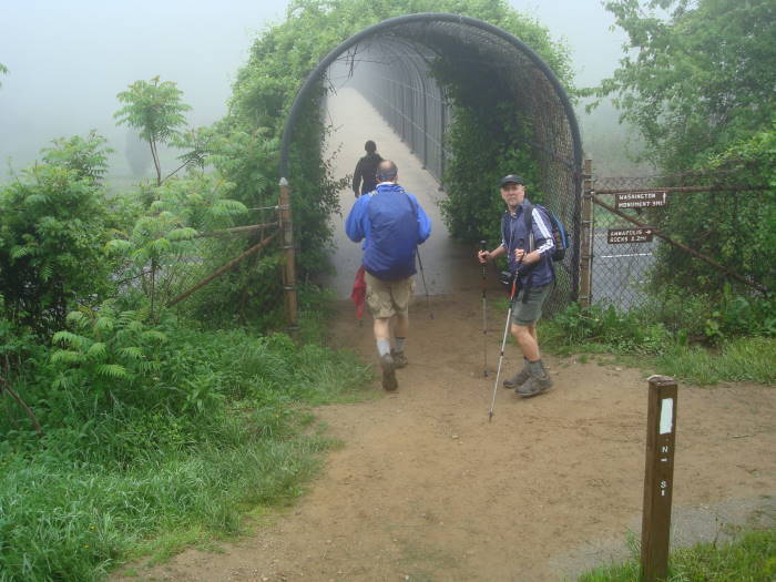
Mile 18.9 – I-70 AT Footbridge and spur trail to I-70/Rt 40 Parking Lot, 40 cars (Parking Lot Coordinates: 39.5355,-77.6040)
Mile 19.0 – Boonsboro Mountain Rd, 1st crossing.
Mile 19.7 – Boonsboro Mountain Rd, 2nd crossing.
Mile 21.9 – Pass through Washington Monument Parking lot. Note: Coming south before reaching the parking lot is a spur trail to the Monument.
Mile 23.7 – Turners Gap (Alt US 40, Old National Pike). Parking is directly across the road on the east side of the Inn closest to the AT (Parking Lot Coordinates:39.4841,-77.6198).If leaving car there, ask permission of the South Mountain Inn Lodge staff.
Mile 24.0 – Dahlgren Backpack Campground. Privy and hot shower.
Mile 24.8 – Reno Monument Rd.
Mile 25.7 – Rocky Run Shelter
Mile 26.2 – Lamb's Knoll Rd
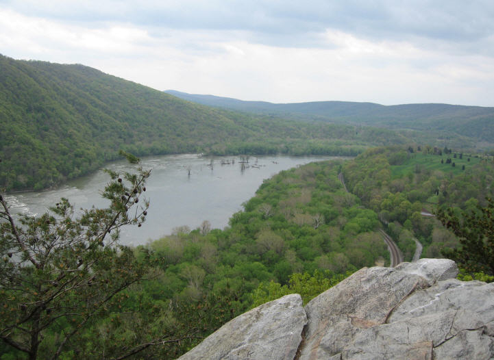
Mile 27.9 – White Rock Cliffs
Mile 30.7 – Crampton Gap Shelter, this is the Day 3 campsite.
DAY FOUR – 10 Miles
Mile 31.1 – Crampton Gap/Gathland State Park Parking (Parking Lot Coordinates: 39.406,-77.6393). Continue on the AT by crossing Gapland Rd.
Mile 38.4 – Railroad Crossing, turn right at C&O Canal Towpath
Mile 40.0 – Sandy Hook, Rt 340 Underpass
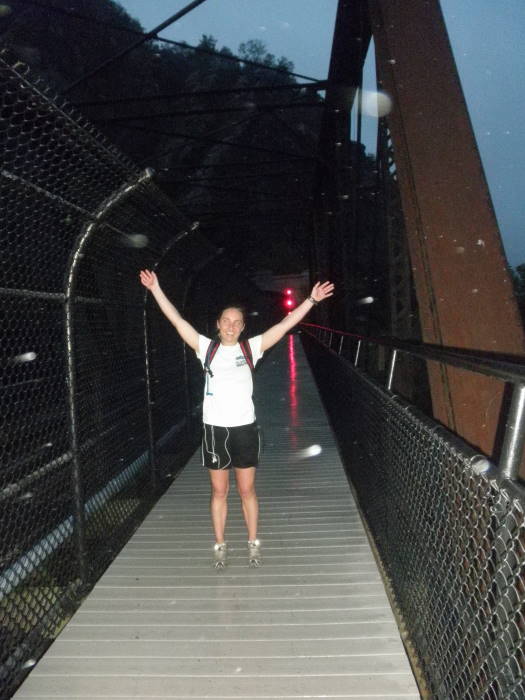
Mile 41.2 – Middle of Goodloe Byron footbridge into Harpers Ferry, WV.
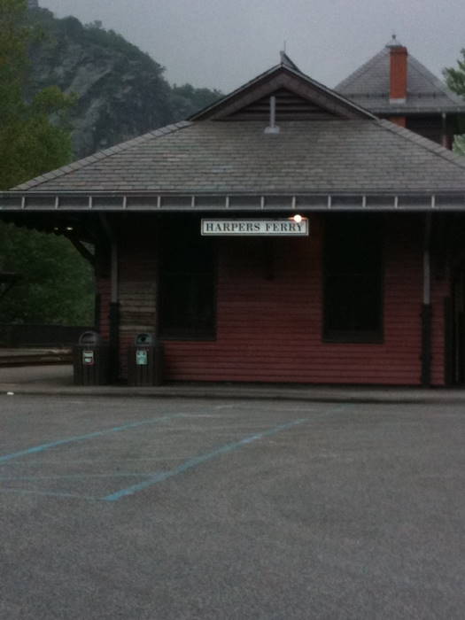
Mile 41.5 – Train Station parking lot (small fee for 3 days).
(Parking Lot Coordinates: 39.32442,-77.73)
Mid May
Maryland Challenge Team
Maryland Challenge Hike Comments
Archived Comments
By:King Kong
Rating:
Date of Hike: Friday, May 24, 2019
I took this on over Memorial Day weekend because I wasnt sure how long it would take me. Ive done sections over the years with friends but have never gone solo. Additionally I had multiple knee surgeries late last year so this was the first hike at any level that I was attempting. Having read numerous posts about doing it in a day or two I figured I would challenge myself and give it a shot. I figured I could do it in 3 days and if my knees werent up to it, 4 days. Also, I wanted to check the sights and try and get 47 miles in before I turned 48 this summer.
The route: north to south. Dropped a car at harpers ferry upper park (free parking with national parks pass) at 5am and my wife gave me a ride to pen mar road. Hopped out and was on my way.
Gear: altra trail running shoes w/rock plate, shorts, T-shirt and Columbia PFG, hat. Trekking poles and 30 lb pack. Too much water.
Day 1: The hike itself started great. Snapped a couple of inches off a trekking pole at mile 3 as it got wedged between rocks. It had rained the couple of days before so it was alternating between mud and rock at times. I had my handy paper AT topo map and downloaded Guthook to check that out. Ended up using the app more. Great scenic pit stops and saw a few people on the trail. Most heading north. The uphill after Ensign Cowall shelter gave me problems. Most of the downhills werent easy on my knees but werent hard. The jagged rocks after POGO also left a memorable mark on me. That was tough on me and a group heading north. Made me think I should have worn boots. Powered through and set a mental destination of Dahlgren. 4 miles out I didnt think I would make it. The heat and humidity stopped me from fueling properly and my face was chalky from all the salt I had sweat out. It didnt look good. Took a long breather and ate/drank and moved on. Got to dahlgren just before 8pm. Legs were shot and got the tent set up and everything out to cook dinner....and then I cheated. Others in camp were walking up to the South Mountain Inn for pizza and beer. Sounded glorious. I joined them. Although Diet Coke sounded better and when I saw the pizza I passed. Diet Coke was the elixir of the gods. Had 3 and hobbled back to my tent and passed out from exhaustion.
Day 2: figured the worst was behind me and planned on finishing that night. I was carrying food supplies to cover 4 days so I started to unload food on everyone. It went quick and my pack was much lighter. Also I carry too much water. Springs are plentiful along this hike and there are a few places that supply potable water. So I rolled up the bladder and stayed with the handheld. The second seemed a breeze in comparison. Some great sites and tons of people out for Memorial Day weekend. Made it to Harpers Ferry only to find my car was 2 miles away because there are two parts of the park. I was parked in the main or upper park and the trailhead is in the lower park. Dagger.
Its a great hike. Too much for two days. Take 4 and youll love it. You could dial back the food, water and even a tent for pack weight. I carried too much myself. I also encourage north to south because you can hang out in harpers ferry and have fun.
By:Sarah
Rating:
Date of Hike: Saturday, May 11, 2019
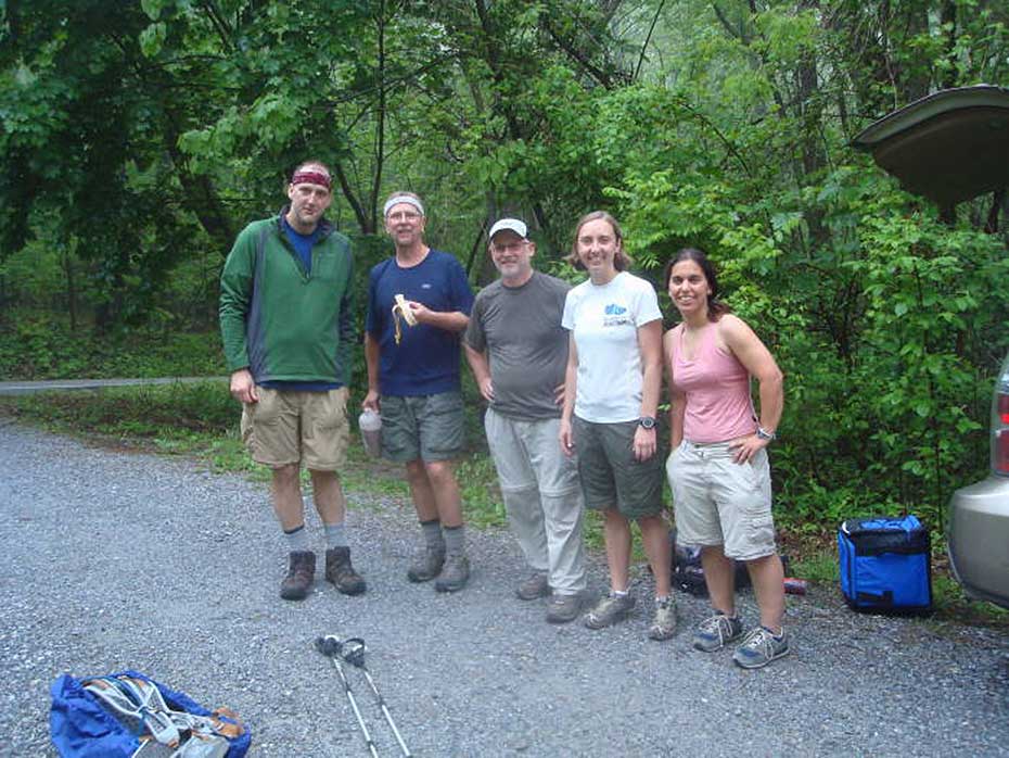
Four friends and I (2F, 3M in our early 30s) did the hike in one day from Pen-Mar to Harper's Ferry. We're all pretty active, and I personally didn't expect the hike to be as challenging as it was for my fitness level, but I still really enjoyed the challenge.
Light and trail issues:
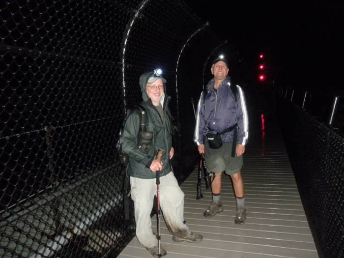
Despite the suggestions from other reviews on this thread, within the first couple of miles even with headlamps we managed to get off the trail and had to scramble up a pretty steep slope in the dark to get back to the AT using a map on one of our phones. It could have been immediately after the first trailblazer - we don't have any idea when we ventured off, but we didn't realize for a bit too long. Do not forget a headlamp or other source(s) of light! After getting back on the trail, it was pretty well marked with the white trailblazers. However, if it has recently rained/is raining, around mile 7 you cross a creek and many of the rocks are nearly covered by water. The vast majority of the hike is extremely rocky. I had never previously done a hike that was this consistently rocky, and my feet definitely felt it. Do not attempt this hike with shoes that are too old or that don't have any arch support left. Toward the end of the hike, rain from earlier in the week created some pretty muddy patches of trail. I'd also suggest bringing 1-2 extra pairs of socks to change if your feet get wet or sweaty.
Food and water:
Three people used 3 L bladders and two had 1.5 L bladders. We also brought 3 Lifestraw water bottles in case we ran out before the springs and a 20 oz water bottle with nuun in it. There are springs at miles 21 and 31. I ran out of all water just before mile 21 (1.5 L bladder and 20 oz water bottle), so this was perfect for me. However, it was about 65 degrees and not sunny during most of the hike. Any warmer/sunnier/more humid day would call for more water for sure, so depending on the weather, I'd suggest getting a 3 L bladder just to be safe. Needing to filter water was not necessary - I'd leave the filters at home to save weight. For food, we actually brought too much. I went through (after bagels and cream cheese prior to starting) 2 fruit leathers, half a small pack of dried mango, 1 kind bar, 3 beef sticks, 1 pack of beef jerky, 1 chocolate covered pretzel, 1 chocolate covered oreo, a couple handfuls of chocolate covered espresso beans (a GREAT pick me up), a half bag of trail mix, a half small bag of peanut butter filled pretzels, a package of dried seaweed, and 2 packages of running beans (jelly beans). The group I was with constantly reminded each other to eat or drink water which was helpful as the mental awareness of thirst wasn't really all there after mile ~35.
Difficulty/suggestions:
This hike was a mental challenge just as much as a physical challenge. My preparation was limited to one 16 mile hike, a 10 mile road race, and a 6.5 mile trail run in the weeks before. Up until the 22 mile water stop at the Washington Monument, I felt great. Between 22 and the 31 mile water stop at Crampton Gap Shelter, all of us had ailments including foot and knee pain. I'd strongly suggest trying to knock out a 25-30 mile hike during training, just for the sake of repetitive motion. I'd also suggest not doing this hike on your own unless you've been able to do 30-40 mile hikes by yourself. I needed the motivation of my friends to get through the last 10 miles. That being said, don't bring too many people. Paces may not match, and there's nothing worse than feeling like you're holding back a group of people, or feeling like you can push yourself to go quicker and other's cannot keep up. Go with people that can keep up with your fitness level - for me, five people was perfect. The hike took us just about 17 hours with a handful of stops. Importantly, go a bit further from the trail than you think you need in order to poop. Thru hikers aren't ashamed to stare otherwise :)
Parking/lodging:
We left one car at the Harper's Ferry train station and drove up to Pen-Mar with another car. We parked in the gravel lot across from Pen-Mar Park, and slept under a gazebo in the park overlooking a town below, which was ideal for getting started early. Our goal was the estimated 16-18 hours, and we left at 4:15 am to try to get back before dark (did not make it before sunset). The end of the hike essentially leads to the train station at Harper's Ferry where we collected our bags and left the car again overnight ($15 park fee, an envelope but not a true "ticket" was left on the windshield). I booked 2 rooms in advance a the Town's Inn which is a very short walk from the parking lot (would highly suggest!). One of the rooms could actually have housed us all, but I'd definitely look into this place for a late check in and ease of getting off your feet quickly after the hike. There's not much open late at Harper's Ferry, but there is a cafe connected to the Town's Inn and a pizza place that are open til 10 pm. We opted to drive to get pizza and beer from a 7-eleven a mile away, brought it back and passed out an hour later.
Things to not forget (aside from the obvious):
Sunscreen, toilet paper, headlamp/flashlight, socks, moleskin if you're prone to blisters, hand sanitizer, plastic bag/ziploc for garbage and used toilet paper, bugspray if mosquitoes are already out, portable phone charger if you will depend on any apps, rain jacket
Overall this was an amazing experience, pushing ourselves together. The weather was absolutely on our side, and I could see this hike increasing with difficulty in other conditions, so just be prepared for what the weather forecast is whenever you do decide to go!
By:Ben
Rating:
Date of Hike: Saturday, June 16, 2018
Two friends and I did this hike mid-June. Were all in our late 20s, hike very often, and are in decent shape. We started at 5:00 AM at the Mason Dixon line and crossed over into Harpers Ferry right after 8:00 PM. Factoring in a 45-minute break at the Washington Monument (pizza!!!) and various 5-10 minute breaks throughout our actual hiking time was just under 14 hours.
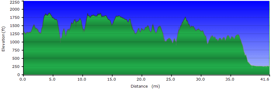
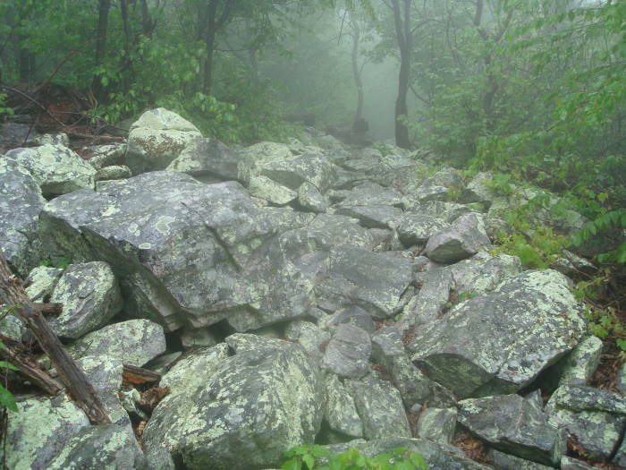
A few things to note about the trail. First, there really isnt that much elevation gain/loss. There are 3 primary hills, High Rock, Black Rock, and Lambs Knoll. Aside from that, the trail is rolling hills and flat areas. The elevation was challenging at times, especially Lambs Knoll, but what got us even more was the rocky terrain. It seemed like miles would go by and wed still be walking on rocks, and sometimes sharp rocks. Dont do what I did and use beat up old tennis shoes. Proper footwear is a must for this trail.
Another thing to note is that the trail, although well marked most of the time, can be confusing. On one occasion, about Mile 7 or so, we were walking along a creek when the trail started to narrow. We became suspicious, so we double backed a few hundred yards and realized the trail actually crossed the creek. There was no bridge, just a few rocks to hop across. Looking back on it now I realize that the creek was just very high at the time so its most likely not much of an issue typically. Little things like this can set you back and also mess with you mentally if they keep happening.
Another area that was quite confusing was about Mile 2. When you get to the large rock beds at the base of High Rock pay close attention to the trees so you can find the white marks. Theres no real trail, you must rely on the white marks to navigate the rocks. This can be particularly difficult in the dark.
I would recommend doing this hike as close to the summer solstice as possible to maximize daylight. Both the start and the end of this trail have difficult terrain (base of High Rock and Weverton Cliffs) so operating in the daylight is ideal. That said, definitely have a headlamp for early morning hiking and in case you pace slower than expected. The hike down Weverton Cliffs is no joke, especially after hiking 35+ miles, and I cant imagine doing it in the dark.
Anyway, a few random thoughts about the hike. From an emotional standpoint, you almost get the sense the trail will never end I remember thinking to myself around the 35-mile marker that this was getting a bit excessive. And it was. Especially when youre literally walking for miles on the toe path to Harpers Ferry.
Another thought I have (or I guess I should say had), and previous writers have suggested this as well, is that prior to this hike I thought that since Ive been hiking 10+ miles for a long time and have done 25-mile hikes before yada yada yada that this would be no biggie. Nope. Unless youre in amazing shape and do long hikes/walks all the time, THIS HIKE WILL TEST YOU. Dont get me wrong, expect that you will finish, just know that physically and especially mentally the hike will challenge you throughout.
Overall, I recommend the hike. It was great to spend time with friends not only doing the hike but also prepping and making plans. But just know what youre getting into be prepared, get the right shoes and study the terrain a little. If possible, hike a few miles in advance of the challenge so you get an idea of what to expect. Bottom line is just go do it.
By:Kevin H.
Rating:
Date of Hike: Wednesday, October 4, 2017
Completed the Maryland Challenge over the course of two days beginning the early morning of October 4th and finishing in the evening of October 5th. Day one was 18 miles to Pine Knob Shelter and day two was the remaining 24 miles to Harpers Ferry.
Began day one at around 5:30am at the Pen Mar County Park parking lot. It was very dark up there at this time for and a headlamp was absolutely necessary to walk safely to up to the Mason Dixon Line sign and to officially begin the journey. I had never traveled on this part of the AT before so it was a challenge to stay on the trail especially given that it was still dark outside. I found myself diverting from the trail a few times by accident because the white blaze was difficult to spot on the trees. Luckily I had downloaded the Guthook app on my phone (which can run on Airplane mode) and I was able to find the trail again.
The first miles between High Rock and the Raven Rock shelter were tough, it was a lot of steep, rocky inclines, followed by a steep decline past Raven Rock, so be prepared. I remember this beginning section as some of the more challenging of the entire first day. High Rock is a very nice view, and I took a few minutes to break and enjoy the view, just try to ignore some the graffiti on the rock itself, in my opinion it kind of takes away from the whole experience. Raven Rock was the next place I wanted to check out and it&rsquos one of the newer and nicer shelters along this section of the trail. I finally finished the first half of the day at Ensign Cowall Shelter for lunch.
Continuing along, Black Rock Cliffs and Annapolis Rocks are two great areas to visit along the way, the views here are probably some of the best along the entire trail and worth blue blazing a quarter mile to take in. These are also good places to drop the pack and ease the weight off your shoulders. I finally settled at Pine Knob Shelter for the night at about 5:00 or 5:30pm. Here you&rsquoll find tent pads, privy, shelter and the bear poles to stick your food on for the night. The major downside to this area is you can hear the traffic from Interstate 70 like it&rsquos in your backyard. I thought traffic would die down a bit as the night went on but it didn&rsquot. It was hard for me to get a good sleep at Pine Knob Shelter. I&rsquod consider Annapolis Rock&rsquos campsite (which isn&rsquot listed on the four day guide here) and you won&rsquot hear the traffic.
Day two began and I was on the Interstate 70 bridge very early on and heading towards the Washington Monument. The journey up to the momument is definitely a steep incline up, but I&rsquod suggest taking the extra small mileage and checking out the monument and the great view. There are also a number of historical signs to take in with regards to our first president&rsquos life. The next stop would be Dahlgreen Backpack Campground, but I&rsquod caution that this is fine for privy use, but the showers are pretty gross looking, I passed on showering here and on the entire journey for that matter.
Gathland State Park is at about mile 30 and it&rsquos has a large pavilion with picnic tables to rest and eat at. There are bathrooms just beyond the pavilion. From here, there was no more stopping for me until Harper&rsquos Ferry. I knew that coming down the very steep decline at Weaverton Cliffs is probably pretty tough at night so I wanted to make sure there was enough day light to get down safely. Having gone about 20 or so miles already that day, this was a major challenge to get down without any incidents.
Once I was down, it is pretty much flat and a straight shot to Harper&rsquos Ferry along the C&O Canal. At this point my feet were ready to fall off and I&rsquod probably would have paid any sum of money for one of the bikes that passed me along the way so that I could get to my end point. However, I pushed on and grinded it out and finished around 6:30pm.
This was the first time I had done anything like this, the most I had ever hiked was 9-10 miles in one day in Colorado. To hike 42 miles in two days was very taxing on my entire body including my hips and shoulders. This hike for an overnight hiker novice like me was more challenging than I imagined, but I consider it quite an accomplishment and would suggest it to those who are up for it.
Some additional tips-must haves on the trail are: trekking poles (can&rsquot tell you how many falls they saved me from having), plenty of water, a good understanding of water sources on the trail (Guthook app can help with this), good headlamp if you want to hike at night or early morning, and plenty of food for energy to keep the legs and feet going. Also like I said before consider other shelters besides Pine Knob, especially if you are a light sleeper. Prepare to walk through tons of spider webs. Take the time to enjoy the views.
By:Rachel S
Rating:
Date of Hike: Saturday, May 6, 2017
3 of my classmates and I decided to do this hike as a last-hurrah during our Senior Year of college. We had minimal hiking experience but are all fit and more or less athletic individuals. We decided to do this as an overnight, hiking from Pen Mar to Dahlgren Backpacking Campground on the first day (about 24 miles) and then from Dahlgren to Harpers Ferry the second day (about 16 miles).
We began from Pen Mar in good spirits at about 8:30am and headed south (after touching PA). The weather was rainy and somewhat chilly, which made much of the uphills and rocks slippery, but not too bad. Our group woefully underestimated the toll that 24 miles would take on our bodies (and spirits), but decided to push through the whole way. Pine Knob shelter was our bail out point, if we thought we wouldn't make it all the way to Dahlgren, but we decided keep walking, knowing that we would be hiking in the dark for the last portion. I am glad we did this because we reached the Washington Monument just at sunset, and it was a GORGEOUS view. However that left us to go the remaining 1.5 miles in the dark. Finally we made it to Dahlgren around 10pm and quickly set up camp before falling right asleep. The bathrooms were a welcome sight.
Waking up on Day Two was difficult but we wanted to get an early start to the day. We left Dahlgreen around 8am and continued south. The uphill to Gathland State Park was brutal, but we made it with frequent stops. It was more or less flat after that, but our feet hurt with every step and the downhills were difficult on our knees. We were so focused on finishing the trip that we didn't stop to enjoy the views off trail- something I wish we took the time for, in retrospect. It felt like forever until we made it to the final switchbacks and then the C&O Towpath, but the level ground was welcome. By the time we reached Harpers Ferry I thought my feet would fall off.
All in all, the hike was HARD (especially for some inexperienced, but very eager friends) but so worth it in the end. The best part of the trip was some Trail Magic we experienced on Day 2. A family in the parking lot of Gathland had a picnic table set up with lots of food and snacks for the taking. It was the highlight of the trip. I would recommend, perhaps as a 3 or 4 day trip so to more enjoy the journey.
By:Soundmind
Rating:
Date of Hike: Friday, November 11, 2016
My girlfriend and I decided to do this one a single day (Veterans day). We parked a car at Harper's Ferry, and then drove to Pen Mar park, parked in the lot across the street, and slept for a few hours. After eating a little breakfast and packing up the rest of the items, we entered the park and made it to the sign for the AT at about 3:45 AM. It was 41 degrees outside at this time, we both had on wool leggings and hiking pants, a wool base layer on top, and a half zip pull over. She also had a thin rain/wind jacket as she runs colder. We had two pairs of light wool/synthetic gloves each, wool socks and hiking / tennis shoes, and beanies, she had a scarf which was a very good idea. We were not over dressed, though several times throughout the day we stopped to take off the half-zips or put them back on.
All the hike was just walking, staying on the AT, except to go to Annapolis Rocks, other views were interrupted due to no sunlight. I wouldn't say we underestimated this hike, as we knew what we were getting into, we just underestimated what hiking for 17+ hours actually meant. We saw about 160 people on the trail, though 90 of them were between Annapolis Rocks and the I-70 bridge, the others were mostly at the Washington monument. If not for these two places we likely would've seen about 15 people total.
For nutrition we each had four liters of water, 3L in our backpacks (Platypus Duthie 15 AM) and a 1L water bottle. We only filled up water at the Washington Monument and had 1-1.5L left apiece. We each had an apple, pb&j, 2 Clif Nut Butter bars, 1 Clif bar, 3 protein bars, 2 Cliff Bloks, 3x Sport beans, 3x Gels, and 2x bags of mixed nuts. It was the exact amount of food required for us. There were several streams that had water, and we had a filter, but it was not necessary.
For the hike, our feet were hurting by mile 10, but it didn't seem to get too much worse. She developed a lot of blisters, I escaped the blisters apparently, but my legs have felt drained of energy for two days now. We had headlamps starting out, which were good, and got to Weverton cliffs well after dark, however it is only about 0.8 miles of steep switch backs, and it didn't seem very sketchy to me walking down it at night. The ups and downs weren't too taxing, only three significant climbs that accounted for the elevation gain, with the hike up to the Washington Monument being the worst, because that was after 20 miles. And it seemed to go on forever. We used the directions from Hiking upward in addition to the Trails Illustrated map and had no issues, just stay on the white blaze and you can't get lost.
We did encounter a slight set back, due to being tired drunk when reaching the railroad / towpath. DO NOT WALK DOWN THE RAILROAD. We did, and it was miserable, and very sketchy. Cross the railroad and get on the C&O path, and save yourself so much heartache.
It was a once in a lifetime experience that I will only be doing once. I would recommend doing it in a single day when the sun is out longer, and temperature is more consistent, as stopping to delayer was probably the most significant cause of time delays.
By:grc
Rating:
Date of Hike: Saturday, October 24, 2015
My friend and I broke this up into two separate trips. On the first trip we hiked from the 70 parking lot to Harpers Ferry and the second trip was Pen-Mar to the 70 parking lot. This was a fantastic hike, a bit warmer a month ago when we did the "second half" from this past weekend when we did the "first half". Our trip: Day 1, Pen-Mar to Ensign, solid foliage in late October, climb to High Rock is a true scramble and a solid climb. Definitely recommend going to High Point for the views and photos. Moved along to the Ravens Rock shelter for lunch beautiful shelter. Got to Ensign at about 4PM, fairly crowded for late in the year, but everything went smoothly. If using a water filter like a Sawyer for the still spring, make sure to bring something to scoop/pour water to the bags (I used my JetBoil w/ lid and worked like a charm). Day 2, Ensign to 70, pretty good climb up the ridge to begin the morning would rather tackle this early in the day. Stopped at Black Rock Overlook later in the hike... great views. Day 3, 70 to Treehouse Camp, we had great weather on this one in mid-September, stop at the overlook at the Washington Monument and there is one memorable climb. We decided to pass the shelter near Gathland and get a site at Treehouse Camp which gave us a little more room to spread out. Despite the ability to buy a steak there, we stuck to our Mountain House. This was my favorite day of the hike. Day 4, Treehouse Camp to HFWV, very reminiscent of Day 2. An initial climb up the mountain and then walking along the ridge until coming to a pretty solid descent to the Potomac River. Neither of us are in the greatest of shape or experienced on multi-day hikes, but we hobbled into town after 2 days/~24 miles of the 'second half'. I would prefer to tackle new sections of the AT, but living in Montgomery County, MD, this is a very manageable drive for great overnight hiking. Highly recommend this as a beginner backpacking trip to those in decent shape, either the 4day/3night approach on this site or broken up into two hike variety like we did. Challenging, but manageable.
By:Soggy
Rating:
Date of Hike: Monday, August 3, 2015
I section hiked this in 3 days from Harpers Ferry to Rocky Run Shelter then to the former Free State Hostel then to Waynesboro. I would recommend carrying plenty of water in the section from Harpers Ferry to Rocky Run. It is a lot of uphill and not a lot of spots to get water. Gathland has water but the drop over to Greenbriar may or may not be marked. Don't rely on this spot to get water. Also, there are bears near the Rocky Run Shelter. They didn't come in to the shelter but to be safe hang your bags. Another tip make sure you watch the trail sign at the Pogo campsite. You can easily drop down to another trail. It is a spur trail and is Rocky and all down hill. If you keep going you will have to road walk many miles to smithsburg to get back on the AT or walk a half mile or so back up to the top. I have met people who have done this. Where the water comes out of the spring at Pogo do not turn left going north continue on the AT. I forgot to mention I stayed at the Tea Horse Hostel in Harpers Ferry very reasonable and is about a quarter to half mile or so past the ATC on the same road in Bolivar, WV. Basically the high ground of Harpers ferry. Let's see...hit Waynesboro when you are done. Great burgers down hill from the Mason Dixon line at Blondies Tavern. Great sushi at Sapporo on the square in Waynesboro. Great wings and beer at the Dawg House on the West End of Waynesboro. If you stay in the motel in Waynesboro you can take a walk west about 200 yards west and look right there is a laundromat behind the Turkey Hill mini mart. Oh and make sure you walk 200 yards off the trail to see High Rock overlook it is the best view on this part of the AT. I think it's better than the Bears Den Overlook.
By:Carl
Rating:
Date of Hike: Sunday, May 24, 2015
First time overnight hikers. I'm 52 and my son is 15. LOL - I have nice broken in hiking boots but since my son has grown so much and fast we have not bought anything for him. So since he's going to be wearing tennis shoes I will also. Dropped off at Pen Mar @0715 AM 5/23/15. Didn't know how far or fast we can go so made plan A, pick up in Harpers Ferry on 5/24. Plan B, pick up @Gathland State park on 5/24, Plan C, pick up @Dahlgren Backpacker campground on 5/24. Made it to Ensign Cowell shelter before 12 and Pine Knob shelter before 3. My feet were starting to hurt but we both decided that we had 6 more miles in us and plenty of sunshine. Make it to the Dalhgren campground by 6. Found some space and set up camp, cleaned up and had dinner. Walked up to the Inn and had a few cold beers, root for him, Sam Adams for me. Up and going @~0715 on 5/24. My feet hurting a little but his were fine. Stopped a few times along the way to fuel up but still made it to the Ed Garvey Shelter by 12 on 5/24. My feet hurt worse on every stop but our goal of making Harpers Ferry in one night was going to happen so we just kept going (pain is only temporary) and arrived before 1500 on 5/24. Funny the last 3 miles on the C&O seemed to be the hardest. Finished with major blister on left "pinky" toe and quarter size blisters on bottom middle pad of each foot. Took a few days to recover. We may have packed a little too much food and water but that's part of the learning curve as pack weight was not a problem. This is a great hike and we are now making plans to do another, maybe a up and back from Pen Mar. Doing this hike from North to South I think the first 12 miles are the hardest with it getting easier after that. Water is not a problem along the way.
eviltwin_1@msn.com
By:Brian S
Rating:
Date of Hike: Saturday, May 23, 2015
I decided to do the 4 State Challenge on the spur of the moment (4 state adds an extra 2 miles or so past Harpers Ferry to the VA/WV state line). I got droppped off at Pen Mar/Mason Dixon Line at midnight on Friday night/Saturday morning this Memorial Day weekend. I parked my vehicle at Harpers Ferry Visitor Center (need to notify them of overnight parking via faxed form found on NPS/Harpers Ferry webpage). I did this hike solo with a 20 pound pack, most weight was snacks and water, but also brought toilet kit, water filtration, basic first aid kit, radio, phone and batteries/charger. The trail was very well marked but I did make two wrong turns one coming out of a field missed the cut-in back into the woods and one going by one of the shelters-I went down hill instead of straight thru because I was trying to be curteous/quiet/keep my headlamp low and missed a White Blaze. Although this is a great hike with some great views, I missed many of those as the first 6 hours of my hike were in the dark. The only bad thing about this hike is there are some brutal sections of rocks with no way of avoiding them so your ankles take a beating. And that is ultimately what caused me to bail out on this hike. I made it to Washington Monument State Park, about 23 miles total with my detours. I texted for a pickup when I got to Black Rock overlook.
This would be a very nice 4 day hike, just make sure you have solid footwear with good ankle support. But to really challenge yourself, try the 24 hour challenge...I do recommend taking someone along because there is a good chance of twisting an ankle in the dark. I ended up taking 11 hours to do my 23 miles, including a couple stops for some views (after I decided to stop at halfway) and a stop to replenish water, which was plentiful this time of year as streams were flowing well, just have your filter with you.


