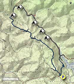
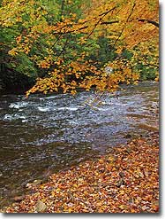
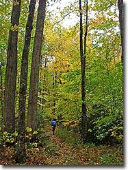
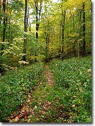
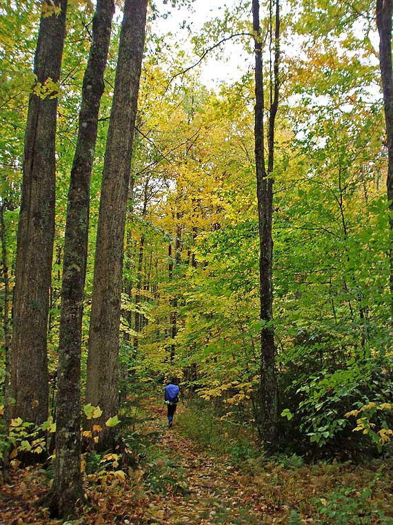
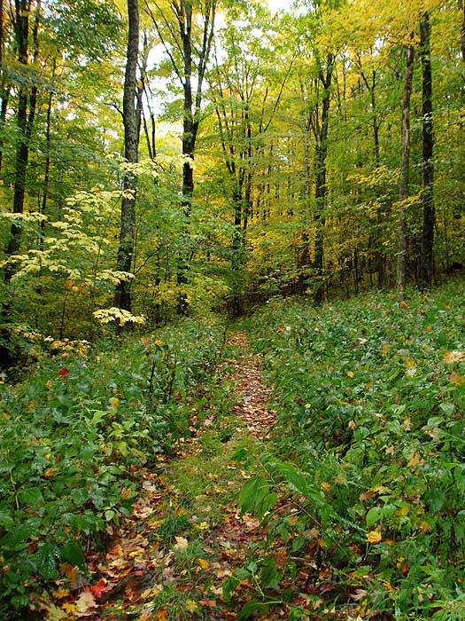
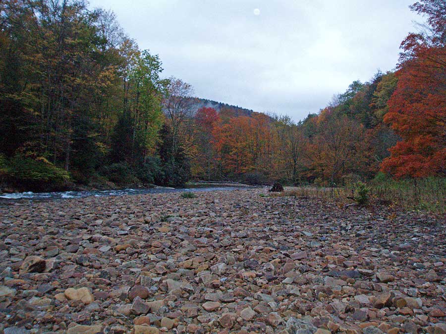
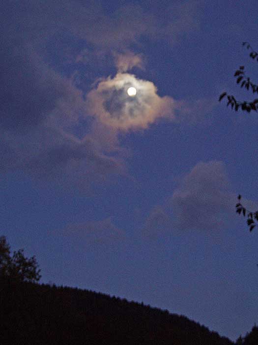
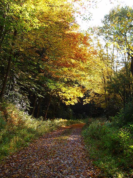
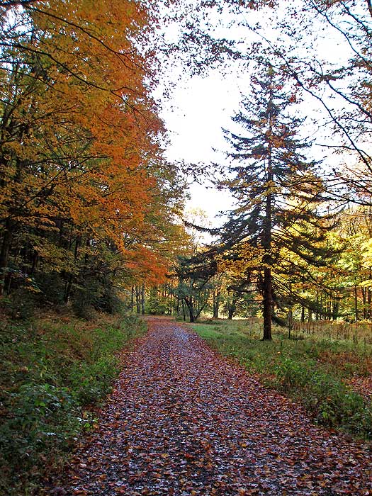
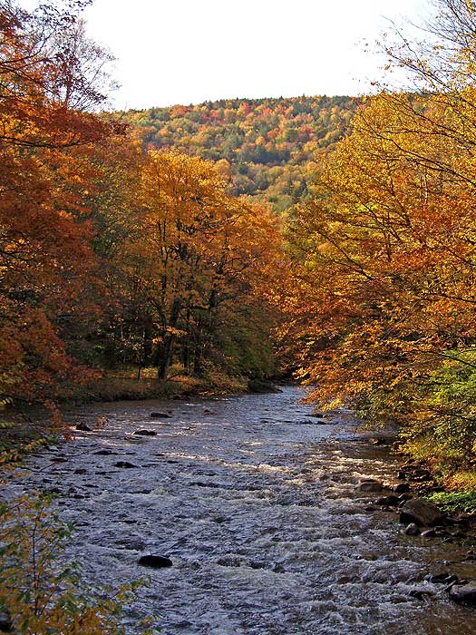
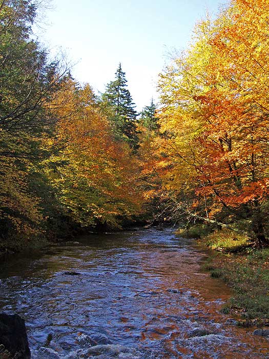
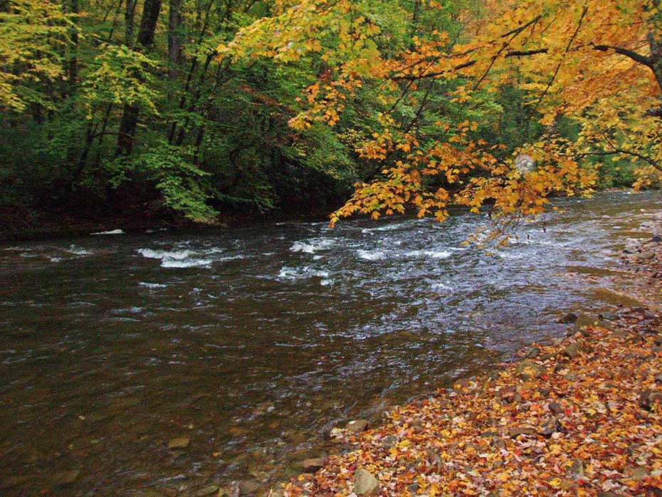
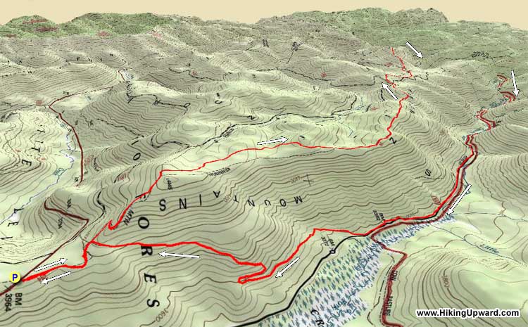
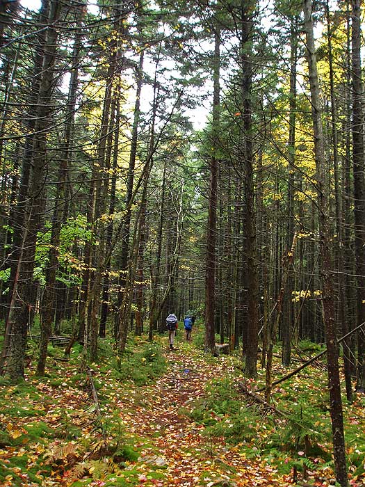
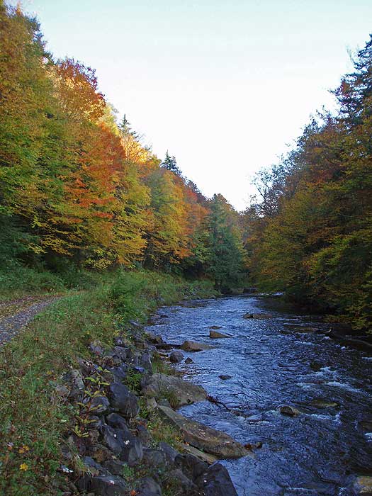
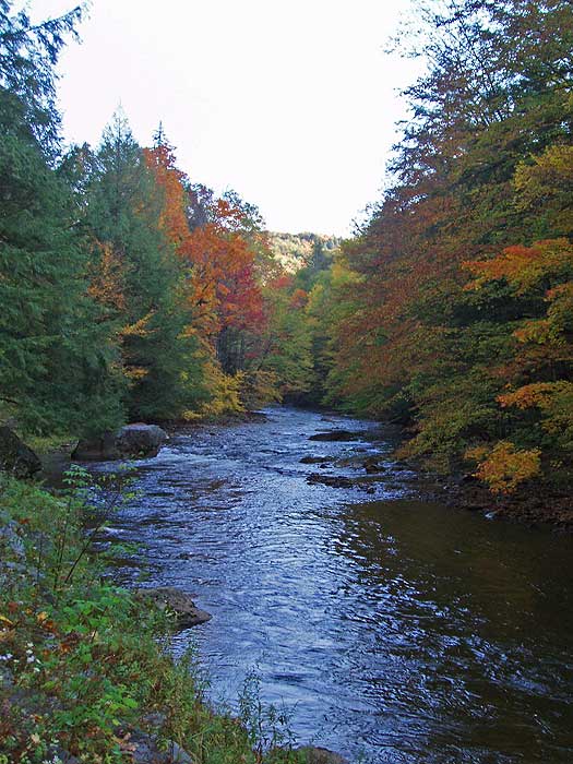
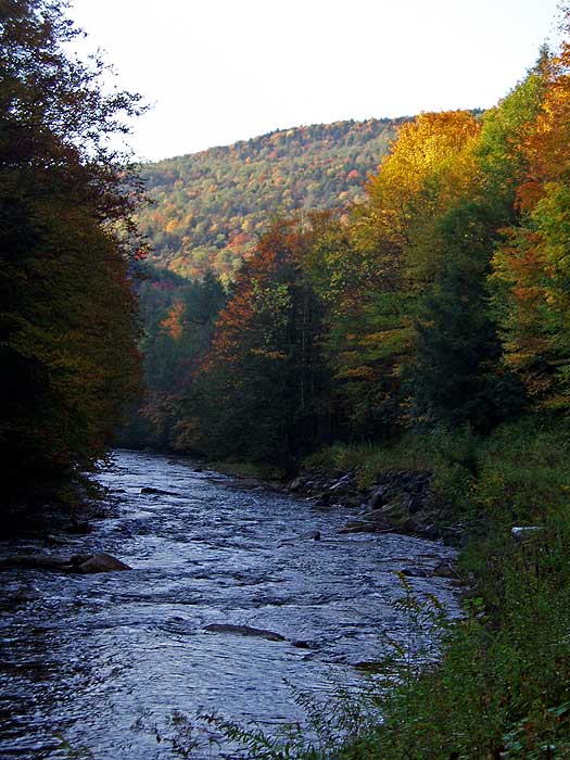
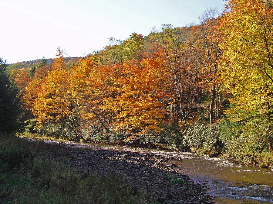
In the Cranberry Backcountry, this 18.9 mile circuit hike traverses a ridge of old growth forest, and follows the banks of Cranberry River. Early October, when the leaves change color, is probably the prettiest time to take this backpack. The valley explodes in oranges, reds, and yellows.
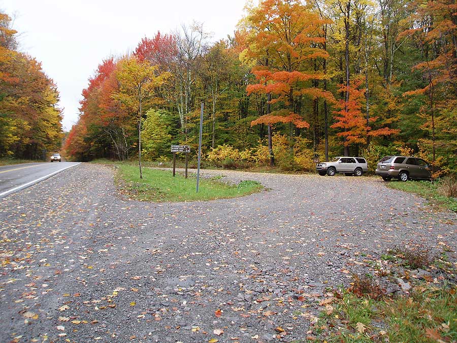
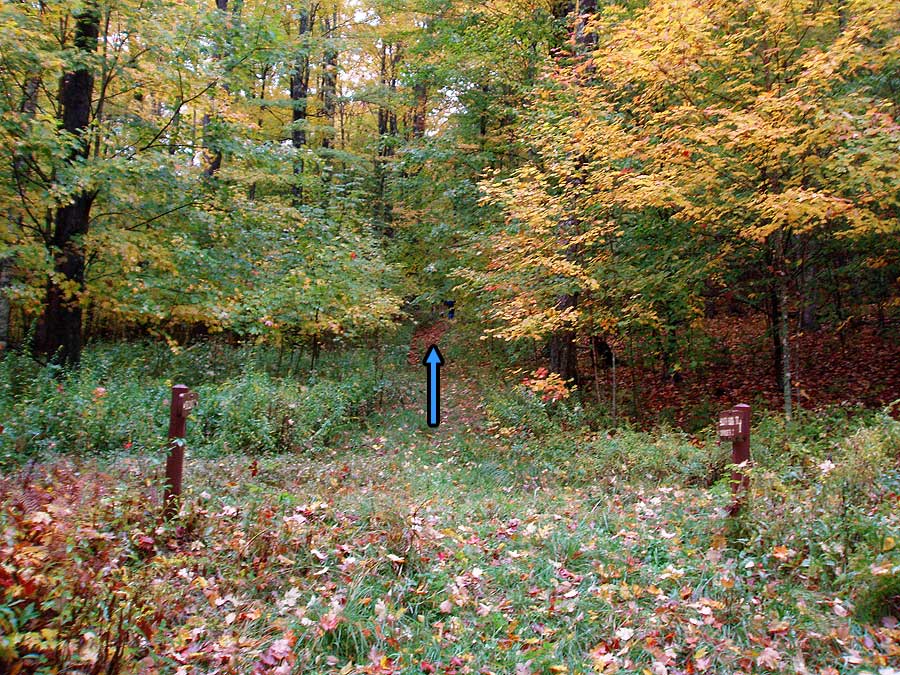
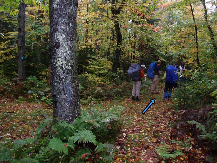
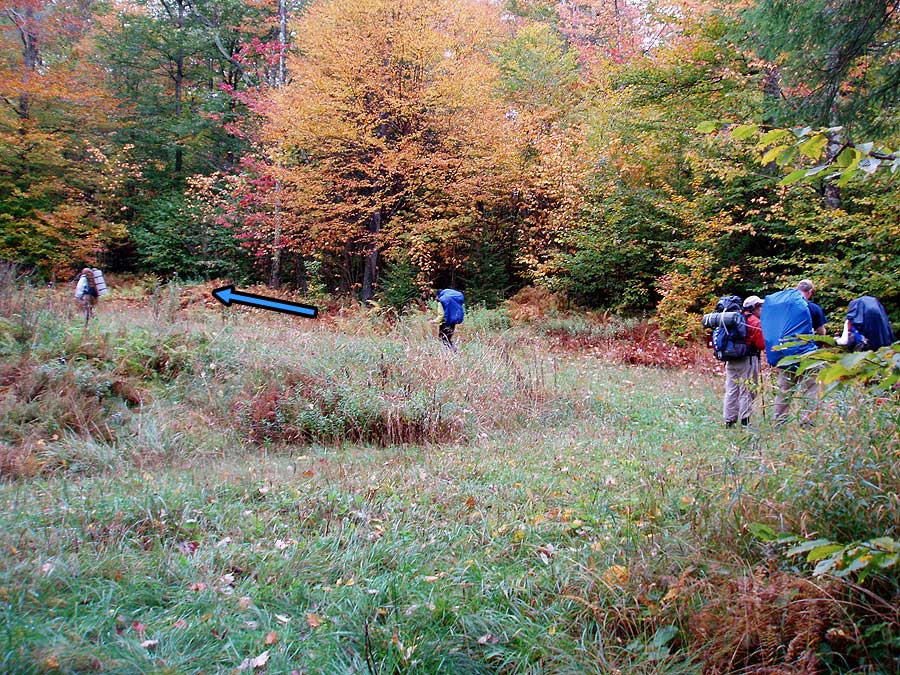
From the parking area start up the blue blazed Kennison Mountain Trail, and in 0.4 miles arrive at the intersection of the South Fork Trail. Continue straight on the Kennison Mount Trail as it climbs the ridge before reaching the junction of the Frosty Gap Trail in another 0.6 miles. Turn right, staying on the Kennison Mount Trail, and in 3.7 miles cross Forestry Road (FR) 738A.
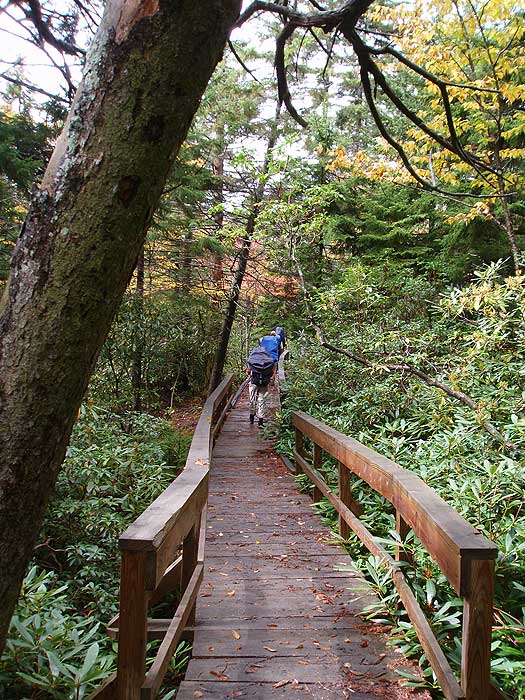
Continue along the blue blazed Kennison Mountain Trail another 1.0 miles where the the trail crosses FR 738B. Turn right on FR 738B for 20 yards, then left uphill on the initially wider continuation of the Kennison Mount Trail. The trail will head uphill for another 0.4 miles before passing around the summit of Kennison Mountain. The Kennison trail makes a very steep descent in the last 0.5 miles before reaching Cranberry River.
Ford Cranberry River, then head 100 yards upstream to the first of many superb campsites. If this site is taken, it's only a short walk to the shelter and next camp site.
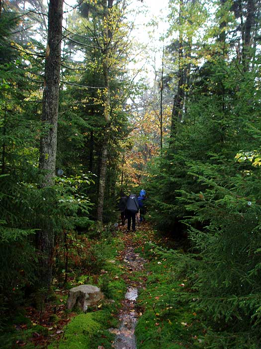
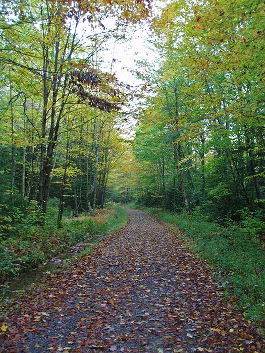
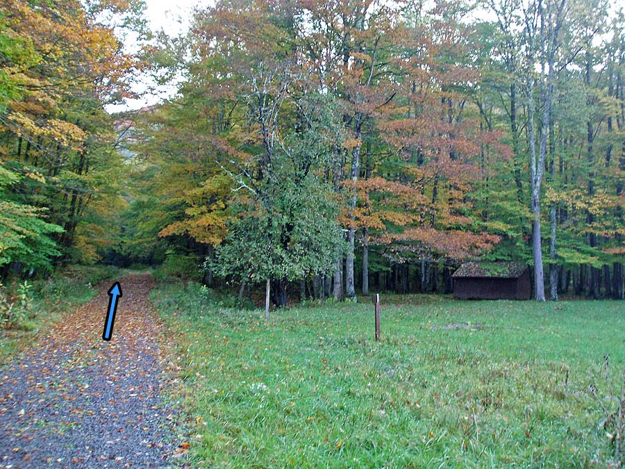
Head upstream on the non-blazed Cranberry River service road passing the Birchlog Trail, Tumbling Rock Trail and Shelter, North Fork Shelter (stay right where the North Fork Trail splits left), and South Fork Shelter where Cranberry River passes under the service road.
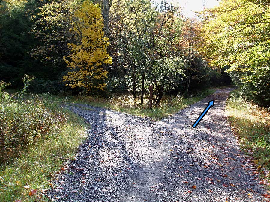
From this point, Cranberry River will be on the left and out of view. In another 2.1 miles, the service road arrives at the intersection of the Cow Pasture Trail on the left, and South Prong Trail on the right.
Turn right uphill on the blue blazed South Prong Trail as it climbs towards the Kennison Mountain Ridge. In 1.0 miles the trail will make a switchback to the right, then turn back to the left, and becoming steeper for the remaining 0.8 miles to the ridge, and junction of the Kennison Mountain Trail. Turn left on the Kennison Mountain Trail, and in 0.4 miles arrive back at the parking area.
Early October
Cranberry River
Cranberry River Hike Comments
Archived Comments
By:Ava
Rating:
Date of Hike: Wednesday, October 9, 2019
This was my first solo backpacking trip and wow it was gorgeous. I hiked it in 2 days, following the suggestions provided, only I did day 1 in 5hrs and day 2 in 4hrs. A few things that I read in the reviews and used in my own adventure were as follows: (1) trekking poles are a must. I went after 2 days of heavy rainfall and the end of the first day was a very steep downhill. I had to go slow the last mile down to the river but it was manageable with my poles. Even if it hadn't rained I still feel poles would be very helpful. This is no easy hike, there are a lot of stretches of uphill climbs. (2) I had called the rangers station prior and was told to pack in all my water "to be safe" but man did I regret that. On the first day, yes, it is necessary to have all needed water but once you reach Cranberry river at the end of day 1, it is a great place to fill up. Also, the second half of the loop follows the river for a few miles and has many little streams you could use. (3) I didn't read this in any other review but most of the trail on day 2 is very easy. You follow the service road (which gets almost full sun FYI) and the killer hill isn't until the last 2 miles or so. Overall, this was a wonderful hike and a fun challenge, I highly recommend it!
By:Joe Tinker
Rating:
Date of Hike: Saturday, October 6, 2018
I went along with four friends to complete this hike. We elected to make this a shuttle hike, taking out the steep portion at the end by leaving a car at the gate along the river. The resulting hike was perfect. The uphill at the start of the Kennison Mountain Trail was enough to get warmed up. Most of the Kennison trail was gentle ups and downs. Trail markings were frequent, and the trail is obvious. For a ridgetop hike, there were many deep muddy spots that had to be navigated around. The last part of the Kennison Mountain Trail is a very steep, muddy downhill. The single water crossing is not difficult. Water was below the bottom of shorts, and not too fast moving.
We camped at the first shelter you encounter. It is pleasant, with a great view of the stars. The road walk the following day was a nice change of pace from a tight trail. Overall I really enjoyed the hike and would highly recommend it as a wonderful 1 night trip.
By:Ryan Jarrell
Rating:
Date of Hike: Sunday, August 20, 2017
Just finished this hike today. Thought I'd add a few things I noticed to complement what everyone else has said.
(1) Trekking poles really came in handy on this trip. The downgrades can be muddy, the final 2 miles (when you regain all the ground you lost coming down to the river) can be very steep, and as for the river crossing--well, anyone who can make it across without poles without slipping probably has a future in Circus de Soleil or something. Trekking poles make all this (declines, inclines, and the crossing) simpler.
(2) The blue-blazed Kennison Mountain Trail is pretty well maintained. Having the blazes there is great for when you second-guess yourself ("Is this really the way?"), but the trail is always so evident that the blazes are almost redundant. You're not going to have to search for the trail.
(3) I've never done a hike that required fording a river. I stupidly thought a pair of flip-flops from Walmart would get the job done (what was I thinking?), and the river stripped those off me four steps in and I had to cross in bare feet--a risky, foolish thing to do. Use decent footwear to cross. Trekking poles can help you maintain three points of contact in order to navigate the slippery rocks, but that won't mean a thing if the current claims your kicks. (Plus, I hate the thought of my dumb sandals still be out there somewhere. Leave no trace, right?) Note that you'll only need to ford ONCE, not three times like I've read on other sites. (I'm assuming they're referring to other routes.)
(4) Monitor the rainfall in the area for a day or two before hiking this trail (https://waterdata.usgs.gov/usa/nwis/uv?03187500). For reference, when I crossed at nearly exactly 7:30 PM EST yesterday, August 19, 2017, the discharge (see the site) was almost exactly 100 cubic feet per second, and the gauge height was almost exactly 2 feet. The current wasn't swift, and the water came up to my mid-thigh in places. (I give this data and experience as a point of reference.)
(4) Don't be discouraged, but woo!--that last 2 miles hiking back up the mountain is strenuous! It feels like someone put in a couple switchbacks, then said, "Oh, to heck with it--let's just get up this thing!" and directed parts of the trails straight up the side of the mountain. Keep some gas in the tank for the end, and have those trekking poles!
(5) I did this hike solo. I didn't have to use my bear mace, but having it gave me peace of mind. I saw bear prints and bear scat (who knew bears could improvise?!), but no bears.
(6) I could see this being a day-hike. I got started later in the day than I wanted, and had to hurry a little the first day. I made it to the river in under 3.5 hours. The second day, from the river crossing to the finish, took just under 4. You could take things a little slower, allow time for a meal or two, and still complete this as a day hike.
Overall, A REALLY FUN HIKE! If you're interested in doing this hike, my advice would be read through everyone else's excellent trail reviews on this site and GO DO IT!
By:Benjamin
Rating:
Date of Hike: Monday, October 31, 2016
So me and my friends did this hike as a three day venture in the last weekend of October. The fall foliage was a couple of weeks past its peak, so I feel like the description is pretty accurate for the beginning of the month to be an ideal time to see fall colors.
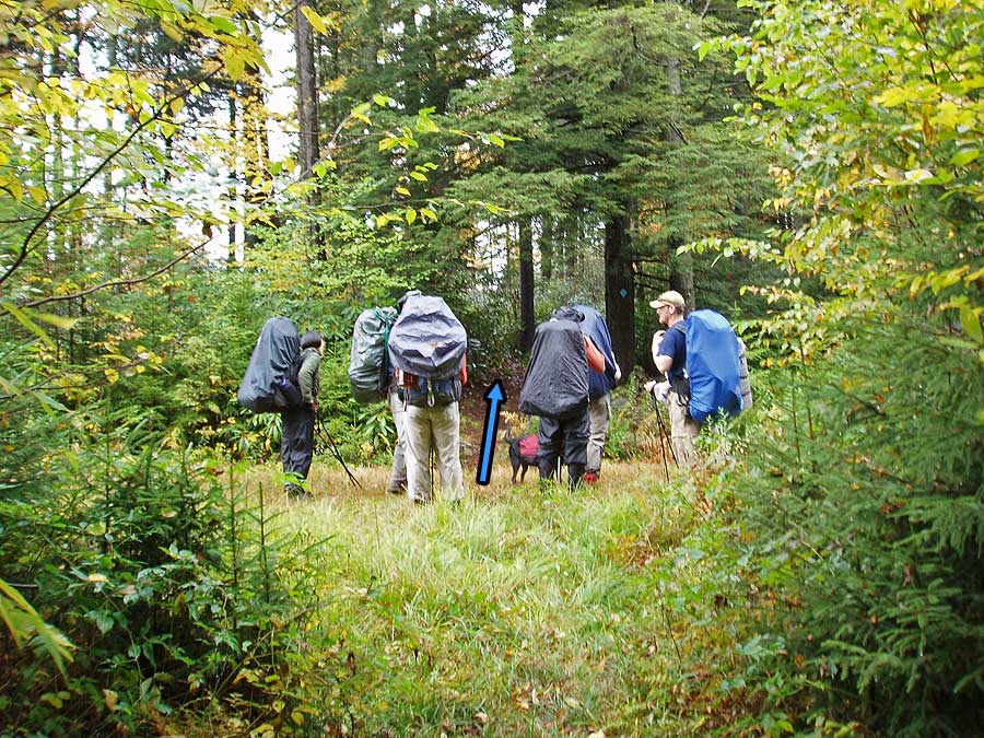
The first day we hiked from the parking area to the first campsite along the river. Water was EXTREMELY cold but all in all we had no problems crossing. The only things I would note from the first day is that when you come up to the first blue blazes that have an arrow on them pointing right, they are pointing right. We made the mistake of going straight. Also, when you come to the junction where it states to turn right up the trail, I feel like that was pretty accurate in that you have to go about 20 yards.
We split the second half of the loop into two days. The walk along the service road next to the river was very easy and pleasant with PLENTY of awesome campsites along the river besides the shelters noted o the maps.
The third day took us up the service road where it picks up the SOUTH FORK trial on the right. I know it says the south prong trail in the description but all three of us saw no signs with that name on it. The climb back up to the junction of the Kennison Mountain Trail was a little challenging but very manageable.
All in all this was a GREAT HIKE!!!!
By:James
Rating:
Date of Hike: Saturday, May 28, 2016
Just got back from doing this hike and thought I would leave a few comments. First, the difficulty rating of 5 is inaccurate. This is a low 4, almost a 3. This was the least technical/rocky trail I've hiked in the region. Sure, the climbs go on for a while, especially the tail end of the second day, but the miles ticked by much faster than a trail like Ramsey's Draft.
As the next review down stated, when you cross the second road do NOT turn right to look for the trail. I did as the directions stated because I saw that others had clearly gone along the "road" through the tall grass. I knew I was not on the official trail but I continued along the road anyway and took a left when it intersected with another service "road." The map shows that the road would eventually take me back to where the trail meets up with the river. Well, it didn't. Luckily, I have a fair bit of experience at navigation so I decided to do a bit of bushwhacking with map and compass. I worked my way down the slope until I came to a small stream that I knew would eventually take me to the Cranberry River. Had do double-back a few times to get around obstacles but I eventually made it to the Blue-blazed trail just 100 yards from the crossing.
Despite the much slower progress with my alternate route, I still made it to the camping area in just under 5 hours. Which brings me to my final point. The time estimates are off for this hike. Unless you are especially slow the first day is 4.5-5.0 hours and the second day is 4 hours. The long walk along the service road on day two is boring but fast. You will see a lot of people on bikes and on foot heading to fishing holes.
By:Chrissy
Rating:
Date of Hike: Saturday, May 17, 2014
Four of us did this hike in a single day (approx. 9 hours) - it was a lovely hike, not too strenuous elevation-wise, just a lot of distance. If you're looking for vistas, this isn't your hike, as there really aren't any. But hiking through the old-growth forest (where tall trees grow straight out of giant boulders!) is truly magical in parts, and well worth it.
Some things to note:
(1) Although the trail is well-marked with blue blazes, it isn't super well-maintained. We encountered one collapsed footbridge over a creek-bed, and an inordinate amount of mud due to a lack of channels to divert rain water from the trail. It was definitely manageable, but waterproof boots are a must if it's rained at all within the past week.
(2) The trail description says that the second time you cross the "road" (which is really just a field with tire tracks in it), you'll turn right and walk 20 yards up the road to find the blue blaze trail on the left. This was wrong - you just cross the "road" and walk straight ahead through the tall grass about 100 paces, and the blue blaze trail continues slightly to the right.
(3) There is a river crossing around mile 9 (just before the campsites, if you're doing it in two days). Be forewarned: the river can be HIGH and FAST if it's rained recently! We had to venture a ways upriver to find a section that was passable. I'm sure that other times during the year it's just a trickle, but if you're hiking after a recent rain, you'll want to make sure to bring water shoes and grab a good stick to stabilize yourself.
(4) Just after the river crossing is 8 miles of hiking on the service road along the river. It is beautiful (and easy) but somewhat tedious - make sure to have plenty of songs and salacious stories prepared for this portion of the hike.
Happy hiking!
By:Eddie Meadows
Rating:
Date of Hike: Friday, July 5, 2013
We hiked a portion of this hike along the Cranberry River. I took my 12 year old son and we did an over night staying at the Lost Run camp site. We hiked a total of 10 miles, 5 on Friday and 5 on Saturday. For this time of year the forest road had several people riding bikes (to reach their fishing spots) and a few other hikers. We didn't go off of the forest road due to the time of the year but will def come back in the fall. There are several nice looking trails that we plan to come back and try out. Thanks for bringing us to this area. We'll be back to stay longer and try fishing more. Thanks.
By:ArPacker
Rating:
Date of Hike: Thursday, April 26, 2012
Another guy and I did the trail in last weekend of apr '12. It was probly the best mixture of dense woods walking mixed with wide open trail next to a river. 1st day went about 6 miles through pine trees and ruff rocky footed terrain. We camped about 1/2 mile above the drop, only cause it was near dark and that drop off was wet. Had 2 hour wait after waking up that in a down poor.
You go down a steep hill that your thankful you don't have to clim. Now ford the river, this was extremely hard for us. The river was high and both lost camping shoes(not hiking boots) the rocks combined with the speed of that water almost sent us down river. Tip: if crossing in heavy rain times, we found the widest point just before the river splits and some runs through 3 down trees. Also grab a sturdy walking stick use it to brace yourself from flowing down river.
When you cross you then walk on a road the next 5-6 miles. The trails indicate there are a # of shelters for camping. What it doesn't say that they have all been taken for fishing camps and are no longer open to the public. The guys running the fishing camp stopped us in the road and told us we were not to camp anywhere near their shelters that was their business they are running. To that park: you need to allow hikers the same access to reserving them as those DB. It stunk thinking we would have a shelter with picnic bench and made fire ring waiting for us, some of the appeal of that trail. Those guys just royally pissed me off.
We camped just beyond the last shelter. While crossing with that much water flowing was hard the sleeping right next the rushing river was great. Slept through the roughest T-Storm I have ever been in a tent for. From there on was a slight sloop until you get off road again. A few creek bridges had fallen bur could get around the well. That last 2 miles out area the only real steep climbs of the whole trip. Would do the trail again in the fall time with leaves changing colors.
This is a Black Bear reserve. Make sure you are hanging your food a ways from your site. While we didn't see any bears we saw plenty of their patties. Also carry or have the pepper deterrent.
By:4 Girls and a Dad
Rating:
Date of Hike: Saturday, October 8, 2011
We stopped at the Cranberry Glades after a trip to WV to see the fall colors and hunt for berries - but we were a tad too early. I hiked the Cranberry wilderness about 15 years ago with my brother and we enjoyed this route, but we liked the middle fork of the Williams and the Beechy Run circuit much better. That route is less monotonous, has a few views, a nice waterfall and a great camp at Beechy run/Williams river confluence. If you want solitude and great opportunities to spot wildlife, the Cranberry wilderness is hard to beat - but being in the Appalachian plateau vistas are generally less grand, but more local.
By:Loner
Rating:
Date of Hike: Friday, June 17, 2011
Overall a nice walk through the woods. Beware that it is a hike through the WOODS. If you are going for views and scenery, I would find a different hike. It may be more scenic in the fall when the leaves are changing colors, but in the middle of June it's all trees. Thick undergrowth along most of the trail caused me to be especially wary of snakes also, but I only saw one the entire trip. What made the trip great was the more than usaul wildlife I got to see along the trail. At the intersection of forest road 738b I got several pictures of a large black bear before it wandered on into the woods, and while making the descent to Cranberry River I was charged by a pheasent with little ones. I spotted a couple trout in Cranberry River, although I wasn't fishing. It also seemed a bit more solitary than I expected: I only saw three people, and they were all on the service road as I hiked out Saturday. All in all a nice hike as long as you're not wanting the more scenic / well trodden paths typical of the AT.


