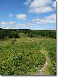
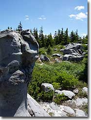
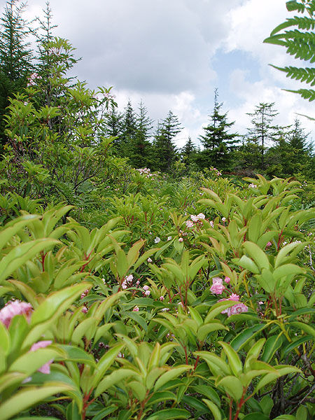
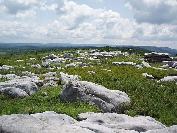
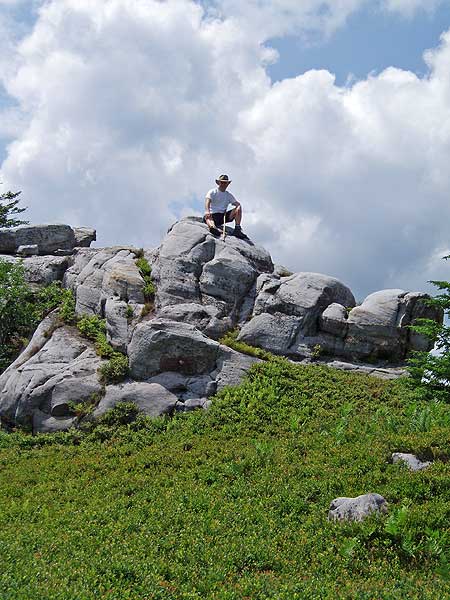
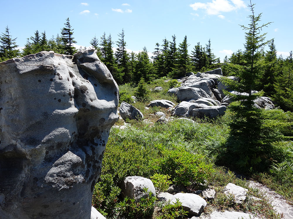
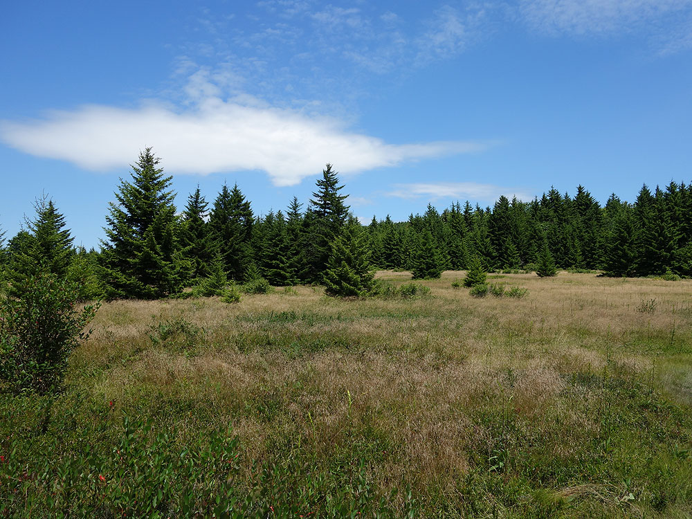
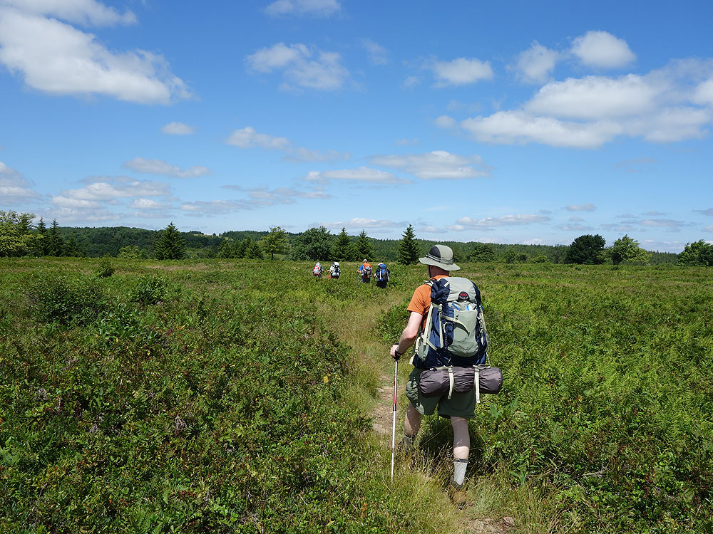
Arguably one of the most unique, and beautiful hiking areas on the East Coast. The high plateaus of Dolly Sods are made up of wind carved sand stone, stunted red spruce, grassy meadows, and sphagnum bogs. The characteristic meadows are the result of logging that took place from 1899 to 1924. During the Second World War the U.S. Army used the area for artillery and mortar training, and at the trailheads the Army Corp of Engineers still displays signs warning hikers that there may be unexploded ordinance in the area.
The name Dolly Sods derives from a combination of Dahles, a local 18th century family, and Sods, meaning an open mountain top or meadow. After WWII the area fell into neglect, and was threatened by multiple construction and mining project proposals. Then in the early 1970’s concerned environmentalists, along with The Nature Conservancy, began purchasing the land for preservation and recreational use. Today the Dolly Sods Wilderness Area comprises 17,371 acres.
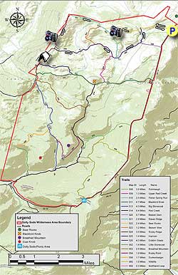
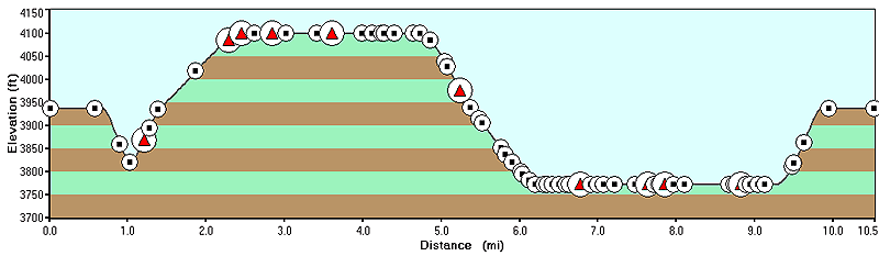
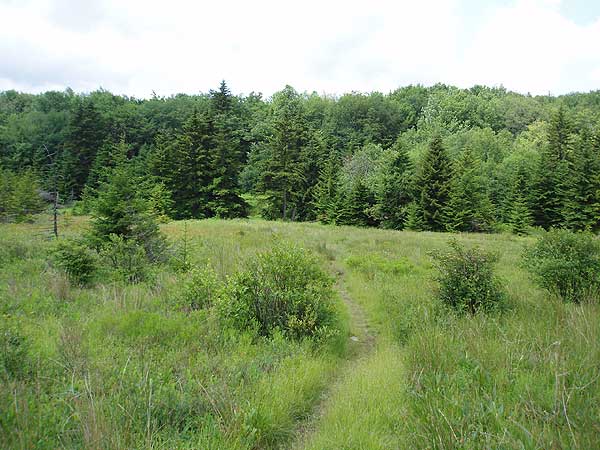
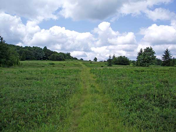
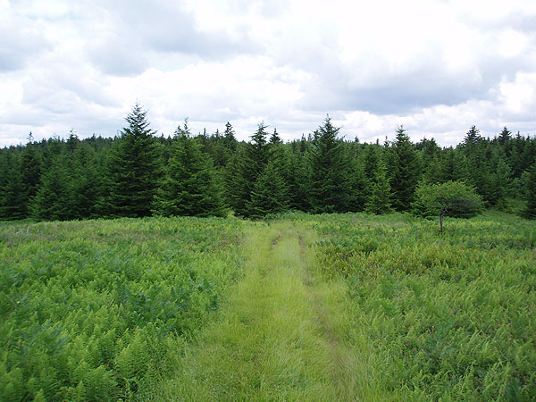
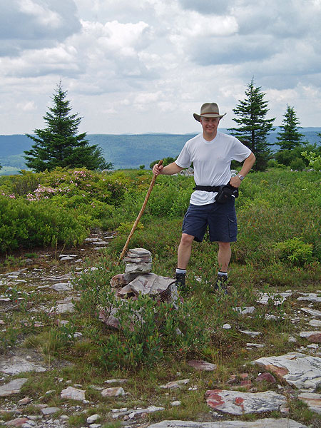
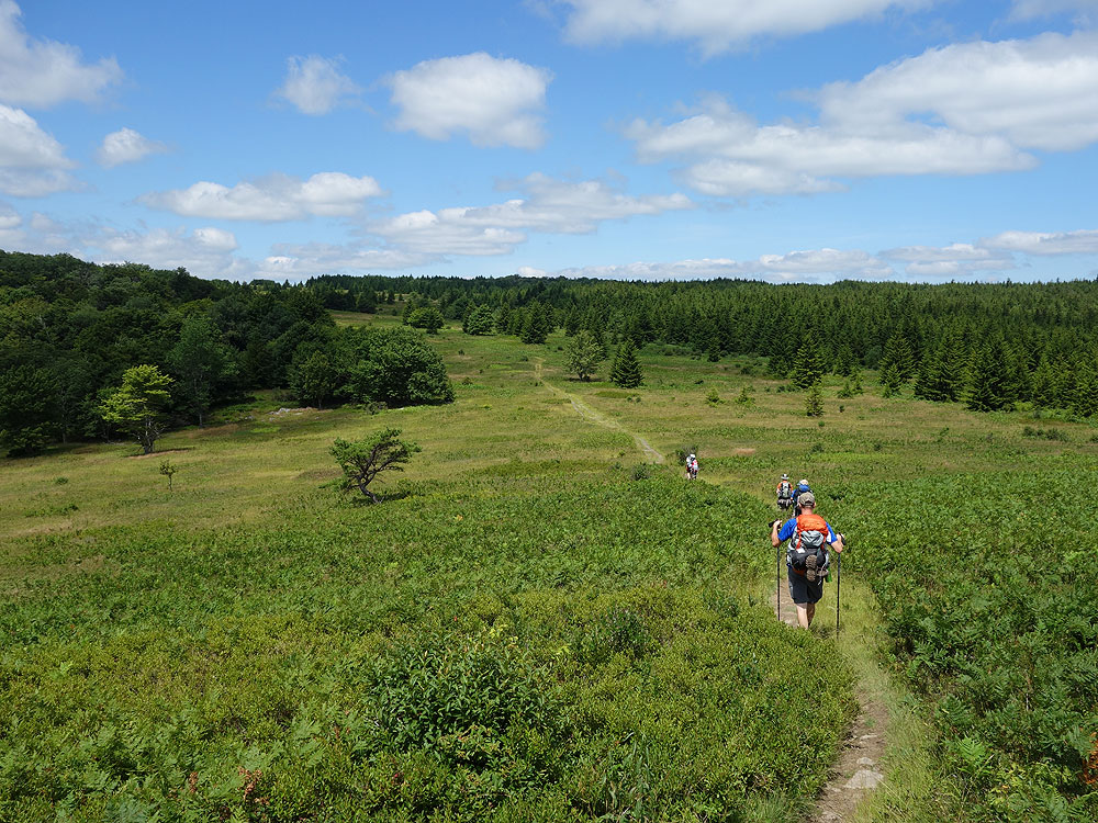
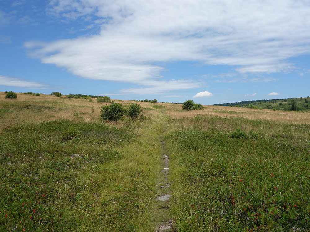
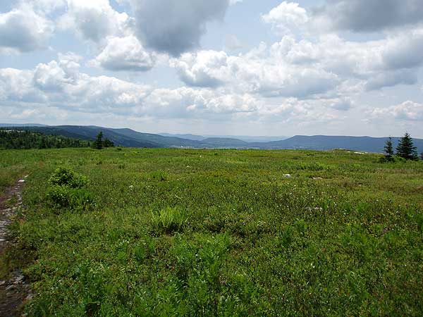
With over 47 miles of hiking trails following old railroad grades and logging roads there are many hiking circuit options. We have 3 circuit hikes posted here: Dolly Sods North, at 11.9 miles this hike highlights the high meadows and mountain views. The Forks of Red Creek, in the central section crossing Red Creek and several streams. And Dolly Sods/Lions Head, that combines the best parts of the first 2, as well as the view from the Lions Head on Breathed Mountain.
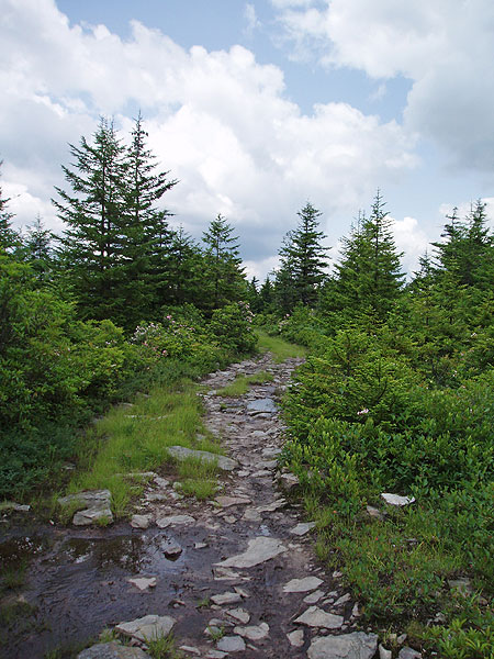
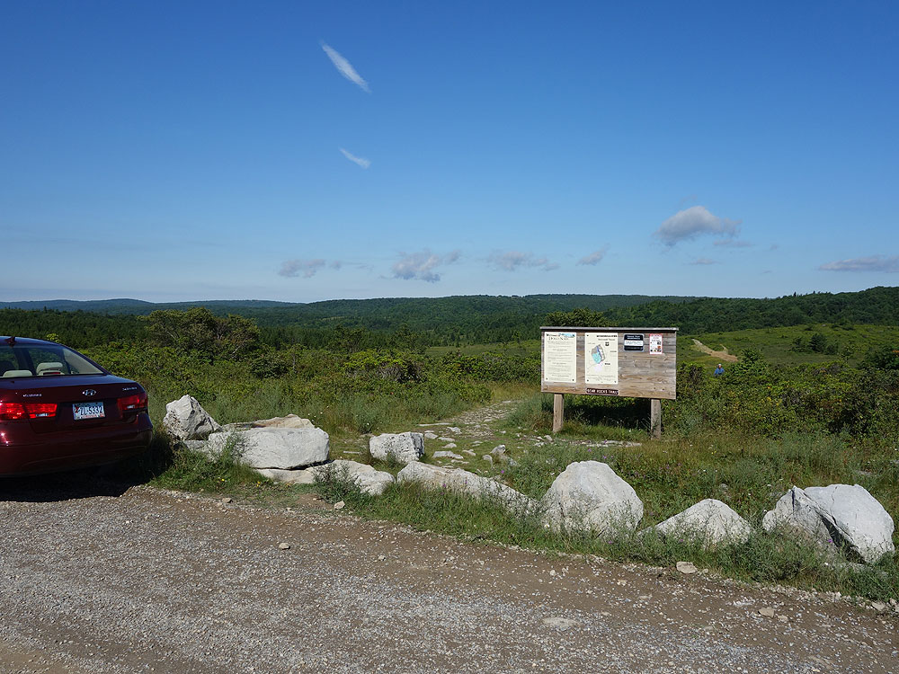
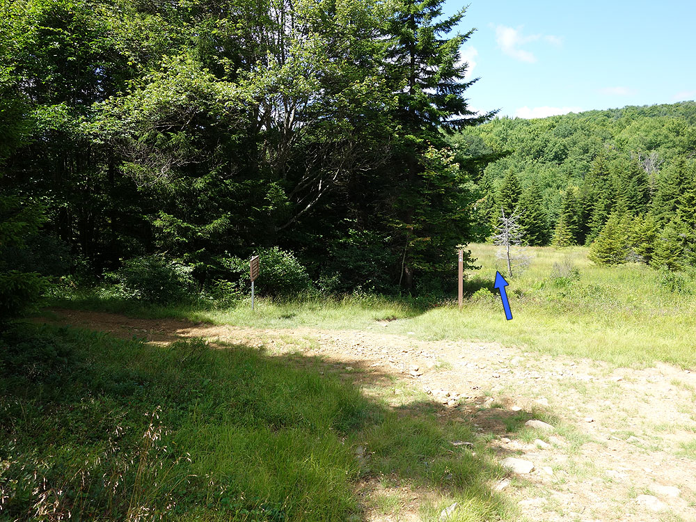
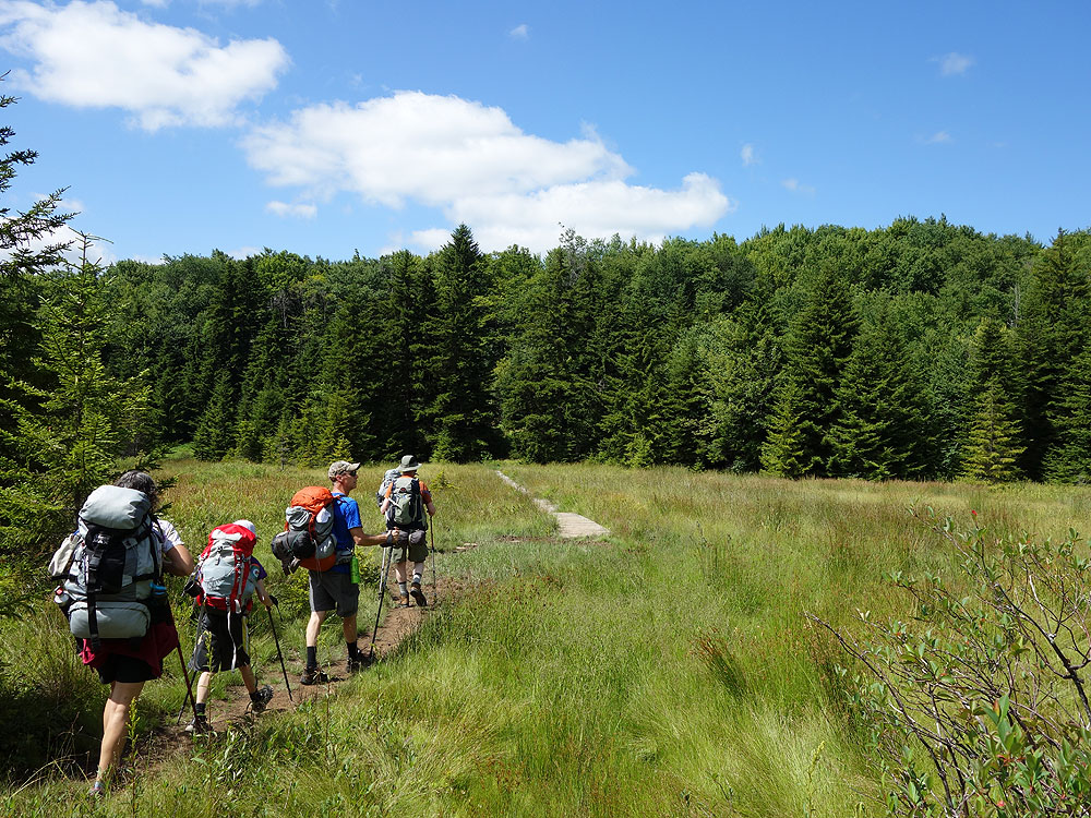
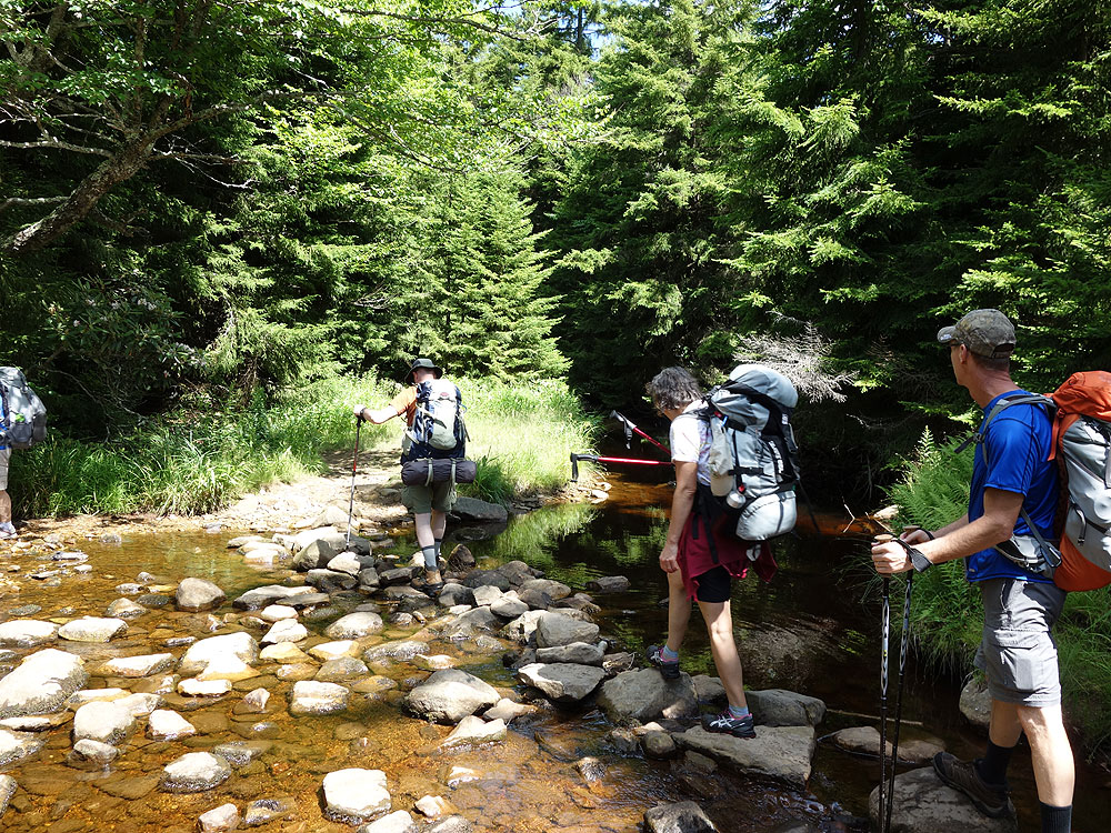
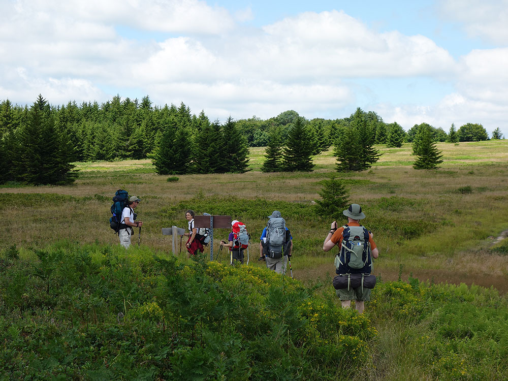
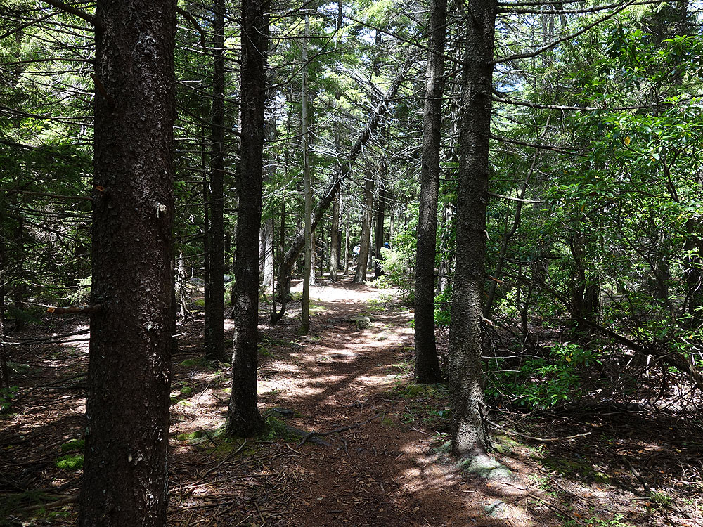
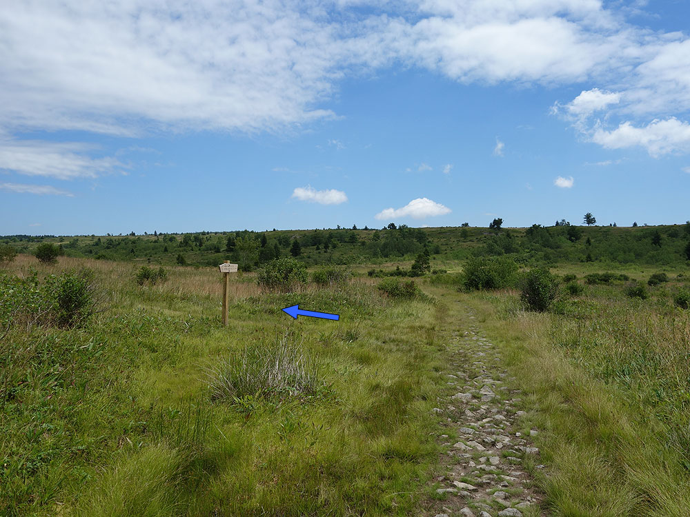
Mile 0.0 – From the parking area on FR75 pass the trailhead sign and start down the Bear Rocks Trail TR522. Note that none of the trails in the Dolly Sods area are blazed, however they are well marked with signage. The Bear Rocks Trail is washed out for the first 0.5 miles until it crosses a small stream. Pass over a ridge, and then descend another washed out section to the intersection of the Dobbin Grade Trail TR526 on the left.
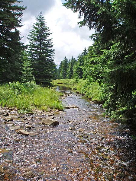
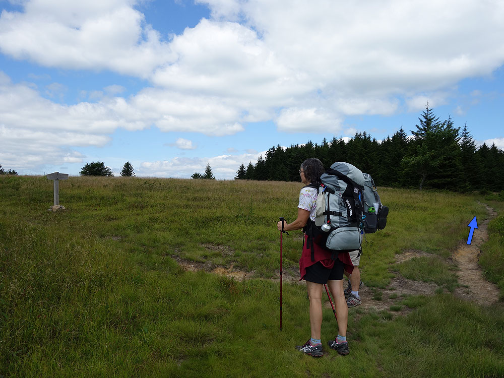
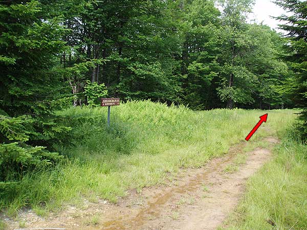
Mile 5.5 – Reach the intersection of the Dobbin Grade Trail TR526. Turn left downhill on the Dobbin Grade Trail TR526 as it descends the valley, then crosses the left fork of Red Creak in 1.0 miles. The trail will turn more to the right before arriving at the junction of the Beaver View Trail in 0.6 miles.
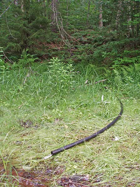
Mile 7.1 - Continue straight on the Dobbin Grade Trail passing a spring (hose attached) in 0.3 miles, then descend to the valley floor and pass through a boggy area before arriving at the intersection of the Upper Red Creek Trail TR509 0.6 miles from the spring.
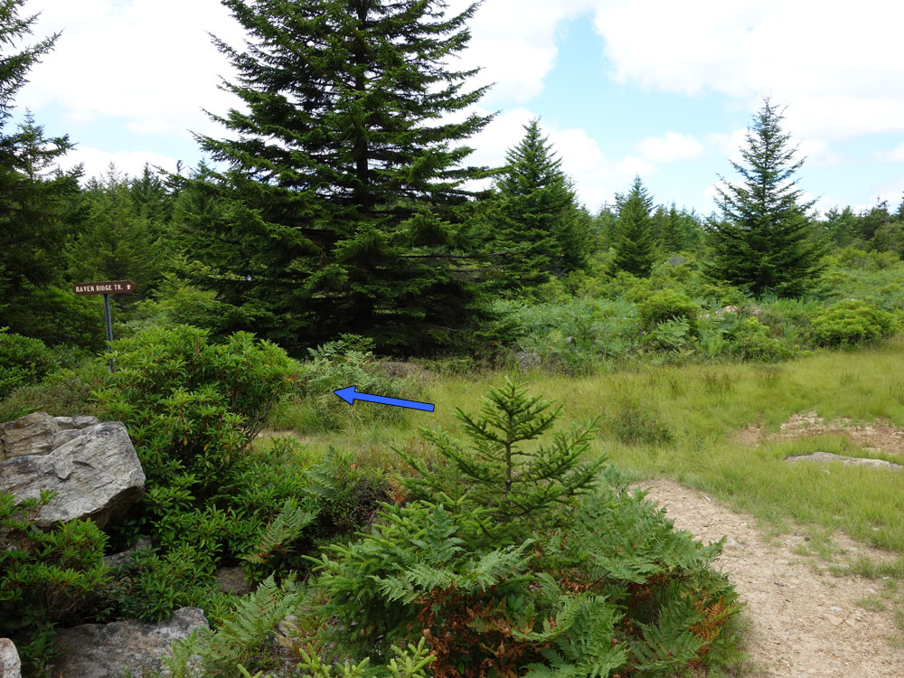
Mile 8.0 - Pass the tereminus of the Uper Red Creek Trail TR509, then in 0.1 miles arrive at the Raven Ridge Trail TR521.
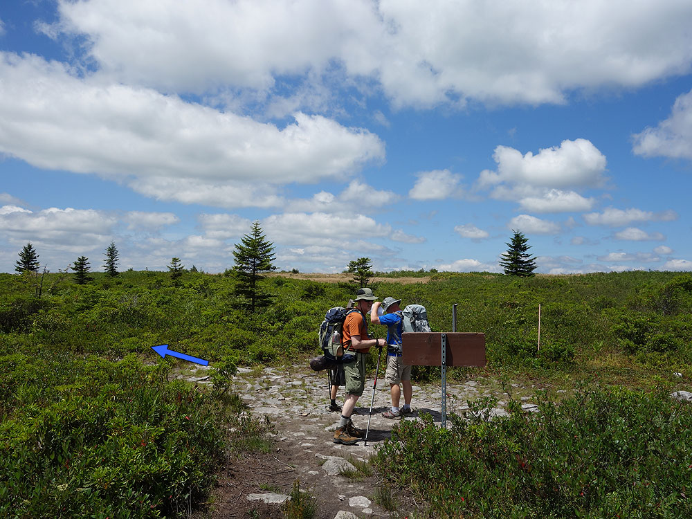
Mile 8.1 – Turn left uphill on the Raven Ridge Trail TR521. WARNING: People look at the map and notice that following the Dobbin Grade Trail back to the Bear Rocks Trail is a shorter route. Don’t do it! The Dobbin Grade Trail is a boggy mess anytime of the year, and offers little scenery. Taking the Raven Ridge Trail TR521 has much nicer views and is completely dry. So, after turning left uphill onto he Raven Ridge Trail TR521 pass through several nice meadows and wooded areas for 1.5 miles back to the intersection with the Bear Rocks Trail TR522 terminus you passed earlier in the hike.
Mile 9.6 – Turn right on the Bear Rocks Trail TR522 retracing your earlier steps through the meadows, crossing Red Creek, passing the Dobbin Grade Trail terminus, and climbing back to the parking area.
Mile 11.9 – Arrive back at the Bear Rocks Trailhead and parking area.
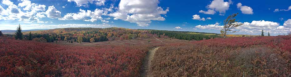
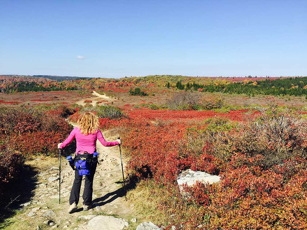
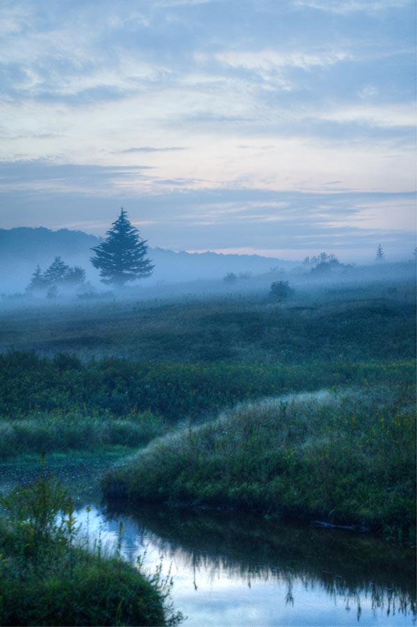
Mid October (photos courtesy Hans und Heidi)
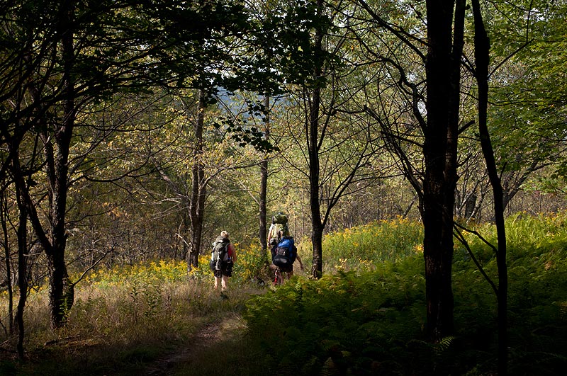
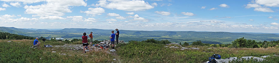
Early September (photos courtesy Jake M.)
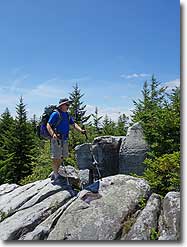
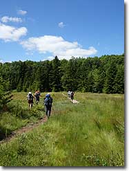
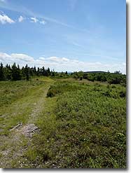
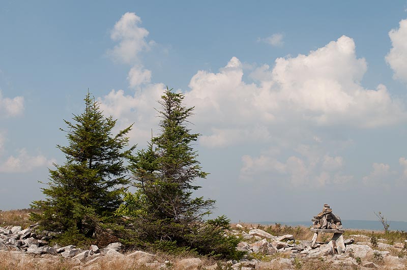
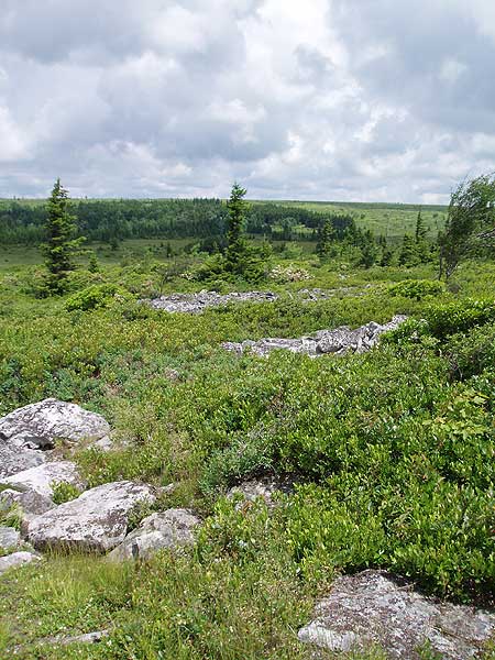
Early July
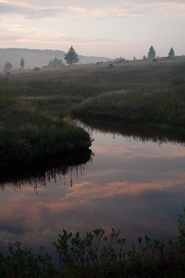
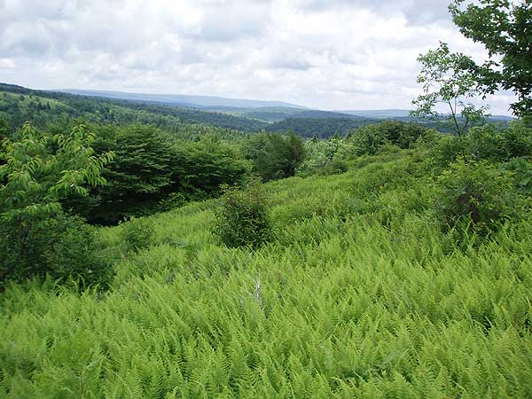
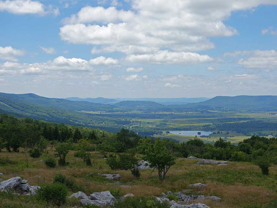
Canaan Valley
Dolly Sods North Hike Comments
Archived Comments
By:Emily
Rating:
Date of Hike: Saturday, August 3, 2019
I did this as a 2-night backpack starting on Friday evening. Friday was mostly a night hike, but we went back over that section in the daylight on Sunday so it was nice to experience the crazy starry sky and then get the views of the surrounding hills later. Good views, not too hard a hike, and though we didn't get any rain it was very muddy!
Be careful about water if you're camping on the West side of the loop. There isn't really anything between crossing Red Creek on Bear Rocks trail a mile or two in and the crossing on Dobbin Grade at about 6.5 miles.
The description strongly recommends against the Dobbin Grade trail East of Raven Ridge, but the Dobbin Grade is also pretty soggy between Beaver View and Raven Ridge. We lost the trail near a fairly large beaver pond where there were a lot of muddy maybe-this-is-a-trails going off in various directions (maybe it's the beavers' fault and they built the pond where the trail was trying to go!) We knew the direction we needed to go though and just trudged onward through the mud and met the trail again. Just be prepared for wet feet. My group had a mix of waterproof boots and trail runners and everyone got wet feet, so it's hard to say which was a better choice.
There's an unmarked trail right after the creek crossing near where Dobbin Grade meets Raven Ridge, heading straight up the hill to a nice little campsite in a stand of 4 or 5 trees on the ridge, which is where we camped the second night. It got cold up there, but it's a beautiful place to wake up.
By:Ben
Rating:
Date of Hike: Thursday, July 25, 2019
Dolly sods is beautiful and really unique, and this was my second hike in the area. This is a solid hike that was not so much physically demanding but somewhat difficult mentally because parts of the trail were extremely wet and muddy. All of us wore trail runners and Id recommend waterproof boots and sandals given the water depth. Took us about 5.5 hrs moving (7 hrs total with stops for lunch and by the creek). Overall great hike and would love to try it again in the fall.
By:Daniela
Rating:
Date of Hike: Friday, April 12, 2019
Let me start by thanking those that have maintained and worked hard to make these trails awesome, because they are. My low rating is more about personal preference than trail quality. I really enjoy wooded hikes with audible running water and fairly changing terrain, and this did not have it. Perhaps better map study would have told me that before I arrived. This trail leaves you exposed a lot and is super wet. I would not recommend coming out without waterproof shoes. Signage is great and it's very easy to navigate. I just personally won't be back because it's not my style of hiking. The drive up to the trailhead leads you through a heavily wooded area with lots of features, and the hike itself is fairly benign. I'm not sure that I would consider it a moderate level, as there are elevation changes, but they are not challenging.
By:C$ and DUH BUG bOyZ pt Duex
Rating:
Date of Hike: Saturday, December 8, 2018
Ol Sods vets here. We decided to pony up and explore the sods before the fire road gate closed. The trick is ensuring the snow has fallen to requisite depths and the mercury has fallen on the thermometer low enough to freeze the swamp that is the sods. Weather was looking low single digits and high in the low 20s with 5-6" of snow on the ground up top so we embarked. We parked at the Bear Rocks parking area and immediately the cold set in. Wind chill was around 0 and horror set in as I had forgotten my cold weather go to fleece and softshell jacket. Luckily I always pack more than is necessary and pulled out my back up thick base layer and hardshell. As my hands and feet froze we set off into the sods. As always the trail is rough and rocky. This time it also was severely muddy in places. It takes a long time for the sods to freeze. Despite maps and a GPS we got lost somewhere up by the Rocky Ridge Trail and began bushwacking back to the trail. This was going well until the GPS died due to poor battery selection on your's truly's end.
Luckily my partner (platonic) had a minuscule cell signal that allowed us to get our bearings and plow ahead so we did not have to backtrack. The delay severely cost us precious time and we upped our efforts to get to camp before nightfall. We had targeted a beautiful pine grove we had passed through on the way in. We made it in time and quickly set up camp so we could get our fire going before we froze. Temps dropped into the single digits as we battled the fire for a few hours before turning in. We woke up early and trekked out the final 1.5 miles to the car, praying to the Sods Gods that the engine would start.
Stray Observations-
1) Saw a handful (5-7) of people. Certainly more than we expected. Only one other crew was spending the night out.
2) The trails are ROUGH. Even with freezing weather and a soft layer of snow they are rocky, uneven and brutally muddy.
3) Bring a GPS if you do not know the area well. Very easy to take a wrong turn as everything begins to look like a trail in the snow.
4) As mentioned previously wear the sturdiest boots possible. Rocks are very tough.
By:C$ and the BUG BOYZ
Rating:
Date of Hike: Saturday, March 10, 2018
This was quite an experience. We had intended twice before this winter to head out to the Sods but had been foiled by warmer weather melting all the snow. This time we would not fail. The Dolly Sods had been hit by some intense weather for the past week, reports said 12+ inches of snow. It was time to soldier into the Sods. Fire road 75 was closed, but where at specifically we were not positive. The rangers thought the gate was roughly 4 miles from the top, so we decided to go for it. We got to the gate and embarked on the climb, about 1600 vertical feet over 3.3 miles to Bear Rocks. We were then in the DOLLY SODS. The temps immediately dropped as we climbed over the ridge line with the wind picking up severely. Stopping for a quick snack our hands went numb as we quickly turned to thicker gear. We then moved down the fire road to the trail head. We went down trail 522 and the going was a bit tough. The wind had played havoc with the snow, creating bare patches of rock in some places and 3'+ drifts in others. The trails are horrible from what we could tell, virtually stream beds and swamps (frozen now, thankfully). The snow cover was much welcomed to make the going easier on the trail (aside from the deep drifts...). We continued down 522 which was unpleasing rock and generic trees until we got about halfway. At this point we crossed a small creek in a fantastic pine grove and went up a large hill. From the top the views were incredible. The trail smoothed out and the valley opened up. It was one of the most beautiful places I had ever been, and it was awesome knowing there were no other people (dumb enough) to be out there with us.
The sky was crystal clear blue, the temps hovered in the mid 20's, a really beautiful day. We brutally slogged up a long hill climb in thigh deep drifts on uneven terrain and eventually got to the intersection of the 521 trail. The full hike here on HU details continuing on right, but we did not have time (or energy) before sunset to do the full hike since we had added 3.3 miles (uphill) at the beginning by parking at the closed fire road gate. We turned left on 521 and entered a majestic pine grove. This was shaping up to be a life altering trip. We continued through a small forest and into a wide open field expanse which culminated in trail 526. We took a left and marveled at the surrounding hills, views for miles. We then came across the first serious obstacle of the day (the 3' drift ridge climbs notwithstanding). There was red creek, 20 feet across and no feasible crossing in sight. We looked briefly around for a way to cross before accepting our fate. Boots and socks came off, and we plunged in barefoot, our howls of pain heard by no one. We quickly put our socks and boots back on before continuing up the hill. We were operating purely by GPS, and with the trail hiding under snow we ended up bushwacking a couple miles back to the fire road, a fact we were not aware of at the time. We believed we were on the trail until I plugged my GPS into my computer the next day and saw the path we had taken. We made our way back to Bear Rocks to find somewhere to hunker down for the night, about 12 miles total traveled on the day. As temperatures quickly dropped into the low single digits, we were sincerely thankful the wind was now nonexistent. We woke the next morning to a thick layer of frost and frigid temperatures. We packed up and made our way the final 3+ miles to our car, truly thankful for heat, cold pizza waiting for us and the luxury of sitting down.
Odds and Ends
1- I can't imagine these trails in warmer weather. The cold and snow were quite the obstacle, but these trails are rocky and rough. Without snow cover they would have been brutal. They are rocky and uneven, and at points are little more than an actual creek. We could also tell that virtually the entire area would be a massive swamp in unfrozen temps.
2- No live animal sighting, but we did see a beaver pond, dam and lodge off the fire road about 2 miles from Bear Rocks. We also saw countless tracks- deer, rabbit, bobcat, beaver.
3- The weather up here is extreme. It is far different than even the approach roads just a few miles away. The snow accumulation is significantly higher (there was no snow at all until we got close to the top of fire road 75) and the temperatures are far lower. The low we saw at night was about 5F, without windchill. Come prepared if you plan on going out here in the winter. This would have been a brutal hike without the proper footwear, we wore our La Sportiva Cube mountaineering boots we use for Mt. Rainier and other cascade peaks and expedition level knee length gaiters. Any less sturdy of a boot and I would have questioned our capability. Ability to transfer between hidden ankle breaking rocks and deep snow was critical. Snow shoes would have been worthless on this varied terrain. We were no strangers to cold weather camping and had been in the Sods in winter before (Red Creek area) so we were duly prepared for the bite of winters kiss.
4- It is absolutely incredible that this place exists just a few hours from Washington DC. Truly a geological and atmospheric gem. Despite the mud and swamp that I am sure this is in warmer weather, I may be tempted to venture out just to see the beauty of the Sods in a different light during the spring or fall.
5- I only give this 4 stars instead of 5 because the trails are rough. Just because the Dolly Sods had the cold and snow were seeking doesn't mean I can fully reward her for making us travel on stream beds.
By:Adventures in Roamance
Rating:
Date of Hike: Friday, November 10, 2017
This is the toughest backpacking trip I have taken to date. At night, the temperature reached just 5 degrees, well below freezing. Combined with the wind chill, this put the overall temperature in the bone-chilling negatives. Surviving a trip into the wild under such dire circumstances would not be for the faint of heart. It is worthwhile to note that my motivation for this hike came purely from the physical and mental challenge it presented. Gusto tends to fill my world when I'm faced with a particularly treacherous adventure. In this case, sleeping overnight in the extreme cold without freezing to death looked like a suitable endeavor worthy of quenching my thirst for the extreme. Needless to say, the Dolly Sods Wilderness is renowned for its beauty, but beauty is not the reason I went. It will, however, be my reason for going again in the spring.
Aside from the ferocious wind at the top, the hike itself was not terribly bad. Moving with heavy packs provided plenty of body heat, and the car did most of the climbing on the way up to the trailhead so the trek was more or less flat with only slight variations in incline. The picturesque green from the trees contrasted nicely with the deep blue of the sky. Views were, in a word, magnificent.
Warmth and safety were of utmost importance on this backpacking trip. I knew this going in. I had checked the weather prior to making the trip out here, and although the forecast called for below-freezing temperatures, it would be dry. The hand warmers, which I purchased on a whim, turned out to be lifesavers. For food, we had packed a variety of snacks and meals. Please click here for a full write-up of my hike: https://adventuresinroamance.com/surviving-a-freezing-overnight-hike-in-dolly-sods/
By:DollySodder
Rating:
Date of Hike: Saturday, October 14, 2017
Logistics
Made camp at the site by Cross Red Creek and day hiked the rest of the loop. For the amount of cars we saw parked on 75, it never felt too crowded. Kid and dog friendly. HOWEVER is not a hike for a dog smaller than 15 lbs/short legs in my opinion simply due to the amount of mud and boggy spots. WEAR WATERPROOF BOOTS AND BRING EXTRA SOCKS. Tall socks will prevent scrapes from the brush. Saw a few folks on the trail with sneakers, you WILL get your feet wet if you do this. Trekking poles help your balance when crossing water on rocks. Took us about 5 hours with many stops and lunch to do the 9 mile loop.
Scenery
This is a beautiful time of year to go. The scenery never disappoints regardless of time of year. The reds, golds and yellows across the scenery is absolutely amazing. The windswept boulders are amazing and there are tons of great spots for lunch.
By:Amanda D.
Rating:
Date of Hike: Saturday, October 7, 2017
Beautiful hike through a unique and alien landscape, but the lack of water was a problem for our group. We did this hike as an overnight backpack on Saturday 10/7 - Sunday 10/8, shortening the route by taking the picturesque Beaver View trail (523) back up to Raven Ridge (521). We camped on Saturday night near the intersection of Dobbin Grade (526) and Beaver View. There are a lot of campsites established along Dobbin Grade, though most were claimed by the time we arrived late in the day. Firewood was plentiful, and there were tall trees to hang bear bags.
Our hike was at the tail end of a very long dry spell for the area - 30 days without rain. Consequently, we encountered no boggy areas along Bear Rocks (522), Raven Ridge, or Rocky Ridge (524). The trail was a little wet and muddy at times along Dobbin Grade, but nothing that was not easily bypassed.
The only water sources we encountered during the entire hike were at the crossings of Red Creek (Mile 1.0) and the Left Fork of Red Creek (Mile 6.5). (We bypassed the spring at mile 7.1.) I was carrying 2.5 L of water with me, but due to the heat/sun, the strenuousness of carrying a heavy pack, the distance between water sources, and sharing with other group members, I wished I had carried an additional liter.
Feel free to email me if you would like further details!
By:Jake
Rating:
Date of Hike: Monday, September 4, 2017
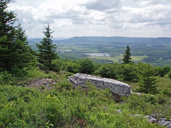
Backpacked this for my first visit, and I was absolutely amazed. I didn't have any problems with the mud because I wore waterproof boots (thanks to previous reviewers!). To hike along so are the northern flora was strange as a native to the region but also almost enchanting. I camped along the Canaan Valley overlook and enjoyed a spectacular sunset. The hike out was just as great. Will definitely be doing the longer version soon
By:Benjamin
Rating:
Date of Hike: Monday, August 28, 2017
Hiked the Dolly sods North Hike As an overnight with my 11 year old Son. We started late in the day and we made camp on the ravens ridge trail just before the rocky ridge trail tucked in the pine trees out of the wind. The trail to this point was very easy to follow. The rocky ridge trail had some very awesome views. There was a point where we got off the main trail but we were able to get back on track without to much trouble. The dobbins grade trail was a little mucky I only got my foot wet once. I took the advice though and Took the Ravens ridge trail back up to the bear rocks trail. We really loved this hikes. So many views all along the trail, the elevation changes were very easy this is West Virginia it gets much harder believe me. This has been one of my favorite hikes and I would highly recommend it.


.jpg)
.jpg)
.jpg)
.jpg)


