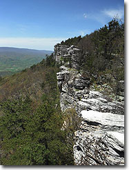
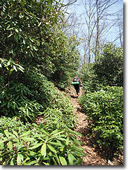
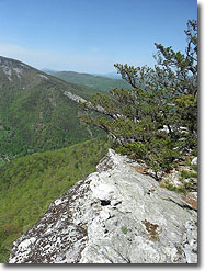
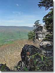
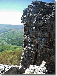
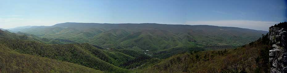
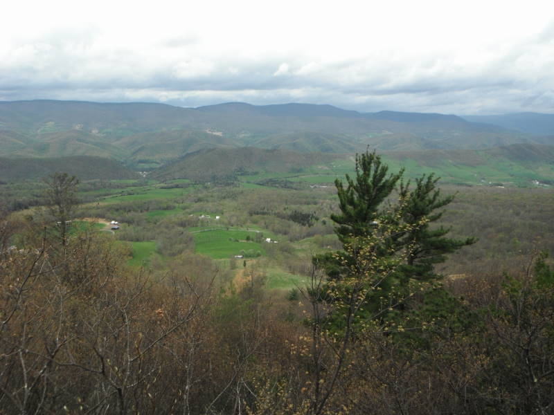
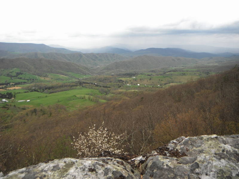
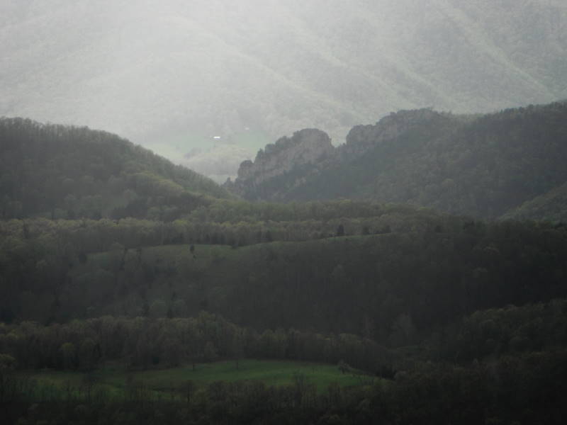
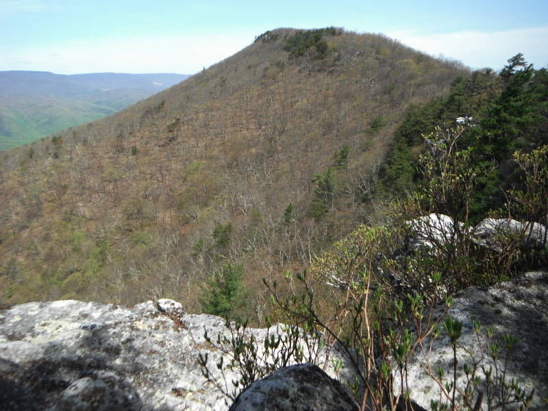
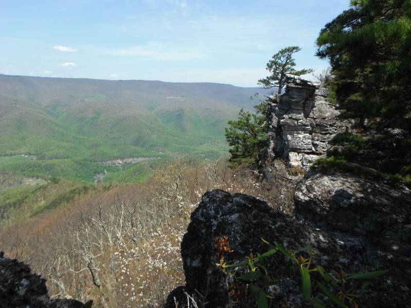
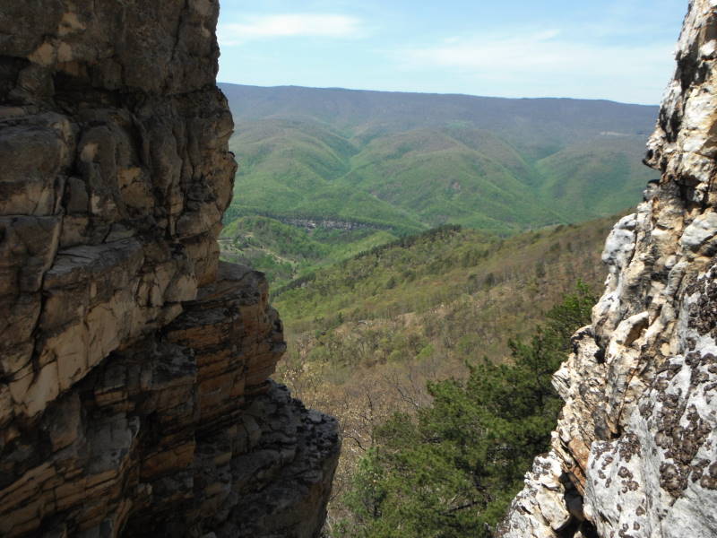
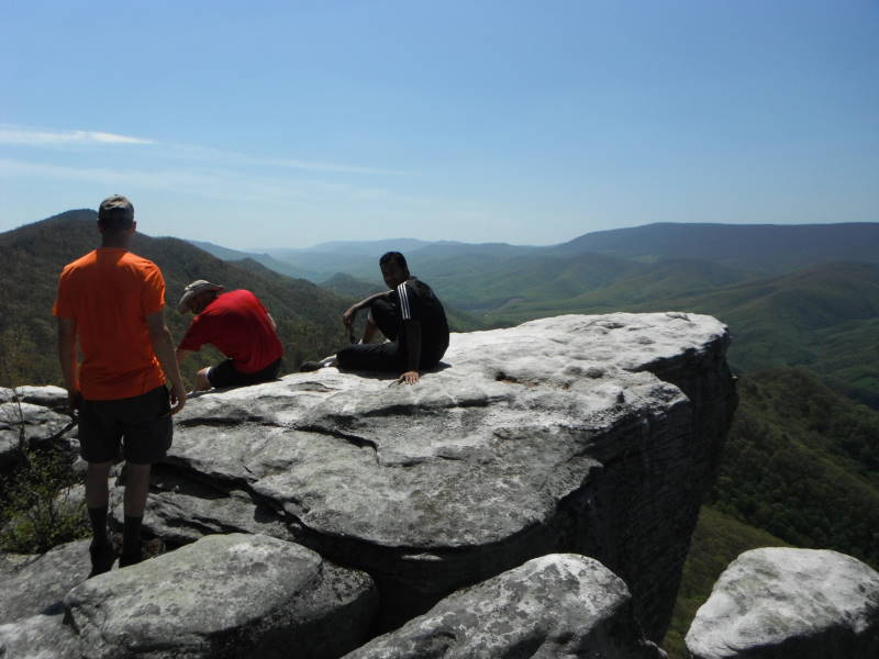
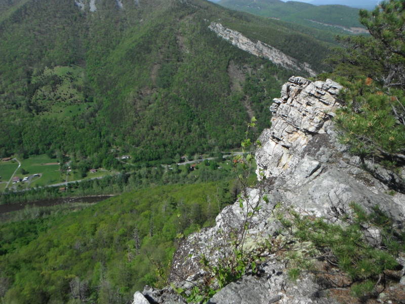
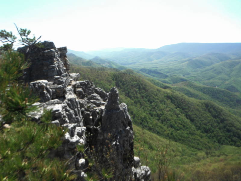
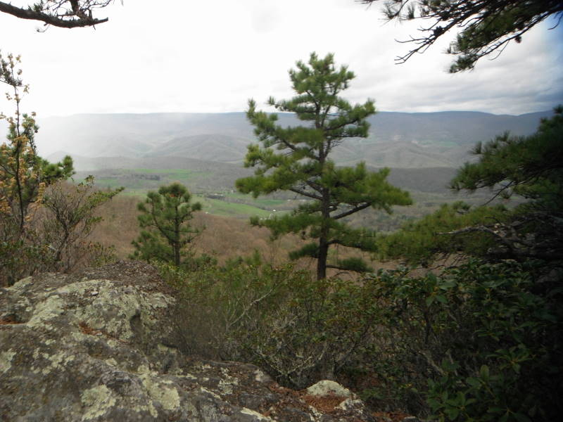
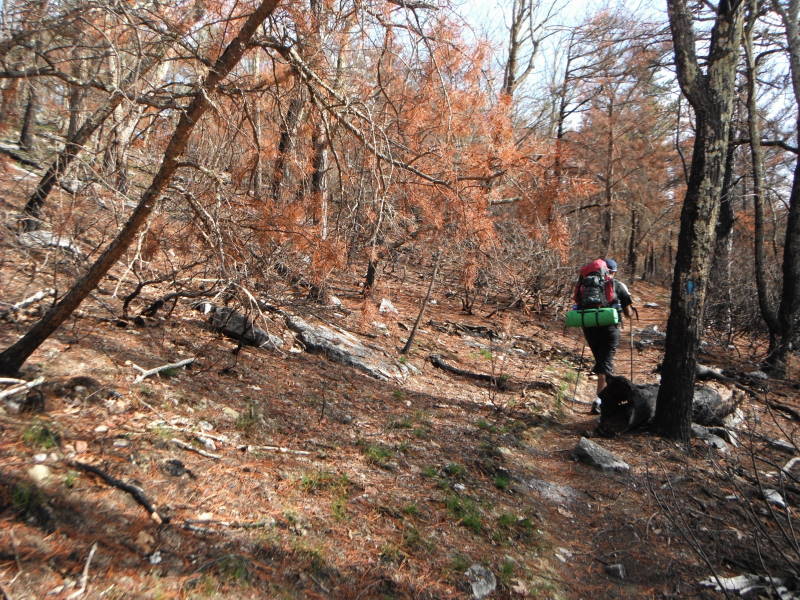
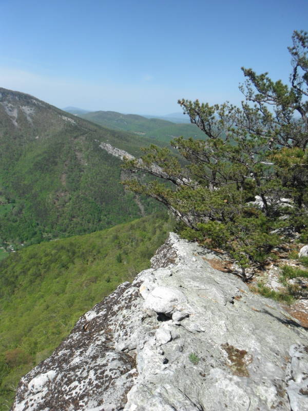
Hikers describe the North Fork Mountain Trail (NFMT) as having "relentless views". They are correct, there are so many overlooks we couldn't mark them all on our hike map. If you want a view, walk no more than 25 yards to the west off the trail and you will find one! We were amazed by this trail and the different types of woodlands, many of them needing fires in order to grow, see this link from The Nature Conservancy for more information.
The lack of water on this trail has always been a concern for hikers. However, a post by Zach F. on the WV Highlands Conservancy site proved very useful in finding a spring at the trail midpoint. If you hike this trail, please post a review with an update on how much water is in the spring. This will help fellow hikers track how reliable the spring is over time.
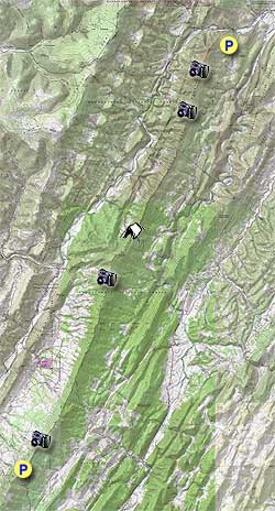
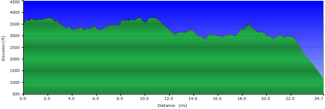
The NFMT at 24.7 miles long, is a point to point shuttle backpack best hiked South to North. At the bottom of this write up we also list several shorter alternatives if you don't have time to do the whole trail. Plan to allow about 35 minutes each way for the car shuttle.
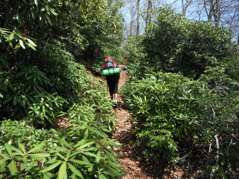
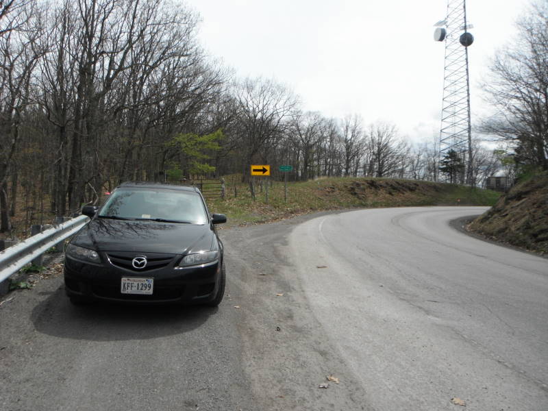
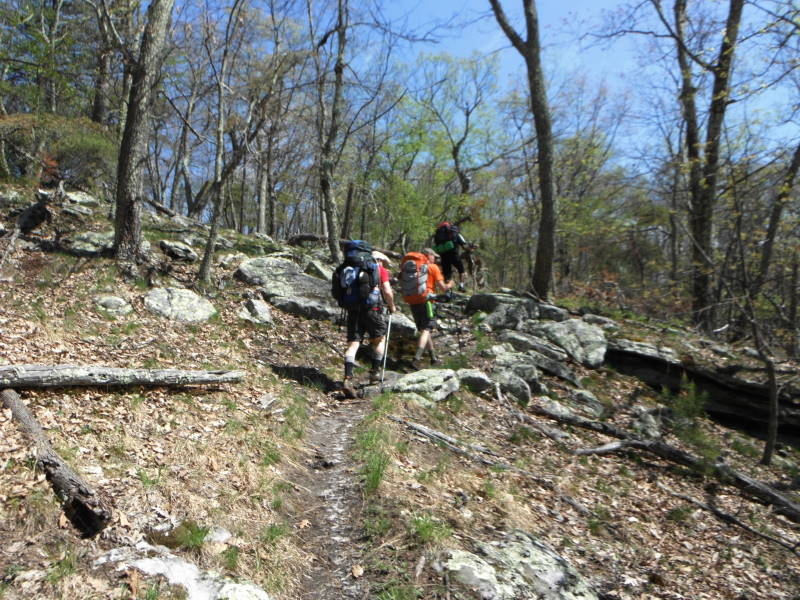
Mile 0.0 – At the South Trail Head, walk around the gate towards the back of the radio building and tower. To your left you will see a discernible trail, this is the North Fork Mountain (Trail 501) and you will very quickly see blue blazes. Eventually there will be blue diamond markers on the trees for the majority of the trail. There is a short climb to the top of the trail.
Mile 0.5 – Reach the first of many overlooks on your left and to the west. The majority of views on the hike will be to the west.
Mile 1.0 – Overlook, the next 2 miles are a gentle walk in the woods.
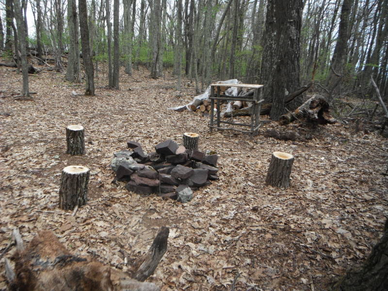
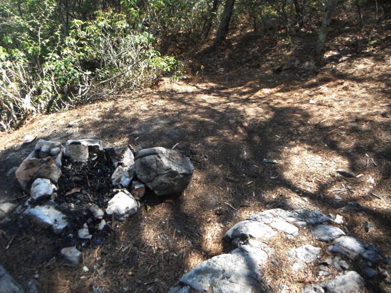
Mile 3.2 – Overlook, unique campsite just after this overlook and before the power lines.
Mile 3.4 – Power lines, views to the east and west.
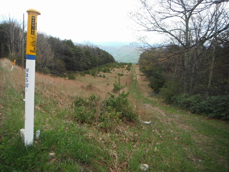
Mile 3.8 – Gate, go around and continue on fire road/trail
Mile 4.5 – Intersection with unnamed trail/fire road
Mile 8.4 – Spur Trail to see Seneca Rocks. Don't miss this, it's a great view of the backside of Seneca Rocks off in the distance.
Mile 8.7 – Overlook
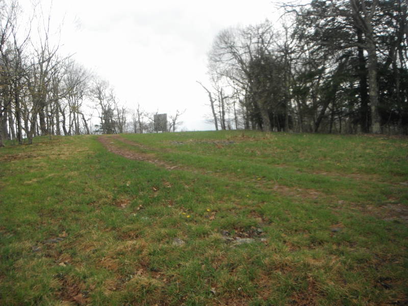
Mile 10.4 – Flat Tower on left and beginning of FR79, bear to right on fire road. From here to the first nights campsite at mile 12.4 was the least enjoyable part of the hike due to it being on a fire road.
Mile 10.8 – Radio Tower, road bears to the left behind tower. Reach first curve on FR79, but continue down road past pipeline crossing.
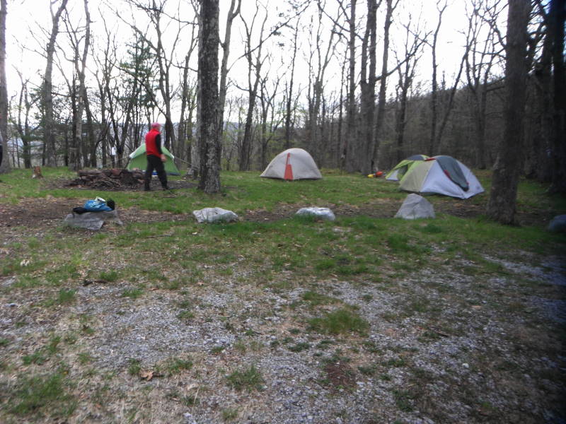
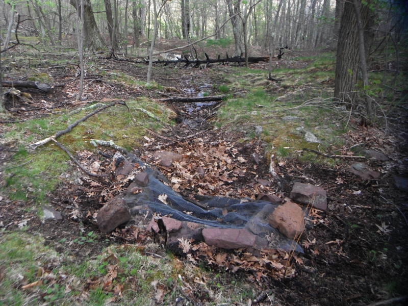
Mile 12.4 – Campsite for night one. To right of campsite is a grass fire road, go about 100 steps downhill, look for square stone, go left about 30 steps to spring. Spring water amount note: 1. May 10, 2014 – 12”, 2. Summer 2013 – flowing. Be prepared to carry enough water in the event the Spring is dry. You could also cache water near this intersection.
Day 2 - Hike begins at the brown "Trail 501" sign. There is evidence of fire from the campsite along the next 2 miles of the trail.
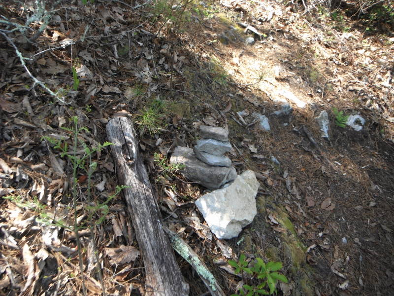
Mile 16.5 – Intersection of Redman Run Trail, just after the intersection is a campsite with an incredible view. As you climb you will soon walk through a Rhododendron thicket, look for cairns on the left for the overlook at mile 18.
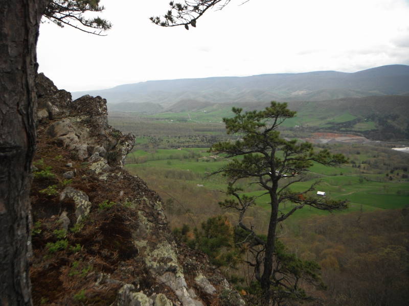
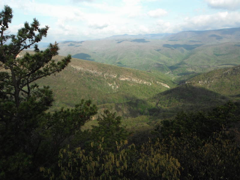
Mile 21.6 – Spur trail to Chimney Top, stay straight for this out and back. The NFMT turns sharply to the right but go straight on the unmarked spur trail, you can see Chimney Top from here.
Mile 21.8 – Chimney Top, great views. There is another way back to the NFMT, a very steep spur trail to the right of a fire ring. This is very steep, so use caution descending.
Mile 22.0 – Original Intersection, bear left back onto the NFMT
Mile 22.2 – Intersection of steep spur trail to Chimney Top on left.
Mile 24.7 – North Trail Head Parking, end of hike.
Shorter Alternative Hikes:
Redman Run Trail up to NFMT and over to North Trail Head parking, 9.6 miles, shuttle hike.
Landis Trail Head up to NFMT and over to North Trail Head parking, 5.4 miles, shuttle hike or you could do as an out and back to Chimney Top.
North Trail Head parking up to Chimney top and back, about 7 miles round trip.
Fire Road 79, drive car to campsite as mentioned at mile 12.4, sketchy road, good clearance needed on this road, camp the night and do the remaining 12 or so miles on Day 2, shuttle hike.
Mid May
North Fork Mountain
North Fork Mountain Hike Comments
Archived Comments
By:Jared H
Rating:
Date of Hike: Friday, November 1, 2019
Beautiful to hike in the late fall, views are unimpeded by leaves up top on the ridge, but still tons of color to be seen. Cliffs are incredible. Campsite at 16.5 was incredible, thanks for marking that out in your write-up.
About the SPRING -- talked to a local climber/backpacker who lives in Franklin WV. He said the spring had only ever been dry to his knowledge in 2007, when they had a 50-year drought. According to him, it is very reliable.
How to find the spring: It's very easy to find. The center section of the NFMT uses Public Road 79, a gravel road. If you're coming from the south, you walk from the radio tower up high on the ridge about a mile and half (mostly downhill) on PR79 . When you come to the point when 79 switches back hard down the east side of the ridge, the NFMT will continue straight along the ridge as a normal hiking trail again, which is clearly marked. It's at that point you'll be able to see a faint grassy road or path heading WEST downhill. Go about 100ft downhill, then look for a short path off to the left (marked by a cairn), which goes about 30ft to the spring.
If you're coming from the North side, just make note as soon as you hit the gravel road, then find the grass road on your right leading to the spring.
GPS coordinates of the spring: 38°51'33"N 79°18'50"W
Google map link: https://www.google.com/maps/place/38°51'33.0"N+79°18'50.0"W/@38.8591709,-79.3160829,17z
By:Jim Bob
Rating:
Date of Hike: Friday, September 27, 2019
Great hike. Amazing views. Practically a state wide drought and water was available at spring. If your looking for a shuttle ask around at some of the area businesses.
By:SR
Rating:
Date of Hike: Monday, September 2, 2019
Did this trail south to north over two nights on Labor Day Weekend. We tracked 8.4 miles the first day to camp, 11.7 miles the second day to the nice overlook camping at Redman Run junction, 9.7 miles the third day = closer to 30 miles. So beware that you may also track more miles than promised!
Lots of variation, both of flora and elevation, more than you may expect from a "ridge" hike. This trail has a bit of everything, and some of the most exceptional views in the east! The only thing missing is water. We carried 5-6 litres a person and the spring at the end of the road section was easy to find and deep enough to filter easily.
By:Michael Broyer
Rating:
Date of Hike: Thursday, June 27, 2019
Hiked south to north from 6/27-29. I previously hiked this trail 3/2017. The spring was working fine at the midway point. Late afternoon heat can be tough. I used AllTrails app to track progress and the mileage did not match with this page. Alltrails said the entire hike was 26.7 miles. Anyway this is a fantastic area. The last 3 miles are jaw dropping! Next time i will go in cooler weather.
By:Shannon
Rating:
Date of Hike: Saturday, June 15, 2019
Gorgeous hike! The spring had plenty of water and was pretty easy to find (its about 15 feet to the left of the fire road and counted 100 steps from the main road to the point you turn off and there was a small cairn). It was a bit overgrown so recommend pants, particularly on the second day. Pretty much had the trail to ourselves the whole time and loved the views!
By:Allen Marlow
Rating:
Date of Hike: Thursday, October 19, 2017
Great overnight to the 12,4 mile campsite from the south end where the remainder of the trail was closed due to fire. Even after one of the driest of summers and falls, the spring still contains ample water. We gathered it and filtered for particulates and drank through a filter and it was a lifesaver.
By:Dave
Rating:
Date of Hike: Tuesday, July 4, 2017
Does anyone have the gps coordinates and/or detailed directions to the spring discussed. I've never through hiked North Fork, but have done several day hikes around Table and Chimney Rocks. I like the idea of a spring mid way on the complete hike, but have not been able to find Zach F.'s post.
By:Kenneth Clapp
Rating:
Date of Hike: Friday, June 9, 2017
Fabulous hike, my second, my hiking partners first. Great weather and views. Shuttled in water to flat tower, used the jugs to refill at the spring, half a gallon for the 3rd day. Just a warning...saw a 4 and half foot rattlesnake at flat tower and it crawled back under the rock imbetween the two front tower platforms....I'm assuming it has a den there...lol...he gave us plenty of warning. Definitely will be a regular hike for me!
By:V
Rating:
Date of Hike: Thursday, June 1, 2017
Great hike with lots of great views. I saw 4 large rattlesnakes on the trail. Also found numerous ticks on me. The well had plenty of water. I purified 10 liters of water for my party. However, the spring wasn't flowing. Someone stole an external light bar from the truck in the north parking lot. That's a big turnoff for this hike. I don't know if I can trust that someone won't cause hundreds of dollars in damage. The intersection of Landis and north fork is poorly labeled. They both have blue markers and the trail signs are a bit twisted.
By:Andrew
Rating:
Date of Hike: Saturday, May 20, 2017
A friend and I day hiked the entire trail. It was a great hike! Tons of views. Took us 8 hrs of walking time and 1.5 hrs for lunch and stops. Checked the spring at the half way point and water was flowing pretty well. Definitely could have filtered some if we needed water. The above instructions were spot on and made it impossible to get lost.


