|
| Length |
Difficulty |
Streams |
Views |
Solitude |
Camping |
| 1.7 mls |
 |
 |
 |
|
N/A |
Hiking
Time:
Elev. Gain:
Links:
Resources: |
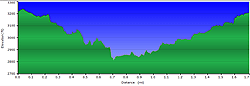
1.5 hrs with 1.0 hrs for breaks
415 ft
 Pisgah National Forest Pisgah National Forest
Topo Hike Trails Map (PDF)
Jonas Ridge, NC Weather Forecast
Current Weather Radar
Garmin (GDB), Gaia/Trails App (GPX) (What's
this?) |
 By Trail Contributor: Zach Robbins (Contact Zach) By Trail Contributor: Zach Robbins (Contact Zach)
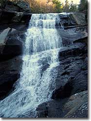
Inconspicuously located beside NC-181 on its way to the popular Linville Falls and Linville Gorge, Upper Creek Falls may well be one of the prettiest waterfalls in North Carolina. Upper Creek roughly forms the western boundary of the Harper Creek and Wilson Creek region of Pisgah National Forest.
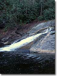
Almost all of the creeks in this area fall steeply from the Blue Ridge escarpment through narrow gorges with tall waterfalls. Upper Creek is no exception, and the waterfall is the crown jewel along this scenic stretch of the gorge that has 2 smaller waterfalls and numerous swimming holes. Even though the loop trail is short, expect the climb out the gorge to be steep and tiring. The trail head is located on NC-181 near the national forest boundary before the housing developments of Gingercake and Upper Creek Acres.
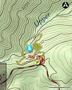
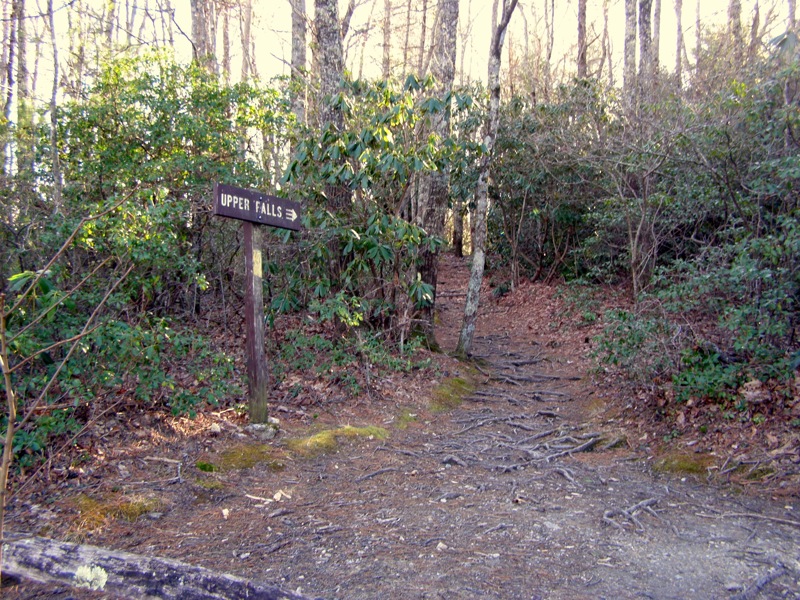
- Mile 0.0 – Hike begins at the gravel parking area for Upper Creek Falls, located in Pisgah National Forest. This hike is a 1.6 mile loop, and most people head left towards the top of the waterfall. A sign labeled “Upper Falls” marks the trail head behind the information board. The Upper Creek Falls Trail (no blaze) is not officially blazed but you will see yellow blazes and flagging tape throughout the hike. The trail parallels NC-181 before dropping into the gorge on multiple switchbacks.
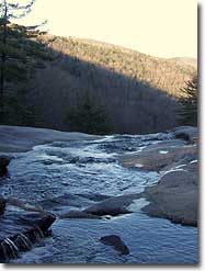
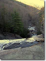
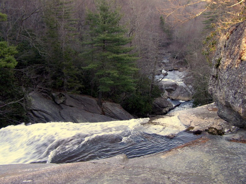
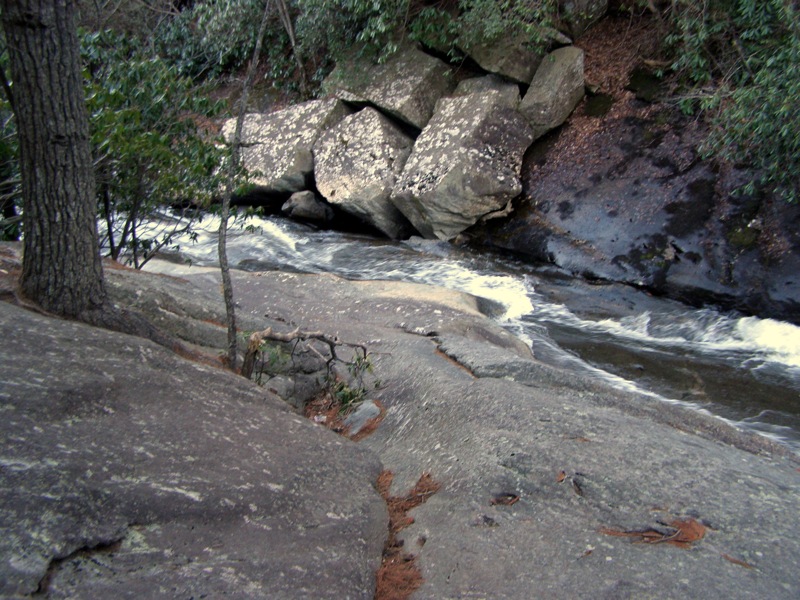
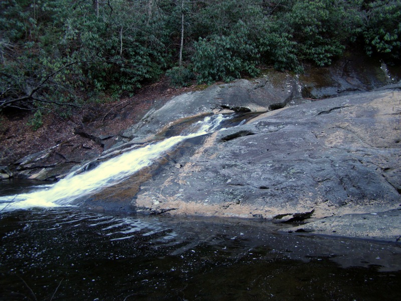
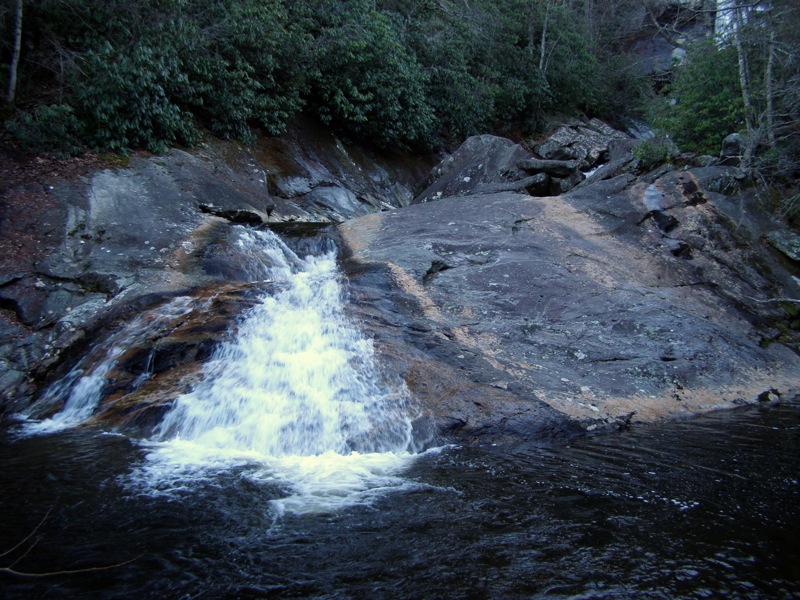
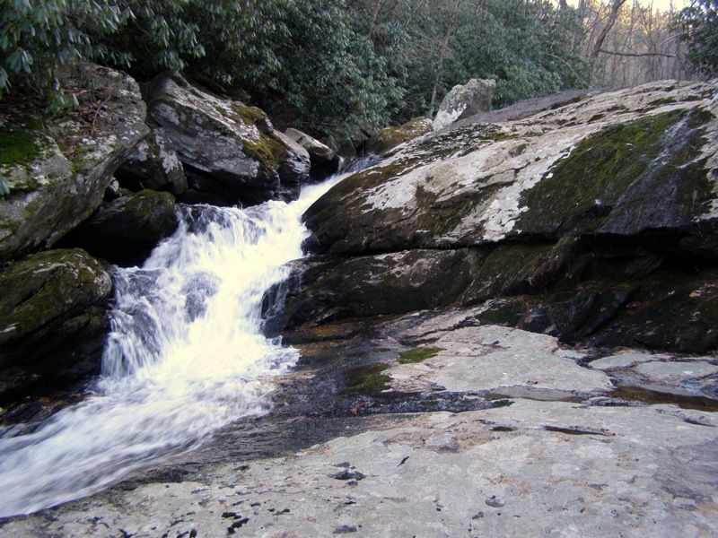
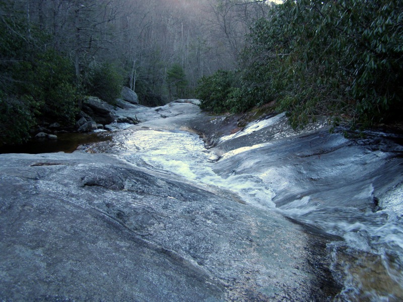
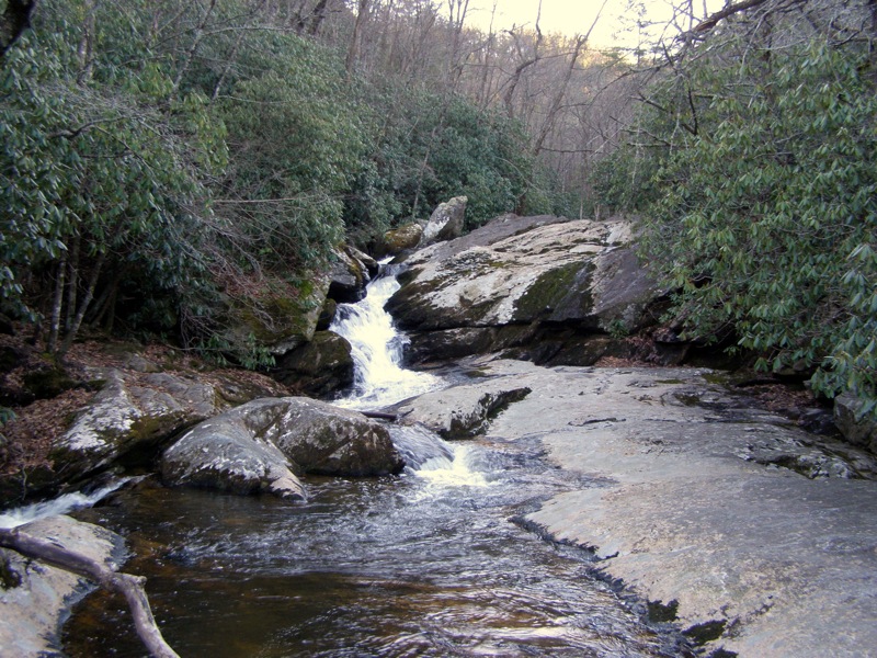
- Mile 0.4 – The trail crosses Upper Creek above the main waterfall. Upstream is a small waterfall with a nice swimming hole below. This rock hop crossing is likely a wade in above average water flow and could be very dangerous if the water is high due to the close proximity of the waterfall. Only explore this area if the rocks are dry, this is a tall waterfall and a slip will probably be fatal. The boulder-strewn Upper Creek Gorge is over 100 feet below. Cross the creek and head down towards the base of the waterfall.
- Mile 0.45 – The trail splits. The older trail goes right steeply towards the base while the newer trail gently switchbacks to the left. Take the left fork to avoid contributing to the erosion problem (this GPS track goes right).
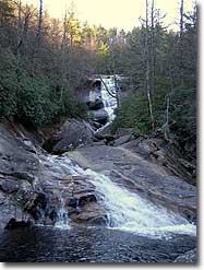
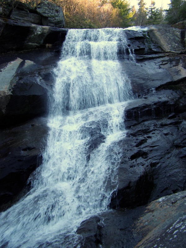
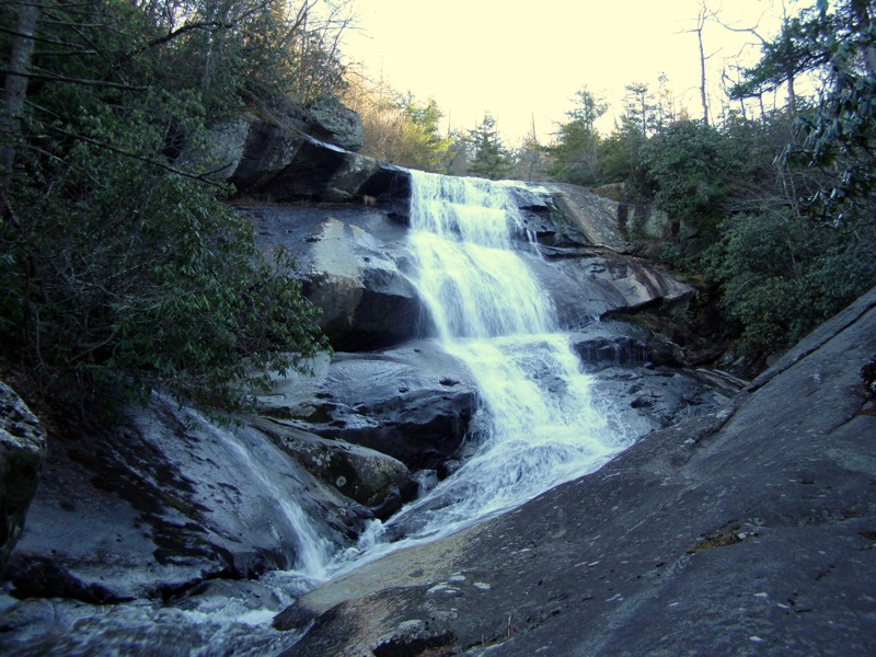
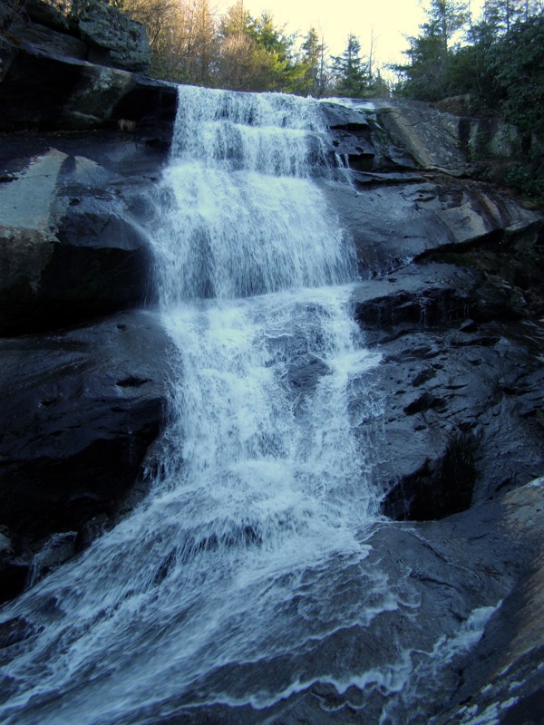
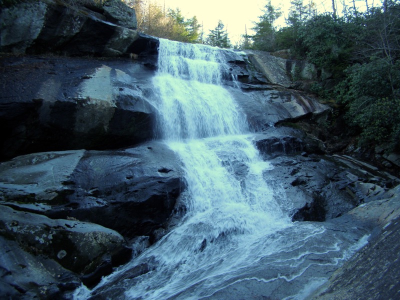
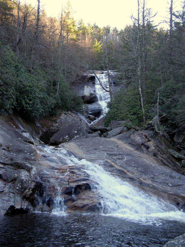
- Mile 0.5 – Reach the base of the main drop of Upper Creek Falls. From an enormous sloped rock you get an incredible view of the ~60-foot drop. Upper Creek plunges over a massive rock face then flows through a narrow chute before spilling out into a pool. The rock is steeper than it appears and there is nothing to stop you from sliding, so be very careful in this area. Adventurous swimmers have been know to slide down the chute to the pool in the summer.
- Mile 0.7 – A side trail on the right leads to a pool at the base of Upper Creek Falls. You can walk out to a small island in the middle of the creek to get a full view of Upper Creek Falls.
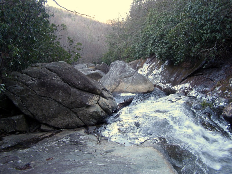
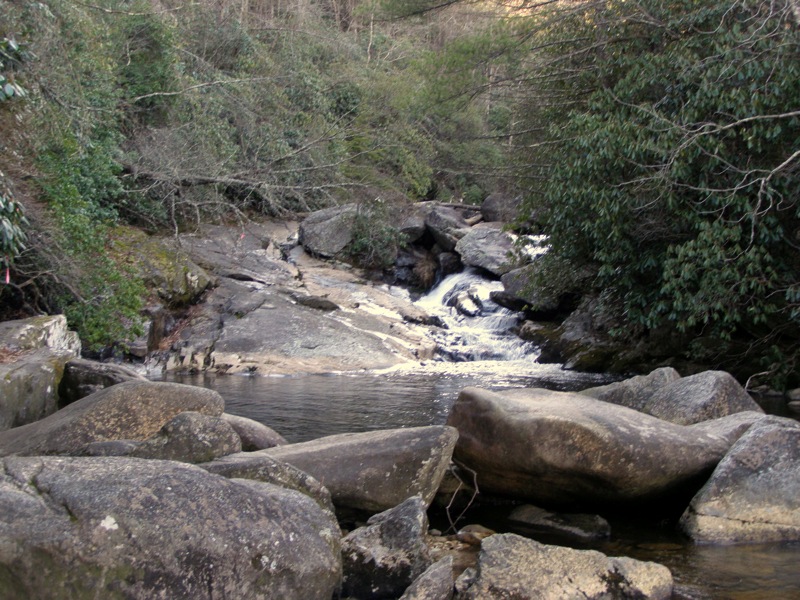
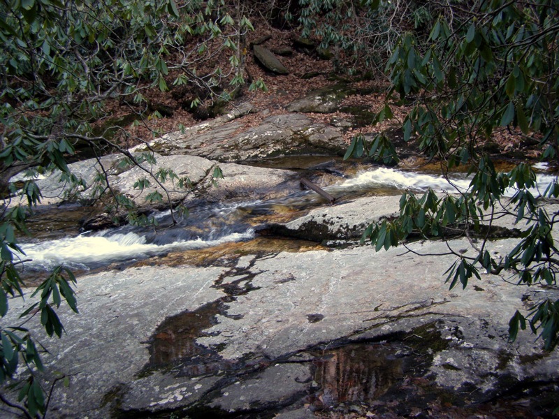
- Mile 0.9 – The trail crosses Upper Creek below a small waterfall. Unless the water flow is below average it is probably safer to wade the creek here because the rocks are quite slippery. Below the crossing the creek splits amongst the elongated, sloped rocks. It is a nice spot to wander downstream and explore these smooth rock formations.
- Mile 1.0 – Pass beneath a gigantic rock. From here the trail arduously climbs up 10 switchbacks towards the parking lot. You will see signs of the old trail that travels straight uphill cutting through the switchbacks. Please avoid using this trail to prevent erosion.
- Mile 1.7 – Hike ends at the parking lot.
|


