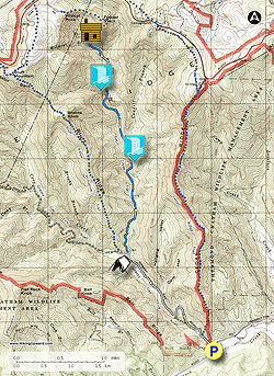
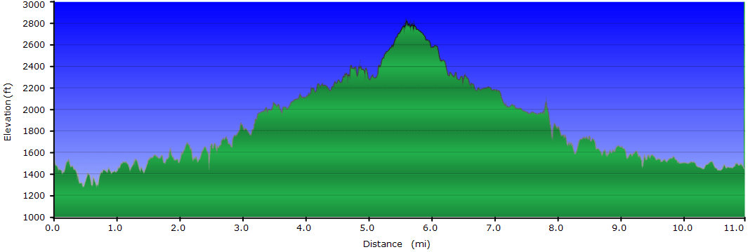
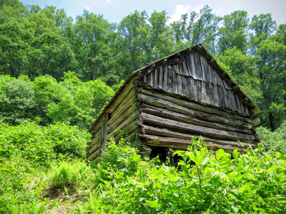
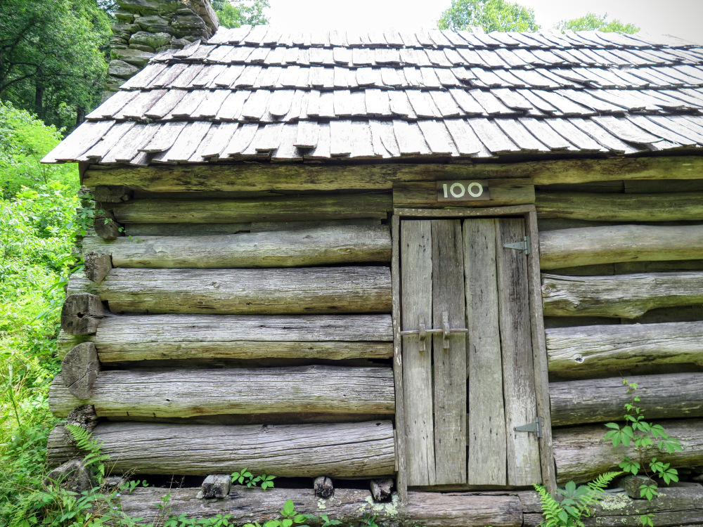
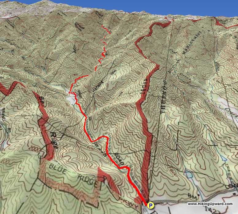
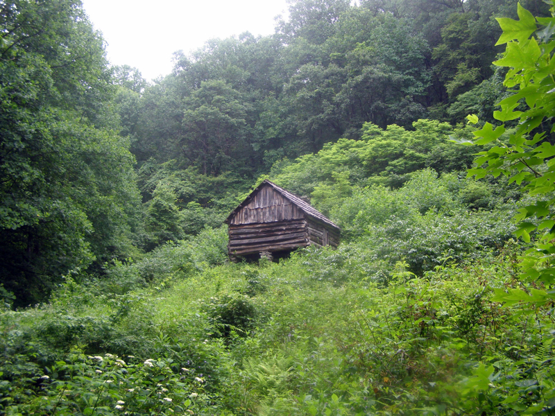
If you're looking for a hike with few people, historical artifacts, water, and more water, then try the Basin Creek Trail in Doughton Park. Doughton Park is a treasure trove of barely used trails in the northwest corner of North Carolina. This is the largest park operated by the Blue Ridge Parkway, and has over 30 miles of trails along creeks and open ridges. Starting at the base of the park on Longbottom Road, there are 5 hiking trails to choose from. Four of these involve steep climbs to the open fields and peaks on the western border of Doughton Park along the Blue Ridge Parkway. The 5th trail, Basin Creek, takes you deep into a secluded gorge. The Basin Creek Trail follows the path many people took 150 years ago to the Basin Cove community. In 1916 a flood roared through the valley wiping out the community except for Caudill Cabin, which stands at the end of the trail. Along the way you'll pass by 2 waterfalls, see historical remnants of the Basin Cove community, and cross many streams 16 times. Usually the highlight of a hike is a waterfall or summit viewpoint, but the end of this trail at the intact and restored Caudill Cabin in a clearing in the middle of nowhere feels remarkable.
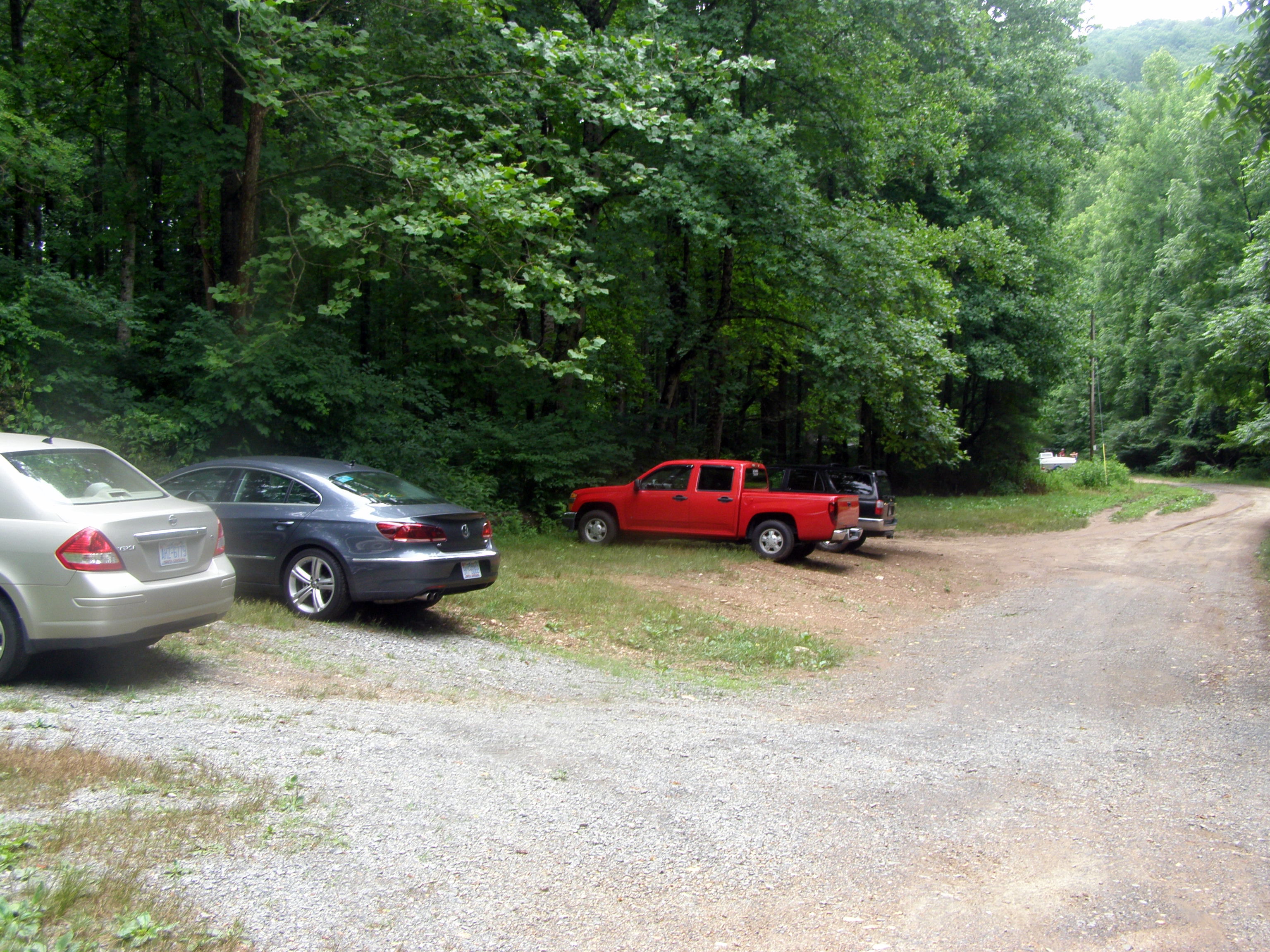
The park is accessed by taking Traphill Road off of U.S. 21 near Roaring Gap. Once you pass the main entrance to Stone Mountain State Park, continue a mile beyond and take a right on Longbottom Road. After 8 winding miles, the road rounds a bend and crosses Basin Creek. Directly before the bridge there is a large gravel parking area on the left. The park boundary and trails are immediately across the street.
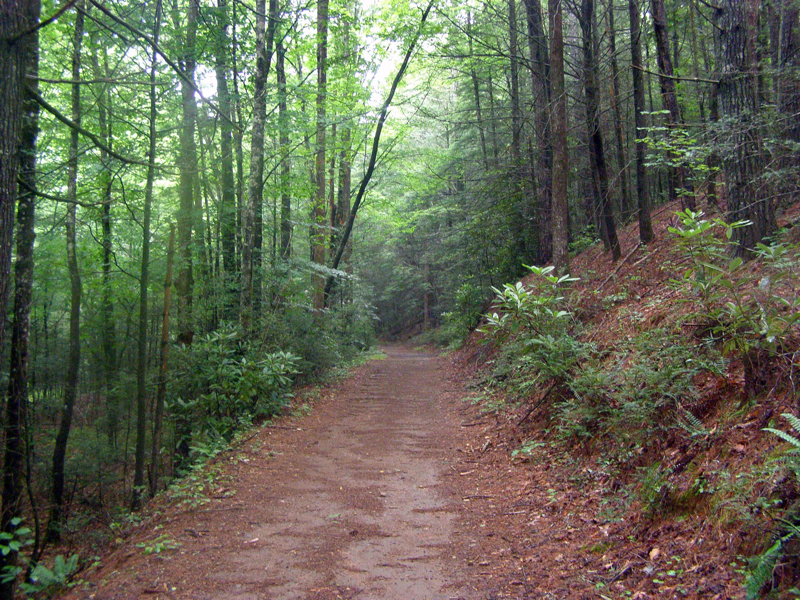
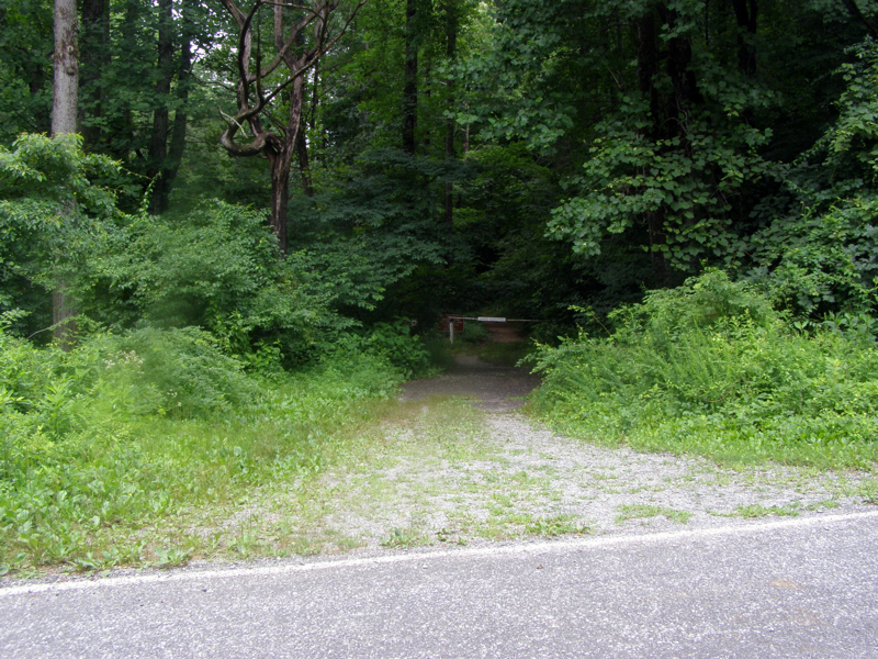
Mile 0.0 – From the parking area cross Longbottom Road and the Grassy Gap Fire Road (no blaze) continues on the other side. A sign for Doughton Park beside a gate is visible.
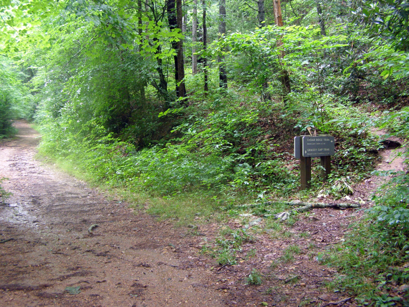
Mile 0.1 – Junction with the Cedar Ridge Trail, stay straight on fire road which gently follows Basin Creek for 1.5 miles.
Mile 1.1 – Step over a tributary stream that flows from a hanging valley.
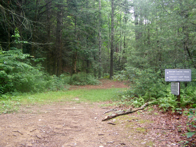
Mile 1.8 – At a T-junction the Grassy Gap Trail turns left, stay straight on the Basin Creek Trail (orange and blue blazes). Immediately climb above Basin Creek on a steep slope through a large swath of rosebay rhododendron.
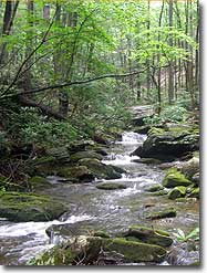
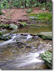
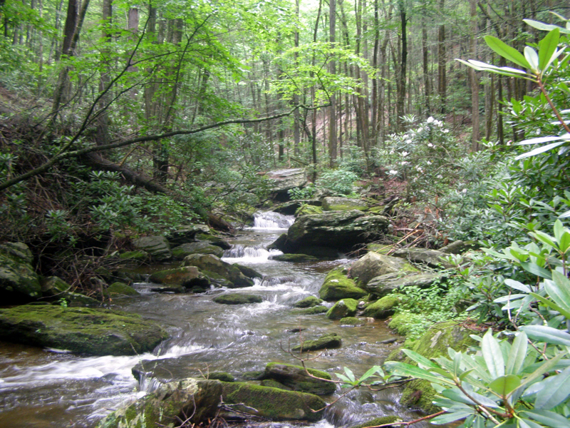
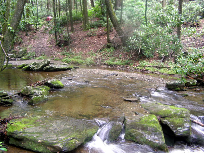
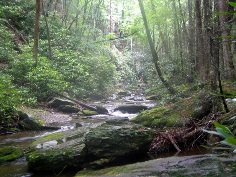
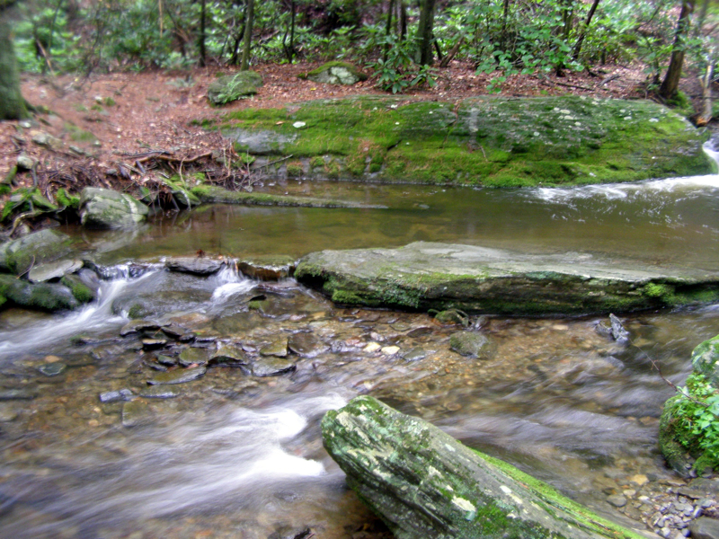
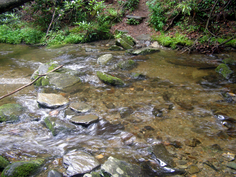
Mile 2.6 –2nd crossing, first rock hop over Basin Creek. There are 15 rock hop crossings over Basin Creek and side streams along the Basin Creek Trail. The orange blazes are few and far between but are prominent near all creek crossings. Note: All of the crossings are rock hops on sometimes slick rocks. If the water is high you will get wet. There are still possibilities of getting wet during normal levels but it is manageable. Trekking poles or water shoes are highly recommended.
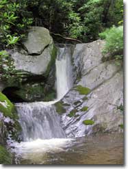
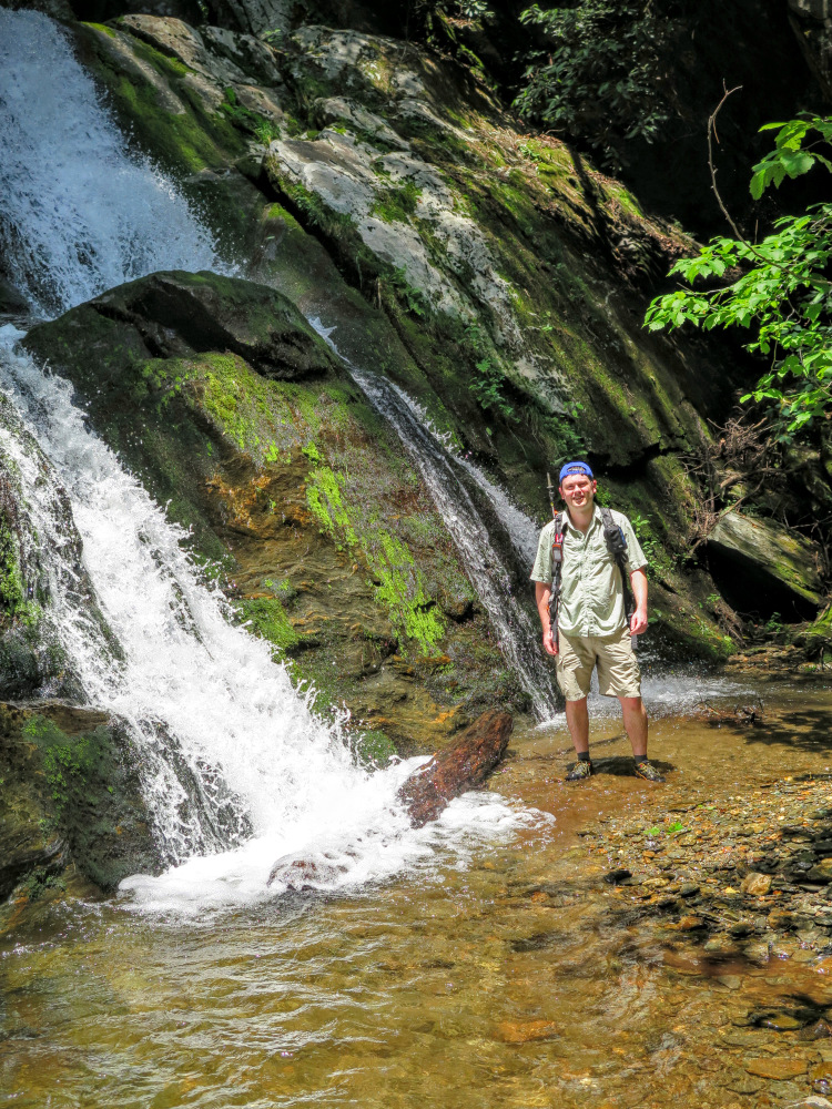
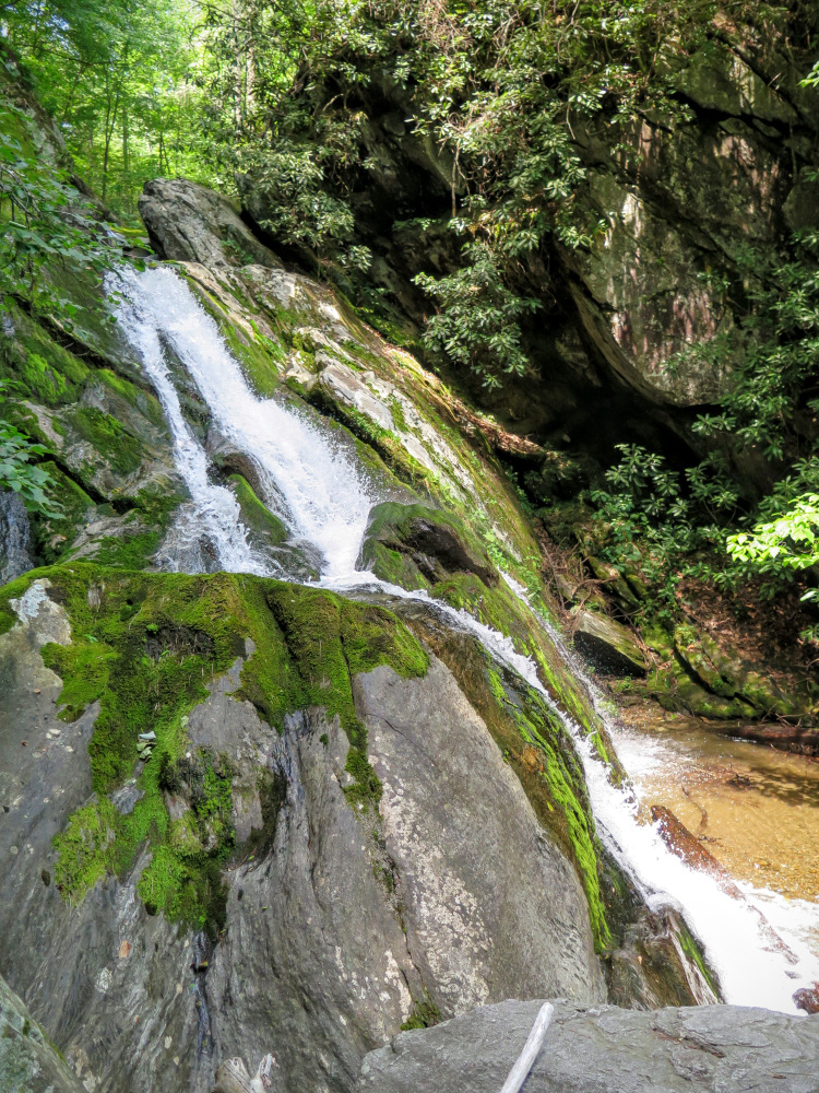
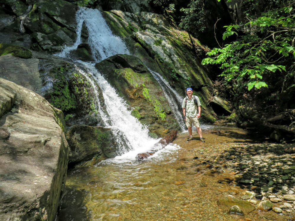
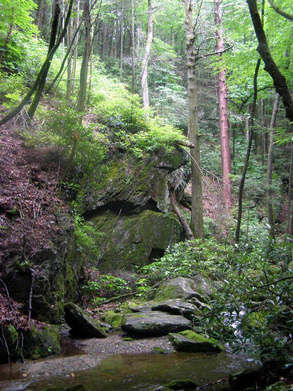
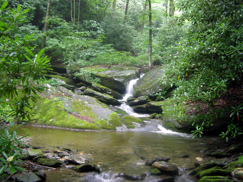
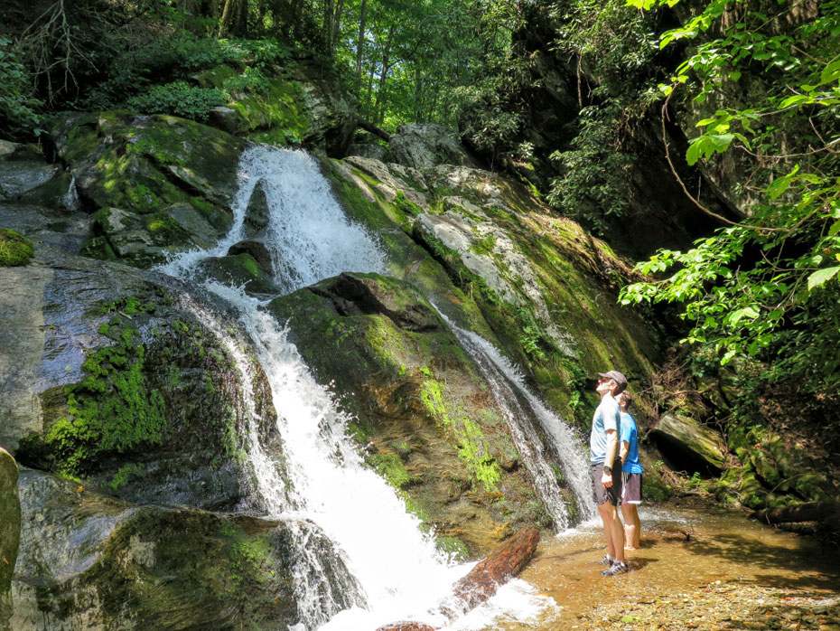
Mile 3.3 – At the 3rd creek crossing the trail climbs high above Basin Creek, which drops into a narrow gorge. While you climb above the creek a waterfall is clearly visible below at the head of the gorge. There is no trail to the base of this waterfall, but access is fairly easy if you leave the trail at the creek crossing and stay in the creek and in the woods on river left. You will reach the base of the waterfall in approximately 500 feet. (The mileage for this hike does not incorporate the side trip to this waterfall.) At the moment there is no official name for this waterfall, so you may see it called Lower Falls on Basin Creek or Waterfall #1 on Basin Creek. Despite lacking a name this ~25-foot waterfall is beautiful. At the top of the falls the creek runs through a narrow chute then fans out over two drops. If you decided to visit the waterfall, retrace your steps down the creek to the trail crossing. It is steep and overgrown around the waterfall so scrambling out is not recommended.
Mile 3.4 – 6th crossing over Basin Creek.
Mile 3.5 – 7th crossing over Caudill Branch.
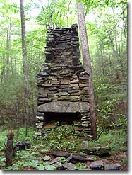
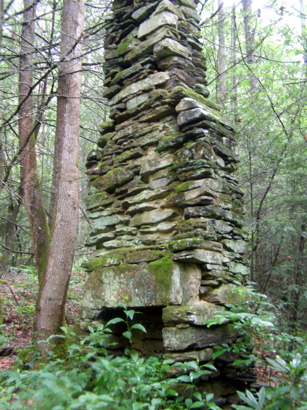
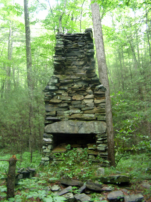
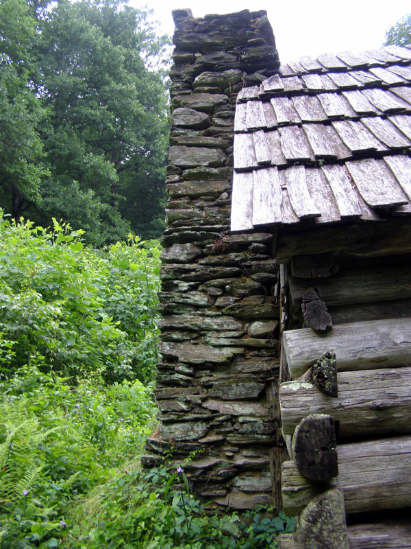
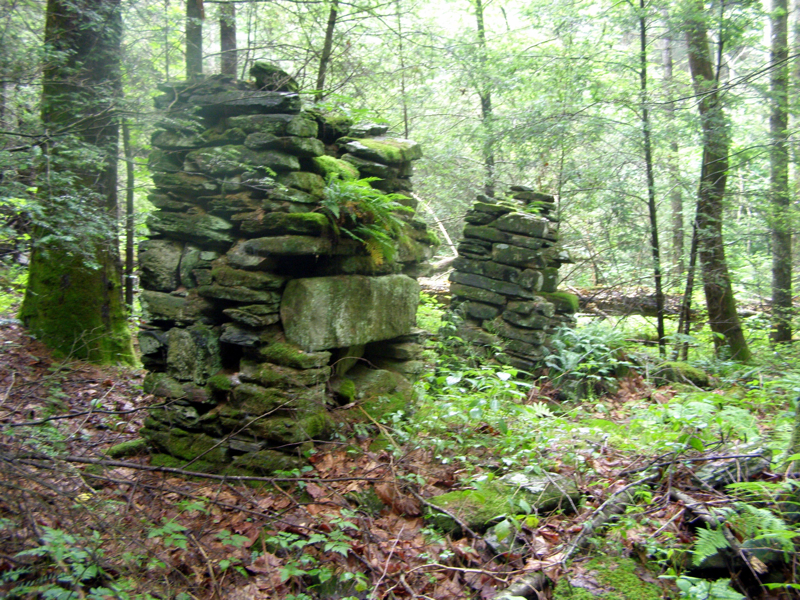
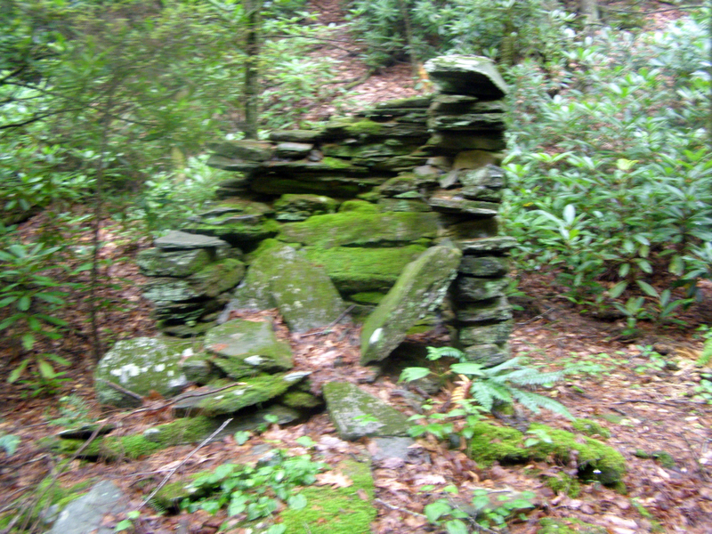
Mile 3.6 – After crossing Caudill Branch, the second site of chimney remnants is on a short side trail on the right. There are two small chimneys here.
Mile 3.9 – 8th crossing over Basin Creek.
Mile 4.0 – Third chimney remnant found on left side of trail. Shortly after is the 9th crossing over Basin Creek.
Mile 4.1 – 10th crossing over Basin Creek. For the next 0.3-mi the trail rises above the creek again and passes through a section of stinging nettles. The creek drops into a small gorge that isn't visible from the trail.
Mile 4.4 – 11th crossing over tributary to Basin Creek. On the other side of the crossing is the fourth chimney remnant beside the trail.
Mile 4.5 – 12th crossing over Basin Creek.
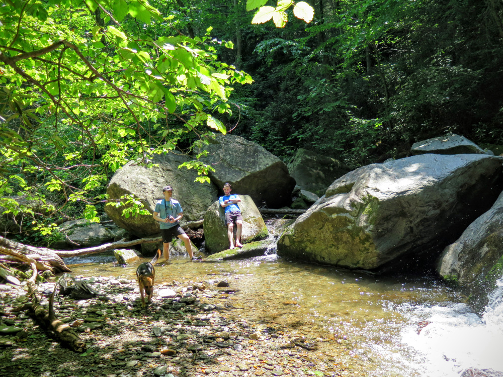
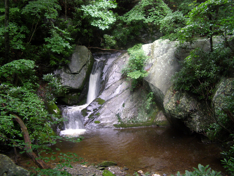
Mile 4.6 –The trail crosses a rock ledge overlooking Middle Falls on Basin Creek (also known as Waterfall #2 on Basin Creek). This is a beautiful 2-tiered drop ~20 feet on the left side of the trail. The rock outcrop on the trail provides the best open view of the waterfall. You can scramble down the bank to the base of the waterfall for different angles and to relax, but the bank is steep and muddy. Beyond the waterfall the trail is much less-trafficked and overgrown with weeds and stinging nettles.
Mile 4.8 – 13th crossing over Basin Creek.
Mile 5.1 – 14th crossing over Basin Creek.
Mile 5.15 – 15th crossing over Wildcat Branch. The trail leaves Basin Creek and follows Wildcat Branch the rest of the way to the cabin.
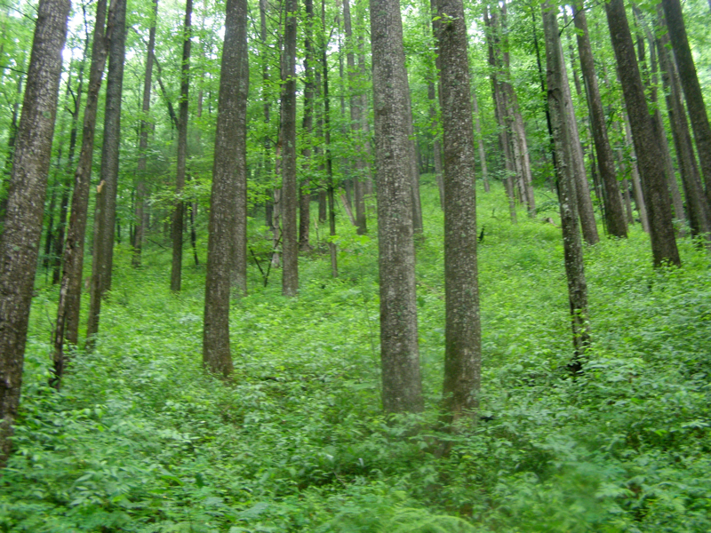
Mile 5.2 – 16th crossing over Wildcat Branch. The trail passes through an older forest.
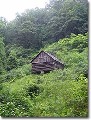
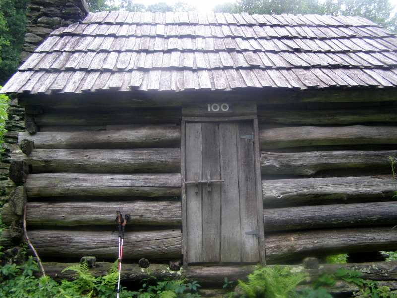
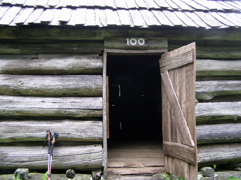
Mile 5.5 – Reach the end of the trail at Caudill Cabin. The cabin sits in a clearing on a hill above Wildcat Branch almost 1000 feet below the Wildcat Rocks Overlook off the Blue Ridge Parkway. From here it is difficult to see Wildcat Rocks. This cabin is the only intact structure remaining from the devastating flood in 1916 which swept through the Basin Creek valley wiping out the community. You can go inside the cabin and read the family tree that contains old photographs of the cabin.
Mile 11.0 – Retrace your steps back down Basin Creek, and the Grassy Gap fire road to end the hike back at the Longbottom Road parking area.
Mid June
Late June
Video
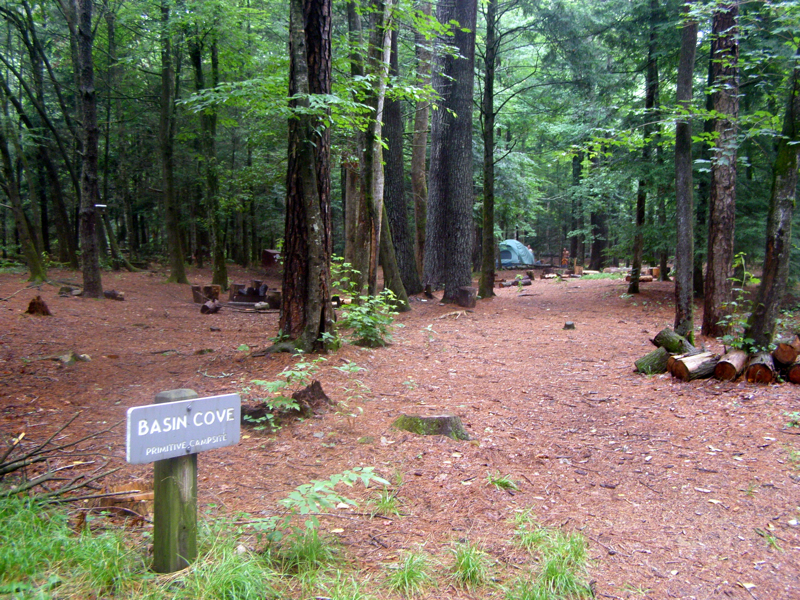
Basin Creek
Basin Creek Hike Comments
Archived Comments
By:Slomoze
Rating:
Date of Hike: Saturday, August 25, 2018
Awesome hike. Very doable hike even with medical-induced limitations. Only 4 other hikers encountered in 5 hours of hiking. Steam easily forded multiple times. This hike is a definite repeat!
By:Rose Syroid
Rating:
Date of Hike: Sunday, July 16, 2017
This hike has something for everybody: rock hopping stream crossings, chimney remnants/history, elevation gain, beautiful woods hike. Enjoy!!!
By:Andrew
Rating:
Date of Hike: Saturday, May 6, 2017
Night before there was a significant amount of rain, so we were worried we wouldn't be able to do the crossings- turned out it wasn't an issue. All the rock hops were submerged but I think the deepest point we crossed was knee deep, so it wasn't a problem. My lab/pit mix had a ton of fun crossing... after she made me carry her over the first 10 crossings...
Accessing the first waterfall isn't terribly difficult, but I don't know if in the future the specific terrain and route won't change. From the crossing immediately before the waterfall, look to the chute at the farthest right. It's a bit slippy, but we were able to get up even when carrying a 50 lb dog. It's fairly flat once you get up there. There's a large flat rock that juts out into the creek, it has twin logs resting on the rock from the other bank. There's also several more logs at the front of the rock After you scramble over the logs, there's a shallow. Stay to the left, and come around that way to the large rocks blocking your view of the falls- There's two major rocks. If you've got shoes with good grip, you shouldn't have any problem climbing up the rocks that block your view to the waterfall. If I remember correctly, from the left bank, hopped a log, crossed a shallow to the furhter of the two larger rocks. A few feet up that rock, theres a little ledge I walked along to the gap/hollow between the two large rocks and climbed up. The top is a good size flat area, and the view is absolutely worth the effort. Be careful though!
I used Salomon Crossamphibians- they were perfect for this hike.
By:The Bimpo
Rating:
Date of Hike: Saturday, October 15, 2016
Not much to add to the exhaustive reviews already posted. Gorgeous walk along the creek. I would change the "solitude" rating though, this trail was very crowded. Granted, it was mid October with great weather, but there were dozens of people along the trail...actually had a hard time parking in the large lot/camping area at Longbottom Road. If there's been recent rain you will definitely get wet on the creek crossings.
By:Zachary Robbins
Rating:
Date of Hike: Sunday, June 12, 2016
I guess I'll be the first to review my own hike. I took a couple of friends here today. We opted to do this hike instead of a longer loop in Doughton Park. At least with the 85F heat we could cool off with some water. I've hiked every trail in this park, many of the miles are exposed and lack water if you're eyeing one of them instead of this hike.
FYI a bridge is being rebuilt on Longbottom Rd and the road is closed on the way to the trail head. The detour signs are very obvious to get around this closure.
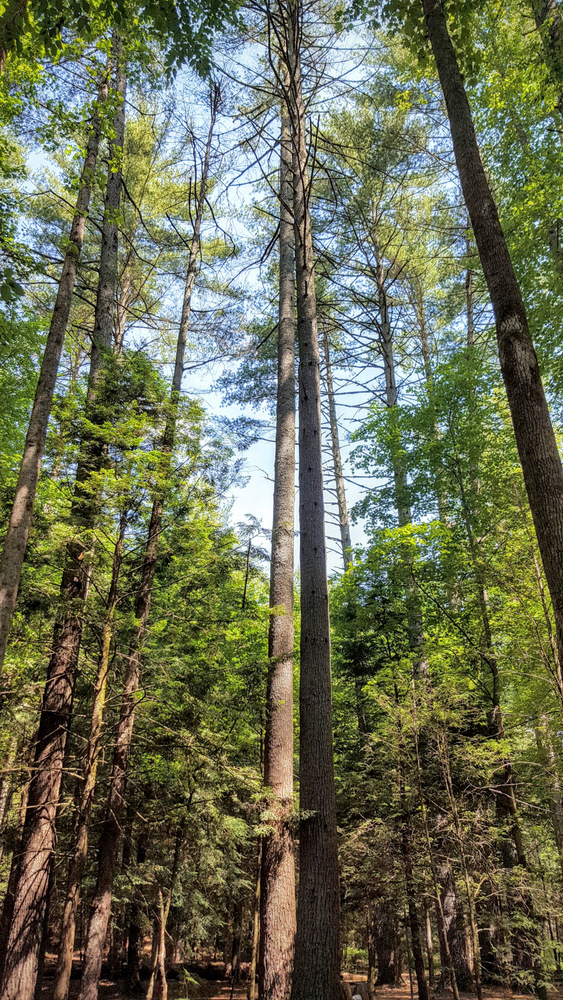
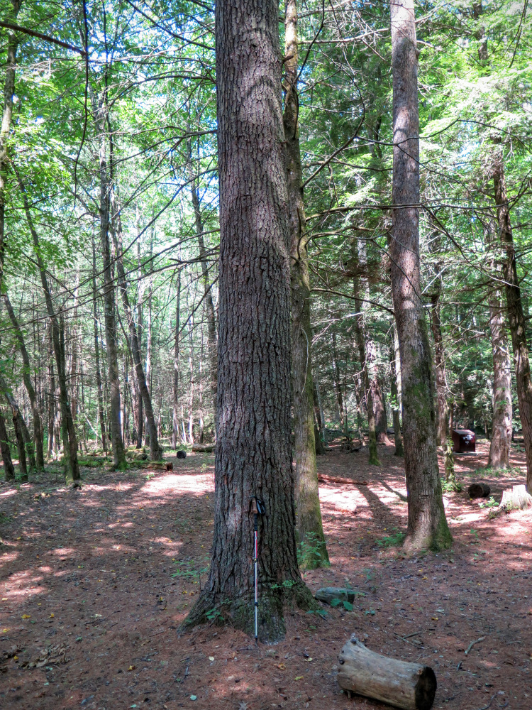
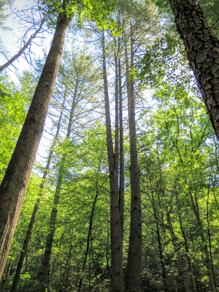
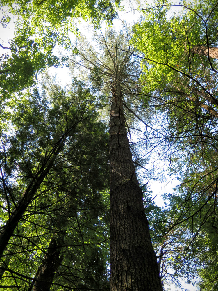
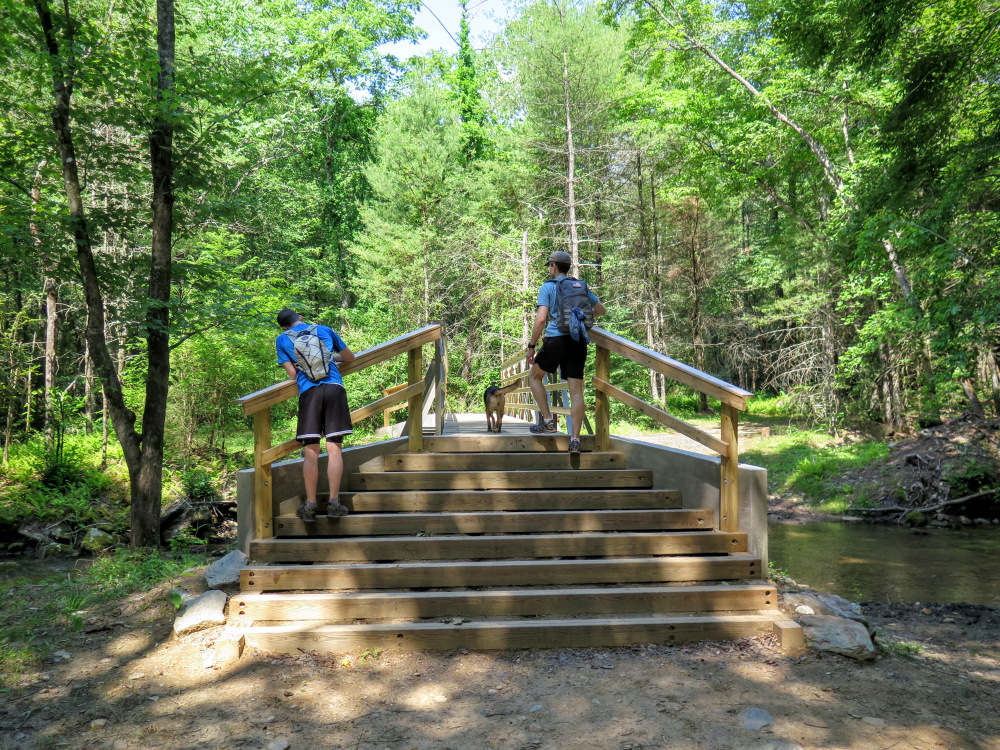
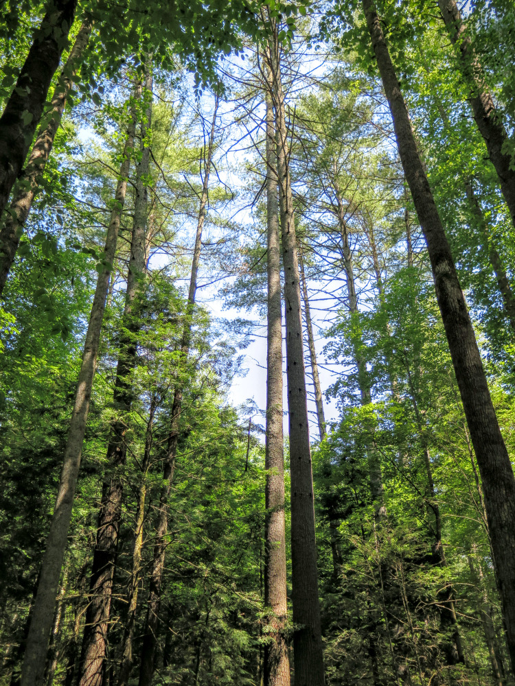
On to the hike. There's been a change since I was here last. A magnificent bridge has been built over the first wide crossing of Basin Creek. I'm not sure it was necessary, but it is built to last. I didn't notice this last time, but the campground has some of the tallest, largest pine trees I've ever seen. Many of them soar over 100 feet high, it's really cool. I can't believe I missed this last time. The creek was lower water than it was for this post, only a couple of the crossings were tricky to avoid getting wet and a hiking stick will help a lot. The trail was more overgrown this time, but those stinging nettles were not really stinging this time. It is more overgrown past the 2nd waterfall. Another addition, I creek-walked to the first waterfall which is not accessible by trail. It took less than 10 min to get there, and although the waterfall itself isn't tall it is a really cool spot.


