
|
 By Trail Contributor: Zach Robbins (Contact Zach) By Trail Contributor: Zach Robbins (Contact Zach)
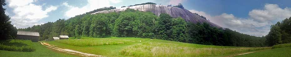
Stone Mountain State Park is a park for people striving to see amazing views and waterfalls without extreme effort. It has everything a casual hiker would want. Easy, well-marked and well-maintained gravel trails leading to high waterfalls and massive rock summits begging for a little exploration. This invites the crowds, but there are still some places to escape within this large state park.
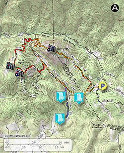
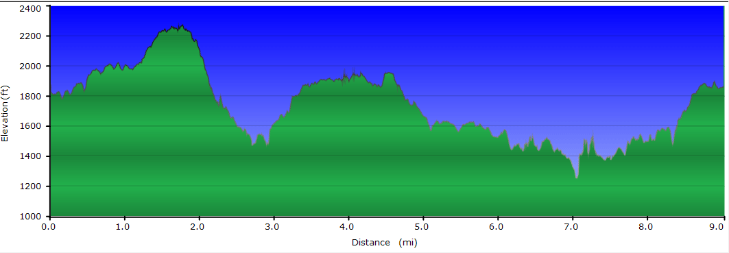
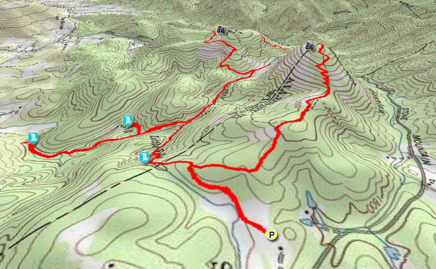
The extremely popular 4.5-mi Stone Mountain Loop covers the iconic pluton summit and the tallest waterfall. This hike includes that loop and adds the Wolf Rock-Cedar Rock loop along with the Middle/Lower Falls trail. All of this is packed into an awesome 9 mile hike with three waterfalls, three massive rock summits, and the historic Hutchinson Homestead. The loop is moderate in difficulty at best and should only take half a day, but you might want to use a whole day to savor the sights.
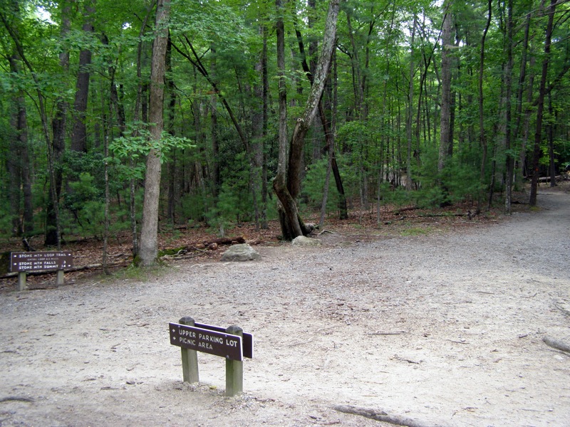
The park is accessed by taking Traphill Road off of U.S. 21 near Roaring Gap. The main park entrance is on the John P. Frank Parkway. Before starting the hike, stop by the visitor’s center for a free state park trail map. After passing the visitor’s center, look for the upper hiking parking lot on the left. This lot is popular due to its close proximity to Stone Mountain Falls. The hike starts to the left of the rest rooms. An alternative start point is the lower parking lot on the other side of the park.
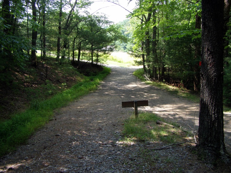
- Mile 0.0 – Begin at upper parking lot. Stone Mountain Loop connector trail (orange circle blaze) starts to the left of rest room.
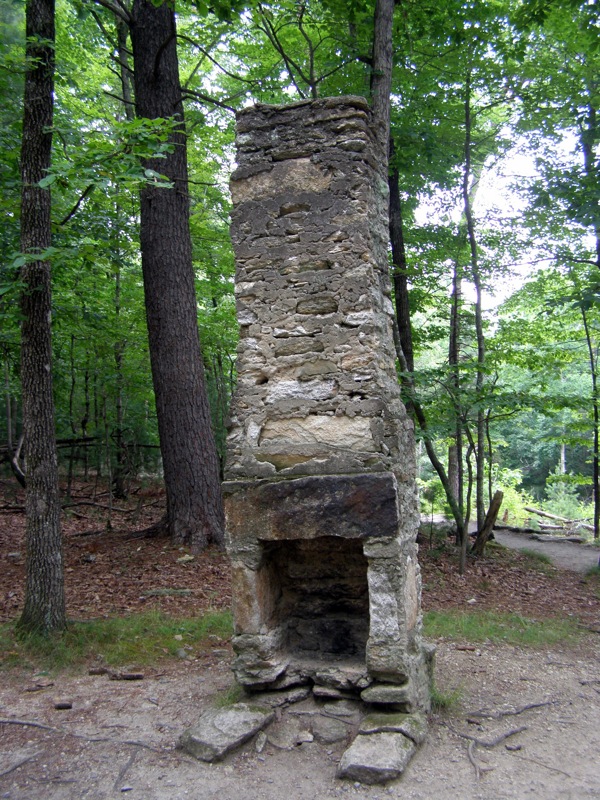
- Mile 0.3 – Intersection with Stone Mountain Loop Trail (orange circle blaze) at a chimney remnant. Go right towards Stone Mountain taking the loop counterclockwise.
Alternate – This hike can be hiked in either direction. Counterclockwise is preferred because the ascents are more gradual to Stone Mountain and Wolf Rock in this direction. However, if you have physical issues going downhill you might want to hike the opposite direction going to Stone Mountain Falls first. The section from the lower parking lot to Stone Mountain is steep and includes a very long section of steps, going up could be easier on the knees here.
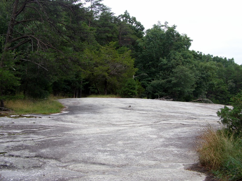
- Mile 0.7 – Pass by open rock face.
- Mile 0.9 – Trail crosses over large rock face then goes back into forest.
- Mile 1.1 – Begin climbing well constructed switchbacks towards the summit. Avoid all the obvious side trails that go up, these were abandoned due to erosion.
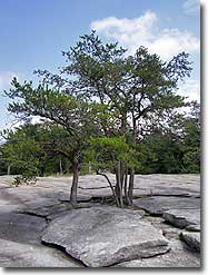
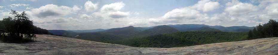
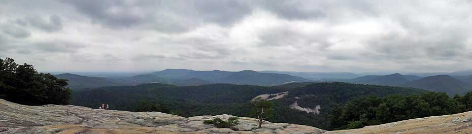
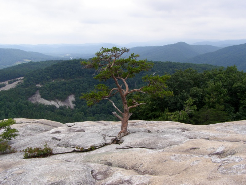
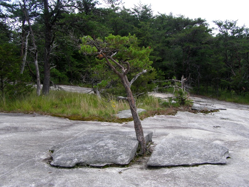
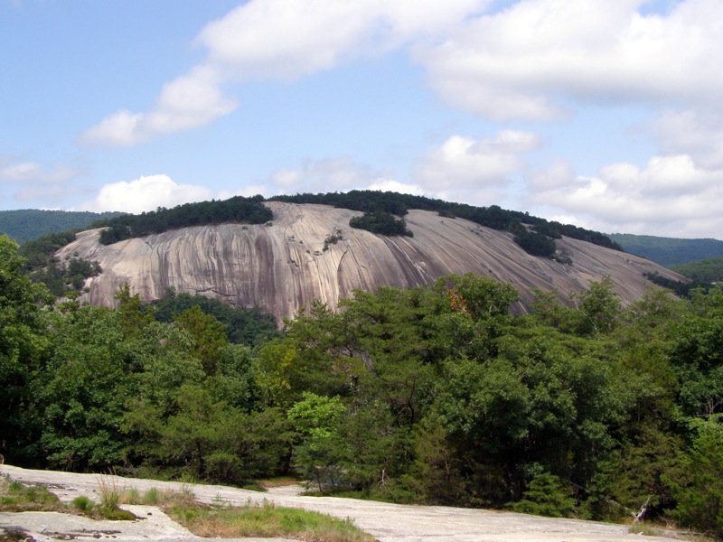
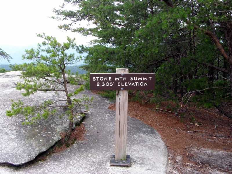
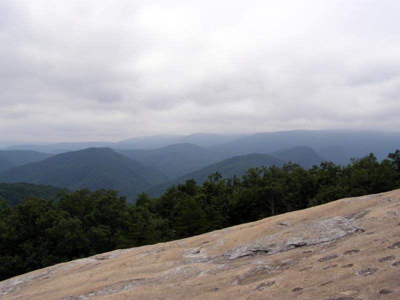
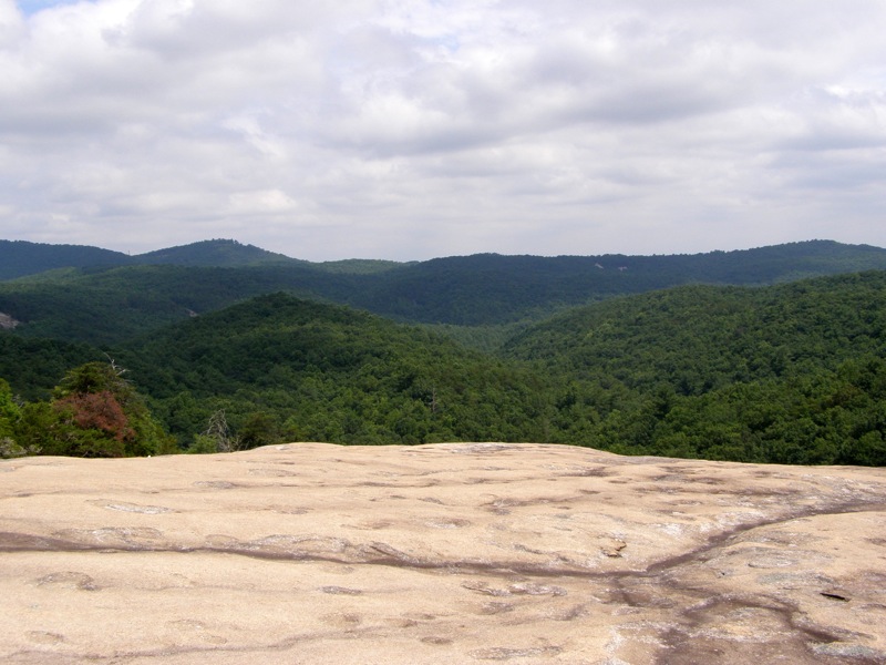
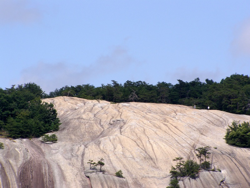
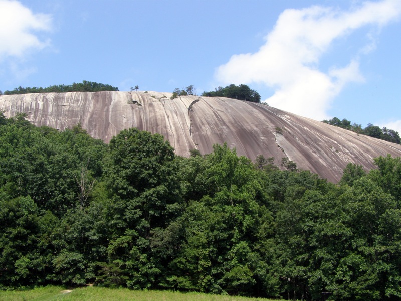
- Mile 1.7 – Reach the summit of Stone Mountain (2,305 feet). The summit is a massive exposed pluton with smooth rock extending hundreds of feet in three directions. You can explore a lot of this summit, checking out all the potholes and arguably the prettiest tree in NC. Cedar Rock is directly south and Doughton Park is southwest.
Caution – do not venture out onto the rock face. The slope is deceiving and begins to slant almost vertically. This vertical angle is easily seen from Cedar Rock and the Hutchinson Homestead.
- Mile 1.8 – North facing rock is easily accessed off the trail.
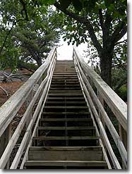
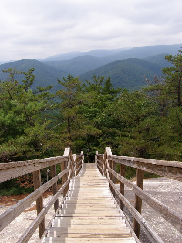
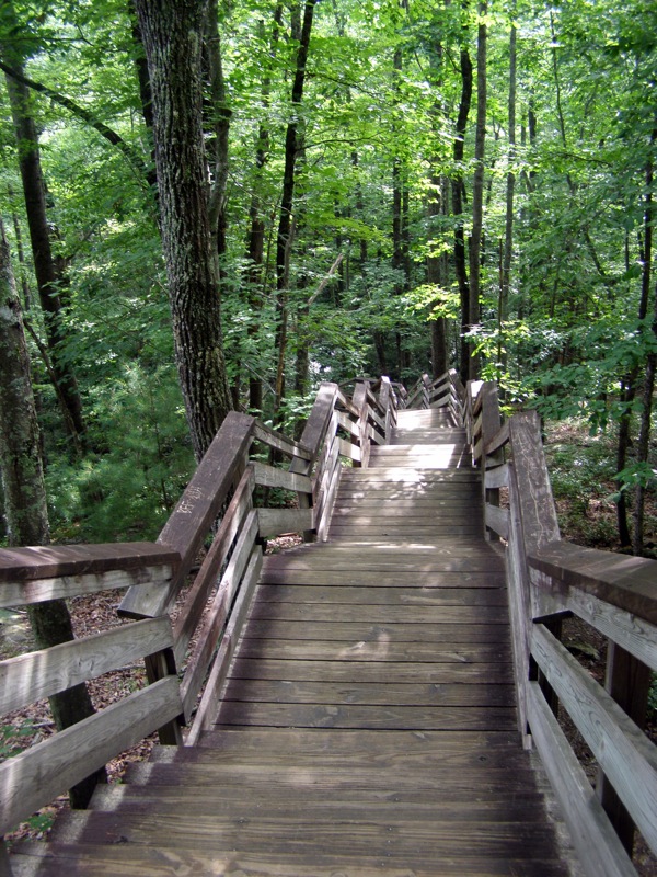
- Mile 1.9 – Being a very steep descent over the west face of Stone Mountain. The trail descends over many wooden stairs or the rock face aided by cable guide lines.
- Mile 2.2 – End of the long stairs descent.
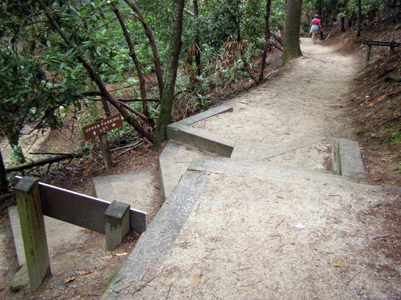
- Mile 2.6 – Begin a quick series of intersections with trails leading from the lower parking lot. Intersect with Hutchinson Homestead road access and continue across road on the trail <0675>.
- Mile 2.7 – Intersect with lower parking lot trail spur, take sharp left on Stone Mountain Loop Trail.
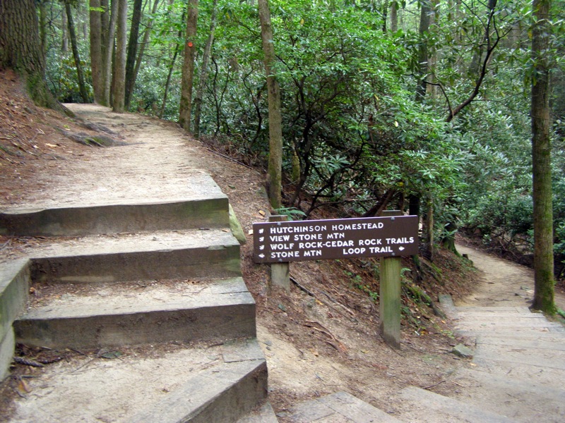
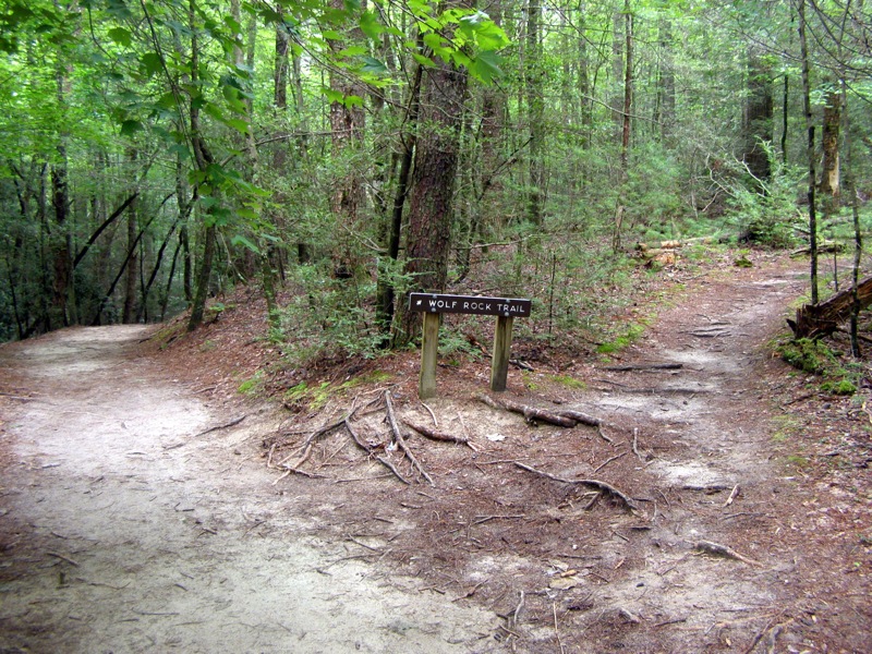
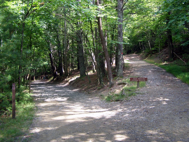
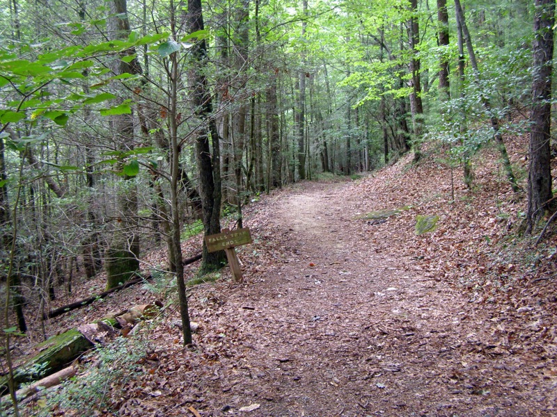
- Mile 2.8 – Junction with Wolf Rock Trail (red square blaze), go right ascending the ridge for the next 0.6-mi and leaving the crowds behind. The trail is moderately steep and unlike most of the gravel trails in the park, is a common narrow dirt path.
- Mile 3.5 – Follow the flat ridge through an open forest, there is an old stone wall along the left side of the trail.
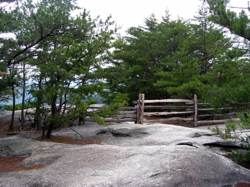
- Mile 3.8 – Junction with unmarked spur trail that takes you to Wolf Rock on the right. There is a wooden post here, likely an old sign.
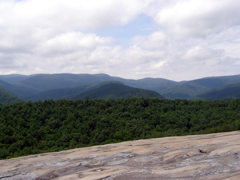
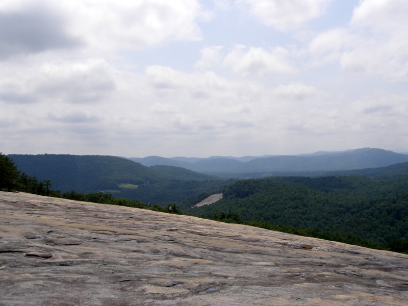
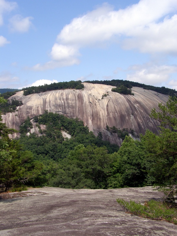
- Mile 3.9 – Wolf Rock. Outstanding open views south of Doughton Park. Wolf Rock is extremely flat and massive, extending a few hundred feet out and over a thousand feet wide.
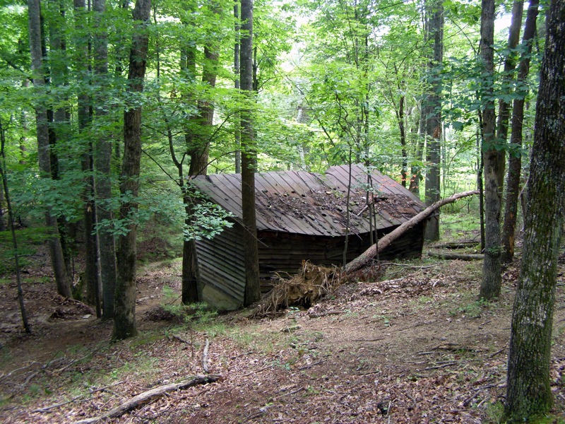
- Mile 4.3 – Pass by an old cabin.
- Mile 4.4 – Junction with the Black Jack Ridge Trail (white rectangle blaze). Stay left on the Cedar Rock Trail (red circle blaze) and immediately leave the forest and cross open flat rock with views to the east. The trail blazes are painted on the rock. It looks like these are the best views from Cedar Rock but keep following the blazes back into the forest.
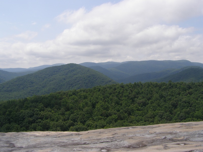
- Mile 4.6 – Cedar Rock. Great views east and north towards Stone Mountain.
- Mile 4.65 – Best view of Stone Mountain from a narrow opening on Cedar Rock. From here you can see the summit of Stone Mountain and pick out people wandering about. The mountain looks much steeper from this angle. After this view the trail descends moderately on an old gravel road bed.
- Mile 4.9 – Intersection with the terminus of the Black Jack Ridge Trail (white rectangle blaze). Stay left and keep going downhill.
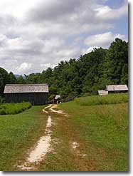
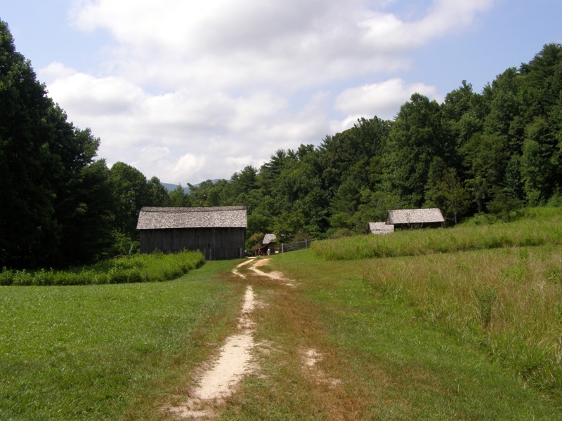
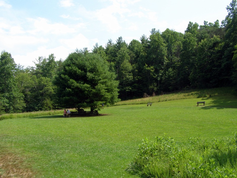
- Mile 5.1 – The Cedar Rock Trail ends at the Stone Mountain Loop Trail (orange circle blaze). Go left for a quick out-and-back to the Hutchinson Homestead. Immediately leave the forest crossing through an open field sitting directly below Stone Mountain. An extremely picturesque setting, many people are milling around here because of the easy access from the lower parking lot.
- Mile 5.2 – Explore all the buildings of the Hutchinson Homestead. Turn around and head back east towards the upper parking lot.
- Mile 5.4 – Return to the Cedar Rock Trail junction, stay left on the Stone Mountain Loop Trail (orange circle blaze).
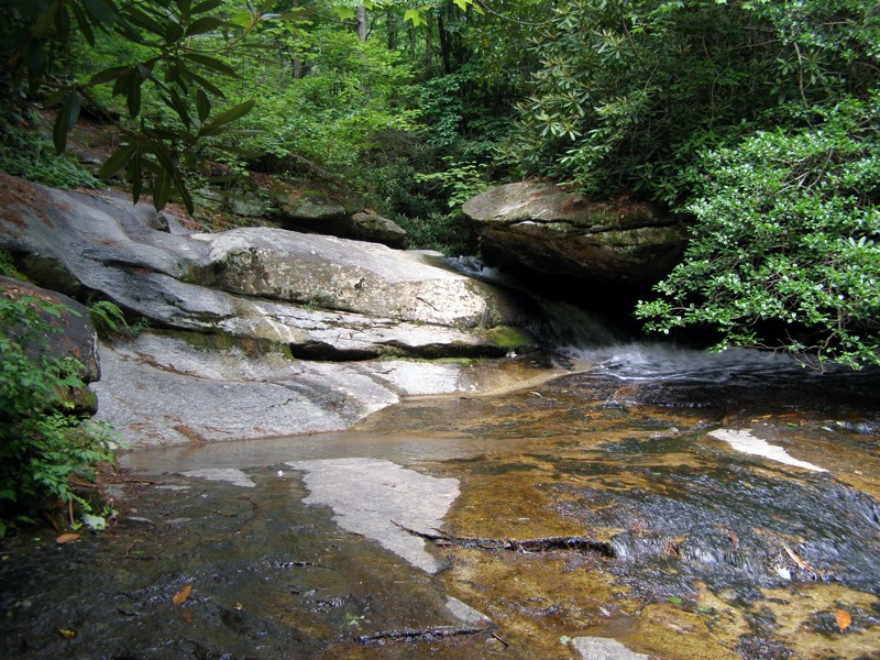
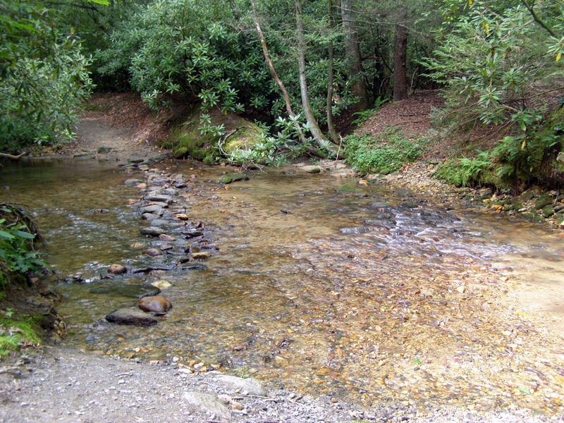
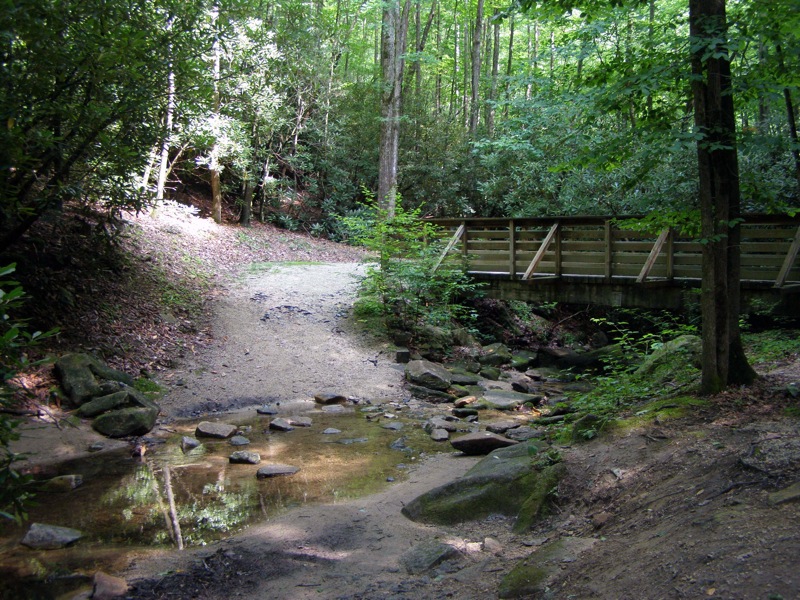
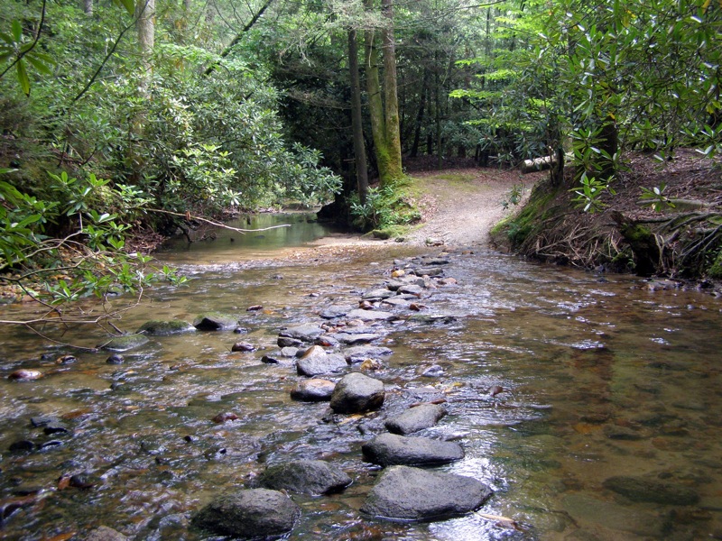
- Mile 5.5 – 1st crossing over an unnamed tributary of Big Scaly Creek. There are 5 crossings, all have bridges but the stream is so small the rock hops are extremely easy.
- Mile 5.8 – 2nd stream crossing.
- Mile 5.85 – 3rd stream crossing.
- Mile 5.95 – 4th stream crossing.
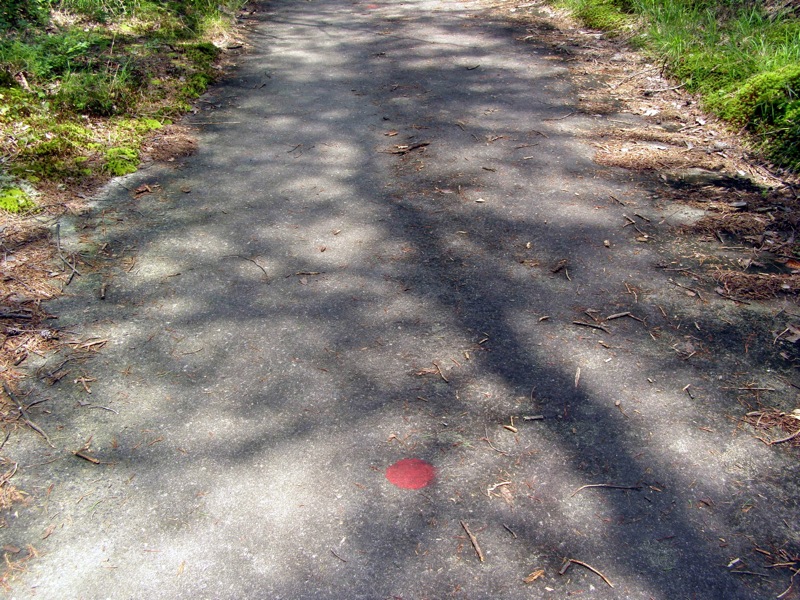
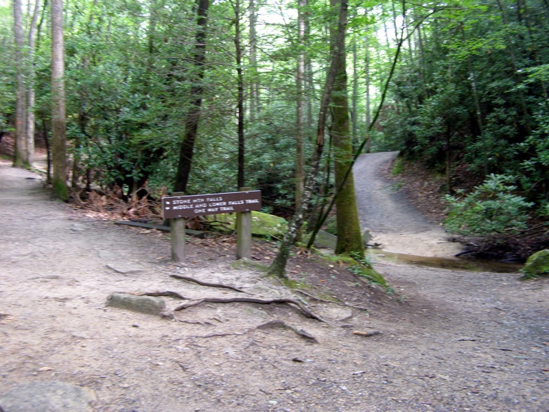
- Mile 6.0 – Intersection with the Middle/Lower Falls Trail (blue circle blaze). Go right on the trail and immediately cross the stream for the 5th time. The tributary flows into Big Scaly Creek near this junction and the trail soon parallels the much larger creek.
- Mile 6.2 – Junction with Middle Falls spur trail, go right towards the waterfall.
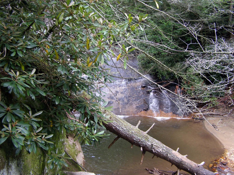
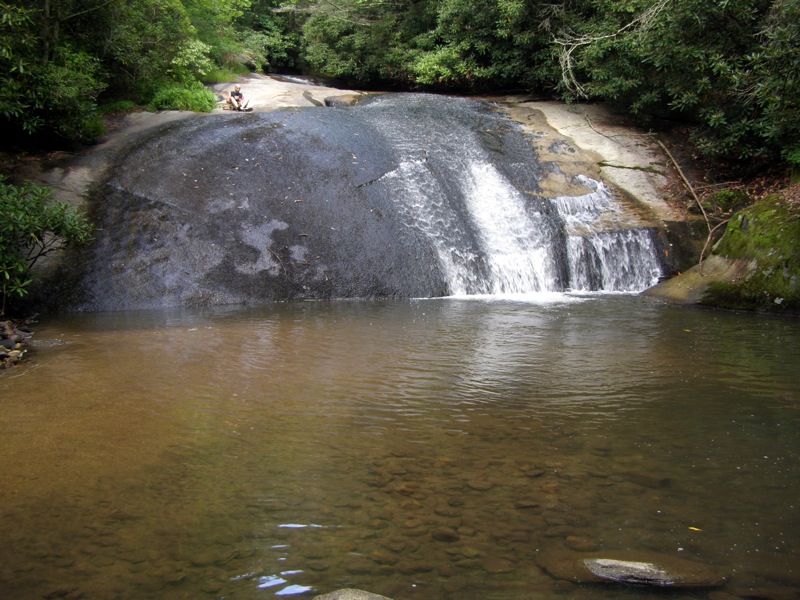
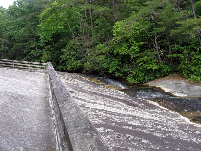
- Mile 6.4 – Reach Middle Falls. This waterfall is a slide waterfall over a broad rock face, approximately 20 feet high. The trail comes out on a rock face at the top of the waterfall and the middle of the waterfall. Turn around and head back to the main trail.
Caution - Beyond the middle section the normal trail disappears and there is a highly eroded trail that goes down to the base. However, there is no obvious spot to actually get off this trail to the base, at each section there’s a 5-6 foot drop to the creek. It looks easy to jump down but getting back up could be difficult without a rope or climbing skills. The waterfall is not scenic, and frankly not worth the effort.
- Mile 6.5 – Turn right heading towards Lower Falls and immediately rock hop over Big Scaly Creek. The trail ascends then steeply descends a hill away from the creek.
- Mile 6.8 – Rock crossing over Big Scaly Creek. The creek fans out beautifully and the rock hop is very long but easy.
- Mile 7.0 – Main trail ends at the top of Lower Falls. This waterfall is also a slide over a huge rock face of approximately 20 feet. There are crude side trails to the bottom of the falls. The waterfall slides into a beautiful pool surrounded by rocks. The left side of the pool is shallow sand, allowing you to walk very close to the waterfall in ankle-deep water. Turn around and head back towards the Stone Mountain Loop Trail. The Lower Falls Trail unofficially continues on meeting up with the Out & Back Trail. This connection isn't shown on the state park map.
- Mile 8.1 – Junction with Stone Mountain Loop Trail (orange circle blaze), go right.
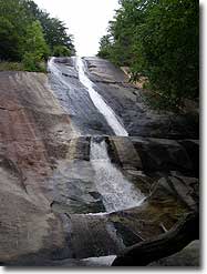
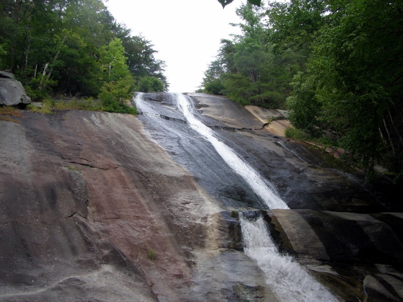
- Mile 8.4 – Reach Stone Mountain Falls, a towering 200 foot slide waterfall. From the base you cannot see the top. Explore the pool at the base and the rocks below but do not climb the rocks up the right side of the falls.
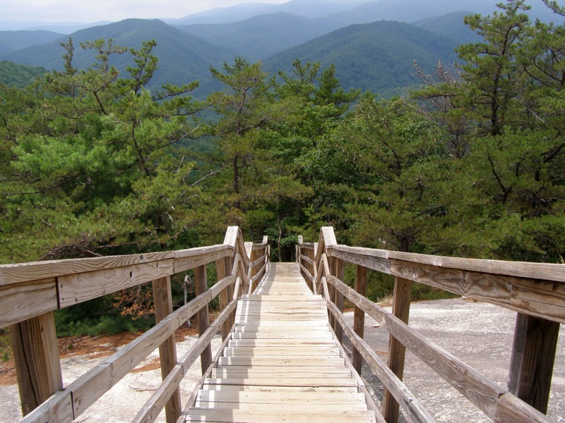
- Mile 8.5 – Ascend a massive set of stairs on the left side of the waterfall. There is an overlook near the top of the waterfall.
- Mile 8.6 – The stairs end at the top of the waterfall.
Warning – DO NOT climb over the wooden railing to try and get a better view from the top of the waterfall. Multiple people have died doing this trying to get a view of the bottom and slipping on the wet, smooth rocks. Warnings are clearly posted.
- Mile 8.7 – Intersection with the upper parking lot trail, go right towards the parking lot.
- Mile 9.0 – Hike ends back at the upper parking lot.
|


