
|
 By Trail Contributor: Zach Robbins (Contact Zach) By Trail Contributor: Zach Robbins (Contact Zach)
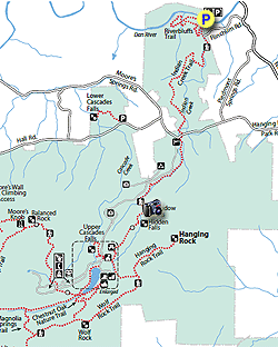
Hanging Rock State Park is one of the jewels of the North Carolina state park system. It is located north of Winston-Salem and Greensboro in the heart of the Piedmont, but encompasses the largest section of the Sauratown Mountains. The Sauratown Mountains are an old, isolated range away from the Blue Ridge, running east to west for 30 miles in Stokes and Surry counties. Hanging Rock is one of the most popular state parks because of its proximity to population, extensive trail system, and abundance of waterfalls and prominent rock outcrops.
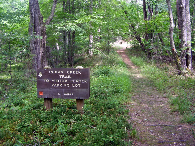
The Indian Creek Trail runs the length of Indian Creek from the visitor’s center to its end at the Dan River. It is a 3.8-mi one-way trail that can be accessed from the visitor’s center parking area or the Dan River access parking. The highlights of this hike are Window Falls and Hidden Falls, plus the gorge views at Window Falls and a smaller gorge near Dan River.
To start the hike at the bottom of the creek at the Dan River access, continue on NC-89 west/NC-8 north 1.1 miles past the main entrance to the state parking. The main entrance is marked with a sign indicating a turn on Hanging Rock Park Road. After 1.1 miles past the entrance, there is a sign indicating the Dan River access left on Flinchum Road. Flinchum Rd is a well-maintained gravel road. The trailhead gravel parking area is at the end of the road beside the Dan River. The area is small but there is ample room to park along the road.
- Mile 0.0 – From the parking area facing the Dan River, the Indian Creek Trail (red square blaze) starts on the left in a dark clearing surrounded by forest. The sign for the Indian Creek Trail is on the far left of this clearing
- Mile 0.1 - The trail passes by the Riverbluffs Trail (red hexagon blaze) on the right, a 1.3-mi loop option along the Dan River
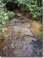
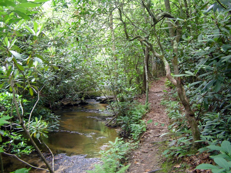
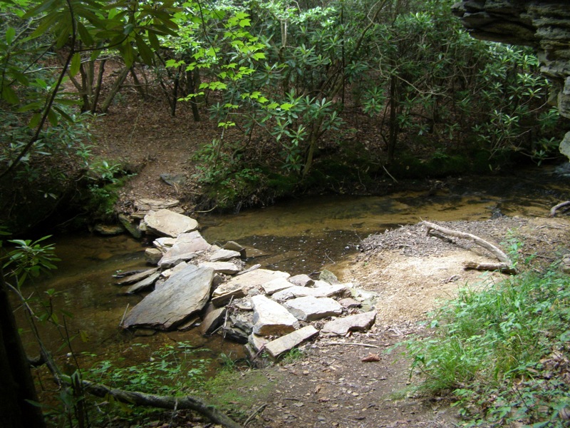
- Mile 0.2 – The trail crosses Indian Creek five times over one man-made rock crossing and four natural rock crossings. Some of the natural fords are tricky because the creek flows over long, flat rocks that offer few dry spots to step on. In higher water flow it is likely you will get your feet wet.
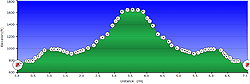
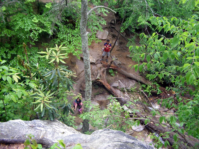
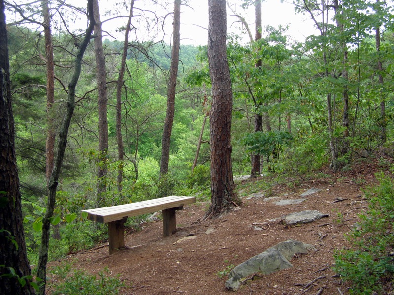
- Mile 0.6 - Veering away from the creek, the trail climbs steeply along a few switchbacks to the top of a small gorge. There are benches here along the cliff to enjoy the views into the gorge. It is impossible to see the creek below because of all the vegetation. One solitary house prominently sticks out across the gorge perched on a cliff.
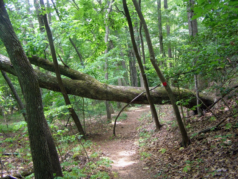
- Mile 0.8 – After the gorge overlook the trail follows a ridge away from Indian Creek for the next mile before dropping into a gully with a dry stream bed. After this gully the trail soon rejoins its parallel journey along Indian Creek.
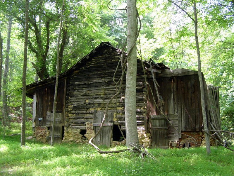
- Mile 2.0 - The trail passes by an old abandoned cabin that sits above a bridge crossing over Indian Creek
- Mile 2.1 – Junction with Hanging Rock Park Road. The trail goes directly across the road here. The Mountains-to-Sea Trail (MST) (white circle blaze) joins the Indian Creek Trail from the road. Continue north along the Indian Creek Trail/MST following the frequent red square/white circle blazes. The trail parallels Hanging Rock Park Rd and Indian Creek. In this section the trail follow the creek gully below the road, crossing the creek 5 times on easy rock hops.
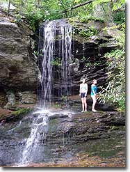
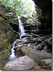
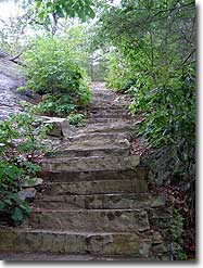
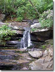
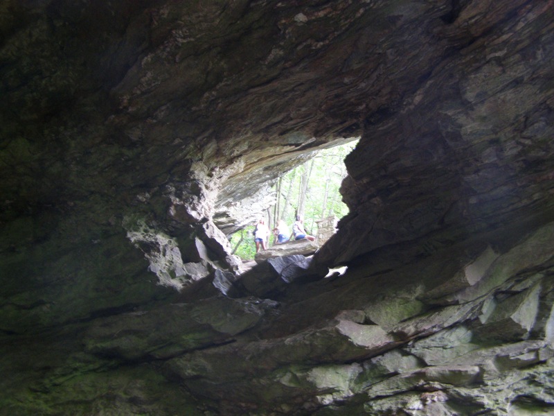
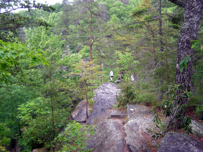
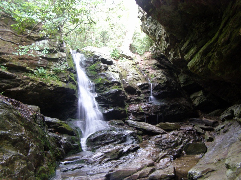
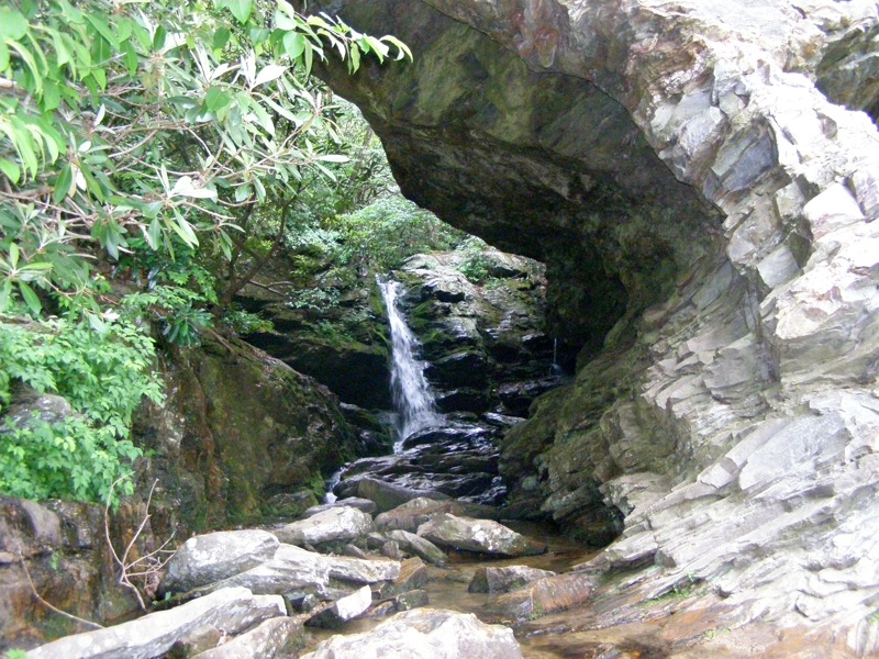
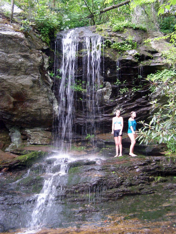
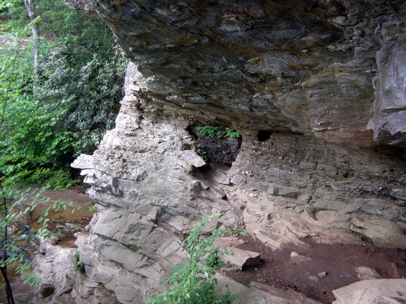
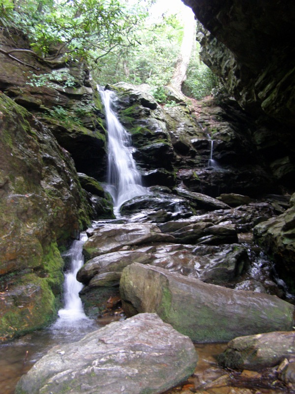
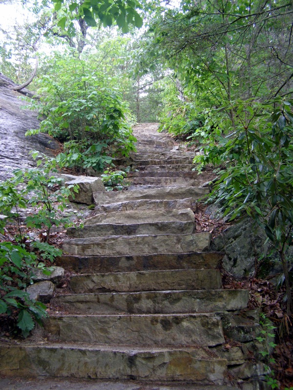
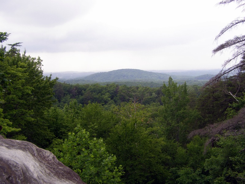
- Mile 3.2 – Reach the base of Window Falls (lower Window Falls, ~25-foot drop). There is the option to scramble down to the base of the falls and also scramble behind the main drop. The trail continues climbing up to the right along the giant rock outcrop that dominates above the waterfall. Tip – The “Window” is seen from a viewpoint along the trail just above Window Falls. There is no official trail to the Window, but it is a straightforward rock scramble to get up close. The real gem is on the other side of the Window, an upper waterfall not identified by the trail signs. This drop is recessed 50+ feet behind the rock wall, giving it the appearance of dropping into a cave. The upper Window Falls is only a 10-foot drop but is more scenic than the lower waterfall. The area is surrounded on 3 sides by rock and is naturally air conditioned by the water. It is easiest to scramble up to this spot from the right side of lower Window Falls and not the “Window” viewing area. The trail climbs to the right above Window Falls along a nice set of stairs cut straight into the rock. At the top of the stairs there is the option to walk along the massive outcrop that juts over the waterfall. This rock outcrop is wide and flat. There is a view looking down to the base of Window Falls plus views northeast of the hills around Dan River. This is one of only two spots along the trail offering open views.
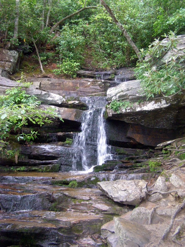
- Mile 3.4 – Junction with a very short spur trail (~300 feet) to Hidden Falls. Take a left to reach the Hidden Falls. Hidden Falls is a short, below average waterfall around 15 feet high.
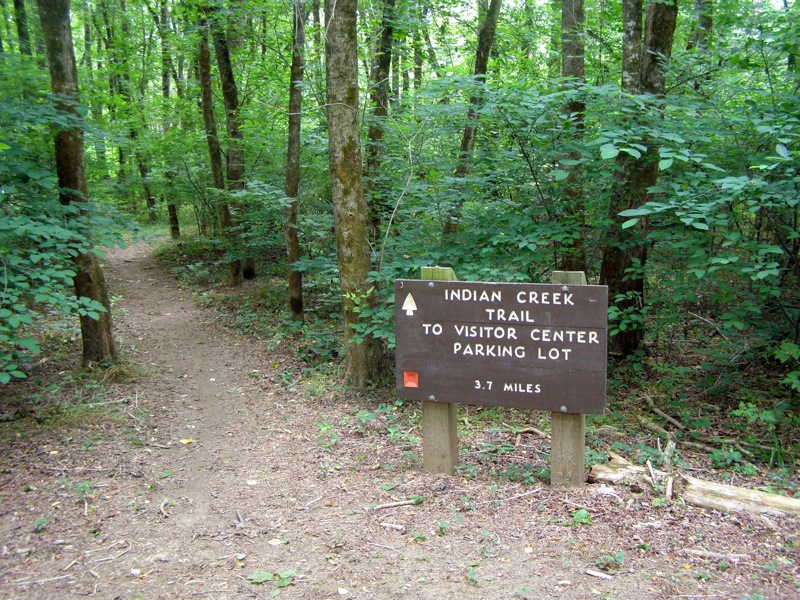
- Mile 3.8 – Reach the end of the Indian Creek Trail at the main parking area for the visitor’s center. The visitor’s center is ahead on the right. Turn around and head back to the Dan River parking to complete the out-and-back hike.
- Mile 8.2 - Arrive back at the Dan River parking area.
Note – From the parking area there is the option to extend the day along many of the hikes available near the visitor’s center. The options are Upper Cascades Falls (0.3-mi), Hanging Rock (1.3-mi), Wolf Rock (1.4-mi), Cook’s Wall (1.6-mi), or Moore’s Knob (2.0-mi).
|


