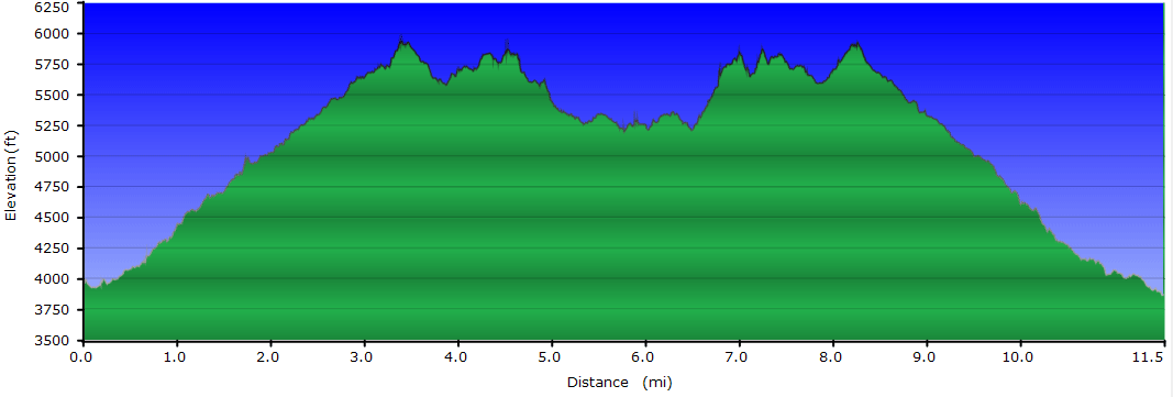
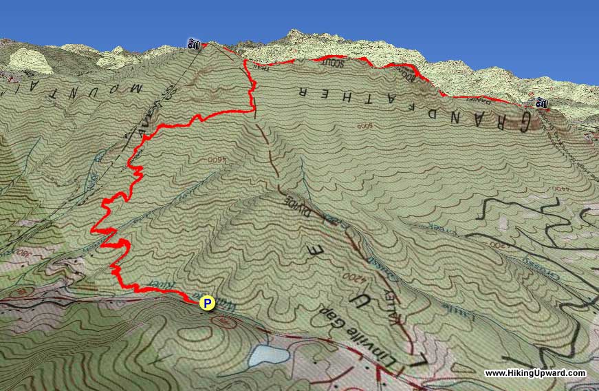
Grandfather Mountain is one of the most beautiful, rugged landscapes in North Carolina but hiking it for free is an all-day affair filled with grand views, steep climbs, and some physical hardships. If you’d rather take the easier route, you can drive up to the tourist attraction for $20/person and hike the Grandfather Trail out-and-back for a hearty mountain experience of only 5 miles (Grandfather.com). Otherwise the bold hikers can hike the mountain via the Profile Trail below or the previously described Daniel Boone Scout Trail.
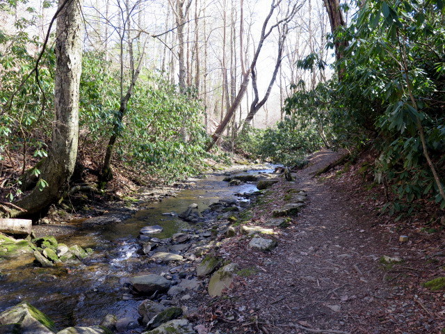
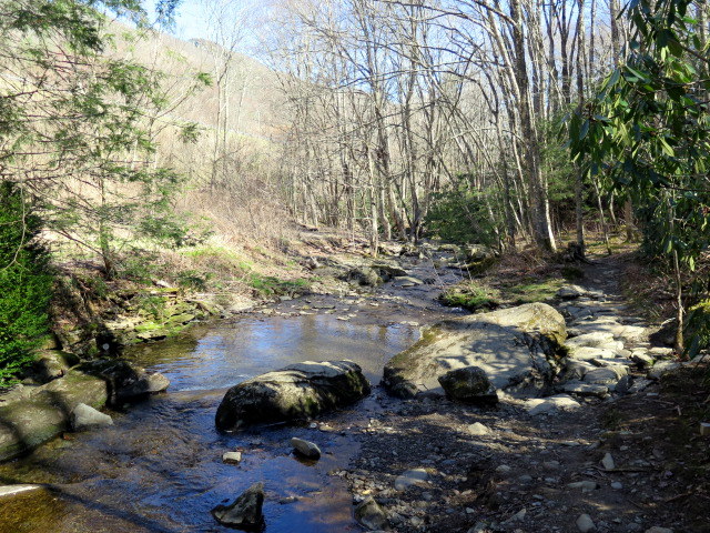
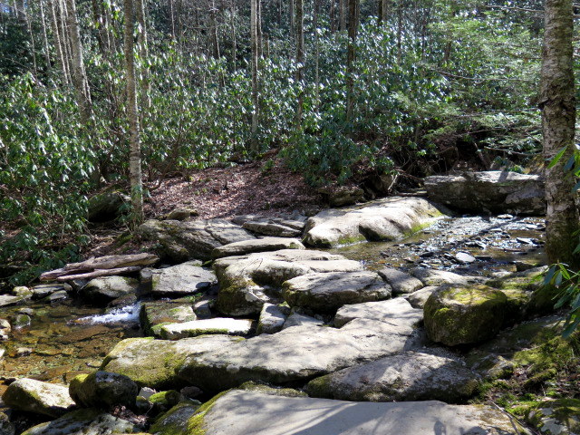
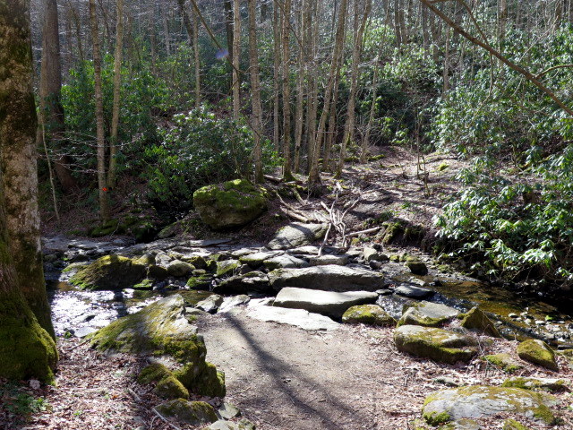
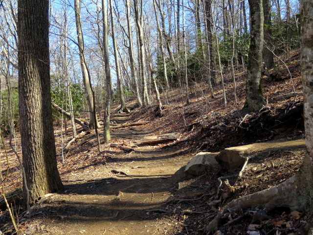
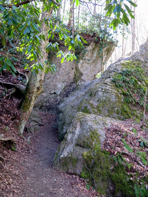
Although shorter, the Profile Trail is arguably the toughest ascent due to the steep inclines and long stretches of boulder-strewn paths. You can cut 1.2 miles by avoiding the out-and-back to Calloway Peak which has the least impressive views, but you’ll be missing out on the high point of this famed mountain. Unlike the Daniel Boone Scout Trail the biodiversity isn’t as impressive on this side of the mountain as you continuously climb due to the western exposure. However, the trail adds a few different flavors like an initial stroll along the peaceful Watauga River, massive boulders trailside, and a bird’s eye view of the Grandfather Profile. Just make sure to hike as far as Attic Window Peak and MacRae Peak, which offer some of the best views and exciting rock scrambles in the region.
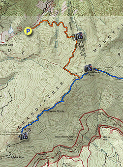
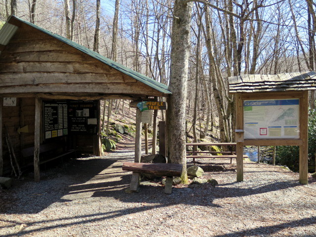
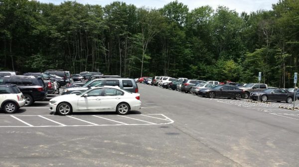
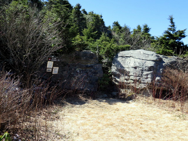
July 2017 Parking Update - A new parking area was opened for the Profile Trail that could accommodate 100+ cars. The original parking lot has been closed. The new parking area adds an additional 0.6-mile hiking each way, making this a 12.5-mile hike. The additional length is almost flat, so it does not add significant elevation gain. We will update the hike mileage in the future when we get a new GPS track. The new parking area is located at The Profile Trail, Banner Elk, NC 28604 (36.1198, -81.8350).
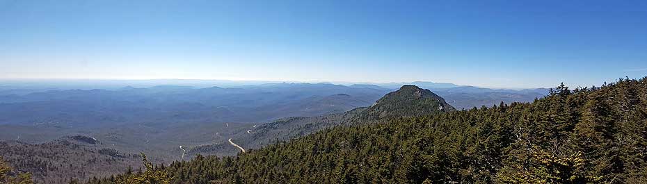
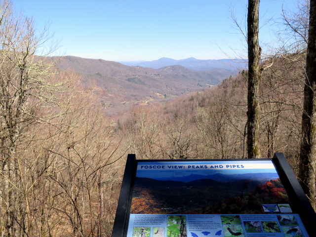
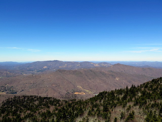
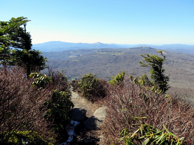
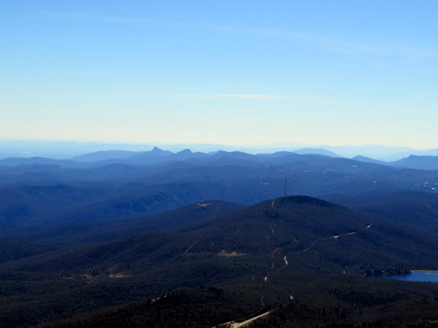
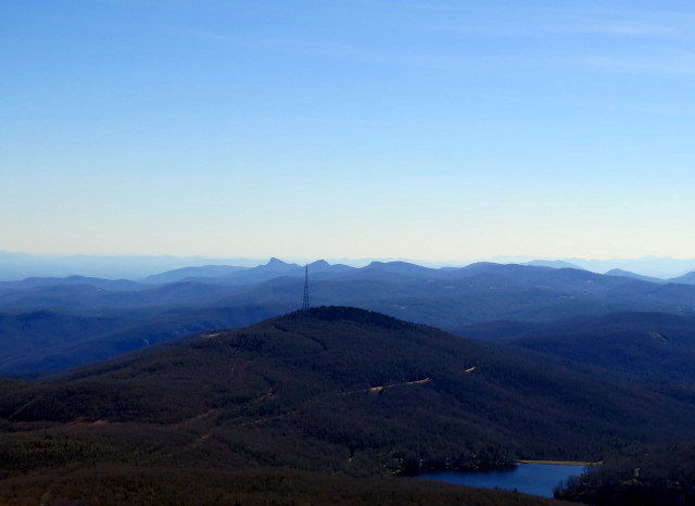
Mile 1.6 – Arrive at the Foscoe View, a window through the trees with a view north of Snake Mountain and Elk Knob. The trail begins a steep climb from here towards the Profile Campsite.
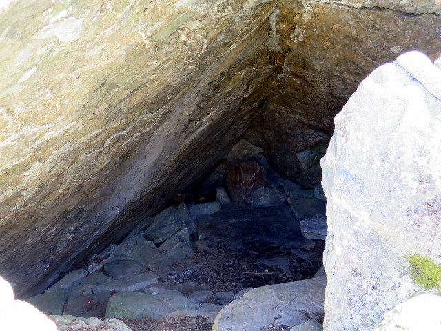
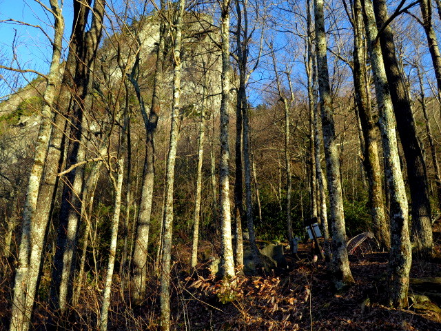
Mile 1.9 – Profile Campsite offers a few spaces for tents below the towering Grandfather Profile. From here it is difficult to discern the unique features of the Profile through the trees.
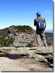
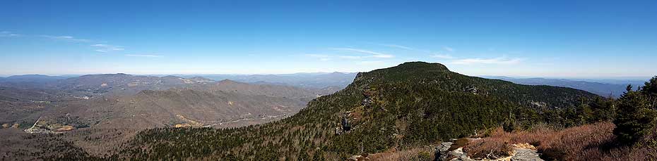
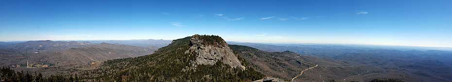
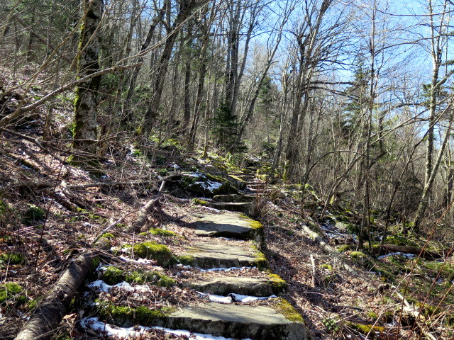
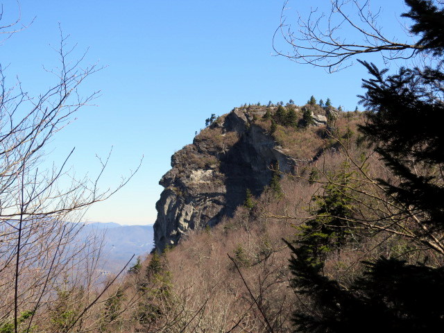
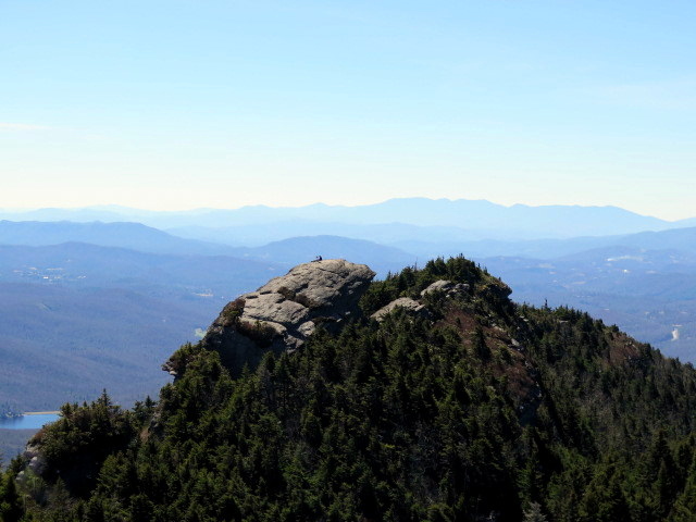
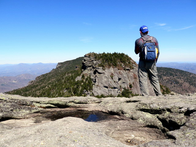
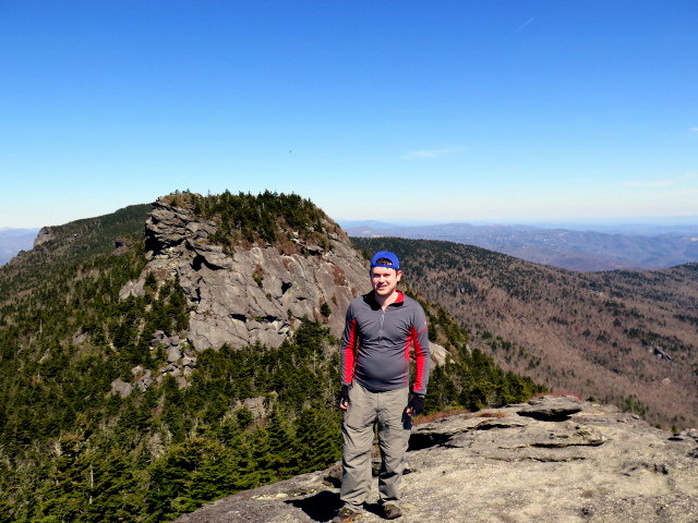
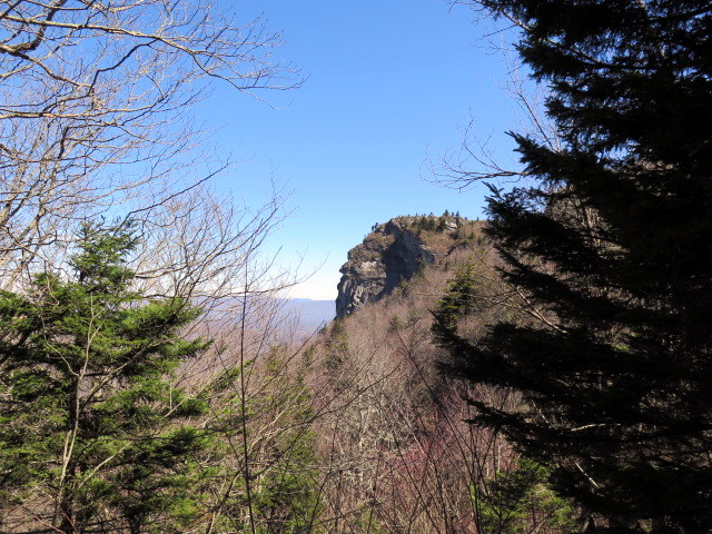
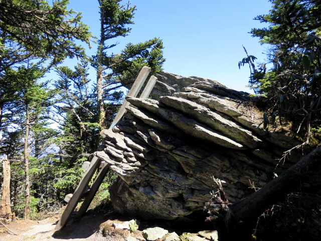
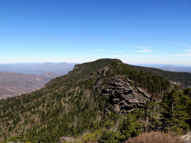
Mile 2.1 – Reach the Profile View, a bird’s eye perspective of the Grandfather Profile for which the mountain got its name. From this planar view the massive cliff looks like a craggy, old face. After the Profile View the tread becomes rockier as the trail begins climbing through spruce forest.
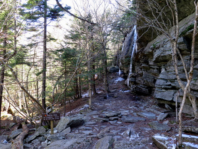
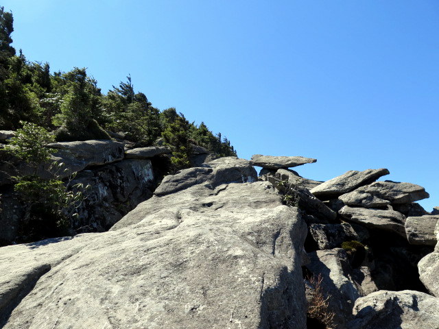
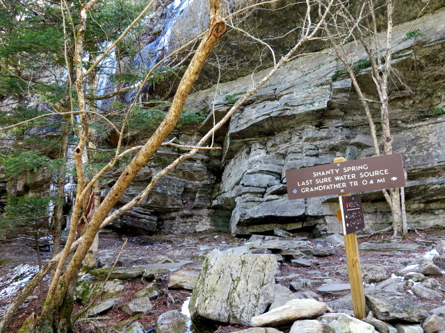
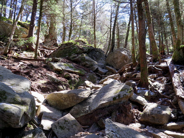
Mile 2.5 – Historic Shanty Spring is one of the only reliable water sources near the crest of Grandfather Mountain. Fill up here if you did not pack in much water. The next 0.3-mi is a rough ascent over a jumble of large boulders.
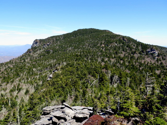
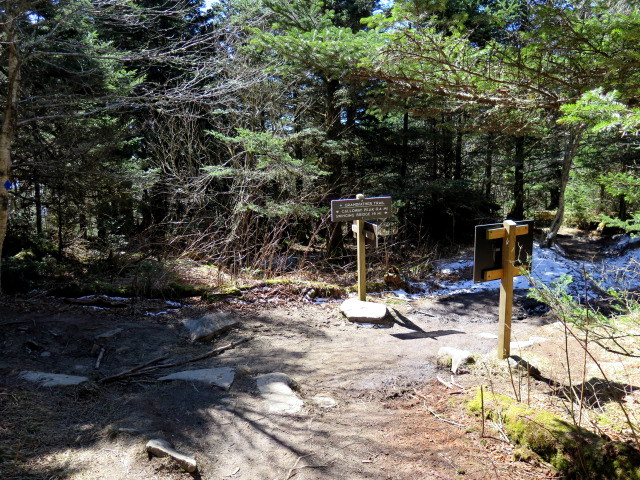
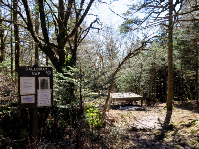
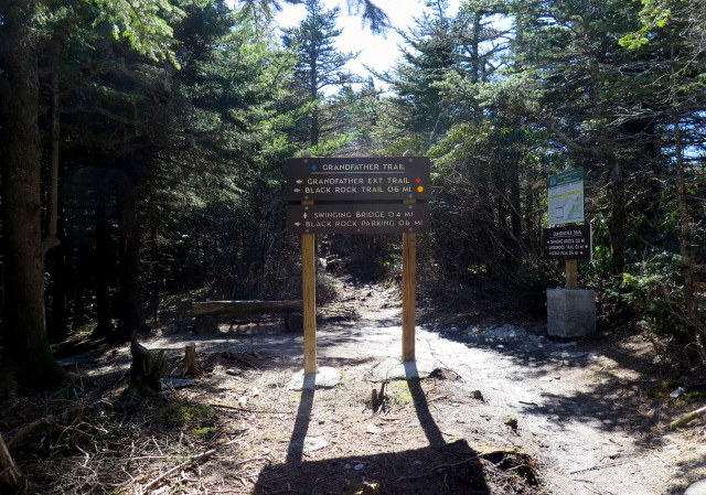
Mile 2.8 – Profile Trail ends at a T-junction with the Grandfather Trail (blue diamond blaze) at Calloway Gap. Turn left to hike up to Calloway Peak, a steep section with many roots and rocks.
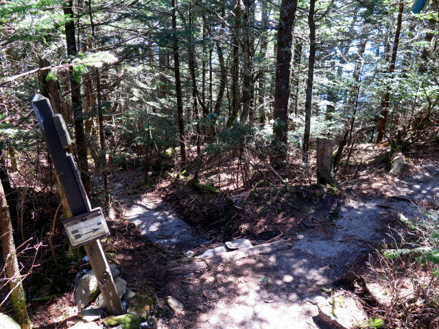
Mile 2.9 – Ledge Cliffside Campsite on the right side of the trail with a grass floor and a small view. This is your second closest option for camping near Shanty Spring.
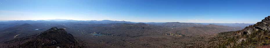
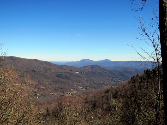
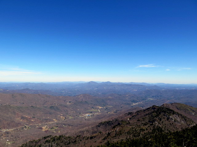
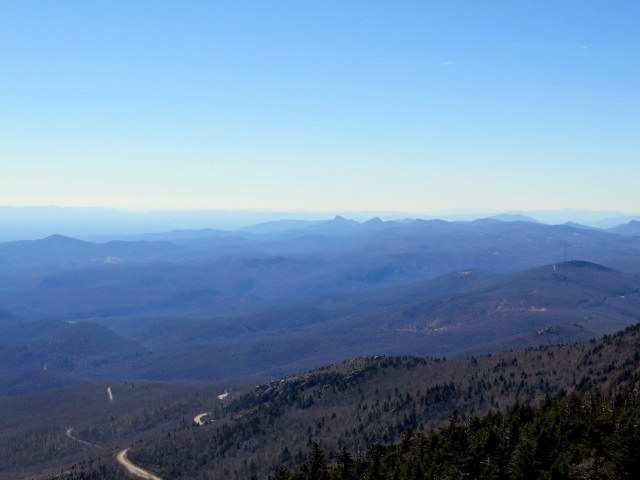
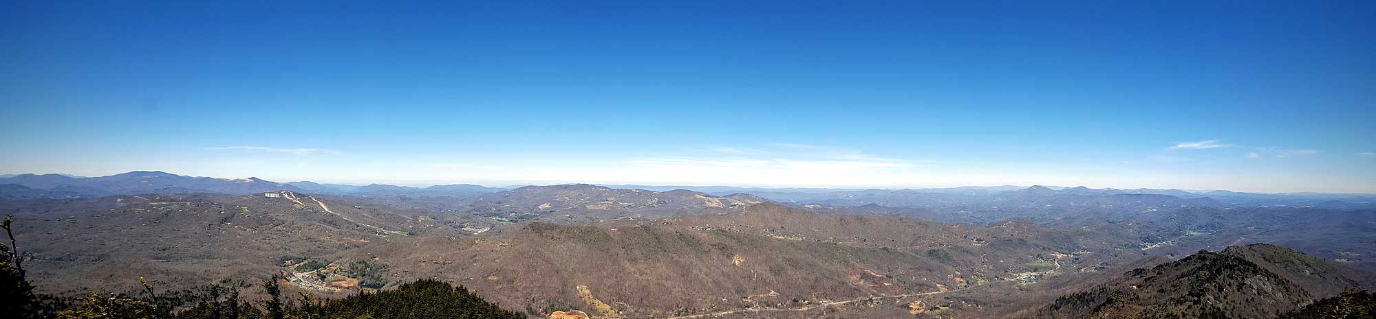
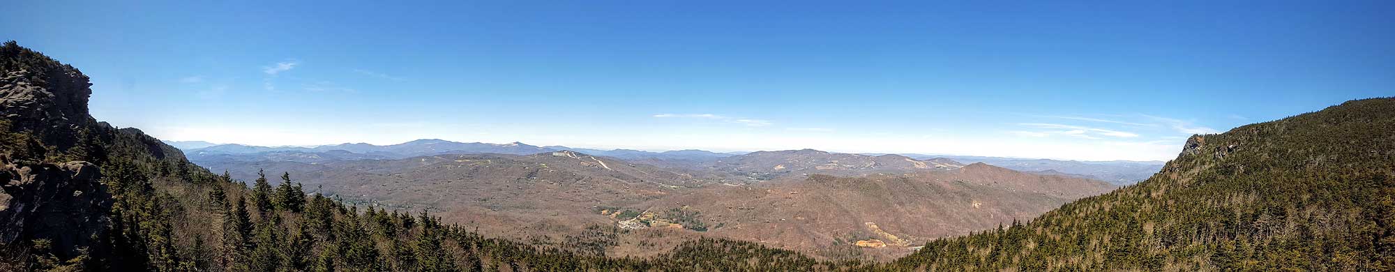
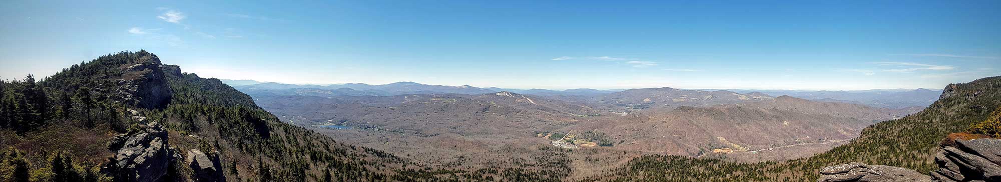
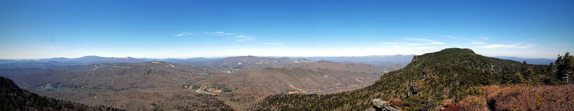
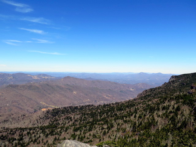
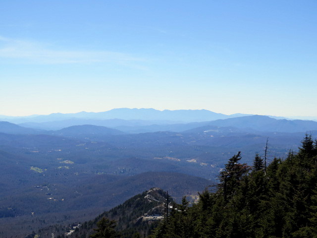
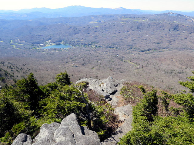
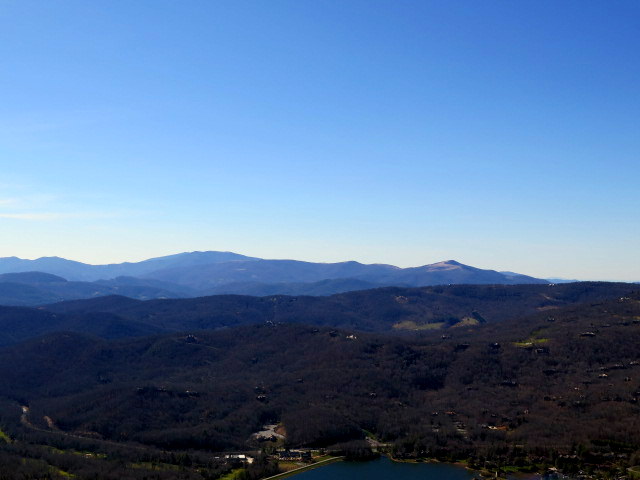
Mile 3.1 – At a T-junction turn left to see the Watauga View. From this cliff you have a panoramic view of the Roan Highlands and also the Amphibolite Range rising high above Boone.
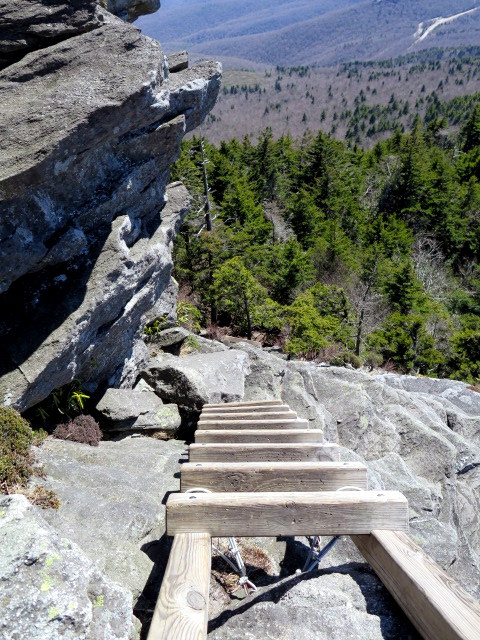
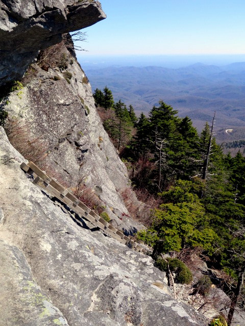
Mile 3.2 – Back on the Grandfather Trail turn left to make the final climb to Calloway Peak. You will have to climb over one rock ledge and use two small ladders along a narrow ridge with cliff views to the left.
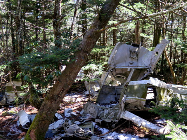
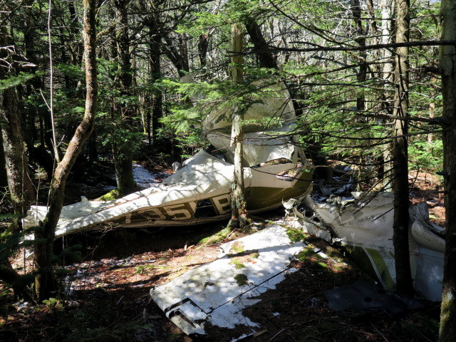
Follow the Daniel Boone Scout Trail (white diamond blaze) east for an optional out-and-back to the site of an airplane crash just below the summit. The way down is assisted by a cable section and three ladders.
Mile 3.4 – Shortly after the base of the third ladder look left through the trees for the remnants of a small airplane crash. The crash occurred in 1978. The parts of the airplane are spread out over a few hundred feet.
Turn around and head up to Calloway Peak to take the Grandfather Trail down to Calloway Gap.
Mile 4.0 – After passing Calloway Gap the Calloway Gap Campsite is located on the left side of the trail and offers platform tent sites. This is your closest option for camping near Shanty Spring.
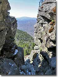
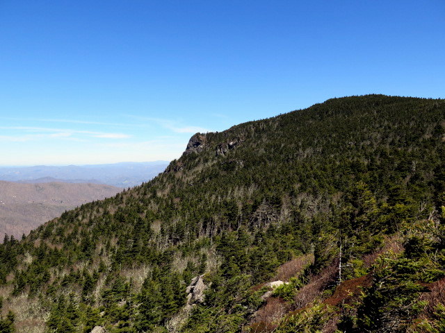
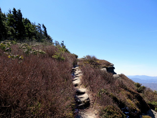
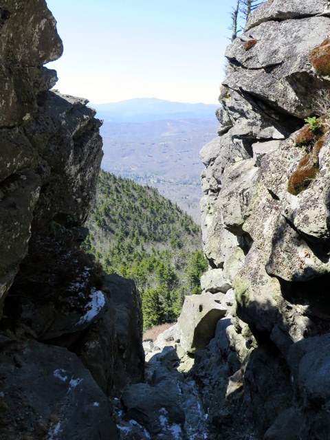
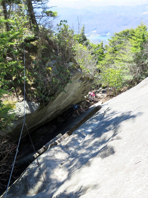
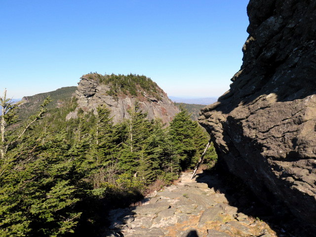
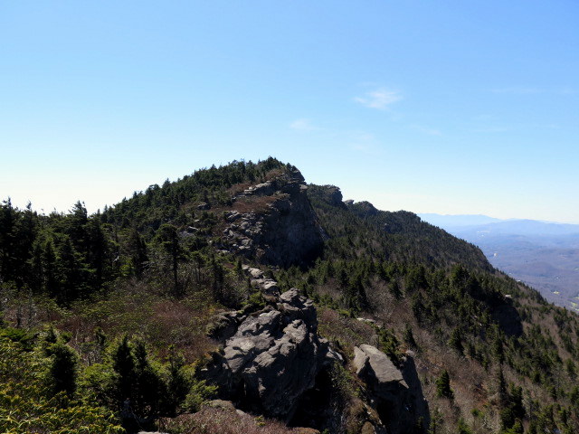
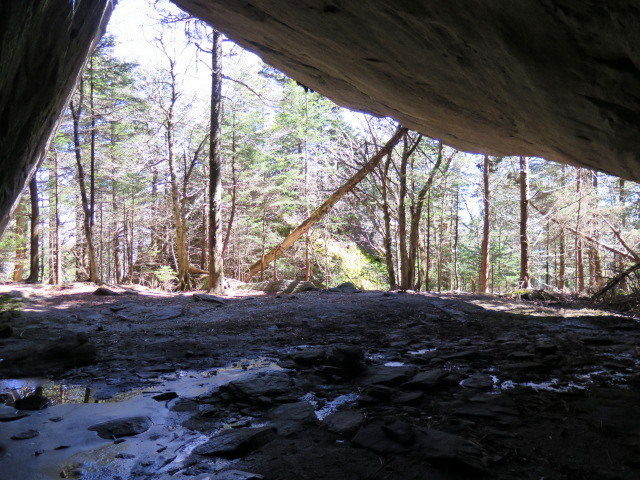
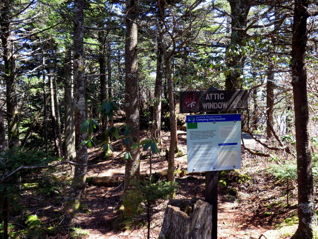
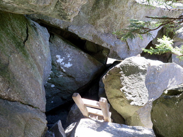
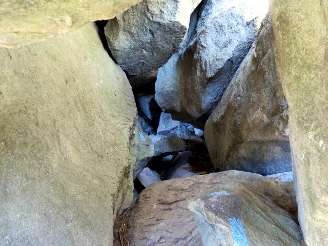
Mile 4.9 – Below Attic Window Peak the trail passes by the Attic Window Campsite before seemingly disappearing at a giant cleft between cliffs. This is the Attic Window and the hike continues down the chasm via a steep rock scramble. The trail curves left out of sight after the initial scramble.
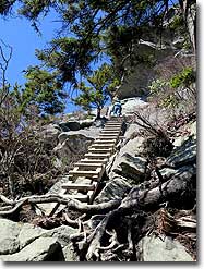
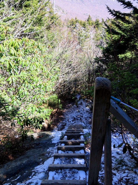
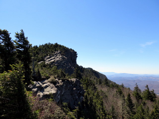
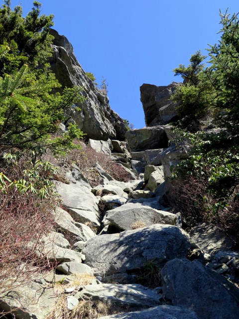
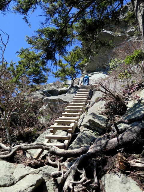
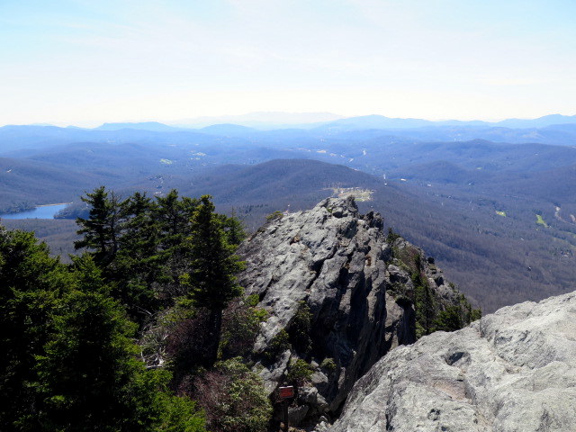
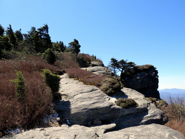
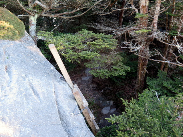
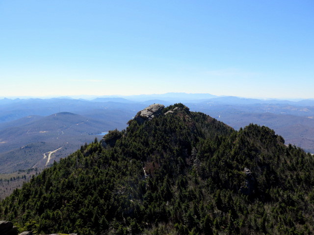
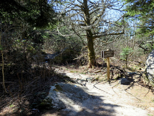
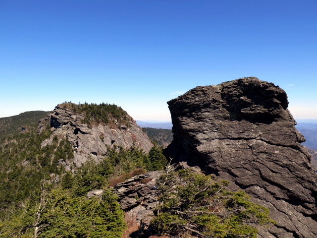
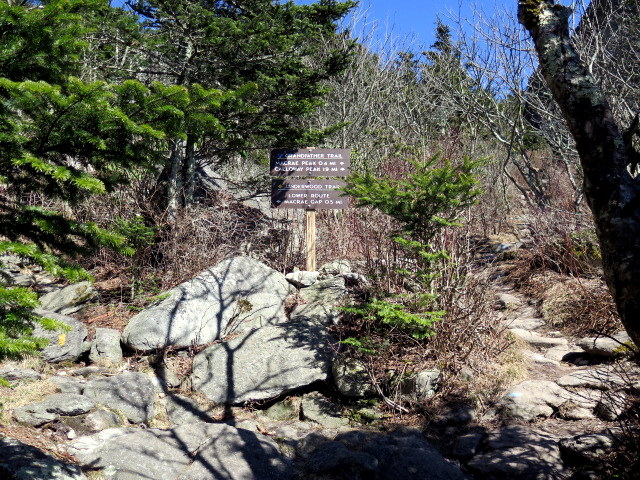
Mile 5.1 – Y-junction with Underwood Trail (yellow diamond blaze) at MacRae Gap. Veer left to continue following the Grandfather Trail to the top of MacRae Peak. As an alternative you can bypass the climb over MacRae Peak using the Underwood Trail. This hike climbs MacRae Peak twice. Initially the climb is steep and assisted by long cable sections and multiple ladders.
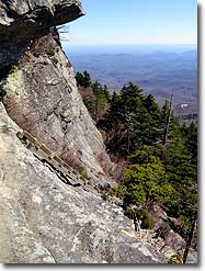
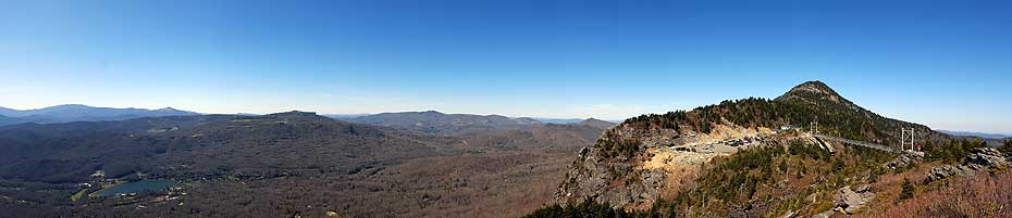
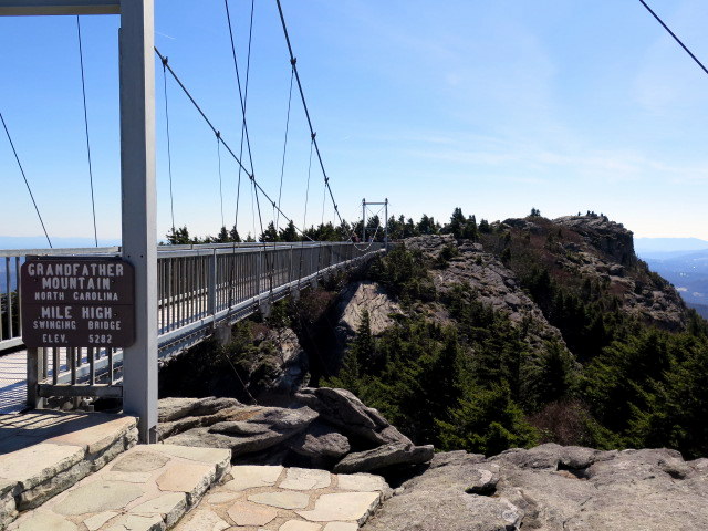
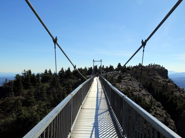
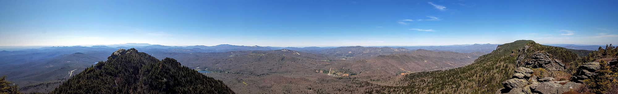
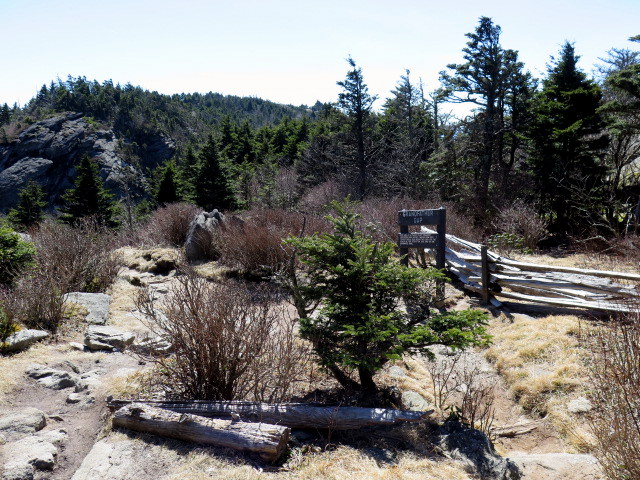
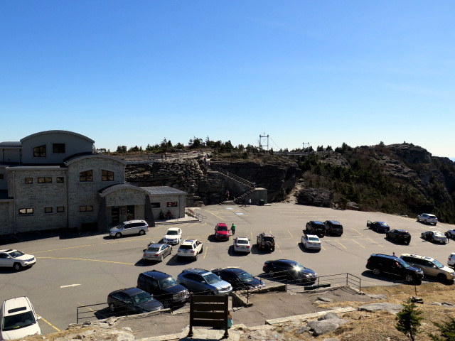
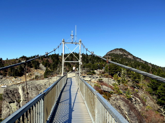
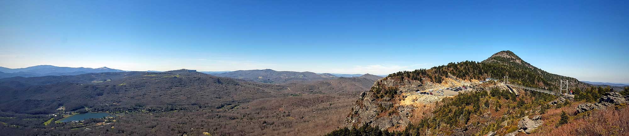
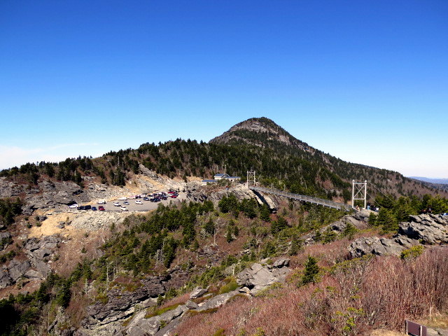
Mile 6.2 – Grandfather Trail ends at the parking area for gift shop and Mile High Swinging Bridge. Cross the parking lot to climb the stairs to the swinging bridge and the cliffs of Linville Peak. Although the bridge is at an elevation of 1 mile, it only stands 80 feet above ground.
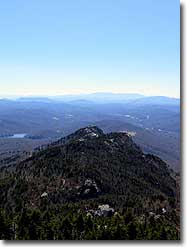
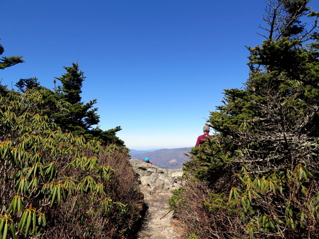
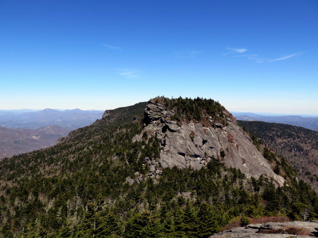
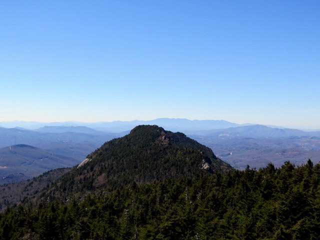
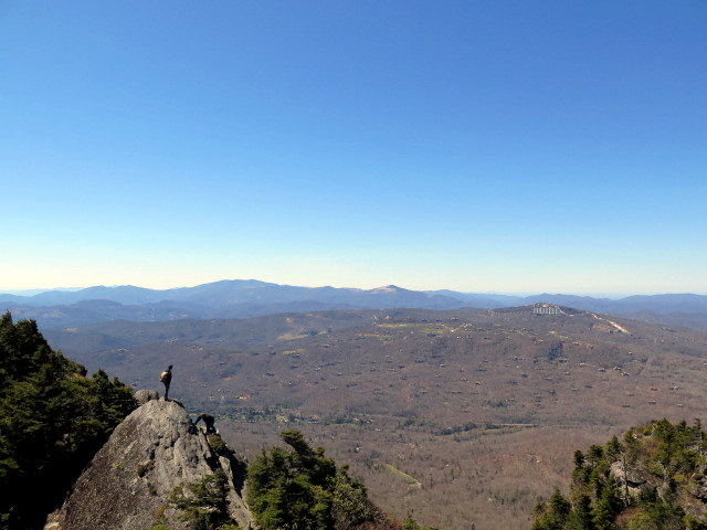
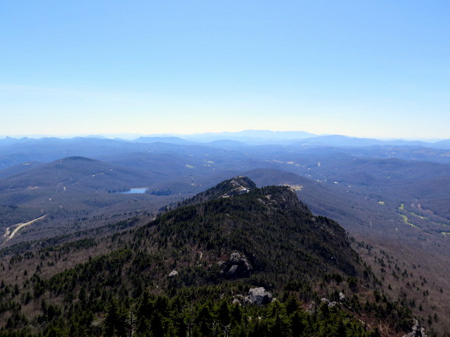
Mile 6.4 – Linville Peak is the 4th named peak on Grandfather Mountain, and at 5,295 feet is by far the shortest. However you get expansive viewssouth and west and a unique view of MacRae Peak towering above the swinging bridge. Turn around and begin your trek back along the Grandfather Trail.
Mile 7.2 – At Y-junction with Underwood Trail(yellow diamond blaze) turn right following the Grandfather Trail up to MacRae Peak. You can bypass the climb over MacRae Peak if you wish by following the Underwood Trail.
Mile 8.5 – Turn left onto the Profile Trail (orange diamond blaze) at Calloway Gap.
Mile 11.3 – Hike ends at Profile Trail parking area.
Video
Mid March
Grandfather Mountain/Profile Trail Hike Comments
Archived Comments
By:Marc
Rating:
Date of Hike: Monday, October 16, 2017
Had to split the hike in half due to rainy/windy conditions closing the Grandfather Trail. Profile trail is a fabulous hike that starts off with a great walk along a stream before the switchbacks begin a mile or so in and continue to the junction with Grandfather Trail. Profile trail had some intense elevation changes and I found the Profile Trail manageable and deeply enjoyable during the fall colors. It was somewhat wet and muggy, with the last mile of the Profile Trail spent in cloud cover due to a morning rain. My partner and I were constrained by time on Tuesday to complete the Grandfather section so we paid the $20/person fee to start it from the opposite direction at the Swinging Bridge. The hike is fantastic and I enjoyed going the opposite direction because we were able to go up the McCrae ladders instead of going down. It was quite intimidating at certain sections due to my lack of experience with a hike of this magnitude. It was a serious challenge mentally and sometimes physically. The ladder section definitely included some shaky knees at times. It's also a good idea to be careful on the bare cliff sections, as it was sometimes hard to find the trial markings and we found ourselves second-guessing ourselves at times.
I would recommend taking the Underwood Trail on the way to the Swinging Bridge and doing the McCrae summit on the way back. I would not have felt entirely comfortable going down the McCrae ladders. Overall, this was the best hike I have been on in NC and plan to do several more of similar rock scrambling and rugged terrain. We will be back next year to do the whole Profile/Grandfather Trail in one day and this hike has definitely lit a flame for us in regards to more difficult hiking. As a rule, bring plenty of water as I did find myself rather thirsty as the trail forced us to slow down in the McCrae section. Took almost 2 hours to make it a mile and a half. This hike is definitely for experienced hikers and was an incredible challenge to someone who had gone on long trails (Black Mountain ridge/Mt. Mitchell so far) but was not fully prepared for the level of climbing/mental tests this trail required of us. It is a must-do hike if you are comfortable and I know we will be doing many more after this inspiring hike.
By:Phil
Rating:
Date of Hike: Tuesday, July 18, 2017
This hike is a must do for any avid outdoor enthusiast! Awesome views around every corner and the trail traverses a variety of ecosystems as the altitude changes. This hike has it all and includes small waterfalls, great flora/fauna, huge boulders and some of the best views in the North Carolina High Country.
We completed a one day, 12 mile out and back from the 105 Profile Trail Parking Lot. This trail is for serious hikers and is very challenging. Take note of the slow pace this trail limits you to, as the Grandfather Trail requires rock scrambles, ladders and cables to complete. I'm on hiking trails regularly and this is the slowest pace I've ever had, averaging 50-60 minutes/mile on the 3 miles along the Grandfather Trail. Plan accordingly and leave early in the morning if attempting the out and back from the parking lot off 105!


