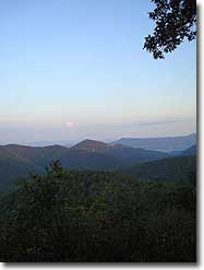
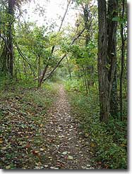
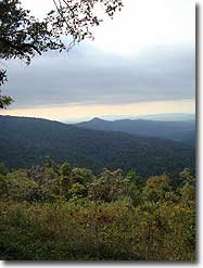
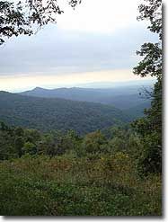
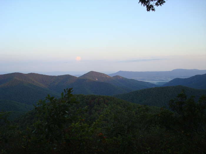
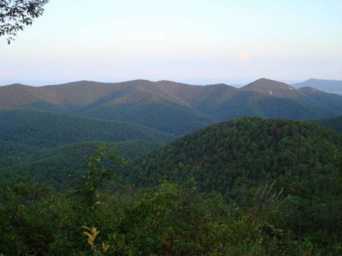
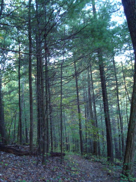
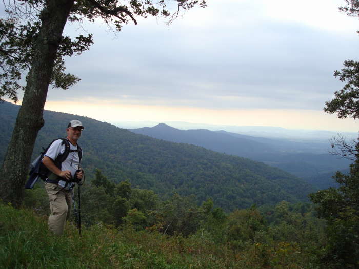
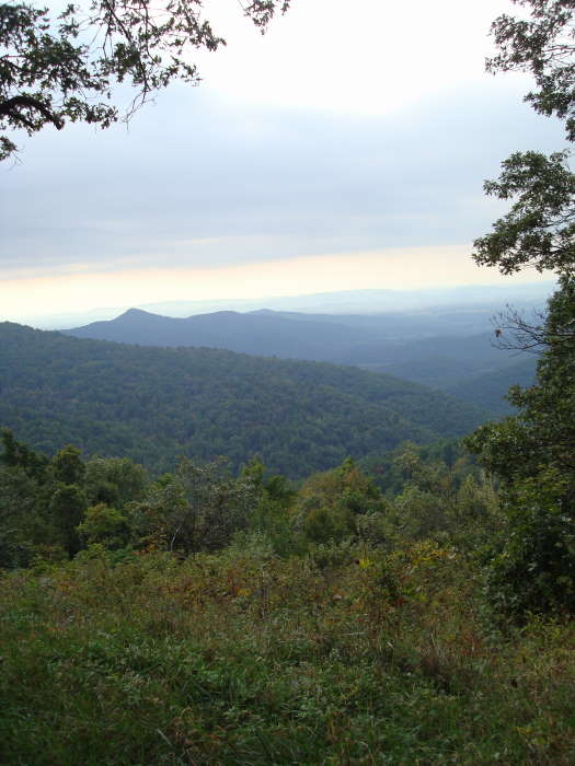
This is a nice hike in the woods if you like solitude. There are a couple of great views at the beginning of the hike at the Big Run Overlook and near the end of the hike as you pass through the Doyles River Overlook on the Appalachian Trail.
The Big Run Basin is the largest single watershed area in Shenandoah NP. 1 inch of rain in the basin equates to 200 million gallons of water to residents downstream.
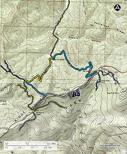
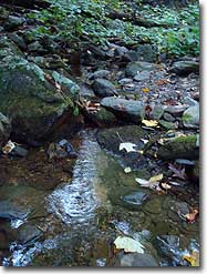
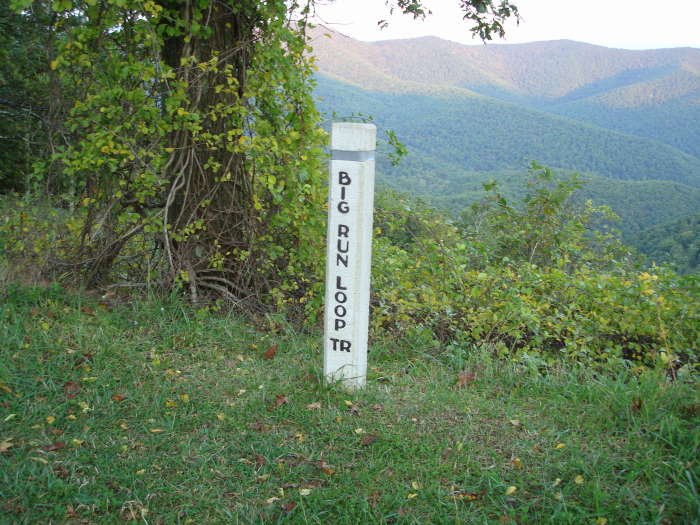
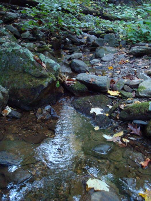
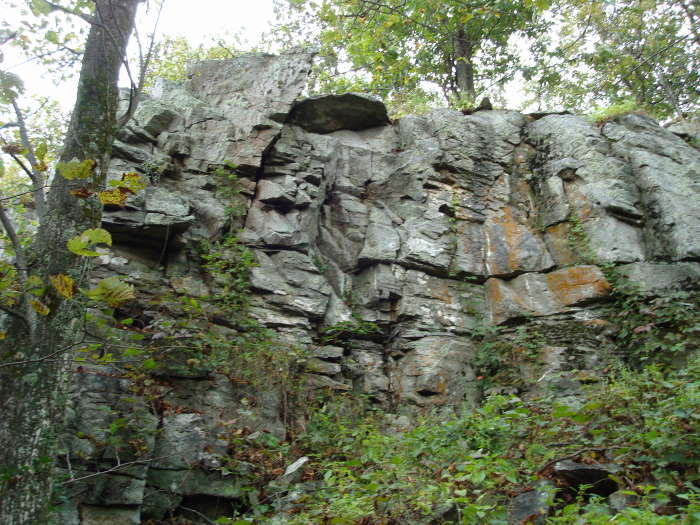
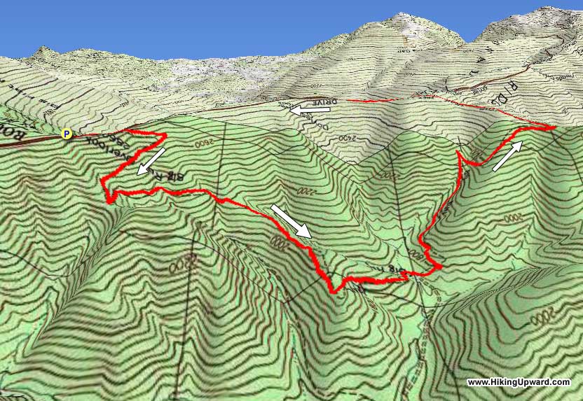
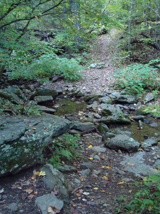
Park at the Doyles River Parking Area and then walk about 100 yards south on Skyline Drive to the Big Run Overlook. You could park at the overlook but there are not many spots there. The trailhead is at the south end of the overlook. Look for the walkway through the wall and the stone trail marker. Head to the left down the blue blazed Big Run Loop Trail. There are a few switchbacks on this gentle stroll down 1,100’ until you reach the first intersection in 2.2 miles. Just prior to this intersection you will cross Big Run which was not flowing much when we were there in late September.
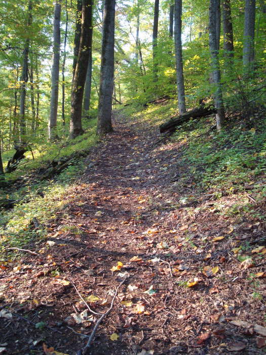
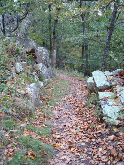
At this intersection, which is about 200 yards after crossing Big Run, bear to the left to continue on the Big Run Loop Trail which is now yellow blazed. There is a little stretch of the next 1.5 miles that is strenuous but for the most part is not too tough as you climb 1000’ to the next intersection. Turn left to stay on the Big Run Loop Trail which is now blue blazed again. It is very gentle from here back to the parking at Doyles River.
In 0.6 miles you will intersect the A.T, bear to the left and in 0.3 miles you will cross Skyline Drive and in 0.5 miles you will go through the Doyles River Overlook with some great views (you may be sharing these views with car viewers). Proceed through the overlook parking area and pick up the A.T. again. In 0.8 miles you will come to the Doyle’s River parking intersection, bear left to arrive back at the parking lot in 50 yards. Bearing right at this intersection would take you to the Doyles River PATC cabin in 0.3 miles. This cabin can be rented from the PATC by non-members.
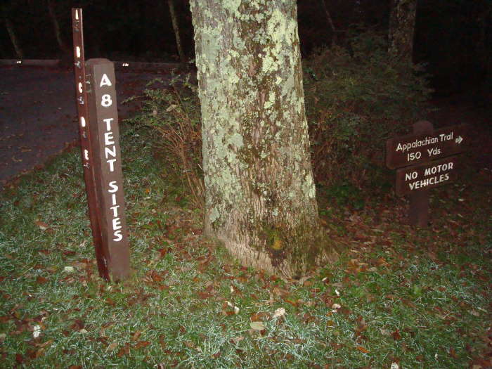
Alternative Starting Point: If camping at Loft Mountain you can take the A.T. South from the Loft Mountain Campground to the Doyles River Parking area. This adds about 1.1 miles each way. We were camping at Loft Mountain so this is the route we took. The spur trail from the campground to the A.T. South starts at the A-8 Tent Sites.
Late September
Big Run Hike Comments
Archived Comments
By:Alex
Rating:
Date of Hike: Sunday, September 15, 2019
Nice, quiet looponly saw two other people, right at the parking lot, the entire time the strong rating for solitude is well warranted.
While humans were few and far between, I did encounter lots of wildlife today. Apart from some deer, I came across one rather recalcitrant and rattling reptile, who despite my best efforts to negotiate mutually agreeable terms, refused to allow passage, requiring a short bushwhack around. A black bear, meanwhile, was far friendlier a cheery hey, bear! was all it took to move him along. The spiders, though, seemed to entirely fail to recognise the hopelessness of their position, erecting extensive silken fortifications every few feet across the middle third of the trail, which while deeply annoying ultimately posed no serious threat.
By:aldikuma
Rating:
Date of Hike: Sunday, July 9, 2017
Another nice hike in the SNP. Only saw one person along the hike outside of the AT - it was really quiet. The ascent is a workout, but not difficult. I enjoyed this short hike.
By:mark
Rating:
Date of Hike: Monday, July 3, 2017
A really nice hike in some beautiful woods. Hiked as described. Lots of beautiful ferns as you hike down and nice groves of trees along the way. Trail was in great shape, though overgrown in a few places, and one of the few trails in this part of SNP that I would be OK bringing out of town guests who dont have hiking shoes. Uphill section is a good workout but not super steep and becomes easier once past the right hand switchback. Saw bear scat at several place along the hike and met a sow and her cub about half mile from Doyles parking lot. Cub scooted up a tree , momas back hair went up, and I cautiously backed up about 50 yards, giving them some time to wander off. I see more bears between Dundo and Loft Mtn than Ive seen everywhere else in the park, but try to closely follow SNP guidance and it has worked for me.
By:JPOutdoors
Rating:
Date of Hike: Saturday, January 21, 2017
I would recommend doing this hike in the winter because you can see all of the mountains due to the lack of leaves. If you do it in the warmer months it will be like walking through a tunnel in the forest because the bush is very dense. Also, the trail can be very narrow at times requiring single file hiking if you are in a group. If you are looking for a quick, nice, get outdoors type of hike this is the one! If solitude is your thing then big run is right up your alley. We only saw on other group the entire loop.
By:Ridgerunner
Rating:
Date of Hike: Saturday, February 7, 2015
I went the opposite direction on this, leaving the uphill for the end.
The write up really tells you all you need to know about this hike. It's a walk in the woods for the most part. I didn't run into a single person on the trail, which surprised me a little, which the weather being in the upper 40's in February.
All in all, i enjoyed it.
By:RyanN
Rating:
Date of Hike: Saturday, July 19, 2014
Great Hike! Solitude is abundant. The downhill is great, real smooth and fairly gradual. The uphill is smooth as well, but still a workout. Trail was in great shape. The tree canopy was thick so we didn't see much of the sky, really gives you the feeling of being in the deep woods. We had one other hiker on our heels initially, but lost him after a bit. No other people for a few hours. A couple of cool stream crossings, enough to keep the dogs all watered up. Didn't see any bear, but heard something large crashing around in the woods just over a ridge out of eyesight. As soon as we finished this an hopped back on the AT to head back to Loft Mtn Campground, we saw over a dozen hikers.
By:D&G
Rating:
Date of Hike: Saturday, July 5, 2014
The description of this hike is quite accurate. The downhill isn't too hard, and the uphill is strenuous, but not insanely tough we did make fairly frequent short stops on the way up to let our heart rates settle down a bit, but these breaks were on the order of one minute or less. You actually cross the stream twice on this hike once at the top of the waterfall(this is one of the prettiest parts of the trail) and once at the bottom. Much of the hike has partially sunny spots, so sunscreen is a must. Overall, this hike isn't anything spectacular, but it's a good workout and was perfect for us after doing a harder hike the day before. It took us 3 hours to finish, with no long breaks, and we were going at a pretty good pace even on the uphill. I think a person would have to be going quite quickly to complete this in 2.5 hours.
By:Michael M.
Rating:
Date of Hike: Saturday, April 13, 2013
Great hike for a novice (me). The second half is a fun challenge with a pretty quick climb. I enjoyed it.
By:M. Greene & BMW
Rating:
Date of Hike: Wednesday, November 23, 2011
Started at 12:00 Finished at 2:15 on a Wednesday the day before Thanksgiving. The Highlight was that we ran into no other hikers, in all truth we were just about the only people on skyline Drive. Very easy hike with no real views and the Big run Creek was more of a trickle. We did not see a bear nor a snake or anything living besides us.
By:Bettina
Rating:
Date of Hike: Thursday, August 4, 2011
We hiked this trail in August and though there were some pretty sections and the no other hikers, it was hot, buggy and the streams were dry. We also saw a bear at the intersection (about 2.5 miles) of the yellow, blue and fire road trails. It was a big, full grown bear about 40 or 50 feet from the intersection very close to the trail. We backed away making lots of noise. It looked at us a went along on its way. After some deep breathing and several minutes of contemplation, we headed down the blue trail to complete the loop. We saw the bear again right off the trail. This time, we headed back to the intersection and detoured down the fire road, walked down Skyline Drive and saw another much smaller bear cross the road. We were glad we did not go down the blue trail. Instead we got back on the AT which completed the loop. I was wearing a bell. My husband thought I was overly cautious but changed his tune after the bear encounter.


