The Old Rag Mountain hike in the Shenandoah National Park is one of the most popular hikes in the mid-Atlantic region. With many spectacular panoramic views, and one of the most challenging rock scrambles in the park, this circuit hike is a favorite of many hikers. But be prepared for the crowds. This hike gets a star rating for solitude, so the best time to enjoy Old Rag is during the week when there are significantly fewer people.
In 2020 the Saddle Ridge Trail was re-routed to the main parking area on SR 600 Nethers Road.
Important:From March 1 - November 30, 2022, visitors to Old Rag Mountain, including hikers on the Saddle, Ridge, and Ridge Access trails, will need to obtain an Old Rag day-use ticket in advance, in addition to a Park entrance pass.Find out more information on our Old Rag day-use ticket FAQ page.Purchase Old Rag Day-Use Ticket Online
The circuit hike listed here follows the popular clockwise loop, however many hikers prefer to do this loop counterclockwise, thereby tackling the rock scramble at the Ridge Trail on the downhill. Either way, the rock scramble can be challenging, being both steep, and requiring climbing through cracks in the rock. If hiking on the weekend, the best time to arrive is by 7 a.m. beating the crowds.
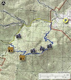
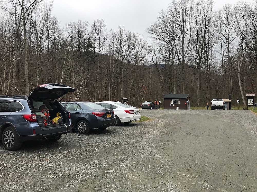
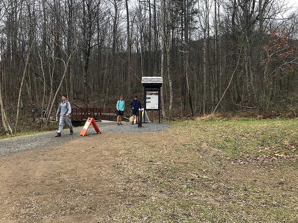
Note: As of 2020, there are now three parking areas on SR600/Nethers Rd: Lot 1 - Upper Lot for horse trailers and RV's, although cars can also park here, the entrance for this one is about 100 yards beyond the entrance to the Lower Lot. Lot 2 - Lower Lot, this is now the main parking lot for Old Rag. Lot 3 - Overflow Lot, only used now when the new Lower Parking Lot is full.
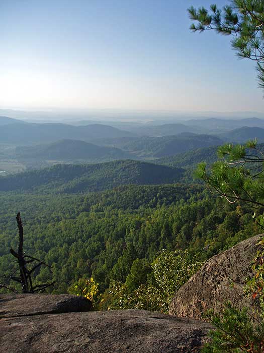
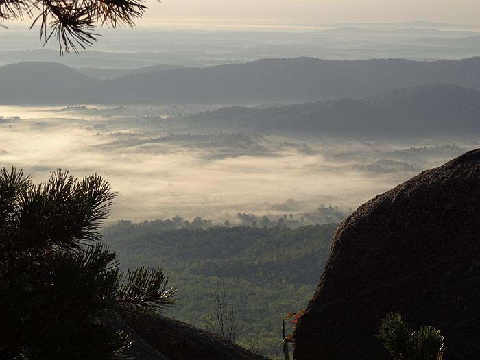
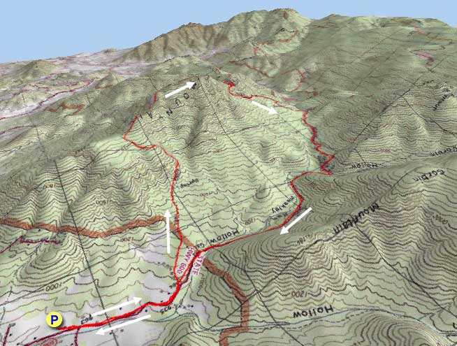
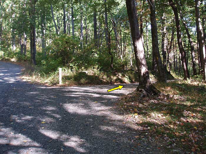
Mile 0.8 - At the intersection of the Ridge Access Trail, bear left staying on the Ridge Trail. The trail will gradually increase in grade and make nine switch backs before reaching the first of many view points. From this first vista to the west, the Ridge Trail will become more rocky.
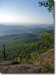
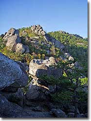
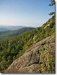
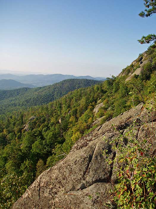
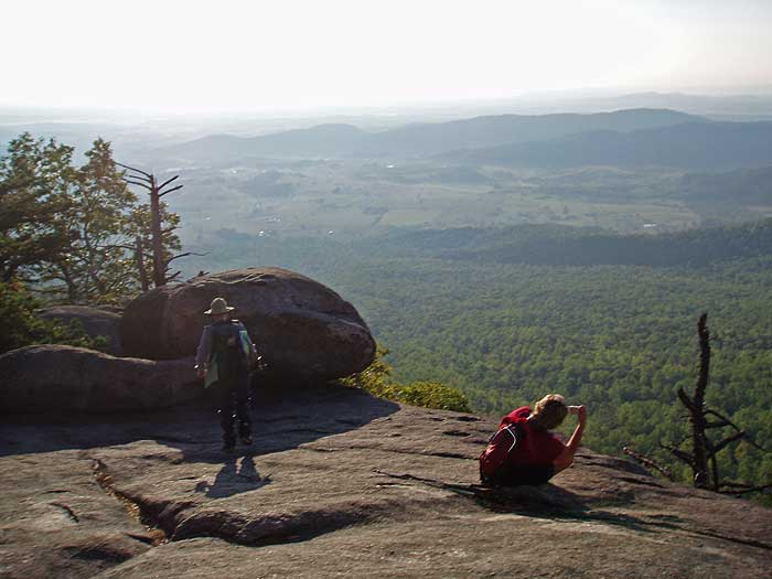
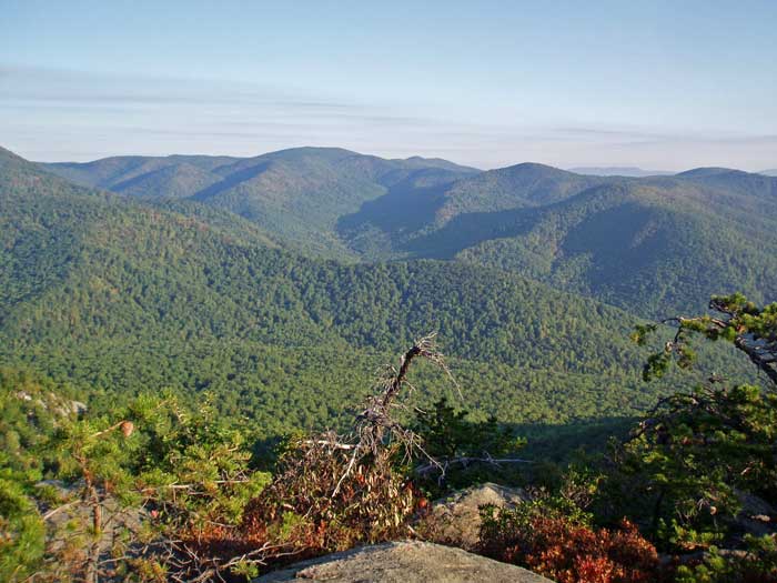
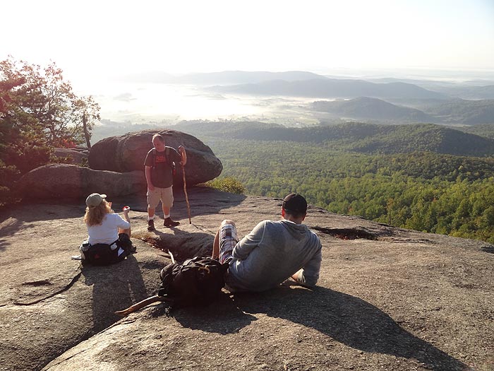
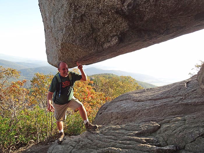
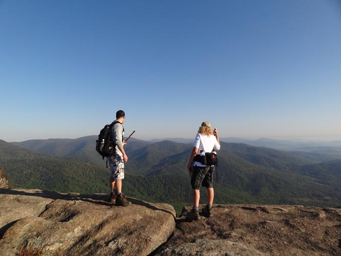
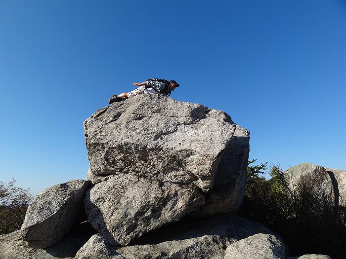
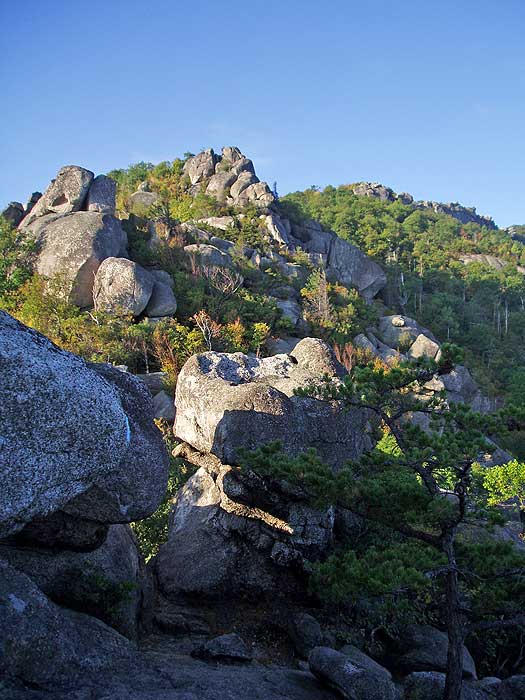
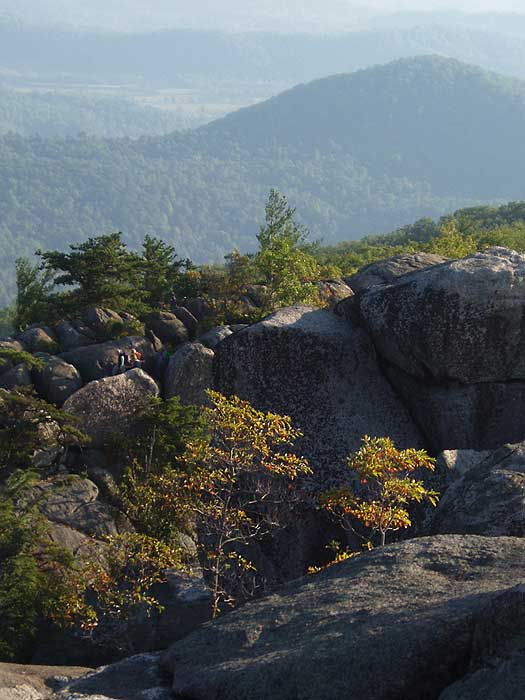
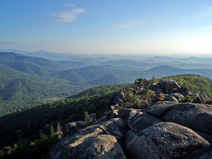
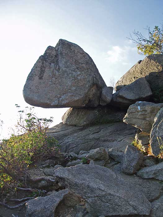
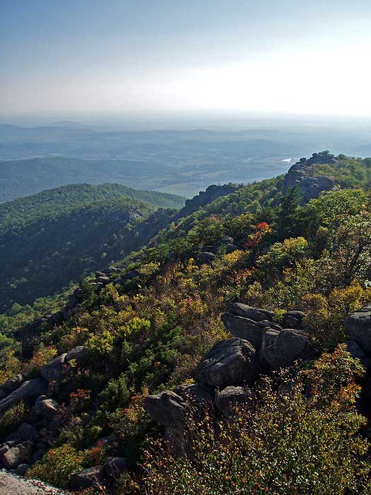
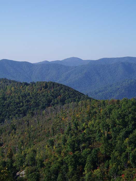
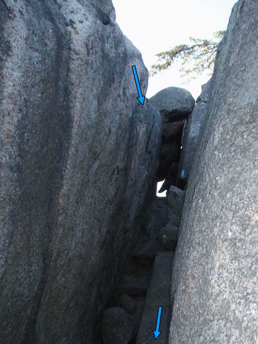
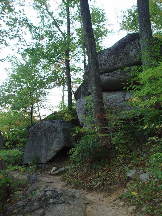
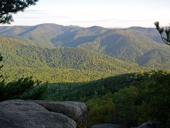
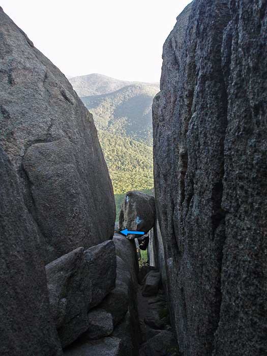
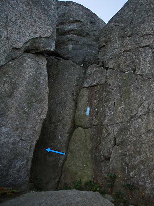
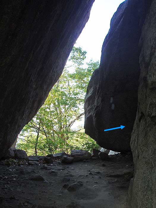
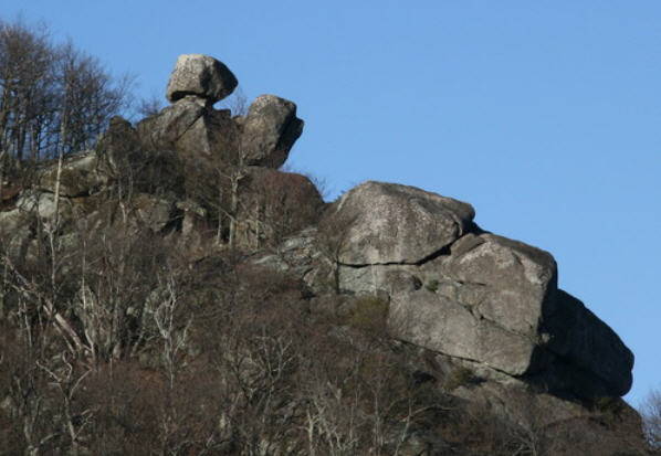
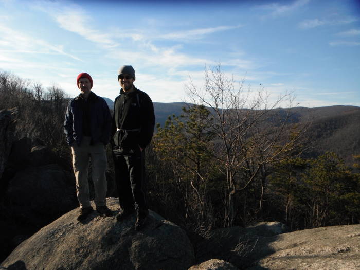
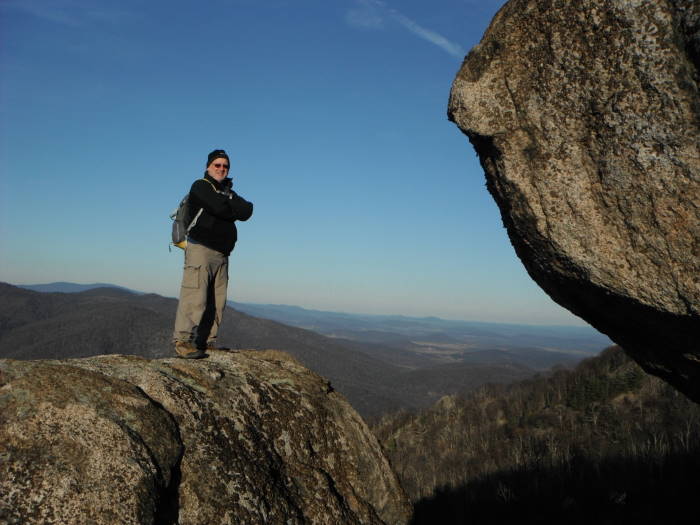
Mile 2.5 - Arrive at the main easterly vista on the ridge. From here the trail becomes a rock scramble with narrow passages and several spots requiring hand over hand climbing. From the easterly vista on the ridge start up the rock scramble, with the first obstacle a 12ft deep small crack in the rock. At the bottom of the crack continue out to the left. Follow the blue blazes passing around the easterly side of the ridge and through another crack where the trail meets a small cliff. From here, the trail will become increasingly steep going through a small cave, then arriving the minor summit where the trail turns left. Be careful to follow the blue blazes, as there are several false trails that lead to overlooks. After passing around the minor northerly summit, the trail is less steep but still requires rock-hopping for most of the remaining 0.3 miles to the true summit where there are several points with 360° views.
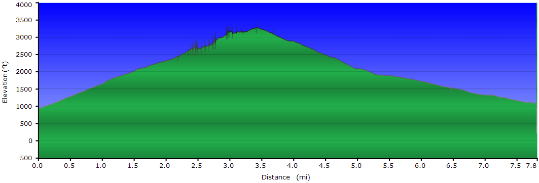
Mile 3.6 - Arrive at the Old Rag Summit, elevation 3291'.
Byrd's Nest Area Scrambling:
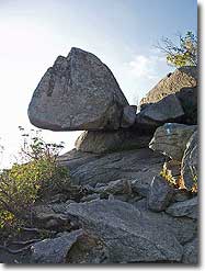
For some additional rock scrambling, consider a side trip near the Byrd's Nest Shelter to see the Balance Rock that you can see from Old Rag and the Saddle Trail. About 20 yards from the shelter is a series of rocks worth climbing and to get a bearing (about 300 degrees with our compass pegged on North) to the Balance Rock, about 0.2 miles away. This will involve some bushwhacking, follow a visible path for about 50 yards or so beyond the first set of rocks and it will bear to the right near a campsite and take you below a cliff and the Balance Rock will be visible to the North West, mostly bushwhacking from this point to the Rock. We did not see an easy way to climb Balance Rock but with a little bit of effort we were able to get on the rock just below it for some great views. The coordinates for Balance Rock: N38.5505 W78.3236, the coordinates for the Byrd's Nest Shelter: N38.5501 W78.3211
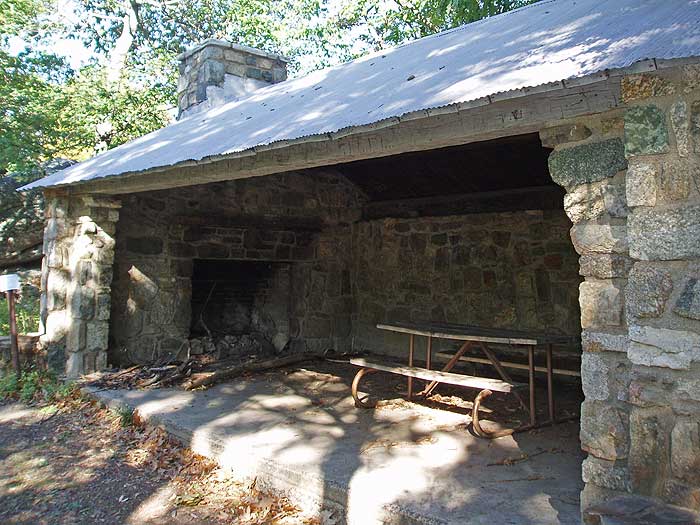
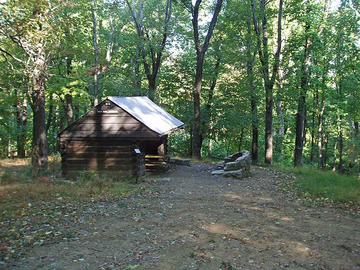
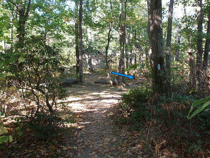
Mile 5.2 - Old Rag Shelter, both shelters are available for day use only. From the Old Rag Shelter the trail widens and follows a forestry road for the 0.4 miles to the intersection of the Berry Hollow Fire road (left), Old Rag Fire Road (straight), and Weakley Hollow Fire Road (right).
Mile 5.6 - Turn right downhill on the yellow blazed Weakley Hollow Fire Road. In 1.2 miles pass the Robertson Mountain Trail, then in another 200 yards the Corbin Hollow Trail. Continue along the Weakley Hollow Fire Road back to the intersection of the Ridge Access Trail
Mile 8.0 - Arrive at the Ridge Access Trail. This intersection has a small parking area that has been closed for many years. Turn right uphill on the Ridge Access Trail.
Mile 8.4 - Turn left on the Ridge Trail back towards the Lower Parking Lot.
Mile 9.1 - Arrive back at the new Lower Parking Lot on Nethers Road.
Video
Old Rag - Saddle Ridge Trail Easterly View
Old Rag - 1st Crack on the Saddle Trail
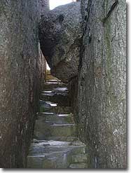
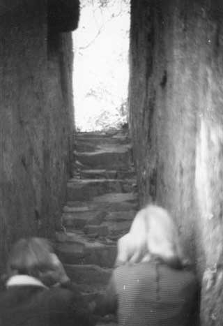
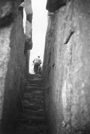
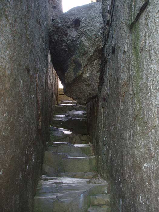
The Staircase - Ridge Trail - Old Rag
Before and after pictures of 'The Staircase' section on the Ridge Trail of Old Rag. The 2 black and white photos were taken in 1968 prior to the boulder falling and partially blocking the route in the early 1970's, then as it appears today in the picture on the right.
1968 Photos courtesy of Henri Weems
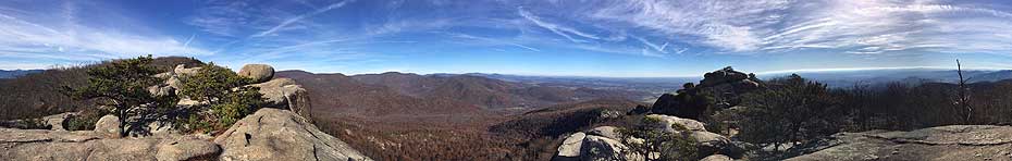
Summit Ridge 360° Panorama
Mid
October
Old Rag Mountain Hike Comments
Archived Comments
By:Yoda
Rating:
Date of Hike: Tuesday, October 8, 2019
In response to the Old Rag parking situation post. The National Park Service and PATC are building a new parking lot for Old Rag to accommodate overflow cars- https://www.nps.gov/shen/learn/news/shenandoah-national-park-announces-construction-begins-on-a-new-parking-lot-for-old-rag-mountain-area-trails.htm
By:Robert Look
Rating:
Date of Hike: Saturday, September 28, 2019
I have heard that there is a new owner of the pasture next to the Old Rag NPS parking lot who is not interested in being in the business of offering paid overflow parking services for the NPS Old Rag parking lot.
The existing NPS free parking lot has approximately 250 spaces. In recent years, on busy Fall weekends, it has not been unusual for several hundred cars to park in the paid overflow pasture.
The parking situation at Old Rag will probably be a rapidly changing situation but based on what I heard, you should not assume there will be the option of paying to park in the pasture next to the NPS lot this Fall.
By:Einar Markussen
Rating:
Date of Hike: Monday, August 12, 2019
Hiked from Nethers main lot and started at 0900 with my wife and some teenage children aged 11 to 19. We are in good shape but we took a few breaks along the upward trek. Temp was 80's and sunny and we were glad we decided to hike on Monday and with school just coming into session in VA. Rock scramble for novice's is more difficult than some would expect. Encountered a black bear about 20 yards off the trail on way down the road past Shelter #2 but it did seem to mind us. TIP# 1: Change socks at summit. GPS showed 10 miles in distance. Start to finish was about 7 hrs. Good luck.
By:Tubal
Rating:
Date of Hike: Friday, July 26, 2019
Arrived around 7 am on a relatively cool Friday in July to a virtually empty parking lot. I ran into no more than two dozen other hikers, mostly at the peak. I have done this hike a few times in recent years, although I'd never go on a weekend as crowds would diminish what has always been a great hike.
A lot more signage warning about bears this time.
A park ranger was at the peak patrolling in relation to bear sightings and noted they were having some bear concerns, one at the peak in particular.
I did not see any bears on 7/26/2019, as I did in early October 2018.
The parking lot was about half full upon my return shortly after noon.
By:Subrata Panda
Rating:
Date of Hike: Thursday, July 4, 2019
i have been there during 4th July 2019 with 5 friends and one kid. This hiking path was great and challenging mainly the rocky part on the top for almost 3 mile . great 360 degree view . It took almost 6 hours for us. I have uploaded my full experience in youtube to see you can click below link :
https://youtu.be/L-t_21mc0Rw
By:Mark D
Rating:
Date of Hike: Wednesday, April 17, 2019
I've hiked Old Rag over a dozen times, and it never gets old. It's one of those hikes that truly rewards your effort - with great views, challenging rock scrambling, and a sense that you really did something challenging when you make it back to your car. It's the one hike that anyone who visits the greater DC area must do.
As others have noted, the trail can get very crowded... so get there early and pack your patience. Stay away from weekends and holidays, and whenever you go, plan to be at the parking area no later than 8:00. Since it's so crowded it's important to practice good trail etiquette. Don't follow too closely. Offer to let fast movers pass you. Give uphill hikers the right of way. Alternate uphill and downhill parties at the tighter bottlenecks, just like we do at a four-way stop. And don't act like you own the place... lower your volume, give others their space, and share the best photo spots.
By:Ian
Rating:
Date of Hike: Sunday, April 7, 2019
Left home at 3 am to be there by sunrise. Drank coffee before the hike and spent 5 hours trying not to crap myself. 4/5 stars would hike again
By:LittleFoot
Rating:
Date of Hike: Tuesday, March 26, 2019
You could say this hike is almost perfect, to me it is. I left home around 1:30 a.m. and arrived at the parking lot at 4:30 a.m. I was expecting the lot to be full or extremely packed but to my surprise, there wasnt a soul there. You have to pay fifteen dollars to park here, which is a bit outrageous. I assume its due to the amount of foot travel on the trail which means a lot of trail maintenance and a lot of trash pick up, so please keep this trail as clean as you found it. You also have to walk 0.8 up Nethers Road, which will add 1.6 miles to your trek. Despite the parking fee and the walk up the road, the trail itself is totally worth it. You eventually find yourself at the trail head sign so heave a big sigh of relief and also take a deep breath because now the experience has really begun. You can either go left or right, the sign recommended going left so thats the way I proceeded. It is still dark at this point so I cant comment a whole lot on the first two or so miles up. I could make out some large and interesting rock formations however. Im sure theyre amazing to look at during day, just one of the many reasons to go back. The first section of the hike is merely walking in the woods, it is not the easiest however. The trail starts off moderate but then it starts to gain a good amount of elevation. I was pouring sweat before I came to the first overlook. I did not get to enjoy the first few overlooks due to the darkness, however the stars were out so I did get to enjoy them somewhat. I told myself Id return this way but I chose not to after the rock scramble. You will think youre at the rock scramble before you get to the main scramble due to it being very rocky at this point. I can recall having to wedge myself through a rock formation. I finally reached the first great overlook around 6:30 a.m and it was still pretty dark. The sunrise wasnt until around 7:00 a.m. so I decided to take break here. Youll want to take a break due to what you just hiked and also due to the overlook. It is truly amazing, its the point where you know youve made it and theres no turning back now. Admire the scenery here and get ready, the rock scramble is just ahead. I climbed over a massive rock at this point to get an even better view. The rock scramble begins with a wedge between two rocks. At first glance, it looks impossible. If you look harder there is actually a step in the rocks that makes getting through wedge pretty easy. After this it gets much harder, but the views get even better. You will have a view after almost every hump on the mountain. The sun was rising at this point and I will say, seeing the sunrise here is an experience in itself. This rock scramble is not for beginners. I found myself on my hands and knees climbing some of these rocks so please use extra caution. I even had to stop for five minutes to contemplate how I was going to climb up one the rocks. I believe this is probably where it gets backed up on busy days. You will also go through a cave and have to crawl under rocks. I kept thinking I was at the summit after every hump because it feels like it. I finally reached the true summit and what a relief it was. Even though the scramble is the hardest part of the hike, its also the most fun. The summit is as beautiful as the hike up to it, and theres so much to explore. Be careful not to walk on the roped off areas up here, theres fragile vegetation that grows at the summit and should be left alone. Enjoy your time here and take in what youve just accomplished by looking at the humps of Old Rag Mountain. The trail is mainly downhill at this point with some flat areas as well. This is the easy part. I eventually came to the first of two shelters. This is great spot for lunch, the inside of the shelter is not very large however. There is also a massive set of rocks that are easy to climb and they offer another great view. I continued on to the next shelter and this one definitely has more room to relax. There is also another viewpoint but I cannot remember if its before or after the second shelter. You can also see Old Rag almost the entire way back. Getting to see what you just climbed is a great feeling, the mountain almost looks like a camel with many humps when you look at it this way. After this section, you will reach an intersection and there is also a sign with information about the community that lived at Old Rag. Take a right on to the fire road and just take it easy. Trust me, you will be worn out by this point. I didnt see a single soul up until this point and I only saw two groups of hikers. The fire road is only about two and a half miles but it does feel like longer. My only complaint of the hike is the fire road so, if you feel like you can take on the scramble again, I would suggest returning after you reach the summit. Doing the scramble downhill is much harder I assume. The fire road does have a small surprise waterfall near the end though. Its worth a picture or two. I finished the hike around 11 a.m which totaled me at six hours and fifteen minutes of hiking. I would recommend giving yourself more time though, at least eight to ten hours. Overall, this is a wonderful hike, but I believe a better word is experience. This is something everyone should do if they feel they are able. I hope to return time and time again!
By:Mark
Rating:
Date of Hike: Friday, December 7, 2018
I've viewed many videos about Old Rag Mountain, and read even more blogs over the years. This hike has been on my list and at 60 years old I finally had an opportunity to hike Old Rag Mountain. I will tell you all the videos and blogs don't even come close to being there in person and conducting this amazing hike. I conducted this hike on Friday 07 Dec 2018, there was snow and ice on the trail from about 2-3 days ago which made it even more beautiful, and maybe even a little bit more difficult. The trail marker or blazes (blue/greenisj in color @ times are hard to spot, it's not hard to find yourself stopping and looking for the next marker, go slow and be careful. There were only about 5 other hikers that I saw during the day. The Rock scramble is challenging and adventurous when hiking solo (I highly recommend going with someone). The views from many locations on the trail are simply amazing, and from the the top of Old Rag Mountain are breath taking and worth every step. I parked at the Berry Hollow Fire Road parking site, and was the only car in the lot when I started my hike at 0930 and returned to my car around 4pm. I had the time of my life out there hiking, it was so peaceful and enjoyable. I can't wait to do it again soon!
By:Geoff
Rating:
Date of Hike: Sunday, October 7, 2018
Old Rag is still an epic hike of roughly 9 miles in 4 sections: (1) a traditional Shenandoah hike up to just below the ridgeline, (2) the entrance to the ridgeline and its rock scrambles, (3) a traditional descent to the fire road, (4) the fire road. The entrance to the ridgeline has two somewhat tricky spots, which can back up if there are crowds: a keyhole, and a downclimb into a slot. Once on the ridgeline, you can take different routes across the boulders if you are adventurous. The 2.5 miles along the fire road can be a bit of a slog if your feet are tired.
The reason for my low rating is simply that Old Rag has become too popular. When I first started doing it many years ago, there were 5-10 cars in the parking lot. Now the parking lot has been moved to a field 3/4 of a mile down, and this past weekend, there were probably 500 cars when I started at 10 AM. If you expect to find some solitude and quiet, you will be disappointed. When the parking lot is full, there will be a lot of noise on the trail, many groups of people, and uneven trail etiquette: following too closely, faster groups passing then stopping before passing again, slower groups not yielding to faster groups, people stopping in the trail, big crowds at the overlooks and all along the ridgeline.
If these sorts of things do not bother you, you will have a great time. But if you would prefer to have a more serene experience, be aware that Old Rag can be very crowded on nice days on weekends and holidays.


