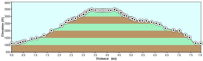
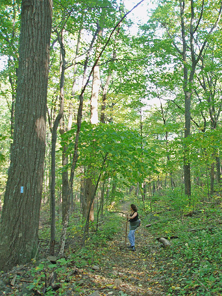
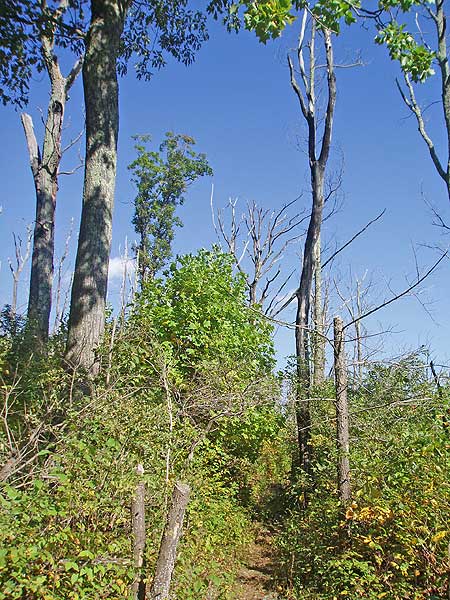
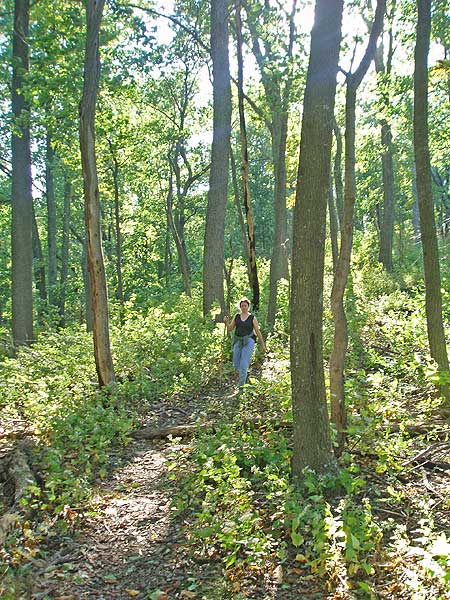
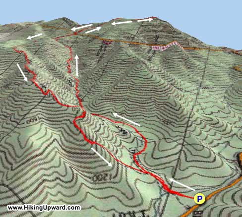
The Buck Hollow/Mary's Rock loop in the SNP can be broken into two hikes; or done as one large loop. The Buck Hollow/Buck Ridge main portion of the hike offers much more solitude than the section from Skyline Drive up to Mary's Rock. However, both offer great scenery.
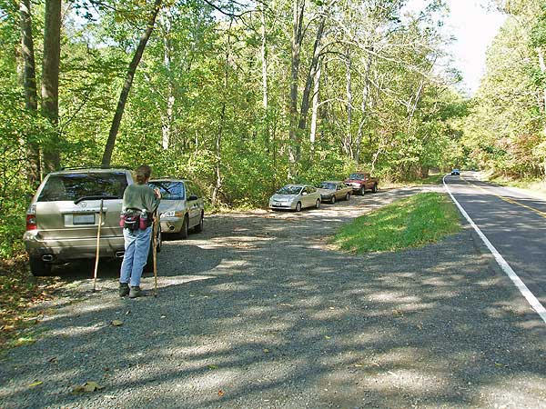
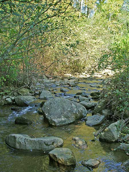
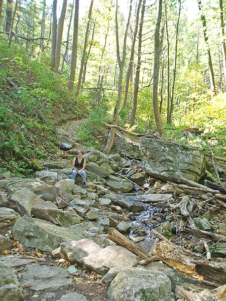
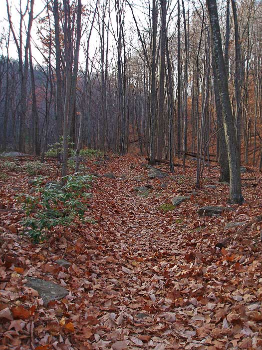
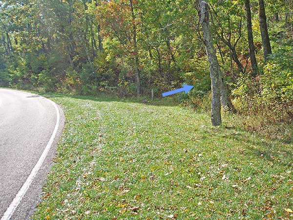
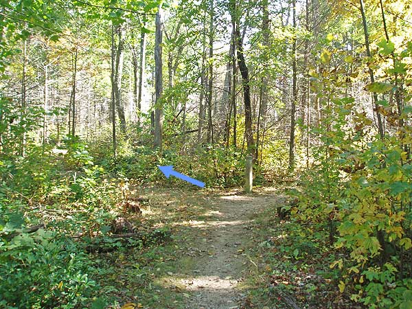
From the parking area on US211 head up the Buck Hollow Trail crossing Buck Hollow stream and in 0.2 miles come to the intersection of the Buck Ridge Trail. Stay right remaining on the blue blazed Buck Hollow Trail.
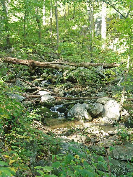
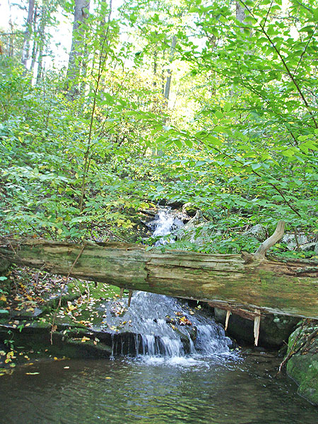
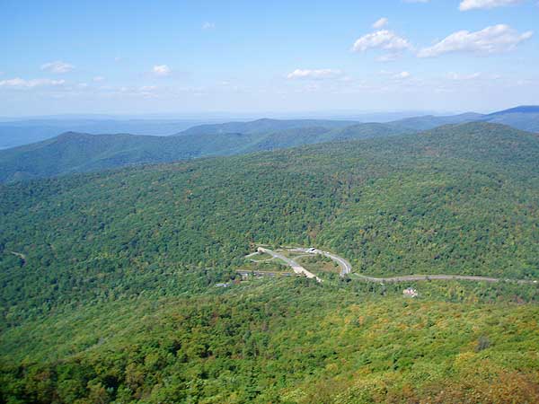
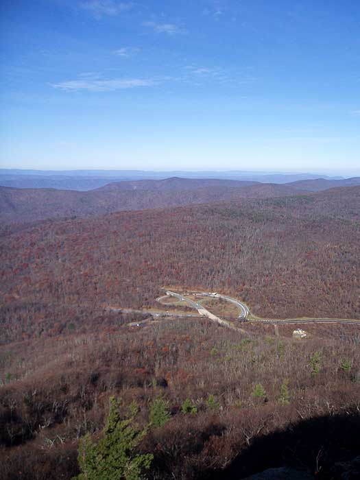
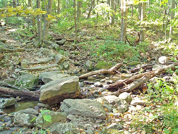
The Buck Hollow Trail climbs the valley crossing the stream several times before becoming steeper and arriving at Skyline Drive and the Hazel Mountain parking area. At this point you can either continue up to Mary's Rock or shorten the hike by 3.0 miles and turn left on the yellow blazed Hazel Mountain Trail.
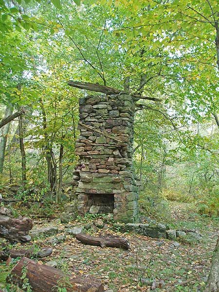
To continue up to Mary's Rock cross Skyline Drive, walk 50 yards left uphill and turn right onto the Meadow Spring Trail. Head uphill on the Meadow Spring Trail for 0.6 miles passing ruins of an old homestead about halfway before meeting the intersection of the white blazed Appalachian Trail and ridge line.
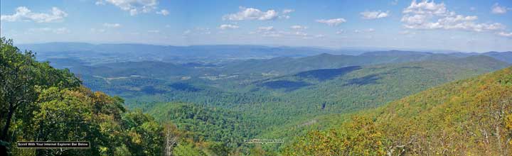
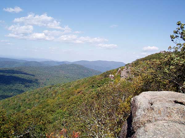
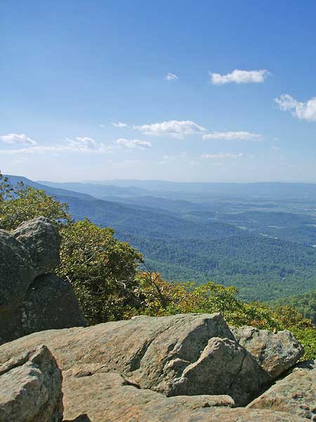
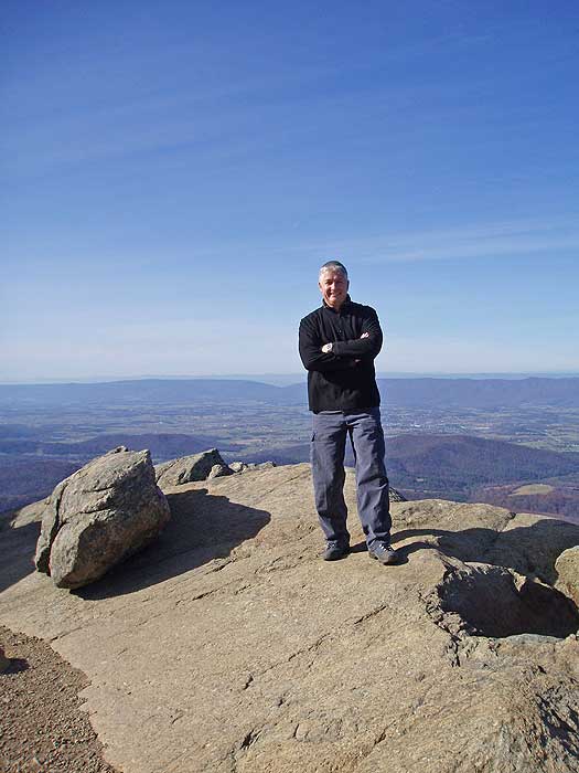
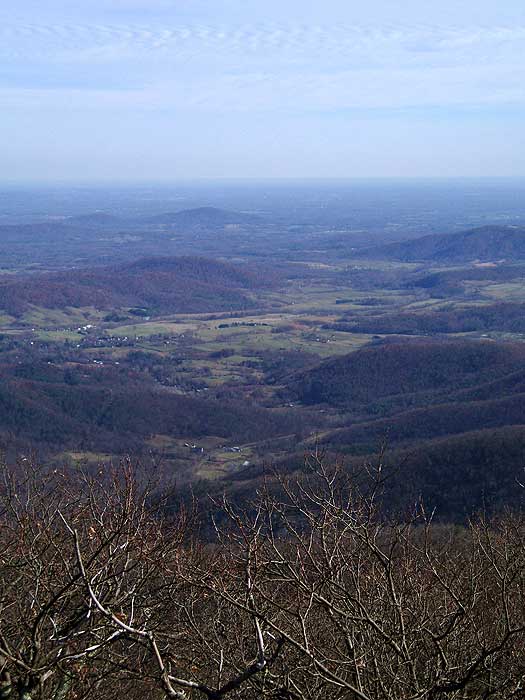
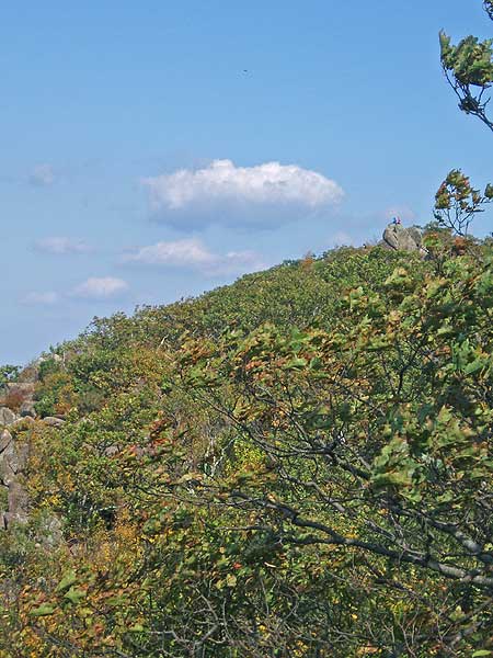
Turn right on the AT following it for 0.8 miles before arriving at the junction of the Mary's Rock Lookout Trail. Turn left uphill on the Mary's Rock Lookout Trail for 0.1 miles and come to the Mary's Rock vista.
To return, retrace your steps back along the AT and down the Meadow Spring Trail to the Hazel Mountain parking area on Skyline Drive. To continue stay right through the closed gate onto the yellow blazed Hazel Mountain Trail and in 0.5 miles come to the intersection of the Buck Ridge Trail.
Go straight on the blue blazed Buck Ridge Trail as it continues downward on Buck Ridge. The last 0.5 miles of the Buck Ridge Trail is very steep on loose rock so watch your footing. Arrive back at the intersection of the Buck Hollow Trail you ascended earlier 2.5 miles from where you left the Hazel Mountain Trail.
Turn right on the Buck Ridge Trail and arrive back at US211 and the parking area in 0.2 miles.
Mid October
Early December
Buck Hollow Hike Comments
Archived Comments
By:Elissa and Zippy
Rating:
Date of Hike: Thursday, April 18, 2019
The directions and details above are perfect to follow. We found the parking lot without any problems (however you do lose cell reception so be sure to screenshot the directions). The first part of the hike (Buck's Hollow) was longer than anticipated (~4 miles) but very secluded. My dog enjoyed swimming in all of the streams! The last part of the trail (Buck's Ridge) was extremely steep going down however, there are man-made steps that help you descend. Overall, a great hike and an accurate description above!
By:Greg M
Rating:
Date of Hike: Monday, January 1, 2018
This is a pretty awesome hike, but a bit easy to get lost in. As long as you follow your directions and don't miss your turn when coming down from the viewpoint, you're golden. Excellent views.
By:Alec U
Rating:
Date of Hike: Saturday, November 18, 2017
Great views once we reached the top! My friends and I (about ages 23-25) were going to do the shorter loop inside the SNP but decided to test our youth.
Took us about 2 hours to get to the top, with a couple of stops for our pups. Gotta say that I would up the difficulty coming from 211, I would say around a 4, as me and my friends are all athletes and this caused us to stop a couple times, not nearly as bad as Big House Mountain.
Would definitely hike this trail coming from SNP, but if you want a challenge/workout, go from 211!
PLH y'all
By:Sean
Rating:
Date of Hike: Monday, October 16, 2017
I hiked this as described. Interesting to have the same general route to and from the parking area, going out in a hollow and coming back on a ridge. Coming back, closer to the parking area, are the famous 600 steps. I can't imagine the work that went into constructing these. I was glad I had my two hiking poles while on them to 1) take some of the impact off my knees, and 2) help prevent slipping forward on the steps -- some steps have loose round gravel on them and my feet started to slip forward a few times. Don't go bounding down the steps. At the bottom of the steps I didn't see any blazes and it was not clear to me which way to go -- you want to go generally right along a stone waterway where soon you will soon see the blazes again. Mary's Rock is a great feature with a nice view looking down on the park's Thornton Gap Entrance Station.
By:Hobo Hiker
Rating:
Date of Hike: Saturday, October 14, 2017
FOG, But still the best views on Skyline drive. I drove in on 211 and past the bottom parking area. Nobody at the 211 parking around 7:30am and still empty around 2pm. Second time doing the hike from the Thorton Gap parking lot to the Pinnacles. We got to Mary's rock around 9am and had it to ourselves. The trees from Mary's rock were still green, not much Fall color. At 2pm coming back from the Pinnacles the Mary's rock overlook was basically standing room only, about 100 people and crowded. Lots of fog between 7am and noon in valley. We were above the fog on top part of the trail the AT part. Couldn't see into the valley until about 2pm when the fog burned off. I was told by some hikers that the day before the view was completely fogged out they couldn't see anything. We did encounter lots of bugs\nats so wear some bug spray. The Meadow Spring\Buck Hollow parking was full around 2pm when we drove by. People parking on the grass. I asked a ranger once if it was legal to park in the grass beside the road. The ranger said as long as your car is completely off the road you should be ok.
By:Hobo Hiker
Rating:
Date of Hike: Saturday, October 7, 2017
I did this hike from the Thorton Gap/Panorama parking lot. It was a 2 mile climb up with no flat zones but well worth the view from Mary's rock. I could feel my legs working but not too bad of a climb. Absolutely the best view in Northern Virginia, breath taking. Some breaks in the trees on the last 1/3 of the trail that provided spectacular sneak peaks. I would rate the hike as moderate from the parking lot. Other reviews said there was a lot of rock scrambling but there is only rock scrambling if you go past the overlook to the higher point of Mary's rock. From the top parking lot to Mary's rock summit is fine for kids.
By:Suzanne
Rating:
Date of Hike: Friday, August 4, 2017
This is great hike and well worth the steep climb from 211 to Skyline Drive and then from Skyline Drive to Mary's Rock. The first part of the hike is spectacular! Beautiful fauna, rolling streams, and the sound of gently rushing water. The last half of the trip up to the parking area is steep, no doubt about it, but very doable.
The vistas on the second part of the hike, on the way to Mary's Rock itself are amazing. Today was crisp, sunny day, with no haze. Probably about 8 - 12 people at the rocks. But there's plenty of space to spread out, and it didn't seem crowded to me.
I did not enjoy the return trip (the loop) as much. Over 600 stairs, with loose gravel and rocks on each stair, made for slow going. I was very careful yet almost wiped out several times. Without hiking poles it would have been impossible to descend. Next time I will make it an out and back hike.
By:Danieamell
Rating:
Date of Hike: Saturday, June 24, 2017
Ran in to a bear on the trail less than half a mile from the summit. Keep an eye out. The lack of crowds made for an otherwise great hike.
By:Jamey
Rating:
Date of Hike: Sunday, May 21, 2017
One of my favorite hikes I did it in April and again in May. I went up Buck Ridge and down Buck Hollow, omitting the trip to Mary's Rock, which is overcrowded. The climb up Buck Ridge was not nearly as hard as I expected. The stairs help, and the mountain laurel, pine trees, and interesting rocks are so pretty I barely noticed the climb. Descending Buck Hollow, after the initial part near Skyline Drive, is lovely. It's like walking in a huge forest bowl, and the brook adds to the beauty. The highlight of my May hike was the azaleas and, especially, the ubiquitous profusion of blooming mountain laurel. Beautiful. It was my last training hike before heading to Canada to hike along Lake Superior, and it served me well.


