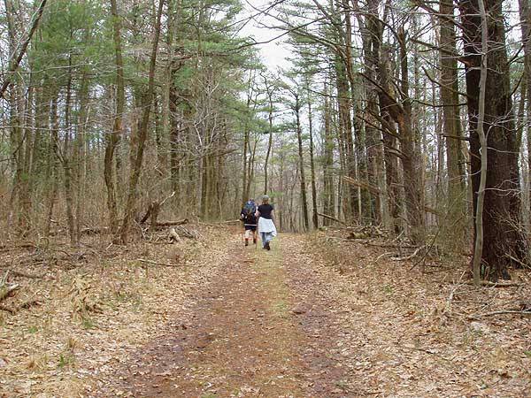
While this hike may not have the sweeping vistas you often find
on other Shenandoah National Park hikes, it features great trails
that wind through scenic valleys. For a more scenic route also consider doing the hike counterclockwise and taking the Little Devils Stairs Trail instead of the Keyser Run Fire Rd.
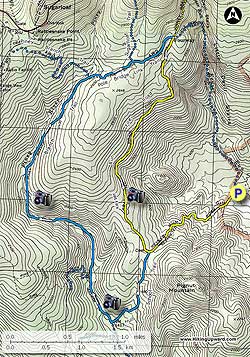
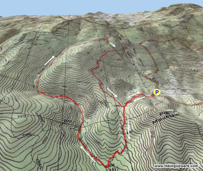
Mile 1.2 - Veer left on the Hull School Trail for 0.7 miles downhill
to the junction of the Piney Branch Trail.
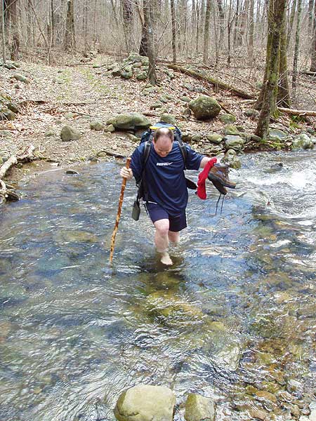
Mile 1.9 - Turn right on the Piney Branch Trail and in 200 yards cross Piney River. At 0.4
miles on the Piney Branch Trail the Piney Ridge Trail will
come in on your left. Continue straight for another 1.0 miles
where you will cross back over Piney River.
Mile 3.3 - Ascend the Piney
Branch Trail for another 1.3 miles on the right side of the
valley until coming to the junction of the Poll Bridge Link
Trail on the right. The Piney Branch Trail turns left.
Mile 4.6 - Turn right on the Pole Bridge Link Trail and pass the Sugarloaf
Trail on the left in 0.4 miles.
In another 0.5 miles arrive at the junction
of the Keyser Run Fire road.
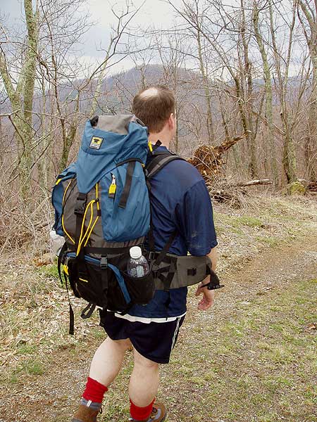
Mile 5.5 - Turn right on the yellow blazed Keyser
Run Fire road and begin your descent for the 2.5
miles back to the intersection of the Hull School Trail
and the Bolen
Cemetery.
Mile 6.8 - Turn left down the Keyser Run Fire road for the
final 1.2 miles back to the parking lot.
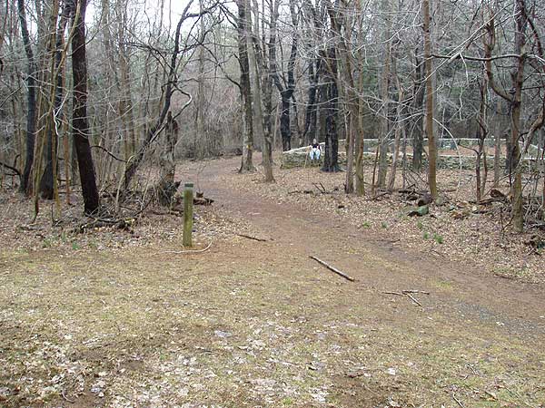
Mile 8.0 - Arrive back at the Little Devils Stairs parking area
Late March
Piney Branch Hike Comments
Archived Comments
By:Tom and Katie
Rating:
Date of Hike: Tuesday, August 27, 2019
Note error on parking directions: Keyser Run Road is VA 614, not VA 670.
From HikingUpward: The road number has been updated. Thank you.
By:Nate
Rating:
Date of Hike: Saturday, August 3, 2019
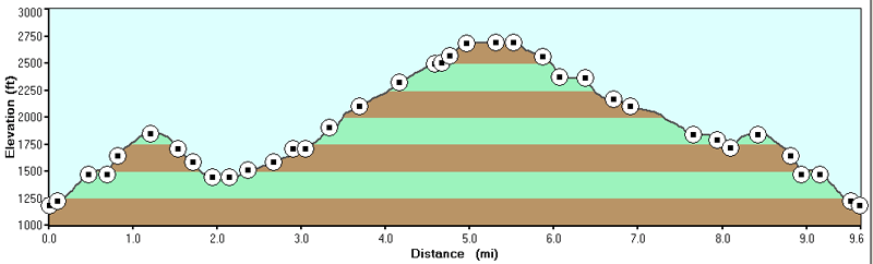
We added Little Devil Stairs to end of our hike to make this about 13.2 miles (about 2 miles of this was due to backtracking). It took us about 5:15 hrs with :45 minutes for lunch and a quick swim. Our elevation change was about 1700ft up then down.
We started up keyser road, stopped at the Bolan cemetery. We then went down Hull School Trail and unfortunately, we thought we had gone too far and missed the trail for Piney Branch trail so we backtracked to the cemetery to start from scratch. Headed back down only to find out we were about .2 miles from the intersection with Piney Branch Trail. This trail was lightly trafficked and we fought our way through some spiderwebs that were strung up by their owners hoping to catch an insect meal. I've dealt with much much worse spider infestations but it still annoying.
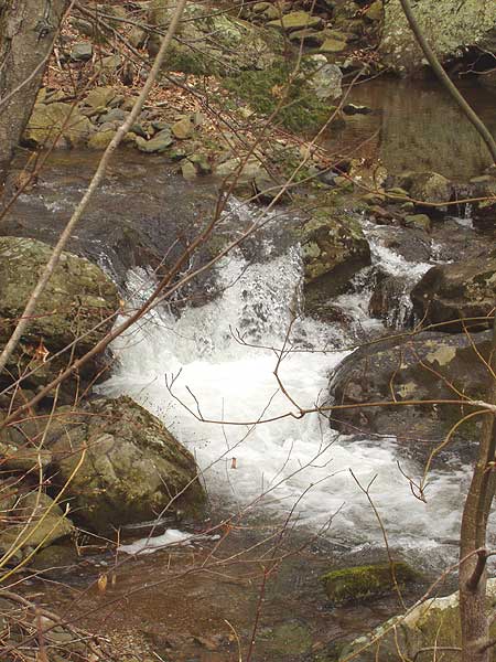
On the righthand side, about 5.5 miles in (or probably 3.5/4.0 miles in had we not backtracked) there was a cascade of small falls and swimming holes. We stopped here, cooled off from the 90 degree heat, and ate lunch. This was our favorite from the hike. Following the trail up river, we saw several large piles of bear scat but not bears.
We finished by taking LDS down. I had never done this before but my lord was it tough - and this was with very low water levels. My knees are barking a bit a day later.
Very quiet hike. Only saw a few people on Keyser, a young couple posted up on a nice campsite on Piney Branch, and then a small group heading up LDS. If this hike had any views built into it at all, it would be a top 3 hike for me. Great nonetheless.
By:David
Rating:
Date of Hike: Sunday, September 2, 2018
Went for a Sunday day hike to escape the mugginess of D.C. Arrived around 10 am and started hiking, following the route Upward's laid out. Nice steady incline on the fire road got the blood flowing, and once entering into the single track area, the greenness of the hike took over.
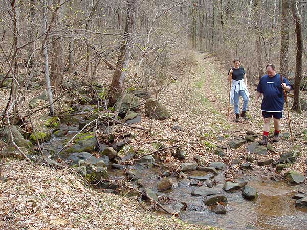
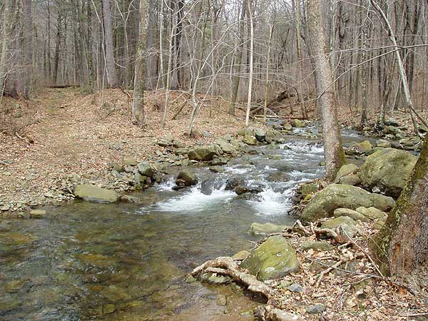
Hiking along the Piney Branch trail, we got to cross several beautiful streams and take in the view. The best spot was a cascading water fall, where we saw a beer and her two cubs! Even with a full sun out, the shade and stream kept us cool.
Highly recommend this hike to anyone wanting a solid 9+ miles of day hiking. We even saw a rattle snake on the fire road heading back to the parking lot.
Easy trails to follow, and no issues with markings.
By:Sean
Rating:
Date of Hike: Thursday, November 2, 2017
I hiked this as described. I've hiked dozens of trails in this area and have never seen so many downed trees on a hike, but they were no big deal. The Piney Branch Trail portion has nice views of the stream along much of its length. I like fire roads for a change of pace. The Keyser Run Fire Road portion is shared with the Little Devil Stairs hike, also on this site and which I also recommend. While a very nice hike in the woods with not many people there is not much in the way of vistas. Going down the Keyser Run Fire Road from the top, about a half-mile down to the left, is a nice small outcropping with a great view. It's pretty easy to see the outcropping from the road and the short trail leading to it.
Previous reviewers reported hike times much shorter than 7 hours. I took 6 hours using a very leisurely pace, doing some off-trail exploring, taking a few breaks to catch my breath, and spending about a half-hour at the rock outcropping.
By:aldikuma
Rating:
Date of Hike: Friday, April 8, 2016
I'd done the Little Devils Stairs Hiking Upward loop clockwise last year, doing the ravine on the decline but on this hike, I decided to start going up LDS and complete the circuit from there. Took 4:10 with several stops for photos - this hike should not take you 7 hours unless you are doing A LOT of exploring. Didn't see anyone else all day, despite a few cars in the parking area when we started. Though you won't find views from the elevation on this hike, the scenery is beautiful nonetheless, as is most of SNP! Some of the stream crossings were slower due to higher water, but not difficult as there are plenty of rocks to navigate. Pretty hike.
By:Suzy and Tom
Rating:
Date of Hike: Saturday, January 2, 2016
Hiked this trail as detailed. Keyser Run Fire Rd/Hull School Tr/ Piney Branch/Poll Bridge Link Tr/Keyser Run Fire Rd. Total of 9.68 mile with a moving time of 4 hours and stopped time of 1 hr 6 min. (Not sure why the description of the hike says to allow 7 hours). Piney Branch section nearest the river very scenic but overall the hike was too much on the Fire Rd. The first 1.2 miles up the Fire Rd is very steep and next time I would put that energy towards climbing Little Devil Stairs and doing the hike in reverse.
By:Ryan
Rating:
Date of Hike: Saturday, September 19, 2015
This ended up as a great hike even though we were woefully lost barely two miles into it.
Upon arrival in the parking area, you'll walk about a mile up a gravelly path to the graveyard. From there you can descend down a more proper trail, at the end of which you will find yourself at a crossroads. Go right, and you will find yourself on the path described above. Go left - as we did - and you'll eventually hit a dead end as the trail stops at a private property marker/barrier.
Tracking back, we found the Hull School trail and took it up 2-3 miles until we found a sign marker for Piney Ridge Trail. Following that path took us another 2 miles higher up until we reached another split - one way taking us to the AT, the other back to Piney Branch. We elected the former and descended back to the intersection where we took our wrong turn and made our way back up to the graveyard and then down to the car. All told it took us about four hours. The trail isn't much for views but if you're keen on a walk in dense woods, it's great.
Two things should be noted about the alternative route we took, however.
One, the trail is clearly not hiked all that often and is at points overgrown. The trails are all marked but they don't look like they're maintained all that often. We had to climb through, over and around a lot of flora as we walked.
Two, spiders. Perhaps because it is so rarely traveled, spiders have taken to building their webs along and across the trail. We could not walk ten feet without having to disentangle or check ourselves. It got so bad that one of us walked ahead of the group with a large stick, clearing the webs as he saw them. If you're afraid of spiders, this hike might not be for you.
All told though, I'd highly recommend this hike. Occasionally difficult but unique and rewarding.
By:Greenfoot
Rating:
Date of Hike: Saturday, June 20, 2015
Took LDS to the AT then to Piney Branch, Hull School, and Keyser Fire Road back to the parking area for about 13 miles total. Since it was July, it was a bit swampy along Piney Branch trail. I got started early enough that the LDS were fun and challenging rather than miserable. Great hike for wildlife. Was lucky enough to see a young black bear about 200 feet away on the LDS, and there were a number of Peregrines visible along the AT.
By:Michelle Roberts
Rating:
Date of Hike: Saturday, May 10, 2014
My son and I did this hike plus the Little Devils Stairs. Instead of coming down the Keyser Run Fire Rd at the 5.5 mile mark, we came down the Little Devils Stairs. The first 1.2 miles up the Keyser Run Fire Rd was a little strenuous, and we ran into a few people here and there. We stopped at the Bolen Cemetery to check it out, and ended up with ticks. A LOT of ticks! Crawling up our legs. From here to the next intersection is actually yellow blazed and not blue. We didn't run into anyone else from this point until we got to the Little Devils Stairs trail. We pulled ticks off our legs the whole time. The waterfalls big and small on this trail make it well worth dealing with the little blood-suckers! It took us about five hours to do the combined trail (about 7.5 miles), and that includes stopping to eat, taking our time to enjoy nature, and time for taking pictures.
By:Dustin
Rating:
Date of Hike: Sunday, March 3, 2013
**The directions are wrong when they say to stay on piney branch trail towards sugar loaf. Ignore that and turn right instead. I didn't read other comments and ended up going 1.5 miles before I realized it was wrong.**
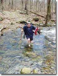
Great relaxing hike if you're looking for a semi-long day hike. The uphill at the beginning is the most strenuous part. Crossing the river/stream is harder in the winter, but doable if you get creative.
The worst is the end of the hike where you are just basically going down hill for 3.3 miles. That is hard on my feet!


