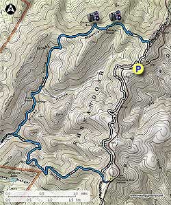
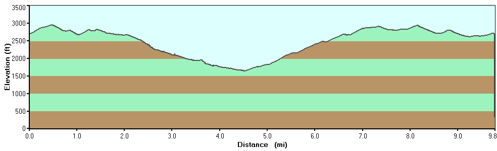
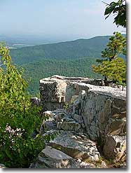
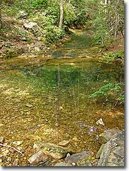
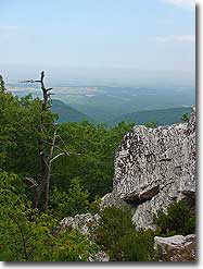
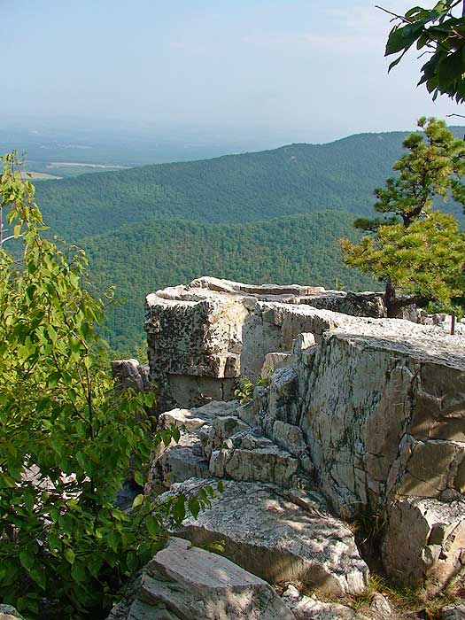
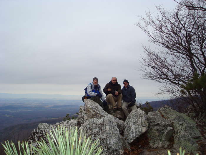
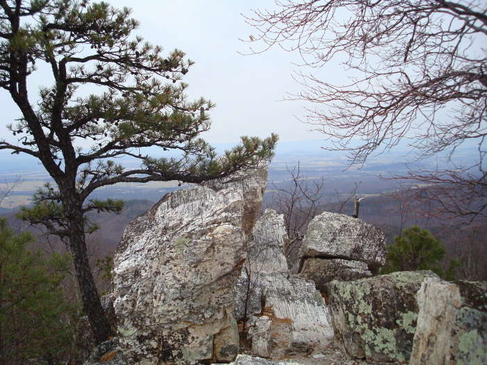
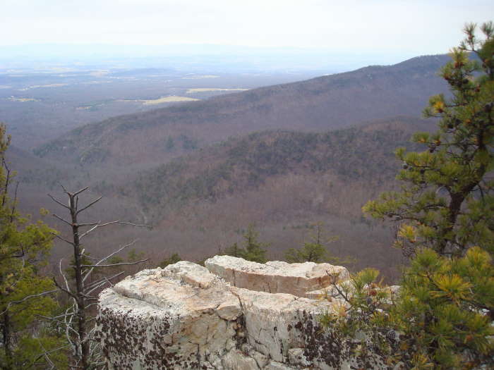
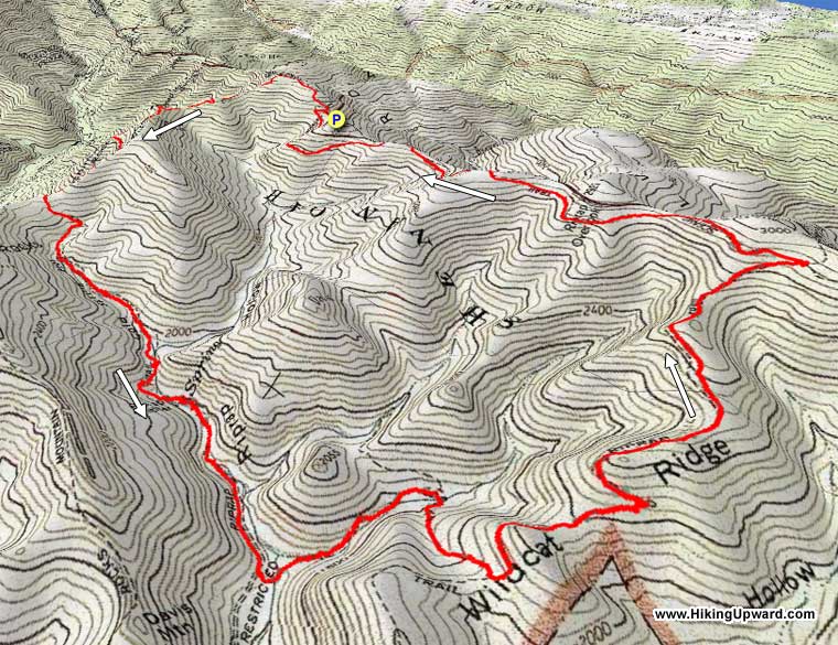
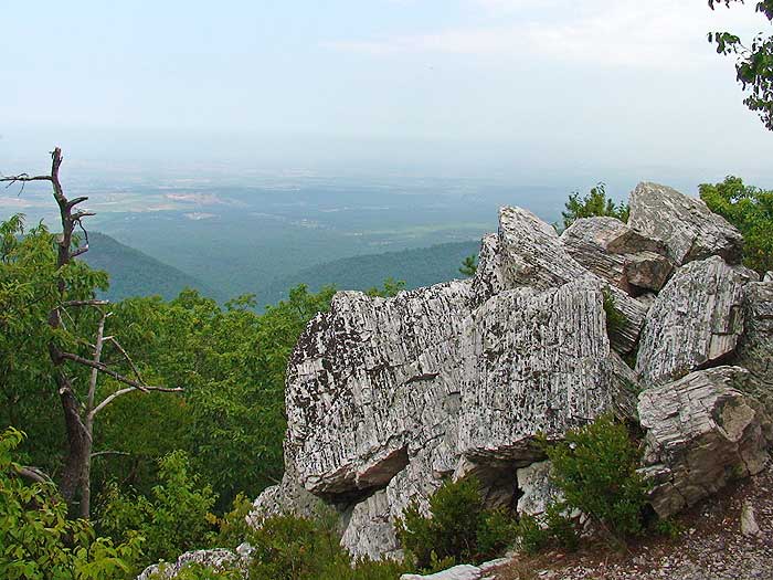
Riprap Hollow is one of the best circuit hikes in the southern section of the Shenandoah National Park. The views from Chimney Rock, and along the ridge of Rocks Mountain, offer great vistas to the west and north. The spring fed stream in Cold Spring and Riprap Hollow is very scenic, and has a 50ft wide swimming hole fed by yet another mountain spring.
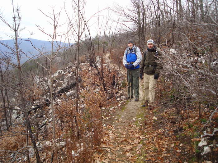
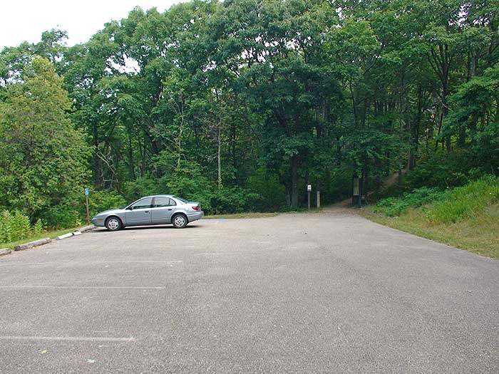
From the Riprap parking area walk the 50 yards along the blue blazed trail to the intersection of the white blazed Appalachian Trail. Turn right uphill on the white blazed trail for 0.4 miles to the intersection of the Riprap Trail.
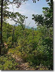
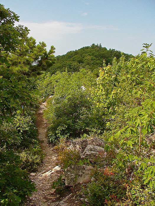
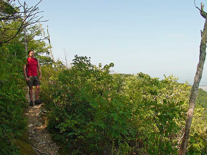
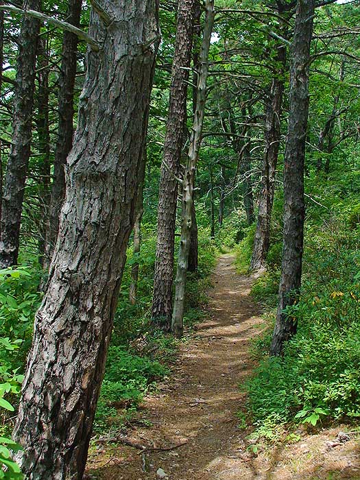
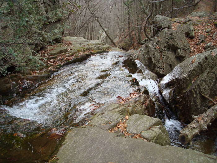
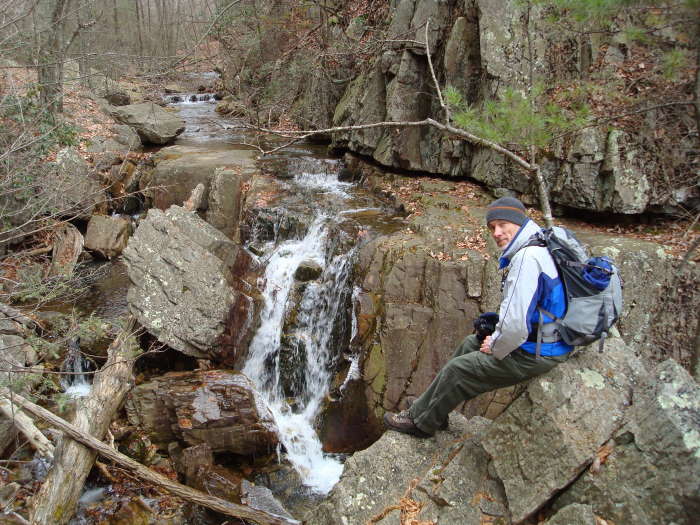
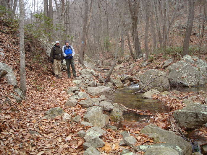
Turn left on the blue blazed Riprap Trail as it descends through a hollow on the ridge before climbing and arriving at the first vista point in 0.7 miles. In another 0.3 miles reach the second vista and Chimney Rock. From Chimney Rock the trail will begin to descend into Cold Springs Hollow. In 1.7 miles from Chimney Rock the spring fed stream that has come in on the left of Riprap Trail will pass through a small gorge and over a 20ft waterfall.
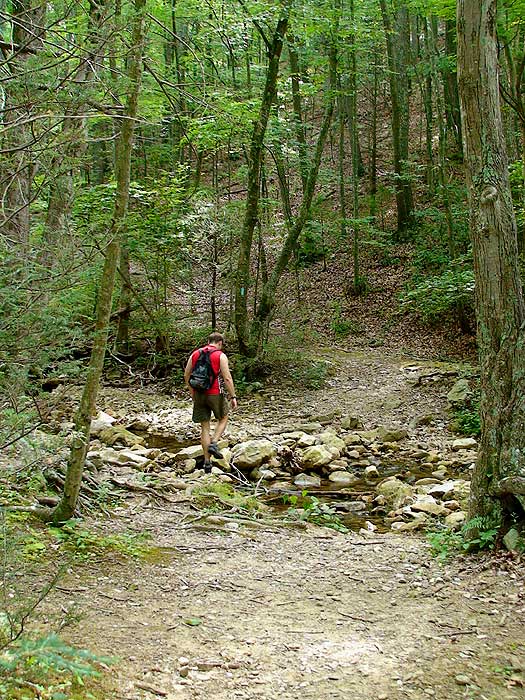
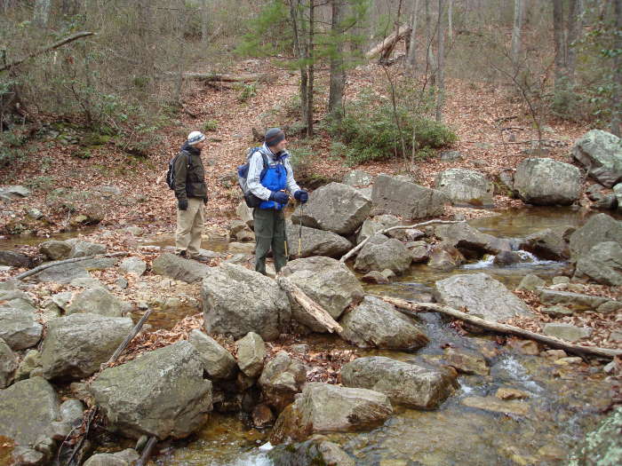
After passing the waterfall follow the blue blazed Riprap Trail for another 0.3 miles to a large swimming hole. Just past the swimming hole the trail will cross the stream, and pass a trail marker and an overgrown trail that leads to an old Riprap Shelter on the right. Continue straight on the blue blazed Riprap Trail next to the stream for another 0.7 miles to the intersection of the Wildcat Ridge Trail.
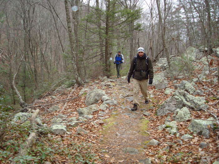
Turn left on the blue blazed Wildcat Ridge Trail and shortly cross the stream again before the trail starts heading uphill through a small gorge. In 0.6 miles the Wildcat Ridge Trail will make several switchbacks and become much steeper, as it follows the Wildcat Ridge for another 2.0 miles to the four way intersection with the white blazed Appalachian Trail.
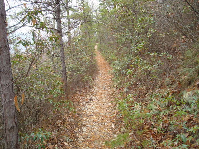
Turn left on the while blazed Appalachian Trail for the remaining 2.8 miles back to the Riprap parking area.
Late July
Early December
Riprap Hollow Hike Comments
Archived Comments
By:John
Rating:
Date of Hike: Wednesday, September 4, 2019
I am amazed that some reviewers have made comments wishing this hike was more difficult. It kicked our butts but, then again, we are retirees.
Went counter-clockwise as mapped out - .we would not call the blue-blazed trails as overgrown but they did feel "close" in places. The views at Chimney Rock were great and we found a nice lunch spot in the 1st creek crossing. Wished we would have gone on another 100 yards to the swimming hole (which was low). Might have missed the left turn to Wildcat Ridge had my GPS not alerted me.
That said, we reached the point where we wished we had missed it. Wildcat Ridge is - by far - the most difficult part of the hike. 1,250' ascent in 2.75 miles...pretty relentless especially with no air moving. We were thrilled to rejoin the AT for the 2.5 mile stroll to the parking lot. The tank was pretty low by then.
This hike offers quite a variety of experiences...views, streams, crossings, a swimming hole and miles on the AT. Wildcat Ridge is simply a necessary evil.
We'll do this again but I would not recommend this hike for a novice. HU rates this hike a 4* and my group is in complete agreement!
By:Rick R
Rating:
Date of Hike: Saturday, July 27, 2019
We arrived at the parking area a little before 7AM, there were a couple of cars in the lot...probably campers. My hiking bud and I decided to do this loop clockwise. The hike along the AT was very benign and there was not much to see. When we got about 4-miles in we noticed that the rocks along the trail changed color to a pale brown and eventually white. It stayed like this for about 1/2 mile until we crossed a stream and they changed back to normal. We ran across this color change in a few areas along the Rip Rap Trail as well. We took a wrong turn on the RRT and came across a marker about in a about a mile. Thinking that this was the marker that led to the shelter, we trudged through some very thick brush on an old trail for about 1/2 mile until we reached a large rock outcropping with a scary looking cave. The trail disappeared and we doubled back. We continued in the wrong direction on the RRT for another .1 mile until we reached what I think was the boundary of the park because there were posted signs for private property. We figured out what we had done wrong and went back down the RRT. This added 3+ miles to our adventure.
The best part of this hike was the small, crystal clear, wonderfully cold swimming hole! I stripped down to my compression shorts and went all in! There is a nice view from Chimney Rock but there isn't much room to sit and enjoy it. We ran into several hikers that were doing the loop counterclockwise or just people heading to the swimming hole. If we had done the loop the other direction we may not have seen anyone else.
This was a disappointing hike for me, I like more of a challenge. There is no way that this hike should be rated a 4 in difficulty! there is maybe a mile of strenuous climbing/descent and even that wasn't really bad. Compared to White Oak/Cedar Run or Buck Hollow/Mary's Rock (both rated a 4) this was a piece of cake!
By:Sean
Rating:
Date of Hike: Friday, October 5, 2018
A fine hike as other reviewers have noted. Their reviews are good and I'll refer you to them. I'll note the description refers to trail marker and an overgrown trail that leads to a shelter. That trail maker is now out of the ground lying on its side and I think may not be at its original location. Another hiker told me that flooding dislodged it. I never did find the trail leading to the shelter. I could have used a few more blazes as I lost the trail near that trail marker -- the trail seemed washed out there -- but following the water and guidance from another hiker got me back on track.
I hiked the route counterclockwise as described. Other hikers were all going the other way and told me they preferred it because the best views and features are left to the end (Chimney Rock, etc.). I didn't care so much about that but what I didn't like going counterclockwise was going up Wildcat Ridge Trail. The trail is in good condition but along its sides is largely brush. There are few downed trees or rocks to sit on, which I do periodically going uphill to catch my breath. Going the other way there are more such opportunities, as I recall. Next time I'd go clockwise.
By:Good Hike Once in Hiking Shape
Rating:
Date of Hike: Friday, March 30, 2018
This hike has a lot to like. Nice views, running streams, places to have lunch, areas that challenge and stretches that let you just hike without thinking too much. That said, its no joke. We hiked as a family with our two teens as a first big hike of the season. In retrospect, we probably should have had a couple of good hikes under our belt before tackling this one. Big issue was the five stream crossings, two of which required us to remove shoes and shocks. Probably should have done the same on another one as one of us ended up with a wet shoe. This was likely more of a factor of recent weather given all the recent rain and snowfall in the area than one might normally expect. All of that, we did the hike in 5 1/2 hours included breaks for lunch, pictures, etc. As others have noted, its worth considering parking at Wildcat (just south of the RipRap trailhead) and knocking out the AT stretch first, or start at RipRap and hike this hike backwards from described. The elevation climb up to Wildcat can be strenuous and it would have been nice to be done at that point. The AT stretch is super easy, just more mental as we tackled it when everyone was ready to be done! Overall, a lot to like!
By:Hairy Llama
Rating:
Date of Hike: Friday, March 9, 2018
Excellent hike - first time I have tried the full ~10 mile loop (I'm in my early 50s and I knocked it out in 4.5 hours). Very cold start at 9 a.m., below freezing and gusty on the ridge. I prefer to knock out long flat stretches of fire road/AT at the start of hikes, rather than at the end when I more tired, so I parked at Wildcat Ridge and hiked North along the AT for the first mew miles. Then over to the rocks, down to the falls and pool, and back up the Wildcat Ridge trail for the last few miles.
Beautiful clear day, and only a few other hikers ~6 total during the day. I clocked the first seven miles down to the bottom of the hollow in just under 3 hours. It then took me an hour and half to clamber the 2.6 miles back up to the parking lot. The uphill is sustained at a fairly manageable grade, with a notable steep section around 1/3 of the way along the stretch.
This is a great hike: not as heavily trafficked as many others in the park, great views from the rocks, lovely stream and waterfall section, and a really solid workout.
By:Three-Eyed Raven
Rating:
Date of Hike: Friday, February 16, 2018
I've hiked the Rip Rap/Wildcat Ridge hike a few times in the past, but today I hiked it solo to see how fast I could do it. I started at the Rip Rap Parking Lot off of Skyline Drive milepost 90 at 1:00pm and did the circuit hike counter-clockwise, heading in the direction of Chimney Rock. After a 0.4 mile hike uphill on the A.T., I took a left turn at the intersection of the Rip Rap Trail. The weather was about 55 degrees and cloudy, and there was a brief rain shower on the Rip Rap Trail before I got to Calvary Rocks.
The views in February in the Calvary Rocks/Chimney Rock area are fantastic no leaves on the trees to get in the way. After quickly snapping a few pictures, I headed onward on the Rip Rap Trail and came across two groups of hikers along the way. After crossing the rushing river a couple times along this path, I finally took a left at the intersection with the Wildcat Ridge Trail. After traversing majority downhill up to this point, I knew ahead of time that taking this counter-clockwise direction would provide a rough climb up Wildcat Ridge. I crossed the river a couple more times on this trail, and then spent a couple of miles hiking uphill nonstop.
The trick with this hike is picking your poison on whether you want the roughest terrain to be an uphill climb or a downhill fall: The lowest elevation of the hike is in the general area at the Wildcat Ridge and Rip Rap intersection. The highest elevation is nearby the Chimney Rock/Calvary Rocks area. If you choose to take the hike counter-clockwise from the Rip Rap area like I did, you will face a long uphill climb up the Wildcat Ridge and a very rocky downhill along Rip Rap. If you choose to take the hike clockwise, you will face a rocky uphill climb up Rip Rap Hollow towards the Vistas at Chimney Rock. The trail in general is very rough terrain all the way around, however going uphill on Wildcat Ridge is a bit smoother than the opposite direction. Don't get me wrong, rough terrain can be tricky regardless of uphill or downhill, so you just have to pick your poison on this decision. I have taken both directions around the circuit and I can't really say for myself that there is an "easier" direction to take.
Eventually, I got to the intersection with Wildcat Ridge and the A.T. and I knew I was on the final 2.7-mile leg of the 10-mile circuit. This final 2.7 miles to the Parking Lot wasn't necessarily a difficult hike, but after the previous 7 miles of rough, up-and-down terrain, it was the most difficult to get through. My legs were cramping up and my ionic fitbit watch was telling me I was approaching my 20,000th step of the hike. I finally got back to my car at the Rip Rap Parking Lot, making sure to notice how long the hike took me this time.
3 hours and 26 minutes, a personal best. I wouldn't be surprised if there are some hardcore hikers out there who could easily break 3 hours, but this is a very strenuous hike that takes most people 5 to 6 hours. I believe the Shenandoah National Park recommends that people take around 7 or 8 hours to finish the hike, so finishing it in under 4 hours is very impressive. It would be interesting to hear how fast some of the more hardcore hikers have done it in.
By:Hobo Hiker
Rating:
Date of Hike: Sunday, November 12, 2017
At 10:30am the parking lot was half full. The trail was easy to follow and included part of the AT. The trail is a short AT up then a long slow blue Riprap trail down that will be more challenging coming back up. A little more elevation than I expected. Once again I was reminded "I'm hiking on Skyline Drive these are mountains." Hikers- I meet the friendliest hikers on or near AT trails, this trail re-enforced that theory. Very friendly hikers and dogs. The views from Chimey rock were awesome. I've hiked most of the trails on Skyline so I'd say the special features on the Riprap trail were the rock formations including a large rock boulder area. A word of caution if you have kids or dogs, this year I've seen a number of rattlesnakes and copperheads in the boulder and rock overlook areas. The snakes won't bite unless cornered or stepped on, so be VERY careful about leaving kids "go play in the rocks." While rattlesnakes may sound like a problem they are friends of hikers, as they keep the lyme disease down by killing rats and mice. Also note it is ILLEGAL TO KILL ANY SNAKE IN VIRGINIA. A very enjoyable hike with a west view. After the hike I stopped at the Riprap overlook which was cool to see where I hiked. HYOH
By:Keith (no trail name yet)
Rating:
Date of Hike: Saturday, November 11, 2017
18 degrees and sunny when I started (9am), 33 degrees when I finished (3pm). First time on this loop. Despite the cold temps, I had a great time. The leaves on trail were deep enough to obscure some of the rocks, so I had to take care on foot placement. The climb out was not a lot of fun for me. I took plenty of breaks and paced myself. Not many people on the trail that day. It was nice day to get out.
By:VSOP
Rating:
Date of Hike: Friday, August 25, 2017
With the weather letting up on the heat and humidity it was a great day for a solo day hike. Got started early but learned that taking US 29 to CVille on a weekday morning to get to the south end of SNP was a mistake with traffic backing up to a mile short of Ruckersville. Turned around and took US 33 to Swift Run Gap an then south to MP 90. Clouds were blowing over High Top on the drive down so it was a cool start and it only got to about 80 during the day. That short bit of blue blaze out of the parking lot is extraneous. Hard to get lost on 10yds of trail. But it did throw off one group of hikers that I ran into later in the day. The brush on the north end of the loop on Rip Rap was getting close to the trail bed but the trail was in good shape and passable. The views from the outcrops on the north end of the loop were worth the trip. And the gorge at the bottom as I approached the swimming hole were unique in terms of other SNP hikes I've taken. Water was low but flowing. The swimming hole was tempting but I opted for lunch at a spot on the old trail above it. There seem to be a lot of "no camping" posts around but there were also a lot of flat spots in other places in the valley to pitch a tent or hammock. The Wildcat trail was in good shape and seemed to have had more traffic. The grade is pretty good on both trails but it's a constant "up". Blazes on the trail were pretty fresh. A pair of SOBOs on the AT leg reported a bear about mid way but I never saw it. Overall, this could become a favorite.
By:Bill Westen
Rating:
Date of Hike: Friday, August 4, 2017
I hiked this on a Friday in August and only saw a few people. The views from the rocks were outstanding. Because of the shade I never got too hot. Descending into the valley after Chimney rock was one of the loveliest sections with a cool babbling brook and lush canopy of trees. The swimming hole is very nice. I would only suggest this hike to people who are in good shape as it is a very strenuous hike with alot of elevation change. It is a workout! But if you are up to the challenge, it is a FANTASTIC hike.


