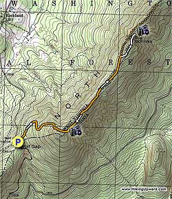
Big Schloss is another treasure in the George Washington National
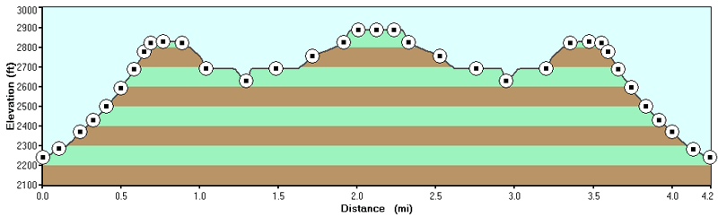
Forest. Relatively easy at only 4.4 miles and 1,000 vertical feet,
it's the sister hike to Tibbet Knob which heads to the south from the same parking location. Tibbet Knob has two short rock scrabbles, but a 10th of the hikers, and just as good views.
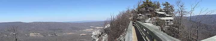
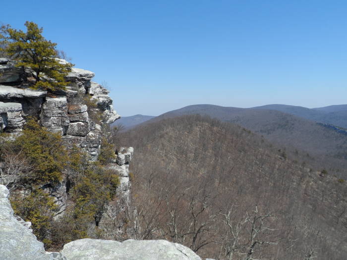
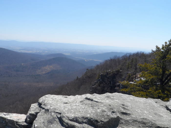
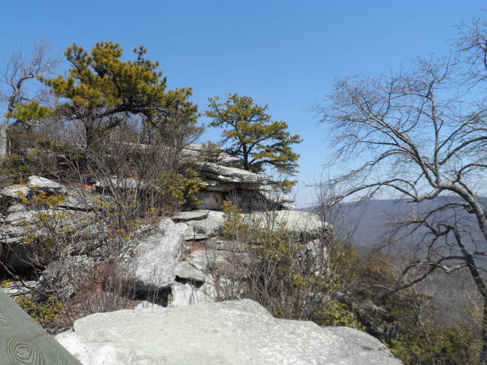
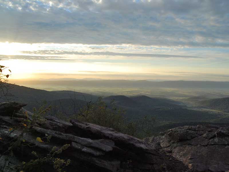
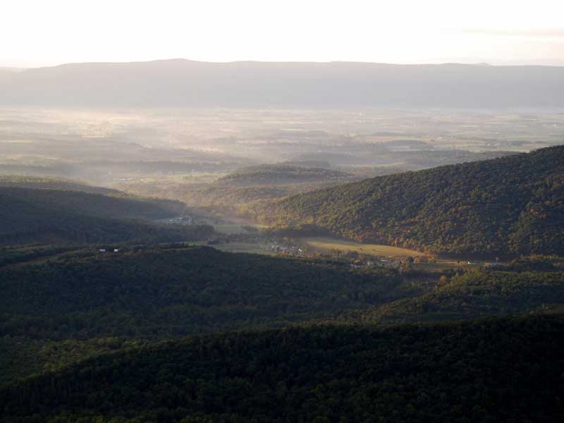
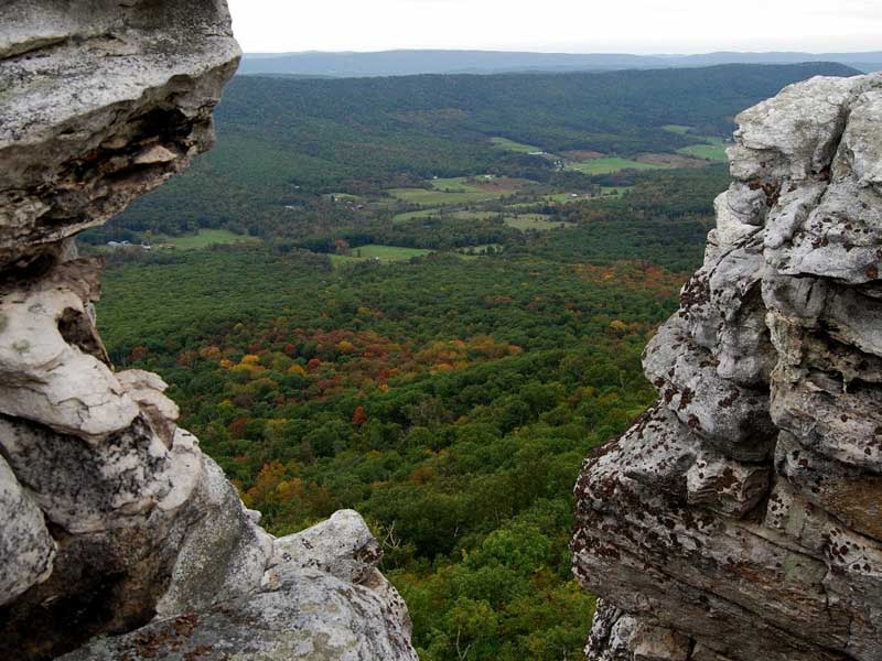
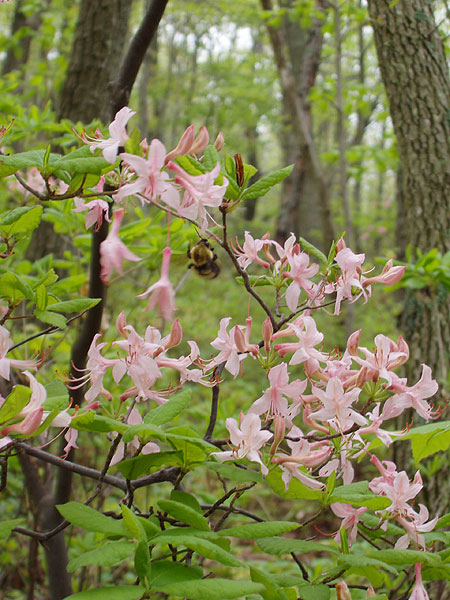
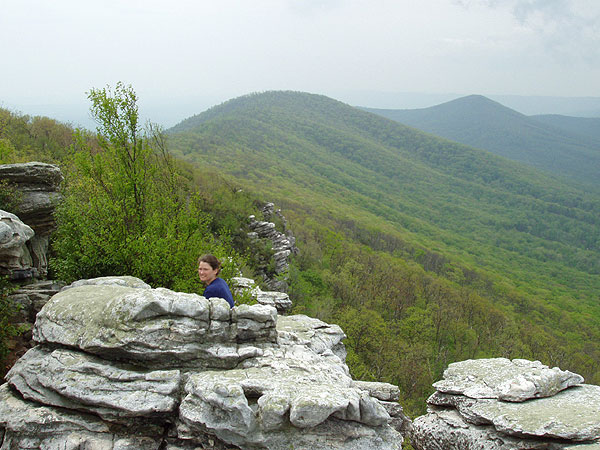
Big Schloss peak, named by German immigrants
provides a wonderful view of the surrounding valleys. Make
sure to bring a packed lunch because you will want to linger
at the Big Schloss rock outcropping and soak in the view.
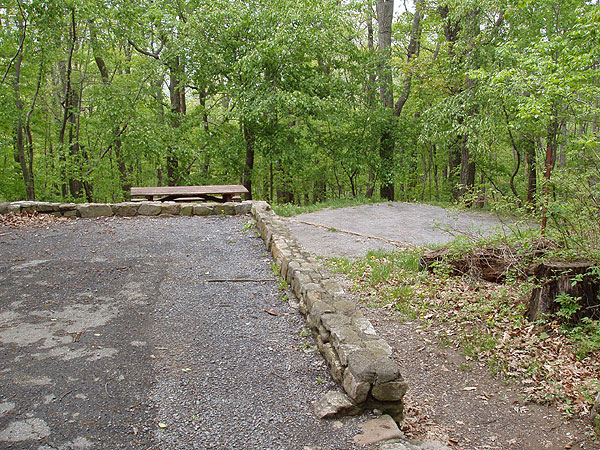
If you want to make a weekend out of it, the Wolf Gap recreation
area has 9 well maintained
campsites with bathroom facilities. If you have some
extra hiking time consider hiking the Tibbet Knob route as well. The views are every bit as good.
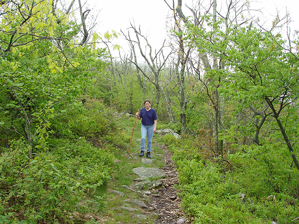
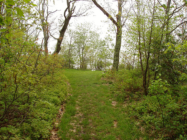
Mile 0.0 - Leave the Wolf Gap Campground (near campsite #9) and start
up the orange blazed Mill Mountain Trail to begin the steepest
portion of the hike. The first mile has several switch
backs before arriving at the ridge
line of Mill Mountain.
Once getting to the ridge line, turn left and continue following
the now narrower trail as it follows the ridge before arriving at the junction
of the Big Schloss Trail in 1.9 miles.
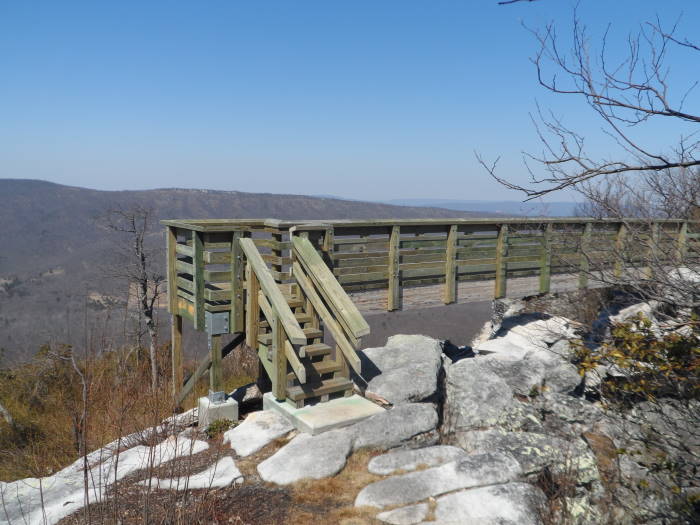
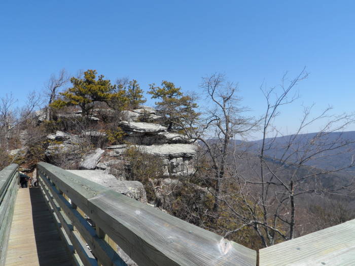
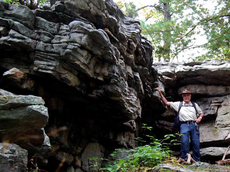
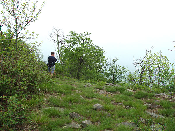
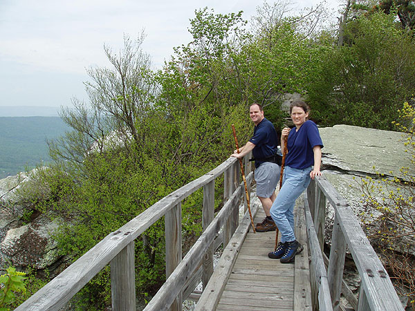
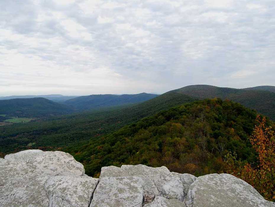
Turn right onto the white blazed Big Schloss Trail for another
0.3 miles before crossing a wooden
bridge that will take you to the overlook just 50 yards
further along. Enjoy the view it's one of the best! To return, just retrace your route back to the Wolf gap Campground.
Early April - Photos - Courtesy of Julie A.
Late September - Photos courtesy of Tom H.
Late Spring
Big Schloss
Big Schloss Hike Comments
Archived Comments
By:Chris
Rating:
Date of Hike: Friday, May 31, 2019
Did an early afternoon trip. I was moving at a pretty good pace as the weather was cool, so it took me about an hour to get up and 45 minutes to get back down after I spent 20 - 30 minutes up top. If I hadn't needed to get home, I would have spent longer up there as it is really quite nice to relax on the rocks. I came across three pairs on the way up, a group of 6 at the top and about four more people on the way down. Having the top to yourself is quite an experience.
With the leaves having filled in, there aren't too many views on the way up. The mountain laurel was blooming which was nice and the trail had drained well enough that only a few spots were muddy.
As an aside, there were quite a few spots where folks had made fires, including under a rock overhang near the top which I could smell was relatively fresh. It's forest service land, so perhaps that's legal but it certainly wasn't LNT...
I wasn't aware this is a horse trail, but there was also evidence of horses having been on the trail recently, so beware as you're walking!
This trail is now one of my favorites!
By:Longhair the Tank
Rating:
Date of Hike: Saturday, April 28, 2018
This is a very pretty hike, and the camping available at the recreational area is very nice. My group and I found great difficulty in the initial 800 ft climb to the first overlook. The grade in some places felt almost as steep as 45 degrees. After the initial climb, the trail just wandered along the ridge, and we reached Big Schloss for good break to take in the views.
By:Rachel S.
Rating:
Date of Hike: Saturday, April 14, 2018
THIS IS MY FAVORITE LOCAL HIKE (I live in Winchester)!!! It's amazing in the summer and fall. We just went in April and it was still beautiful but there was not much foliage. The great thing about that was that you could see even farther into the distance, but I prefer the greenery. The best time to go would be between July-October for the summer or fall views.
By:VaHiker
Rating:
Date of Hike: Monday, January 1, 2018
New Years day hike. 10 degrees at the trailhead, who knows up top. I solo'ed this time expecting to see no one but I saw 2 more solos and 2 couples. The snow was under 1 inch so there was no trouble hiking. Great day hike. it took me 1 hour up and 50 min back. One of my favorites!
By:Arjun
Rating:
Date of Hike: Sunday, October 15, 2017
I would highly recommend this hike for someone looking for easy to moderate 4 mile hike. We hiked this one on this past Sunday afternoon and the trail was mostly empty for most of the hike, We did meet a few other people at the summit. So if you looking for peaceful empty trail , this is the one and the views from the top are incredible. Started around 2:30 and were back to the parking lot at 5:30 after spending quite a good amount at the top.
By:Phil S.
Rating:
Date of Hike: Sunday, October 8, 2017
This is a fantastic hike! Starts out with a moderate climb, followed by a mostly level breathtaking walk along the ridge. Along the ridge you have a clear view towards the south east almost the whole time. There are many points were you can sit and enjoy the view in relative solitude even though the trail is popular. The bridge and the cliffs at the summit are really striking, and provide dramatic views to the north west. This a really great climax to the trail.
I've hiked most of the Shenandoah trails on here and this is in my top three. Very surprised that it only scored a 5 in the view category. This hike has better views than Sky Meadows and you can see them for a much greater percent of the hike. I can't wait to do Big Schloss again, I'm going to try it in all the seasons.
I did Tibbet Knob as, which was a great little hike. If you arrive early enough you could probably do both in the same day.
By:Bret
Rating:
Date of Hike: Friday, June 23, 2017
Wonderful hike with amazing views. After reading the other reviews I decided to hike Big Schloss and wish I had done it sooner. After the initial climb it's an easy hike along the ridgeline with plenty of places to stop and take in the view. The views from Big Schloss were wonderful and the breeze was welcome on a humid overcast day. I hiked this on a Friday and was surprised to only pass 4 other hikers with none at the overlook. Only surprise was a timber rattlesnake that was more interested in the sun than me as I passed. I have hiked many trails in Shenandoah NP and the views here were better than most of them. This will now be a go to when want a easy day with good views. Also hiked Tibbet Knob on the same day, great views and a new favorite as well
By:Julie
Rating:
Date of Hike: Sunday, May 21, 2017
My husband and I hiked Big Schloss on this weekend before Memorial Day in order to avoid what we assumed would be larger crowds Memorial Day weekend. There were still ~8 other cars in the Wolf Gap lot, but it wasn't overflowing. The weather was damp but not raining and it was a little foggy at the overlook. The trail is wide and clear so you can see the roots/rocks in the trail. It is steep the first mile as others have said, but not too bad. I'm 6 months pregnant and I did it without feeling overwhelmed. We stopped on the incline a few times for me/us to rest, but beyond that main climb, it was not too challenging. The bridge at the overlook is pretty awesome and the overlook itself had beautiful views! We saw some birds, chipmunks, frogs, and salamanders. It was a nice hike, not too many people the day we chose to go. We hiked Tibbet Knob last season and that was a more difficult hike. As we were hiking down we passed a few groups who were asking if they had much further to go. I said "if I can do it 6 months pregnant, than you certainly can!" Hopefully they continued on. Certainly once you finish the first incline and get to the ridge, the rest is nice!
By:Becky
Rating:
Date of Hike: Friday, April 14, 2017
This hike was wonderful! I will say that for a "2" on the difficulty scale, the first .75 miles is pretty steep. It's doable, that's for sure, but it is not a two. My girlfriend and I are both personal trainers, and it was definitely a bit of a challenge to start off. Taking little breaks here and there is probably your best bet. We passed several people taking breaks on the way up. There were two women we passed that were probably in their sixties who were taking a break headed to the top. They expressed that it was harder than they anticipated. We never saw them again, so I assume that they gave up and turned around. That's not to say that someone in their sixties or older can't do it! Just make sure you have water, and are prepared to take little pit stops every once in awhile. After the first .75 miles it's pretty much easy sailing. Once you hit the two mile mark, you will then have another .25 miles up another steep incline. And then, voila! The views are outstanding! Definitely worth checking this place out.
By:nematode
Rating:
Date of Hike: Saturday, October 15, 2016
So my boyfriend and I really had no idea what we were getting into it was our first time backpacking in, my first time camping not at a music festival. The hike up was difficult for two people who rarely exercise, but aren't necessarily out of shape, and carrying heavy packs. There was only one other couple on the trail, but more people than we were expecting camping in the meadows.
The views were really everything and more. We got there right at sunset and the next morning we woke up early to catch the sunrise. We got lucky because it was a full moon that weekend, and watched the sun rise as the moon set.

 Arial Video


