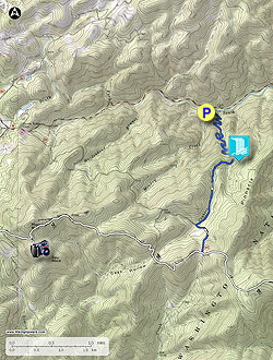
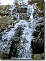
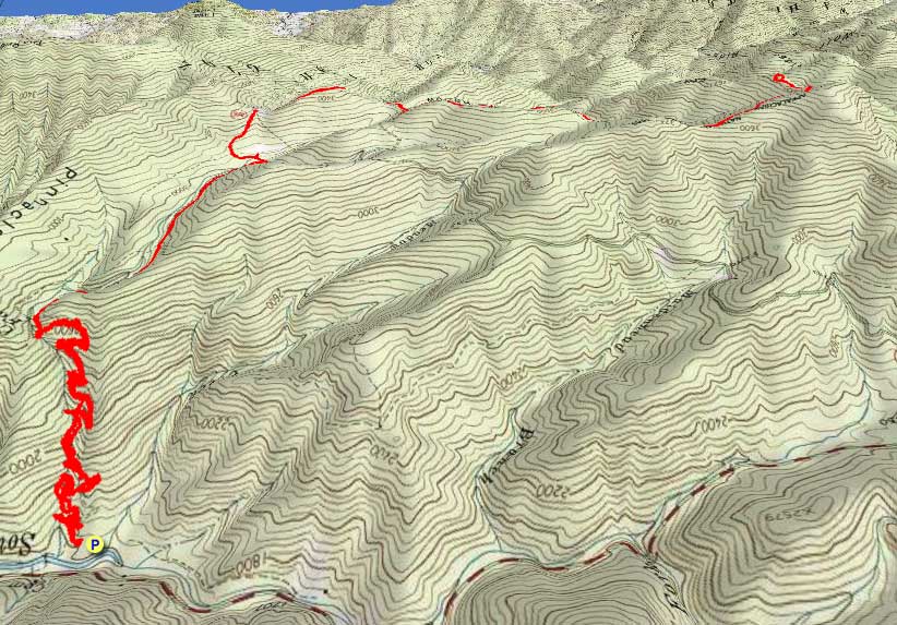
Crabtree Falls is one of the most beautiful waterfalls in Virginia, and certainly the tallest. It is commonly referred to as the tallest waterfall in the East. This is a mistake because Crabtree Falls is actually a series of waterfalls, all beautiful and tall but not one distinct drop. Crabtree Creek flows from Crabtree Meadows through a rare hanging valley for this region before plunging 1,080 feet towards the Tye River.
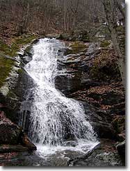
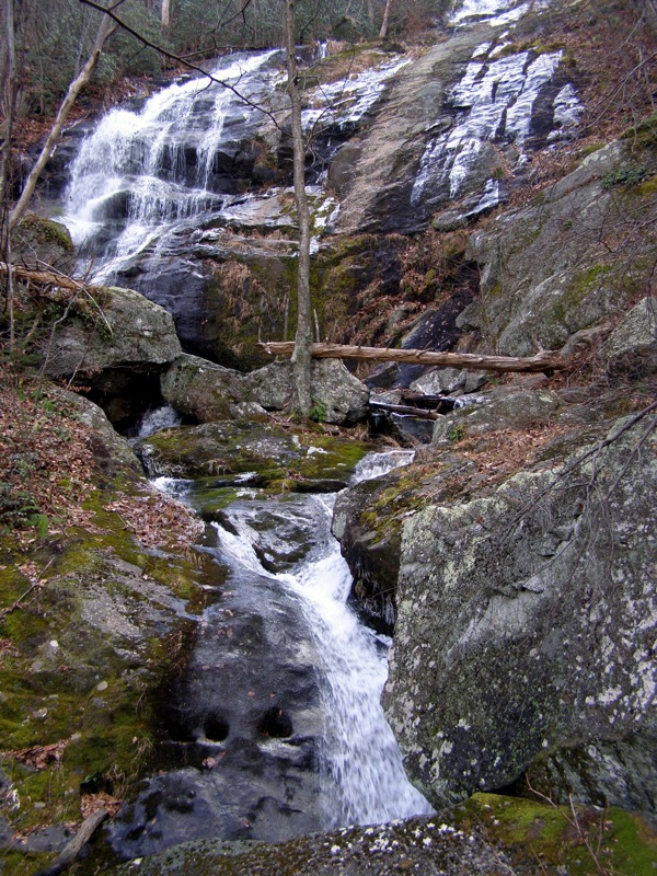
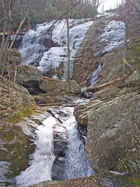
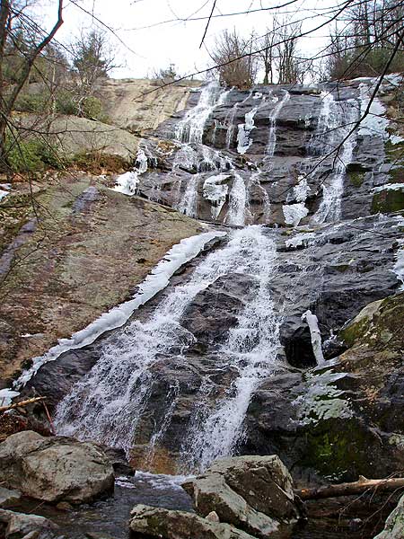
There are 3 distinct sections. The lowest section is the tallest and consists of many drops, the lowest right near the parking lot. The middle section is a single drop through a crevice surrounded by trees and moss, it is wildly different than the lowest section. The upper waterfall is the largest single drop over a massive cliff. You could spend an entire day here taking pictures, soaking up the scenery, but there is so much more to explore.
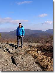
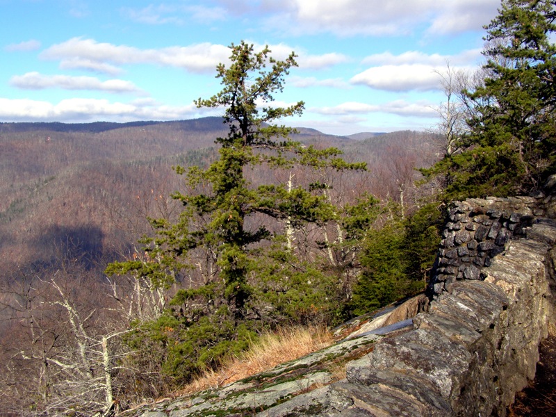
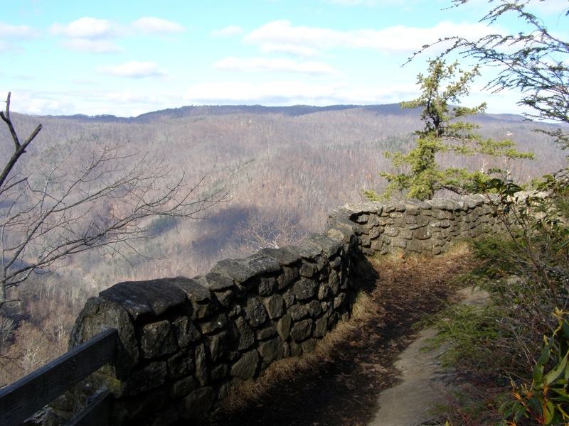
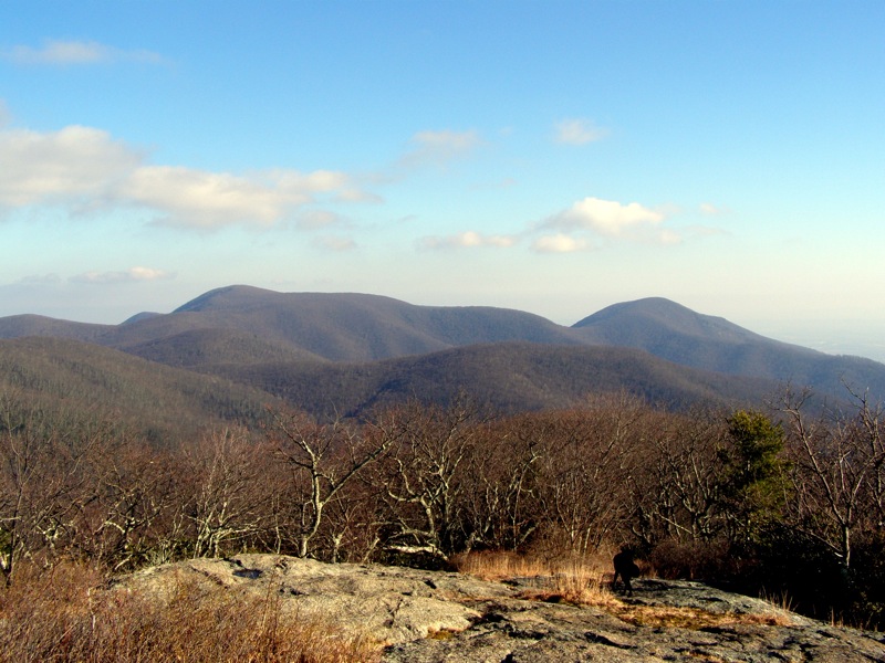
Beyond the upper waterfall the trail climbs through a hanging valley on its way to Crabtree Meadows. From the meadows it is a short hike to the Appalachian Trail where you can choose to hike to The Priest or Spy Rock. This hike takes you south on the Appalachian Trail to Spy Rock. Spy Rock is an incredible rock dome on the east side of Maintop Mountain with 360° views of the Religious Range, Mt. Pleasant, The Priest, Three Ridges and St. Mary’s Wilderness areas, and the eastern foothills. You can do Crabtree Falls and Spy Rock as separate short hikes or you can try this hike for a wonderful day combining waterfalls with incredible vistas.
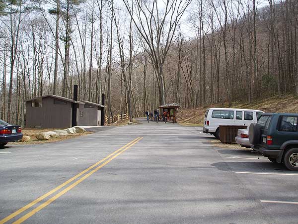
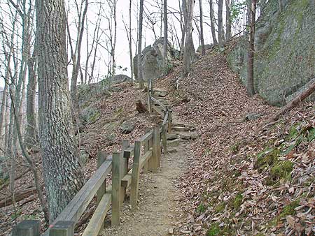
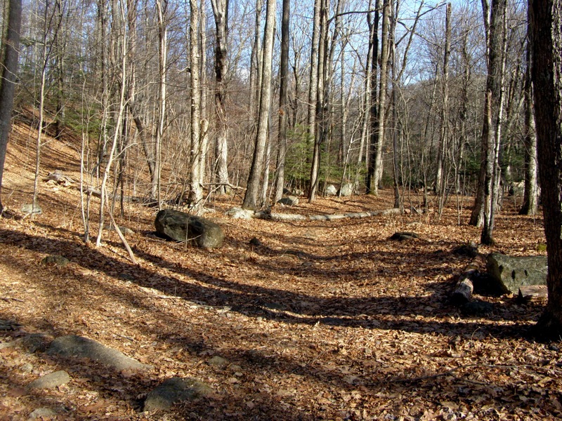
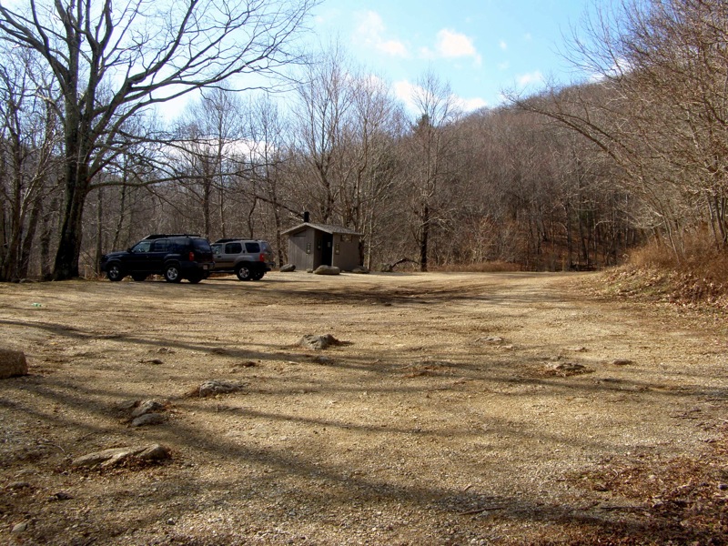
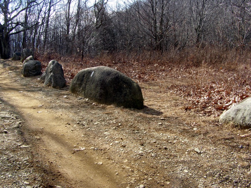
Mile 0.0 – Hike begins in the Crabtree Falls parking lot. Take the paved trail at the far left of the lot beside the information board.
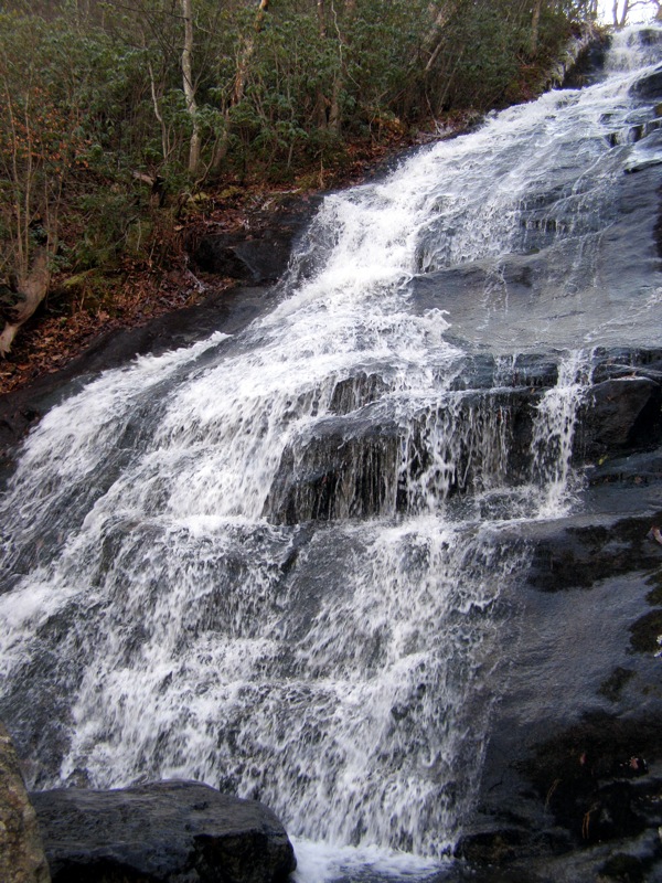
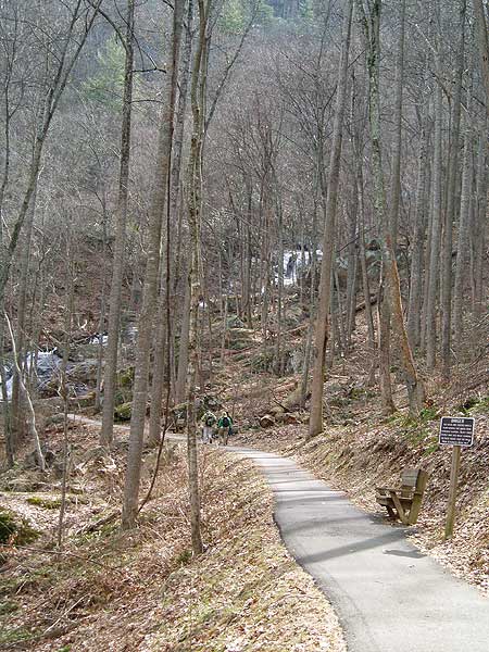
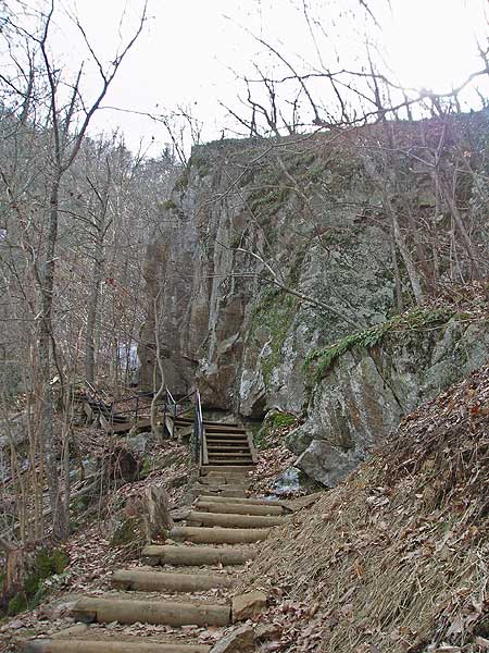
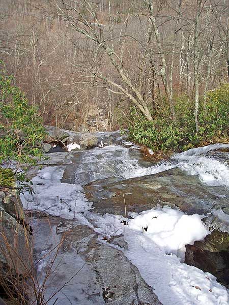
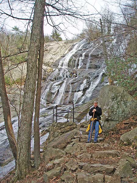
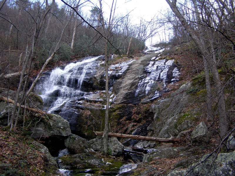
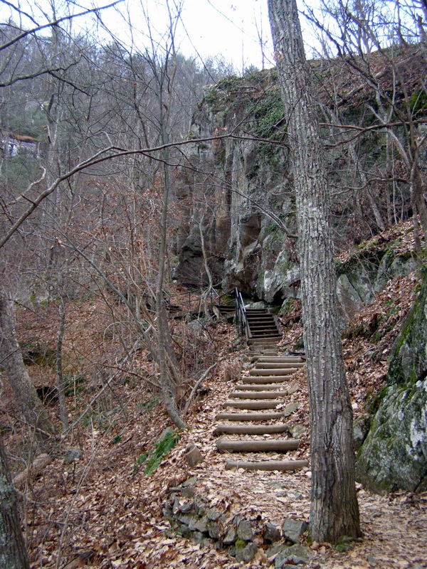
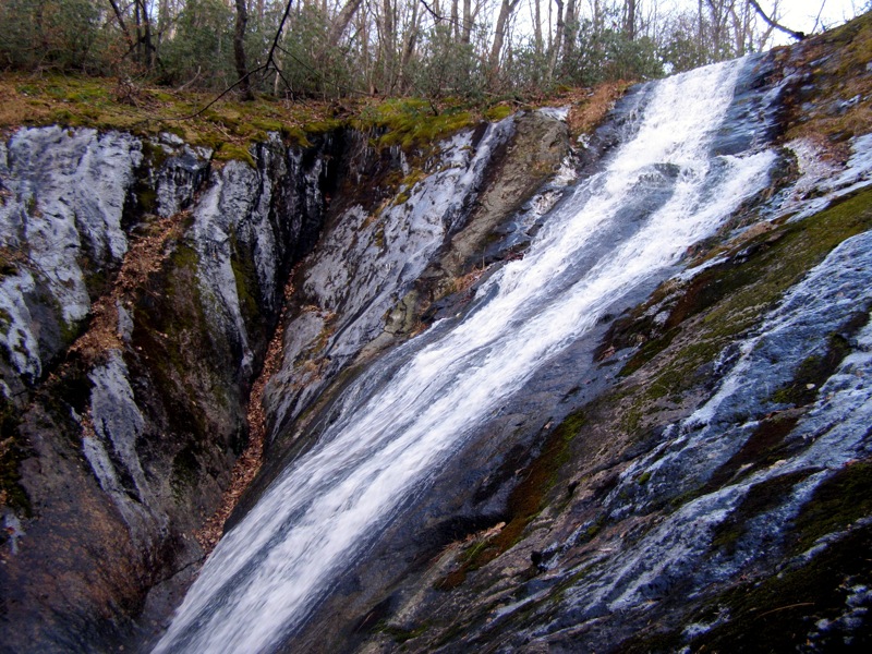
Mile 0.2 – Reach a viewing platform at the base of the lower section of Crabtree Falls. For the next 0.7-mi the trail switchbacks up the lower falls. The lower section consists of multiple drops totaling over 350 feet. Mile 0.4 – The trail follows a large staircase below a boulder to the base of a beautiful drop. The water is funneled to the far left side of a cliff while the rest of the cliff is covered in moss and ice (in winter).
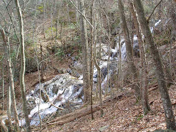
Mile 0.7 – Reach the largest drop of the lower section, well over 200 feet.
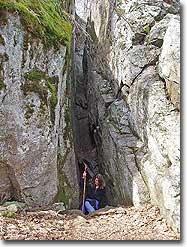
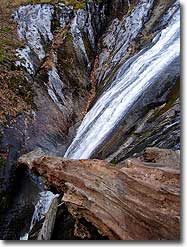
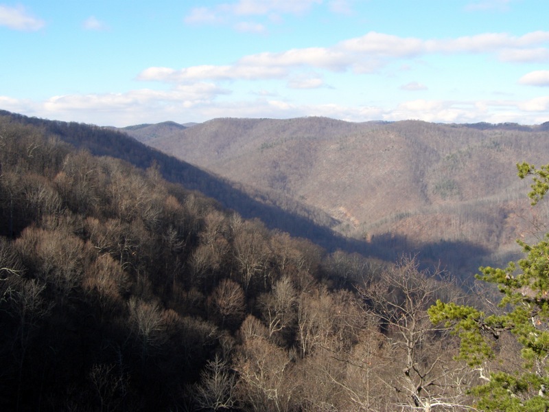
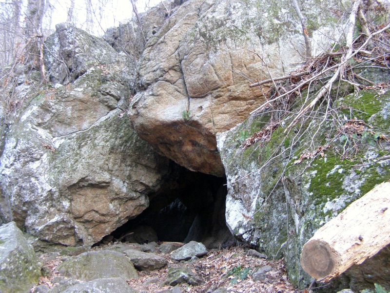
Mile 0.9 – After 0.7-mi of climbing the trail passes by an observation platform at the top of the lower falls. Crabtree Creek flattens out beyond this viewpoint on its way to the middle falls. There is a large cave on the right formed by fallen boulders.
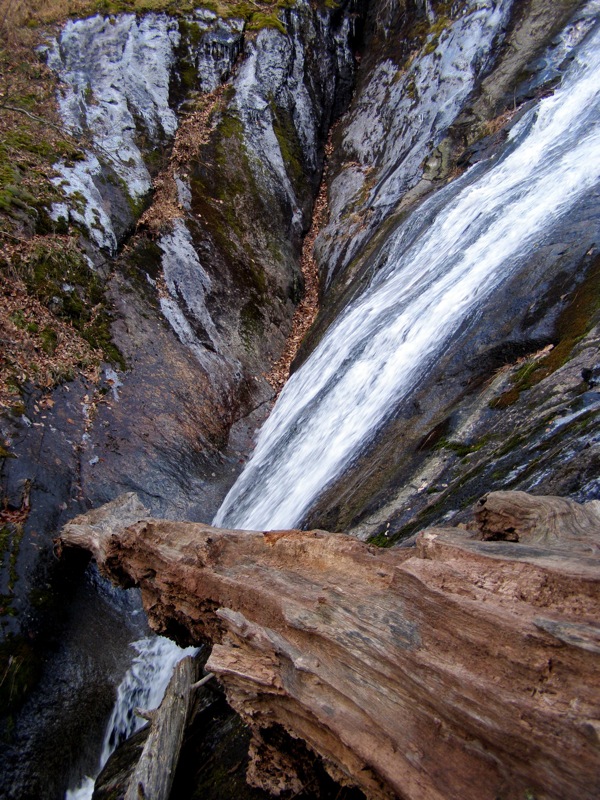
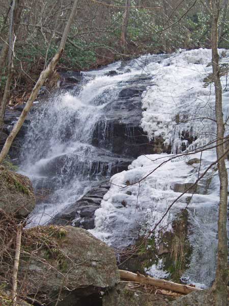
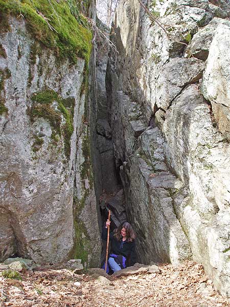
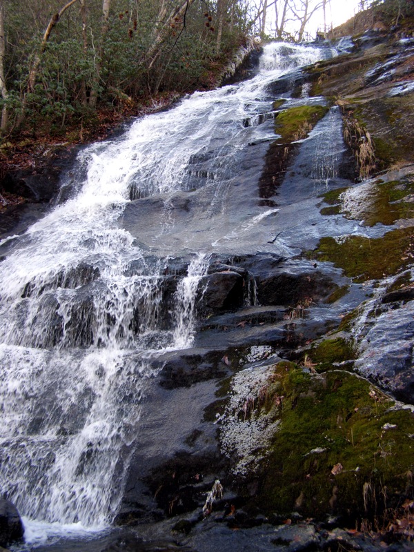
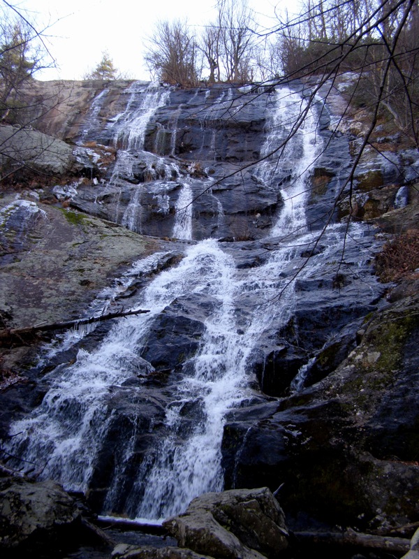
Mile 1.0 – The trail reaches the base of middle falls section. The middle falls is a single drop ~90 feet where the water flows through a moss-covered crevice near the bottom.
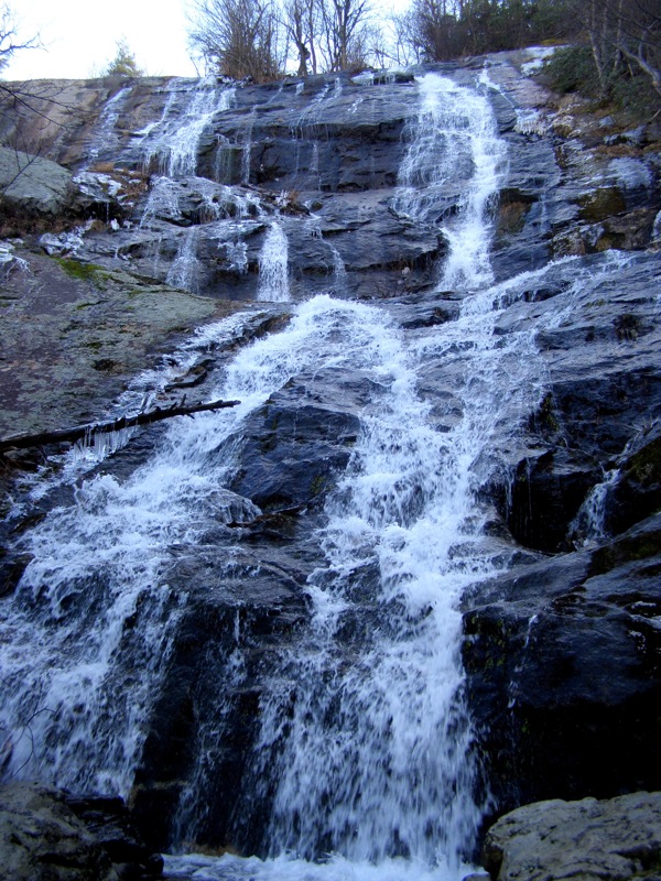
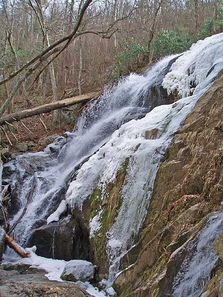
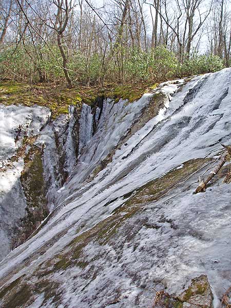
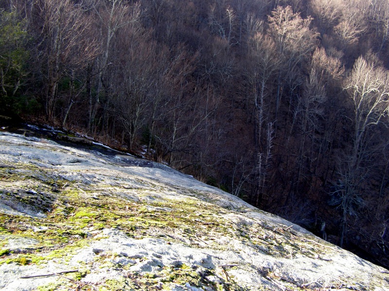
Mile 1.6 – Arrive at the base of the upper falls. Crabtree Creek plunges over a towering cliff on a double drop over 200 feet high.
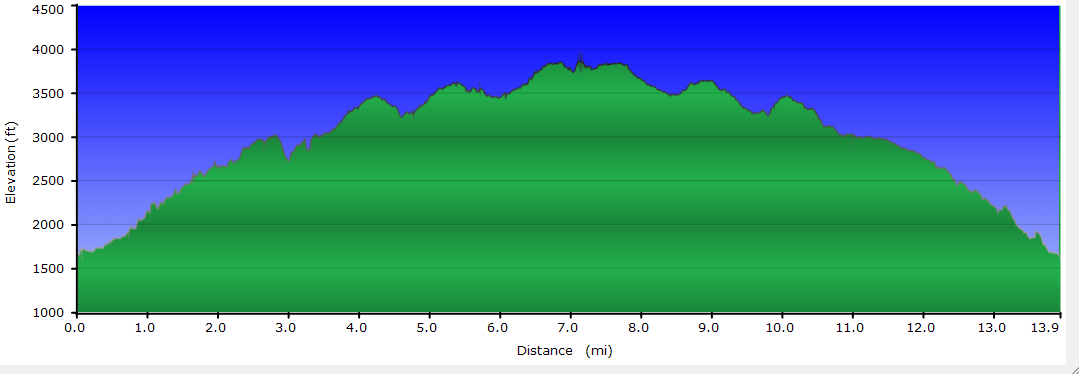
To complete the 3.8 mile out/back Crabtree Falls
hike only, return down the trail. If you are hiking the 13.9 mile Crabtree Falls/Spy Rock route continue with the directions below.
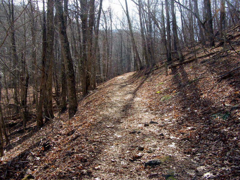
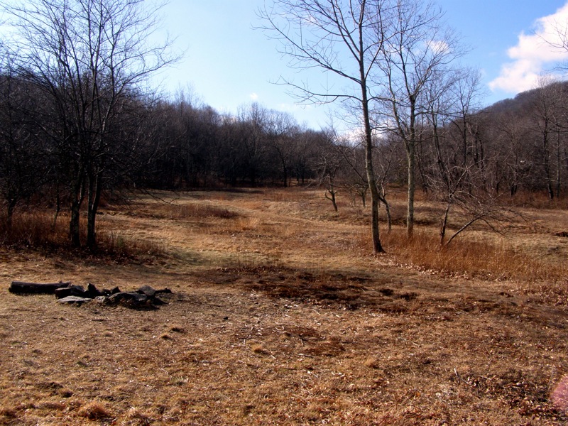
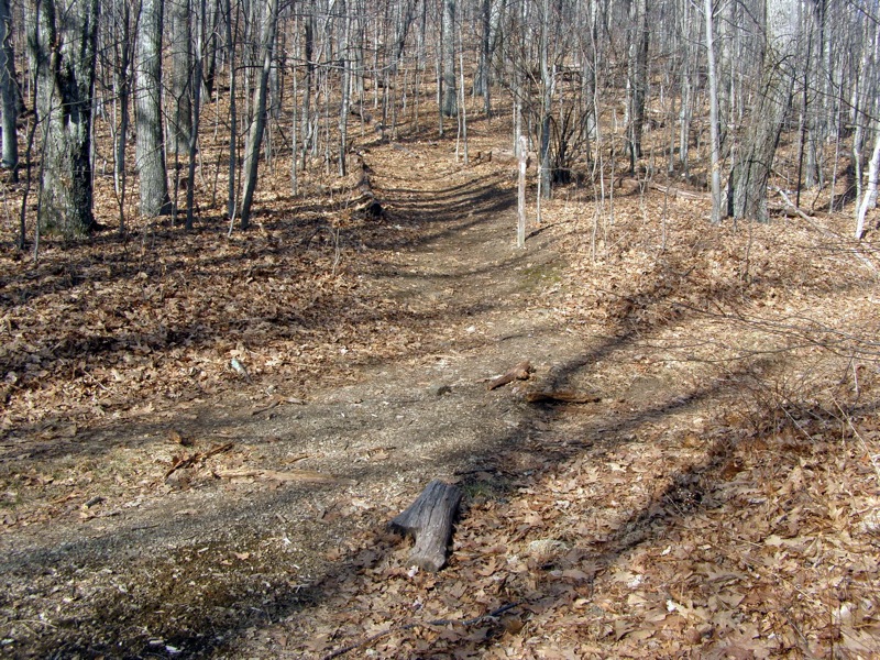
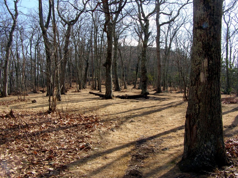
Mile 3.4 – Pass by Crabtree Meadows, a large field at the headwaters of Crabtree Creek. The forest road climbs above the meadow passing by multiple campsites on each side of the road.
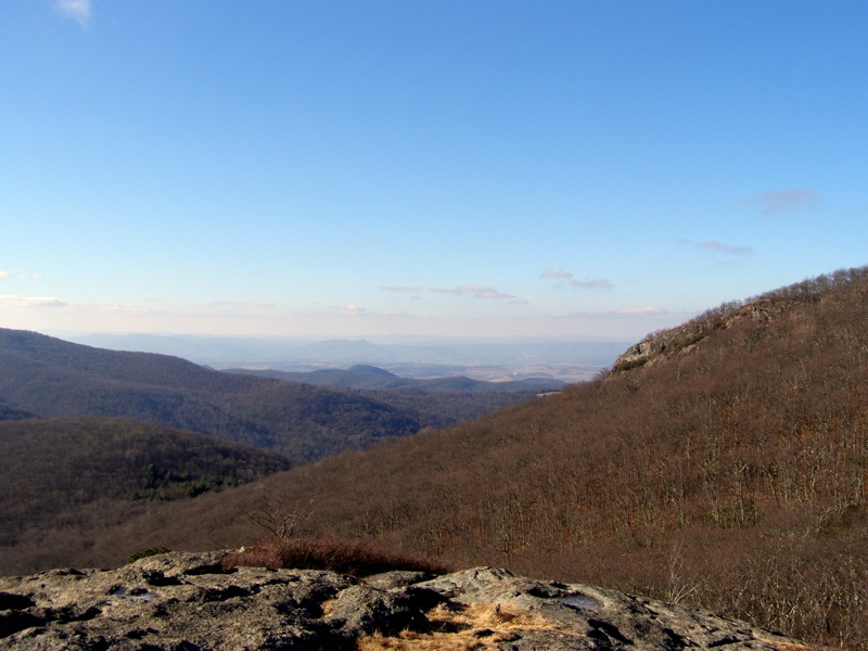
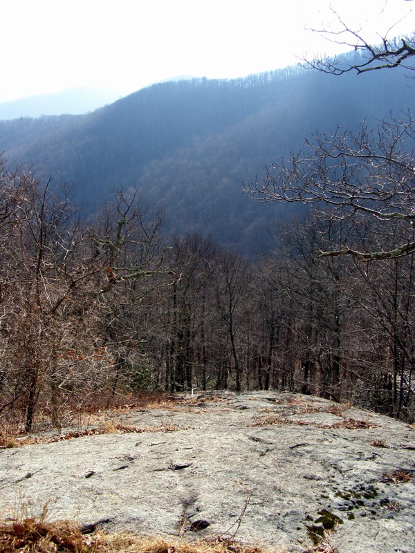
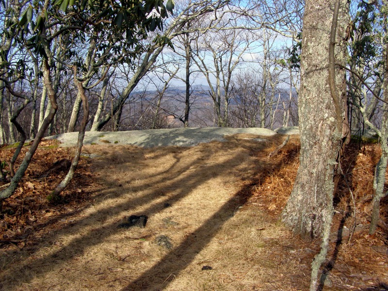
Mile 6.1 – The trail passes over a series of large rock faces that have open views to the southeast of Spy Rock and the peaks of the Religious Range. The rock face looks to be the result of a landslide.
Mile 6.5 – A small campsite on right in a grass clearing.
Mile 7.0 – Spy Rock Trail branches left away from the Appalachian Trail and passes through a very inviting sparse, flat forest with many campsites.
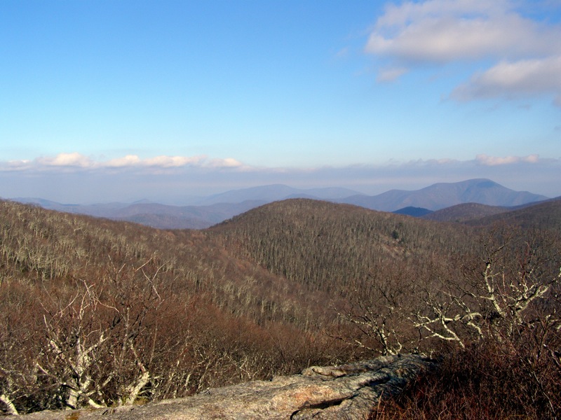
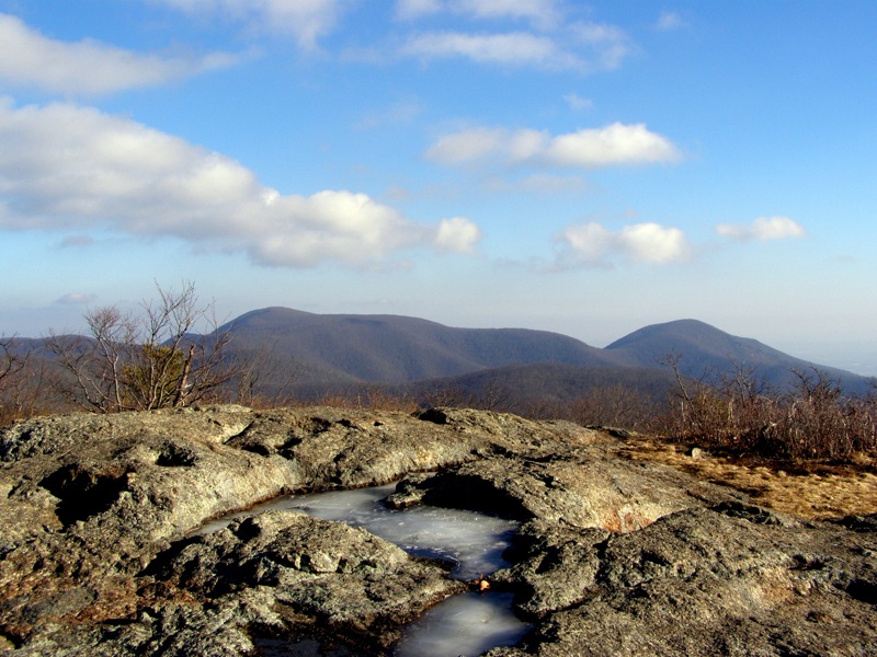
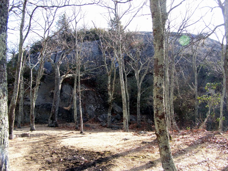
Mile 7.1 – Reach the base of Spy Rock. There are no trails to the top and you will have to find scramble routes. The summit of Spy Rock is a huge rocky dome with 360° views. Due west Black Rock is clearly visible on the south side of Maintop Mountain. The southern view includes the Religious Range and Mt. Pleasant. The best view is arguably to the north of The Priest, Little Priest, and Three Ridges Mountain. The scramble down is tougher than going up. Pick your footing carefully. In the winter there are large patches of ice.
Mile 7.3 – Turn right heading north on the Appalachian Trail.
Mile 9.5 – Cross the intersection with the forest road to Cash Hollow and avoid the slight right on another forest road than wasn’t noticeable from the other direction.
Mile 13.9 – Hike ends at the Crabtree Falls parking lot.
Late December
Late February
Video
Crabtree Falls Hike Comments
Archived Comments
By:Susan
Rating:
Date of Hike: Tuesday, September 24, 2019
I hiked Crabtree Falls with my 2 kids - 8 and 11. It wasn't the most difficult hike I have done, but not the easiest either. I think the stairs are more brutal than the trail. Some stages of the trail are very rocky - large rocks, but still trickier on footing. They are in need of rain in the area, so the water was more of a trickle in some spots than a fall. The lower Falls come very quickly, and we saw people with dogs out in the water. The middle Falls were definitely the prettiest spot! Between the middle and upper Falls, you encounter a small cave, which the kids thought was pretty cool. The upper Falls must flow over the large rock face, but as I said - little rain, little water. Being with the kids, we didn't continue on to Spy Rock, but went back, the way we came in. I want to say with stops at the lookouts, the whole hike took us 2 hours. There were maybe 10 others on the trail over the course of the morning - many with dogs. If anyone knows where you can get a hiking stick medallion for this hike, my son would be very grateful!
By:Rick R
Rating:
Date of Hike: Saturday, September 7, 2019
Please Note: There is now a definitive trail to the top of Spy Rock. Just follow the blue blazed trail to the left around the base of Spy Rock and it leads to a roped-off trail to the top. There are also roped off areas on the top to limit damage to the ecosystem.
This is the 1st time that I have hiked Crabtree Falls. My hiking bud & I arrived at the parking area a little before 7:00AM and there was only one car in the lot. We didn't see anyone on the Crabtree Falls trail until we got to the top observation area...there were 2 people already there. We continued on to Spy Rock up the very steep fire road to the AT. We ran across a couple of campers but no one else on the trail. When we arrived at Spy Rock we were not aware of the trail to the top so we both scrambled to the top to find 4 other hikers that told us about the new trail. They had hiked to Spy Rock from the south, I think it is about 5 1/2 mile round trip. The view from the top of Spy Rock is fantastic, the best I have seen! Truly a 306 degree view! We didn't encounter any other hikers until we got back to the Crabtree Falls portion of the hike...there were a ton of hikers now! It probably took us an extra 15-minutes to get down the 1.7-miles due to stepping aside to let folks through. Overall it was a great hike!
By:Chris
Rating:
Date of Hike: Thursday, February 14, 2019
We have hiked this one many times, and it is always a fun short hike (we do the 1.7 mile there and back). This is by far the best marked trail I have ever come across. Due to the ice storm in Nov 2018 there are currently some tree still down across the trail and a few parts washed out near the 1.6 mile mark. It looks like the park service is actively working on repairs they just haven't gotten up that far yet. They seem to also be rebuild a porch mid-falls. I'll be interested to see it when they are done. My 4 years was able to do this hike so, anyone can!
By:Marek
Rating:
Date of Hike: Saturday, January 26, 2019
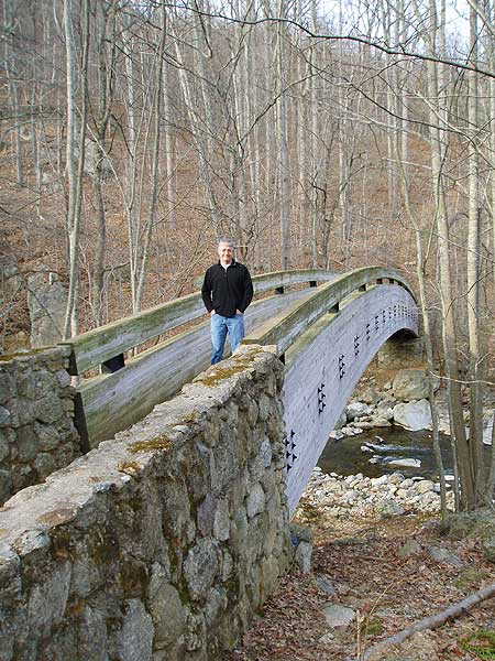
Overall very nice hike, about 6 hours in length. In winter, navigating the trail along the Crabtree Falls can be very tricky, as parts of the trail may be covered by ice. At the top of the falls, the trail continues on the right side of the creek (looking upstream, the bridge is on your left). Took me about 2 hours from the top of the falls to Spy Rock. There were multiple tents at the base of the summit boulder. There is no obvious way up the summit I scrambled over the rocks to the left of the trail leading to the base. Views from the top are superb!!
By:Jason
Rating:
Date of Hike: Tuesday, January 1, 2019
I have heard this is a great trail to hike, and finally did it yesterday. Totally worth it, and the amount of rain in Virginia, the falls were really flowing. Besides the amazing views, I enjoyed the gentle switchbacks. Hopefully they will be cleaned up soon, but there was a major windstorm (according to the locals), and a lot of trees snapped or fell, including many over the trail. They are working on cleaning it up, but there are just so many, so be prepared for some going over or under trees that cross the trail. The trail is never completely blocked.
By:Sarah Russell
Rating:
Date of Hike: Saturday, October 6, 2018
Did this as an overnighter from Crabtree to Spyrock. The 1.7 mile hike up to Crabtree Falls is very, heavily populated with day hikers and we were asked probably 75 times if we were hiking on the AT (we did not see any other backpackers on this trail). After the 1.7, it's a beautiful walk beside the creek where you end up at a parking lot with other campsites which had a few trucks and some car campers. The steep incline up the fire road wasn't exciting but definitely wore us out by the time we got to the top. There are a few secluded campsites a mile or so before Spy Rock which would be ideal if you want some privacy. There are probably about 10 campsites next to Spy Rock. There was a group of 12 kids who walked up (from apparently another short trail from a parking lot that we didnt know about) who were loud and obnoxious. It appeared as though a lot of car campers have easy access to SpyRock - people were bringing, coolers, big tents, chairs, etc. up from another trail. The view from Spyrock is a nice 360 but we spent more time gazing at the stars than viewing it during the day. It's a short scramble up to the top of the rock and my advice is take the same way down - we thought we would find an easier way down than then the rock scramble, but ended up getting lost in the trees and came back to the summit to rock scramble back down. The hike down from Crabtree was pretty slippery and was especially hard going downhill on tons of steps with a pack. This was a nice hike but we definitely chose a busy weekend and it seems to be generally heavily trafficked :)
By:Keith
Rating:
Date of Hike: Saturday, July 14, 2018
Out and back to spy rock per direction, BUT the direction seems to indicate to stay on the AT till you reach the falls parking lot.This is an out and back on the same trail retrace your step to get back to your car. Scramble up spy rock is nice and the view is good, but lack of trail marker got me wandering around till find my way off the rock. ARGHH!
By:Joe
Rating:
Date of Hike: Wednesday, June 6, 2018
Hiked this shortly after heavy rainfall hit the area and the falls were quite impressive. The discussion of the presence of bees almost deterred my hike, but while I did see a single yellow jacket and a good number of "other bees," they seemed to be out by themselves and, given some room, flew away without causing any problems. We saw a rabbit and a snake. I only caught the last foot or so of the snake, but it wasn't a dangerous one.
The hike is a spectacular one and well-maintained. It was muddy, with standing water in a lot of places, including between the stone wall and bench at the summit. With record rainfall, this was to be expected and the trails were in better shaped than I had expected.
There was a lot of fresh lumber on walkways, stairs, and bridges. There were even piles of lumber and wheelbarrows off to the side that seemed to be working on current projects. There are still some "pipe" railings up, but there were many more large wooden railings.
I did the hike with my 6 year old, who had no problem tackling the trail. There were a number of others on the trail, despite it being the middle of the day on a Wednesday young, old, and everywhere in between, many with dogs of all sizes. If you have difficulty climbing stairs, or coming down them, this would not be the hike for you: there are a lot and they are steep. Everyone else, there are plenty of places to stop and take a rest, so all skill levels can complete this hike.
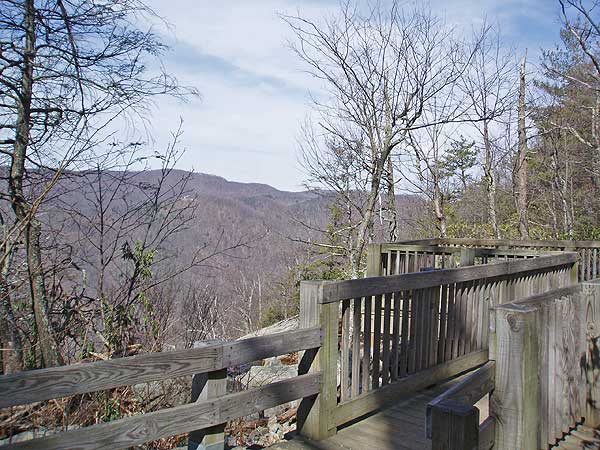
Also, the top of the falls (bridge, stone wall) is absolutely worth the view. There is so much discussion of the falls, which are incredible, but the view is just as impressive. Don't miss it.
By:BrianJB
Rating:
Date of Hike: Monday, June 4, 2018
Did the out-and-back to Spy Rock as an overnight . . .outstanding hike. Falls were going great because of earlier rains, and the weather was perfect, except for fairly strong winds at night. Camped at Spy Rock, only one other site occupied. Fair warning - lots of gain on day one, I measured 2200 feet plus, and thus, lots of down on the way back. Well worth it - the falls are the best I've seen, and the views from Spy Rock are great there are probably 5-6 decent campsites there are well. It's thru-hiker season (hey Mule - hope your food held out until Wayneboro). You can climb Spy Rock on either the right or left sides. . .the right side is shorter, but a scramble, left is longer but easier. Vault toilet half-way is a nice touch (not open in the winter), looked like a number of drive-in campsites at the Meadows (but would say the upper sites probably are best accessed with four-wheel drive). Lots of great places to stop for lunch on the way out as well, including Devil's Backbone brewpub.
By:Andrew Wilder
Rating:
Date of Hike: Friday, April 27, 2018
Due to the rainfall the previous week I decided to hit a waterfall today and I was not disappointed. I have done Crabtree many times but usually in the winter to avoid the crowds. This time I got there very early (6:30 a.m.) and enjoyed spectacular falls due to the spring waters as well as complete solitude. I followed the trail all the way up to Spy Rock and for once was the only person at the top enjoying the incredible views. On the way back the crowds increased and coming back down the Falls I was fighting a steady stream of people coming up. I also noticed a large number of yellow jackets that I didn't see in the morning. Overall a great hike!


