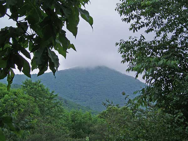
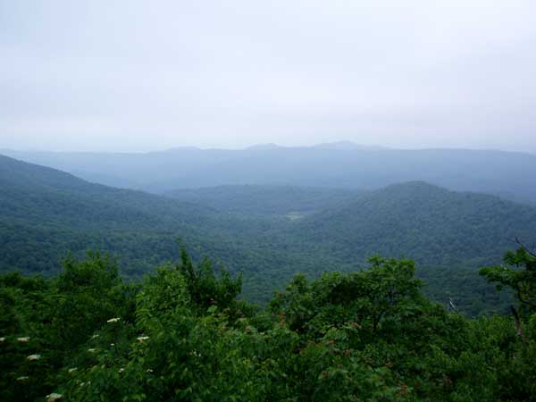
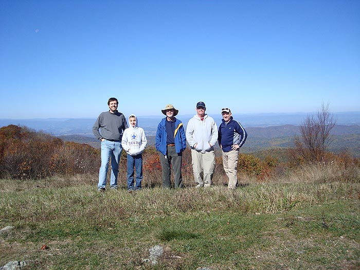
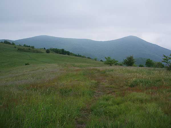
Can't make it to Scotland or Switzerland anytime soon to hike those spectacular high mountain meadows? Well right here in the Old Dominion we have the next best thing! Every hiker in the mid-Atlantic should hike Cold Mountain at least once. The 360° meadow views from the saddle are are some of the best on the east coast.
Cold Mountain is the sister circuit to the Mount Pleasant hike on the next ridge. If you are looking for a slightly longer hike, or a backpack, consider combining this hike with the Mount Pleasant route for a combined 11.3 mile figure eight circuit.
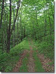
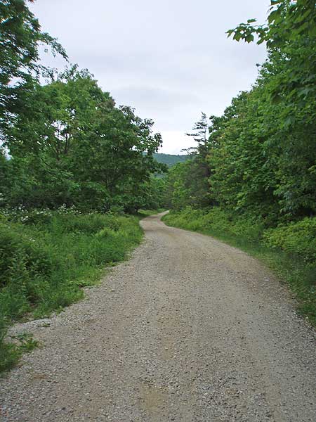
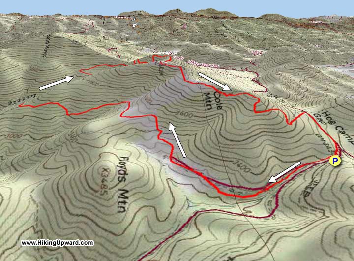
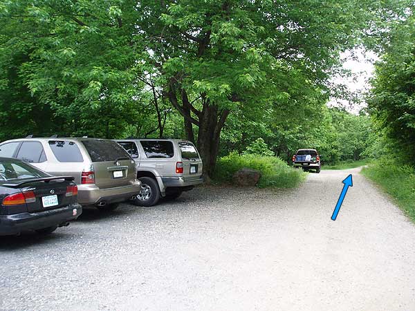
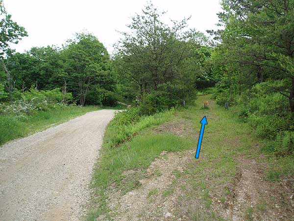
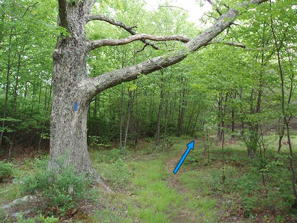
From the parking area continue down FS48 for 0.2 miles. Just before the road splits the Hotel Trail will be on the right marked by two posts with blue blazes. Head up the blue blazed trail for 0.1 miles arriving at a wooden horse gate (the trail on the left leads down to the Mount Pleasant parking area). Stay straight on the Hotel Trail passing through the horse gate. Descend slightly, then in 0.6 miles head back uphill climbing a spur of Cold Mountain.
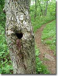
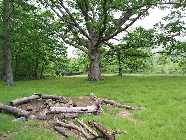
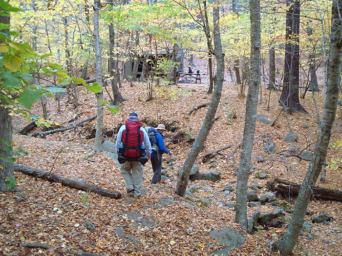
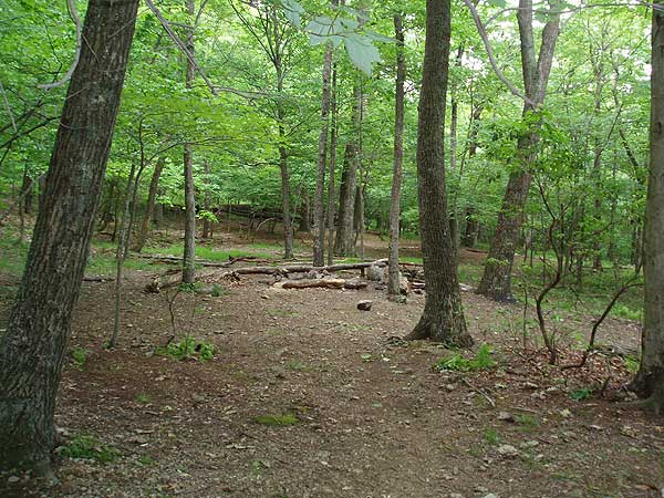
Reach the spur ridge entering a clearing 0.4 miles from beginning your ascent. At the end of the clearing is one of the prettiest back country campsites in the Blue Ridge. Situated among a stand of mature oak, this site is suitable for multiple tents.
On the southwest side of the campsite, or on its right corner as you approached, the blue blazed trail descends the spur. Continue to follow the blue blazed trail, cross a small stream, then arrive at the crest of a second spur in 1.5 miles (there is an overgrown abandoned trail on the left here).
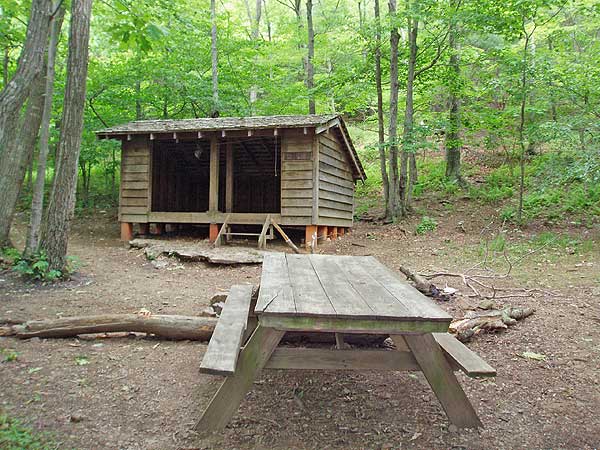
Continue downhill on the blue blazed trail into Cowcamp Gap, cross Little Cove Creek, then in 200 yards Cowcamp Gap Shelter is on your right. 100 yards to the right/southeast of the shelter in is a large campsite suitable for 4-6 tents, and 75 yards to the left/northwest of the shelter is a spring and the source of Little Cove Creek.
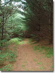
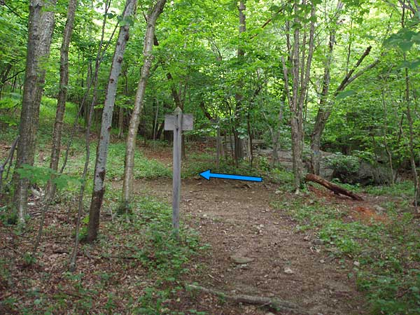
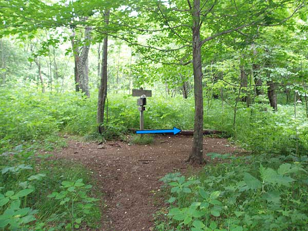
Continue up the blue blazed trail, on the opposite side of the creek than the shelter, and in 75 yards turn left on the Hotel Trail at the sign towards the Appalachian Trail (AT). (turning right and crossing Little Cove Creek at this point leads back to the spring and shelter. note: this side trail is also blue blazed)
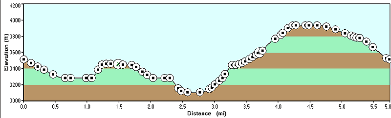
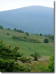
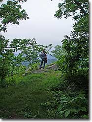
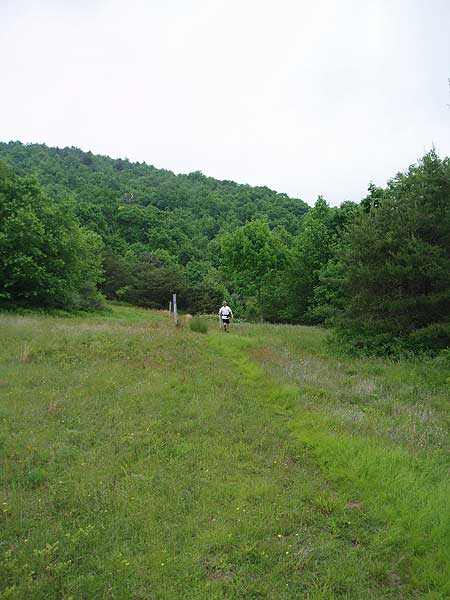
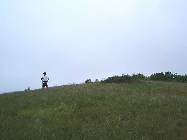
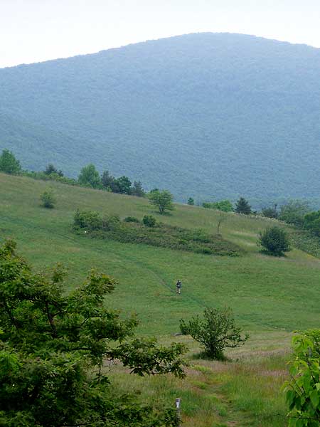
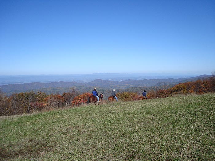
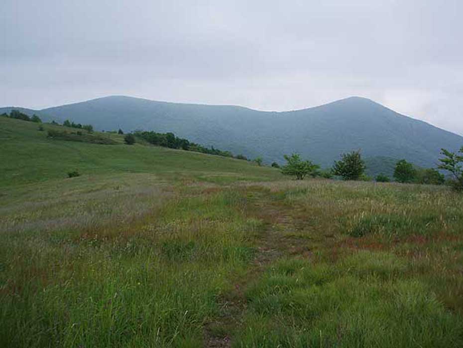
Continue up the Hotel Trail for 0.5 miles to the intersection of the AT. Turn right/north on the white blazed AT and make two switchbacks, pass two view points, then arrive at the first open meadow and 4033ft summit of Cold Mountain in 1.2 miles. Continue, passing through a small stand of trees before reaching the the main Cold Mountain saddle, and largest of the high mountain meadows. The saddle provides a 360° panoramas with views of Pompey Mountain and Mount Pleasant.
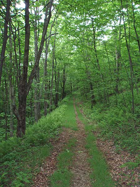
After re-entering the forest at the end of the meadow, follow the white blazed AT as it winds its way downhill for the remaining 0.6 miles back to FS48 and hike parking area on the right.
Mid June
Mid October
Cold Mountain
Cold Mountain Hike Comments
Archived Comments
By:Naturefunhunt
Rating:
Date of Hike: Monday, October 14, 2019
Beautiful day! Loved this hike with my furry friend. Saw a few people on the trail, but it was a Monday. Really pretty views along the way and a nice workout. I have done Mt. Pleasant before and this one is now on my go-to list for great views!
By:Benjamin Trogdon
Rating:
Date of Hike: Saturday, September 21, 2019
Great hike with an easy to follow trail marker. Spectacular views and secluded without being creepy. Loved it. And easy to do - was my first hike in a while.
By:Chris
Rating:
Date of Hike: Saturday, July 27, 2019
Great hike, trail well marked. I combined this with Mount Pleasant and camped at the meadow before the AT shelter. Make sure you pack all the water you'll need. The previous commenter who mentioned the drive to the parking area is 100% correct. Take a route from the west into the parking area. I accidentally took the eastern route out and it took FOREVER on a dirt road with deep trenches and no clearance.
By:Lea Ann
Rating:
Date of Hike: Monday, May 27, 2019
Traveled via 29south from Charlottesville. If GPS tries to take you across back roads between 29 and 60, don't do it. There is a major bridge out until projected November 2019 on route 718 or 788. The detour takes you all the way back to 29 to where it intersects with 60. Other than that the drive was fine to Hog Camp Gap parking via Wiggins Springs and FS 48 in a Chevy Malibu. No issues if you pay attention and drive around rocks/holes. Car camped there. It was absolutely stunning. Huge area so even though a holiday and the AT passes right through it, we felt alone at our campsite. The hike was as described here. Great views, lots of pretty streams, enough variety of up, down, and level time get a good workout without needing many rest breaks. Enjoy!!
By:Jeff Nelson
Rating:
Date of Hike: Saturday, September 29, 2018
My teenage and tweenage daughters and I are new to this. We did this hike overnight and thoroughly enjoyed it. The directions here are spot on. I intended to do the loop clockwise, starting with the blue trail, but we went counterclockwise. That was quite a hike with backpacks for people who aren't used to backpacking. We slept in hammocks at the clearing in the middle of the blue trail. Several groups were there and everyone had a good time. This was our first time with hammocks. It went well, but they were colder than I expected. I was bundled in a sleeping bag that has kept me toasty warm in the low 30s, but I was chilly in the low 50s. I was glad we got there early (just before 9 a.m.) and did the hike up the mountain first- we were able to look out over the valley before the fog in the low areas burned off. It was very pretty. The girls- 14 and 12 - really enjoyed it.
I wish I had...
brought more water (we had two reusable liter bottles per person and a gallon jug. We used it all and boiled some spring water).
brought the dog (lots of dogs on the trail)
brought something additional to wrap around the hammocks.
I worried unnecessarily about...
getting lost
getting too worn out
the girls being scared in the middle of nowhere with nobody around (lots of people around. Somewhere around 20 within a few hundred yards of where we camped.)
glad I brought...
a small stove and pot to boil water for freeze-dried meals (fire making is tricky with damp wood).
plastic measuring cups. It seems the right amount of water (and adding 5 minutes to the rehydration directions) makes a big difference in those meals. Toilet paper, hand sanitizer and a small folding shovel.
By:Ian M.
Rating:
Date of Hike: Sunday, July 8, 2018
Easily one of my favorite hikes in GW National Forest. 10/10 would recommend doing both loops, but FYI Cold Mountain is actually named Cole Mountain as youll see it referenced on the map/information board at the trailhead parking area. Either way, when combined with Mt. Pleasant, it made for one of the most enjoyable 2-day hikes Ive done in the blue ridge mountains.
By:Summit bumz
Rating:
Date of Hike: Monday, January 1, 2018
We have a tradition of New years hikes and this one was no let down. We made a out and back which is very easy to put together in this area if you can navigate maps. We arrived at salt log gap and hiked the AT SoBo to Tar jacket ridge. Temperature was 10 degrees F. Winds were low but clouds blocked the sun. We descended down to hog camp gap parking and onto the hotel trail to the camping spot as mentioned above. It is in very nicely groomed condition. Leave no trace was in full effect so thank to those before. We had things setup before sunset and it had hit 6 F by sunset. We did not come out of our 0 degree bag all night once setup. My thermometer wouldn't work but my phone had signal and it read -5 in Amherst at 6am so maybe -8 up at camp. It took awhile to get moving in the morning but we backtracked to the car on the AT NoBo.
By:Sara Beth
Rating:
Date of Hike: Thursday, September 28, 2017
This hike is fantastic. Very easy. You wouldn't have any trouble with a weighted pack, kids, or dog. The saddle is worth every second. It's breathtaking. I spent about two hours in it with my chocolate lab. Today was super foggy, so it wasn't too much for views. But the meadow is something out of a storybook. Be warned, take it slow on the road up to the trailhead. Even in a four-wheel-drive vehicle, it's extremely rough. In my low set 2 Wheel Dr. car, there are point where you're not quite sure if you're going to make it. But you will. Don't be deterred. Just drive slow. :)
By:Victoria
Rating:
Date of Hike: Saturday, September 16, 2017
My boyfriend and I hiked this and it was awesome. We passed maybe 5 other couples and 2 families the entire 4.5 hours we were out there. The trail is very well marked and it didn't get boring. We went "off the beaten path" a couple of times too that was exciting! We already plan to return because setting up camp here would be a great idea. We passed several tents at the camp ground along the way and were jealous that we weren't prepared. When you get to the top where the meadow is, it becomes so rewarding. Growing up in the south where mountains don't exist, seeing that view was incredible. This was the prefect hike for a Saturday afternoon. Looking forward to going during the fall when the leaves start turning!
By:Nick
Rating:
Date of Hike: Sunday, August 6, 2017
I've hiked quite a few places in VA, but the near 360 view from this mountain is like no other. The hike is very manageable, almost easy. The meadows are great for pictures. Highly recommend this hike.


