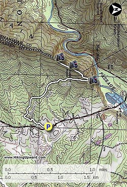
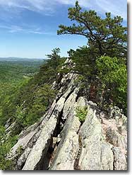
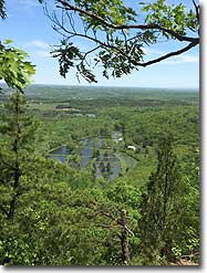
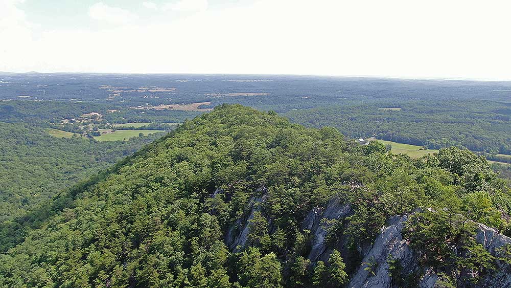
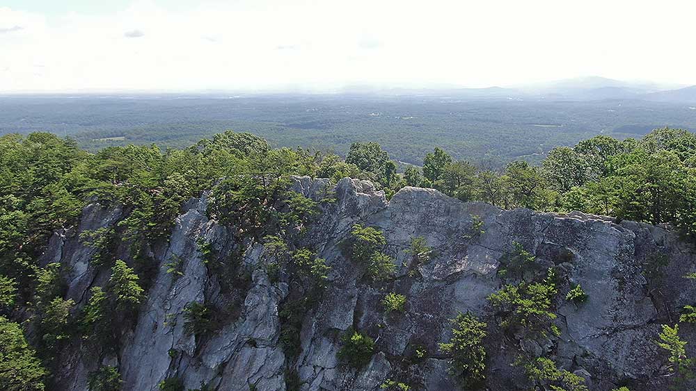
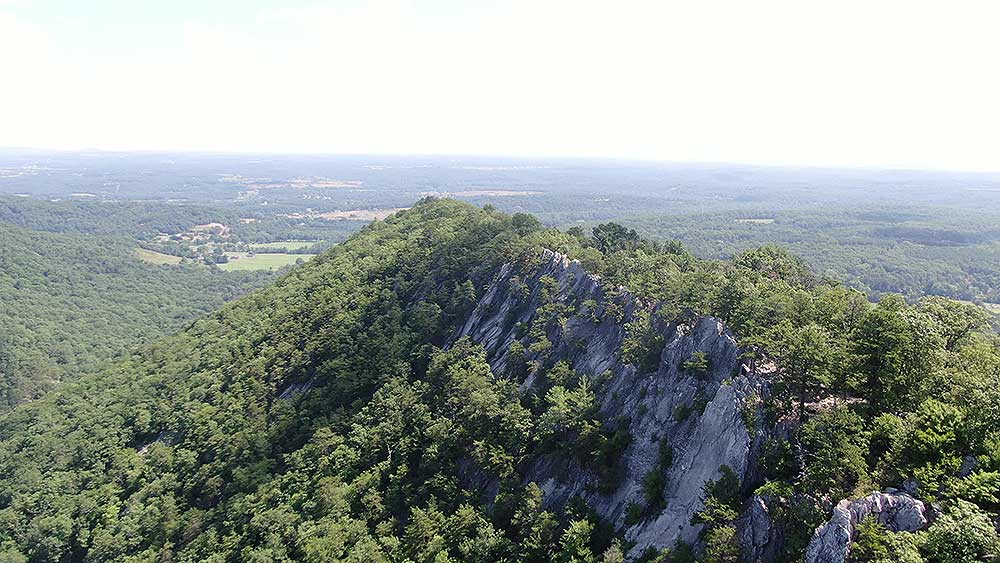
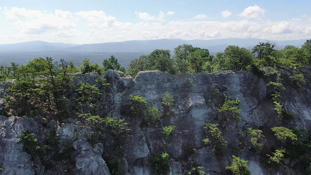
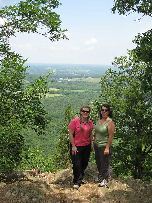
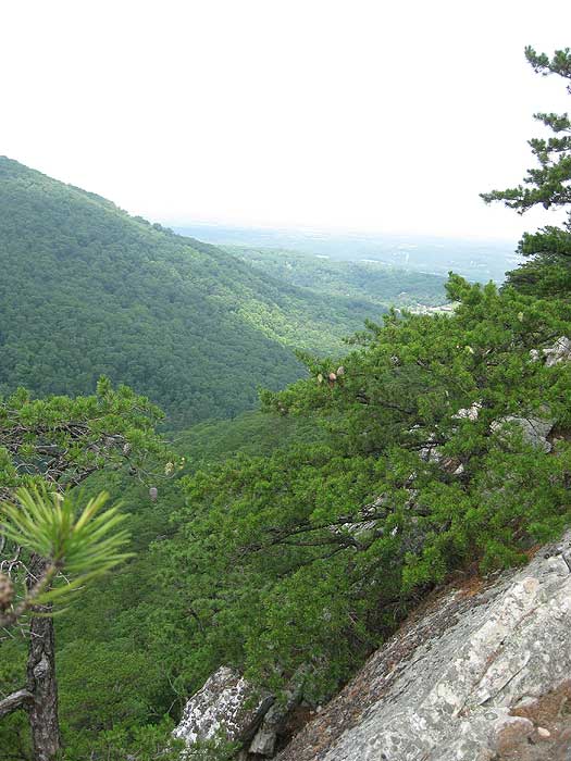
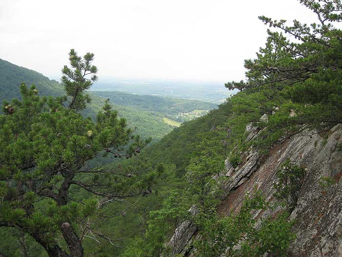
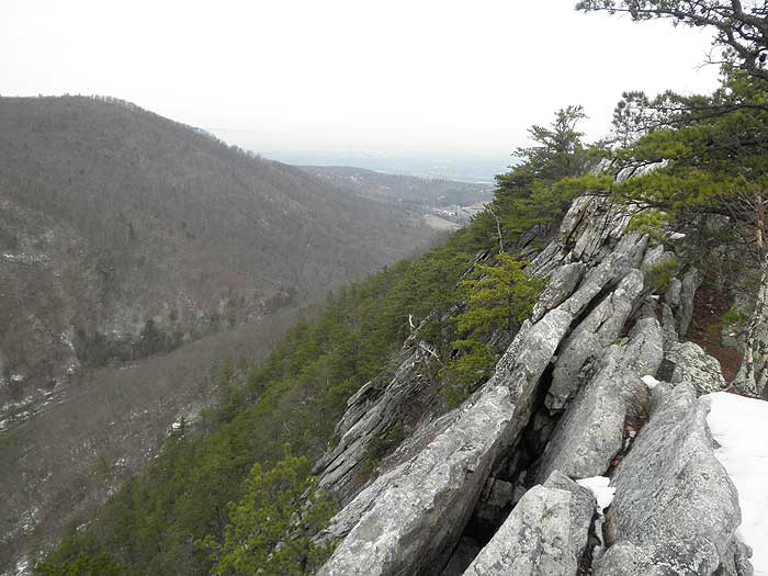
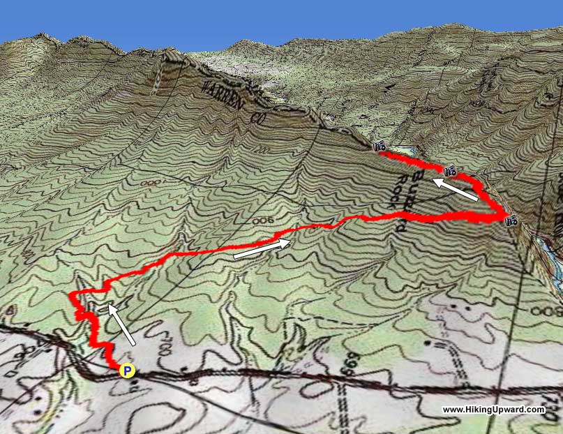
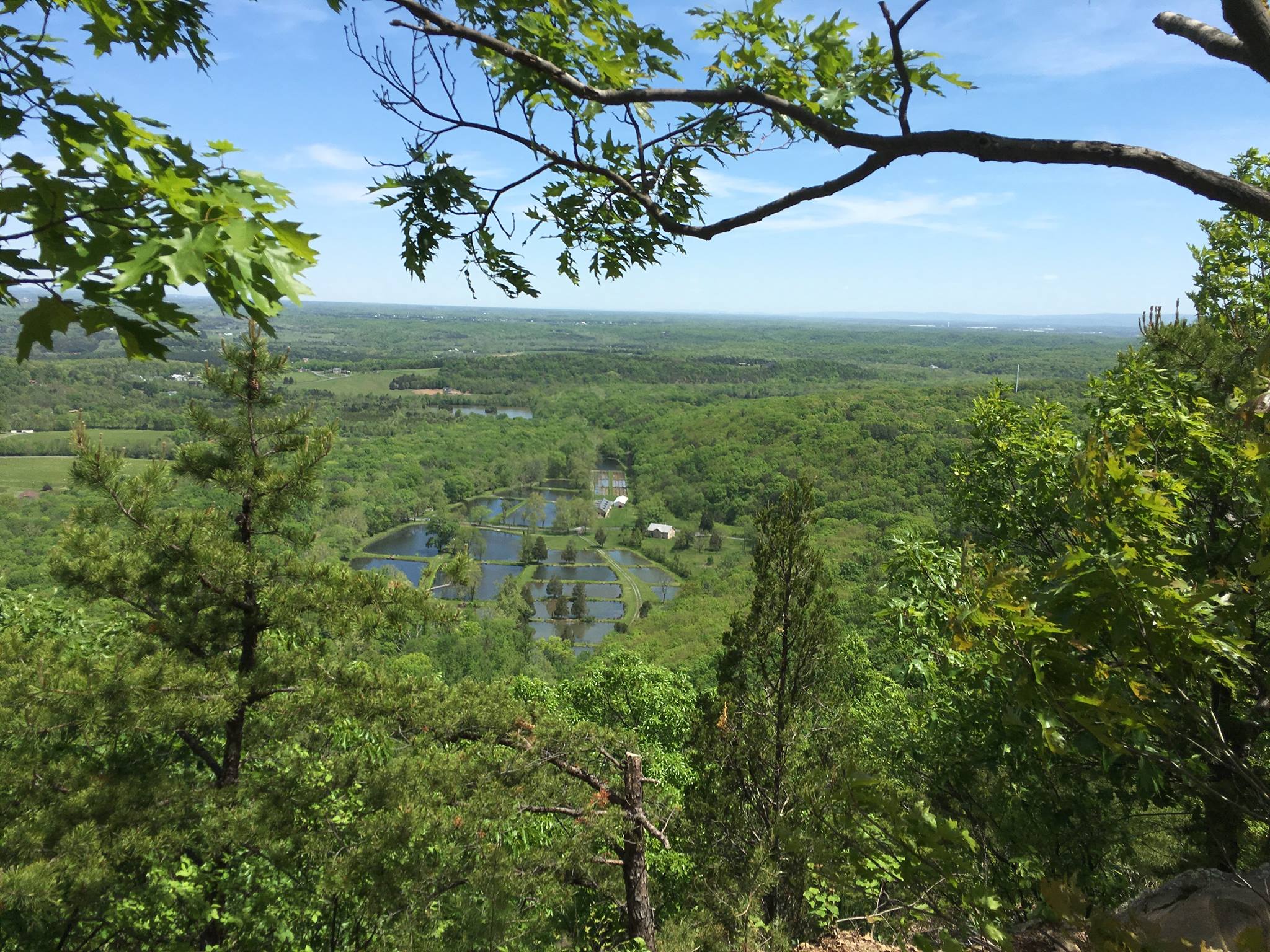
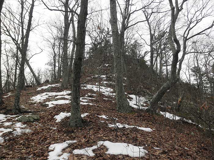
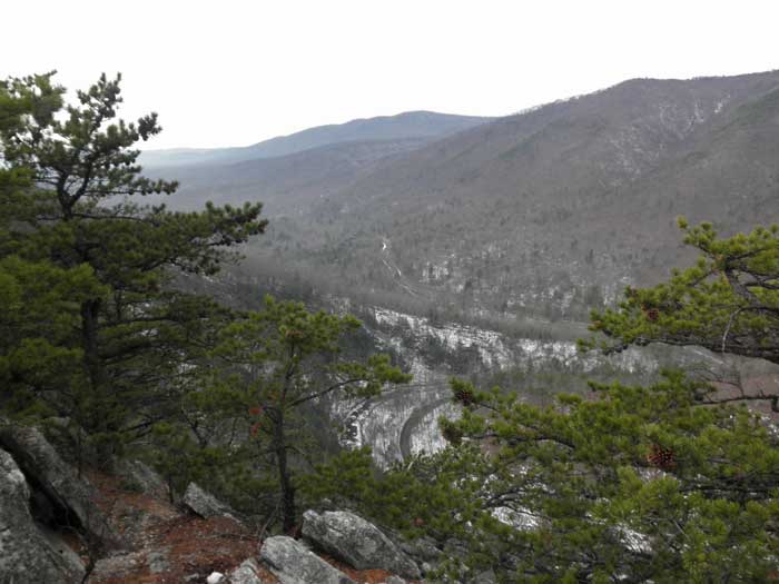
The Buzzard Rock North hike is a short and easy hike that has a great payoff with spectacular vistas from Buzzard Rock. Buzzard Rock is the high point of the cliffs that are visible from Fort Valley. The main rocks area have commanding views to the south through Fort Valley, as well as from the overlook of the Fish Hatchery to the north. The Buzzard Rock cliffs can also be accessed from the south on the Buzzard Rock hike that starts at the Elizabeth Furnace picnic grounds.
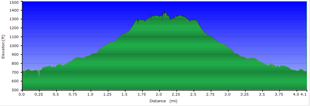
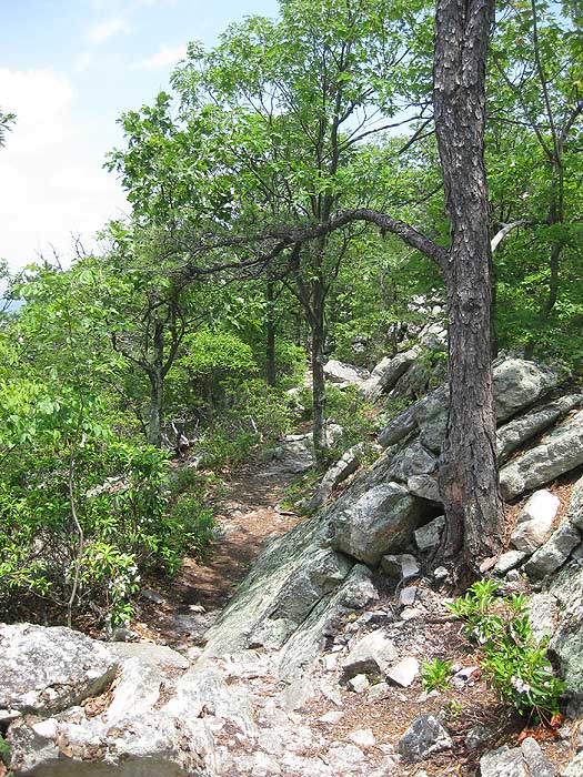
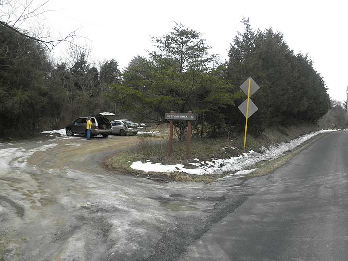
From the Buzzard Rock parking area on Mountain Rd/VA619 follow the white blazed Buzzard Rock Trail as it winds through several small hollows on the lower part of the mountain before becoming more steep and reaching the ridge in 1.5 miles.
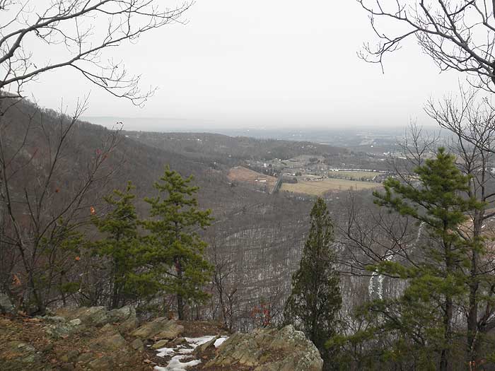
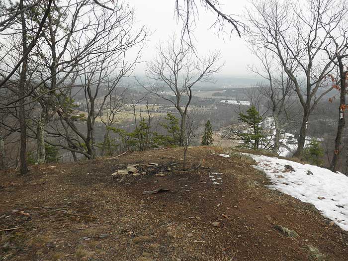
From the ridge there are views towards the north and Winchester, as well as to the east and the Front Royal area. There is a small campsite and fire ring at this point but the ground is uneven. The next good campsite on the ridge is in another 1.8 miles, 0.1 miles before the Shawl Gap trail intersection.
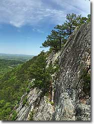
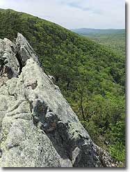
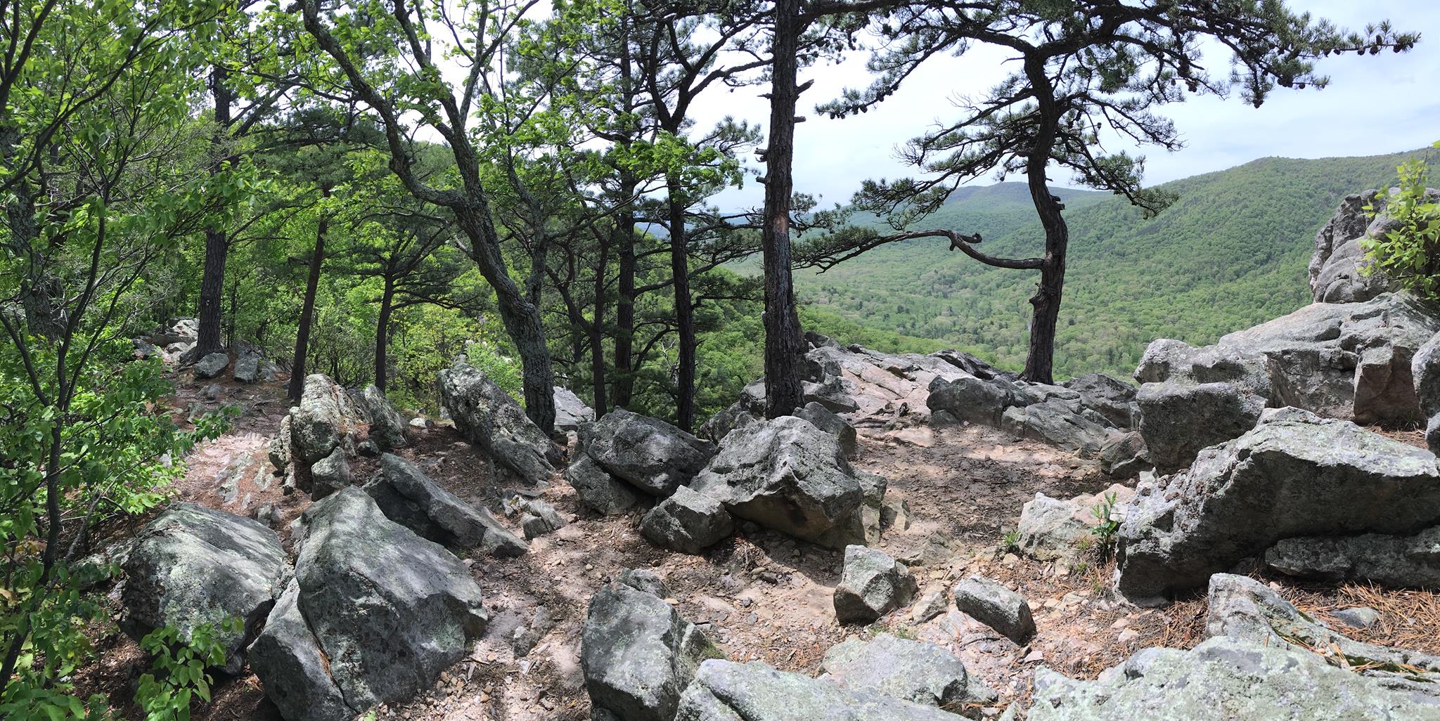
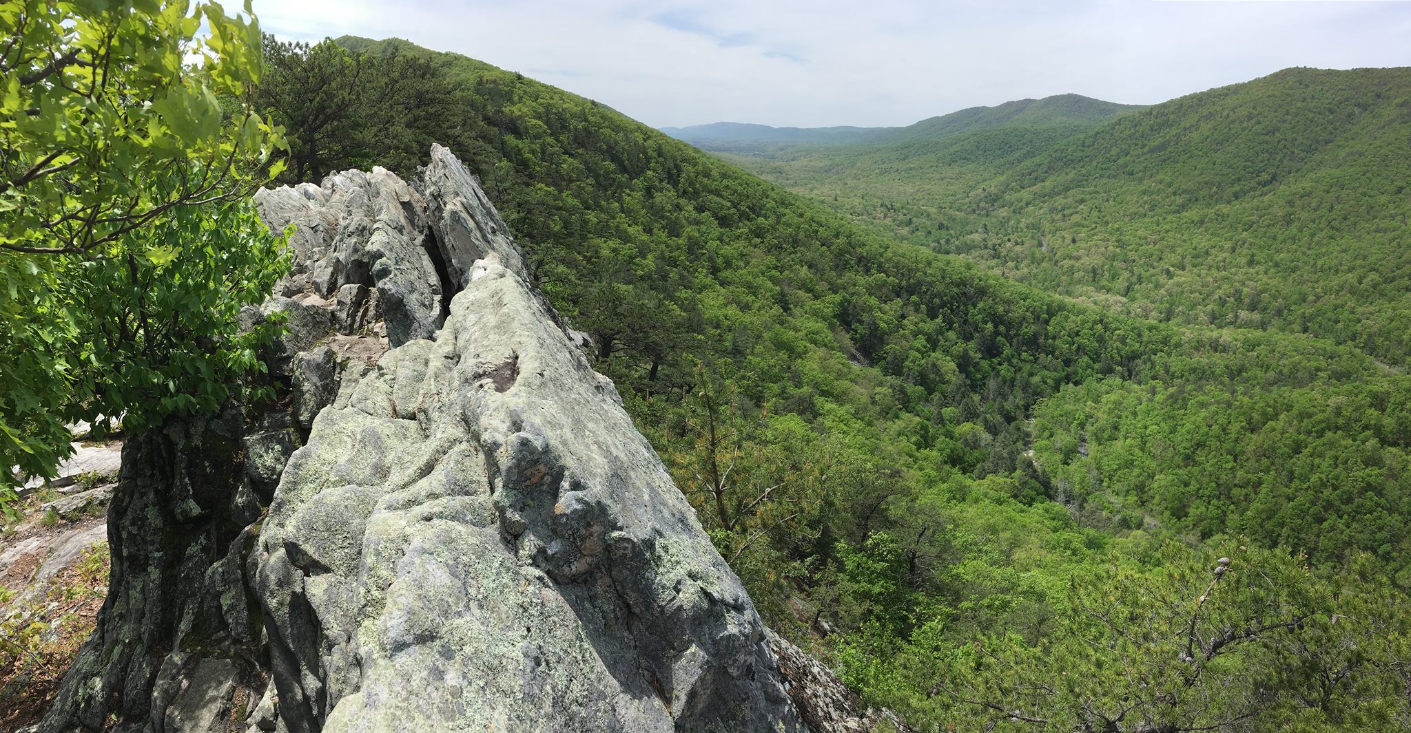
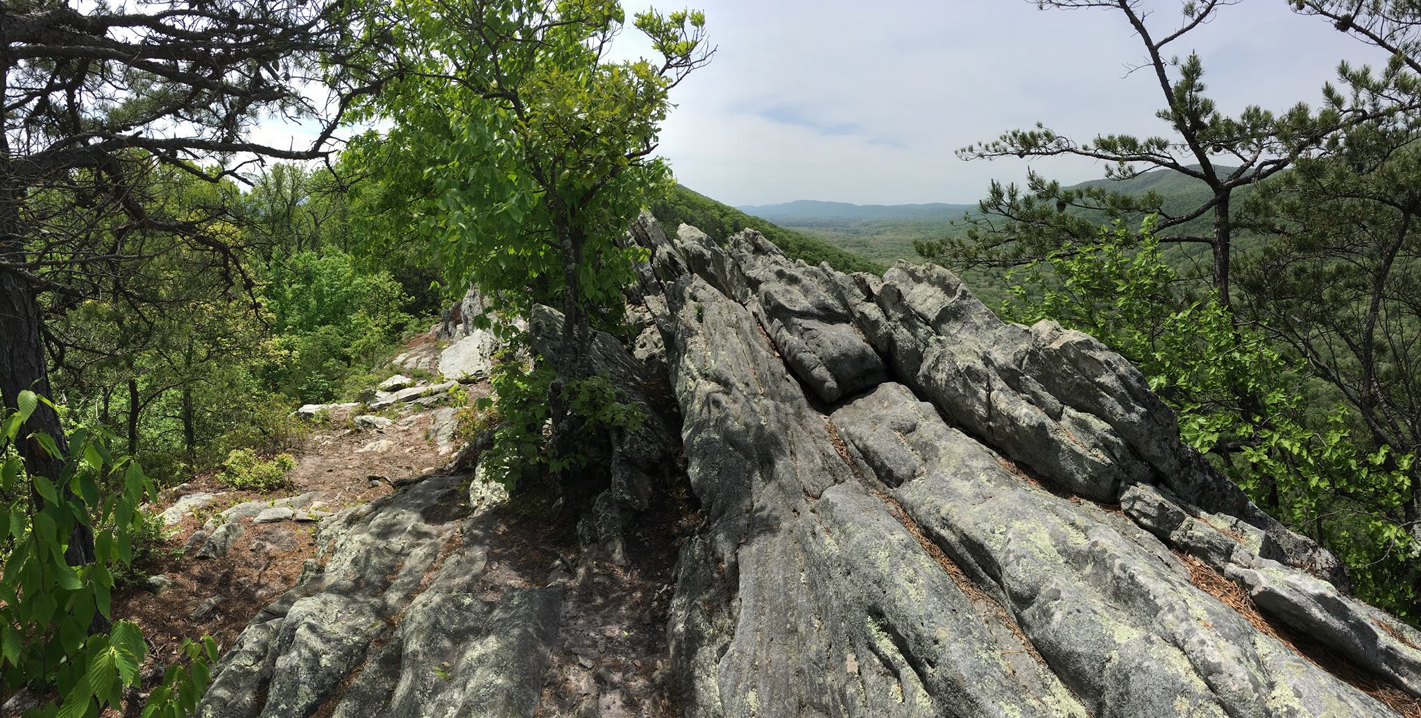
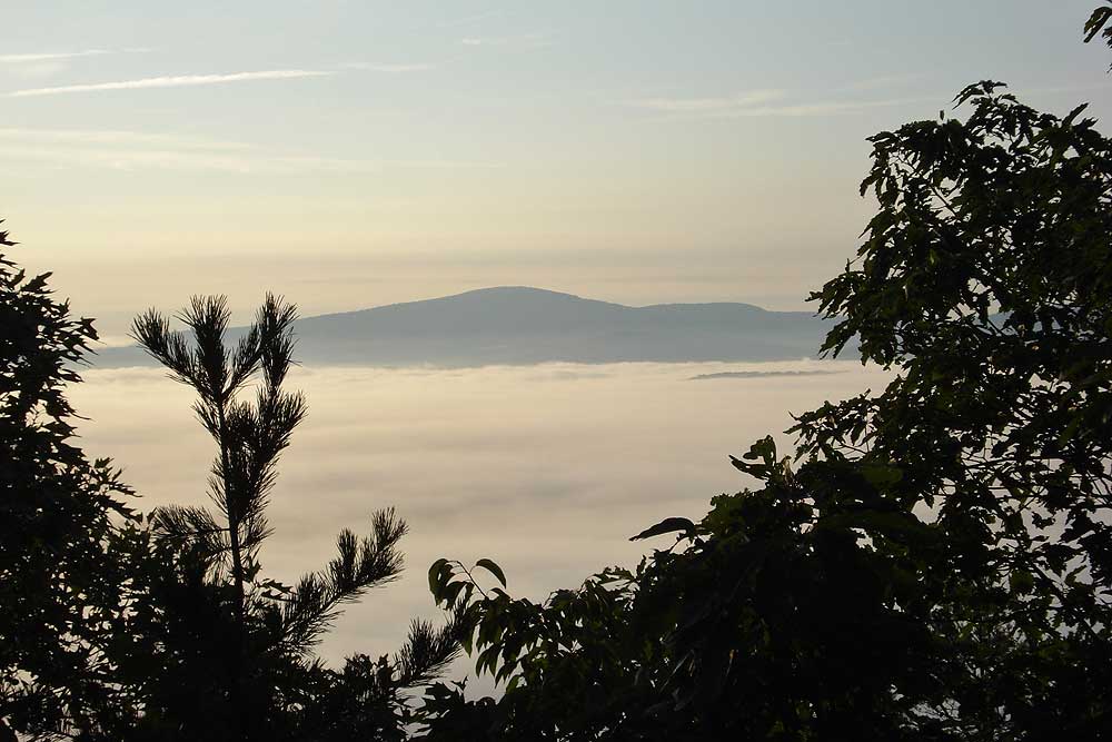
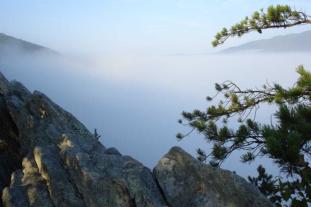
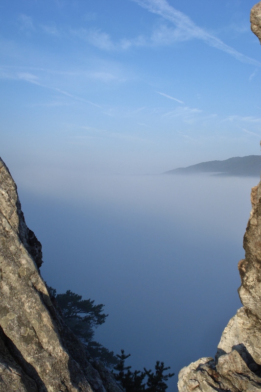
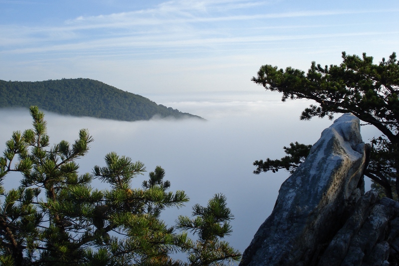
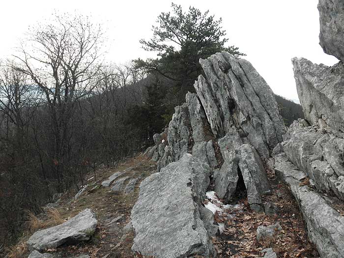
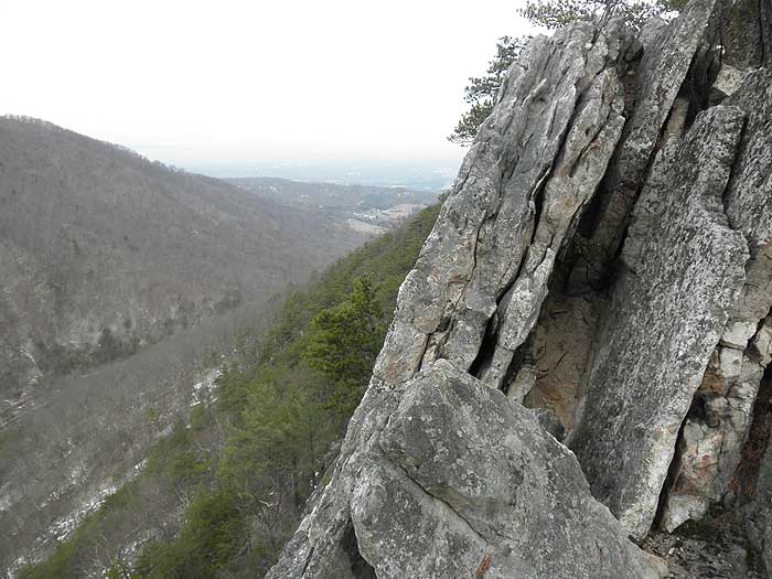
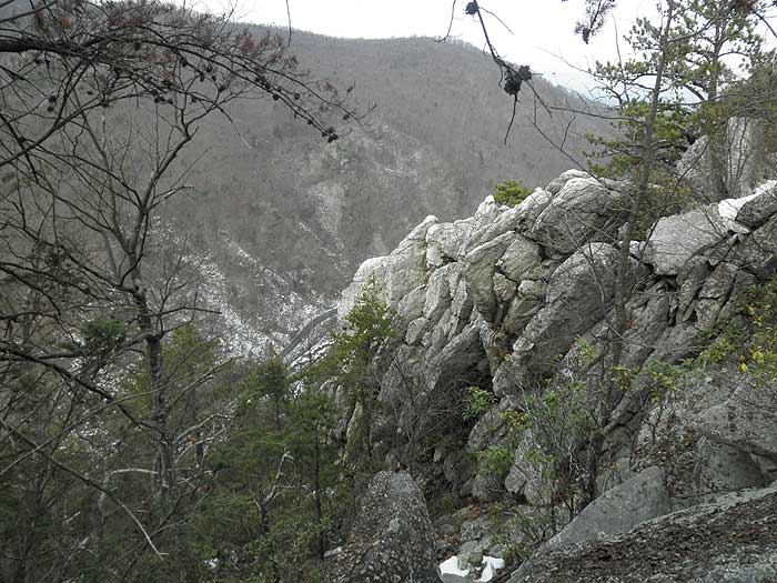
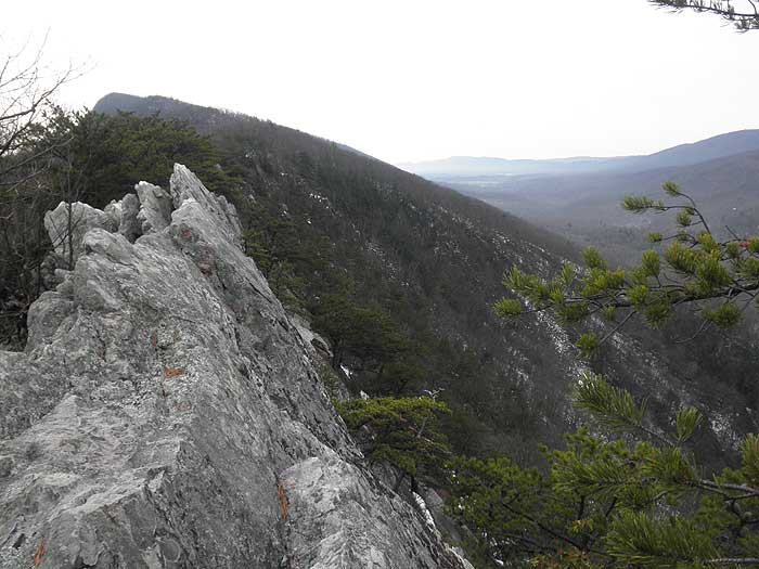
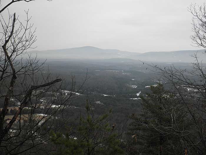
Continue on the ridge and in 0.1 miles, the trail will make a short switchback with a climb over a small knoll. In another 0.1 miles after crossing the knoll reach the first of several great overlooks from the Buzzard Rock Cliffs. Follow the cliffs for another 0.3 miles where there are spectacular views of Fort Valley. Turn around at this point. The white Blazed Buzzard Rock Trail continues another 1.8 miles to the intersection of the Shawl Gap and Massanutten Trails.
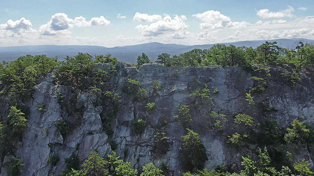
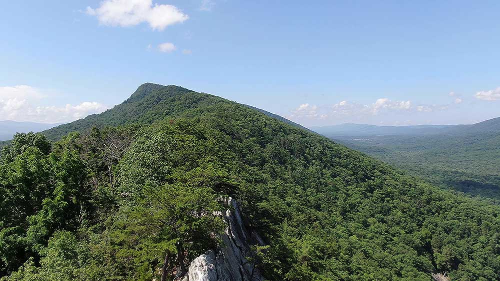
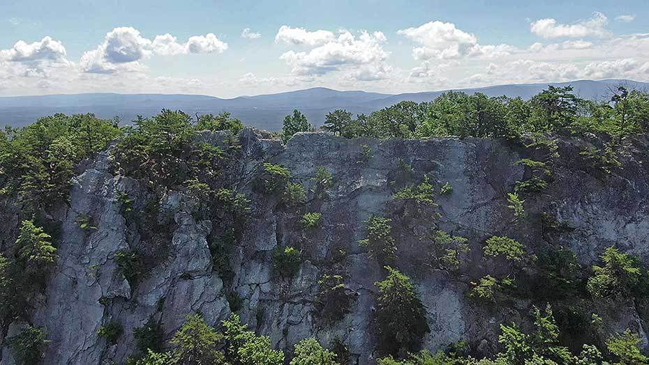
Early July Aerial
Early May - Photos Courtesy Jim Brewster
Late
August - Photos Courtesy of J. Thomas Holman
Late
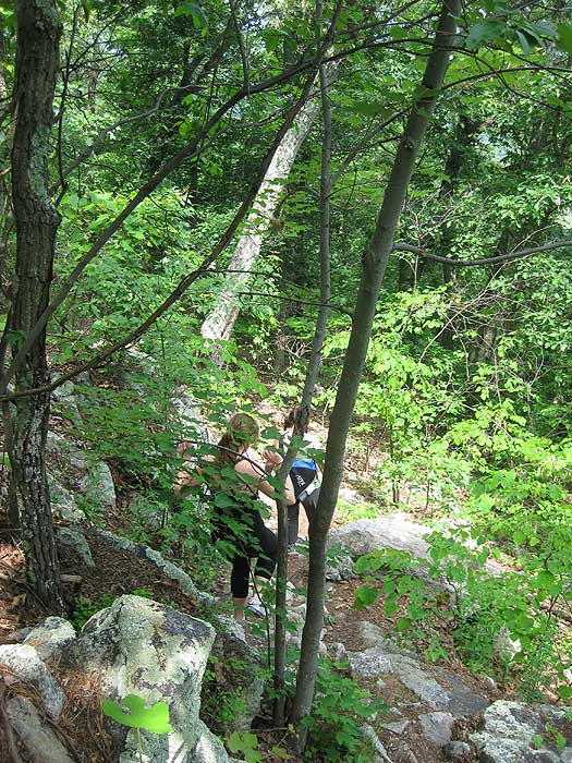
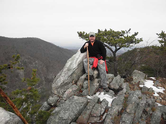
May - Photos Courtesy of Heidi W.
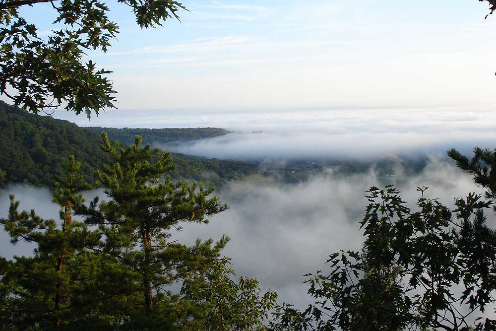
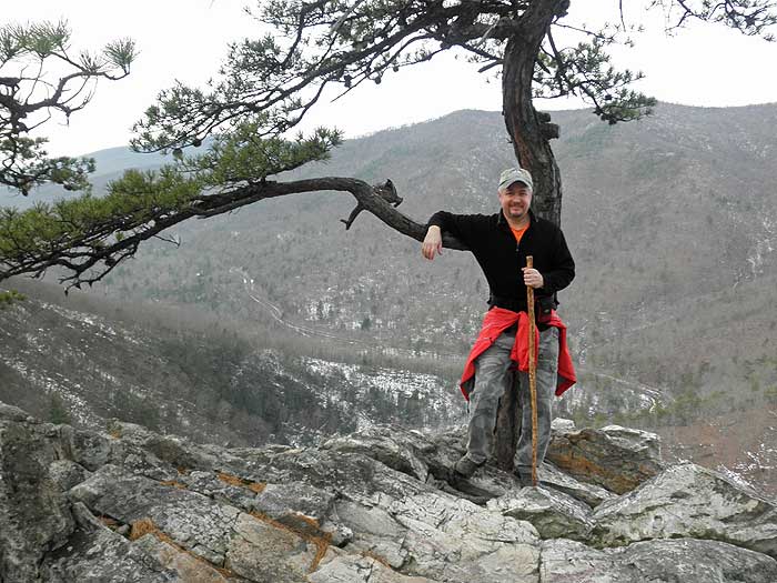
Mid January
Buzzard Rock Video
Buzzard Rock
Buzzard Rock North Hike Comments
Archived Comments
By:Ash
Rating:
Date of Hike: Friday, May 10, 2019
I was looking for a short hike with nice views and this met those requirements. Not the hike to do if youre looking for solitude. The trail is well maintained and easy to follow. I think that this would be a good hike to take kids on since its not too strenuous yet you get some great views.
By:Barry C.
Rating:
Date of Hike: Friday, November 10, 2017
Great hike--local "go to" favorite with stellar views of Fort Valley with a relatively short hike. If the parking lot is full, DO NOT PARK ALONG THE ROAD! West side is posted, east side is not, but they'll tow you regardless, even if you're 100% off the pavement. If you do get towed, call the Warren County Sherif and they'll tell you how to get your car--it's likely in Front Royal and will cost you $150.
By:Alexandra
Rating:
Date of Hike: Sunday, May 7, 2017
Hiked out to Buzzard Rock to climb at the top, and the hike was very moderate, even on the "steep" section at the end. The views overlooking the fish hatchery and at the top are incredible, and comparable or better than views from the other side of the valley along the Meneka Peak trail.
By:michelle
Rating:
Date of Hike: Saturday, March 25, 2017
Warning! The "No Parking" side on the side of the road at the trailhead on route 619 Mountain Rd is bent over and facing the wrong way. Do not park on the side of the road. You will get towed. I got towed because I didn't see the "no parking" sign because it was knocked over facing the wrong way, behind another car that had parked in front of it. If it were not for finding my car gone at the end of the hike, it would have been a perfect day. Thank you to the two wonderful women who had just finished their hike for giving my son and I a lift into Front Royal to pick up my car.
By:Jamin
Rating:
Date of Hike: Saturday, February 25, 2017
Great Hike! local favorite short hike with big reward check out out the video link below
https://www.facebook.com/dronejamin/videos/1845174062364595/
By:BarbG
Rating:
Date of Hike: Saturday, February 11, 2017
Loved this hike! FABULOUS VIEWS. Mostly Easy hike.*** NOTE TO ALL-- we arrived at 3pm on a Saturday and were lucky to find an open space in the small lot. Just after our arrival a Police officer arrived and informed us that all cars that were parked out on the road were to be towed. There were 6 at least. He asked us to tell everyone who we saw. ugh. We did, which was awful news to deliver to each group coming down, but at least people knew where their cars went. Some made it in time, some did not. After we came down, we talked with people who had cars towed... seems the one No Parking sign had been in the ditch as they parked.
By:Christopher Boyce
Rating:
Date of Hike: Sunday, December 25, 2016
Hiked out to Buzzard Rock on Christmas day. Was my second hike here, and was again rewarded with beautiful views, unique rock formations, and gnarly wind-swept vegetation. Give this hike five stars for its high payoff with minimal investment of effort and time!
By:Stephanie
Rating:
Date of Hike: Sunday, September 11, 2016
We (group of 3) started the trail at approx. 10:15am on Sunday and there were 3 cars in the (small) parking lot. My husband and I are semi-regular hikers (weekenders mainly), and our friend had not been hiking/active for probably 2 years or more. We all found this hike to be fairly easy (probably a #2 rating). I would recommend proper footwear with ankle support, as the trail does get rockier (but not too bad) as you near the top. I didn't feel like there was really any challenging incline until you are closer to the top - then you do a small bit of scrambling and your there. Of course this all varies on your overall fitness level - just take it slow and steady and you'll get there. We had trekking poles with us as well, which helped both on the way up and down. The trail is fairly wide and well maintained, so there are plenty of places to stop and take a breather if you need. The views are great. We had a lovely breeze and beautiful blue skies. On our way down we passed a group of about 10 - looked to be a family get-together. All ages, including a dog, were on the trail. Go out and enjoy!
By:Cary C.
Rating:
Date of Hike: Saturday, June 18, 2016
Whew! This hike kicked my butt. I hike weekly and am in good shape for my size, but I am overweight (trying to lose!) and so I purposely don't do hikes rated over a '2' in difficulty. Most of the 2's on this site I've done have been solid 2's (and I've agreed with the difficulty level assigned)--a good example of this is Hollow Brook Trail in Bluemont. I'd been eyeing Buzzard Rock for a while, but some of the comments made me a bit unsure about the difficulty level (someone below said this should be a 3 or 4 and not a 2). This past Saturday was a beautiful June day and I decided to head out with my dog and try it out.
I'd say the first 15-20 minutes were enjoyable. The rest of the hike--literally--was unpleasant and HARD. The whole way up was mostly uphill--no real breaks of flat or downhill walking, just slowly trudging uphill and navigating increasingly bigger/more challenging rocks. I think for MOST people who are decently fit, this would just be a good workout. But I read somewhere on this site that this trail is great for beginners through experienced hikers/hikers of all levels, and I would disagree with that. This is NOT a trail for beginners or people who aren't used to hiking/this kind of exercise, and definitely not during warmer summer months. Once you get to the first overlook (and you still have by far the hardest ahead of you), you already feel like you've done enough hard climbing for the hike to be over with--and this is not just me saying this, as I encountered half a dozen other groups of fit, experienced hikers who said the same. At the first overlook I was resting and a group of hikers descended to where I was, commenting, "wow, and I thought THIS was hard when we got to this first overlook!" I said "Great!" and they laughed and said, "well, it's not really far to the top DISTANCE wise but...it's quite a steep climb!" And another chimed in "They told me it wasn't that long, but oh my god, my LEGS!" and acted like her legs were jello--this girl was maybe 125 lbs max. From this first lookout I proceeded to the "top" of the hike and was confused along with at least 3 other groups who were confused, about where the actual "top" or culmination of the hike was supposed to be. Once you're on the ridge there are multiple places with vistas, but you're unsure the whole time whether you've finally reached the last point that this site references or not. Some of the groups ended up stopping at one of the first because they were tired enough, others kept going. I stopped at the 3rd or 4th vista and a group of guys went ahead of me to keep looking, but I was told from other hikers that the next closest vista was about another 45 minute-hour long semi uphill climb on the ridge and once there you had views of the airport, etc. Having run out of water and at least 3 hours in, I threw in the towel. Even though once you ascend the ridge it's technically mostly flat, climbing the rocks and boulders on the ridge make it aerobically almost as hard as going up the ridge (where there were fewer rocks). After looking at everyone else's pictures I now think I did reach and probably went PAST the "end point" but am still curious to know.
A few points:
-The parking area is easy to miss. If you put the coordinates into your GPS that the site provides, it will tell you you've arrived when you're driving and woods are on both sides of you with no parking lot. So, you have to look out for it--it's a bit hidden until you're right up on it, but there's a sign with the trail name on your right.
-Dog friendly trail! I saw at least half a dozen dogs that were all leashed. I take mine off leash and no one cared except one couple who gave me dirty looks.
-This site and commenters say there are a lot of streams--that's true for maybe the first quarter of the trail, but once you start heading uphill more (and once you start getting hotter and needing more water) there is no more water access. So if you have a dog, definitely bring a bowl and water for them! My dog was super hot and thirsty and another group of hikers was nice enough to let me borrow their bowl for him.
-Beginners, people with children or out of shape or overweight people--this trail will take you at least 4 hours round trip.
-Bring hiking poles or pick up hiking sticks to help you navigate the rocks, and even when going downhill keep your eyes glued to the path and be VERY careful! Even the ridge climbing (relatively flat) and downhill are a workout and require your absolute focus because of the navigating and scrambling over rocks and boulders. I fell twice!
-I would rank this trail as a 3 in difficulty and not a 2, and that is based on not only my experience but the over dozen other groups of hikers I encountered and their comments.
-The views are BEAUTIFUL! Just wish there were a way to be more clear what the actual endpoint is, so that you can relax and enjoy your hard work!
By:Micah
Rating:
Date of Hike: Sunday, May 15, 2016
Hiked this last month and loved it. Trail was in good condition, however it was a big muddy in spots. Not many people on the trail and the views at the top were great. We took our 9 month puppy who had a great time playing in the streams. Would definitely recommend this hike to someone looking for a day hike with rewarding views. I made a short GoPro vid of our hike if interested: https://www.youtube.com/watch?v=6rR3cixPobw


