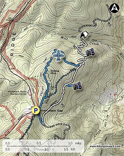
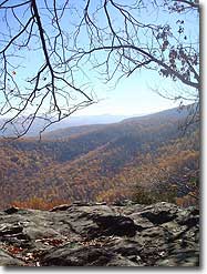
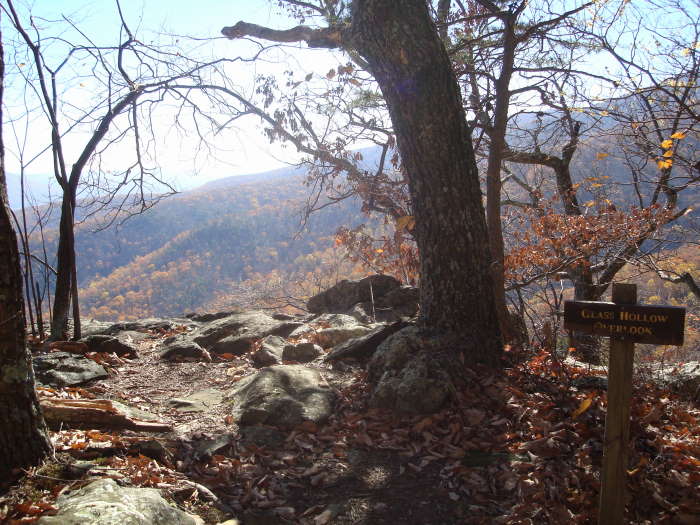
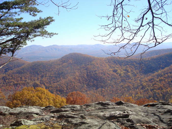
Dobie Mountain is not as popular as its neighbor, Humpback Rocks, but is a nice hike if you want to get away from the crowds. Less than 1.1 miles into the hike you will reach the Glass Hollow Overlook that has some great views of Rockfish Valley. We had lunch at the Paul C. Wolfe Shelter and then returned via the Albright Loop Trail with a side visit to a visible plane wreck just off the trail.
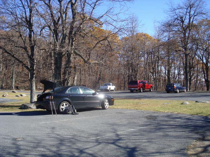
We parked at the Humpback Rocks Parking Area (MP6 on the Blue Ridge Parkway). This hike can be done as a shortened 4.0 mile hike or as a 6.8 mile hike if you choose to go to the shelter for lunch.
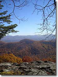
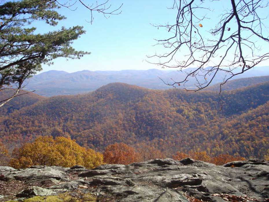
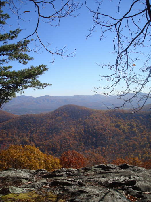
The blue-blazed trail begins to the right of the picnic table and directly in front of the first parking spot, do not take the well signed Albright Loop Trail to the left of the picnic table or you will miss the Glass Hollow Overlook. There is no sign for this trail, it is the Old Howardsville Turnpike and will take you to the A.T. intersection in 0.3 miles. At the intersection take a sharp left onto the white blazed A.T. heading north. Continue 0.8 miles to reach the spur trail to the Glass Hollow Overlook. Take a right on the blue-blazed spur trail reaching the overlook in 0.2 miles for some great views of Rockfish Valley.
Return to the A.T. and take a right heading north. In 0.3 miles you will pass the first intersection of the Albright Loop trail, go another 0.1 miles to reach the second intersection of the Albright Loop Trail. If you want to do the short 4.0 mile hike, take a left at this intersection. If going to the shelter, bear right staying on the A.T. going north.
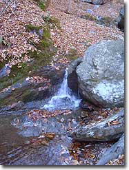
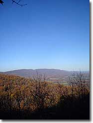
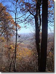
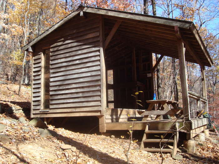
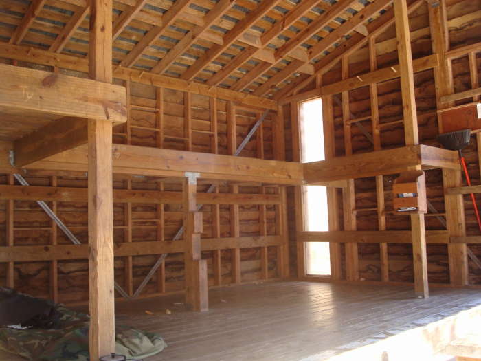
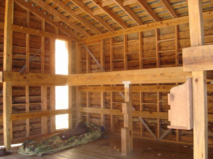
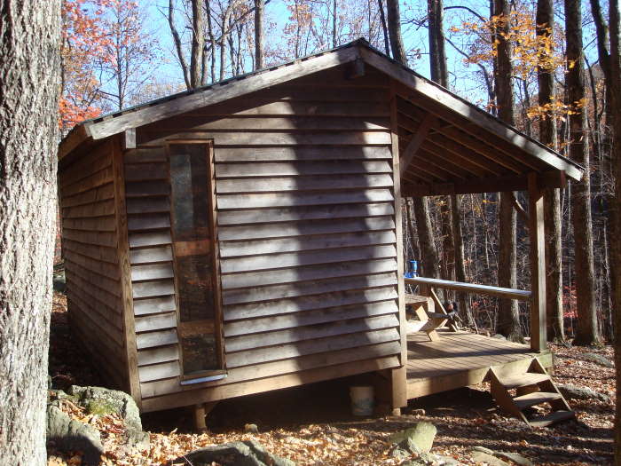
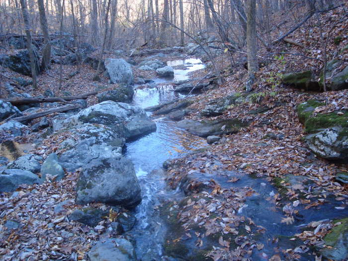
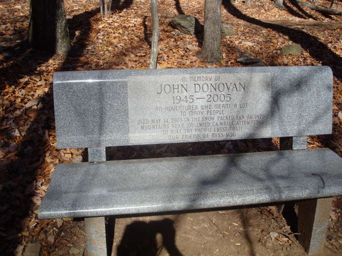
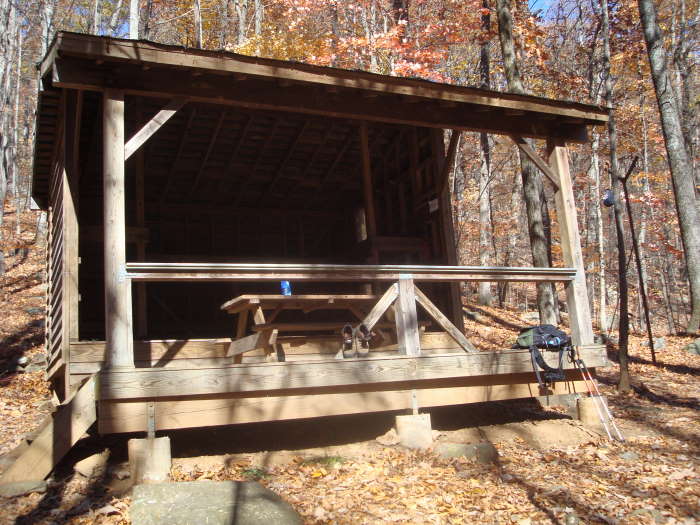
The next 1.4 miles down to the shelter is a fairly gentle series of switchbacks, dropping 700 ft. At the 0.5 mile mark there is an overlook with views of Scott Mountain and Bear Den Mountain in Shenandoah National Park to the north. I-64 will also be visible. Just before the shelter you will cross over Mill Creek and to the right you will see a beautiful granite bench that is a Memorial to John Donovan, a long time Old Dominion Appalachian Trail Club (ODATC) member who died in California while hiking the Pacific Crest Trail. The ODATC maintained shelter is one of the nicest on the A.T. in VA. After lunch, head back south on the A.T. and at the first intersection you arrive at take a right onto the blue-blazed Albright Loop Trail.
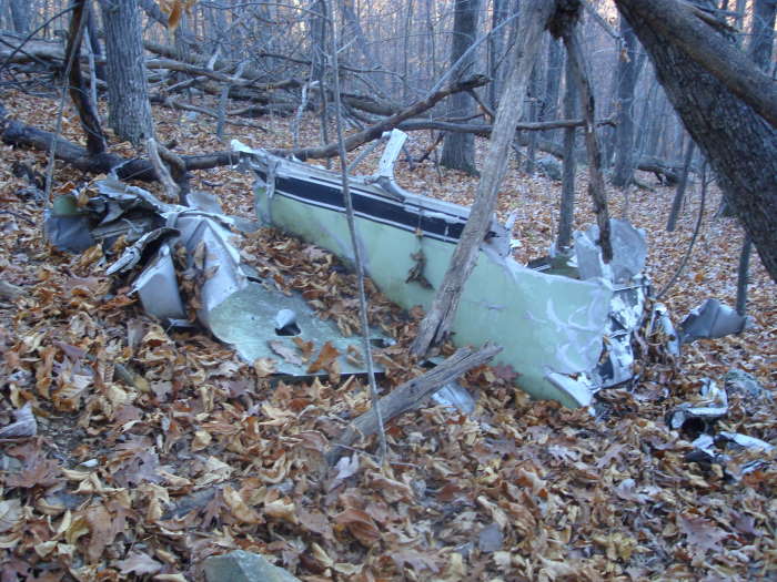
Go about 0.7 miles and after the second switchback look uphill to the South for plane wreckage that is visible from the trail. Mr. Henri Weems provided information that it is a Beechcraft that crashed in 1964 and was found a year later by ginseng hunters, no flight plan had been filed. Please respect this site and adhere to the Leave No Trace principle "Leave what you find".
Continue on the Albright Loop trail, passing the intersection of the east portion of the Albright Loop trail, arriving at the Humpback Rocks Parking area in 1.3 miles.
Mid November
Dobie Mountain
Dobie Mountain Hike Comments
Archived Comments
By:Chris OD
Rating:
Date of Hike: Saturday, November 2, 2019
Crystal clear blue skies and a brisk 35F at 10 AM when I started. The Humpback Rocks parking lot was already overflowing. Thankfully none of them followed me North! Only saw a couple of other hikers as I headed North. Chatted with a through-hiker at the shelter. He was flip flopping and was only 150 miles north of finishing the trail. The loop trail on the way back to the parking lot was a little more challenging that expected. Most turns are not marked on the trail, and with the forest covered in freshly fallen leaves it was not always obvious where the trail was.. I had to stop, look, and think 4 or 5 times to make sure I was still on the trail. Also, it's mostly uphill all the way back to the car. It's never steep, but be warned if 3ish miles uphill is not something you want to do. Did the route as suggested here in 3:15 and stopped at Blue Mountain Brewing for a post hike beer on the way home.
By:Carly
Rating:
Date of Hike: Sunday, September 29, 2019
This is a great trail that I have come back to a couple times. The shelter is clean and the stream next to it is peaceful. You won't run into too many groups, but you may run into a non-aggressive bear. We had no problems when we ran into said bear, but I would read up on how to safely deal with a bear encounter before doing this hike and keep your dogs leashed for safety. The airplane crash site is awesome and relatively well maintained. It does take a good eye and some time to find the wreck. I would recommend bringing at least 50 oz of water per a person to ensure you don't run out.
By:Irina Allen
Rating:
Date of Hike: Sunday, July 28, 2019
Hiked today. Followed "hikingupward" directions, made it to the shelter. Nice shelter indeed, with very peaceful stream - saw 2 through hikers refilling water bottles. I did not see any granite bench by the shelter, and I really looked. Now, my real goal was to find plane crash site. So, I turned right to blue trail from AT, walked almost 1.5 mile, did not spot any plane crash site. Maybe it's overgrowth, or just me - I don't know. After 1.5 mile blue trail started to go steeply up. I was tired, and figured, just forget it, came back to AT and retraced my steps to parking lot. Surprisingly - although humpback mountain parking lot was full at 0915 am, I hiked all the way to the shelter by myself.
By:Jeff
Rating:
Date of Hike: Saturday, March 16, 2019
Update: the "inner" loop of the Albright trail is now closed. The route described is open and in great shape. We enjoyed the Glass Hollow overlook and the nice climb over Dobie with views in all directions all the way with the leaves still off. It's amazing how much less crowded this trail is considering the number of vehicles crowding the lot and overflowing into the visitor center lots down the road. Very enjoyable short hike.
By:helen
Rating:
Date of Hike: Sunday, August 19, 2018
Gem of a hike and can't believe I've never done it before. If you love rock and moss colonies, this is for you. We started at noon on an overcast day, warm and damp, which illuminated the various shades of green. Took us two hours to stroll the loop without the shelter spur. Ran into mama bear and two cubs near Glass Hollow overlook - they seemed quite used to people and walked calmly along side us about 50 feet away. We live nearby so hope to walk it once per season going forward. A Sunday and met 8 or so people on the loop - will try for a weekday next time.
By:Sean
Rating:
Date of Hike: Wednesday, August 8, 2018
As noted by the May 2018 reviewer the start of the trail (to the right of the picnic table) is now marked as the Albright Loop. It looks like there is new trail signage in several places. I hiked the route as described. The John Donovan memorial bench has been removed -- according to a local hiker I spoke with it was removed because permission was not granted to place it there. The bench is to be relocated to a permissible location probably somewhere in the area. Near the top of Dobie Mountain I became a little disoriented -- I think I followed faded older blazes, went straight and overlooked what for most people was the more-apparent newer blazes that will guide you to a sharp left. I think. I'd pay better attention next time. A fine hike with trails in generally good condition.
By:Lea Ann
Rating:
Date of Hike: Saturday, May 12, 2018
Warm, breezy day. We are a couple of fairly fit people whonhadnt hiked for a number of years and found this to be a great hike to get back into it. The map and descriptions easy to follow, just a couple of updates to offer: the trail to the right is now marked as the Albright Loop. The Glass Hollow overlook is worth seeing but you can go there hiking either direction on the loop. Counterclockwise is pretty flat for the first 1/3 with allnof the elevation change thereafter. The shorter route mentioned in the description and marked as dots on the printable map is closed at this time. Enjoy!
By:katz
Rating:
Date of Hike: Saturday, February 17, 2018
Hiked the 7 mi version, going to Paul Wolfe Shelter and back, returning by way of passing air crash site. Very cold day but the trail was in great shape. Well marked. Not much elevation change. The scent and subsequent climb to from the Shelter was easy. Pretty views, largely because of the lack of foliage this time of year. Last two miles done in a winter ice storm, low visibility but it was forecasted so we were fine.
By:Marti
Rating:
Date of Hike: Saturday, January 13, 2018
We have hiked this many times and always enjoyed it. This time it was in 26 degree weather with a stiff wind. We considered shortening the hike by taking the stretch of the Albright Loop represented by a blue dotted line on this map only to find that section closed and no longer maintained. The loop now encompasses the section of the AT included in this hike. Bear in mind that the stream at the shelter can be a difficult crossing in high water.
By:Schnitzel
Rating:
Date of Hike: Friday, December 30, 2016
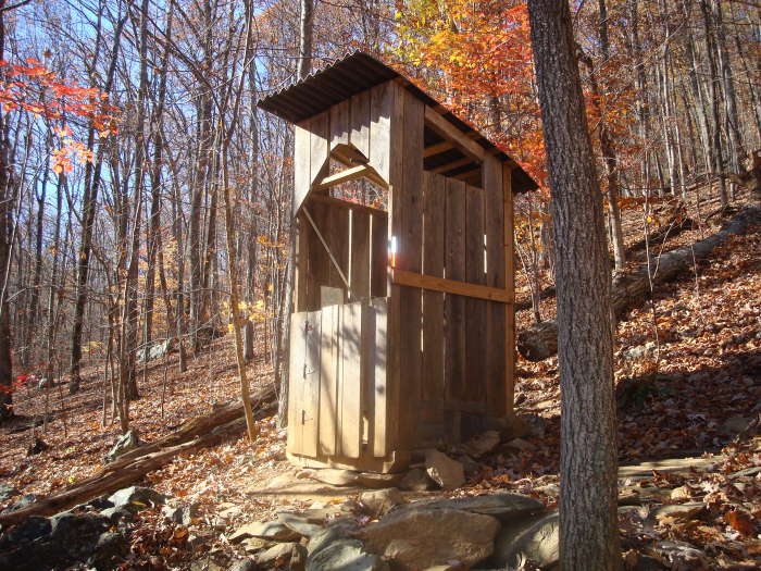
Took my visiting father for the circuit plus down to the shelter at Mill Creek. We had the fortune of a clear, but cold day with a blustering wind (and some snow flakes) from the west. Gratefully the wind was greatly reduced as we dropped down from the Humpback Rock parking lot going counter clockwise on the trail. Take note: While there were only two other cars when we arrived at around 9 am it was full when we returned around 2:30 pm - most hiking up to Humpback. Also had the fortune of repeatedly running into two gentlemen spending the day hiking with a dog who shared additional info about the area: a bit further North on the AT is a cemetery and chimney of an abandoned homestead. Be sure you stop and take some time to visit the overlook (excellent views and a wide area for a group too) on the Eastern side of the trail. Also go down to the shelter - while the hike back up to the circuit is a bit taxing, the creek and great shelter are worth a lunch break site. Met two southbound thru-hikers hunkered in at the shelter, checked out the privy (excellent location and view of the creek). On the return up the switchbacks on the blue marked trail looks to have been a fire which has left some of the hillside charred - approximate area of the plane which we never saw. Saw some deer at the top of Dobie on the return to the now full parking lot. Overall - a quiet alternative route as we only saw one other hiker outside of what I mentioned above leaving the crunchy frozen trail to ourselves. Trail was largely level on the East side with some climbing on return trip from the shelter and the switchbacks noted on the Albright Loop Trail.


