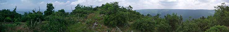
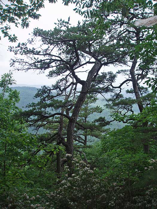
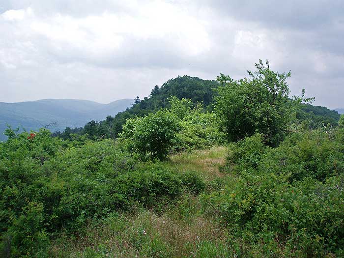
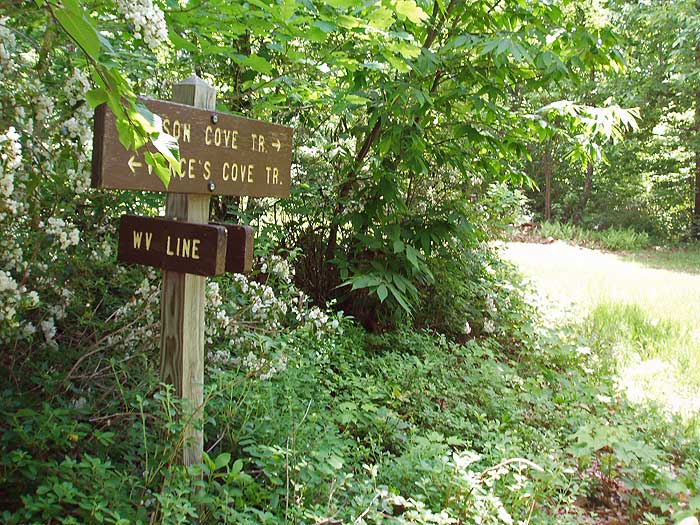
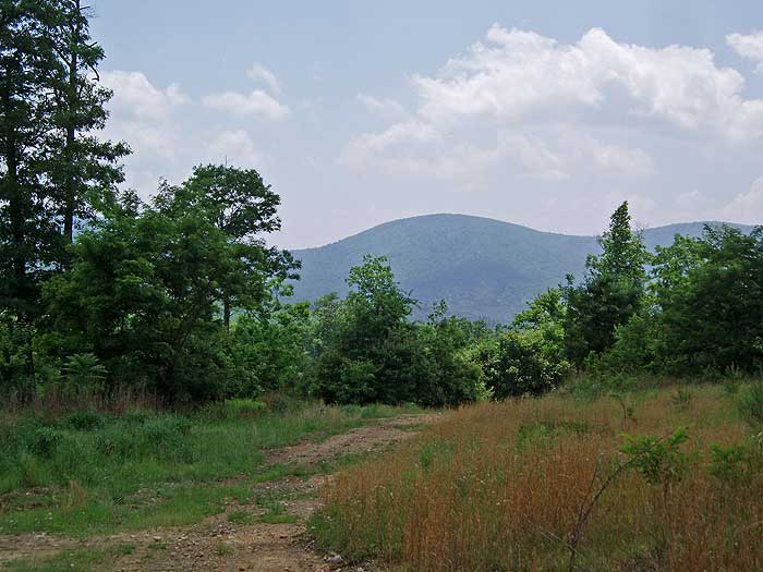
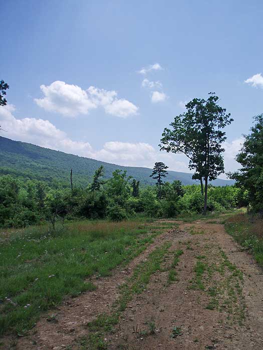
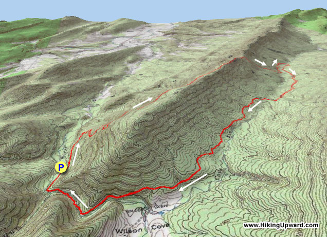
There are some nice views on both sides of Great North Mountain from the ridge just before arriving at Gerhard Shelter. The views of the valley from Vance's Cove can be wonderful on a clear day as well, but the main attraction is the solitude. We have never seen other hikers on this route.
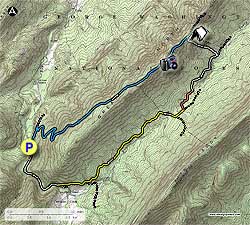
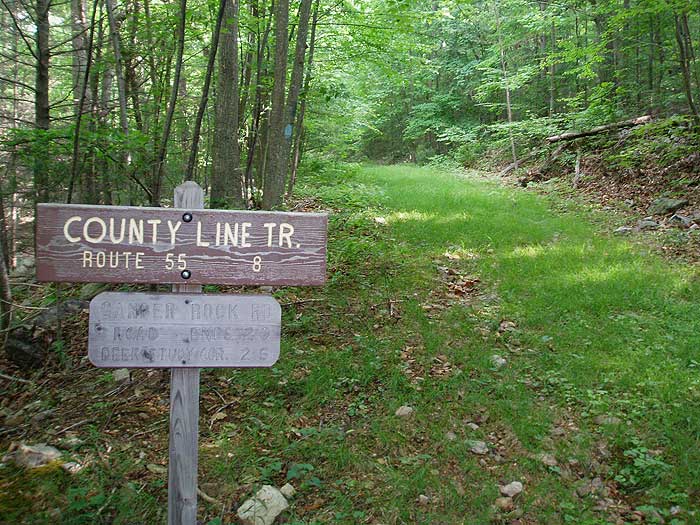
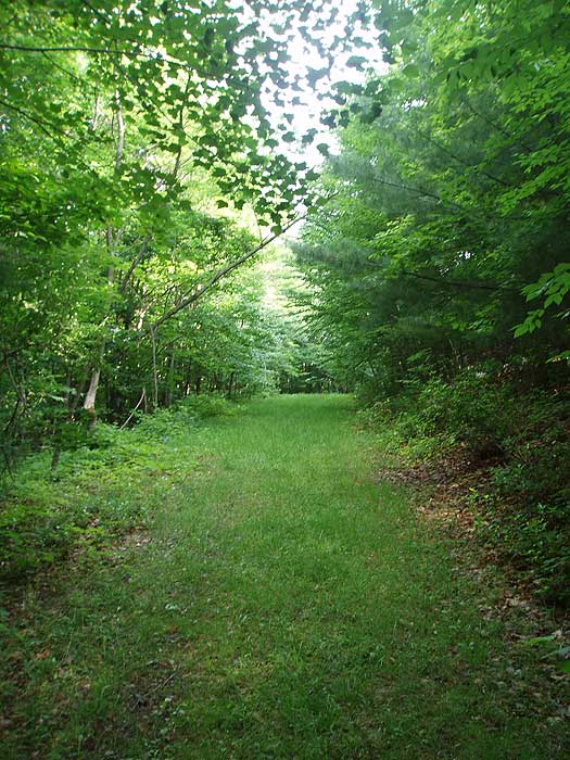
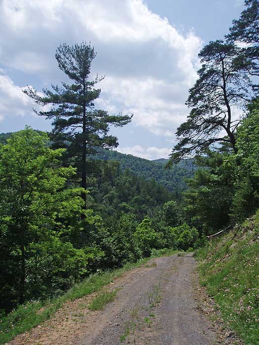
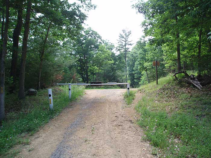
Begin by turning left uphill on the blue blazed Tuscarora Trail passing a closed gate. At this point the trail is a closed forestry road (FS) that slowly climbs the side of the mountain for 0.8 miles before the blue blazed Tuscarora Trail makes a sharp right, and the FS road continues straight. Turn right on the blue blazed trail. If you start going downward on the FS road you missed the right turn.
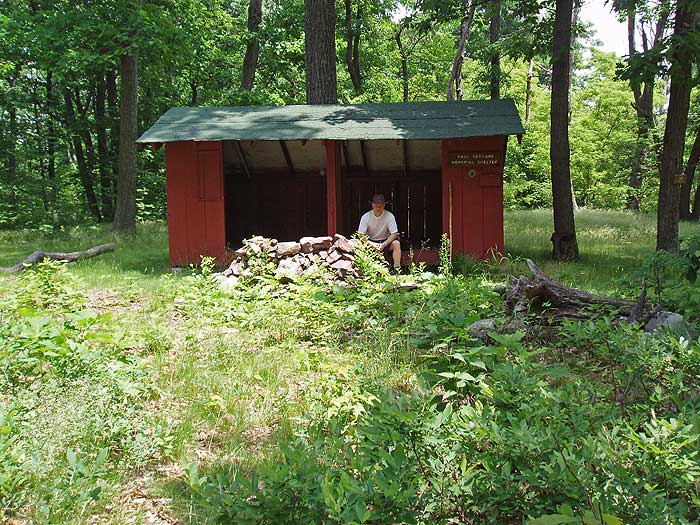
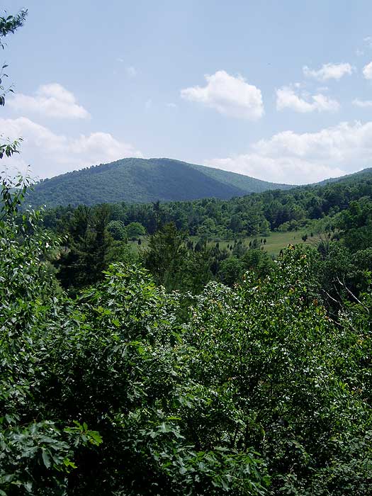
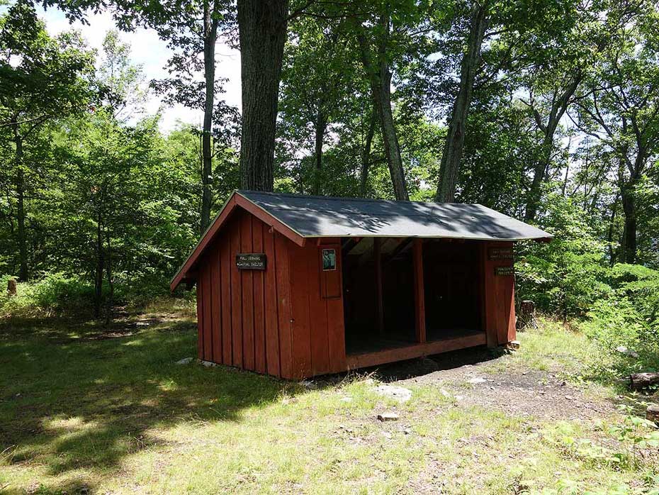
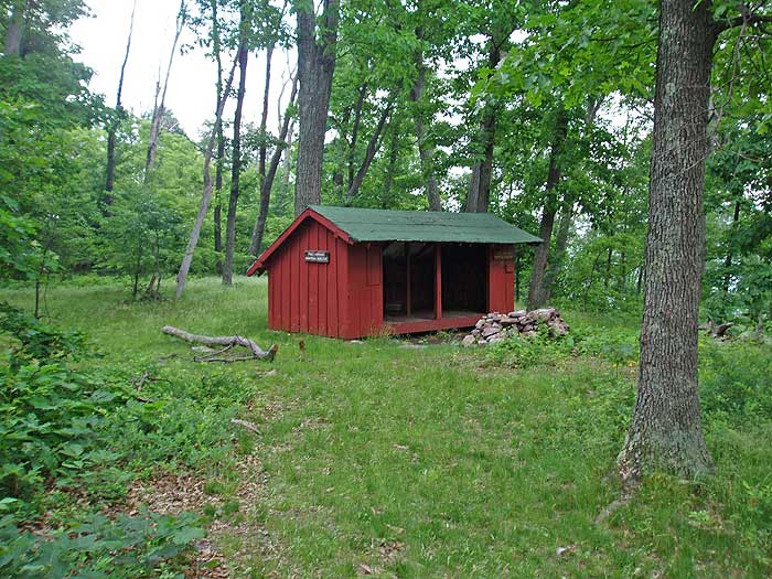
The blue blazed trail climbs the side of Great North Mountain steeply and makes several switchbacks before reaching the ridge line in another 3.0 miles. Follow the ridge for 1.0 miles and arrive at Gerhard Shelter. The shelter is generally used by through hikers.
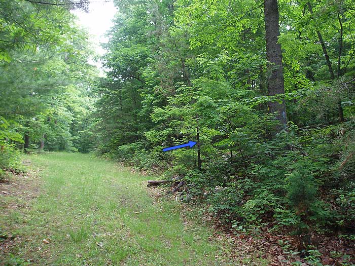
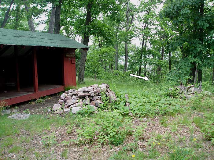
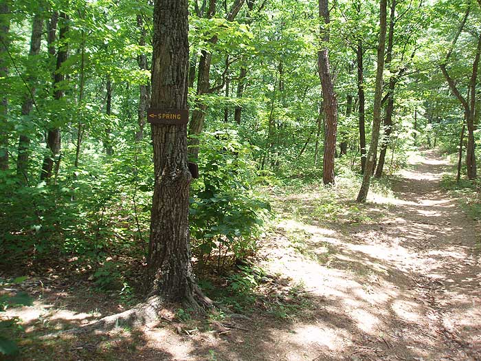
Turn right downhill on the white blazed Gerhard Shelter Trail that very steeply descends Great North Mountain. The footing is precarious with loose stone for the majority of the descent. In 0.5 miles pass a side trail on the left that takes you to a spring, and in another 0.2 miles emerge onto a FS road.
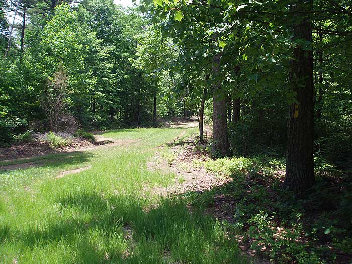
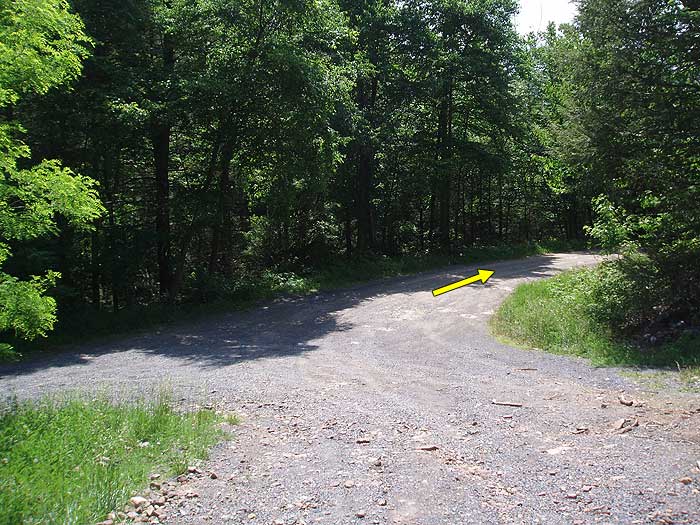
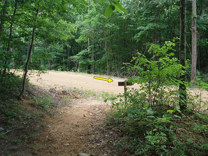
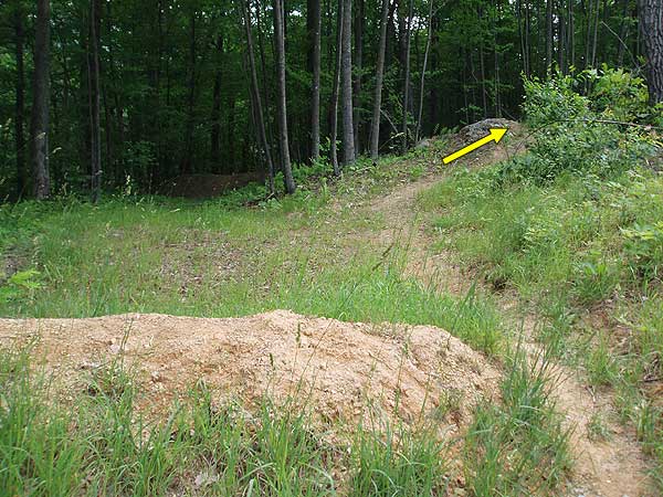
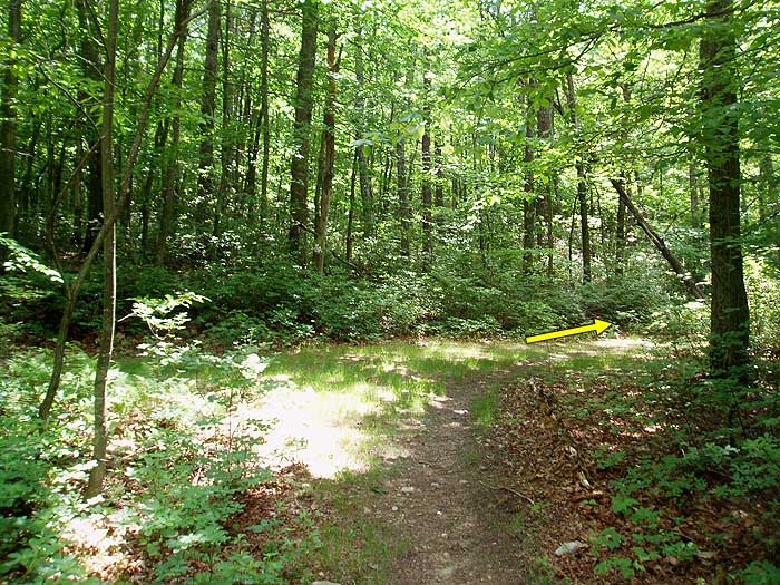
Turn right on the unblazed forestry road. The forestry road is normally closed to motorized traffic, unless your hiking during hunting season (bad idea!). At the end of the FS road in 0.8 miles, just past a burn, the unmarked Vance's Cove connector trail will bear right. Follow the trail for 0.5 miles where it merges with the yellow blazed Vance's Cove Trail.
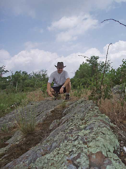
We've hiked all around this particular loop but hadn't hiked this loop as described here, though we've done bits of it on other hikes. I really enjoyed myself. We saw nobody else the entire day.
NOTE: The mileage is now about 10.95 miles due to a PATC relocation of the Gerhard Shelter Trail. It no longer shoots straight down the hill, but rather is a marvelous new trail with switchbacks. Thank you PATC! It is still steep and you really don't want to go what is now 6/10 of a mile to the spring and schlep water back up that hill. If you are staying at the shelter, you are best advised to pack your overnight water in from the nearest source. The new mileage to FR 93 is now 0.93 miles from the shelter, according to the placard on the shelter. It didn't feel that long, but our GPS had us finishing the day at 10.95 miles, so it must be.
I didn't find the hike to be particularly strenuous, but I am probably not a good judge at this point. My trail legs are back under me. I am sure the views at the top are wonderful, but we were in a cloud. You are advised that at this point there are a couple of hundred yards of traverse at the top through knee-high grass and you have to cross a patch of poison ivy that is about 20-feet across. I'm recommending high gaiters or long pants. I did it in shorts with the inevitable wet feet in the cloud/fog/mist. I saw no sign of deer up top and I only had one tick after crossing the grass. I expected more. DO A TICK CHECK and DO IT FREQUENTLTY.
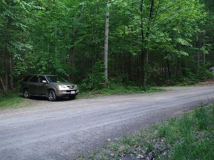
Tips: Parking and the trailhead are on the left. Waite's Run Road crosses the stream a couple of times. When you see the sign for the Wilson Cove wildlife area just before a substantial bridge, you'll know you're in the right place. When the blue-blazed trail takes off from the County Line fire road, it is at a seriously acute angle on the right. It may seem counterintuitive to be going right here, but do it anyway. Down off the mountain after the shelter, you will turn onto the unblazed dirt road which ends about 8/10 further south. Just keep walking straight on the trail after the road ends. This will seamlessly merge into the Vance's Cove trail. Though the directions make it seem a bit more complicated, it's not. Just keep walking straight and south.
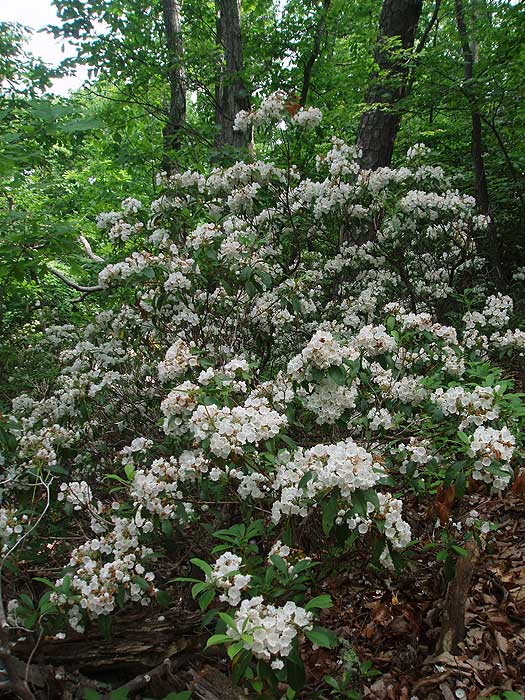
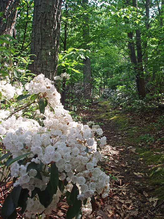
Beautiful wildflowers everywhere. Cuckoos and tanagers likewise. Very nice hike. The nearly 4 miles of fire road walk on the backside keeps this from being a 5 for me.
Trip report and photos: https://mangiabeve.blogspot.com/2017/05/gerhard-shelter-loop-wardensville-wv.html
By:aldikuma
Rating:
Date of Hike: Sunday, May 3, 2015
Overall, this was a great hike, but the first three miles till you get up to the ridge was just OK. I'm not sure how else to describe this part other than "dead". A lot of rotted and dying trees and there were a couple of signs about chemicals that had been applied, so who knows. But it's a gradual ascent - in fact, I never thought this hike was ever difficult. Once you reach the open ridge, though, it was really nice. The views are excellent. The shelter was pretty cool, and I would like to return to stay up here for a night. There's a book where you can leave a note for other hikers/backpackers. The spring off the white blazed trail is just a small creek - it's a very short hike down a steep hill. As you come to the end of the grey FS road on the HU map, you'll cross onto a dirt road and will see a clear trail to the right, now marked with white ribbon all the way to the yellow blazed trail. The sign marking VA and WV was cool. I know a lot of hikers dislike being on the FS roads, but I don't mind them at all as long as it's not the whole hike! I enjoyed the yellow blazed trail on the FS road a lot. The wildflowers were in full bloom all along the way and it gave me and my dog some space to move. A note that you will actually pass two gates/small parking areas - the first off the yellow trail, then the second one mentioned in the directions above after you pass the pink blazed trail on your left (you'll see a bench and trailhead, which is the start to the White Rocks hike, another great one posted here on HU). The last part back to the parking area follows Waites Run - beautiful. Didn't see anyone else the whole hike.
By:JeffersonHunter
Rating:
Date of Hike: Saturday, May 24, 2014
I did this hike on 5/17 in the direction suggested in this guide and in reverse on 5/24. The first time I went to "scout" the area to see if it would be a good trip for my wife's second ever backpacking trip. I did it in "reverse" that time since the hike up the standard way was pretty tough. It's not so bad that it's not doable, but I'm hoping she'll come to enjoy hiking so I didn't want to overdo it with her. I'll review the standard route.
First, I spend a lot of time in the outdoors and approximately 10 weekends a year in GWNF or another forest/park nearby. I have never encountered as many ticks as I did on this hike, particularly on top of the ridge and especially at the shelter itself. I'm not generally bothered by bugs, but I am very concerned about Lyme Disease and this was a constant worry. I treat my dog monthly with Frontline and he was annihilated by the ticks. Both weekends I ended up pulling over 100 ticks off of him. I wear tall socks and long sleeves while hiking, so I can almost always feel the ticks on me before they bite. I probably knocked 100 off myself and four or five actually bit me. I don't know if there is something about the particular environment of this area or if it's just a particularly bad year. Whatever the case, be prepared to deal with ticks if you go here. I was using the strongest bug repellent available, which helped but did not prevent the ticks from getting all over me. There is an appropriate sign describing the danger of ticks at the shelter. OK, that's all I have to say about that. You've been warned! :)
The hike up is fairly rigorous. I'm in pretty good hiking shape but had to take several breaks on my way up. The trail, forest roads and switchbacks are easy to follow. It took me about 3 hours to reach the shelter, although I perhaps could have done it faster if I was in some kind of hurry and not carrying overnight gear in my backpack.
It is not overly scenic, but there are some nice vistas once you get to the top of the ridge, including a particularly nice view about 1/4 mile from the shelter. As with almost all ridgetop camping spots, not having access to water at the camping location can be a pain.
The trip down the mountainside to the spring is pretty long. It takes about 15-20 minutes to walk down and about double that to walk up. It's totally doable, but just be sure to set up camp up on top and then take your empties and empty backpack down the mountain to get water if you need it.
The shelter is in good condition. Judging by the log book, it gets a few visitors each week, including a fair amount of hunters during the fall/winter.
All of my spring/summer backpacking trips are also hunting scouting trips, so that was my primary focus. Unfortunately, I did not see much in the way of deer sign other than a few tracks and droppings near Paddy Run. I only saw one grouse. I heard many coyotes howling just after dark each night, which might help explain the lack of deer. However, I do plan to return for muzzleloader season if only to enjoy the mountain after the ticks are mostly gone.
I spent some time on Sunday fishing in Paddy Run. The only other people I saw were fishing, so I assume there are trout in that creek, but I only caught one fingerling that I had to throw back. I tested a variety of little grub lures. I saw a few crayfish so I tried a little crayfish lure. I caught a little frog and used it as a lure. Still, nothing. Maybe I missed the run/stocking. Still, a weekend spent hiking in the elements and fishing in a beautiful creek sure beats sitting behind a screen like I am right now!
TLDR there are better hikes out there, but this one is pretty fun and great exercise. I won't ever return during tick season, but look forward to hiking the trail again after a frost this fall in search of deer.
Thanks to all who came before me, maintain the trail, maintain the shelter, and left no trace!
By:Greg S
Rating:
Date of Hike: Saturday, June 9, 2012
I hiked this two days ago on Saturday with my wife, my sister-in-law and her boyfriend. Our trusty mountain dog, Boone, also came along.
We had no problem getting to Wardensville but once we got to Great North Mountain we couldn't really tell where to park. We ended up going further down the road then we needed to and then hiked the loop in reverse by accident. We realized it about 2 miles in but decided to keep going. At one point we misread the map and missed the turn on to Vance's Cove trail as well, which ultimately increased our total distance to about 13 miles.
It was a beautiful day to go hiking but honestly, this was not one of our favorites. We chose this hike because it offered seclusion though, and we certainly got that. We passed 2 mountain bikers early on in the hike but for the rest of the day we had the trail to ourselves.
So yeah, it was a nice day but not much to look at other than service roads for the majority of the hike. The steep trail near Gerhard Shelter was challenging but fun, and the Shelter itself offered a fun respite in the middle of our journey. The views from the ridge, well, they left something to be desired. The ridge walk itself was not nearly as interesting as I thought it would be either, but that may have had something to do with the constant tick removal we were doing at that point.
That's also worth mentioning, the ticks are terrible right now (early June). We found dozens on ourselves during this hike. Clearly, it goes with the territory of being outside, but sometimes it just gets old.
While we didn't love the hike, it was nice to have the trail to ourselves and be out in the sun and fresh air. Hope you enjoy it more than we did!
By:M. Greene
Rating:
Date of Hike: Saturday, March 17, 2012
What a great day for a great hike. This was a very pleasant walk in the woods. Some great views some very long walks down a fire road and always fun to see a well maintained shelter. I pretty much had the entire hike to myself besides a few fishermen in the last 20 min of the hike. Very easy to do hike not to many blazes on the trees but the trail is very easy to follow. Did see a very big bears butt as it ran away from me trying to catch a picture. I would recommend wearing a hat during this hike about 50 percent of the hike is in a field also bring sun block I have a little red to me today. I Did this in 5 hrs with 120 pictures taken. Would love to do again in a few weeks when more leaves and flowers are out in full.
By:Rachel H
Rating:
Date of Hike: Wednesday, March 7, 2012
This is a pretty hike that rewards you for the early miles of uphill exertion with wide views to the east and west and a very well-maintained shelter for a rest stop. The switchbacked section was sometimes obscured by a layer of leaves, but otherwise the trail was very easy to follow, even the unmarked connector trail towards the end of the loop. We were definitely glad to have done the loop clockwise, as suggested, as the trail just below the shelter is extremely steep and would have been unpleasant to climb up we were also happy to cool our feet in the pretty stream that follows the road for the final few miles. Besides the elevation change early on, this hike is lacking a bit of challenge and variety, but I found those both to be forgivable.
By:Matthew
Rating:
Date of Hike: Saturday, January 14, 2012
Date/Time: Sat the 14th of Jan 12, from 1215-1445.
Difficultly: The stated difficultly is 4. I am uncertain if it merits a 3 or 4, maybe halfway in-between. The overall distance does make it long, but the ascent is not overly high or steep. There are some loose stones/rocks under foot as you make your way up though. Although they rate in discreet integers, I think a 3.5 is in order if you're looking at picking a trail. Also, I am of mid-fitness level sporting about 15 extra pounds, and with no pack was back at the car in 2.5hrs. Much of the ridge and fire roads are jog-able, as is part of the ascent (most if your in a little better shape than I am).
Streams: The spring described in the directions is a small stream (maybe there was a recent rain as another post stated the spring/stream was practically non-existent). On the return on the fire road, a mile or so is along a large stream I noted a guy fishing in. There were also a couple places here and there where water was flowing across the trail/road. I don't think you'd have too serious of issues doing this one after a large rain, although you would definitely get your feet a bit wet in a couple of places.
Views: I agree with the stated rating (4). Admittedly, I keep on the move to keep my heart rate up, so I am not too focused on smelling the roses, that being noted, I would place this one at a 3, instead of a four, except that the trail does go along the ridge for a good mile, more if you walk some from the trail, and views can be had on both sides of the mountain as you go along the ridge for a nice distance. This does give a nice experience, but then to balance my comments, the views weren't over the top. It is worth doing, please don't take my points as negative, simply trying to round out my opinion.
Solitude: I met three others as I went along. There were 5-6 other cars in the parking area (not too big of a spot). I think the rating of 5 is accurate. I have done Wildcat Mountain, and you could stop to bury a body and smoke a cigarette and not see anyone (rated a 6), so a 5 seems about right having seen three others.
Camping: I've never camped on one of these hikes so I don't have an experiential benchmark. I did note in other comments that some have camped this one, and at the shelter it appeared you definitely could, and with the spring/stream not far it would be an ok place. Perhaps a bit cold up on top in the wintertime (of course that's what fires are for, lol, and there is a spot for one at the shelter).
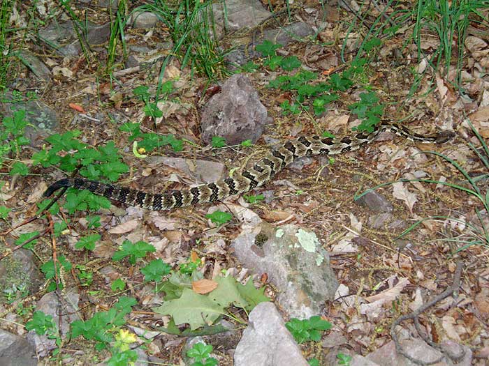
Foliage/Fauna: I saw no animals. I did hear some rustling leaves from a scurrying something, so maybe a hidden rabbit or two. I haven't had any poison ivy. I noted no ticks. I would expect ticks in season given the grasses growing along part of the ridge.
Weather: Thereabouts low 30s on the day of. It may have been in the high 20s up high, as my beanie cap seemed stiff in parts, I think from frozen sweat. I also noted ice on some streams and frozen over puddles that didn't seem tempted to thaw. I noted no hidden patches of ice on trail rocks (as tends to occur under leaves sometimes) that would make for 'awesome' footing. There was remnants of a snow dusting on the ridgeline.
Other: The trail markings as per the instructions seemed sound, as did the given instructions in general. I will comment on the trail head. The blue blazes are really light at the parking spot. There are many, many prominent green blazes. When you park at the parking area, just off the road, there is a fire road that heads off past a gate, this is where the trail starts (the trail is the fire road). Also, the blue trail that leads off this initial trail/road can be located by two green blazes circling a tree, not too mention that the fire road begins to descend as per the instructions. At the shelter, the white trail would be at your 10 o'clock position if you were in the shelter and looking out (I didn't note a blaze on the trail until going down the trail a bit).
There are houses on the road that the parking area is at. The nearest being maybe 3/4 of a mile, give or take, in the direction that you come in on. I would guess a phone could be had here in an emergency. I had spotty ATT cell service on the hike.
At the shelter I talked to a gal for a second. There is evidently a trail leading from the shelter to an outhouse. I didn't see it but I believe one does exist. This is not on the white trail leading down.
I really enjoyed this hike and felt good afterwards. I noted other comments about the decent from the shelter being hard on knees. The trail down isn't ladder-like, but if you have some knee issues you will feel it given friends I have hiked with. I wasn't overwhelmed on the ascent as it is not as far up or steep as say Old Rag. I didn't get lost either, which is always a plus. Parking might be lacking in the warmer months on weekends. There is a gas station and restaurant on the main road coming thru town before you turn on the backroads leading to the parking spot (call it 5-7mi to gas from the trail).
By:N & L
Rating:
Date of Hike: Sunday, September 5, 2010
A beautiful day for Labor Day weekend of 2010. Weather was crisp and perfect. We had trouble finding the trail head at first but after backtracking 0.8 miles (per directions) from the last point, we found it. The first 3 miles were uphill via the switchbacks, which were decently marked. Recommend repainting the blue blazes. Hardly any views as trees were blocking but nevertheless, indeed a solace-finding trail. Hike itself was great, with plenty of sweat and breaks. The reward came as we reached the ridge. Again, the views were lovely, not spectacular. The valleys were clear and pleasant. Ridge was not clearly marked to Gerhard Shelter. But we arrived. At this point, we should have been at the 4.0 mile marker but our GPS was 3.87 mi. We enjoyed our small lunch, signed the book and off we went.
White blaze downhill after the Shelter was steep, and pressure on the knees. We bypassed the Spring, and off we continued until we hit the WVA/VA crossing, then all the way down the FS road to the parking lot where we first turned around in the morning. We should have been at around 10 mile mark by then but again, GPS indicated 8.0 mi. Hmm?
Does anyone else have this sense of shortened trail by 3 miles or so? We're not complaining as our backs and knees felt it but felt like we should have done the full 11.4 mi... ?!
I'm amazed more haven't been on this wonderful hike. The first 1.5 hours are a delightful challenge to a spectacular ridge with breath taking views. And then onto Paul Gerhard (not Gerhar"t") Memorial Shelter where we stopped for a snack. I sure wouldn't walk down that slippery spring slope .2 miles to get water to bring back up to the shelter though. This was the best part of the hike by the way. The rest was mostly forest service roads although they were not as bad as some. 14 of us had time for nice conversations on that portion and finished the entire hike in 4 hours 15 minutes. Could have easily cut off a half hour or so if we hadn't stopped as often. There are campsites in a number of places and I suspect we'll come back to camp & perhaps find ourselves back on that ridge for a meteor shower or sun rise. Pictures should be posted on one or both of these sights.
By:thomhouse
Rating:
Date of Hike: Sunday, December 21, 2008
I was dumb. On a cold, drizzly December Saturday before Christmas, after a week of rain and wintry mix, I got a late start and left my rain and head gear at home -- what was I thinking? The trail head was a little tricky to find, but once I found it and parked, I wondered how I could have missed it. The ascent up to ridge was as described, and a very good workout. Lots of rock covered with wet leaves -- hmmmm. The trail is generally very well marked and easy to follow, but the leaf covering made some of the switchbacks hard to discern in a number of places. At the ridge, the trail flattens out somewhat to a much more gradual ascent and is an outstanding walk. But it was getting late, had started to drizzle, and fog was settling in as the ridge walk started to climb more severely. I never made it to the Shelter and decided to turn back -- I was probably within a half mile. But with the temperature dropping, the hour getting later and the fog severely limiting visibility, I chickened out and retraced my steps back down to the forest service road and the warmth of my car's heater. Lesson learned. I will go back and start earlier on a better day - the trail was worth it.


