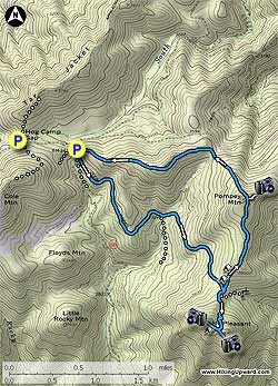
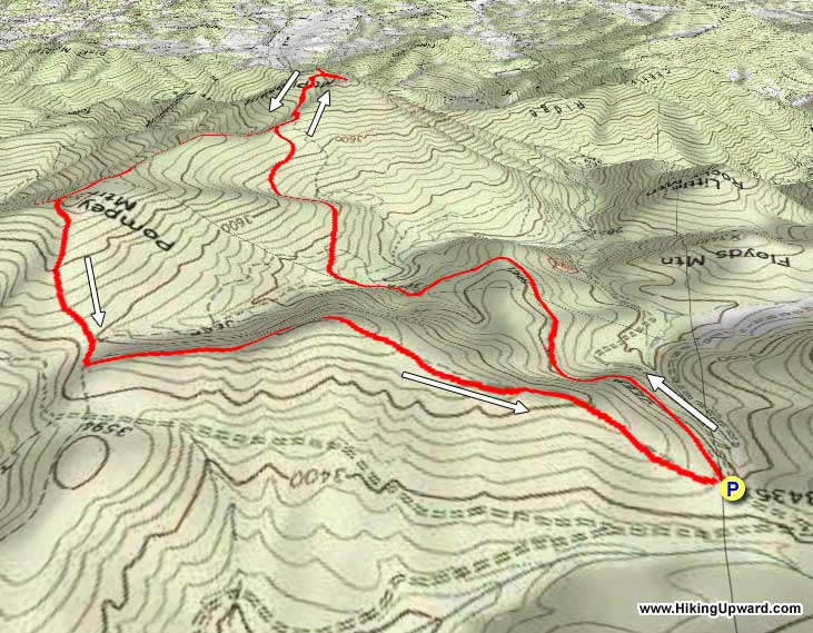
A short day hike suitable for most fitness levels. Mount Pleasant has both an east and west summit, each with spectacular views. Designated by congress in 1994 as the Mount Pleasant National Scenic Area, the trails are kept in fantastic shape by the NBATC. For the campers, the ridge has several large campsites suitable for multiple tents.
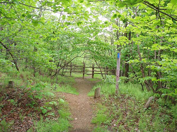
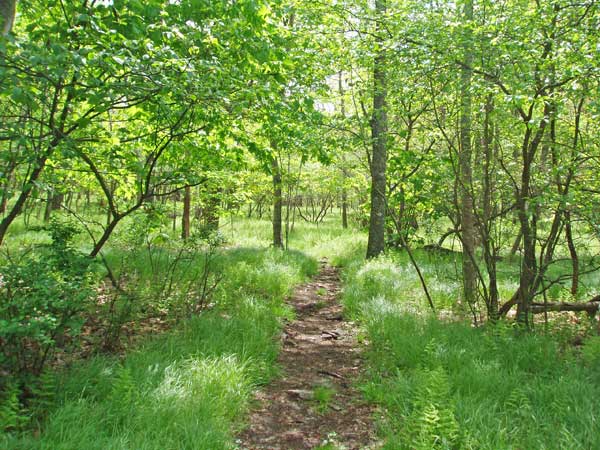
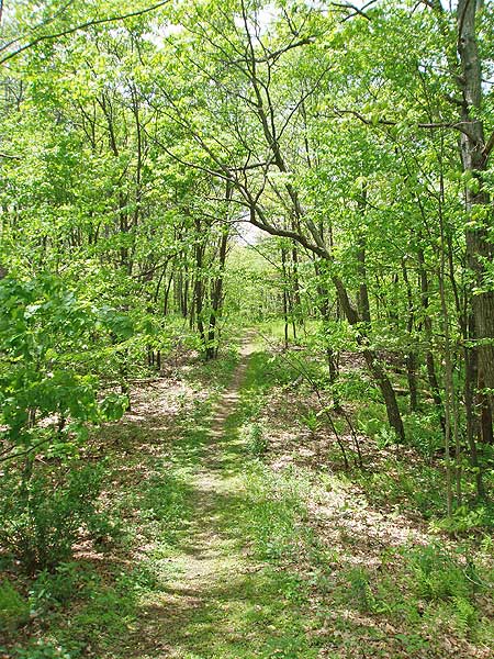
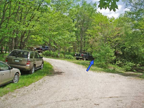
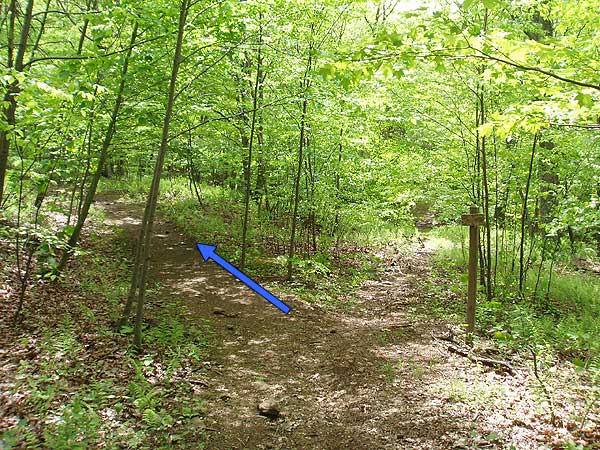
At the parking area there are three trail heads. The two Henry Lanum Memorial trails pass through wooden horse gates. Take the right Henry Lanum Memorial Trail. You will return down the left one. Once passing through the gate the blue blazed trail is mostly flat for the first 1.1 miles. Make sure to follow the blue blazes at 1.1 miles as the trail turns off the old FS road to the right, then in 0.1 miles arrives at a trail junction.
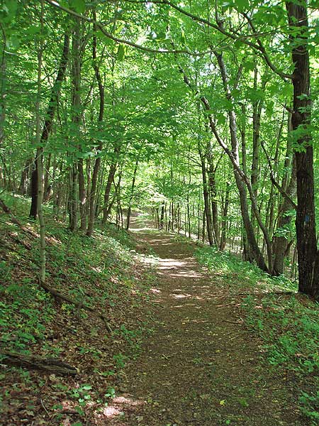
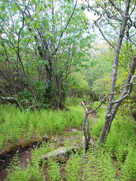
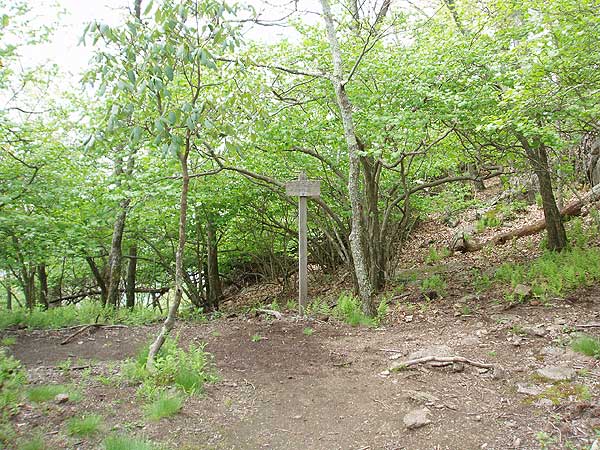
Turn left uphill following the sign and blue blazed trail. This is the steepest section of the trail where it traverses up the mountain arriving at the ridge in 1.0 miles, and intersection of the Mount Pleasant Summit Trail. Stay straight on the blue blazed Mount Pleasant Summit Trail, and in 40 yards pass a trail marked 'Water' on the left that heads downhill to a seasonal spring. Continue on the Mount Pleasant Summit Trail as it winds its way up the mountain.
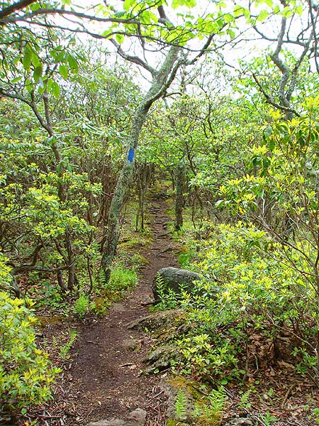
In 0.3 miles be alert to follow the trail back to the left, the old summit trail continues straight. In another 0.2 miles arrive at the saddle between the two peaks. Make sure to visit them both!
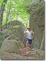
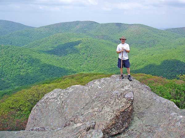
The westerly summit, turning right at the saddle, has two small campsites, the second just before the overlook. Keep in mind that because of its geology the Mount Pleasant summit can experience strong winds. Also, to reach the overlook at the westerly summit you have to scramble 7 feet up through a rock scree.
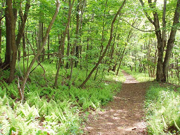
Return back down from the summit to the Henry Lanum Memorial Trail intersection. Turn right, along the ridge towards Pompey Mountain. There are two large campsites within the first 0.1 miles. In 0.8 miles, and at the high point of Pompey Mountain, take the unmarked trail to the right for 75 yards to a rock outcrop and views to the northeast.
Return to the Henry Lanum Memorial Trail, turn right, and now head downhill for 0.5 miles before the trail heads to the left along the ridge for another 0.4 miles, then descends the remaining 0.7 miles back to the parking area.
Late May
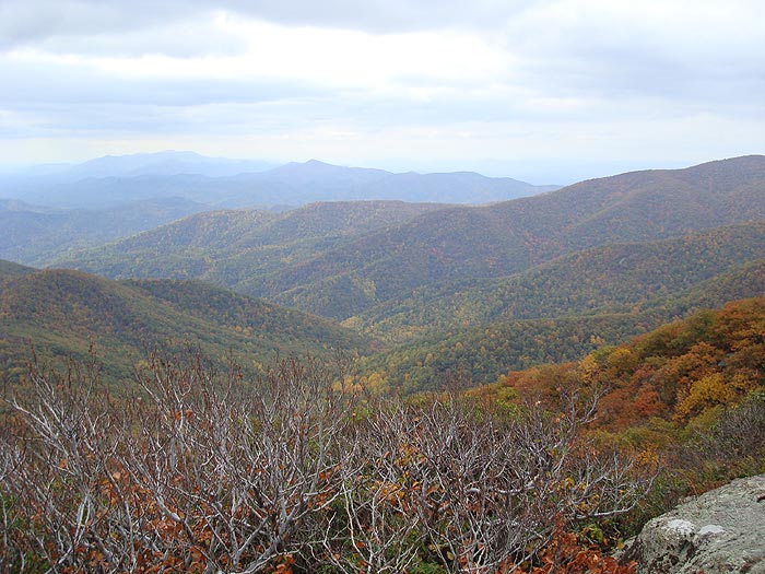
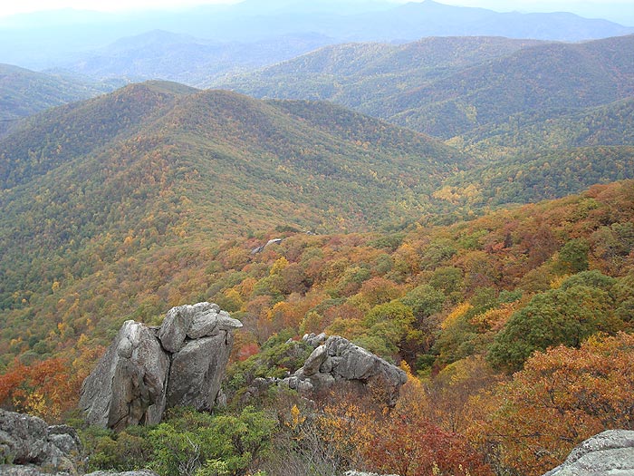
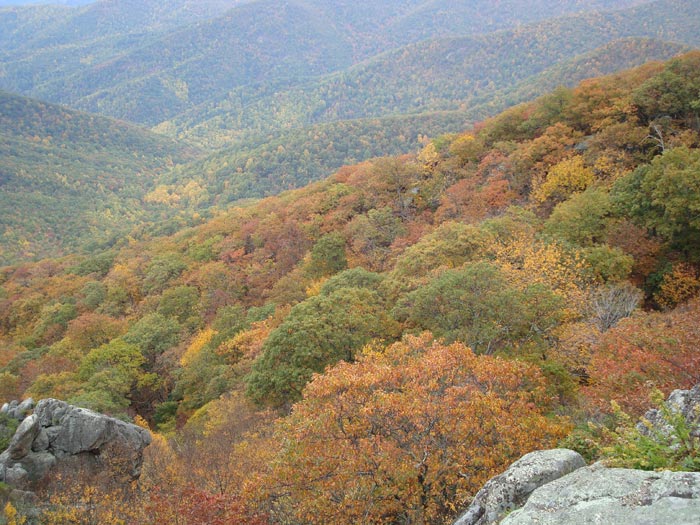
Mid October
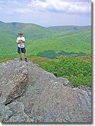
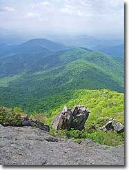
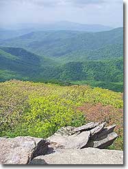
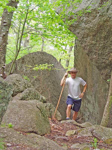
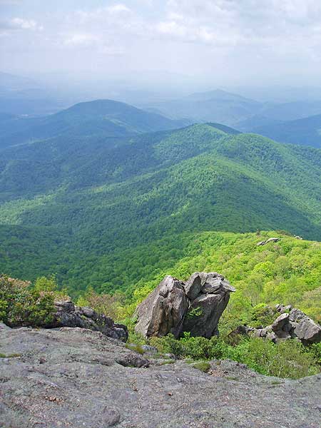
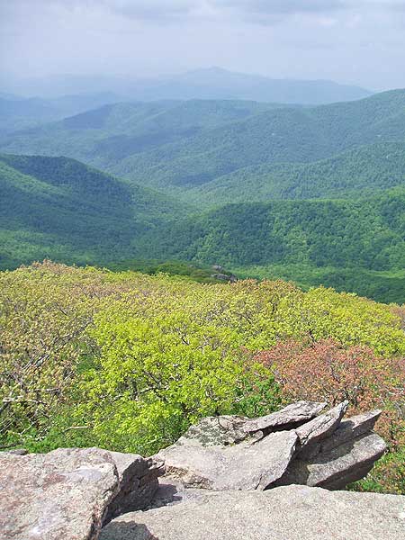
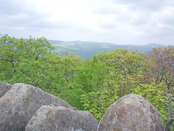
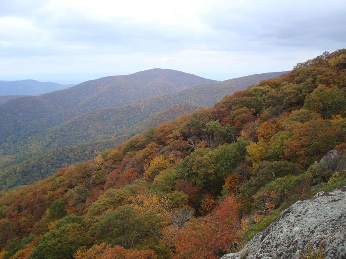
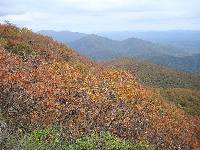
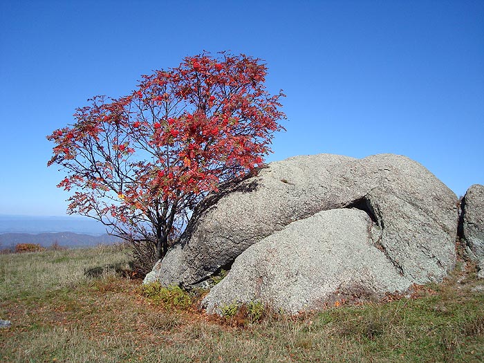
Vista from Mount Pleasant
Mount Pleasant Hike Comments
Archived Comments
By:Ash
Rating:
Date of Hike: Friday, November 15, 2019
I really enjoyed the view at the summit of Mount Pleasant. That made the hike very enjoyable. Otherwise its typical GWNF stuff. I will definitely hike this again in the other seasons to gawk at those views with leaves on the trees.
By:John
Rating:
Date of Hike: Thursday, October 24, 2019
Headed up to Mount Pleasant in southwest Virginia on the evening of Oct 24 to check out the foliage this year. I saw plenty of yellow leaves in the process of changing while others have already fallen. There werent too many red and orange yet. This lead to a generally muted, but still good foliage. I would guess the peak is still to come, but soon. For the hike itself, the double summit viewpoint on Mount Pleasant was great. Otherwise, the hike was mostly on easy former fire roads in the woods. I personally would recommend to hike this clockwise, the ridge is a nice view to start and you'll go up the steepest portion to Pompey Mountain.
Here is my writeup on the full details of the hike: https://travel2walk.com/2019/10/25/virginia-hikes-mount-pleasant-loop-october-24-2019/
By:Chris
Rating:
Date of Hike: Saturday, July 27, 2019
Great hike, trail well marked. I combined this with Cold Mountain and camped at the meadow before the AT shelter. Make sure you pack all the water you'll need. The previous commenter who mentioned the drive to the parking area is 100% correct. Take a route from the west into the parking area. I accidentally took the eastern route out and it took FOREVER on a dirt road with deep trenches and no clearance.
By:Drew S
Rating:
Date of Hike: Saturday, December 29, 2018
Really enjoyed this one. Here are a few notes:
- Even after all the rain this year and the recent rain, the road was fine. I drove a FWD 4-door sedan out there with no issue.
- Missed the view on Pompey Mtn (wasn't paying attention, walked past it). Can't confirm it's still there.
- The trees from Pompey Mtn to the Mt Pleasant summit are spaced far enough away to allow camping basically anywhere off the trail.
- Didn't think the climb on the spur trail to the summit was particularly hard. Excellent views at the top.
- Trail was not difficult to follow at all. There was no point where I was confused. Trail conditions were 5/5. Mostly wide trail and not rocky.
- There were three water sources along the loop. Two of them looked like they would have water most times of the year.
- Total measured distance was 6.1 miles. Did the loop clockwise instead of CCW. Other than that we followed the same path.
- Would recommend doing an overnighter connecting this with the Cole Mountain loop.
By:Doug
Rating:
Date of Hike: Monday, October 8, 2018
Great hike with beautiful views from the summit. However, with the exception of the 1/2 to the summit, I was a little underwhelmed by the forest and understory for most of the hike. I've noticed in recent years that the Blue Ridge looks unhealthy and under siege by a variety of environmental factors, and no exception here. I imagine there are exceptional vistas all along the ridge line in the winter months. Also, not sure I agree that the hike is suitable for most fitness levels, particularly the 1/2 mile to the summit. Overall, a good hike with summit views well worth the trip.
By:Goulash
Rating:
Date of Hike: Sunday, July 1, 2018
If you do not have a car that is well-suited for rocky terrain and driving through lake-sized puddles, I suggest approaching the trailhead from the west if it is not too far out of your way to do so. We came in from the east and that portion of Wiggins Spring Road was very difficult for our little sedan to handle! After the hike we departed in the other direction (toward Route 60) and that drive was much more pleasant.
Once on the trail, this hike is great and very well-marked. The summit views are spectacular. We did the loop in reverse, which we found enjoyable as that meant most of the uphill legwork was taken care of early on. Definitely worth five stars out of five, but if there were six stars available it would still only get five.
By:HikeVa
Rating:
Date of Hike: Friday, April 13, 2018
Great hike, done as an overnight figure 8 along with Cold Mountain. Heads up, the water stop on the topo map on our trip was pretty low, plan accordingly.
By:Schnitzel
Rating:
Date of Hike: Friday, March 23, 2018
After being turned away by the thought of excessive snow in the Luray, VA area, Pennzoil and I decided to salvage our plans and instead do this day hike. This was our first snow hike... What follows are some thoughts to consider for those of you interested in making a hike on snow covered trails.
1) More snow is always present the higher the elevation. This seems obvious, yet it bears repeating that the snow height might be substantially different from the trailhead to the highest point of a hike. We thought there would be minimal amounts, yet we ended up pushing through drifts up to our knees at numerous points throughout the day. Also, the road to the trailhead was covered and I was grateful for the 4 wheel drive option on Pennzoil's CRV. The road from the main road crests and then falls before arriving at the trailhead leaving the potential of some to be left stranded should snow accumulate or those without an all wheel drive option. I suggest parking in the vicinity of where the Cold Mountain trail arrives at the entrance road... should this be the case (perhaps .2 from the trailhead).
2) The trail was not easy to follow as the snow that had fallen since the previous Wednesday had drifted -- someone had done the loop at some point since / during the last snowfall and faint footsteps could still be seen intermittently -- thanks to whoever that was as it really helped keep us on trail -- and return back to the trail when we incorrectly continued on what looked to be an old fire road. Blue blazes were most helpful as well but with no obvious trail in the deeper snow areas... these were at times too far apart for orientation from one blaze to the next.
3) 5.5 miles versus almost 10 on my iPhone? Had we had additional GPS, perhaps I could offer that the site's mileage was dead-on... regardless it took us 7 hours round trip with the occasional chat, snack and lunch at the top. Chalk it up to our age and fitness level versus the twenty-something crowd -- yet Pennzoil and I agree that 3.5 hours would have required a brisk walk -- the entire time. Keep this in mind as you ensure your pack contains a headlamp.
4) The area before making the final push toward the top looks to receive good wind (as well as the last mile -- before returning to the trailhead if going counter-clockwise as the map suggests). The area is the location of the tent sites so be prepared for changing wind conditions as evident from the snow drifts. It looks to be a beautiful spot as I know my Scout Troop routinely uses this hike to acclimate younger Scouts to backpacking.
5) Have shelter and warm weather gear should an unfortunate accident occur. While our feet were soaked (yet warm from exertion), had one of us slipped (and there was a lot of slipping) and been injured -- the cold, wind, sweat and wet snow would have quickly become a concern. A warm lunch that included coffee made a drastic difference in our comfort level as we returned down from the peak. Be prepared by taking a few more essentials -- just in case.
6) The views at the top are breathtaking. There are two views at the top. While the western peak looks to be higher, don't pass up the eastern peak for its 180 degrees across the valleys below. It's well worth the day's effort.
Overall, another great hike as outlined by this site. Thanks to those that have created this resource as it has guided my friends and I toward some fantastic memories. Happy hiking all.
By:Arionis
Rating:
Date of Hike: Friday, April 7, 2017
After attempting to do this hike twice before I was finally able to complete it. You may be wondering why a hike that is described as suitable for most fitness levels would be such a problem. The first time I attempted this hike was a couple days after Thanksgiving in 2016. After driving four hours I arrived to find the area closed due to a forest fire. Serves me right for not checking ahead. Now I always check for any problems in a planned hiking area on https://inciweb.nwcg.gov before I make the trip. About a month later I attempted the hike again. No fire this time but there was obvious fire damage and many trees down from it. Like an earlier reviewer pointed out, in the fall and winter the trail is less obvious. This combined with the fact that several of the trees that had blazes on them were burnt and not visible, contributed to me making a wrong turn and hiking several miles off trail. By the time that I realized my error and backtracked it was too late to continue the hike and I had to abort. I'm happy to report now that new blazes have been added and the trail is much easier to follow. It's a very nice hike that starts off level and gradually starts climbing. The streams are listed as N/A on here but I made several stream crossings including a pretty big one that I missed last time when I went the wrong way. Maybe the streams are not there in the summer but they are certainly there during Fall and Winter. The east and west summits of Mount Pleasant are breath taking. It does get VERY windy at the summit. I lost my cap on the west summit. Also, be aware if you bring your dog that the rock scramble at the west summit will probably prevent them from going all the way up with you. My golden retriever could not make the climb and had to wait back at the little campsite below. Once we were done at the summit we took the trail on to Pompey Mountain summit which doesn't have much of a view but is still a nice hike. The trail does do a sneaky ascent after Pompey when you think it's all down hill but after that it descends back to the trailhead. Overall a very enjoyable hike and one I will do again when things get a little greener.
BTW, when I got back to the trailhead, someone had placed a pair of hiking shoes (in fairly good condition) on either side of my jeep. Anyone know what that is all about? Is it a trail tradition that I am unaware of?
By:Ashley
Rating:
Date of Hike: Saturday, March 11, 2017
FS road is in good shape right now. This is one of my favorites in this part of the state. Both viewpoints are spectacular. Keep an eye on the blue blazes, the trail is less obvious in wintertime without the foliage and I made a 2 mile boo boo. Minor fire damage visible.


