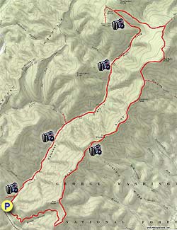
The Ramsey's Draft Loop is beautiful with ridge line valley
views, springs and streams but is tiring with long
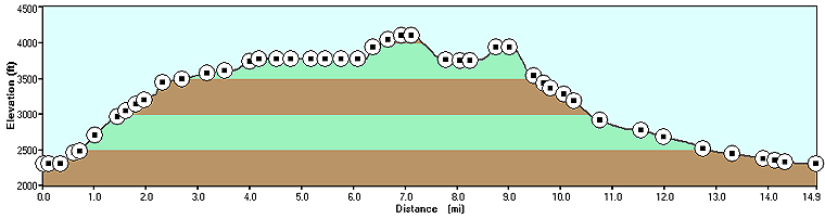
ascents and knob traverses on the 11.0 mile first day. Unlike
most ridge trails the Bald Ridge Trail is a long series of
ascents and descents of six knobs. It is 6+ hours of hiking
to one of several great camp spots anywhere from Hiner Spring
and below. Also note that some portions of the trails are hard
to spot and not well marked.
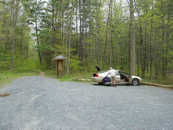
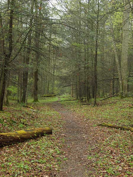
Start out at the end of the parking lot for 150
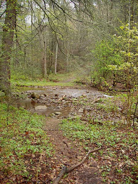
yards then turn right where a trail will cross Ramsey's Draft.
We needed to go about 50 yards upstream to find a low
water spot to cross. Follow the trail as it begins to ascend
the mountain for the longest steepest section of the loop as
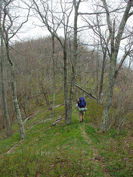
it winds up to the ridge in 2.0 miles.
At the ridge turn left
as the trail you have been following now continues
down the other side of the mountain. Follow the ridge trail 4.5
miles (yellow diamond marked in places) as it crosses The Peak,
Bald Ridge Knob, The Pinnacle and Gordon Peak before arriving
at the next trail junction.
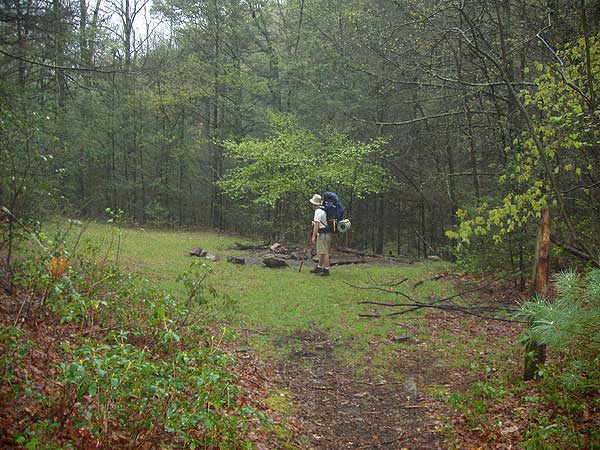
There is a small clearing with a trail coming in from the right
and pond to your left. Continue around the pond on the right
side where the trail continues uphill, then descends and in 1.7
miles arrives at the next trail junction.
Turn hard left at this junction and gradually ascend
for 1.3 miles to arrive at Hiner Spring. There are several good
camp sites here.
Turn hard left downhill staying to the left of the stream down
the valley (the trail does not become apparent for about 150
yards as it passes over rocks). In 0.3 miles you will pass several
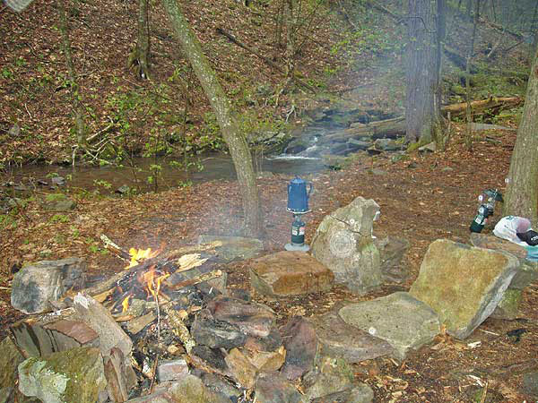
great camp sites. Choose one for your camping spot.
Continue down the trail as crosses the steam and
in 0.4 miles turns more to the right. For the next
3.0 miles you will cross Ramsey's Draft several more times before
arriving at the intersection of the Jerry's Run Trail that comes
in from the right.Cross the draft again continuing down the
trail as it crosses back and forth several more times for 2.1
miles where you will arrive at the next rail intersection.
Stay left continuing next to the draft for the
remaining 0.1 miles back to the parking area.
Early May
Ramseys Draft
Ramseys Draft Hike Comments
Archived Comments
By:Diego
Rating:
Date of Hike: Saturday, June 2, 2018
Planned on doing this hike as described as an overnighter but ended up doing the whole thing in one day. Unfortunately the rainy forecast was not intermittent rain like I had hoped, but constant, steady rain the entire day. In thinking about the overall experience, I am trying to keep in mind how the hike would have been with good weather.
The trail conditions on the 2.2 miles of the Bridge Hollow Trail was 5/5. This section contains most of the uphill. Shortly after turning left on the Bald Ridge Trail, there was a nice campsite with plenty of room with a nice view. Trail conditions quickly deteriorated after that. 90% of this trail is stinging nettles or thorns. I would give this trail a 1/5. This section of the hike is the easiest to get lost. The other campsites (with the exception of the last one by Big Bald Knob) on this ridge have little or no room for a tent. The Hiner Spring trail conditions were better, maybe a 4/5. Hiner Spring had a ton of room and was really nice.
As others have said, be attentive leaving Hiner Spring to keep the trail. The posted directions help. The Ramsey's Draft Trail had stinging nettles and thorns making up 95% of the trail. There are lots of blowdowns. These make it slow-going. Then there are the stream crossings. I kind of liked them, but again it makes it slow. You WILL be walking with soaked shoes and socks for 6+ miles. Trail conditions 2/5, but overall it was a cool experience being in / near the stream.
If you're going to do this hike, you MUST wear pants. Your pants will be wet the entire Ramsey's Draft Trail. Like other wilderness areas, the trails are overgrown and portions are very faint. With good weather this might have been a 3/5, but trail conditions just cause it to be more tedious than enjoyable. I'm not even sure it would be better in winter since I think the trails would be more difficult to follow.
By:NH Hiker
Rating:
Date of Hike: Saturday, May 12, 2018
We did the twin of this hike on the West side - came up the draft, camped at Hiner Spring, and then continued on to the Shenandoah Mt. trail before heading back down via the Road Hollow trail. The draft itself was still flowing well, so we had to ford most of the crossings - there are so many that it would have taken forever to remove shoes every time, so we just forded in our shoes and walked with wet feet. I think the deepest crossing was about thigh-deep on me (I'm 5'11"). Parts of the trail had lots of blowdowns, so it could be very tiring to maneuver. Also not sure I would hike it much later in the year, because the weeds were already growing up along the trail. Lots of poison ivy too. Camp site at Hiner was nice, although lots of bugs! Plenty of water, and we shared the large site with three other people. Not much in the way of views the 2nd day, but still a pleasant ridge walk with a couple of glimpses here and there. I'd love to come back earlier in spring to do the Bald Ridge trail too.
By:Dan Dudis
Rating:
Date of Hike: Saturday, May 12, 2018
I did this hike counter-clockwise, as suggested. The ascent really isn't that bad, and the views from Bald Ridge are quite lovely, especially this time of year when the trees above 3500 feet haven't yet leafed out and many spring flowers are in bloom. It's true that the Bald Ridge trail isn't very well marked, but the trail is pretty obvious in most places (this might not be so true during fall and winter), and you basically just need to follow the ridge line.
I made it to Hiner's Spring in just under 5 hours and wound up camping there. Plenty of water and some very nice campsites.
The next day, I descended the draft. The remains of the hemlock stand are truly a site to behold, at once awesome and sad. Many of the dead trees must measure five to six feet in diameter at the base, and I would guess that some of the ones that are still standing must be over 100 feet tall. This forest must have been truly amazing when the hemlocks were still alive.
Ramsy's Draft itself is a beautiful stream although it wasn't very high, you basically have to get wet the crossings are so numerous. I did quite a bit of fly fishing on my way down and caught several gorgeous six to eight inch brook trout.
One note of caution: although the nettles and poison ivy were not a problem as they had just started growing, there are portions of the trail along the stream where they grow right up to the trail and will soon probably be in the trail, so if you hike this trail during the summer, wear pants. Oh, and I also saw a big rattler right along the trail, but it rattled at me well well before I saw it.
All in all, this is one of my new favorite hikes in the region - a truly unique and wonderful place!
By:Patrick
Rating:
Date of Hike: Saturday, May 12, 2018
We are old buggers so hiked up the Ramsy's Draft side (ie clockwise) as far as Jerry's Run - multiple crossings, so advice is take good water shoes and keep them on. Jerry's Run no fording, walked to site of old hikers cabin, good camping, lots of room, is about 1/2 mile from Shennanodoah Mountain Trail. Left our tents there and day hiked up Shennanodoah Mountain Trail - noted camp sits at intersection with Sinclair Hollow Trail and about 1/2 mile north of that (there is a spring just across the trail from this site).
Coming back we came walked the last bit of Jerry's Run then left down Shennanodoah Mountain Trail leading to Road Hollow Trail which joins Ramsy's Draft Trail right at the bottom, 1/4 mile from parking lot, and is a nice, steady trail with no water crossings.
By:BENJAMIN
Rating:
Date of Hike: Sunday, April 22, 2018
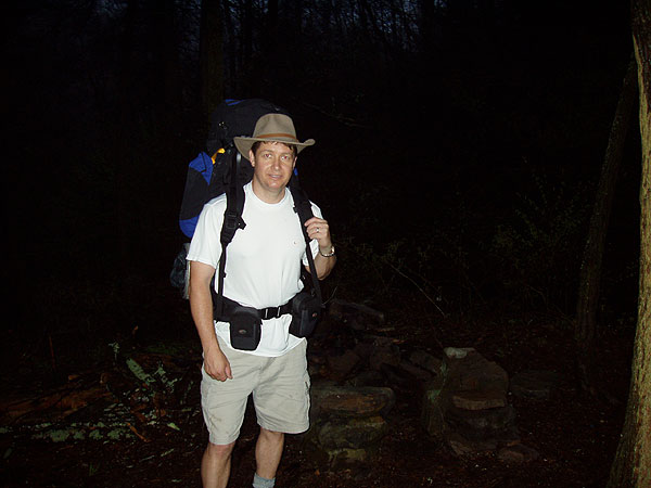
Did this as a day hike last weekend. Hiked it counter clockwise as I wanted to come down the Draft instead of up it, which turned out to be a good idea for one reason. I saw absolutely not a soul on this hike the entire day. I parked in the parking area and there were maybe 10 vehicles there but I believe most people hike up to Hiner Springs via the draft and back, so this explains why I saw no one.
So once you come off of the bridge hollow trail and head up the bald ridge, there were two spots where the trail just disappeared and I went off trial twice. Do not expect to see ANY yellow tree tags after about 2 miles up the bald ridge. All I can say is keep following the ridge line and you should be fine. Great views up there along the ridge which I would imagine would get obscured once the leaves start to show up.
All around it was a good hike. The Draft had the highest flow on it that Ive seen so far. Actually had to put on my water sandals to cross the last 6 times or so. Also, I only counted 17 crossings of the Draft. Another note is when you come to Hiner springs and either start up or down keep the draft to your left going down and to your right going up and you should be fine. The trail is very obscure in this area. ENJOY!!
By:Willin
Rating:
Date of Hike: Friday, April 6, 2018
Did the loop hike just yesterday (6 April 18) as a day hike. Did it counter clockwise just as the notes are written. Absolutely Loved It! Great weather & Great hike! I didn't use the little map, but did use the notes, and they are pretty much dead on. As it is spring time, the water levels are up of course, so I had a total of twenty fords (from mid shin to above knee deep) to make across Ramsey's Draft as I followed it down, and a handful of smaller feeder streams that were easily enough rock hopped across. Such a beautiful river Ramsey's Draft is. I had no issues, and completed the entire loop in about five and a half hours. I definitely recommend this hike, but due to somewhat scant trail markings & "invisible" trail in places, and don't know that I'd recommend it for a lone beginner - only my opinion, of course.
By:Tim D
Rating:
Date of Hike: Friday, November 10, 2017
Because it was so cold this weekend, we actually hiked Shenandoah Mountain, camped at Hiner Spring, and took Bald Ridge to Road Hollow back to the car, skipping Ramsey's altogether. However, wanted to leave this here (and also at Shenandoah Mountain page) as a warning given the leaf cover on the trail.
Overall, fantastic route, and quiet and great views from the Bald Ridge trail. However, there was on tricky spot to look out for. On the USFS topo map there's a hairpin turn about 1/3 the way between The Pinnace and The Peak. We lost the trail in a sloping hardwood forest where the trees were too wide apart to make the trail, and had to backtrack, then bushwhack down to the approximate location of the trail after that turn. Not the worst bushwhack in the world, but save yourself some time if you're going with all the leaves down and just plan on the short bushwhack.
By:Anna
Rating:
Date of Hike: Tuesday, July 25, 2017
Did part of this hike twice in two weeks with 2 groups of youth. From Confederate Breastworks to Camp Todd via the Shenandoah Mtn trail and Jerrys Run. Be aware that the water source at the Jerry's Run campsite is dry (as of July 27, 2017) due to the dry conditions, so we carried 4L of water/person. Additionally the spring at Hiner Spring is low (as of July 27, 2017) due to the high temps and lack of rainfall. Overall a wonderful hike and flexible enough to turn into a multi-day trip.
By:idanho
Rating:
Date of Hike: Saturday, June 24, 2017
Did this as a day hike, clockwise like are in the directions. Took about 10+ hours, but we didn't move too fast. Saw a few black bears (4), cubs and yearlings, but never came across the mamas. Almost no one on the trail. Only saw 1 other pair of overnighters and another day hiking group down near the parking lot, but we were the only ones up on the ridge. Bring pants or long socks. The nettles are brutal, and have overgrown a good portion of the trail. A machete might be a good idea if you really want to get at the thorns and overgrowth. I still wore shorts and long socks, and my knees weren't too beat up, but the nettle sting is irritating.
Enjoy the overlook at the beginning of the ridge, it's the only one we saw with the canopy as thick as it is right now. When you first make it to the ridge as per directions there's a couple of campsites off to the right with clearings to view the valley below. This is the best view for the rest of the loop, take it in.
Overall, this was great fun as a day trip.
By:Shamus
Rating:
Date of Hike: Tuesday, June 20, 2017
From the onset I was frustrated with the lack of current information I was finding on hiking Ramsey's Draft. As a father, I wanted to be sure I was not placing my family in undue danger. My two boys, six and nine, along with my wife and I hiked this last week as part of our vacation to the surrounding area. The terrain itself is difficult, made complicated by the MASSIVE tree falls and lack of defined trail. This all gets compounded by carrying overnight packs for the duration. To be fair/clear: Everything known/written about this hike makes it known that this is Wilderness area, and therefore not maintained like a national (or state) park of forest, or other such typical hiking destination.
If you approach this trail as a challenge you will be successful and find it rewarding. It is not a turn-key walk in your local park.
Also:
I found the people at the North River Ranger Station to be a great resource for information as I educated myself on the area. They always answered the phone and were content to engage in conversation and answer all of my questions.
I would be pleased to reply to anyone with questions about this hike for themselves.


