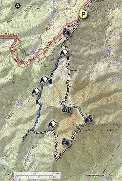
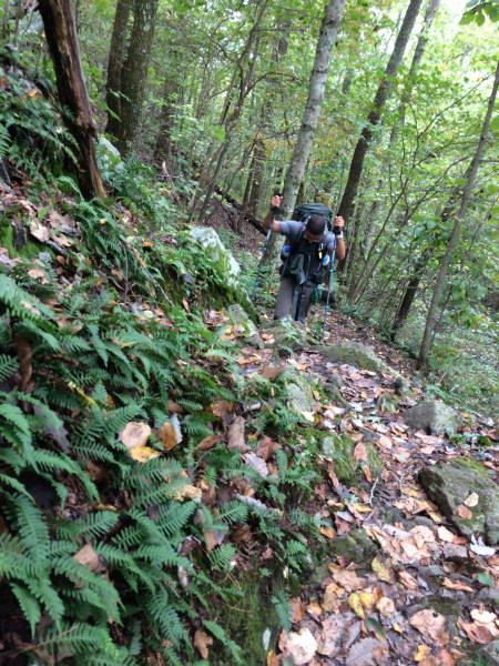
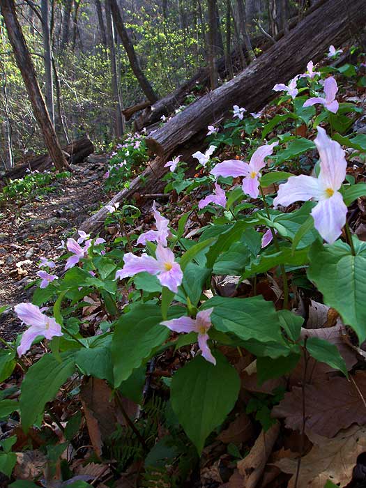
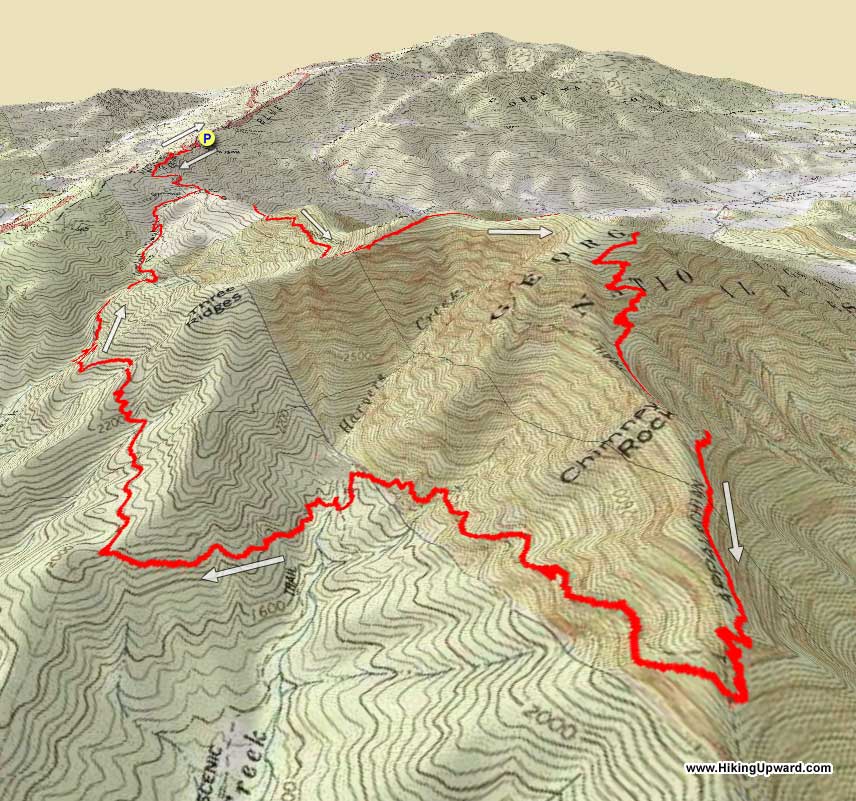
Three Ridges is one of Virginia's most popular backpacking circuits. Situated in Central Virginia, just 30 miles southwest of Charlottesville, the hike has vista after vista along the Appalachian Trail, and many small waterfalls and pools on the Mau-Har Trail on Campbell Creek.
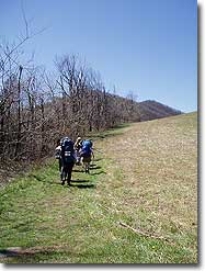
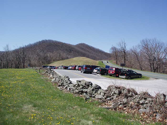
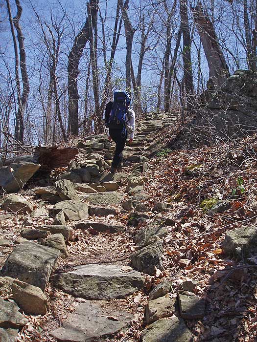
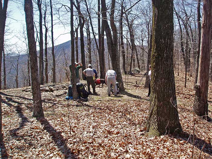
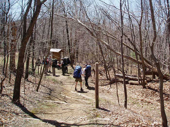
From the parking area at Reeds Gap, head south along the white blazed Appalachian Trail (AT) as it initially hugs the left side of a clearing. At the end of the clearing start climbing Meadow Mountain, and in 0.8 miles arrive at the top of the ridge and campsite/overlook.
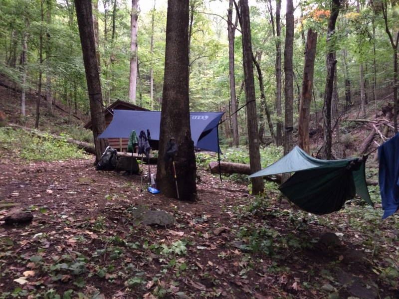
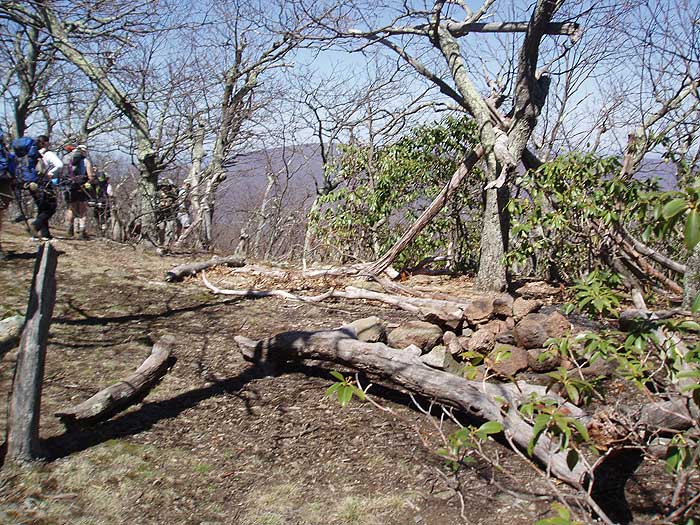
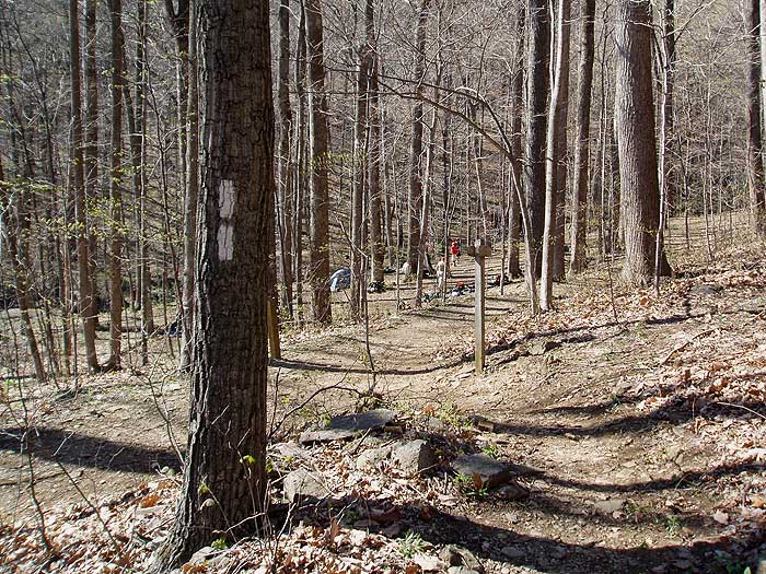
Continue along the AT as it now heads downhill, and in 0.8 miles arrives at the Maupin Field Shelter, and intersection with the Mau-Har Trail that will be your return route. The shelter is not visible from this intersection, and is 100 yards downhill. Several small trails intertwine this large camping area.
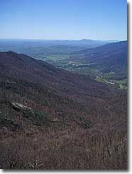
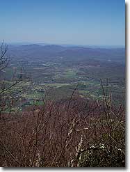
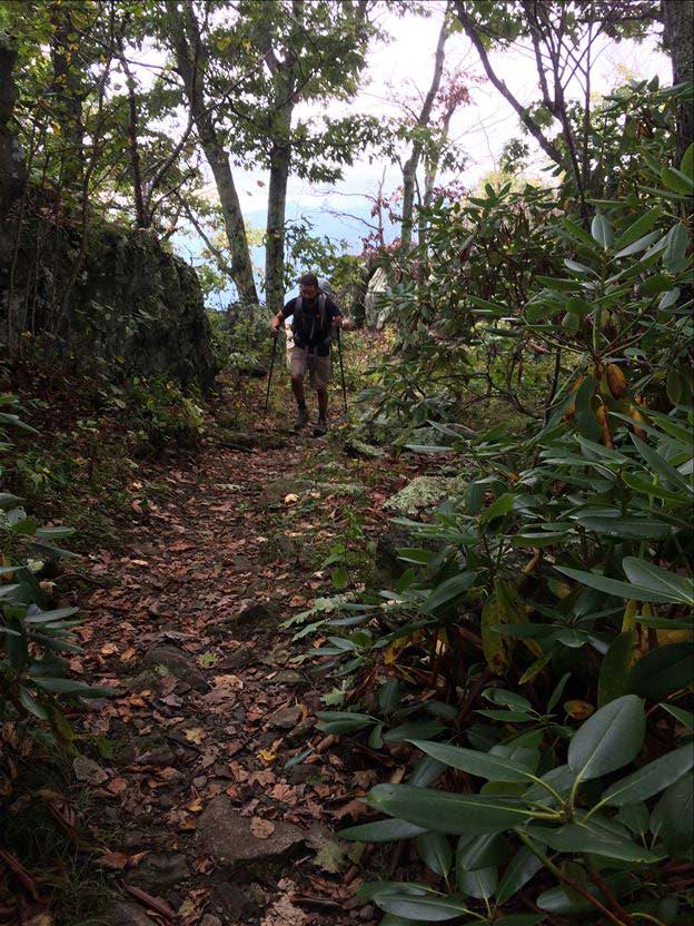
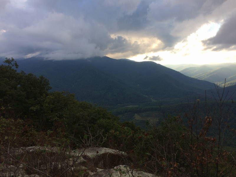
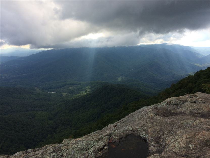
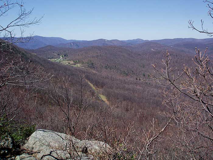
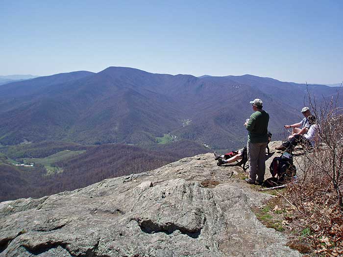
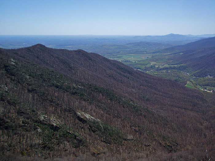
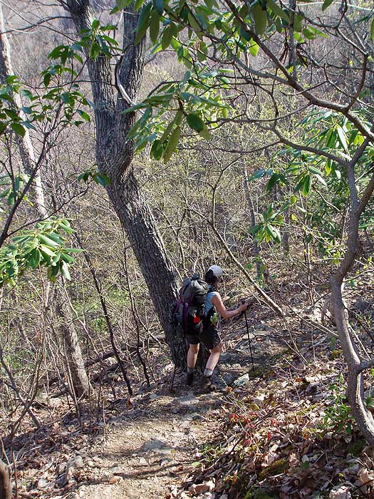
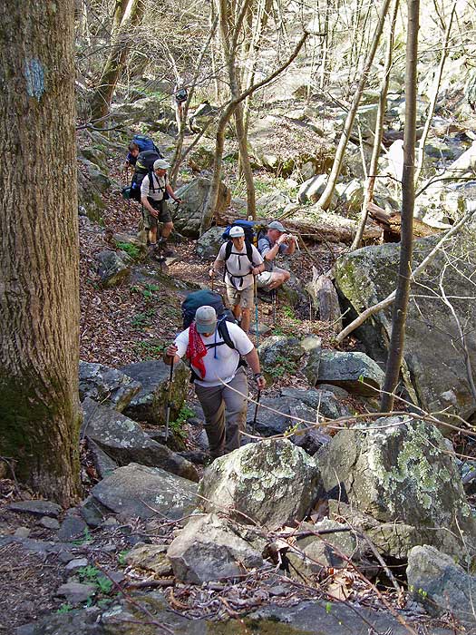
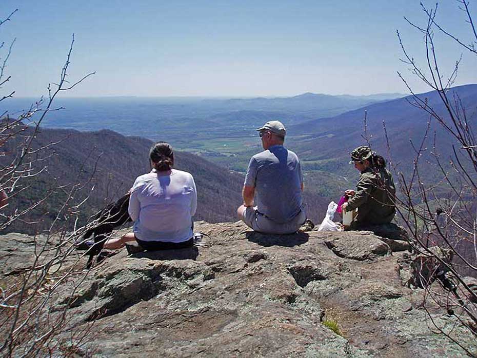
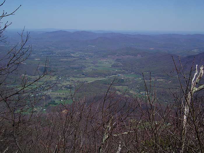
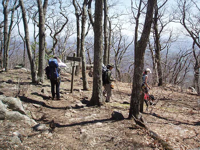
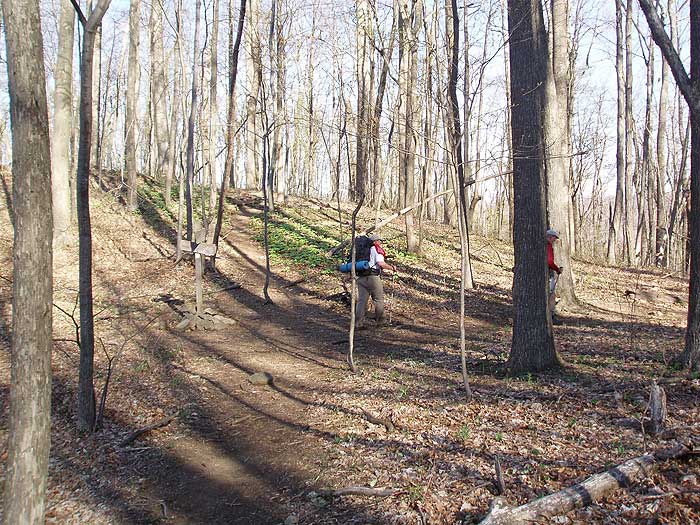
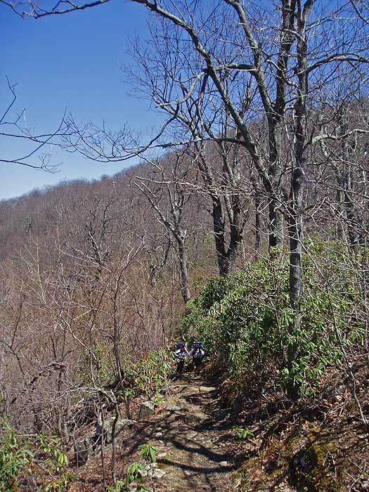
At the intersection remain left, staying on the AT as it passes a small clearing. The AT will now climb and pass over Bee Mountain in 0.5 miles. Descend Bee Mountain, then climb the northern knoll of Three Ridges and arrive at the best vista of the hike.
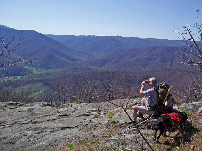
Continue up the AT as the trail traverses the ridge before reaching the top of the second knoll in 0.8 miles, and view to the northeast. Look for an unblazed side trail on the left marking the overlook and campsite.
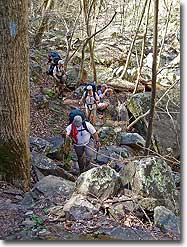
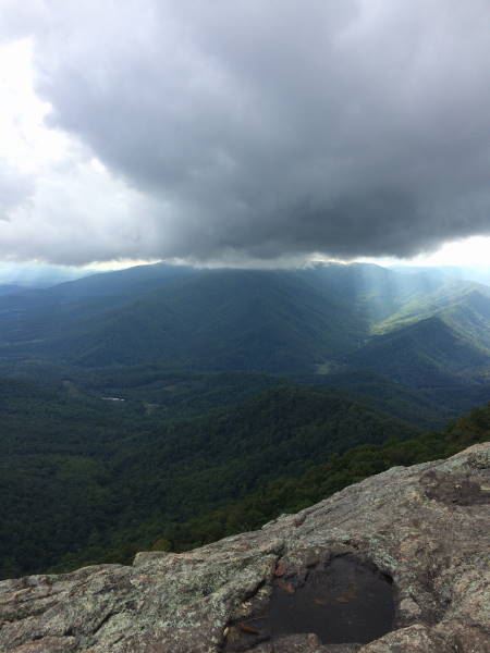
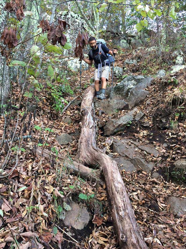
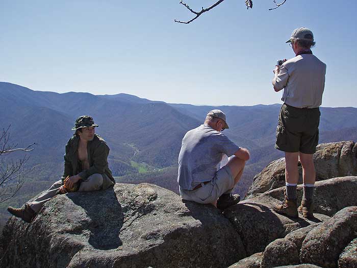
The AT now heads downhill from the hike highpoint, and in 0.1 miles stay right a the trail marker. Descend another 0.2 miles before making a switchback to the left. At the switchback there is another overlook. After making the switchback the AT will descend steeply for 0.8 miles, then pass around the left/north side of Chimney Rock. A faint unblazed trail ascends steeply for 25 yards, then passes around the left side of the summit to the Chimney Rock overlook.
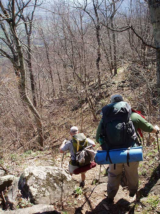
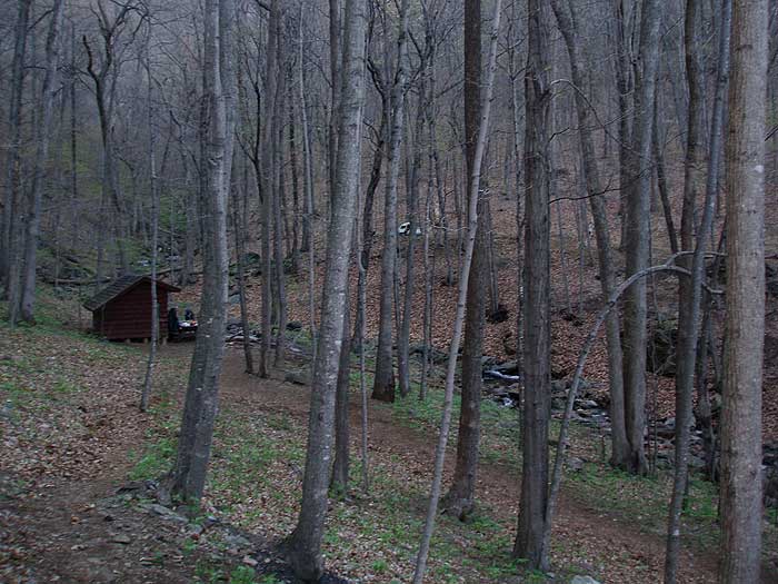
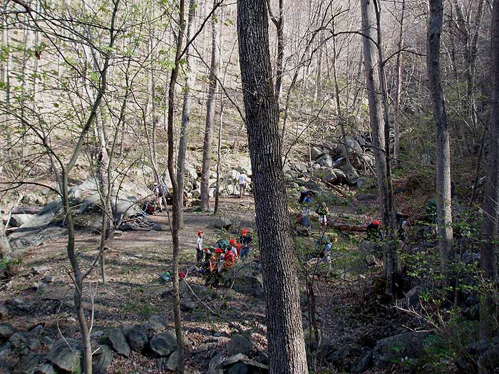
Continue downhill on the AT for another 1.8 miles as the trail descends to the right/south of Three Ridges, then arrives at the main camping area and Harpers Creek Shelter.
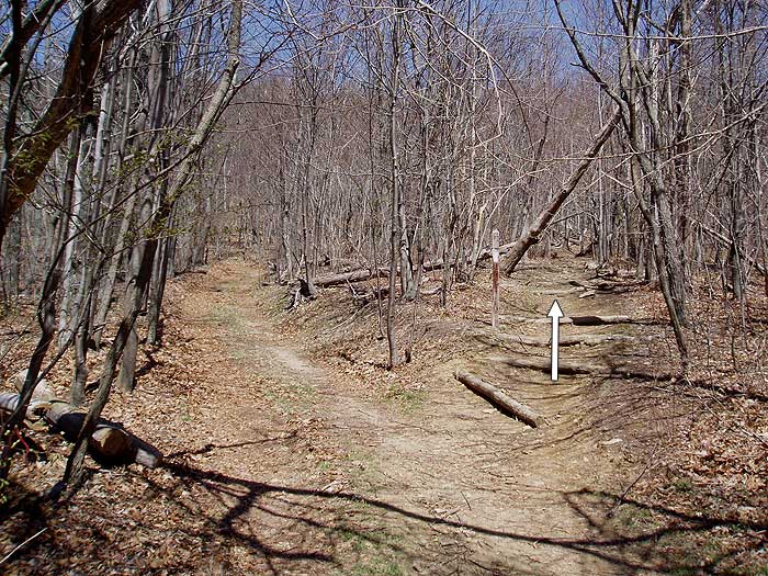
Turn left downhill on the AT (opposite side of the creek from the shelter). In 0.1 miles the AT will turn right crossing Harpers Creek before heading uphill, and reaching the intersection of the blue blazed Mau-Har Trail in 0.7 miles at a small pass on the ridge.
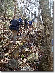
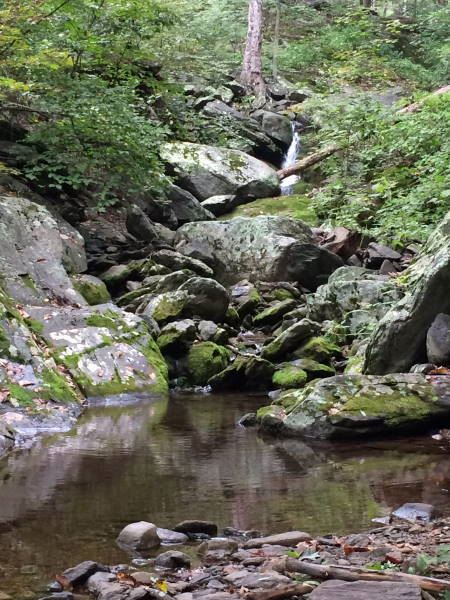
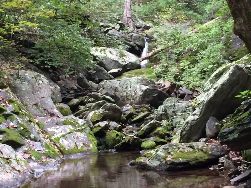
Turn right on the blue blazed Mau-Har Trail, descend, switchback up the next ridge, then descend again and reach Campbell Creek and large camping area in 1.5 miles. There is a yellow blazed spur trail that leads downstream to a small pool and waterfall in 200 yards.
Continue upstream on the blue blazed Mau-Har Trail as it becomes steeper, crossing Campbell Creek, and making several switchbacks before arriving at Maupin Field Shelter in another 1.9 miles.
There are several trails at the shelter leading to different campsites. Continue straight past the shelter for 150 yards and reach the intersection of the AT you descended earlier.
Turn left on the AT, then in 20 yards stay right remaining on the white blazed AT. Continue uphill on the AT as it passes back over Meadow Mountain, before descending and arriving back at the parking area at Reeds Gap in 1.6 miles.
Early October
Late April
Three Ridges
Three Ridges Hike Comments
Archived Comments
By:Brian and Sylvia
Rating:
Date of Hike: Friday, October 25, 2019
Fantastic Hike, very much lived up to billing Surpassed only by Old Rag on the list of Virginia hikes...definitely an icon. Fall colors very much still in peak on the last weekend in October. We did the loop counter clockwise, unlike most, and found this route to be quite viable. We had no significant issues going up the Mau-Har trail. But either way you do this, be prepared for the fact that there are MAJOR ascents and descents on both days of the hike. Situational notes: The ground bees past Harper's Creek appear to be gone or at least dormant, there is now reliable water at Harper's Creek, but Maupin Field Shelter appears to be dry (and overrun with Boy Scouts.)
By:Señor
Rating:
Date of Hike: Friday, October 4, 2019
All around a gorgeous loop: beautiful views all the way in from Reeds to Three Ridges and on down the AT until the junction with the Mau Har. Ample campsites along the way, especially on the AT, though the biggest trade-off there is water: your only water spot coming down is behind the Maupin shelter 1.6 miles in from Reeds, which itself was a trickle (though just enough of an ebb to fill and treat). Otherwise you'll have to wait until the next shelter or the Mau Har, where Campbell creek is flowing with lots of water, including bathing pools. Amazing ecosystem diversity throughout, from the high fern plains on the ridges to the mossy forests with huge trees along the Mau Har. Easy to see why it's so popular only downside is just how many other people were also on a two night loop, thus making competition for campsites inevitable. This is especially true for the Campbell creek spot: lots of folks end up camping here right on top of each other in a relatively tight area, so if you're looking for solitude, it can be a challenge. If you're headed up the Mau Har for your second night, there's a small spot tucked away near the pools below the main area at Cambell, or if you head another mile upstream, another larger site.
And speaking of crowds, PSA: IF YOU'RE GOING TO CRAP IN THE WOODS, DO IT RIGHT FFS. Walking 10 feet away from your campsite literally in a creek bed to what seems like a dry area and barely covering it with a tiny rock and some leaves aint it. There were multiple of these all along Campbell creek, including right above one of the pools near the waterfall (apparently the concepts of rain and gravity are difficult to conceptualize for some folks).
By:Emily
Rating:
Date of Hike: Wednesday, September 25, 2019
Nice easy overnight backpacking trip or a substantial day hike. It's a highlight for its proximity from Rockfish Gap. Easy to get to, easy to hike, easy to follow, and nicely rewarding. It's not flat, but the climbs and descents aren't that hard either. On the Mar-Har section there is plenty of water and a nice swimming hole. It's got some really pretty campsites, but in my experience they can get overrun on the weekends. I definitely recommend using this trail as a mid-week option, especially in the fall.
----- Here are some important tips for Sept/Oct 2019:
POISON IVY: Know this leaf before you go because it is very abundant and close to the trail. Be careful. ----
LOW WATER LOW WATER LOW WATER: If you're planning on camping at Harper's Creek shelter (really beautiful spot with a shelter or ground camping halfway through the loop) follow these instructions so that you don't have to dry camp:
The closest water to Harper's Creek (mi. 7) right now (Sept 2019) is accessible by continuing to hike down the AT past the shelter until the stream crossing - maybe 1/4 mile tops. At the stream crossing follow the dry bed a couple of hundred feet down until you see a small pool of water about 10ft across. Lower yourself down to the mouth of the pool and underneath the stacked boulders you will find a small stream of flowing water that is slow but sufficient enough to collect for filtering or cooking. I don't recommend collecting from the pool itself.
From there you can return to the campsite at Harper's Creek or continue the hike. The next available water for filtering is 2.5 miles later on the loop off of the Mar-Har trail once the trail hits the much more plentiful stream.
By:Jim Nichols
Rating:
Date of Hike: Saturday, August 24, 2019
Hike the Mau Har Trail today as a follow up to completing the Three Ridges. Last weekend I did the Hike fro Rt56 to top of Three Ridges. This time I started at Reeds Gap and went counter clockwise along the Mau Har to the intersection with the AT up on Three Ridges and then back.
The day was cool, and perfect for hiking. Lots of people out. Once I was on the Mau Har past the camp area there was plenty of tough up/down along the creek. Seemed more down than up which made sense since the path was following the creek. Eventually the path started to curve away from the creek and climb to wards the intersection with the AT. Took a sandwich break at the trail intersection.
On the return back down the Mau Har Trail I made a 30 minute stop at the waterfall to take some pics and chomp down trail mix. This portion of the whole Three Ridges loop was a little tougher than the main AT portion that I hiked the previous week. Thank goodness for the cool weather.
Overall, about 10 miles and 4.5 hours. Then off to a watering hole and some dinner along Rt 151.
By:Jim Nichols
Rating:
Date of Hike: Sunday, August 11, 2019
My wife and I started at the Alternate trailhead off Rt56. and hiked up to the top of three ridges then back down. We each carried more than day packs since we are prepping for some Peru hiking in Sept. Obviously we can't simulate elevation but we needed to build up 8 - 10 hour treks with elevation and single track. This was just what we needed. Since we haven't the hike before we opted for an "out and back" with a time limit.
The day was warm, we started at noon and finished around 8pm after about 12 total miles. VG up/down, some beautiful views with not a lot of traffic on the trail.
Next time we'll include the Mau Har trail.
By:Jane
Rating:
Date of Hike: Friday, August 2, 2019
Great hike for a WORKOUT! Definitely harder to do in one day than say, Old Rag. I understand why people split it up. My boyfriend and I are in good shape and it took us around 7 hours to do the full loop with a couple stops for lunch and snacks/water. The view at the first ridge was wonderful, but after all three, the loop back is quite strenuous. Lots of steep inclines the whole way. But many beautiful waterfalls and little watering holes, and pretty much the entire thing is in the shade. By the end you feel really accomplished! Definitely not your casual stroll, but it was incredible! Worth the trip for sure!
By:Jake
Rating:
Date of Hike: Saturday, July 27, 2019
Hikers beware that the water sources are dry along the AT so pack accordingly if you plan to do the full loop. The Mau-Har trail is the best source for moving water as of 7/27. We started our loop at RT. 56 Trail head and hiked counter clockwise. There is a small trickle at the Harper's Creek crossing but don't expect anything else in terms of fresh water until you start heading back SW on Mau-Har.
By:C Hemenway
Rating:
Date of Hike: Friday, July 5, 2019
Terrific hike for hardy souls. The HikingUpward map and description are spot-on. Read and memorize them! Learn who The Appalachian Ambassador of the Blue Ridge is so you recognize him when he hooks up with you.
_____This is NOT easy! But it is truly worthwhile. Beautiful, lush, varied, easy campsites, and delivering earned bragging rights. The key is having enough WATER and TICK REPELLANT.
_____Take the route seriously, wear good boots that support your ankles, use poles (highly recommended), use plenty of Picardin everywhere, take a water filter/bags (!), choose clothes for brutally hot days with very chilly nights (this IS the mountains), pack a good first aid kit and hand sanitizer, take a laminated map (we each took the above map and description, double-sided) and a compass/ball-less whistle, and, most important, make sure you carry enough water and nutrition! We each had a 2L camel-back of water, and a bottle with another 20oz. And lots of GORP, honey Stinger packets, and salt/Nuun tabs, along with food.
_____PLAN on 1 mile per hour, especially if you're carrying 25 pounds (at 5'2" and 125 lbs myself), and want to keep your knees buckled. There are many potentially treacherous rockfall scrambles (up and down, worse when wet), and scree (worse when dry). Down is MUCH HARDER on your body than up!! Work and hope for better time than that, of course, but PLAN on this rate to be sure of enough water, calories, and, if you need it, moleskin!
_____Four of us (me, my daughter, my nephew, and my blonde-blue-eyed border collie mix) started at Reed's gap around 3:30pm on a very hot and steamy Friday in July, going clockwise. I recommend this route because there is NO WATER for the 7 (or 4.5, depending) miles on the east side of this hike until you get to Harper's Creek, and the rockfall scrambles and switchbacks are SERIOUS. This is not the route to return on! Pack water in. You can replenish close to the start (1.6 miles in) at Maupan Field Shelter where there's a spring (100 yards off the AT). Don't know how dependable the spring is, but it was running well this week. (It also has an outhouse, but, well, it's the wilderness, after all...)
_____There was NO WATER for another hard 4.5 miles to Harpers Creek. If you're cooking between "here and there," as we were, that's more water needed. But then there was plenty, fresh and delicious, all the way home on Day 2.
_____IN SHORT: From Reed's gap parking lot, we hiked South on the AT for that 1.6 miles to where the Mau-Har Trail (the return route) joins it at the northern end. We hiked another mile before pitching camp. Left around 8:30 am on Day 2 after a raw breakfast, summited, got to Harpers Creek Shelter and water refills at about 11:30am, cooked brunch, hit the Mau-Har at about 12:30pm, and arrived back at the parking lot at around 6:30pm, with stops along the way.
_____SHORT STORY LONG: At mile 1.6 on Day 1, where the Mau-Har joins the AT, we met up with Floyd, a really friendly, if smelly, guy, who traveled with us for the next 10 miles, spending the night with us between Bee Mountain and the summit.
_____He gave us a story to tell! And warmed our hearts.
_____
_____When we met him, we thought he was lost and called the number on his tag (he was well-tagged and had a flea collar on), and his owner said Floyd is known as the Appalachian Trail Ambassador of the Blue Ridge and knew his way home, which was nearby. I asked if we should just leave him be and was told yes. But Floyd had other ideas. HE wouldnt leave US and since he and our female pooch got along, we just let him tag along. He seemed pretty buff, despite a nasty sore on his rear end a big energetic white pit bull mix with a dark patch on his forehead. And VERY friendly!
_____We hiked over Bee Mountain, maybe another mile, but not as far as the second knoll and summit because it was getting late and storms were brewing -- lightning (hard to tell if it was heat lightning at that point) and thunder nearby, generally from the southwest and passing to the east. Fog rolling in. We found a great camping spot for two tents at a clearing with a fire pit, right off the trail.
_____We were concerned about water since we knew we wouldnt get to a stream until late the next morning. ALL of us needed more water than we expected, including the dogs, and were in danger of dehydration if we didn't ration. Though we'd packed only enough for ourselves and our pooch, we spared what we could for our guest.
_____We then learned a few hard LESSONS: Plan on having to share water and comfort with others in need!
_____We had some pasta, fed the dogs, and let them clean our dishes, then got our food/smells bag up a tree and away from bears. I made a shelter for Floyd because we werent gonna let him in our tents and it kept threatening rain. At about 8:30pm, we turned in. But Floyd had other ideas -- he would not settle down and kept grunting around our tents, trying to claw his way in.
_____We knew he wanted companionship and water. We took turns going out to scritch him a little and say soothing things. I tried tying him up, first near by shelter, which he broke from and tore down, then to a tree near some ferns he could sleep in, then to a makeshift dog run, but no rope we had would hold. Meantime, heat lightning and thunder periodically boomed by. Our dog, who was sleeping with my daughter, would growl a warning when he came near their tent, which kept him from trying to tear that one down.
_____But he kept huffing and circling ours for the next few hours, settling periodically just enough for my nephew and me to drop off to sleep before he started up again.
_____Finally, at about 2 AM, I prepared to go out and sleep with him if I had to. First I checked my water supply and figured I could share another cup. That seemed to do the trick and he fell asleep outside our tent opening, pressed up against our feet. At about 5am, he'd had enough of alone, ripped a hole in our tent screen, and climbed right in. We had to use all our might to shove him out and close the tent fully up for the rest of the night. (Anybody have tips for replacing a tent screen?)
_____All of us felt simultaneously sorry for him and upset at our interrupted sleep and at his owners. We decided a bear visit would have been better: It would have just grabbed the food and skedaddled. Chalk our mood up to sleep-deprivation grumpiness. But Floyd was so friendly and so clearly needed to be with people that he won our hearts! <3
_____He stayed with us most of the next day, both dogs absorbing as much water as their bodies could take the instant they reached Harpers Creek, till somewhere way up along Campbell Creek he took off, apparently knowing he was near home. Hasta la vista, Snuffleupagus Floyd!
_____My nephew texted his owners once we got back and found out that Floyd is 10+ years old (they're not sure) and that the only way they could prevent him from wandering was to chain him up which didnt seem right to them. They assured us theyd take him to the vet on Monday for his open sores. They seemed very kind. We mentioned nothing about the tent.
_____It turns out Floyd is well known for traveling a good distance with hikers and that he is TERRIFIED of thunder!!! Poor boy!
_____All of us felt extra bad then because we knew he had just wanted to be comforted during last nights scary noises! We had done our best though, and gave him yummy leftovers and good companionship.
____
_____It never did rain, though all of Day 2 we were getting ready for it on and off as dark thunderous clouds swept overhead. I'm extra glad it didn't because the rockfalls would have been absolutely ankle-breaking with water cascading over them. Just damp or dry, they were challenging and I was really grateful for all those boot camps that strengthened my core and joints, and for high tech walking poles that provided stability. Could have used workout gloves for those poles, though.
_____Definitely take the time to stop at overlooks and to take in the life-affirming lushness of it all. What's the point, otherwise? There aren't that many overlooks in any case.
_____Chimney rock is easily missed since it isn't exactly at an overlook -- but it sure as heck does look just like its namesake, so watch for that. If for no other reason than it anchors you on the map. The most difficult part of the trek was from the next overlook down to Harper's Creek Shelter, imho, mainly because the scree and rocks were hard going, I was a bit wobbly from too little to eat at that point, and now I really wanted enough water to gulp it down indiscriminately. Lesson: Keep those calories going in!
_____You can hear the water well before seeing it and no, it is not wind in the trees! You're not imagining the oasis. But my goddesses it takes FOR-EVER to get down down down down down to that fount! Have faith.
_____You're finally at "signs" of civilization where the AT does a U-turn just before the shelter you can imagine you're at the Mau-Har going to the right in your delerium, but you're not. You're at that shelter -- and the creek! Nothing looked sweeter than to spot "the kids" filling up water bags ahead of me there, let me tell you!
_____
_____There are amazing god-people who can leave "on time" (i.e., early early) from Northern Virginia and get to this shelter 2.5 hours away on Day 1, in time to set up camp and relax with their wineskins and "joints" all in order. We are not those people. At least *I* am not those people, as the looks from "the kids" let me know the morning of Day 1. "The looks" that didn't appreciate how I had actually HELPED BUILD THE BIG BLUE and MAINTAIN THE AT back in the day!!! Snort.
_____I am not "those people" after Momming, and "loaning" outdoorsy things to my three kids for 20 years, and now wondering where they walked off to when I'm ready to befriend them myself again. Oh no! Not after remembering that my own (then primo) Kelty bit the dust years ago and I this week have to figure out the new rigging of the backpack I scrounged out of the attic that I had got one of the boys when they were wee Scouts and just about my size! Not after hunting and pecking for first aid supplies as someone who DOES DISASTER PLANNING for a living!!
_____But I AM the Mom who em braces with all her heart the invitation a week before from her daughter for our first non-full-family actual backpacking trip together. I'm the one who says "YES" and will figure out HOW later. :-)
_____AND I AM the Mom who has the perfect GORP recipe, knows that you can't have enough heel blister packs or waterproof bags, and has enough experience with bears, snakes, and bugs to know how to calm a few "kids'" fears (ahem) with tree-bag spotting, Black-vs-Grizzly-bear trivia, before-stepping-over-logs copperhead hellos, Picardin, and tick removal skills.
_____And I'm a Mom who is an early-adopter of tech, but can't afford what the kids can, so they get the cool stuff. I know what the cool stuff IS, kids! And I used to have it before I had you, who it turns out ARE the coolest of the cool "stuff," and who re-defined "cool." And (hey!) from whom I can can now borrow!
_____
_____Having said all that, DO NOT STINT ON A "COOL" aka "HIGH TECH" WATER FILTER!
_____The water beginning at Harper's Creek is really good and comes from uncontaminated springs, and gets even better along the Mau-Har. But fill up at Harper's because it's a long while with lots of uphill and over-the-ridge before getting to Campbell's Creek.
_____The rise up to the Maupin Shelter is easy to tell because it's where the trail definitely leaves the creek, whose tributaries you cross over several times. Rest there for a bit and check your water because the last 1.6 miles back are deceptive.
_____The uphill is just regular uphill mostly, but the downhill takes work. You have the psychological component of knowing you're "near" the end but it seems much further than you "remembered." You forget that the climb up this was a no-brainer, with all your anticipative spirits taking the lead. You're tired and the risk of injury is now highest. And there are rockfall trails to navigate. Take care.
_____Nevertheless, the ridgeline is a welcome distraction, as is the gorgeous vegetation, and when you get to the double-track trail, you know you've just about done it! Hurray!!!
_____
_____We came back with more than a few stories: Tick count was 30+ among the four or us, most of them dead and from the dog, none of them engorged.
_____DO A THROUGH, CM-BY-CM TICK CHECK!!! All but one tick was large (ca. 3-5cms) one was smaller than a pinhead. We found many of them the next day in the sheet the dog slept on (deliberately, so ticks wouldn't nestle in a blanket), thankfully dead, having probably been tangled in hair or lying close to skin under it. Since they were not engorged, I had had real trouble "feeling" them. I did another nose-to-tail-to-nose check. She-the-dog probably thought I was the BEST MOM EVER, giving her all this loving. Heh.
_____I discovered that A) Picardin works, but spray it on all your clothes, especially the openings, and on the dog, especially the tail and joints and warm/moist spots, B ) The dog's thick border collie coat is a great deterrent and net, and C) her oral tick protection (NexGuard) actually kills them right away when they get near her skin.
_____LESSON: Take the tick-removers with us next time (I have TickTwister -- easy and works every time!). We are all agreed ticks have no business existing they contribute nothing to the ecosystem but gross us out and spread disease. Eh.
_____As for solitude vs. crowds, this was billed as a popular loop but we met very few people, expecting more for a long weekend. We came across mostly AT through-hikers and some hardy souls doing the 14-mile loop in one day, including a wiry woman I guessed was in her 70s who probably finished the whole thing in 8 hours. Inspiration! And a man had heard-tell of the Blue Ridge Ambassador (Floyd) and was glad to meet him! So I guess we hiked with a legend, after all.
_____
_____Walking along ridges with vistas on each side, mossy nooks, lush fern meadows, a well-maintained trail, fresh clean water, and family friendship.... Never felt so good ....
_____Chewy pasta, instant oatmeal and coffee (yes, with real cream, I have my standards), hard boiled eggs, GORP, salami and cheese, apricot/PB&J on pita, and apples .... never tasted so good...
_____A big old VW van to take us home to a shower and a Women's Futbol World Championship from the sofa ...
_____Who could ask for more??
_____TOP HIKE!
_____
_____(I didn't rate this five stars because it couldn't climb to "one of my favorites" YET -- a hard task for any trek since I've backpacked all over the world. But it is WELL-worth the trip from NoVa, the side-eyes from kids during prep, and getting your old gear out, tested, cleaned up, and ready for action! Smiles all around.)
By:Jeff Monroe
Rating:
Date of Hike: Saturday, May 25, 2019
I've been hiking Three Ridges for over 25 years, since way before it was designated federal wilderness in 2000. It remains my go-to fitness hike which I complete several times a year because it is close to my home and offers a tough workout. Unfortunately, it is reaching Old Rag-level overcrowded levels on Spring and Summer weekends, with parking lots on both ends full beyond capacity by 8AM on a Spring Saturday. If you are looking for a true "wilderness" experience, this is not the place, due to large numbers of backpackers and day hikers on the loop. I've seen over 50 tents camping at Maupin Field! Several loop hikes in Shenandoah National Park offer similar challenge and much more isolation than Three Ridges.
It is also important to know that the Mau-Har Trail is an exceedingly difficult trail to complete, especially with an overnight pack. It is steep in parts and very rocky in others. It is not a good shortcut between Maupin Field and Harper's Creek Shelters. Stay on the AT instead.
By:Grant Wiley
Rating:
Date of Hike: Saturday, May 25, 2019
Second time hiking this trail with an overnight backpacking trip in mind. The first time I ended up hiking the entire loop in one day while this past weekend I hiked the trail stopping at Harpers Creek Shelter and finishing the second half the second day. With this being said, the guide is somewhat misleading with the first day being 7.3 miles and the second being 7.1 miles. If you stop at Harpers Creek Shelter on night one it ends up being around 8 miles and day two is closer to 5 miles. The second day has a huge climb out of the waterfall area and therefore it is still tricky especially if you are exhausted from the day before.
Overall, it is a great hike although it was extremely crowded on Memorial Day weekend therefore I would recommend getting out early to secure a camping spot. If there are no spots at Harpers Creek Shelter you can go downhill from the campsite and find many smaller campsites that have been made over the years.
This is a tough hike so make sure you are ready for some above average hills for this area.


