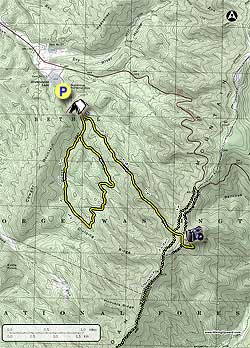
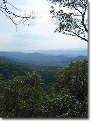
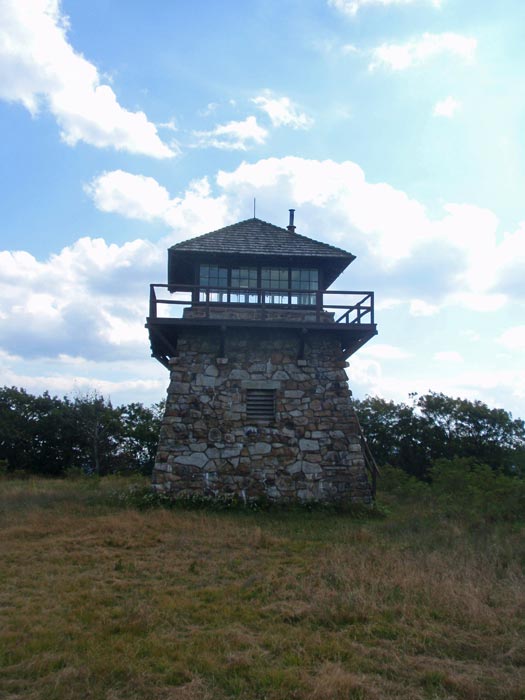
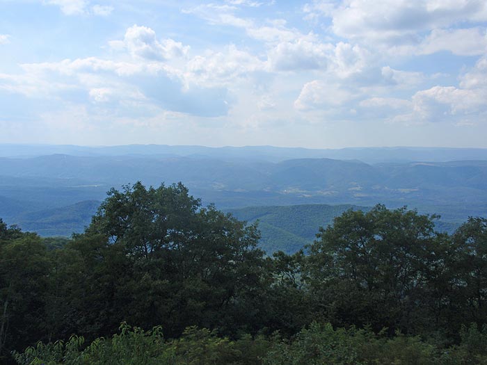
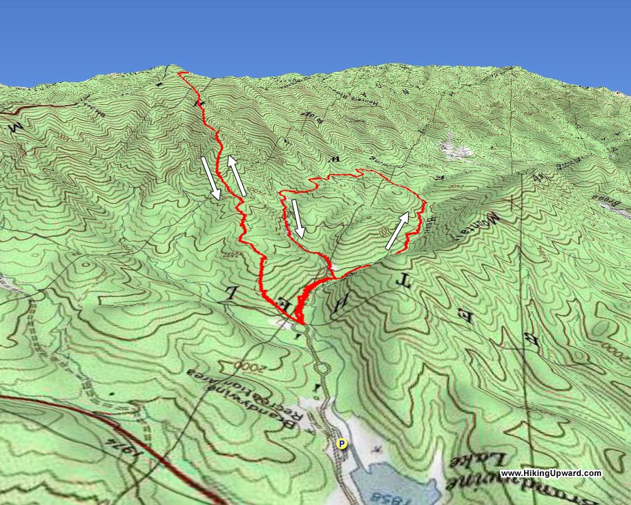
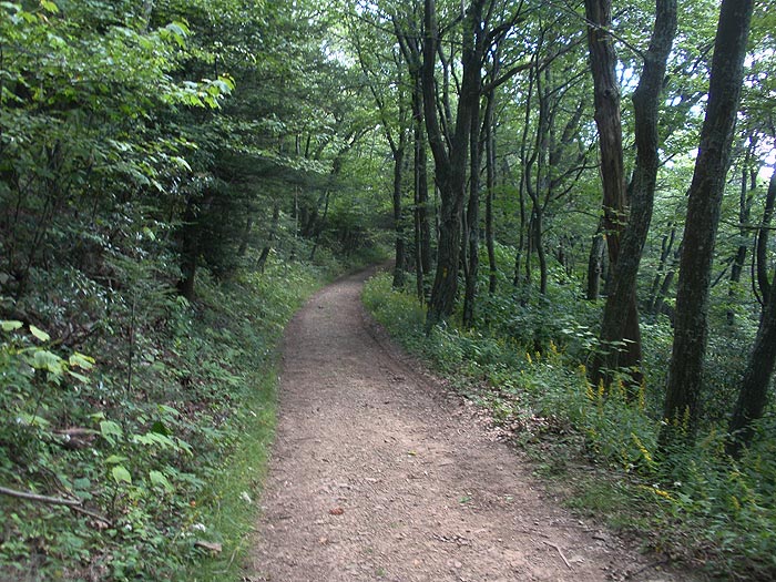
The Brandywine Recreation Area, on the border of Virginia and West Virginia, has two totally different hikes within its borders. The strenuous High Knob hike up to a spectacular 360° view at the fire tower, and the Saw Mill loop which is an easy 3.7 mile walk along two of the areas creeks.
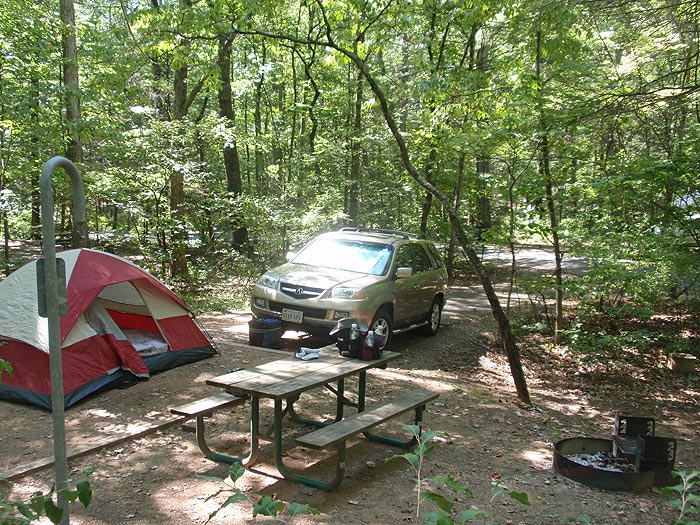
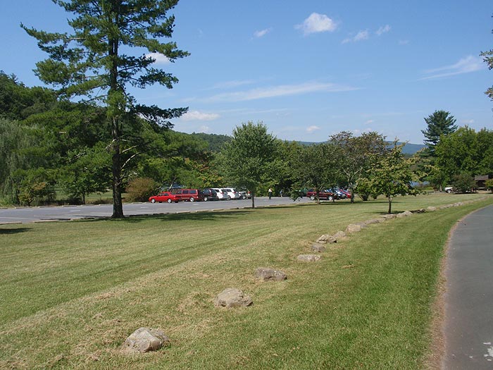
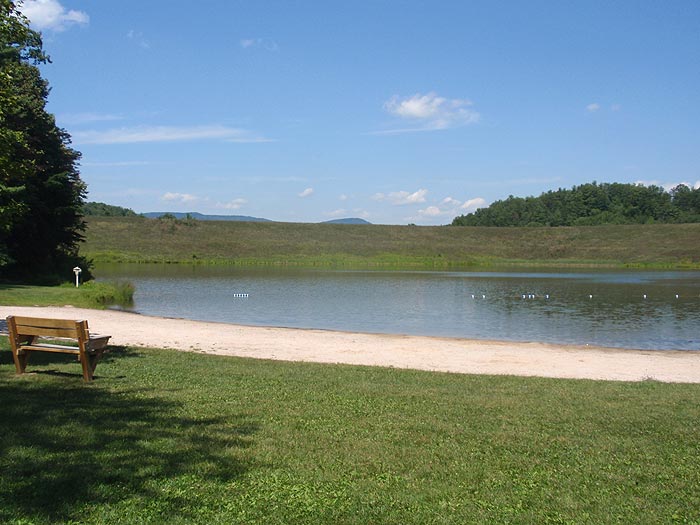
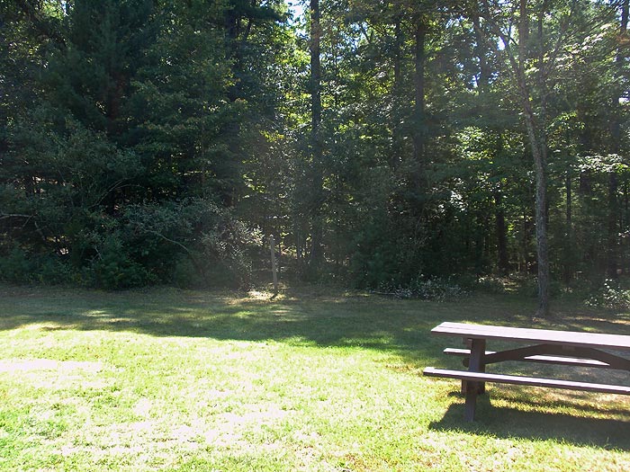
The Brandywine Recreation area is a perfect spot to go for the weekend. With a man made beach on Brandywine Lake plus 32 campsites, clean bathrooms and hot showers, and potable water throughout the camping area. Also, if you come with a large group there is a group/overflow camping spot with picnic tables and fire rings at the back of the main camping facilities. Please Note: Both hikes are rated for camping because of the camping facilities at the Brandywine Recreation Area, not for campsites on the trails.
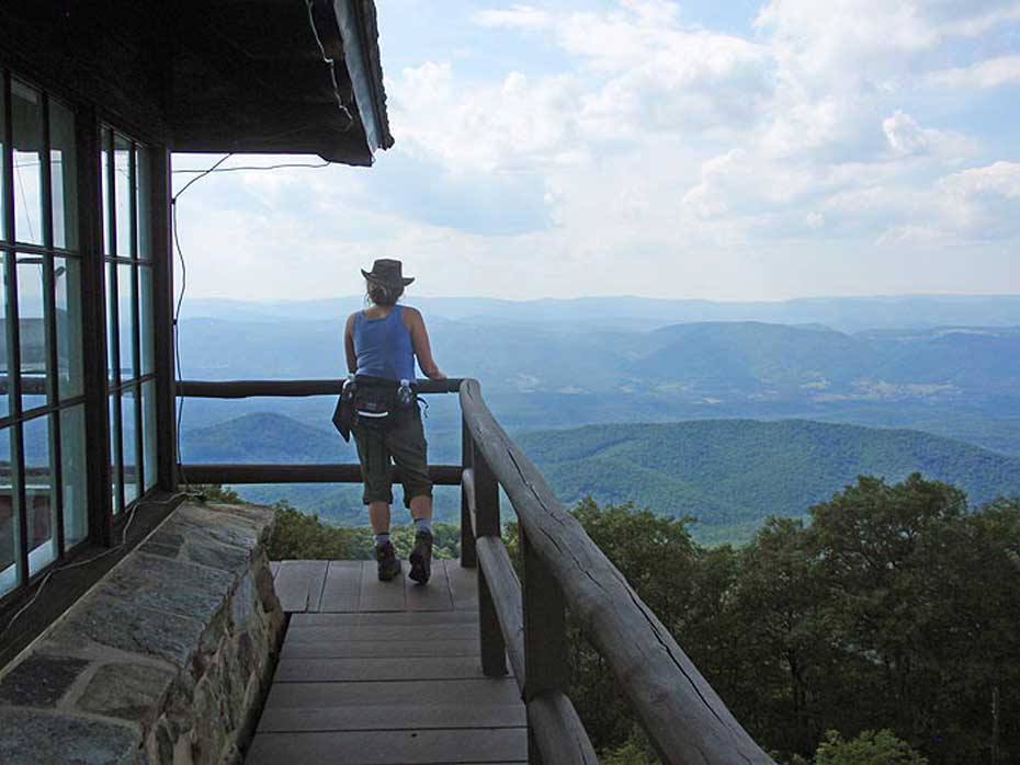
High Knob Tower:
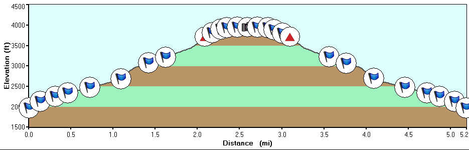
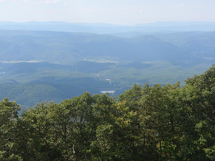
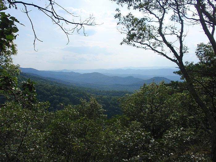
This hike is rated strenuous because of the steep grade of the trail. The trail does not make any switchbacks on its 2.9 mile climb to the fire tower.
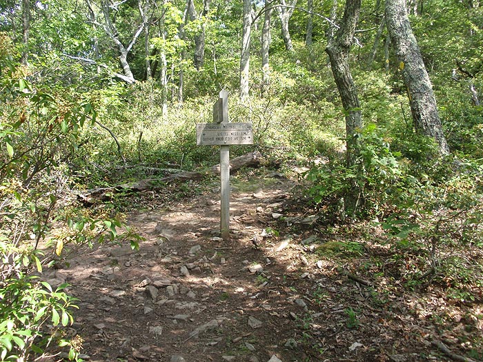
The High Knob trail starts at the right front of the Group Campground. Start up the yellow blazed High Knob trail as it steeply climbs for the first 0.2 miles before becoming an easier grade along the ridge. The trail will again become very steep for the last 0.5 miles then reach the intersection of the Shenandoah Mountain Trail.
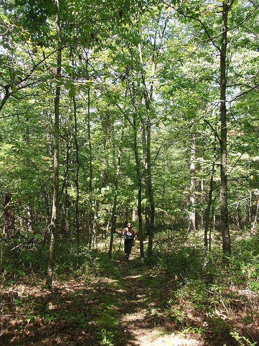
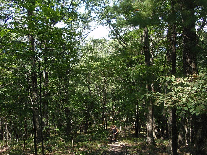
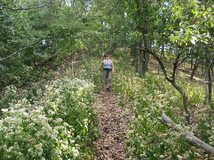
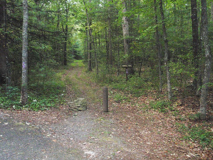
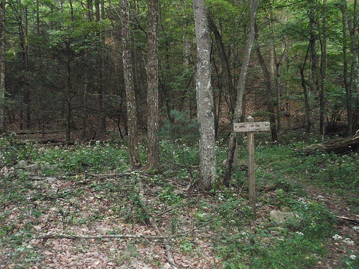
Saw Mill Loop:
The Saw Loop is an easy walk in the woods compared to the hard climb up to High Knob. There are several open wildlife clearings as well as two seasonal creeks.
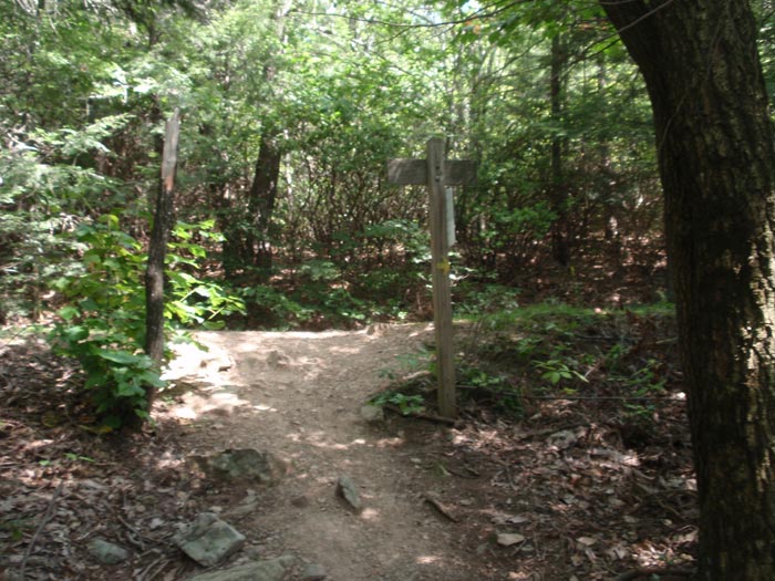
From the back loop of the campground follow the yellow blazed Saw Mill Loop trail for 0.3 miles to the beginning of the loop portion of the hike. From here turn right and follow the loop 3.1 miles back to the same point. On the first part of the loop Hawes Creek is on your left, then cross a small ridge on the back side of the loop and follow a feeder stream back to the beginning of the loop before turning right for the 0.3 miles back to the hike start point.
Early September
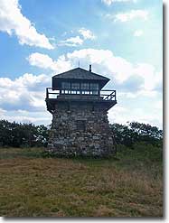
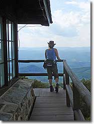
High Knob Tower
Brandywine Recreation Area Hike Comments
Archived Comments
By:Peter
Rating:
Date of Hike: Saturday, October 13, 2018
I haven't hiked this hike since my review in 2010, when I had the negative bear encounter. I went with a friend, and it was great. The hike was much easier than it used to be for me, and I wasn'y even slightly sore at the end. The views are as I remember them, amazing, however, there were more people at the fire tower than when I was younger, with 6 showing up after we got there and 8 more going up, all from the parking lot trail on 33. When I was younger, I never saw anyone at the fire tower. I used to be able to go inside, but you no longer can, they have boarded up the door. But, that aside it is a wonderful hike, and is still one of the hardest ones I know in the region.
By:Dick
Rating:
Date of Hike: Saturday, March 31, 2018
I first hiked High Knob on August 4th 2017. I had plans on hiking Down Pikes Peak on September the 2nd with my son and I felt I should get some practice in before attempting to hike 13.5 miles down from the 14,115 foot summit.
I hiked several other trails before I found High Knob and none of them can compare to High Knob for difficulty, (no switchbacks and straight up) it was perfect for my training purpose. I truly believe that to hike up and down High Knob is just as difficult if not more difficult than our hiking Down the 13.5 miles of Pikes Peak. The BIG difference was the elevation issue. You do need to make sure youre ready to hike at that extreme elevation (14,115 ft.) for the 8 ½ hour hike.
For here in the Shenandoah Valley, for strenuous, solitude and views, I dont think you can beat the hike from the Brandywine Recreation Area to the top of the Shenandoah Mountain on the High Knob trail.
I enjoyed this hike so much that since August 4th, 2017 thru December 31st (5 months) I hiked this trail twenty-seven times. (Some would say that's crazy and they may be right). Anyway, with the weather warming, looks like its time to hit that trail again. :)
By:Ed & Jackie
Rating:
Date of Hike: Sunday, June 11, 2017
Hiked the Sawmill Loop Trail, starting early (9:30am) in order to beat the heat forecast for the day. The trail doesn't appear to get a lot of use, and there are many trees down that you need to climb over or walk around. There are several grassy areas that are overgrown with tall vegetation and it was pure guesswork as to where to go as the trail completely disappeared. Overall, though, this was an enjoyable hike, with pretty, open woods. There are several small stream crossings, but water was very low and they did not present a challenge. Over half the hike is uphill, but never very steep. Very quiet, we had had the trail to ourselves. We give it 3.5 stars...
By:John
Rating:
Date of Hike: Monday, March 6, 2017
Our hiking group (all 60+) tackled this hike yesterday - although we did not follow the path as described here. Rather, we dropped shuttle cars at the Brandywine Recreation area (where the fishermen park) and began our hike at the Shenandoah Trail at the High Knob parking area on VA 33.
From the parking lot, we hiked to the High Knob Tower - a little chilly but great views. This was unquestionably the hardest part of the entire hike for us.
From there, it was all downhill on High Knob Trail...a fairly gentle descent for the most part although you needed to be careful in several spots where is was quite steep. None of us expressed an interest in climbing back up that trail!
We jumped over to do the 4.0 mile Saw Mill Loop. The creek was mainly dry and the trail littered with blow-downs (which is what you get when hiking in late winter before the trail crews have had a chance to clean things up). Must have been 20-30 large downed trees across the trail. That said, it was a pleasant loop to hike.
The return to our shuttle cars was about a mile from the loop as the entrance gate for "hiking parking" was closed.
All in all, a very nice hike. My GPS odometer reported 9.4 miles (but it tends to read 5-10% long). I'd call it 8.5 - 9.0 miles.
We're really glad that we didn't go the other way - not hard to understand why HU rates that approach as 5-star difficulty.
By:Steve S.
Rating:
Date of Hike: Saturday, June 18, 2016
We did the High Knob Fire Tower. Really fun hike with very few people on it. Previous reviewers are right that this trail is steep - straight up the side of the mountain with no switchbacks. The fire tower at the top is a nice reward, with gorgeous views of the surrounding park area. In the summer there's also a nice benefit insofar as the Brandywine Recreation Area has a swimming pond and showers at the bottom, so if you're camping out in the area, you can get clean from what is inevitably going to be a sweaty endeavor.
By:Tim
Rating:
Date of Hike: Monday, August 18, 2014
I did the hike to the fire tower and it was brutal. No switchbacks, just straight up and straight down. Beautiful views at the top, but it is a killer going up and down.
By:Laurie
Rating:
Date of Hike: Saturday, April 5, 2014
Hiked the High Knob Fire Tower Trail - Started from the Brandywine Recreation Area - the trailhead is off to far left in the back of the campground - enter the group camping area and there is a sign.
The first 3 miles are straight up hill!! No switchbacks-straight UP with a couple areas that level off and you can walk upright for a little while.
Very secluded and quiet trail-nobody else on this trail. It took us 2 hours to reach the fire tower. It was really windy on top but beautiful views!!
There were several people on the tower when we arrived and more showed up while we ate our lunch.
We decided against going back the way we came in & hiked out the easy trail to Rt 33 and walked 4.1 miles down the hairpin curved road back to the recreation area parking lot.
By:Laurie
Rating:
Date of Hike: Monday, January 20, 2014
Hiked the Saw Mill Loop and it was a beautiful day for a hike!
Campground area is closed with locked gate across but I assumed that we could park in the small parking lot off of drive.
We found the trailhead easily but NOTE that now the blazes are yellow which stumped me at first because the directions on this site said purple-there is actually a sign that says Saw Mill Loop with arrows. Easy hike, not much to look at -many creek crossings that could have been difficult if the water was higher but all have rocks placed in the right locations to step across :)) I Plan on coming back to do the Fire Tower Hike!
From HikingUpward: Thanks for the note on the blaze color changes. The map and directions have been updated with the new information.
By:Cheryl T
Rating:
Date of Hike: Wednesday, September 4, 2013
Got a very late start, so I decided to take the trail from the parking lot off Hwy 33 instead of from the Brandywine Recreation Area where I was going to tent for the evening. The sign at the lot states it is a 1.3 mile hike from the parking area to the fire tower. The trail was well marked with yellow blazes. The trail itself wasn't too bad...starting out mainly a soft dirt forest trail, and as you climb along the ridge it becomes slightly rocky. Prior to getting to the top you are on an old fire road. Not a hard climb at all. I didn't see anyone on the way in, but when I was returning I met 2 guys going up. It took me about 30 minutes from the parking area to the summit. Plenty of signs marking the trails and private property is well marked with bug read paint and signs! When I climbed the tower there were amazing 360 degree views. I had planned to eat up on the tower while admiring the views, but there were too many flies, wasps and other flying things. There is a big area to camp out in next to the tower with a fire ring. However, watch out for poison ivy, I managed to pick up some, probably while I was walking around the tower. In all I give it 4 stars, all for the view.
By:AD
Rating:
Date of Hike: Saturday, March 16, 2013
The weekend a friend and I decided to hike to high tower knob and the fire tower was a particularly dreary one, having just snowed and expecting some more. We did not start from Brandywine rec but the parking lot right off route 33 and the state line. Conditions were extreme on the section before Brandywine trail meets high knob trail. 2 inch thick slick ice, little to no room for safe footing. A lot of slips and falls on the way up.
Service road conditions were better with more slush. Once to the tower there were high winds enough to realize we shouldn't pitch the tent and stay.
On the hike down we thought to follow the service road knowing it would be safer with less ice and more room to walk. The service road was much much safer with crunchy snow and more areas to place feet. We came to a fork in the road and decided to keep left on the road rather than take the unmarked right. (Was told that this may have been the right way to go, after a little while we may have seen a yellow blaze indicating the High Knob trail).
We continued to walk on the service road and I knew we were closing in on 33. I was relieved knowing we didn't have to slip and slid down the slick trail but then -
We approached a cabin and car on the service road, two young individuals came out and told us to turn around. We told them the truth as we saw on the map (Google satellite) we could take a safer route on the service road. They told us the map is not true and leads onto their land. After that I practically pleaded to just pass through to 33 telling them that the descent would be treacherous (also losing daylight fast). I also told them that I had fallen 3 times on the way up to the tower. The young man seemed to be sympathetic but the young lady said "we should have thought about that". I was at a loss for words because of the lack of moral servitude. We had nothing to say and turned around.
We hiked back up the service road and down the icy trail. It was literally terrifying on the descent.
Loved the tower and views! Unfortunately we made a decision out of safety to walk the service road and had that confrontation.
If it has recently snowed and you expect ice could be present - do not go without proper footwear. The trail was the only thing iced over, and with the steep mountain slopes on either side, there was no where to place feet. We did not have proper footwear but we also drove 3 hours just to hike this trail (from Richmond).
DO NOT GO DOWN THE SERVICE ROAD - EVEN IF THERE IS A DANGEROUS SITUATION. They don't care...


