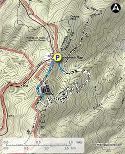
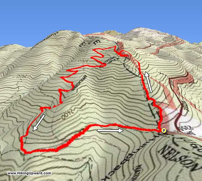
Humpback Rocks is a very popular hike due to its proximity to the Blue Ridge Parkway and
I-64 near Afton Mountain. Most people do it as a 1.0 mile up and back. We decided to add a few miles for the return trip by following the Appalachian Trail North and a couple of un-named blue-blazed trails.
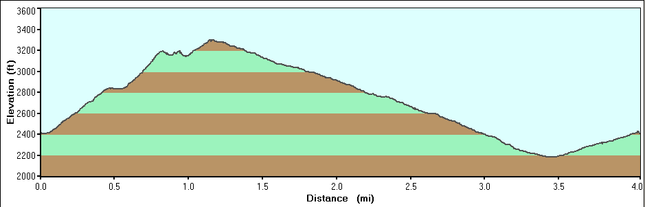
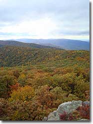
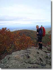
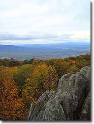
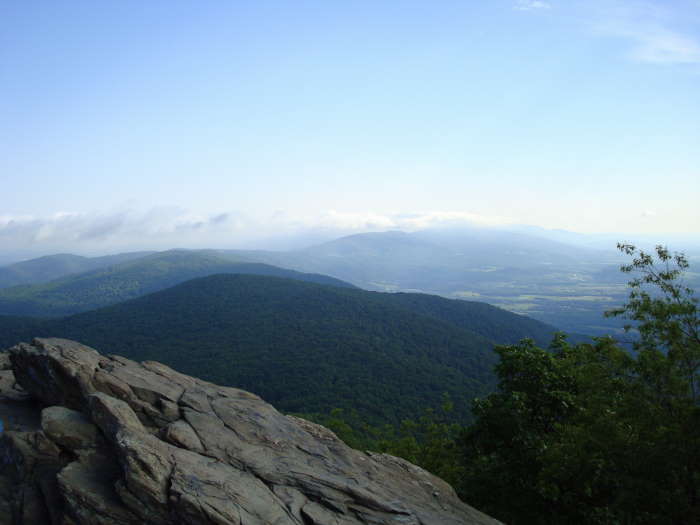
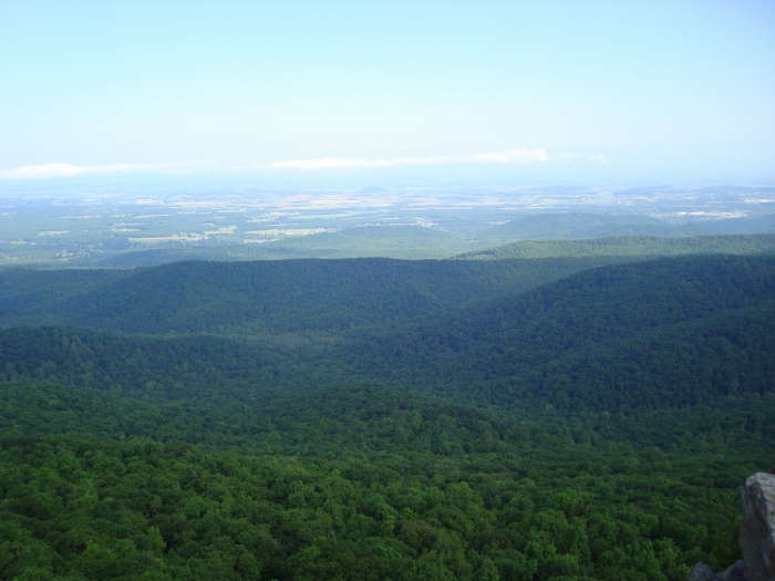
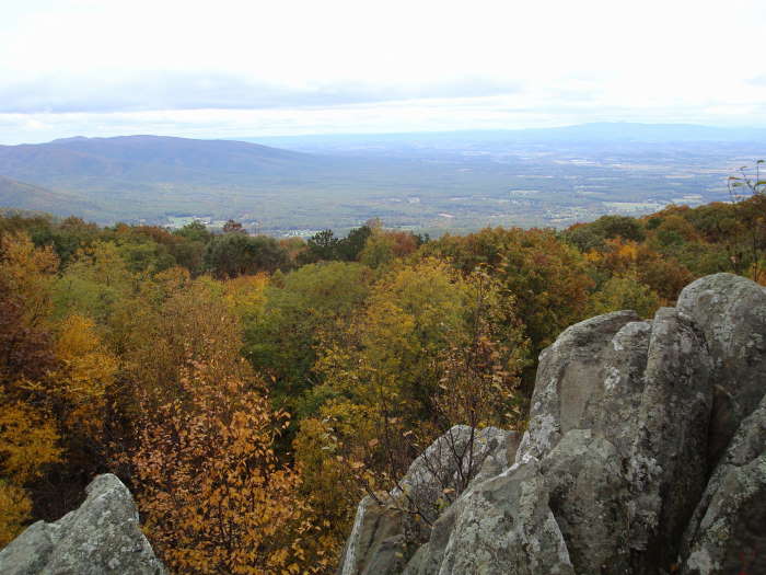
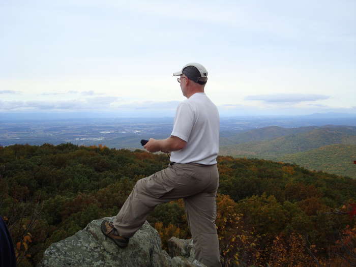
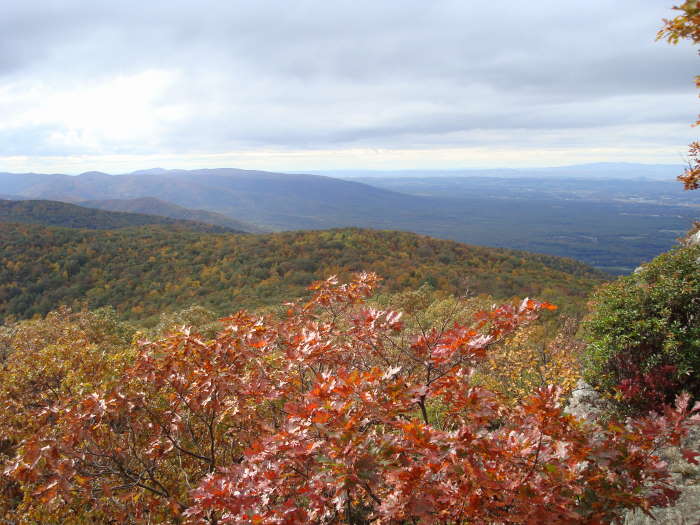
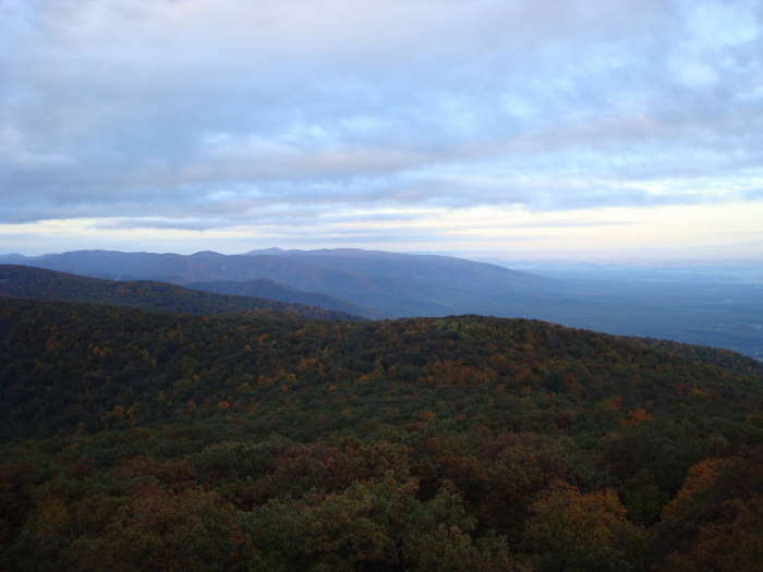
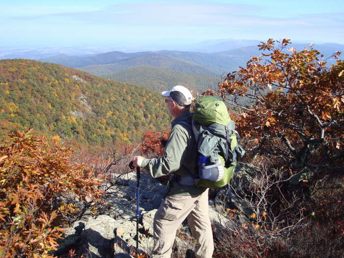
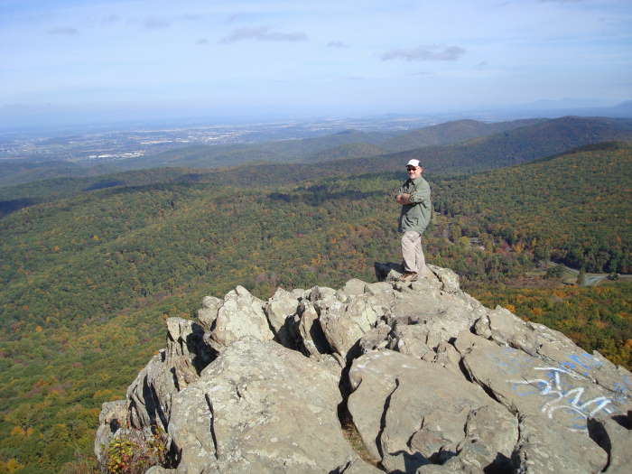
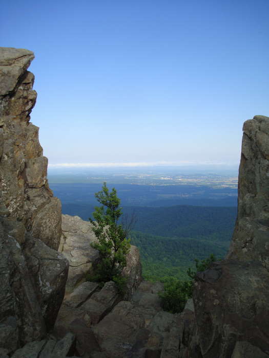
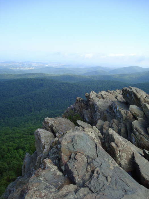
The 1.0 miles to the Rocks is very tough, gaining about 800'. The views at the Rocks are great looking west onto the Shenandoah Valley and north to Shenandoah National Park.
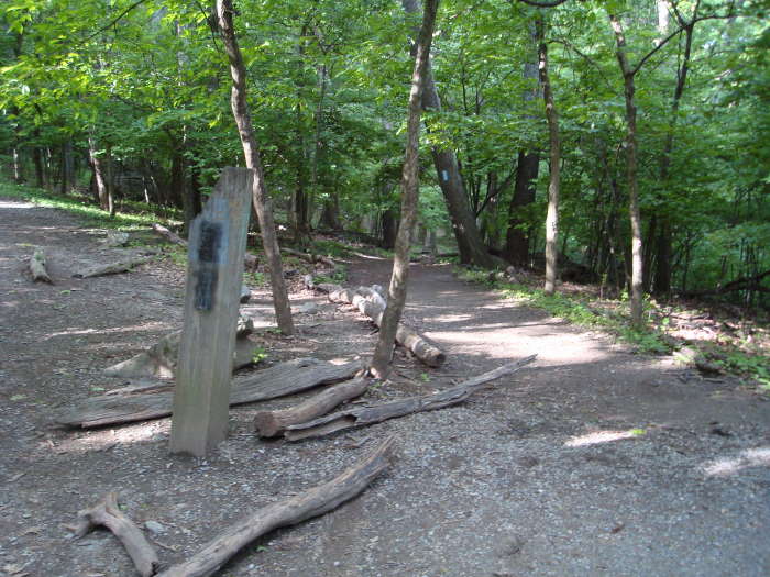
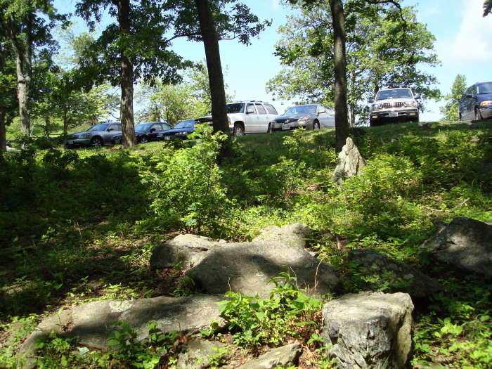
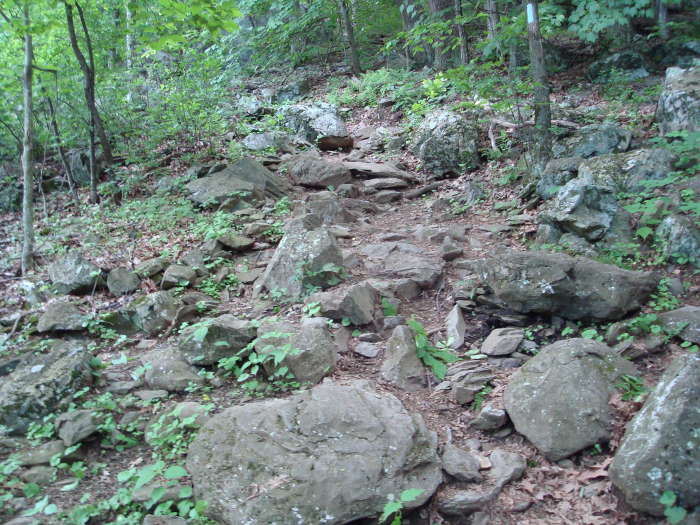
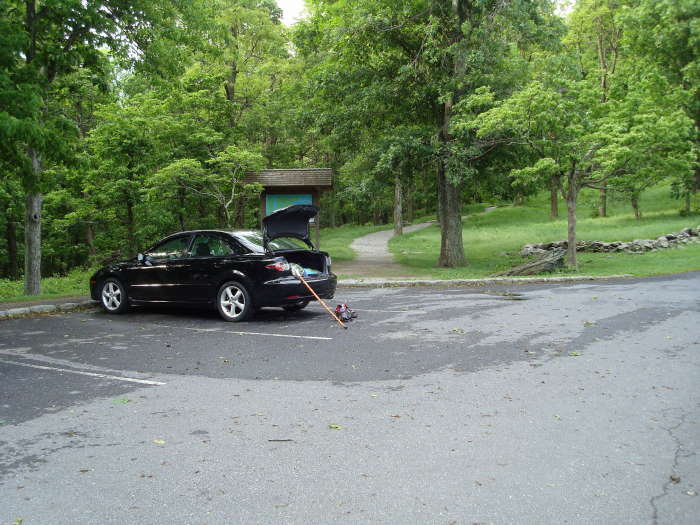
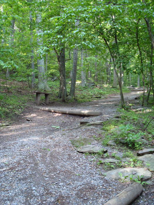
We parked at the Humpback Rocks parking area (MP6 on the Blue Ridge Parkway). The blue-blazed trail begins to the right of the kiosk . The trail wastes no time ascending with park benches scattered every so often if you need to take a break. Don't be fooled by the 1.0 mile to the top, if you are not used to hiking you will find muscles sore that you forgot you had!!
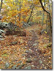
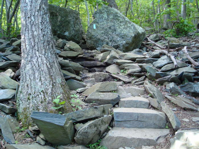
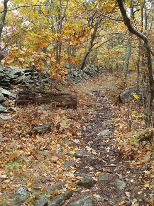
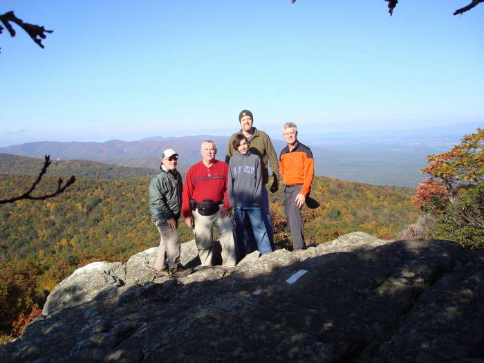
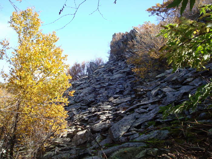
There will be an intersection on your left in 0.5 miles, ignore it and stay straight on the blue blazed trail. For the next 0.4 miles the trail is very rocky but there are both wooden steps and rock steps for some of the more difficult parts. If it has rained be prepared that the trail can be a little muddy and in some places becomes a temporary stream. At the next intersection bear left on the spur trail to the Rocks and some incredible views. There are multiple places to take photos, just be careful especially if wet. We were a little disappointed in the amount of graffiti at the Rocks but try to ignore it and concentrate on the views.
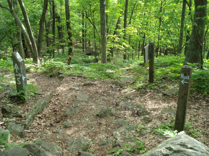
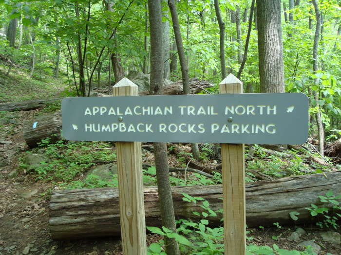
Return to the intersection with the 'Rocks' sign, ignore references to the A.T. as those are old signs when it ran close to the Rocks before it was re-routed years ago. At the 'Rocks' intersection, go straight on the blue blazed trail towards Humpback Picnic Area and reach the A.T. in less than 0.10 miles.
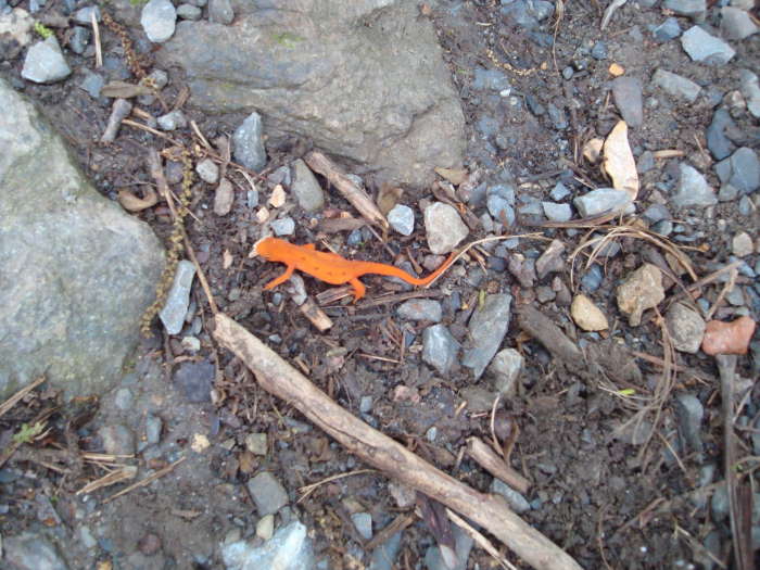
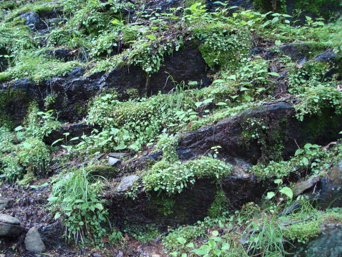
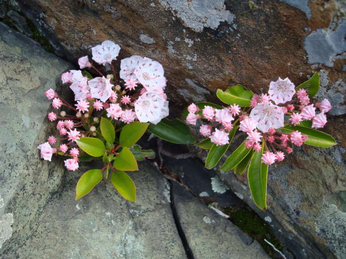
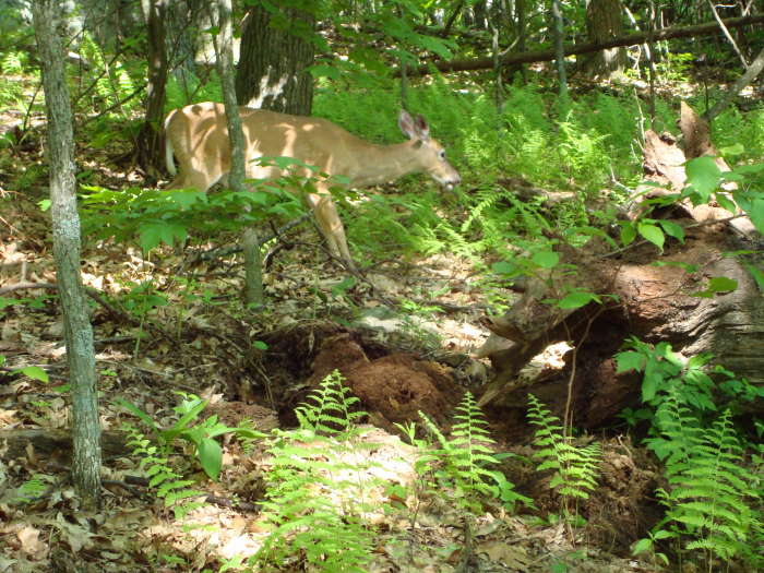
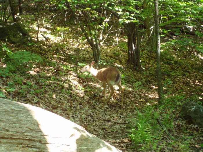
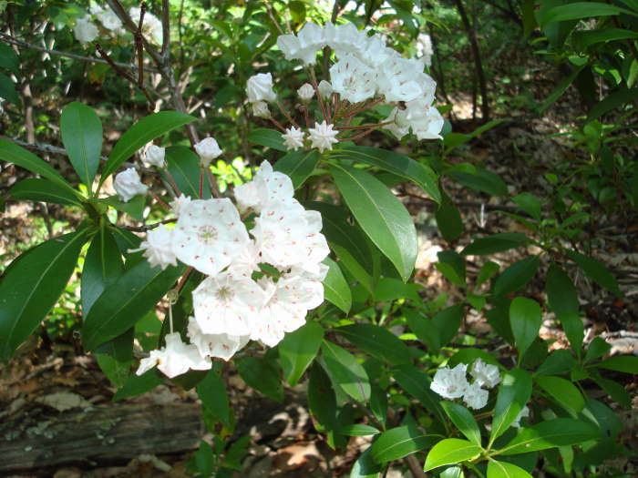
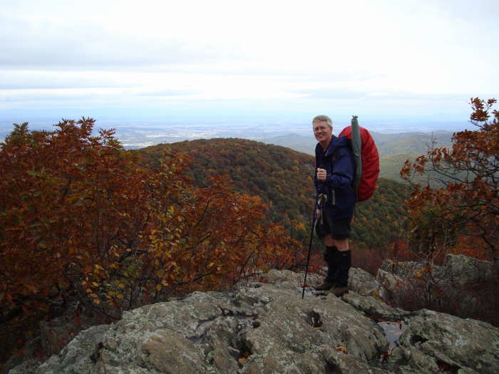
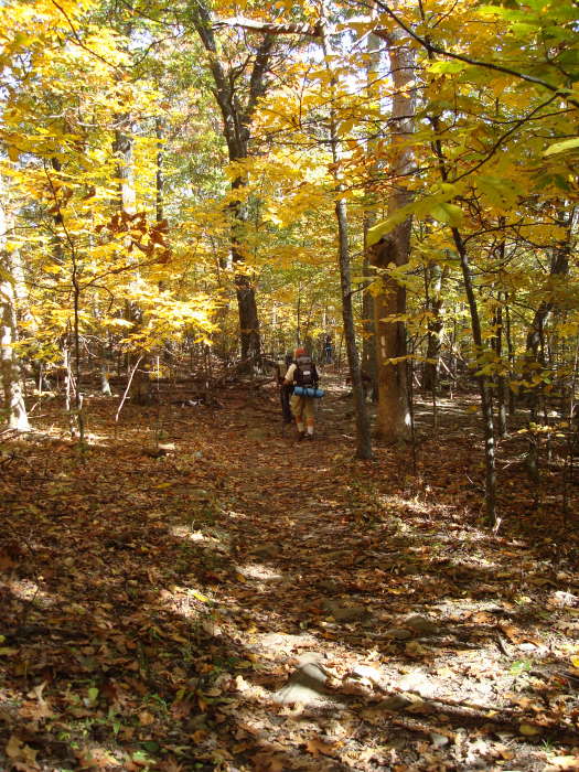
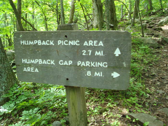
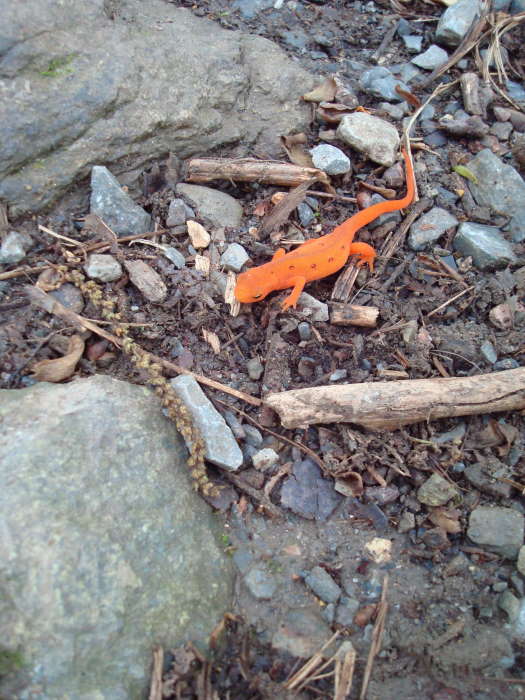
Turn left onto the white-blazed A.T. North (*for additional views see A.T. South Out and Back directions below). This begins a 2.7 mile gradual descent for most of the trail back to the Parking area. We saw lots of wildlife: eastern newt, deer and tons of chipmunks - they are too fast to get a decent photo. The mountain laurel and rhododendrons were blooming all over this section of the trail. Returning this way made for a very pleasant stroll and we ran in to only a couple of hikers. The next intersection is in 2.7 miles. Bear to the left, onto a blue-blazed trail to return to the Humpback Rocks Parking area.
*A.T. South Out and Back for Additional Views
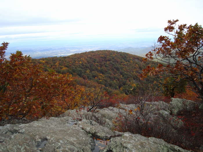
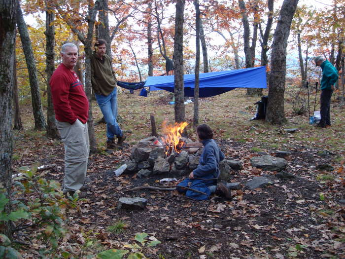
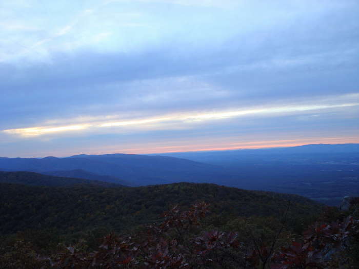
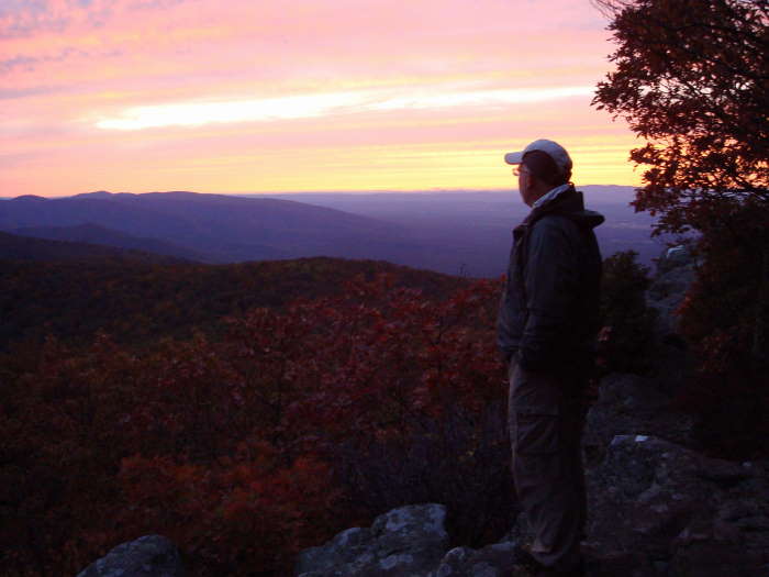
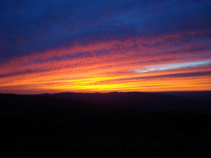
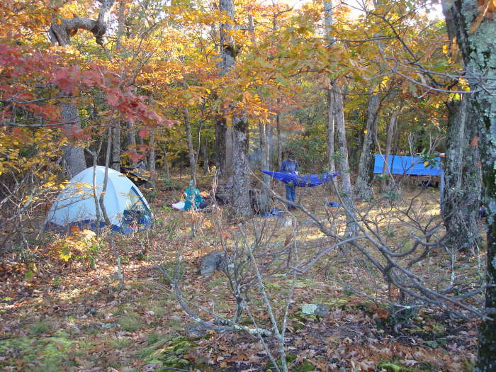
If you prefer seeing more great views without the crowds take the A.T. South instead of North at the Intersection mentioned in the previous paragraph. If you take in all 3 additional views in this out and back you will add about 4 miles to your trip. In 0.4 miles from the intersection you will come to an unmarked spur trail to take you out to the first view. These rocks are very similar to Humpback Rocks but not as massive. You will see these rocks on your left as you are on the trail and at the top of the hill you will come to the spur trail. Continue south on the A.T. for 0.7 miles to reach the second view on your left looking out to Rockfish Valley on the east and Shenandoah Valley on the west. The last view will be 0.9 miles beyond the second view. About 30 yards before the last view you will pass a great campsite with room for about 6 tents. We actually did this as a short overnight backpack and spent the night at this campsite taking in one of the most beautiful sunsets we have ever seen in Virginia. You will have an almost 180 degree view of Rockfish Valley, Wintergreen Resort, and finally the Shenandoah Valley. This is your turn around point. Note: If you do camp here, bring plenty of water as there are no water sources on this section of the A.T.
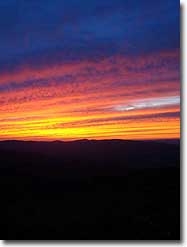
Late May
Mid October
Video - Courtesy of Mike Holloway
Humpback Rocks
Humpback Rocks Hike Comments
Archived Comments
By:Davey James
Rating:
Date of Hike: Sunday, August 25, 2019
For August, today was a beautiful day. Therefore, there were a great deal of people on the trail. I'm not sure if it's always this crowded but today it was highly populated. The trail is well maintained. It is challenging for the first couple of miles - as it goes pretty much straight up! I brought my dog with me (there were several dogs out today.) I didn't get to enjoy the views from Humpback rock because there were just too many people cluttered there and it's not ideal for dogs. So, I decided to hike towards the AT for some additional exercise and serenity. This was my favorite part of the hike because there is less traffic. Overall, a nice hike - but, I won't do this one again with my dog.
By:AAP
Rating:
Date of Hike: Monday, August 5, 2019
Started my solo hike up Humpback Mountain around the Parking area after checking in with the Rangers at the Visitors Center at 9:30am on a Monday, and I was one of the first cars in the lot. Ranger report: Black bears and some rattlers have been seen on the local trails, but all I saw were a garter snake, a gray squirrel, and a chipmunk... and a ton of butterflies and centipedes. The first mile to the Rocks was very nice, though as advertised, very steep. Recent rain led to a few muddy spots, slick spots, and a hint of standing water. Great scents kicked up by the rain and humidity, though... really felt like I was outdoors. I'm slow, so I was passed by about 20 folks on my way up, and only a few passed me headed back down before I got to the top, so the Rocks were crowded. I didn't linger at the Rocks, but the photo op is not to be missed. The left turn off to the Rocks was clearly marked. I then continued up (following markers to the Appalachian Trail), and followed signs toward the Summit. Note that the tree blazes change from blue (Rocks trail) to white (Appalachian Trail). Continued up for about another mile. Still definitely upward, but I'd guess about half as steep as the trail to the Rocks.
There was no clear indication that I saw that I'd come to the summit, so I just kept on for a bit. Some landmarks were (1) when I crossed through a stone wall, that was where I believe the first "summit" is. Then you go down into a gulley and back up to what I thought of as a second "summit." Finally, there was a second gulley and another upward motion which led to a beautiful viewpoint. I couldn't find any higher points that that, so I'm going to call that the Summit. All in all, I measured that to be about 1.8 - 2.0 miles past the Rocks. Trip back was easier, but I'm glad I had trekking poles to deal with the slippery rocks and muddy trail.
By:Bob W
Rating:
Date of Hike: Sunday, October 7, 2018
Excellent hike- my wife and I (both 48 years old) thoroughly enjoyed this outing. Took short breaks as needed- which was more often than I thought, but we never felt over matched by the incline. But it was steep and slippery in many spots. Starting out early was the key to making this so good, because it meant that we were able to enjoy the summit for about 20 minutes with very little crowd (only one or two other couples) - so plenty of space to hang out and enjoy the breeze in a very peaceful environment. Judging by the number of people coming up the trail as we were going down, and the crowded parking lot upon our return I don't imagine those people got the same serenity we did at the top. Saw more people than I thought I would carrying small children on their way up- they did not look to be enjoying it.
By:Christopher Boyce
Rating:
Date of Hike: Friday, October 5, 2018
This hike appears to be popular. For a Friday afternoon, the lot was full and there were all levels of hikers on the trail.
Short but strenuous out-and-back up to Humpback Rocks. Great views while you're there. On this day the mountains were partly cloud covered, which made for misty stretches along the trail and views above the clouds at the rocks!
By:Rob Tracinski
Rating:
Date of Hike: Monday, November 27, 2017
LOST CAMERA-Fuji underwater camera lost by my son about halfway up,dark grey and bright lime green. If you find it Id be very grateful for a call at 540-223-1981.
Oh, and other than that it was a very good hike.
By:Courtney
Rating:
Date of Hike: Friday, May 26, 2017
This is a great hike! It's well worth the trip but I might have lost my class ring in the parking lot! It's a small silver UVA ring with BA and 18 on the sides and the 2018 Jefferson logo on the inside. Please let me know if you find it by contacting me at cnc8bc@virginia.edu! Willing to offer a reward!
By:Dave B
Rating:
Date of Hike: Friday, April 14, 2017
We arrived at the parking area around noon and it was just about full. This is a very popular hike and of course it is spring break for kids so the solitude was pretty much at the bottom of the scale. But, everyone was talkative and friendly at the summit and folks were taking pictures for other people and everyone was enjoying the view and the cool weather. I would highly suggest taking sunscreen along because there is almost no shade at the summit. This was our second time doing this hike and again opted to take the AT for the way back to the parking lot. This is where the solitude climbs to the top of the scale as most folks return the way they came. It was amazingly quiet on the AT and we only passed a couple of other hikers. We did get to meet a couple of AT thru-hikers and spoke to them for a few minutes as they are making their way to Maine from Georgia. If you want solitude - take the AT portion for sure......and your toes won't be crammed into the front of your shoes going back down the steep trail. The trees are just starting to bud at this elevation so the view was quite different than we saw it in June 2016.
By:Bill
Rating:
Date of Hike: Monday, April 10, 2017
Humpback Rocks was an easy and quick way to take in great views of the Shenandoah valley. The trip up was a little steeper and tougher than imagined, but took less than one hour to get to the top. There were plenty of people on the trail because it was spring break, but it didn't detract from the views or finding space on the rocks to sit for awhile. Coming back down, we took the easier and more gradual decent following the AT north. It was a much easier decent, but it was much, much longer than just going down the initial way up. Took about 1.5-2 hours at a good pace. The trails were well marked and we had no issues finding which way to go or the proper route to the parking area.
By:Shawn R.
Rating:
Date of Hike: Sunday, November 20, 2016
We completed this hike on a cold and windy Sunday with temperatures hovering around freezing with the hopes of hiking on a day with few hikers. Even on this blustery day, the parking lot was nearly full and people were everywhere up and down the trail. For this reason, I highly recommend taking the AT back to the parking area for a much peaceful and gradual return to the lot. The view was spectacular, but with so many people on the Rocks it was difficult to get situated. Overall, a good hike if you are looking for something short and not too far off the beaten path, but if you are looking for a nice hike in solitude, avoid Humpback Rocks. There are plenty of other great hikes in the area which are free of college students and others who are unwilling to drive or hike an extra mile or two.
By:Rainchell
Rating:
Date of Hike: Saturday, October 15, 2016
We started our overnight hike by taking the steep one mile climb to the Humpback Rocks. It was very busy (tis the season) but enjoyable none the less. The views were great on this blue bird day. We then took the AT north, but instead of veering left on the blue blaze trail back to the parking lot, we continued on the AT. Ran into many thru-hikers headed south (I'll bring more M&M's to give away next time!) We stopped at the beautiful Glass Hollow overlook before continuing on to the Paul C. Wolfe shelter. There were no fewer than 20 people in and around the shelter. Thru-hikers, high school students, you name it. What an awesome group of people! We thoroughly enjoyed our time and Mill Creek was such a GEM. Flowing strong with mini waterfalls everywhere. This shelter area is first class. It is large and well made. There are bear poles and even a privy.
We hiked back to the parking area via the Albright trail, which will warm your bones on a cool morning :) Our total milage was around 11.5 (8 miles on day 1).
We ran into several fine folks with the ODATC, who maintain this area. Many thanks for the work these guys do! This entire loop was well marked and maintained.
Many thanks also to HikingUpward. This is such a great resource. I recommend it to people frequently.


